Map of Clark Peak with...

Map of Clark Peak with...

Map of Clark Peak with possible routes. The orange line shows my route of ascent (I spent the night at Timber Lake). The red line shows my route of descent down a steep, talus-filled gully and across the boulder field. I don’t see any reason why you couldn't ascend this route, though I thought my route of ascent was probably much more pleasant. The green line shows a possible route from Blue Lake Pass via Clark Peak’s northeast ridge. Parts of this ridge look rugged and exposed. I imagine that sections of this are at least class 3. The blue line shows a possible route of approach from Jewel Lake in Colorado State Forest. For more photos from my climb of Clark Peak and Rawah Wilderness visit my website: www.leachfam.com.
Andy
on Sep 1, 2003 2:57 pm
Image ID: 26717

Comments

Post a Comment
Viewing: 1-2 of 2
alpinistjoe

alpinistjoe - May 24, 2010 7:10 pm - Voted 10/10
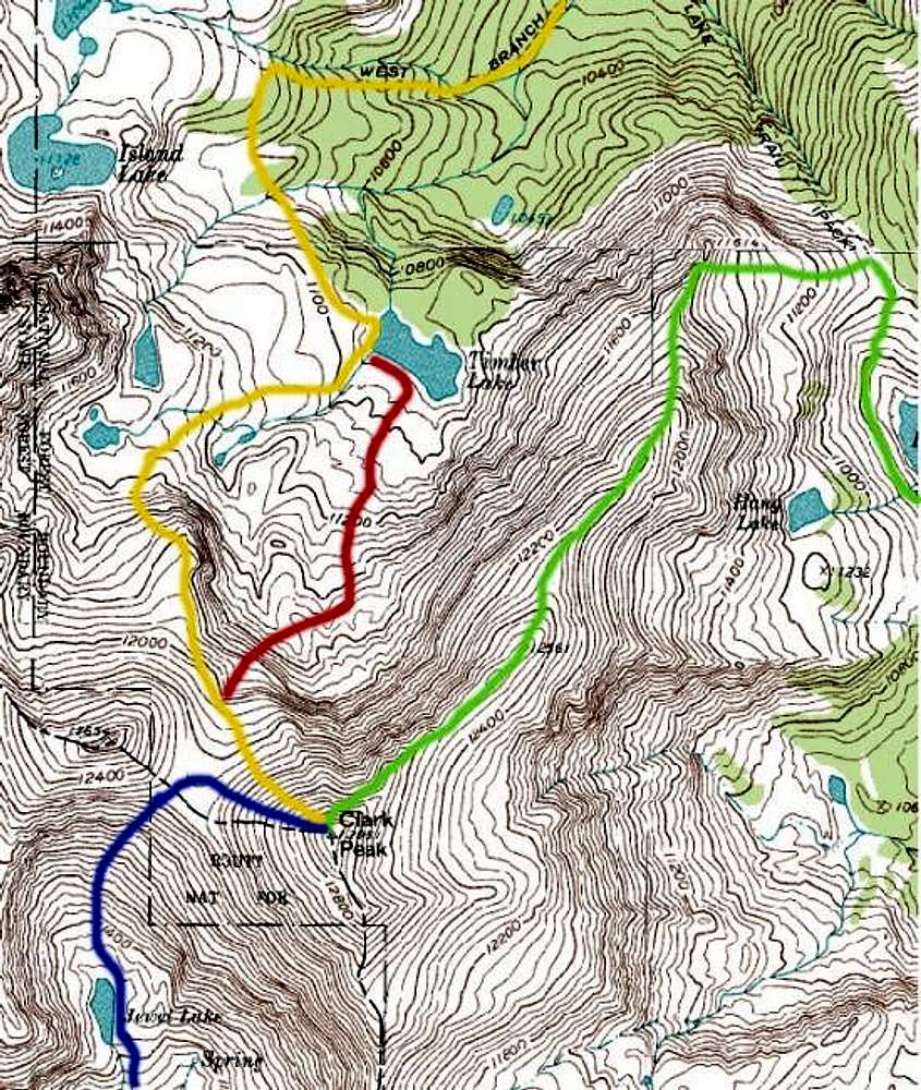
The green line route.

That route is pretty easy and only requires some rock hopping. Its well worth the climb as the veiws are amazing. Stretching all the way to RMT and the Neversummers. I do not advise doing it in a day as I did from blue lake trail head.

FlyingZebra34

FlyingZebra34 - Sep 10, 2014 1:16 am - Voted 10/10

Day Hike

I got here by the Blue Lake Trail Head and started my hike around 9pm. I got to Clark Peak around 2:30pm and went South East back to the parking lot.(I enjoy going back a different way from which I arrived)

Saw a bunch of marmots and possibly 2 bears (didn't bring my binoculars sadly)

I hopped on Sawmill Trail and got back to my Jeep around 7pm.

Completed the trail around the end of August

Viewing: 1-2 of 2