Toggle navigation
Mountains
Routes
Images
Trip Reports
Forum
What's New
People
Areas & Ranges
Articles
Trailheads
Canyons
Huts & Campgrounds
Albums
Logistical Centers
Fact Sheets
Lists
Custom Objects
Gear
Plans & Partners
WELCOME TO SUMMITPOST
SIGN IN
REGISTER
Maps
Additional Parents
Image
1:100K Scale
View High-Resolution Image
1:100K Scale
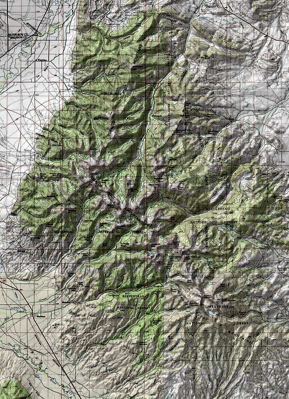
Here is a 1:100K scale Map of the Tobacco Roots
« PREV
NEXT »
bigsky801
on
Nov 7, 2007 5:51 am
Comments & voting
Other parents
Image ID:
354168
2304 Hits
71.06
% Score
1
Votes
Log in to vote
Comments
No comments posted yet.
to post!
Don't have an account?
Maps
(Album)
« PREV
Viewing
#5 of 5
GALLERY
You are at
the Last
Image
bigsky801's Image Gallery
« PREV
Viewing
#228 of 278
GALLERY
NEXT »
×
You need to login in order to vote!
User Name
Password
Remember me
Forgot your password?
Log me out when I close my browser.
Keep me logged in all the time.
sign in as a user
Don't have an account?
Register now for FREE
Rating available
Suggested routes for you
People who climb the same things as you
Comments Available
Create Albums
Register Here


