Is it really 10 years since we first came to Benasque?
Maybe a too rhetorical question? Prior to visiting Benasque we had been to Torla on the boundary of the Ordessa National Park, another beautiful area of the Spanish Pyrenees.
Although we loved the Ordessa area and had fond memories of climbing Monte Perdido, the draw of the area surrounding Benasque was too great a lure to resist so we had to come back again.
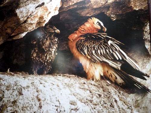
All images by Johnnie and Ken except the Lammergeier picture which is a photograph of a picture in the Hotel Ciria bar.
(original photographer unknown)
Day 1. – June 9th - Barcelona to Benasque.
![Lammergiers]() Lammergiers
Lammergiers
A lot of water has surged under the bridges since our first visit to Benasque in 2005 including that from the tragically melting Aneto glacier and although Ken and I had been back there in the intervening years, 2014 did feel a bit special.
By way of a change, Ken travelled down from home in Liverpool to my Essex abode for an overnight stay before we flew out on June the 9th from Southend on Sea to Barcelona.
A taxi from door to door made for a relaxing start to our trip, Ken had been suffering somewhat before we went and had been for a short stay in hospital so we planned a gentle introduction to the hills.
Ken had hired a car and we searched the area outside terminal 2 of El Prat airport for the bus stop to take us to the off-terminal GOLD car hire depot.
Once off the transfer bus we had a long wait in a queue to get our car which was a bit frustrating as it took us at least two hours from touchdown to leaving the airport and to start driving up the autopista towards our destination.
Following our normal route on the non-toll roads, we stopped at Igualada for coffees and bocadillos as well as another coffee stop once we got beyond Lerida.
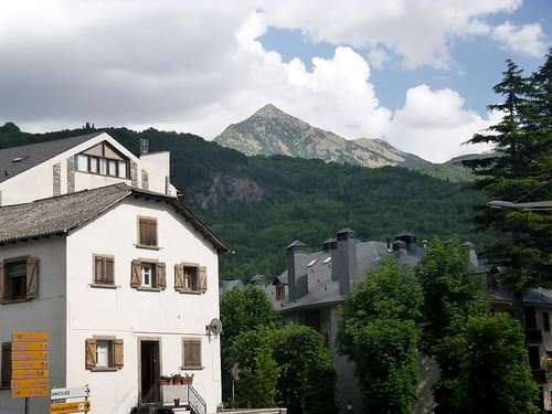
We arrived in Benasque around 5pm and after checking into our refugio at
Camping Aneto, we headed into town for a plato combinado and a few cańas at the
Hotel Ciria as usual. Our fine repast was watched over by the picture of the Lammergeiers on the wall.
Day 2. – June 10th– Ascent of
Pico de Sacrotz –2676m.
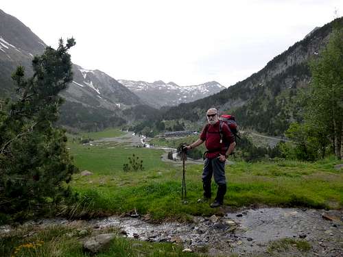
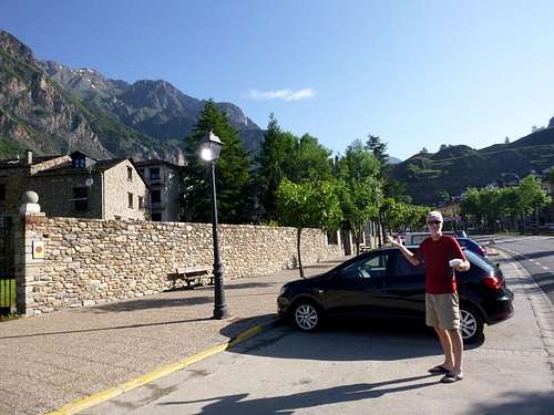
![Ken gets ready]() Ken gets ready
Ken gets ready
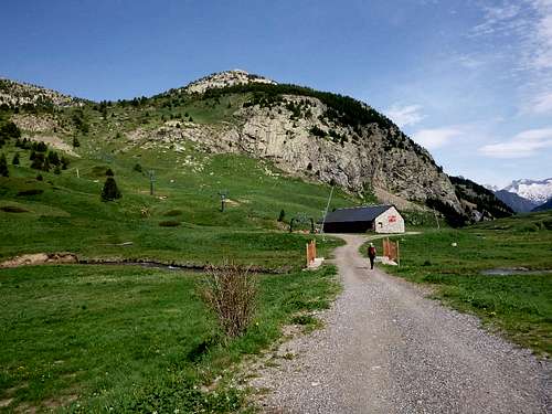
![Near Hospital de Benasque]() Near Hospital de Benasque
Near Hospital de BenasqueUp early but we were dismayed to find that the formerly well stacked refugio kitchen was totally bereft of plates, saucepans and other necessary cooking implements. Luckily we’d brought our own mugs and a mini saucepan, so at least we could have a brew before setting off at 7:30 am. Setting my watch to the barometric pressure prevailing gave us our starting altitude of 1300 metres in accordance with the spot height at Camping Aneto. We drove up to the car park above the
Hospital de Benasque at 1775 metres and parked the hire car. The car park was just below the end of the road which leads from Benasque to the border with France. It doesn’t quite reach the border and we hoped that it never would, as there are enough crossings for motors without spoiling the virgin slopes with a tunnel or a zig-zag highway. We soon kitted up and moved up the track from the car park towards the end of the road at 1825 m where we admired the view of the Maladeta massif across the valley to the south east.
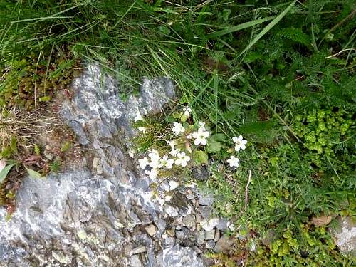
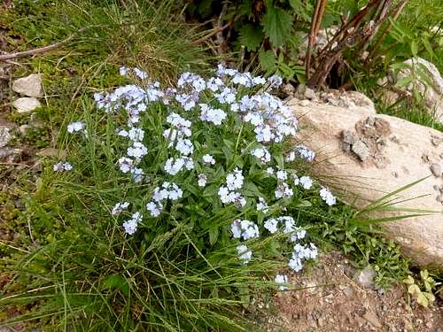
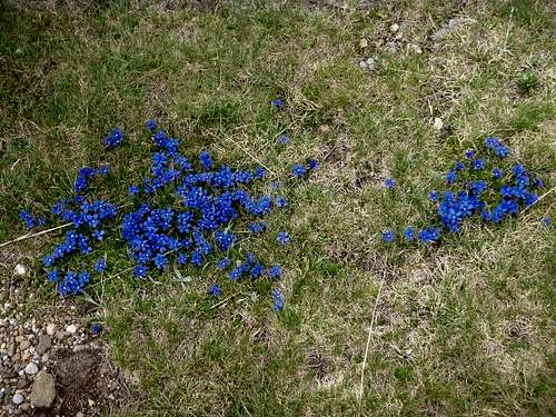
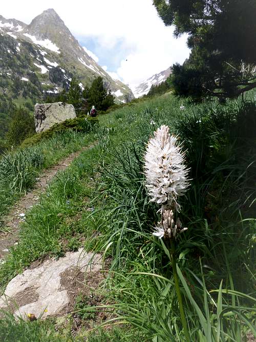
It was a fine dry day and pleasantly warm and we enjoyed the surrounding myriads of late spring flowers lining the pathway as we made our way towards the end of the road. ![Spring flowers]() Spring flowers
Spring flowers![More spring flowers]() More spring flowers
More spring flowers
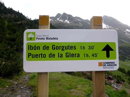
At the road head, newish signage indicated the ‘estimated’times on the route up to a pedestrian crossing of the ridge above which the trail allows a passage into France and also to the nearby ibon of Gorgutes. We generally found that these times were somewhat ambitious.
![National Park signage]() National Park signage
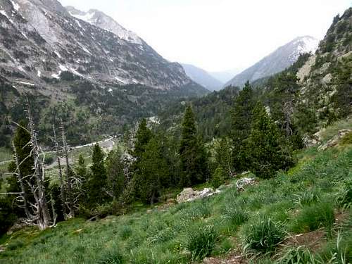
National Park signage![View down to La Besurta]() View down to La Besurta
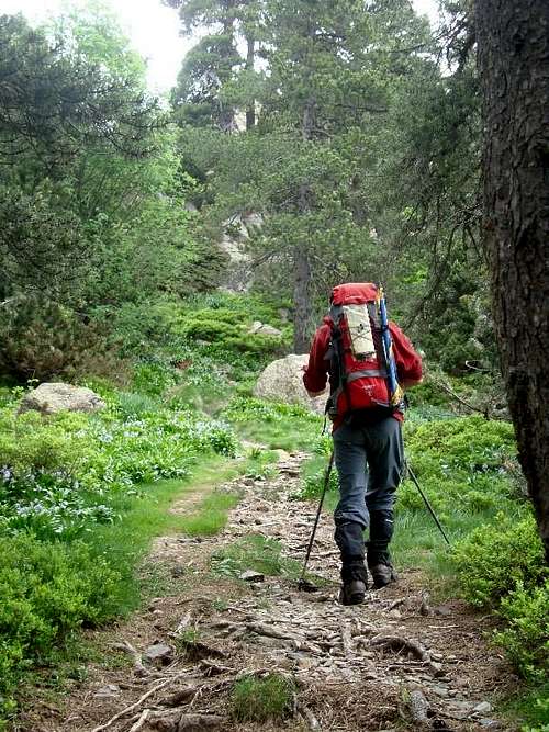
View down to La Besurta![Heading up through the pinewoods]() Heading up through the pinewoods
Heading up through the pinewoodsThis signposted trail was obviously a very well trodden route in the height of the season but amazingly although we saw one other car in the roadside layby, we didn’t encounter anyone else on the trail during the whole ascent or decent of this the first target for our holiday in the beautiful national park. After we crossed a small stream, the trail began to rise steeply through dense pine woods and as we plodded along we were gifted with most pleasant views across the Plan d’Estan through the occasional breaks in the tree cover.
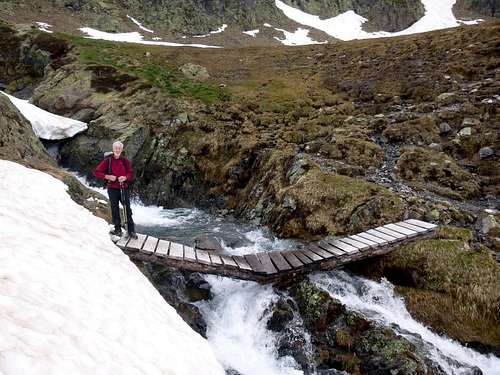
![Rickety bridge]() Rickety bridge
Rickety bridge![Kicking steps]() Kicking steps
Kicking steps
So refreshing was the pine scented clean morning air that before we knew it we had passed through the woods and arrived on grassy slopes with the occasional patch of old snow which led up to the side of a surging stream of melt water. A rather rickety bridge crossed the stream but Ken was not phased by this and was soon encouraging me to cross over it.
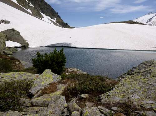
![Ken at the Ibon]()
Ken at the Ibon
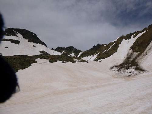
After crossing the stream we soon arrived at the snowline. The old snow was quite firm and so we started to enjoy kicking steps across it as we made our way towards the Ibon. Although the air temperature was quite cool, the Ibon was not completely frozen over and it almost looked inviting enough for a dip if it were not for the icy surroundings and of course the rules of the National Park that prohibit bathing in its rivers and lakes. We decided to take a few minutes rest stop there beside the Ibon to enjoy the panorama of those familiar views of the Maladeta across the valley and the various other surrounding mountains that we had climbed on previous visits during the ten year period since our first visit to the area.
Moving on past the Ibon, we soon sighted the summit ridge above and headed towards it.
![Gulley ahead]() Chosen gulley ahead
Chosen gulley ahead![Mini bivvy]() Mini bivvy
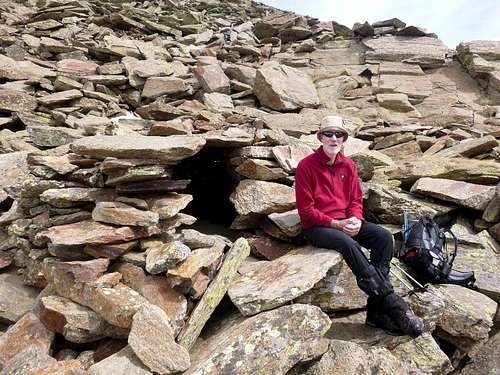
Mini bivvyAs we neared the Puerto, we discovered a small one person bivvy constructed just above the descent route into France.
I guess two people could have crammed themselves inside the bivvy in a dire emergency if they were friendly enough.
Above the bivvy we noticed that the slope had avalanched and it seemed that the resulting debris had crossed the area of our intended ascent,so we took care to be alert for any signs of a repeat fall of rock and ice.
![Avalanche evidence]() Avalanche evidence
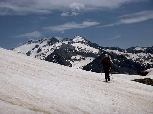
Avalanche evidence![Johnnie enjoying the snow]() Johnnie enjoying the snow
Johnnie enjoying the snowHowever, the rest of the climb was uneventful and we soon approached the final metres of the ascent.
Stunning views of the Maladeta, the twin peaks of Forcanada and the nearby tops of Salvaguardia and Pico de la Mina stirred memories of our previous visits.
Before too long we had reached the summit and typically we were still alone with no other mountaineers in sight.
The air was cool, crisp and ideally suited for viewing the surroundings.
![Ken on top of Sacrotz]() Ken on top of Sacrotz
Ken on top of SacrotzWe had arrived at 13:30 after our unhurried and almost leisurely ascent which took four and a half hours from the roadhead.
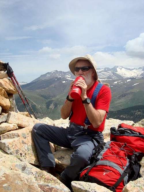
![thirst quenching]() Thirst quenching
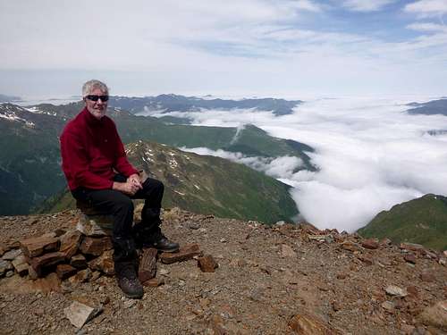
Thirst quenchingWe were in no hurry to leave the summit as its position and height provided what we thought was one of the most marvellous viewpoints in the whole of the Posets – Maladeta National Park.
The summit at 2676 metres is not the highest in the area, being 62 metres lower than Salvaguadia but its position across the valley from the Maladeta and Aneto and with its clear views of both Posets and Perdiguero makes it really unrivalled for a fantastic panorama of majestic summits. After our drinks, snacks and many minutes spent admiring the views of the stunning scenery we finally had to descend but the sight of the Maladeta and the Aneto glacier across the valley continued to please us as we lost height.
![Ken framed by the Maladeta]() Ken framed by the Maladeta
Ken framed by the Maladeta
![Cool water at the Ibon]() Cool water at the Ibon
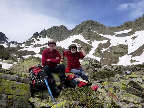
Cool water at the Ibon![Team foto]() Team foto
Team foto
Before too long we were back at the Ibon where we paused for a short while and took the mandatory team photo.
We thought that the Ibon area would have made for a brilliant wild camping spot but reluctantly we left there and were back at the car by 16:30. A reasonable days outing and not too strenuous to start the week.
Day 3. – June 11th– Ascent of Pico de Cerler – 2409m.
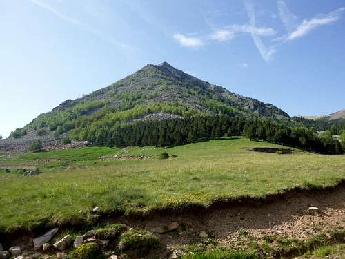
![Pico de Cerler]() Pico de Cerler
Pico de CerlerTrue to our normal expedition style, the next day we agreed to take an easier ascent and after scratching our heads to find one that we hadn’t done before, we decided to tackle the Pico de Cerler, an almost perfect pyramid rising above the pistes of the Cerler ski resort.
Being outside the ski season, the road up from Benasque was deserted apart from a tarmac gang putting a new surface on the road. We arrived at the deserted resort car park at 10:23.
We did actually see another car in the parking area at one point but we were again amazed at how few people were in the area. If it were our normal stamping grounds in the UK it would have been swarming with all flavours of outdoor types.
![Ski station Cerler]() Ski station Cerler
Ski station Cerler
Passing the ski lodge and its associated buildings we crossed over a vehicle bridge and headed up to one of the lower ends of a ski tow.
Above us we could just make out the top of Pico de Cerler so navigation was not a problem. We just had to avoid bushwacking through the junipers that seemed to completely cover the lower slopes at the side of the tow cable route.
Following Ken I found the climb very pleasant and without any difficulties apart from having to make our own trail. We didn't completely follow the direction of the piste route as we wanted to move north towards the peak so there was a lot of vegetation that otherwise would have been flattened by the resort's machines.
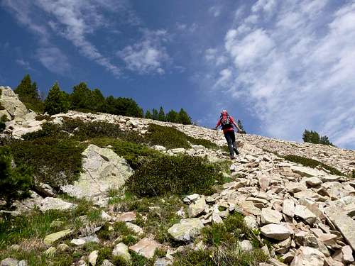
![ascending the pico]() Ascending the pico
Ascending the pico![Ken on the crest]() Ken on the crest
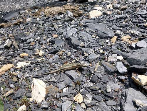
Ken on the crestThe day’s temperature was a pleasant 12 degrees C, ideal for a steady climb and we crossed the shattered scree slopes easily before arriving on the top at 12:19. After consuming our refreshments we decided to head down along the well defined ridge towards the top of the ski tow below. It was quite an easy descent along the ridge and we spotted a lizard amongst the scree.
![Common Lizard]() Common Lizard
Common Lizard
![Pico Cerler from Benasque]() Pico Cerler from Benasque
Pico Cerler from Benasque
![Alpine flora]() Alpine flora
Alpine floraFor once, we had managed to sort out our brewing kit and we enjoyed a fresh cup of tea with our snacks as we viewed the Maladeta ridge from the opposite side to the previous day.
Later, descending back to the ski station we had time to admire the local flowers and animals.
Back down in Benasque we were able to view the Pico from below and it still looked quite impressive as you can see.
The evening weather proved to be a bit stormy so we stayed in the refugio with a sumptuous salad for our dinner whilst searching the TV channels for future weather forecasts.
Day 4. – June 12th– Ascent of Tuca de Gallinero – 2732m.
![Fine weather in Benasque]() Fine weather in Benasque
Fine weather in Benasque![Back at the ski station]() Back at the ski station
Back at the ski station
Having seen a rather nice ridge to the south of the ski station the day before, we decided to return the next day and have a look at it. According to the weather forecast, in common with every other day we were there, there would be ‘tormentas’ in the area, but so far these had been minimal and not occurring whilst we were on the hills. Today would change all that but more about this later.After a leisurely start following our usual breakfast of café con leche and bocadillo tortilla in the café opposite the Hotel Ciria in Benasque, we drove up the hill through the small town of Cerler again past the tarmac gang and arrived at the ski station at 10:49.
The resort car park was totally deserted again as we parked our car under a solitary tree for shade. We crossed between the locked buildings of the resort and headed up the 4x4 track towards the upper ski station.
It was quite a steep pull from the 1910 m level up to the ski station at 2240 m but we arrived shortly after 11:30 and got a brew going. A marmot under the building kept us entertained with his burrowing attempts.
He did look out a couple of times but soon ducked under at the sight of us.
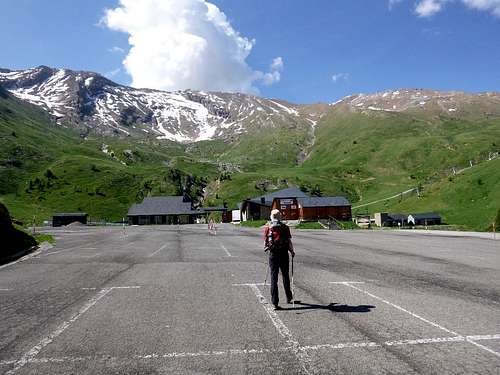
The promised ‘tormentas’ were still holding off so after tea we continued on up to the south
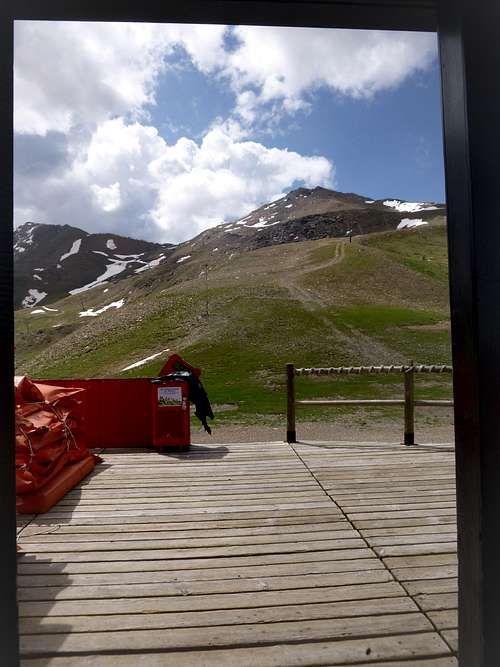
![High Level Ski Station.]() High Level Ski Station.
High Level Ski Station. following the 4x4 track parallel to the line of the steepest ski chairlift.
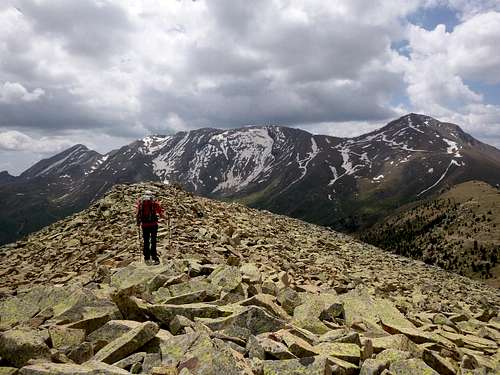
![Our next objective in view]() Our next objective in view
Our next objective in viewA steady pull up the hill brought us to the summit of Gallinero at 2685m (according to my Suunto watch) at 13:45.
The 53 m difference to the actual height was accounted for by a change in the weather and obviously the barometric pressure.
From the rocky top of the hill, we could survey the distant Maladeta and over to the west the impressive peaks of Posets and Perdiguero.
Right about then we noticed a definite thickening of the clouds and a cooling in temperature, so our possible plan to traverse the ridge to the east was abandoned and we decided to lose height as soon as possible.
![On top of Gallinero]() On top of Gallinero
On top of Gallinero
![All our previous climbs]() All our previous climbs in view
All our previous climbs in view
Soon back at the ski station around 14:30, we quickly arranged a brew and ate our prepared sandwiches.
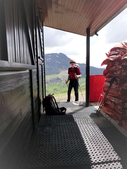
The rain was holding off but with a threatening aspect to the cloud cover we were in no rush to get back down, the ski station porch provided excellent cover from the elements.
Eventually we decided to move and descending the road we watched lightning playing across the ridge of our putative traverse and heard the thundering from below.
That was when the rain started falling in earnest so we had to keep on our mountain jackets for a while.
![On the 4x4 track]() On the 4x4 track
On the 4x4 track![Immaculate blue]() Immaculate blue
Immaculate blue![exquisite blooms]() Exquisite blooms
Exquisite blooms
Soon enough though the rain eased off and we had returned to the car, got changed and had headed down to Benasque for a beer by 16:45. As heavy rain was falling again outside the bar we had no choice but to stay in there for a couple more cańas.
Day 5. – June 13th– Estos valley and the Puerto de Gistain.
![The Ball de Estos]() The Ball de Estos
The Ball de EstosOne of our whimsical fancies over the years was to maybe do the tour of the 3 refugios which entails a complete circuit of the Posets massif. We’d been to the
Estos refugio a few times and also the refugio of
Angel Orus but never to the
Biados refugio. We didn’t visit the Biados this year either but we got closer than ever before. We decided to go up the Estos valley to the refugio there and then head onwards towards the Puerto Gistain beyond that point, the trail gives access to the Biados refugio about 5km further on than the puerto.
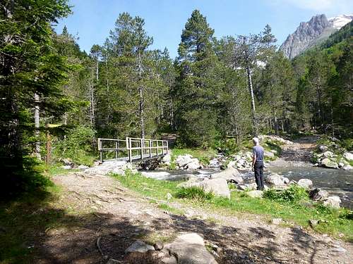
Leaving the refugio at Camping Aneto just after 9:00 am we crossed the old Puente and entered the Ball de Estos, following the surging river to a vehicle bridge provided for farmers and park wardens. This was familiar ground for us as we had been there quite a few times before.
We noticed that the footbridges at Batisielles had been much improved but apart from that, the trail was much as we remembered it from our previous visits.
![Ken admires the new bridge]() Ken admires the new bridge
Ken admires the new bridgeWe had no reason to hurry and took our rest stops at regular intervals.
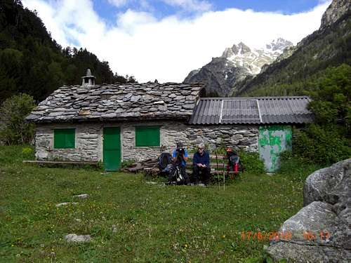
The trail is designated as part of the GR 11 and as such has a number of unattended and guardian attended refugios along the section through the national park. We had passed one of these, the cabin of Santa Ana before the 2nd river crossing where we had taken a short break. Further on we stopped outside the private Cabańa del Turmo for a short rest and a rehydrate. As on previous days, the forecast of‘ tormentas’ had luckily proved inaccurate and we were sweltering in the late morning sun as we admired the mountain scenery.
![Cabana del Turmo]() Cabana del Turmo (on an earlier visit)
Cabana del Turmo (on an earlier visit)Soon enough though it was time to leave the bench and recalling from previous visits some steeply paved sections of the trail we girded our loins and stalwartly marched on.
After losing a considerable amount of perspiration, we crested the steep slope of the trail to see not far ahead the welcome sight of the Estos refugio.
![Approaching the refugio]() Approaching the refugio
Approaching the refugioArriving at the refugio at 12:15, we wondered if our old acquaintance Nando was still the guardian but that was not the case. As I entered the cabin after removing my boots, I discovered a lady guardian in charge. “Como va” I said in greeting and she replied with what I took to be a sardonic response of “estamos aqui”. Seeing only her I wondered about the plural but soon spotted a large woolly haired dog asleep behind the counter.
I enquired about Nando who she obviously knew and she told me that he had left the organisation and possibly the area also. A shame I thought as we had enjoyed a lot of amusing repartee with him on previous visits. I ordered a couple of cafés and took them outside to Ken along with the latest gossip.
We sat on the veranda supping our coffees and munching on our sarnies that we’d prepared earlier at the refugio Aneto whilst also chewing the fat about the previous times we’d been there together and with our other companions.
It was a very pleasant rest spot, surrounded by stunning mountain views with clean crisp air and clear, sunny skies overhead but we had to eventually get up and go.
We knew the first part of the trail beyond the refugio as we had used it on our previous ascent of Posets. Not that this was necessary really as the way further up the valley was obvious and marked with signs at intervals.
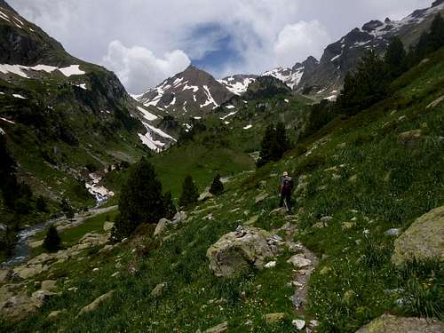
![New ground for us.]() New ground for us.
New ground for us.![the Puerto is ahead]() The Puerto is ahead
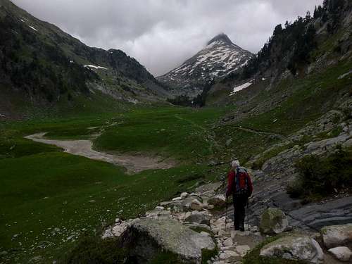
The Puerto is aheadSuitably refreshed, Ken set off at a cracking pace and Johnnie was wallowing behind a bit. Obviously our first few days exercise had restored Ken to his usually vigorous self.
Before too long we were traversing new ground for us and we looked forward to seeing view into the next valley once we had reached the Puerto.
Another couple has left the refugio before us and were travelling in the same direction. We got occasional views of them as we passed clearings on the trail.
After a while the valley opened out more, the trees grew fewer and we could at last see ahead to the Puerto in the distance.
It was still a few kilometres away but at least we could see the point where we would be stopping prior to our return journey.
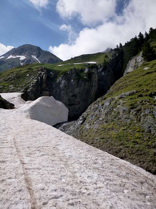
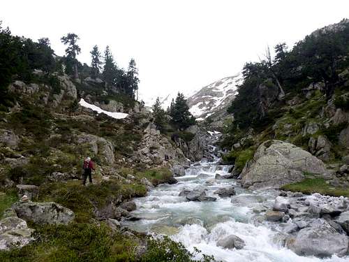
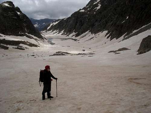
As we got nearer we could see that the winter snows were still plainly in evidence and we would soon have to decide if we needed our axes and crampons.
![looking for a crossing]() Looking for a crossing
Looking for a crossing
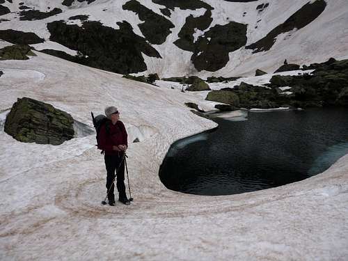
We found a way to cross over the surging meltwater after a brief look higher up on the right bank. All normal trail indicators were covered with snow so the normal crossing point was not evident but we found a way across and still had dry feet.
We spied the couple that we had seen earlier sitting at their highpoint.
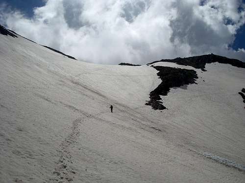
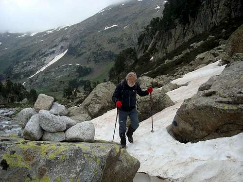
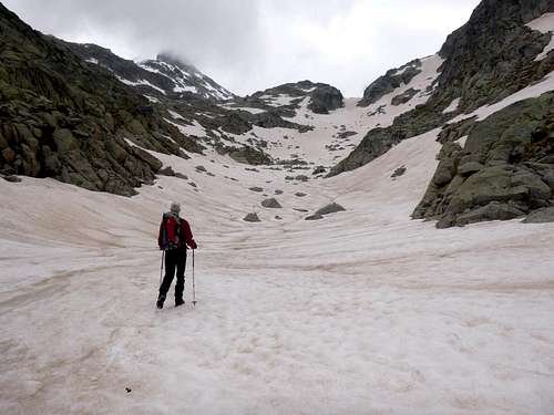
![crisp but not icy]() Crisp but not icy
Crisp but not icyThey had obviously decided not to venture onto the snowy slopes.
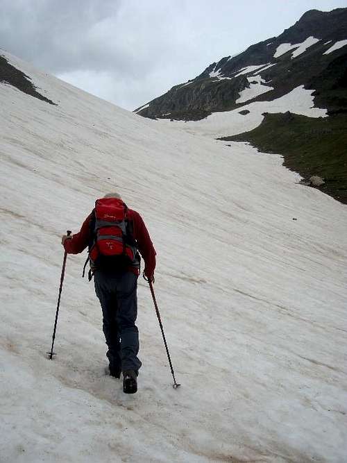
Once we got onto the snowfield proper, we found that the snow was firm but not icy, so crampons were not necessary for safe progress
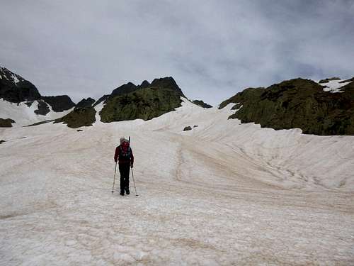
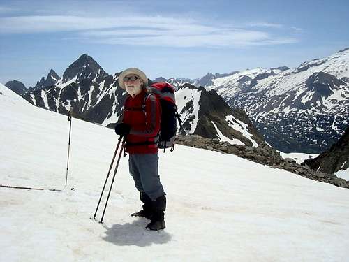
Up we started with a steady gait, well I did for sure.
Ken went a bit ahead of me after taking this picture and I returned the favour with a shot of him.
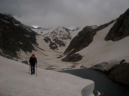
Looking back down the valley, we could see that the weather was closing in somewhat.
![Ken beckons]() Ken beckons
Ken beckons![a look back]() A look back down our trail
A look back down our trail
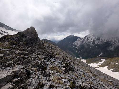
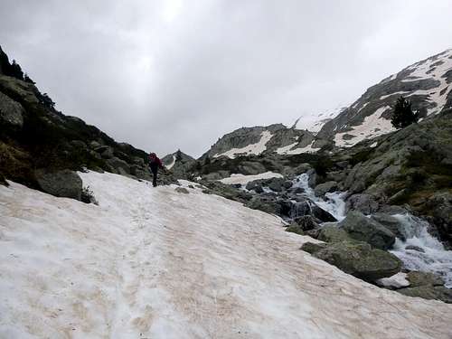
![past a false summit]() Past a false summit
Past a false summit
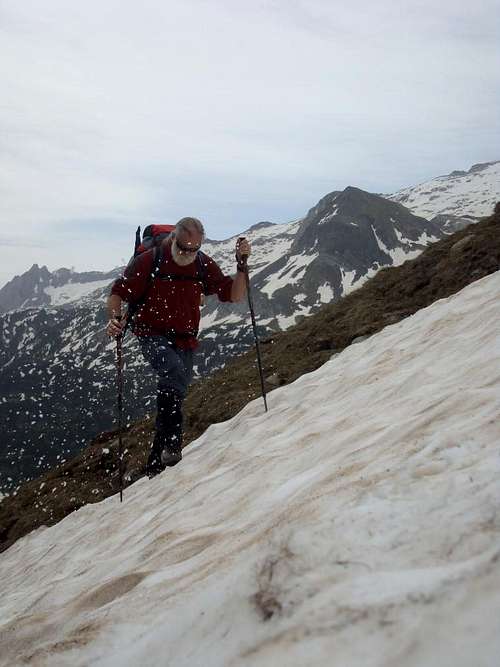
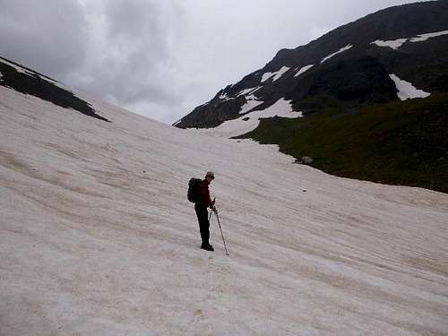
However although it was turning cooler, there was no evidence of the promised ‘tormentas’ yet. I was quite a slog up the snowfield, so the cooler air was a definite benefit.
Cresting a rise, we thought we had arrived at the Puerto but is was a false summit and after a brief relented section, the snowfield steepened again before we could reach the final high point.
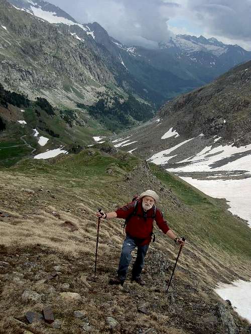
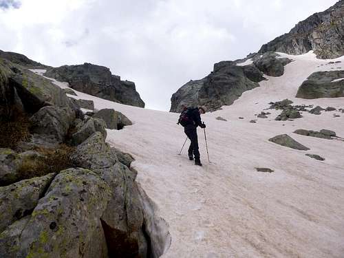
![Johnnie is puffing a bit]() Johnnie is puffing a bit
Johnnie is puffing a bitA rocky spur on the left hand side of the approach gulley gave some relief over the final few metres compared to tedious plodding over the snow and allowed Johnnie at least a brief respite before surmounting the final slopes up to the Puerto.
This crossing point is situated at a height of 2577 metres,only 99 metres short of our high point on day 1!
Following the rock spur actually led us to a point at 2595 metres (according to my Suunto) and we had to descend a short scree slope to reach the marked crossing point
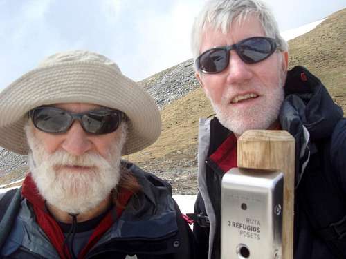
The marker post indicated the route following the tour of the refugios.
![team at the puerto]() The team at the puerto
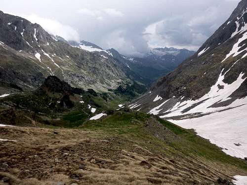
The team at the puertoViews to the west were interesting but limited due towering clouds so we decided to set off back towards the Estos refugio.
![The way to the Biados refugio]()
The way to the Biados refugio
![Returning from the puerto]() Returning from the puerto
Returning from the puerto
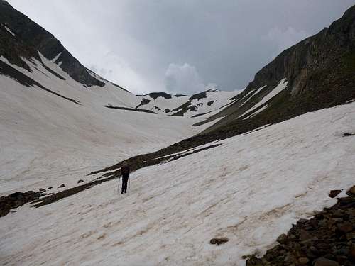
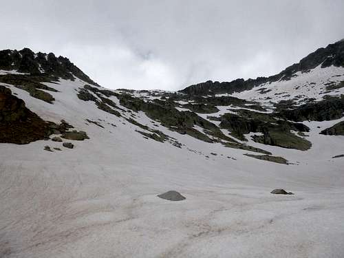
![snow stays firm]() Snow stays firm
Snow stays firm
It was more fun descending than going in the upward direction. The old snow was firm so there was no ‘postholing’ on the way down.
![The blind canyon]() The blind canyon
The blind canyon We passed a snow filled gorge that was the scene of my earlier route finding attempt but where Ken had made sure that I kept on the right road.
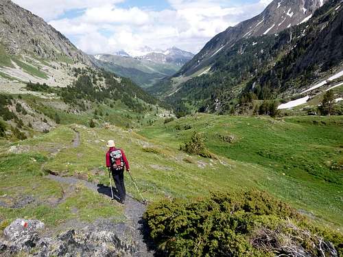
![The excellent GR11 trail]() The excellent GR11 trail
The excellent GR11 trail![Marmot lookout]() Marmot lookout
Marmot lookoutA marmot lookout spotted the two of us descending and soon started off whistling to warn any other marmots around there of potential danger.
We whistled back but the cocky little creature was obviously unimpressed with our poor mimicry of its warning signals. Our trekking poles could have looked like hunting rifles.
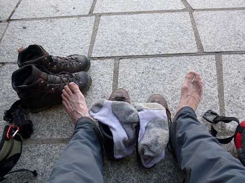
![Cooling the feet]() Cooling the feet
Cooling the feet
Back at the Estos hut, Ken went in for some refreshment and clutching a couple of ice cold cans of beer soon came back outside to give us a cooling draft of the amber nectar.
![Estos refugio patio]() Estos refugio patio
Estos refugio patioWe quaffed our ales whilst admiring the beautiful views down the valley.
I’m not sure if the erratic angle of the foto was due to the influence of alchohol or just plain tiredness.
However we soon felt refreshed enough to leave the refugio and head back towards Benasque and dinner. We got back to the refugio at 20:40, a long day out.
Day 6. – June 14th– A rest day trip to .Ainsa.
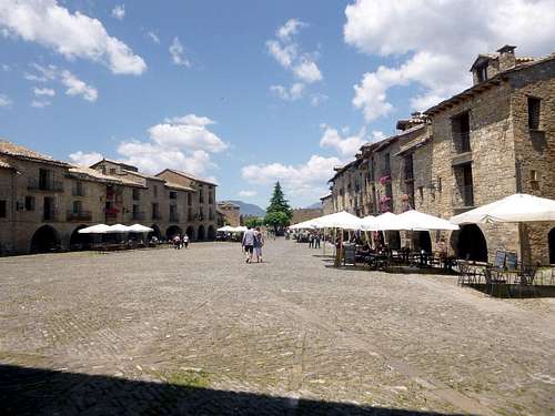
![main square Ainsa]() Main square Ainsa
Main square AinsaAfter the strenuous previous day, we decided on a rest day and a visit to Ainsa, an ancient fortified town some 61 kilometres from Benasque.
![View from the battlements]() View from the battlements
View from the battlementsAinsa is a very picturesque town and thus a bit of a magnet for tourists but on the way there we decided to check out another small pueblo a bit further up the road. This was the small hillside town of
Bielsa. We missed the turning off the A138 and were heading for the tunnel to France when we realised we’d gone too far up the road. Returning, we parked up in a riverside car park on the outskirts of the housing and took a stroll around. It was a really small town so we had soon completed our tour. Stopping in the tiny town square outside the ajuntamiento, we called into a café for coffee and sat for a few minutes watching the passersby. The entertainment was short lived so we decided to get out of town before boredom struck too severely. Just before we reached the car park, we spotted a war memorial to fallen local heroes. This monument was quite sad as the names repeated down the granite face of the obelisk were quite repetitive showing that a very few families had lost a lot of their younger members in the Guerra civil. It was a saddening and sobering moment.
Returning to the car we were left with our own silent thoughts as we drove away from Bielsa.
In Ainsa, coach parties of youngsters were milling around so we quickly bypassed them and took a stroll into the old narrow, medieval streets.
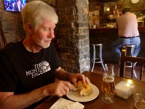
Finding a small café/bar open, we ordered a couple of cańas and dos bocadillos de queso for our lunch.
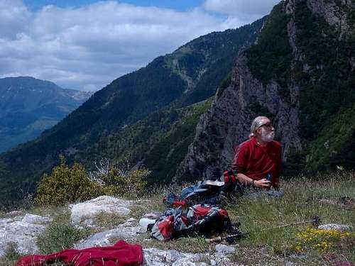
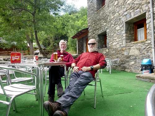
![lunch]() Lunch
LunchIn the picture beside Ken is our ‘kitty’, asmall polythene box that we keep topped up with Euros. We found this the best way to split our costs for accommodation, meals and refreshments. We each occasionally pop in the same amount of Euros when it gets low and this avoids any head scratching for who’s round it is. Ainsa would be a quite a pleasant place to spend a few days holiday as it is situated virtually in the centre of the Pyrenees between two National Parks. (The Ordessa & The Posets - Maladetta). For mountaineers though, Benasque is definitely the prime location and is where we will always stay.
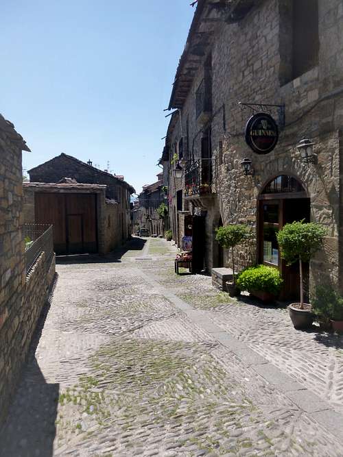
![Ainsa alley]() Ainsa alley
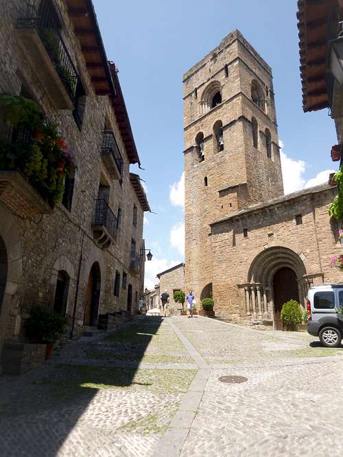
Ainsa alley ![Religious edificio]() Religious edificio
Religious edificioDay 7. – June 15th– Father’s Day - Ascent of Pico de Salenques – 2993 metres.
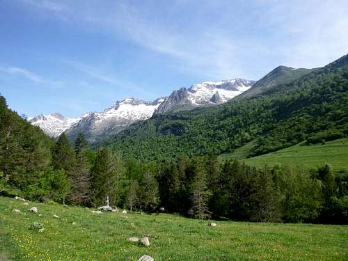
![beyond the Renclusa]() Beyond the Renclusa
Beyond the RenclusaAfter our well earned rest day, we needed a good target for our last ascent of the week. We had mooted the possible climb of Forcanada, that had been silently beckoning us for years but in view of the time needed we agreed that it was a bridge too far and maybe a target for future years.
![Johnnie and Peter attempt the Salenques]() Johnnie and Peter attempting the Salenques in 2010
Johnnie and Peter attempting the Salenques in 2010Wayback in 2010 on a previous visit with Ken and his brother Peter we had attempted to climb Salenques from the ridge between it and the Forca d’Estasen which lies somewhat to the south west. We reached the area of the Col de Salenques in very poor visibility and Peter and Johnnie attempted to ascend the remaining 72 metres to the summit but it proved a bit too risky without a rope and belay and we retreated.
This time Ken and I agreed to follow the route recommended in the Kev Reynolds guidebook which is to ascend the Ball de Barrancs, and passing below the Pic de Barrancs, locate an easier ascent line between the two mountains. This line is also marked on the Editorial Alpina map.
So setting off from our car parked in La Besurta below the Renclusa refugio at 8:30, we followed the trail towards the Forau des Aigualiuts.
The sky was sullen but free of the promised tormentas so we were able to enjoy the walk. The trail is well defined as hordes of tourists travel on it to see the Forau and we could just stroll along enjoying the morning without the need to use the map and compass.
Once past the Forau, the next stage was the crossing of Plan dels Aigualiuts, a rather boggy area with a number of streams. Essentially,here, the trail is divided by the bulk of the impressive pyramidical Pic dels Aigualiuts which rears up ahead.
![Barrancs]() Barrancs
Barrancs
Taking the left hand trail after hopping across stepping stones, we followed the left hand bank of the river into the valley above.
![Following trail markers]() Following trail markers
Following trail markers
The trail was fairly well marked with cairns and paint spots on boulders but it was confined between opposing wall anyway so these didn’t seem entirely necessary although we found out later that we should have paid more attention to them!
We soon lost the trail as it was covered with old snow but we continued on as we did have some remembrances of the previous time we had ascended in the same direction albeit then we were in virtual whiteout.
![Ken leads as usual]() Ken leads as usual
Ken leads as usual![head for the gap]() Head for the gap
Head for the gap![The gap gapes]() The gap gapes
The gap gapes
Above us a distinct cleft in the ridge looked like the right way up so Ken led off towards it.
![beyond the gap]() Beyond the gap
Beyond the gapThe panorama distinctly improved once we had passed through the gap.
Once we were through, the narrow valley reached a much wider profile with a distinct dome over which we had crossed to see below another dome but unfortunately this one was convex and so we had to descend but from there we at least had a view of our objective.
It’s never a nice feeling loosing height when you know that straight afterwards you are going to have to gain it again, but girding our loins we headed down, trying to contour around the bowl as far as possible in order to minimise the loss of height.
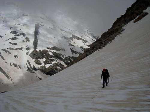
After crossing the depression we weren’t exactly depressed but had to choose a line up the snow slopes that looked the least likely to avalanche on us as it was at a very steep incline. We picked a line on the left hand side of the main snowfield so that we would be partly crossing rocks as well as snow as this seemed a safer proposition. Even so we still had to cross some pretty steep white stuff.
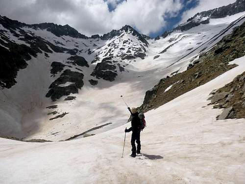
![the climb to the collado]() The climb to the collado
The climb to the collado
From the picture, the slopes leading from lower centre to the top left below the ridge, look quite easy but this is a deceptive view.
Although many maintain that the camera never lies. Maybe it doesn't just tell the whole truth.
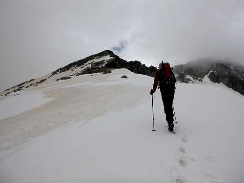
At last, getting used to the angle, we started to enjoy ourselves, knowing that we were nearly there. Collectively gathering our breath at the col, we could see to our right, the slopes leading up to the Salenques summit.
Although the day was a lot less clear than previous days we couldn't complain about visibility. After many summit days with no views we were at least blessed with clearing skies as we headed upwards.
![summit ridge ahead]() Summit ridge ahead
Summit ridge ahead![rock scrambling needed]() Rock scrambling needed
Rock scrambling needed
Ken headed away, the snow was still nice and firm and required nothing more than placing the boots.
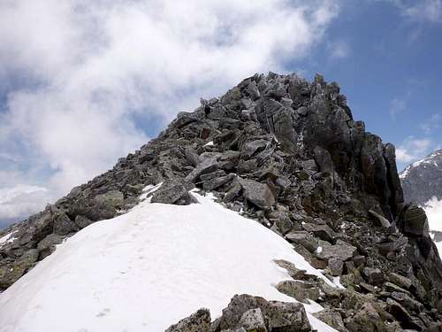
Once we’d crossed the initial snow slope, a rocky ridge appeared and it became a occasional hands on experience as we scrambled upwards and before long we saw our final obstacle.
The summit ridge reared up again but we at least thought that we must be very near the top.
It was a lot of fun scrambling along the last few metres of rock. The friction was amazing and verglas totally absent. A suddeen urge to break into a yodel was suppressed but the smiles on our faces said it all.
![Ken is nearly there]() Ken is nearly there
Ken is nearly there
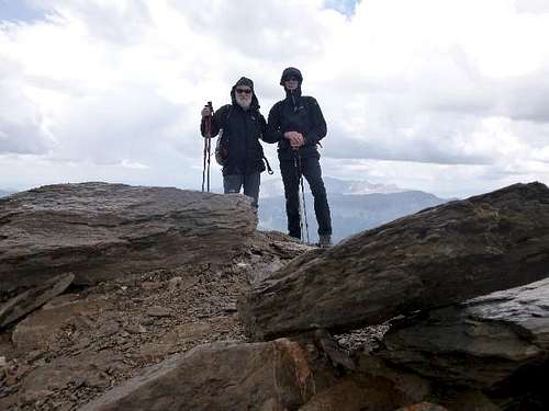
![The team on top - Pico de Salenques]() The team on top - Pico de Salenques
The team on top - Pico de SalenquesJust in case our navigational skills left any doubt as to whether we were on the actual Salenques summit, a previous ascendent had marked a stone on the summit cairn as you can see in the team selfie.
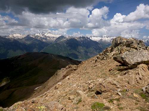
![summit view from Pico de Salenques]() Summit view from Pico de Salenques
Summit view from Pico de SalenquesAfter a short while admiring the views as it was quite cold at the top when we arrived at 14:48, we didn’t want to hang about for too long. So, after the summit selfies and photos taken of the surrounding scenery we started down again. We had a discussion about the best line of descent and decided to head straight down the steep snowfield that we had traversed on the way up. We felt justified in this as we had assessed the state of the snow on the way up. It was very well consolidated, with no sign of fresh layers of deposit and no obvious sheer lines. So half jumping and half glissading we made our way swiftly to the bowl below. Here again we had a conflab as we didn't really fancy climbing up out of the bowl to reach the gap that we had passed through earlier. After studying the map we reasoned that a route along the lago would lead us to a point further below where we could rejoin the ascent trail.
![route choice required]() Route choice required
Route choice required![another frozen ibon]() Another frozen ibon
Another frozen ibonThis alternative proved to be OK and did avoid climbing out of the bowl before descending again. Walking along the edge of the Estany was a bit hairy as some of the frozen banks had broken away depositing mini icebergs in the lake.
Once below the northern end of the lake we had to cross back west to recapture the trail to the plan. Following what was apparently the trail (see earlier comment) we crossed a surging stream and descended a boggy hillside. Then we found ourselves boxed in by a dead end and couldn’t see a way to continue the trail down to the plan. We searched along the river bank for a suitable crossing place, climbing back up the hill the way we has descended. Ken spotted some large boulders that seemed to offer a potentially dry crossing over the raging torrent.
I was looking around for an alternative as my reach is not as extensive as Ken’s but when I looked back he was already across. Ah well I thought, nothing ventured…, so approaching the nearest boulder from the bank. I stuffed my poles away and leapt across the void, grasping a sharp flake on top of the water surrounded boulder. After a brief scrabble of the boots, I found purchase and a short hand traverse and a mantleshelf got me on board. From there it was a couple of short leaps to other boulders and I fetched up alongside Ken on the far bank. Ken didn’t look too happy then, but it was nothing I had said (apart from a few expletives on the crossing). What up mate?I said, “I’ve lost a pole” said Ken and he only had one left. Oh bugger I thought, we should have followed the paint spots back down the trail instead of trying to find a new route. Oh well at least we were over any difficulties and still bone dry with just about an hour walk back to the car park. We got back to the car at 19:15, another fairly long day.
Day 8. – June 16th – Last hill day.
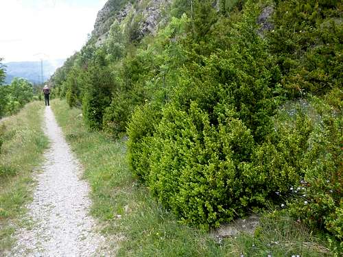
We felt that we had done justice to our past performances andso decided to stick with another rest day. That thought didn’t last too long as we were getting itchy feet. Not too keen on another marathon, we thought that taking the trail from below the campsite to the top of the Collado d’Ixeia, a smallish hill (1714m.) that overlooks the town of Benasque. At a height gain ofonly 400m above the campsite, we could almost classify it as a rest day.
The path was fairly well trodden but quite overgrown at the sides with lush vegetation and box bushes. Apart from the steepness, our only problem was the flies, they buzzed around our heads incessantly all the way up the hill. At last we reached the top and a light breeze seemed to be a bit of a deterrent and the fly nuisance reduced.
![on the bolwling green]() On the bolwling green
On the bolwling green
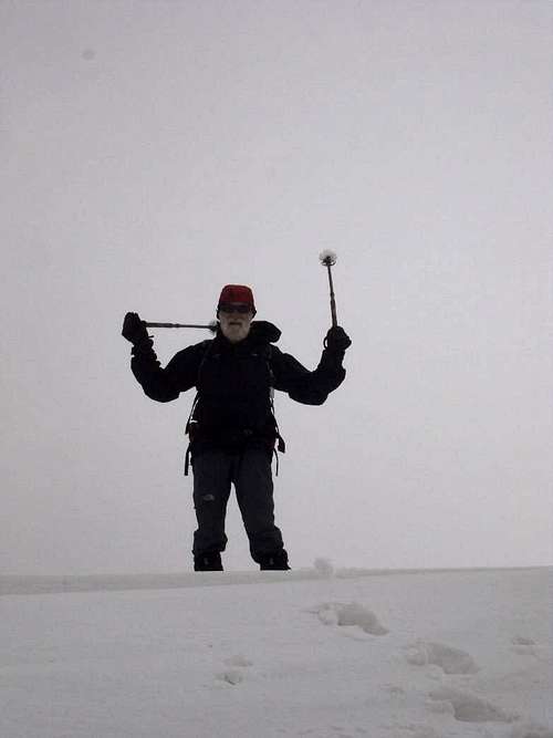
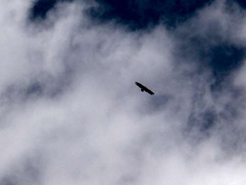
![a real Lammergier?]() A real Lammergier?
A real Lammergier?At the collado was a veritable bowling green of short grass which we threw ourselves down onto at 12:15 and sucked in some oxygen after making a fairly brisk ascent.
We’d not been there long when we spotted some large birds wheeling overhead. It was difficult to identify them but after studying a photo it seems like they were real Lammergeiers. You can make up your own minds from the rather blurry picture.
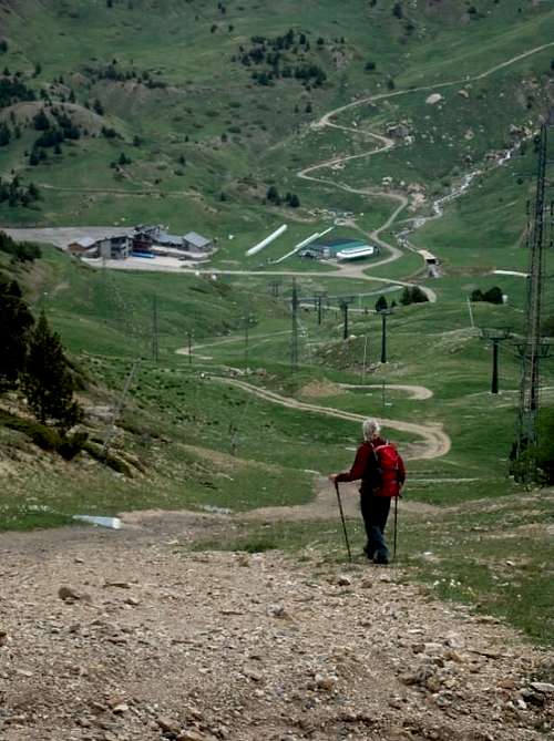
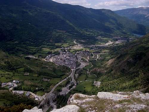
The Collado provided a superb vantage point for views down the valley towards the town below.
Ken’s foto of the town of Benasque from the collado perfectly illustrates its compact nature.
Almost like a Ying & Yang symbol the old townto the left is snuggled up to the new development area on the right hand side.
![aerial view of Benasque town]() Aerial view of Benasque town
Aerial view of Benasque town
Down the valley below the town is just visible (top right) the reservoir at Eriste from where the start of the trail leading to the refugio Angel Orus starts.
On the left hand side are the hills that lead up to the Ski resort of Cerler, where we had two of our easier days climbing.
In the town itself, the old road passes directly through, following the line of the road that leads down the valley, but most of the traffic takes to the left hand side along the semi-circular ring road.
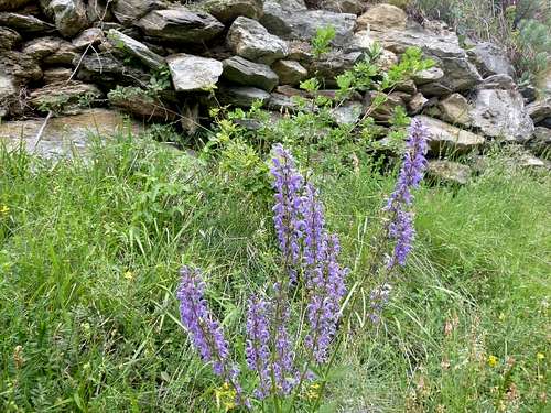
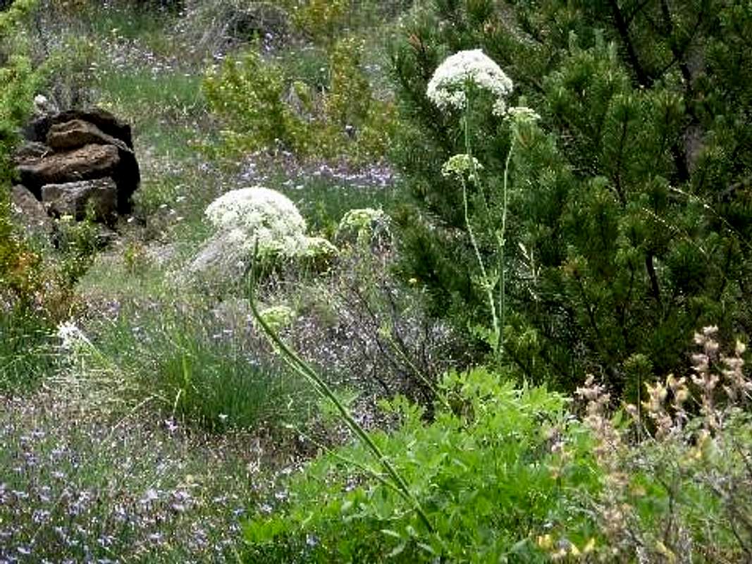
After our sojourn at the collado and the descent through the forest trail, we decided to head into town. There is a very nice path away from the road that allowed us to admire the abundant flora.
![botanical walk into town]() Botanical walk into town
Botanical walk into town
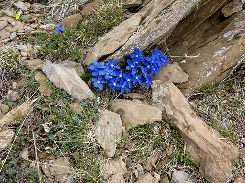
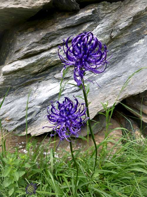
![azure flowering spikes]() Azure flowering spikes
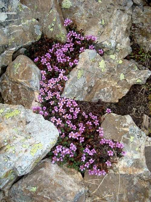
Azure flowering spikes![blooming marvelous]() Blooming marvelous
Blooming marvelous![looks like cow parsley?]() Looks like cow parsley?
Looks like cow parsley?
The trail into town was well surfaced and the path surrounded by a veritable botanists paradise. Shown below are just a few examples.
![Refugio at Camping Aneto]() Refugio at Camping Aneto
Refugio at Camping AnetoA final beer at the Camping Aneto refugio bar. As with our experience in previous years, the bar / restaurant had seasonal opening times so it was only towards the end of our stay that we found it open.
(probably a good job too!)
Day 9. – June 17th– Benasque to Barcelona.
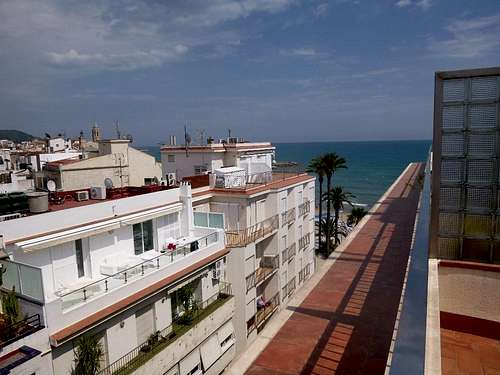
![Sitjes hotel room view]() Sitjes hotel room view
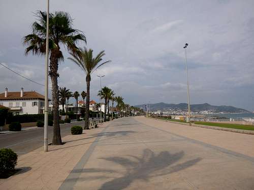
Sitjes hotel room view![Passeig Maritim - Sitjes]() Passeig Maritim - Sitjes
Passeig Maritim - SitjesIn view of the earlyish flight time for our return trip to the UK, we had previously decided to travel back from Benasque the day before. In accordance with our past preferences we stayed in Sitjes not far south of the airport. We’d not booked accommodation and hoped that we could stay at the small hostal outside the Plaça del Dr Robert but when we arrived we found it closed for refurbishment. So we went along to the Hotel Subur where both of us had stayed previously with our respective wives.
Our accommodation in Sitjes was definitely more luxurious than at the refugio but somewhat remote from the mountains. After check in we strolled along the promenade and after working up a thirst visited our favourite Basque-style tapas bar.
![Basque style tapas]() Basque style tapas in Lizzaran
Basque style tapas in LizzaranSo all too soon we had ended our 10th anniversary visit, it was a great week and made all the more savoury because to our great delight the daily dire weather forecasts had been quite inaccurate for our locations at Benasque.


Comments
Post a Comment