Toggle navigation
Mountains
Routes
Images
Trip Reports
Forum
What's New
People
Areas & Ranges
Articles
Trailheads
Canyons
Huts & Campgrounds
Albums
Logistical Centers
Fact Sheets
Lists
Custom Objects
Gear
Plans & Partners
WELCOME TO SUMMITPOST
SIGN IN
REGISTER
Skaftafell National Park
Additional Parents
Image
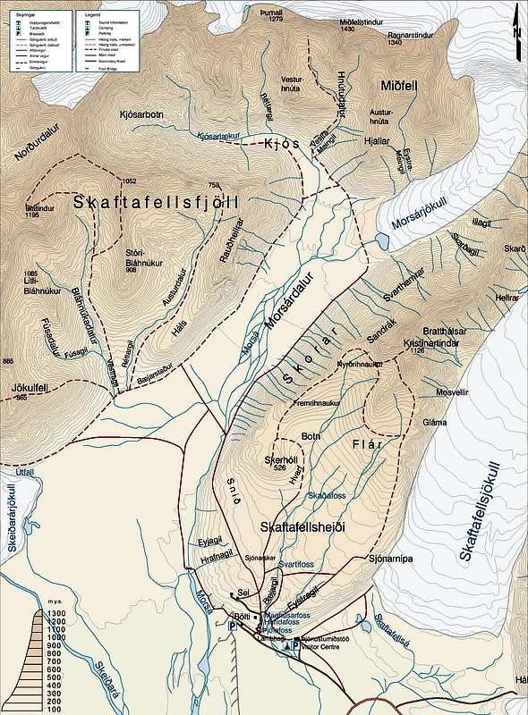
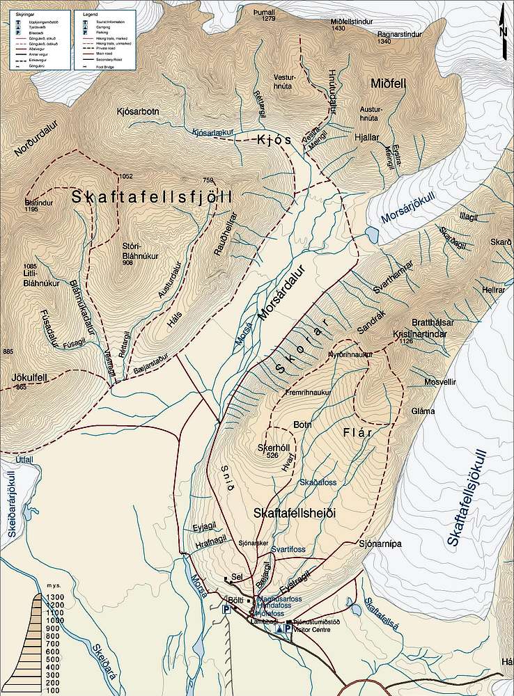
A map of Skaftafell
View High-Resolution Image
A map of Skaftafell
This map covers the southern and most popular part of the Skaftafell National Park and is courtesy of the park authority.
« PREV
NEXT »
Nanuls
on
Nov 21, 2007 3:43 pm
Comments & voting
Other parents
Lat/Lon:
64.04997°N / 16.94641°W
Image Type(s):
Topo/Diagram
Image ID:
358812
7900 Hits
71.06
% Score
1
Votes
Log in to vote
Comments
No comments posted yet.
to post!
Don't have an account?
Skaftafell National Park
(Area/Range)
« PREV
Viewing
#85 of 95
GALLERY
NEXT »
Nanuls's Image Gallery
« PREV
Viewing
#2114 of 2366
GALLERY
NEXT »
×
You need to login in order to vote!
User Name
Password
Remember me
Forgot your password?
Log me out when I close my browser.
Keep me logged in all the time.
sign in as a user
Don't have an account?
Register now for FREE
Rating available
Suggested routes for you
People who climb the same things as you
Comments Available
Create Albums
Register Here


