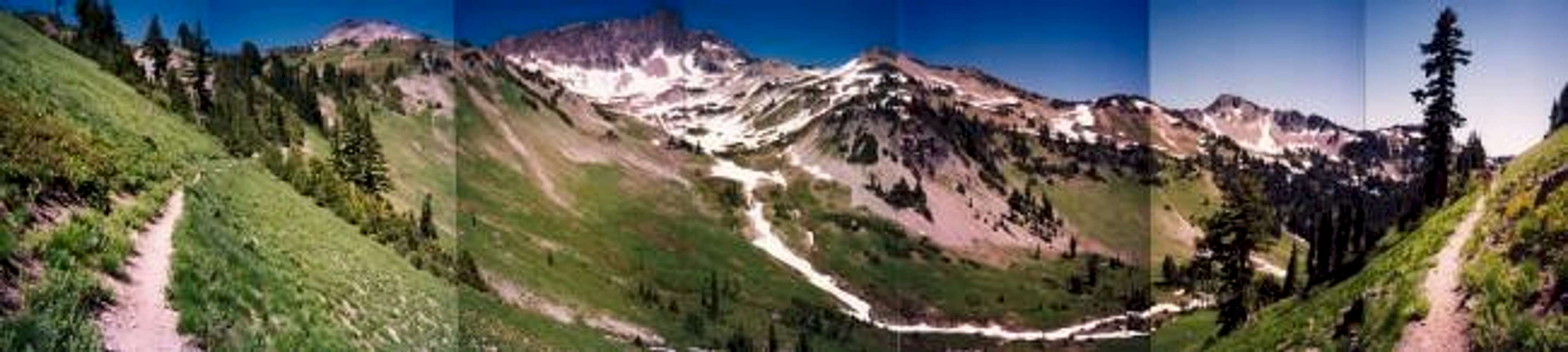
A panorama of Cispus Basin just east of Snowgrass Flat, which is the standard western approach to Mt. Curtis Gilbert. For a full-size viewing go here:
Large Size Image. From left to right in the image are: Ives Peak (7,932 ft), Big Horn (est. 7,850 ft), Pt. 6872, Cispus Pass (6,473 ft), Pt. 6735 (distant rocky point in second panel from right). Photo taken July 9, 1994.


