Toggle navigation
Mountains
Routes
Images
Trip Reports
Forum
What's New
People
Areas & Ranges
Articles
Trailheads
Canyons
Huts & Campgrounds
Albums
Logistical Centers
Fact Sheets
Lists
Custom Objects
Gear
Plans & Partners
WELCOME TO SUMMITPOST
SIGN IN
REGISTER
Kotova Spica Normal (W) Ascent
Additional Parents
Image
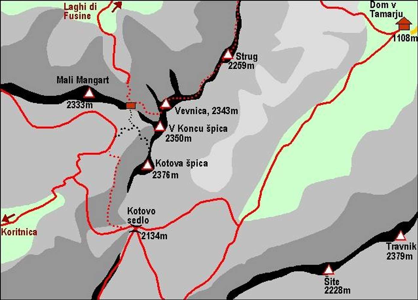
A self-made map of Kotova...
View High-Resolution Image
A self-made map of Kotova...
A self-made map of Kotova spica and its neighbourhood.
« PREV
NEXT »
Vid Pogachnik
on
Dec 28, 2004 5:14 am
Comments & voting
Other parents
Lat/Lon:
46.43510°N / 13.68810°E
Image ID:
82819
4076 Hits
74.01
% Score
4
Votes
Log in to vote
Comments
No comments posted yet.
to post!
Don't have an account?
Kotova Spica Normal (W) Ascent
(Route)
« PREV
Viewing
#7 of 9
GALLERY
NEXT »
Vid Pogachnik's Image Gallery
« PREV
Viewing
#5486 of 9272
GALLERY
NEXT »
Kotova spica
(Mountain/Rock)
Loading....
×
You need to login in order to vote!
User Name
Password
Remember me
Forgot your password?
Log me out when I close my browser.
Keep me logged in all the time.
sign in as a user
Don't have an account?
Register now for FREE
Rating available
Suggested routes for you
People who climb the same things as you
Comments Available
Create Albums
Register Here


