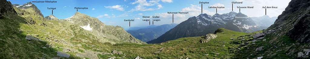
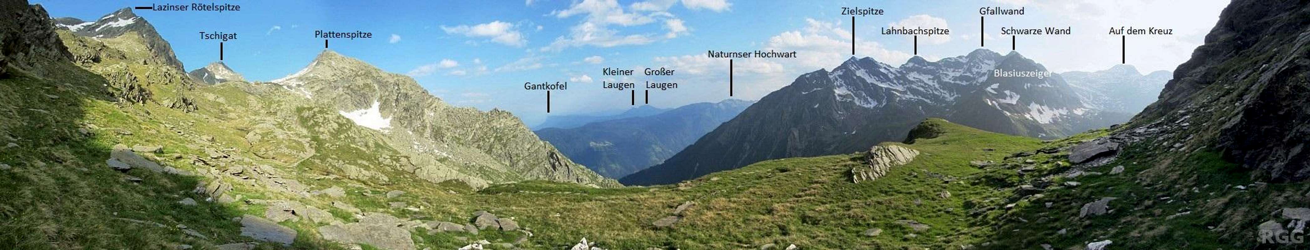
Annotated 200° panorama from the western slopes of the Lazinser Rötelspitze
The normal route to the Lazinser Rötelspitze, on the far left, follows a hiking trail to the saddle on with Tschigat, from where it's an easy scramble up the southeast ridge (UIAA grade I). Neither saddle nor ridge is visible, both obscured by the steep south ridge.
I've just taken an alternative way down, and the main part of it is still easy to see: from the summit, I followed the northwest ridge (to the left) until I got to the snow field. It looks small now, from this distance, but it wasn't when I was still high up. After leaving the ridge, I descended on the snow, first towards the west but soon starting a gradual turn in the direction of the south ridge. Lower down, near the bottom of the snow, I turned west again, and hiked down the gentle grassy slopes.
Click on the image for a large version.
15 July 2013.


