
-
 38512 Hits
-
 98.46% Score
-
 83 Votes
|
|
Area/Range |
|---|---|
|
|
18.59222°N / 98.48667°E |
|
|
Hiking, Sport Climbing, Scrambling |
|
|
Spring, Summer, Fall, Winter |
|
|
8415 ft / 2565 m |
|
|
Overview
Thailand is located in southeast Asia. It is the about same size as the country of France. It shares borders with Myanmar (Burma) on the north and west, Laos on the north and east, Cambodia on the southeast, and Malaysia on its southern end. Thailand is ruled by an elected government and is inspired by the world's longest-reigning monarchy. Buddhism is the main religion of about 95% of the population. The country is often called the land of smiles. This slogan holds considerable truth to the Thai people who are gracious with a strong sense of self and humanity. Throughout history, Thailand has been known to create its own unique path and has tried to retain its past while moving into the future. The result is a country that has never been colonized by a foreign power and never sought to conquer a neighboring country.
The largest city in Thailand is Bangkok. It has a population of about twelve million and is kind of like its own little world. To give you an idea on how big the city is, one out of every six Thai people live there. Bangkok's full name would take a whole paragraph to spell out but in English translates to City of Angels. It is the international gateway to much of southeast Asia. For tourists it seems like a bewildering maze of traffic, noise, and people. Yes, this is all true, but Bangkok is also Thailand's capitol and most famous city. It contains some of most beautiful temples and shrines. There is a lot of history to be discovered here and most people can not walk away without being impressed with places such as the Grand Palace, Wat Pho, Temple of Dawn, and Temple of the Emerald Buddha. In reality, the city of Bangkok bears little resemblence to the rest of the country. Most of Thailand is actually a rural patchwork of rice fields, villages, lakes, and forests.
In 1939, the name Siam was officially changed to Thailand, meaning the Land of the Free. Thai is the official language of Thailand but each region has a different dialect. This can be confusing to people who have never been there before. In Northern Thailand, Doi or Phu, means mountain. In Northeast Thailand, Phu, is most commonly used to describe a mountain. The word, Khao, means mountain or hill and is used a lot in Central Thailand but can also be seen in the north. The word, Pha, is used to describe a cliff.
Before visiting Northern Thailand, I had made a plan to see as many places as possible. With a family that doesn't enjoy traveling as much as I do, and other circumstances, I ended up seeing only a few places on my list. You'll have to pardon my lack of photos and the quality of most of the ones I was able to take. I had brought two cameras with me and by the end of the trip one was broken and the other only worked occasionally. It also took me a while to get use to photographing in a jungle environment.
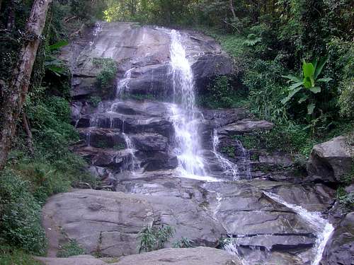
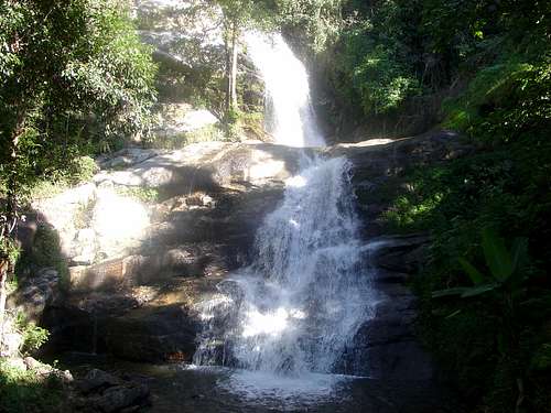
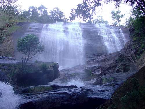
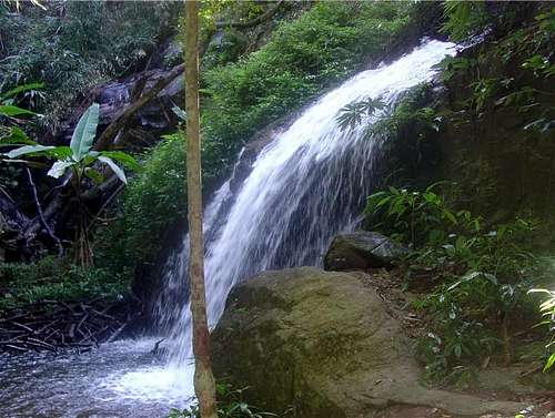 Monthathon Waterfall
Regions Overview
Thailand is generally divided into four regions: The central plains, the north, the northeast, and the south.
The North-Eastern Region - The northeast region of Thailand is known as Isan and is located on the Khorat plateau. It comprises about one-third of Thailand's total area but is generally poorer than the rest of the country. This is where rice and other staple crops are grown. The majority of people that live here are farmers. This area is famous for its annual festivals and ceremonies and hot spicy food. There are many mountains to climb in this region too. The northeast was once an important part of the mighty Khmer Empire with its capital at Angkor Wat, the entire Isan region is rich with ancient Buddhist shrines and temples. The military was a stong influence on this area during the Vietnam War. The city of Udon Thani, which is also called Udorn, was the site of a major U.S. Air Force Base. The base is still used today by the Royal Thai Air Force. The whole northeastern region consist of nineteen provinces.
The Central Plains - This is where Bangkok is located. Central Thailand is the basin of the Chao Phraya River. It is fed by a large network of canals and rivers in a lush, fertile valley supporting vast fields of rice, sugar cane, pineapples and other fruit. It is the richest and most extensive rice-producing area in the country and has often been called the "Rice Bowl of Asia". Two places that you should see are Erawan National Park and Sai Yok National Park which are well known for many of their spectacular waterfalls. The former capitol of Ayutthaya is located to the north and is something that should not be missed. The old temples and ruins in this city date back to the year 1350. Another place to visit is the city of Kanchanaburi which is located west of Bangkok. It has the Death Railway Bridge used in WWII, more commonly known as The Bridge on the River Kwai made famous by the movie of the same name.
The Southern Peninsula - This region is south of Bangkok and extends down to the Malaysian border. This region has something for everybody, marine national parks, endless beaches, and several resort towns. Tourists are always having fun here and enjoying the cheap accommodations that are available. Popular rock climbing areas can be found in the province of Krabi. Winter is the best time to visit this area. On December 26, 2004, a magnitude 9.3 earthquake, erupted on the floor of the Indian Ocean. Along Thailand's Andaman coast, a tsunami struck six provinces. In Thailand, the toll was 8,000 people confirmed dead or missing. Since then, Thailand has slowly rebuilt itself out of the disaster. Tourists are encouraged to visit these areas. The country has successfully recovered.
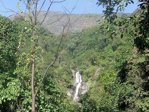
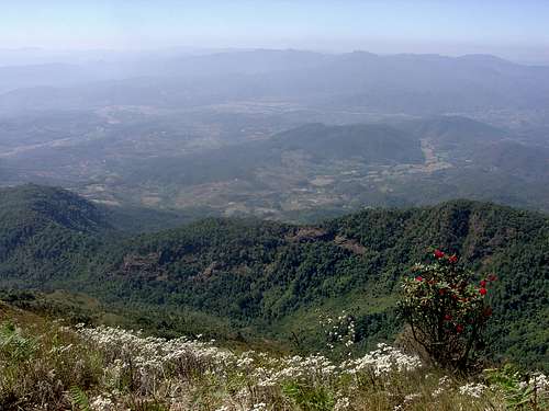 Doi Inthanon View
The Northern Region
The Northern Region appears to be a remote area that is far away from many tourist destinations. Even though it is located 450 miles north of Bangkok, the area is quite accessible by driving or air travel. It consists of 17 provinces and occupies approximately 170,000 square kilometers. There are two distinct areas. They are the wide plains of the lower north from Nakhon Sawan up to Sukhothai. Sukhothai was the old capitol of Thailand. It lasted from the year 1238 till 1438 and has many ruins and temples in amazing condition. This area leads into the mountainaous upper north that has long borders with Myanmar and Laos. Trekking is popular along with elephant riding and river rafting. These mountains are home to several hill tribes. There are also many national parks.
Chiang Mai is the second-largest city in Thailand, the largest and most culturally significant city in northern Thailand, and the capital of Chiang Mai Province. It is located on the banks of the Ping river and is set in a green, fertile plain. Modernization has crept into this place for decades. This has had both positive and negative effects. Chiang Mai now has a well developed tourist industry with hotels in all price ranges. The city of Chiang Mai has tried to retain its traditional charm and centuries-old culture throughout all of this. More than three hundred temples are located here and give the city an atmosphere of calmness and timeless elegance. Chiang Mai is famous for its traditional handicrafts. You'll notice that each locality has its own particular craft product, such a wood carvings, jewelry making, silverware engraving, and silk weaving.
Chiang Rai is a city in the northern-most province of Thailand. The mighty Mekong River creates a border on the north. The small town of Sop Ruak is a place where the borders of Thailand, Laos and Myanmar converge. It's called the famous-infamous Golden Triangle. This is an area which was well known for being unsafe because of drug smuggling across the borders. Today, it is a popular tourist stop where many visitors come for an hour or so to take pictures. You can even visit the Opium Musuem which showcases the history of opium in the region. The views across the river into Laos and Myanmar are excellent and there are several open-air restaurants which offer panoramic views. The Chiang Rai province is mountainous and covered in large parts with tropical rain forests.
Here is a map of Thailand and the Northern Region
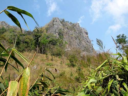
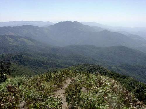 Doi Inthanon National Park
Doi Inthanon

Doi Inthanon

Doi Inthanon
Doi Inthanon
This is the highest mountain in Thailand. It is located in Doi Inthanon National Park above the town of Chom Thong and about 1.5 hours southwest of Chiang Mai. It is the most popular National Park in northern Thailand. Since 1899, the mountain was formerly known as Doi Angka. Doi Inthanon is a shortened version of the name of Chiang Mai's last sovereign, King Inthawichayanon. During his reign, he had great foresight to express his concern for the forests of the northern hill country as being the watershed for all of central Thailand. Before the King died near the turn of this century, he said that he wanted his remains to be placed at the top of this mountain. His ashes at the summit stupa are visited by thousands of people each year.
You can drive all the way to the top along a windy road. A short trail takes you to the summit past a sign that says Highest Spot in Thailand. You'll want to hike some of the trails while you're there. The Gew Mae Pan Trail is one that I recommend and takes about two hours. It is a rewarding hike that goes through the jungle and then onto a high mountain ridge. You should also see the two temples that were completed by the Thai Air Force in 1989 to honor the 60th birthday of the King and Queen Sirikit. There are several waterfalls here too. Mae Yah Waterfall is remarkable for its combination of size and beauty. It has a large volume of water that plummets for nearly 30 stories down to the rocks below. Brichinda Cave is impressive and has two gigantic chambers and takes an hour to get to.
Hikers who want to experience a longer and more strenuous trip may want to travel on foot from the base of the mountain. This was the traditional means of climbing Doi Inthanon before car transport was available. The popular hiking route begins at Mae Klang Waterfall. The first night, hikers can stay overnight at a Karen village or in the forest. The second overnight is at the Karen village of Pah Mon. The third overnight is at Pang Somdej before reaching the top of Doi Inthanon. During the journey, hikers will enjoy the high mountain environment and also get the see the lives of local hill tribes.
 Doi Pha Hom Pok National Park - by mrchad9
Doi Pha Hom Pok

Doi Pha Hom Pok Hot Springs

Bhoo Muan Waterfall
Doi Pha Hom Pok
This mountain is located in Doi Pha Hom Pok National Park. This large park is situated at the northern limits of the Chiang Mai Province near the city of Fang. It is in one of the least spoiled areas of Thailand. Strong winds blow every day and have caused the mountain to have a flat top with layers of dirt and granite rocks. From the summit, there are usually wonderful views of a sea of clouds and the ridges of mountains along the Thailand and Myanmar border. There are also several other trails to waterfalls and caves in the area.
Doi Pha Hom Pok has cooler weather during much of the year. The lowest temperature in the winter is around 35 degrees and up to only 60 degrees in the summer. The route to the mountain has a trail and is a popular viewpoint for both Thai people and foreigners to watch the sunrise. The mountain is made up of forest with trees covered by moss, fern, and lichen. This gives the area the appearance of being covered by a blanket and given the name; Pha Hom Pok, which simply means the blanket covered mountain. There are rare orchids and other flowers and over one hundred types of birds.
About ten kilometers from Fang, are the headquarters of the national park where maps and information can be obtained. It is thought that the landscape of Fang looked like the seed of a Fang tree in which the town was named after. This is also where the famous hot springs are located. In 1989, an geothermal power plant was installed using the pressure of hot water from a hundred meters deep well. This project was carefully planned so that it would not ruin the environment. The staff is happy to show visitors around the plant. There are number of boiling geysers that shoot up from the ground. This is a great place for sightseeing or a picnic and the whole area is beautiful.
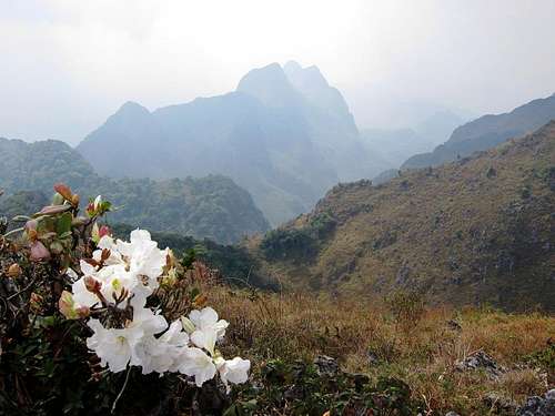
 Limestone Cliffs below Doi Chiang Dao - by mrchad9
Doi Chiang Dao

Doi Chiang Dao

Doi Chiang Dao Forest
Doi Chiang Dao
Doi Chiang Dao is located about 1.5 hours north of Chiang Mai. Chiang Dao is a massive, cone shaped, limestone mountain in Chiang Dao National Park. It attracts many visitors every year. The peak is usually cool and windy especially in winter. It is full of rare highland flowers, birds, and butterflies. Doi Chiang Dao's steep and jagged cliffs dominant the area.
It is well worth the hike which may be arduous for some people and not that difficult for others. Narrow plains on top of the mountain overlook spectacular views of the Chiang Dao mountain range, Doi Sam Pi Nong, and the far end of Doi Inthanon National Park. Descending the mountain is possible on the trail near Ban Tham, which is located near Chiang Dao cave. The trail is rather steep; nevertheless, it could shorten a lot of the hiking distance. It is quite difficult to climb up though.
Equally popular, if not more, is Tham Chiang Dao near the mountain. "Tham" meaning cave which includes 5 areas designated to visit: Tham Maa, Tham Kaew, Tham Phra Nawn, Tham Seua Dao, and Tham Naam. The caves extend around twelve kilometers into the mountain but only experienced cavers should venture beyond. Admission to the caves doesn't cost much and guides are also available.
A hiking guide can be hired but is not required for climbing Doi Chiang Dao. At Chiang Dao Cave, guides and porters are available. You can also be chartered to the starting point of the trail. Rented local truck costs around 900 baht and, a porter is 300 baht per person. There are also tents available at a reasonable price for camping near the mountain. Visitors can bring their own gear but it can be rented as well. It is recommended that travel be arranged a few weeks in advance of your trip.
 Flowers on Doi Chiang Dao - by mrchad9
Doi Pui / Doi Suthep

Doi Pui

Doi Suthep
Doi Pui / Doi Suthep
Doi Suthep is the mountain that stands right above the city of Chiang Mai. It is one of the most visited mountains in northern Thailand. It is located in Doi Suthep-Pui National Park. Doi Suthep is considered a sacred mountain to Thai people and is a symbolic landmark to the area. It was originally known as Doi Oi Chang. The name was later changed in honor of a local hermit named Prarusiwasuthep who lived in the nearby forest on the mountain. The area has cooler weather in winter and is known for its dense forests which has several important places of historical and religious interest.
The majority of people come to visit Wat Phra That Doi Suthep. This is one of the most famous temples in Thailand. This Buddhist place of worship has been used for centuries. The temple was founded in 1383 when the first chedi was built. It is easily recognizable because of its gold color and is quite a site to see. A road to the temple was first built in 1935. There are about 300 steps that lead to Wat Phra That Doi Suthep on the summit. It is connected to a legend featuring a white elephant. The temple is also a popular destination for foreigners. With all temples, you should remove your shoes and dress accordingly, no shorts or sleeveless shirts.
Cruba Sriwichai was a teacher and a forest monk in the local area. He was often called the, Engineer Monk, because he mounted and supervised over one hundred construction projects in northern Thailand, including the building of many Buddhist temples, which are also known as wats. His memorial statue is situated at the base of the mountain and is regularly visited. Also in the area is the beautiful Bhubing Palace. It is the royal winter residence where the Royal family stays during seasonal trips to northern Thailand. The palace is also the royal guesthouse for prominent visitors from other countries. It was built in 1961 and took five months to complete. Other buildings that surround the palace were additionally constructed on later dates.
There are three prominent peaks in the national park. They are Doi Suthep, Doi Buakha and Doi Pui. The highest summit is Doi Pui. You can hike to it starting near the local village or you can drive higher below the peak. At the end of the road is a trail that climbs to the summit. There are several hill tribes that live in the area below. You may also see different types of wildlife in the park. Bird watching is the most popular activity here. You can hire a nature guide to learn about the different types of birds and animals in the park. You'll also want to see the waterfalls while you're there. Monthathan Waterfall and Mae Sa Waterfall are both multi-tiered falls that shouldn't be missed. The Huey Kaew Waterfall is located near the Cruba Sriwichai Memorial.
 View from Doi Pui
Other Mountains
This is a list of more peaks worth visiting. If more pages in this area are added to SP then I'll add more information to this section too.
Doi Lang Ka
Doi Lang Ka is located in Khun Chae National Park. It is the fifth highest mountain in Thailand. Most of the area is covered with granite, which is common in Northern Thailand. It is very steep with many creeks that drop down into a number of waterfalls. This terrain is caused primarily by the high amount of seasonal rain and highly erodable soil. Doi Lahnga has many subpeaks and is located at the southern end of the park.
Doi Mod
This mountain is also located in Khun Chae National Park. It was made a national park in 1995 and is located an hour northeast of Chiang Mai. The trail to Doi Mot passes by a scenic evergreen forest. The environment is wet and ferns, mosses, and several types of orchids can be seen here. The view from the summit includes the Chiang Mai province to the west, Chiang Rai province to the east, Doi Lahnga in the south, and Doi Phangome to the north.
Doi Khun Tan
This mountain is located in Doi Khun Tan National Park. It is in a mountain range that borders the Lampang and Lamphun provinces. There is a 1,362 meter railroad tunnel, the longest in Thailand, underneath the mountain. It was constructed in 1907 and completed in 1918. Doi Khun Tan consists of four seperate mountains that the route climbs over. Camping is allowed and houses known as a "Yaw" are available for hikers. These yaws were actually military camps used as lookout points during WWII. Beautiful views can be seen from all four summits.
Doi Tung
This mountain is located in the Chiang Rai province. It is known by locals as Thailand’s Switzerland. Doi Tung means "Flag Mountain" named for the prominant flag on the summit. At the top of the mountain is the Wat Phrathat Doi Tung. This temple was built one thousand years ago and is an important place of pilgrimage for Buddhists from Thailand and overseas. A scenic mountain road goes through these mountains offering spectacular views.
This place is home to the Doi Tung Development Project, an initiative of Her Royal Highness Srinakarindra the Princess Mother, mother of Thailand's current monarch, who passed away in 1995. The purpose behind the project was to establish a way of overcoming the area’s social problems through education, training, and through "Sustainable Alternative Development" such as changes in agriculture. It encouraged people to grow crops such as coffee, tea, strawberries, and macadamia nuts, instead of opium. A Cottage Industry Center was set up to help residents develop their skills.
 Monthathan Falls
The Fauna
Thailand is a country with a tropical climate that is rich in wildlife. Some of the animals have evolved over millions of years into some of the most beautiful and interesting in the world. These ecosystems are fragile and include such wildlife as the asian elephant, moon bears, leopards, water buffalo, plus a multitude of other mammals, birds, reptiles, amphibians, and insects. The population of wildlife has decreased over the years for a number of reasons. This includes human population growth and poaching and encroachment in protected areas. These have taken their toll and the country's flora and fauna. These wild places are now a smaller percentage of the magnificent ecosystems of the past.
Water Buffalo
Water Buffalo are also known as Asian Buffalo. Almost all of the water buffalo in Southeast Asia are domesticated but there is a small number in Thailand which are still wild. Asia is the native home of the water buffalo, with 95% of the world population of water buffalo. The wild Asian buffalo originally ranged from eastern Nepal and India, east to Vietnam, and south to Malaysia. Its numbers were substantially reduced and eliminated from much of its former range. Currently, the total world population of wild Asian buffalo is almost certainly less than 4,000 animals and may well be less than 200 animals. It is even possible that they may be extinct. Population estimates are hampered by the difficulty in distinguishing wild buffalo from domestic, feral, and hybrid buffalo.
Many Asian countries depend on the water buffalo for use in labor. It is also valuable for its meat and milk. Asian buffalo weigh between 1,500 to 2,600 pounds. They are large animals with a wide horn span of more than two meters. The wild Asian buffalo is very dependent on the availability of water. They prefer habitats with alluvial grasslands, riparian forests, and woodlands. The wild Asian buffalo eats grass and leafy aquatic vegetation. They feed in the morning and evening and stay in wallows during midday. Wild Water Buffalo are an endangered species. Their biggest threats are interbreeding with feral and domestic buffalo, habitat loss and degradation, and hunting. There are diseases and parasites that are transmitted by domestic livestock.
Monkeys
Monkeys in Thailand include gibbons, macaque, and langur. In Northern Thailand macaque monkeys are common. Two macaque species include the rhesus monkey and the long tailed monkey. The rhesus monkey is well known and has brown or grey hair and pink faces. The long tailed macaques are also known as crab eating macaques. This is because they enjoy eating shellfish and crab. These macaques usually travel in communal groups of twenty to sixty monkeys. Most females remain with the group which they are born in and male macaques tend to move between different groups. Macaques are smart and often use rocks to open things or to break fruit. Some monkeys are accustomed to seeing humans and are not afraid. It's not a good idea to feed them. Many tourists may not know this and if they are not careful they may lose their camera, or lunch, or hat...
Wild monkeys found in the hills and mountains are usually scared of people and won't approach too closely. Thai people believe that monkeys are descendants of Hanuman, the Monkey King of the mythic Hindu figure Rama, so they respect and tolerate them. This story is based on the Indian Ramayakien. The monkey Hanuman and his army helped Rama to take his wife Sita back. She has been kidnapped by the demon Ravana. The aid of Hanuman explains why monkeys are so worshipped in Thailand. Many monkeys can be seen around temples in the northern region. Some monkeys can be very aggressive especially when they are in large groups. If you are bitten by a monkey go to a hospital immediately as there is a risk of rabies.
Asian Elephant
No other animal is symbolic to Thailand as the Asian Elephant. It can be found in forest habitats in low elevations and higher in the mountains. A male Asian Elephant can weigh up to 11,900 pounds. An adult eats about 330 pounds per day. This is mostly grasses, leaves, and bamboo. They also like cabbage, lettuce, sugar cane, apples, bananas, papaya, and other fruits and vegetables when they are easily available. They feed during the morning, evening, and night and rest during the afternoon. During the season of hot weather they look for shade and water to keep from overheating. Elephants cannot go for long without water. They need 19 to 24 gallons a day. Mature male elephants may live alone, females live in family groups consisting of mothers, daughters and sisters, together with immature males. Elephants can live to be over fifty years old.

Elephant

Elephant
Elephants helped build the country of Thailand. For decades, they were a key to the valuable teakwood timbering industry. The elephant’s unique ability to carry logs through narrow forest paths and traverse steep mountainous areas made them indispensable. In 1989, the worst flooding in the Thai history caused the death of thousands of people. The flood was a direct result of excessive timber harvesting. In reaction, and to protect the rapidly diminishing forests, the Thai government outlawed timbering. This left over three thousand domesticated elephants with no means of supporting themselves.
In much of Southeast Asia, elephants are now endangered. There are an estimated 3,500 to 4,500 of them in Thailand. The largest group of wild elephants is about six hundred. They inhabit a tract of protected forest along the border with Myanmar. Elephants have also been affected by some persecution due to the crop damage they are perceived to cause. The single most important cause of the decline of the Asian elephant has been the loss of habitat. Female Asian elephants are not affected by ivory poaching due to their lack of tusks. The overall population of Asian elephants hasn't decreased as drastically as it has in the case of the African elephant. The main problem is the higher ratio of female to male Asian elephants.
Asian Black Bear
Asian black bears are closely related to the North American black bears. They are also called moon bears, or white-chested bears, because of the sickle-shaped marking on their chest. Asian bears are omnivorous, feeding on both plants and animals. Their diet varies with availability and location and includes buds, fruits, nuts, berries, small animals and birds, carrion, insects and honey. They may also take livestock or feed on crops if in the vicinity. Asiatic black bears are medium sized with a stocky build. They average about 198 to 254 pounds. Large males can weigh up to 400 pounds. Males are larger than females.
These bears are similar in general appearance to brown bears, but are more lightly built and more slender limbed. The skulls of Asian black bears are relatively small, but massive, particularly in the lower jaw. Asian black bears tend to live in mountain forests at altitudes of 1,000 to over 3,000 meters, moving to lower-lying areas in the winter. They climb trees often and with great skill, building “nests” in which they sleep at a height of up to forty meters. In colder areas they usually sleep during the winter. The bears frequently set up their den under the roots of trees which have toppled over. Asian black bears are considered endangered as hunting and increasing logging and agricultural activity, amongst other factors, are causing its numbers to decline worldwide.
Poisonous and Dangerous Animals
Here are animals that most of us do not want to encounter in Northern Thailand. The chance of seeing a lot of poisonous animals while hiking is low. You should still use caution when walking in areas of undergrowth, dense jungles, wet vegetation, and rocky boulders. Watch where you are walking and where you put your hands. Open-toe shoes are not recommended when hiking. It leaves you vulnerable to all kinds of animals.
Snakes can be found in all areas of Thailand. There are many species and several of those are venomous. The snake that comes to the mind of most people when they think of Thailand is the King Cobra. This snake’s bite has killed water buffalo and elephants because of the amount of poison transferred. If you are bit by a snake, seek medical attention immediately. Hospitals stock Anti-venom for the most common snake bites. Different snake species require specific anti-venom to treat the snake-bite victim. See the following list of dangerous snakes.
Less Dangerous Snakes - Small-spotted Coral Snake, Speckled Coral Snake, Red-Necked Keelback, White-lipped Pit Viper, and Large-eyed Green Pit Viper. Very Dangerous Snakes - Chain Viper, Malayan Pit Viper, Banded Krait, Blue Krait, Spitting Cobra, and King Cobra.
The ants in Thailand will attack you. That's all there is to it. Try not to disturb any giant ant piles or you'll be sorry. There are more species of ants in Thailand than anyone even knows about. The larger varieties are bigger than the ones I have seen in the U.S. They usually rely on brute strength to take down their insect enemies. These ants will only give you a small bite with their powerful teeth. The smaller ones have all sorts of poisons and allergens to inject. After a day or so, the worst bites can feel like someone is poking you with a needle. Of course, in Thailand they eat ant eggs and larvae.
Giant centipedes and millipedes are found all over Thailand. They are kind of gross looking but their bites do not result in death. A person will probably need medical attention though. This usually requires anti-tetanus and painkillers. For several days the victim will be in a lot pain and will need to rest. The bite marks are similar to those of a small snake and centipede bites can be mistaken for snake bites in the dark. In urban areas and in the hills they can grow to the size of your forearm. During monsoon season, they like to come indoors to avoid drowning. Your shoes or backpack can be a nice place for them to hide.
The most common scorpion in Thailand is the Black Scorpion. They rarely have a fatal sting and aren't thought to be a serious health risk. Actually, scorpions in other countries like Mexico or Iraq are more lethal compared to the ones in Thailand. The scorpions are large and can be the size of your hand. They may not look smart but they can move surprisingly fast. The smaller ones have a more painful sting since the poison in their tails is usually more concentrated. Go to the hospital if you are stung since some people may have an allergic reaction.
Thailand has a lot of big scary looking spiders. Many people get bit by them every year. No need to worry because most spiders are not poisonous. Luckily, spider bites result in only a few deaths, but some people have allergic reactions. The most dangerous spiders are mainly found in forested areas. Some Tarantula species in Thailand have a reputation for aggression and the bites are painful. They are best treated in hospital with anti-venom. Symptoms can include swelling, exhaustion, muscle cramping, difficulty breathing, and fever. Sometimes symptoms occur days after the bite.
Who likes leeches? Not me. They can be found anywhere in Thailand. They are common in water and wet vegetation. If they find contact with skin, they quickly attach themselves. They have tiny razor sharp teeth that slice an opening. Then they take up to seven times their body weight in blood before leaving. In water, they swim towards any disturbance that they sense. On land, if they detect the presence of a human or an animal they stand up and wave from side to side in a searching motion. There are leech socks aka anti-leech socks that you can buy. They look like gaiters but you put them on like a sock all the way up to just below your knee. They seem to work since they are available for trekking in some National Parks.
Mosquitoes
Everyone will encounter mosquitoes when they visit Thailand. They are not any worse here than in other tropical countries but you should still take precautions. In cities and tourist areas they are not very high risk but they are in mountainous and rural areas especially near the border. Mosquitoes are the worst during the rainy season. Malaria is carried by some mosquitoes which are most active at dawn and dusk. This isn’t the only thing you have to worry about though. There is Dengue Fever which is transmitted by the Aedes mosquito which typically bites during the day time. It usually results in fever with rash in the skin, severe headache, and muscle pains. It is usually not fatal if you are already in good health but no vaccine is currently available for Dengue Fever. A more dangerous form of the disease is called dengue hemorrhagic fever which usually requires hospitalization and can be life threatening. There is also Japanese encephalitis which is a viral infection of the brain. This may be contracted through mosquito bites in rural areas. Vaccinations are recommended if you plan on spending a lot of time in rural areas. Mosquito repellent with deet can be bought at many stores and is a good thing for preventing mosquito bites. Otherwise, just use common sense. Even though Thailand has hot weather, it's probably not a good idea for men to hike shirtless.
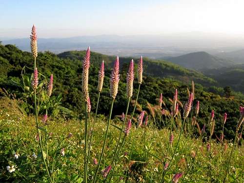
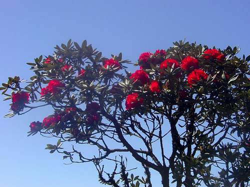 Red Rhododendrons
The Flora

Doi Pui Garden

Wild Plants
Thailand is associated with two basic types of forest including tropical forest and monsoon forest which has a distinctive dry season of three months or more. Monsoon forests amount to about a quarter of all remaining natural forest cover in the country. They have deciduous tree varieties that shed their leaves during the dry season to conserve water. About half of all forest cover consists of rainforests, which are typically evergreen.
There are thousands of species of plants. They range from bamboo to fruit trees. The Ratchaphruek is the country’s national flower. It is also known as the Golden Shower Tree. The flower is also known as "Chaiyaphruek". The reason that the Ratchaphruek is used to symbolize the nation lies in color. The yellow blossoms match the yellow of Buddhism. Thai people also regard yellow as the color of the King as well. Moreover, all golden shower trees bloom at the same time; this unity in flowering is felt to reflect the unity and identity of Thai people. Rhododendrons derive from the Greek word rhodos, meaning rose, and dendron, meaning tree. They are diverse plants because they can grow as trees, bushes, or as low ground cover. Rhododendrons grow at the highest elevations of Thailand.
Thailand is home to hundreds of types of orchids. The Thai word for orchid is “Gluay Mhai”. Orchids are one of the most famous and beautiful flowers in Thailand. The white or pink lotus, seen floating on ponds or depicted in Buddhist art, is a sacred symbol of wisdom, purity, peace, and compassion. Another plant sacred to Buddhism is the Rose Apple. Many visitors will have seen, and perhaps tasted, the rose apple as it is readily available at any fruit and vegetable market. Another well known tree in Thailand is the Jambu or Chom-poo Tree. It is a large tree that grows 40 feet high. With its thick leaves and great span of branches, the Jambu Tree offers great shade and coolness against the sun. The Bho Tree is known to botanists as Ficus Religiosa and it is commonly known as the Boddhi or Peepul Tree. It is believed that Buddha attained enlightenment in the shade of the Bodhi tree.
The Bat Plant is native to Thailand. It is also known as the “devil flower” or “tacca chantrieri”. This purple-black flower looks like a flying bat. Some people say it looks like a mean cat with lots of whiskers. It usually blooms in late summer and early fall. It’s a complex plant that has shiny green and white leaves. Frangipane is known as “lantom” in Thailand. It is used mostly used in Buddhist temples for worshiping. Frangipane is a deciduous plant and comes from the genus Plumeria. It can grow to a height of about 8 meters. It blossoms in three different colors including pink, white, or yellow. Most of the time, it has pink flowers. The flowers are most fragrant at night. Curcuma petiolata - Emperor is also known as “Hidden Lilly” or “Hidden Ginger”. It blooms in June and is found in different colors including near white, pink and white. It comes from the family Zingiberaceae and often has tuber-bearing roots. Steams are usually short and are replaced by pseudostems formed by leaf sheaths. It is a perennial and terrestrial herb.
 Thanon Thong Chai Mountain Range
Early History
The area known as Thailand has been populated ever since the beginning of civilization in Asia. The earliest inhabitants were hunter and gatherers. Around 4000 BC they began farming. They grew rice. Later they learned how to breed livestock. People began metal casting and pottery making as their skills developed. Cast bronze technology in the northeastern Thailand area dates from around 3600 BC. The prehistoric settlements in Thailand were as advanced as those of China and India. Ban Chiang has been the most significant historical site in Thailand. There were hundreds of artifacts found in this area. The Ban Chiang people were very prosperous in the agriculture of Northeastern Thailand. They are known for their early bronze metals, clay pottery, and especially for pots and vases with burnt swirl designs. Archeologists would later study rock paintings in several areas of Thailand that date back 3,000 years ago.
Rice growing communities were established and areas were divided into small states called Meuang. They lived in the fertile plains in what is now central and western Thailand. Some of the areas where they lived include Lopburi, Nakhon Pathom, Khu Bua, and Phong Tuk. These people shared a culture that was part of the Mon civilization during a period that was called Dvaravati between the 9th and 11th centuries. The Mons came from the same linguistic lineage as the Khmers. The area where they settled came to be known as Syam which means golden land in Sanskrit. Syam would eventually be known as Siam. Mon dominance over central Thailand would later be replaced by the power of the expanding Khmer Empire from the east by the 11th to 12th centuries. The capitol of their empire was Angkor in Cambodia. Kingdoms also formed in the North. Lanna developed into a well organized and powerful state based out of Chiang Saen near the Mekong River. The capital was later moved to Chiang Mai in 1296. The center of the Hariphunchai Kingdom was Lamphun which pre-dates this settlement.
The Khmers controlled most of the trade routes in the Thailand and Indochina region. They were located in the area covering the northeastern region and much of the central area. The Khmers were skilled at building stone temples. Some of them can be seen in northeast Thailand today most notably at Phimai and Phanom Rung. They have a distinctive style with stone sculptures depicting Hindu gods and Buddha images. They also have prangs on their buildings which are tall, intricately carved, spires. This was a common feature of Khmer religious architecture and was later adopted by Thai builders. In Thailand, they usually only appear on the most important religious buildings. The Mons, Khmers, and Lawas, who were similar to Thais, all lived in the The Chao Phraya River Basin. Khmer power eventually began to decline. New kingdoms in the Mekong River valley started to emerge which were dominated by the Thai people.
Several small Thai states united to form a kingdom called Sukhothai. The kingdom existed from 1238 to 1438. Sukhothai means “The Dawn of Happiness.” The nearby city of Si Satchanalai is considered the sister city of Sukhothai, which existed at the same time. Direct family members of the Kings of Sukhothai usually ruled nearby Si Satchanalai. King Ramkhamhaeng ruled Sukhothai Kingdom from 1279 to 1298, during its most prosperous era. He is credited with the creation of the Thai alphabet and the firm establishment of Theravada Buddhism as the main religion of the kingdom. During the reign of King Li Thai, from 1347 to 1368, many temples were built and restored at Si Satchanalai. The incredible architecture of the Sukhothai Kingdom can still be seen today. They constructed beautiful temples. Sukhothai style Buddha images are distinctive for their elegance and beauty. The graceful form of Buddha was introduced into Buddhist sculpture. The kingdom of Sukhothai ended when it was conquered by Ayutthaya. Sukhothai would later be incorporated into the Ayutthaya Kingdom as a province.
Northern Hill Tribes

Akha Hill Tribe

Akha Hill Tribe
Over time, thousands of hill tribe people migrated south from China into what are now Burma, Laos, Vietnam, and Thailand. There are six major tribes in Northern Thailand that include the Karen, the Hmong, the Mien, the Akha, the Lisu, and the Lahu. Each tribe is district, with its own culture, religion, language, art, and dress. The main profession of all these tribes is farming. In the Thai language they are not referred to as tribes but as Chao Khao, meaning "owners of the mountains."
The largest group is the Karen, which make up close to half the hill tribe population in Thailand. They live in the mountainous northern and northwestern regions that border Myanmar and Laos. They are the most settled of the hill tribes and usually live in permanent villiages in constructed houses. Some Karen have assimiliated into mainstream Thai society. The Karen tribe are Buddhists however there has been an increase of Christianity in recent years due to missionaries visiting the area.
The Hmong are found in mountainous regions of China, Vietnam, Laos, and Thailand. They are a well known hill tribe and the second largest group in the country. They are spread over a wide area of Northern Thailand but most are concentrated in areas of the Chiang Mai, Chiang Rai, Petchabun, and Tak provinces. The two main sub-groups are the White Hmong and Green Hmong. The Green Hmong are also known as the Blue Hmong. They usually live in houses that are built on the ground and not on stilts like many other hill tribes. They make and wear clothing that is richly decorated with gorgeous embroidery and silver jewelry. A large population of Hmong also live in the United States, specifically in California and the upper midwest in Wisconsin and Minnesota.
The Akha tribe originated from Tibet. They migrated south into Burma, Laos, and Thailand more than a century ago, along with the other hill tribes. Then more Akha migrated later to Northern Thailand from Burma to avoid persecution under the military regime. The majority of the Akha villages are to be found in the mountains of Chiang Rai province. They are subsistence farmers who cultivate mountainside vegetables. They have animals like pigs and chickens and they grow rice. They usually build bamboo and grass structures to house an entire family. Akha villages also have a giant swing, constructed from three long poles, and used for their memorable swing festival each year. The Akha are one of the poorest of the hill tribes. They are known for their beautiful dress and clothing which is heavily embroidered. Akha women traditionally wear black caps which are covered with silver pearls and coins.
Lahu people are found in the mountains of China, Myanmar, Laos and northern Thailand. There are four tribes within the Lahu including the Black, Red, Yellow, and She-Leh. In Thailand, they live mostly in the provinces of Chiang Mai, Chiang Rai, and Mae Hong Son. They have houses that are built on stilts with walls of bamboo or wooden planks layered together with grass. There is usually an open central area and a store room to one side and living quarters to the other. The Lahu generally have little amenities although some of them have animals like chicken, pigs and buffalo. Lahu women are skilled in weaving cloth and produce delicate patchwork trims with unique embroidery work. Men and women together make very beautiful baskets. They are skilled in hunting and gathering. Lahu men produce crossbows and other items made of wood, bamboo, and rattan. The Lahu are well known musicians especially for playing the flute.
The Mien tribe is also known as the Yao. Their origins can be traced back to 2000 BC in northern China. Their religion combines elements of Taoism, animism, and ancestor worship. In the late 19th century, the Mien migrated to Laos and Vietnam where they lived in communities as subsistence farmers. The Mien fled to Thailand to escape from the communist government in Laos. In Thailand, they are found mainly in the provinces of Chiang Rai, Phayao, Nan, and Lampang. The traditional clothing of Mien women is very unique. They wear heavy black jackets with red fur collars and black embroidered loose trousers. They have large black or dark blue turbans which are decorated with silver coins and colored beads. Today, the younger generation can be seen wearing more modern clothing. From 1976 to 1979, the first group of Mien arrived in the United States. A large population of Mien lives in Northern California.
The Lisu originated from eastern Tibet. They later migrated to the Yunnan province in China. Some of the southern Lisu moved into northeastern Burma. Then in the late 19th century they moved into northern Thailand. They live in the provinces of Chiang Rai, Chiang Mai, Mae Hong Son, Phayao, Tak, Kampaeng Phet, Phetchabun, Lampang, and Sukhothai. The Lisu like to build their villages close to water to provide easy access for washing and drinking. Their homes are usually built on the ground and have dirt floors and bamboo walls. The Lisu are outgoing and friendly people. There are the striped Lisu and the black Lisu. Most of the Lisu in Thailand are of the striped Lisu sub-group. Lisu women are known for their colorful and pretty clothing. Their shoulders, sleeves, and cuffs are embroidered with narrow, horizontal bands of blue, red and yellow. The Lisu men build crossbows, musical instruments, and animal traps.
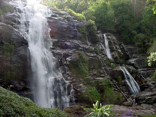 Wachirathan Waterfall
Places of Interest
This area has many places to visit. This is just a few that I have been to and recommend or would like to go to.
Elephant Nature Park
Chiang Mai Province. I recommend going to the Elephant Nature Park. The park’s purpose is to save the Asian elephant from extinction and provide a sanctuary and rescue center for elephants. It was founded in the 1990s. There are about thirty elephants that live here. They have all been rescued from being neglected and injured. After the elephants heal, they are transfered to the Haven's forest where they live out their days. There are over twenty elephants that live here. Both, foreigners and Thai, can arrange to go to the nature park for a day or more to learn about and interact with the elephants.
Wat Prathat Doi Suthep

Mae Pan Waterfall
Chiang Mai Province. This is one of Thailand’s most famous temples. It overlooks the city of Chiang Mai from its spectacular mountain location. The winding road up to the temple passes a couple of nice waterfalls including Huay Kaew and Monthathan Falls. There are the 300 steps leading up to the temple. The view is very good. Wat Prathat Doi Suthep dates back from 1386 and is revered among Thais as one of the country’s most important temples. You can’t miss the temple because of its distinctive gilded chedi and marble floored courtyard. The temple is full of symbolism. It is a popular place that is worth seeing.
Tribal Museum of Chiang Mai
Chiang Mai Province. The Tribal Museum was established in 1965. They recently moved to a new area in the pretty Ratchamankla Park. The museum illustrates and lets you learn about the hill tribes and their culture and life styles. If you are planning to go and see the hill tribe villages, and want to have some prior information, then you should visit this museum. The hill tribes include the Hmong, Karen, Akha, Lisu, Lahu, and Mien. There is an impressive array of colorful costumes, unusual accessories and jewelry, tools, utensils, and musical instruments. Rural equipment is on display and the story of each of these ethnic minorities is well told.
Museum of World Insects and Natural Wonders
Chiang Mai Province. This is a unique and interesting museum in Chiang Mai. It was founded in 2002 by an entomology enthusiast Manop Rattanarithikul, who is also known as mosquito man, and his wife Rampa, a PhD in the field. At the museum, you will realize that they have done extensive research on these creatures. There is everything including massive beetles, mosquitoes, centipedes, butterflies, moths, and little gnats. The museum displays over 400 species of insects that survives in Thai climate. The museum is open daily between 09:00 to 17:00. Entrance fee to Museum of World Insects and Natural Wonders, Chiang Mai is 200 baht. The money is used by Manop for conducting further research on insects.
The Golden Triangle
Chiang Rai Province. This area is known as The Golden Triangle. It is well known as an opium growing region. It covers northern Thailand, eastern Myanmar (Burma), and western Laos. The area at the northern border of Thailand is now a tourist attraction that bears little resemblance to what it used to. It is a quiet area full of small villages. The scenery is beautiful and there are many ancient temples that you can visit. Places to visit include the town of Mai Sai, where you can cross into Burma for some shopping. The small village of Sop Ruak is where the Ruak and Mekong rivers meet, forming the borders of three countries. The ancient city of Chiang Saen is where you’ll want to visit Wat Chedi Luang, next to the National Museum. You can also take a boat tour to view the upstream scenery of the Golden Triangle and to travel downstream to Chiang Khong. Another popular boat ride is to a small island named Don Sao in Laos. No visa is required to go here.
 Huay Saai Leung Waterfall
Historical Parks
Si Thep Historical Park
Phetchabun Province. Si Thep is an ancient city where many architectural structures can be seen. It is located on the Pa Sak River in Phetchabun Province Si Thep was once the center of contact between the Central Plain basin and the Northeast. The city is believed to be over 1,000 years old. The people at Si Thep established a long relationship with the Dvaravati Kingdom in the central plain of the Chao Phraya River. This helped the city maintain its prosperity for a long time. The power of the city didn’t start declining until 11th to 12th centuries. During that time, the kingdom began a new relationship with the Khmer Empire and adopted Hinduism beliefs as the main religion. Many architectural structures established in Lopburi and its neighboring cities at that time had signified the profound influence of Khmer architecture. In Si Thep, the Khmer stone sanctuaries such as Prang Yai and Prang Song Phi-Nong were established in the center of the city. The city of Si Thep was abandoned sometime in the 13th century.
Sukhothai Historical Park

Wachirathan Falls
Sukhothai Province. The Sukhothai Historical Park covers an area of the former capital of the Sukhothai Kingdom, an ancient city that thrived between the 13th and 14th centuries. Sukhothai literally means Dawn of Happiness. Though the golden era of Sukhothai no longer exists, tourists should bear in mind that respect and admiration for the renowned ruined twin cities of Sukhothai and Si Satchanalai is valued. This park features a number of Buddhist shrines, Buddha statues, former palaces and temples. Among ancient monuments within the city wall, the largest and most impressive is Wat Mahathat. It is the place where the first stone inscription was discovered. The park covers about 70 sq km. and is divided into five zones. Sukhothai Historical Park is the best place in Thailand to celebrate Loy Krathong, a festival of light held over nine nights around the full moon in October or November.
Kamphaeng Phet Historical Park
Sukhothai Province. Kamphaeng Phet, along with Sukhothai and Si Satchanalai, is probably the least visited historical park of the three. This shouldn’t be the case, since it is a great place. It is located on the bank of the Ping River. Kamphaeng Phet was established during the reign of King Li Thai from 1347 to 1371. The area was strategically located as an important military defense. The park has separate zones for religious sites both within and outside of town limits. Structures are usually large and made of laterite. Religious sites on the west bank of the Ping River at Nakhon Chum are built of bricks and of smaller size. The Kamphang Phet National Museum showcases ancient objects and other antique arts articles from various eras found in the provincial town.
Si Satchanalai Historical Park
Sukhothai Province. Si Satchanalai was the sister city to the Sukhothai Kingdom during the 13th and 14th centuries. This historical park seemed less crowded than Sukhothai. Satchanalai Historical Park is located on the bank of the Yom River. There are a hundred ruins here including old walls, pagodas, stupas, gateways, moats and kilns. The most photographed is probably Wat Phra Sri Rattana Mahathat. Another interesting one is Wat Chang Lom which is the elephant temple. It has several elephants where some of them have lost their heads over time. Wat Chedi Chet Thaeo is a large temple with seven rows of chedis. There is a museum and old kilns that were used to make ceramics.
 Yom River in Sukhothai Province
Rock Climbing
Rock Climbing is very popular in Thailand. This is because of areas like Railay, Tonsai, and Phi Phi which bring climbers from all over the world. They are located in the southern peninsula of the country. Steep limestone sport climbing above the water sounds like fun especially during winter. What about rock climbing in the rest of Thailand? I’m glad you asked. New destinations have been climbed in Northern Thailand. The first area to be developed was Crazy Horse Buttress. Climbing here usually only requires having a rope, quickdraws, slings, climbing shoes, harness, and chalk bag.
Crazy Horse Buttress is the most well known area. It was named for its horse shaped appearance. The buttress was first developed in 1998 by Kraisak Boonthip aka Pi Tom. Other routes were added later by Josh Morris, Francis Haden, and others. There are now over a hundred routes spread over fifteen cliffs. Loong Nan is a local Thai man who became the caretaker for Crazy Horse Buttress. He shuttle climbers from town to the climbing area. In 2002, Josh Morris and his wife Khaetthaleeya Uppakham aka Kat founded the guide service, Chiang Mai Rock Climbing Adventures.
Read the following for Northern Thailand climbing information:
1) Guide to Rock Climbing in Northern Thailand - by Josh Morris and Khaetthaleeya Uppakham. Second Edition Sept 2010.
2) Climbing Magazine - Issue #283 March 2010. The Other Thailand. Crazy Horse Buttress climbing photos and information.
Forest Parks
Forest Parks in Thailand
There are over a hundred forest parks in Thailand. Over sixty of them are in the northern region. I'm not going to list them all. I’m just going to mention why they are important. One thing you may notice about national parks in Thailand is that many of them started as a forest park. Then their status was updated to a national park later. Forest Parks usually focus on one or two attractions. It may be a peak, cave, waterfall, cliff, or viewpoint.
The main difference between the two is that a national park is managed by the central government that enforces protection regulations. A forest park is less protected and governed by the provincial administrations. Forest parks are also smaller in size. In Northern Thailand, Chiang Rai has the most forest parks of any province, twenty eight to be exact. The province of Chiang Rai has many forest parks named after waterfalls. I think forest parks are just as interesting as national parks. Many of them are not well known to tourists but are worth seeing.
 Siriphum Waterfall
Peak List
This isn't a complete list but it's pretty good considering what little information is available. The Chiang Mai Province has the largest concentration of known peaks. You may also notice that the spelling of mountain names is not always the same in books or on maps. This is normal in Thailand because each area has a different spelling or pronunciation. The word "Doi" means mountain and the word "Khao" means hill or mountain. The word "Pha" means cliff. You will also see the word "Phu" which means mountain but it is usually only used in the northeast. So mountains located in the provinces that border the north and northeast like Phetchabun may use the word Phu instead of Doi. Another thing to mention is the elevation listings. Some of these are approximate but should give a good idea when comparing mountains. I would say that Doi Inthanon and Doi Suthep are probably the most visited summits.
| NORTHERN THAILAND : NOTABLE MOUNTAINS | ||
| Mountain | Elevation (meters) | Province |
|---|---|---|
| Doi Inthanon | 2,565 | Chiang Mai |
| Doi Pha Hom Pok | 2,285 | Chiang Mai |
| Doi Chiang Dao | 2,225 | Chiang Mai |
| Doi Lang Ka | 2,031 | Chiang Mai |
| Doi Mae Tho | 2,031 | Chiang Mai |
| Doi Langka Luang | 2,031 | Chiang Rai |
| Khao Mae Ya | 2,005 | Mae Hong Son |
| Doi Phu Kha | 1,980 | Nan |
| Khao Mo Ko Chu | 1,964 | Kamphaeng Phet |
| Doi Chang | 1,962 | Chiang Mai |
| Doi Ang Khang | 1,928 | Chiang Mai |
| Doi Lan | 1,918 | Mae Hong Son |
| Doi Phatang | 1,909 | Chiang Mai |
| Doi Hua Mod Noi | 1,900 | Chiang Mai |
| Khao Yen | 1,898 | Kamphaeng Phet |
| Doi Hua Suea | 1,881 | Chiang Mai |
| Doi Phu Wae | 1,837 | Nan |
| Doi Wiang Pha | 1,834 | Chiang Mai |
| Phu Man Khao | 1,820 | Phitsanulok |
| Phu Soi Dao | 1,800 | Uttaradit |
| Doi Pukphakka | 1,794 | Chiang Mai |
| Phu Thap Buek | 1,786 | Phetchabun |
| Doi Pha Charoen | 1,765 | Tak |
| Doi Pui Luang | 1,752 | Mae Hong Son |
| Doi Chi | 1,752 | Nan |
| Khao Paeng Ma | 1,746 | Phetchabun |
| Doi Phi Pan | 1,745 | Nan |
| Doi Phu Kha | 1,728 | Nan |
| Doi Pui | 1,722 | Mae Hong Son |
| Doi Chang | 1,720 | Chaing Rai |
| Doi Chom Hot | 1,718 | Chiang Mai |
| Doi Pung Kia | 1,708 | Chiang Mai |
| Doi Mod | 1,700 | Chiang Rai |
| Doi Kio Rai Mong | 1,699 | Chiang Mai |
| Doi Luang | 1,694 | Chiang Rai |
| Doi Pui | 1,685 | Chiang Mai |
| Doi Wao | 1,674 | Nan |
| Phu Lomlo | 1,664 | Phitsanulok |
| Doi Khun Lan | 1,652 | Nan |
| Doi Ku Sathan | 1,630 | Nan |
| Doi Suthep | 1,601 | Chiang Mai |
| Doi Daen Din | 1,558 | Nan |
| Doi Khun Tien | 1,550 | Chiang Mai |
| Doi Mae Sa Noi | 1,549 | Chiang Mai |
| Doi Phong Sanit | 1,547 | Chiang Mai |
| Doi Khun Nam | 1,530 | Nan |
| Doi Hin Luang | 1,518 | Chiang Mai |
| Khao Phu Miang | 1,500 | Uttaradit |
| Doi Huai Mai Khong | 1,474 | Mae Hong Son |
| Doi Huai Mi Samat | 1,465 | Mae Hong Son |
| Doi Khon Rong | 1,459 | Chiang Mai |
| Phu Chi Fa | 1,442 | Chiang Rai |
| Khun Khlong Lan | 1,439 | Kamphaeng Phet |
| Doi Mae Chok | 1,424 | Nan |
| Doi Huai Luang | 1,415 | Chiang Mai |
| Doi Plai Huai Mae Cha Yam | 1,407 | Mae Hong Son |
| Doi Prae Mueang | 1,395 | Nan |
| Doi Tung | 1,389 | Chiang Rai |
| Doi Ban Huai Ha | 1,359 | Mae Hong Son |
| Doi Phakho | 1,352 | Mae Hong Son |
| Phu Phaya Phor | 1,350 | Uttaradit |
| Doi Chong | 1,339 | Lampang |
| Doi Mae Lib | 1,311 | Chiang Mai |
| Doi Ton Huai Dong Ching | 1,310 | Mae Hong Son |
| Doi Khun Khun | 1,307 | Nan |
| Phu Pha Jit | 1,271 | Phetchabun |
| Doi Mae Moi | 1,250 | Tak |
| Khao Khun Huai Huek | 1,234 | Nan |
| Doi Kiaulom | 1,202 | Lampang |
| Doi Phu Nang | 1,202 | Phayao |
| Phra Mae Ya | 1,200 | Sukhothai |
| Pha Lom Pha Kong | 1,134 | Phetchabun |
| Doi Luang | 1,100 | Lampang |
| Khao Kho | 1,085 | Phetchabun |
| Khao Aom Yom | 1,065 | Tak |
| Doi Sanklang | 1,022 | Lampang |
| Doi Phahuad | 975 | Lampang |
| Doi Nang Non | 830 | Chiang Rai |
National Parks
Northern Thailand is the area which contains the highest mountains in Thailand. The weather is usually cooler at higher elevations than the rest of the country. This is most noticeable during winter which last from December through February. Much of this area was off limits for a long time due to a series of Communist insurgencies and Myanmar's drug battles and civil wars happening near the border. The area is open for tourism but caution should still be used near the border with Myanmar specifically the Tak and Mae Hong Son provinces. Trekking is one of the main attractions in northern Thailand. You'll need to hire a guide for some mountains while others can be hiked on your own via a trail. Guides are usually only needed for mountains that require an overnight stay.
| NORTHERN THAILAND : NATIONAL PARKS | |||
| National Park | Year Created | Comments | |
|---|---|---|---|
| Chiang Rai Province | |||
| Doi Luang National Park | 1990 | This national park is named after Doi Luang, in the northern area of the park, which is the highest summit. There are many Falls including Wang Kaew, Poo Kaeng, Mae Yain, and Cham Pa Thong. Doi Nok is a great viewpoint. | |
| Khun Chae National Park | 1995 | Named after Khum Chae Waterfalls. There is also Lum Klew Waterfall and Maetow Waterfalls. Mountains in the park include Doi Lang Ka, the highest summit, and Doi Mod and Doi Pha Ngom. There is Mae Chang Khao Reservoir. | |
| Lam Nam Kok National Park | 2002 | Named after Lam Nam Kok River. Falls include Khun Kon waterfall, Huai Mae Sai waterfall, and Huai Kaeo waterfall. Mountains in the park include Doi Yao, Doi Bo, Doi Chang, and Doi Pha Mup. Huai Mak Liam is a hot springs. | |
| Mae Puem National Park | Named after Mae Puem Reservoir. The national park is located in two provinces which are Chiang Rai and Phayao. It is part of Mae Puem National Conserved Forest and Mae Pung Forest. Doi Ngam is a mountain similiar to Phu Kradueng. | ||
| Chiang Mai Province | |||
| Doi Pha Hom Pok National Park | 2000 | Named after the mountain Doi Pha Hom Pok. It is one of the highest summits in Thailand. The view includes mountains along the border of Thailand and Myanmar. There are several hot springs, caves and waterfalls to visit. | |
| Doi Inthanon National Park | 1966 | Doi Inthanon is the highest mountain in Thailand and is a popular destination. There is a paved road that goes to the summit. The elevation reaches over 8,000 feet and has cool weather in winter. Doi Hua Mod Luang is another high peak in the park. There are also hiking trails. Many hill tribe villages are located on the mountain. | |
| Doi Suthep-Pui National Park | 1981 | Doi Suthep is considered a sacred mountain in Thailand. Many Thai people and foreigners make the trip to Wat Phra That Doi Suthep each year. Doi Pui has a trail and is the highpoint of the park. There are a lot of waterfalls to see here. Hill tribes live on the mountain. | |
| Chiang Dao National Park | 2000 | This national park is surrounded by the Doi Chiang Dao Mountains and Pha Daeng Mountains. One of the best mountains to climb in Northern Thailand is Doi Chiang Dao. There are rare species of birds that can be seen here too. This mountain is considered sacred by Thai people. | |
| Doi Wiang Pha National Park | Doi Wiang Pha is the highest peak. It is near the boundary of Chiang Mai and Chiang Rai Provinces. There are falls including Doi Wiang Pha Waterfall, Huai Sai Khao Waterfall, Mae Fangluang Waterfall, Huai Hok Waterfall, and Pa Sor waterfall. | ||
| Huai Nam Dang National Park | 1995 | The park was named after Huai Nam Dang Waterfall. Doi Chang is the highest summit. There are several waterfalls and natural hot springs including Pong Duet Hot Spring. Doi Gew Lom is a viewpoint where you can see beautiful flowers. | |
| Khun Khan National Park | Doi Pung Kia is the highest mountain. The park is located in the areas of Pa Samoeng National Conserved Forest and Mae Chaem Forest. There is Luang Mae Sab Cave which you can hike to. Pha Sam Na is a mountaintop with cliffs on three sides. Falls include Huai Mae Na Pur Waterfall and Huai Tad Waterfall. | ||
| Mae Takhrai National Park | 1992 | The park is named after Mae Takhrai Waterfall. There is Tat Moei Waterfall. These are limestone mountains with reservoirs, lakes, and rivers which lead to the Ping River. Doi Lang Ka is one of the highest mountains in the area. | |
| Mae Tho National Park | Doi Mae Tho was named after an impressive viewpoint in the park. These steep mountains are located north of Doi Inthanon. Doi Kio Rai Mong is the highpoint of the park. Waterfalls include Mae-aep and Mae-lit. | ||
| Mae Wang National Park | Named after Mae Wang Waterfall. There are a half dozen other waterfalls. Doi Phatang is the highest peak. Another great viewpoint is Doi Pha Ta. Kaew Seau Tent are rock formations. Pha Choi is near the Ping River. | ||
| Ob Luang National Park | 1991 | Named after Ob Luang Canyon where Mae Chaem River flows through narrow rock walls. Caves include Tham Tong and Tham Tu Pu. Waterfalls include Mae Bua Kham, Mae Chon, and Mae Tia. Doi Pha Chang is a peak that resembles a lying elephant. There is Prehistorical Community Area rock art that can be viewed. | |
| Ob Khan National Park | Ob Khan is an interesting area of the Mae Khan River surrounded by cliffs. The highpoint of the park is Yod Khun Tien. Other peaks include Doi Khun Huay Prachao and Doi Khun Win. Tham Tukkatan is a large cave in the area. | ||
| Pha Daeng National Park | 2000 | This park was named after a sharp pointed peak called Doi Pha Daeng. Doi Kum Fa is the highest peak. There are many other mountains in the area. Viewpoints includes Doi Pha Tang, Doi Tuay, and Yot Doi. You'll find several caves here like Crab Cave, Rom Cave, Tab Tao Cave, and Chaeng-Pa Hok Cave. | |
| Si Lanna National Park | 1989 | Rugged mountains and waterfalls. There is Huai Nang Lae Waterfall, Boutong Waterfall, Mon Hin Lai Waterfall, and Pa Pule Waterfall. Nong Pha Cave is nearby. The water source of Mae Ngad reservoir leads down to the Ping River. | |
| Kamphaeng Phet Province | |||
| Khlong Lan National Park | 1982 | The park was named after Klong Lan Waterfall which flows over a 100 meter cliff. It is one of the most beautiful falls in Kampaeng Phet Province. Khun Klong Lan is the highest peak of the park. You'll want to also check out Klong Suan Mak. | |
| Khlong Wang Chao National Park | 1990 | Named after Khlong Wang Chao Waterfall. There are many other waterfalls in the park. Khao Yen is the highest peak. Other mountains include Khao Tao Dam, Khao Tad Roop Kai, Khao Mee, Doi Bang Sung, and Doi Bang Cha Le. Khoa Kradan is a cliff located on Khao Tao Dam Mountain located by Tao Dum Waterfall. | |
| Mae Wong National Park | 1987 | This national park was named after Mae Wong River which receives water from these mountains. The highest peak is Khao Mokoju. The mountain requires several days to climb and is highly recommended. Waterfalls located here are Mae Rewa Waterfall, Mae Gee Waterfall, and Mae Kra Sa Waterfall. | |
| Lampang Province | |||
| Chae Son National Park | 1988 | Named after Chae Son Waterfall which has water flowing all year. Caves include Pha Ngam Cave, Nam Cave, Mor Cave, Luang Cave, and Loug Kae Cave. There are three waterfalls named Mae Koon, Mae Mawn, and Mae Peak. Chae Son has a popular hot springs. Dok Siew is a wild flower that blossoms in February. | |
| Doi Chong National Park | Named after Doi Chong which is the highest peak in the park. The water from these mountains lead to reservoirs and then to the Wang River. Reservoirs include Mae-thai Reservoir, Mae-yong Reservoir, and Mae-arb Reservoir. | ||
| Mae Wa National Park | 2000 | This park was named after Mae Wa Waterfall which has eight tiers. Two good caves include Nampha-Pha Ngam Cave and Phrachedi Cave. Mountains include Doi Khun Huai Pong, Doi King Kot, Doi Tachi, and Doi Pae Luang. | |
| Tham Pha Thai National Park | This park recieved its name from a limestone cave called Tham Pha Thai. Another cave is Tham Ratchakreu. Keunkewlom Reservoir is popular with rafting and sailing. There are waterfalls named Mae Jaefa, Mae Kae, and Mae San. Mountains include Doi Kewlom, Doi Luang, Doi Sanklang, and Doi Phahuad. | ||
| Lamphun Province | |||
| Doi Khun Tan National Park | 1975 | This park has a lot of history including Thailand’s longest railroad tunnel. Doi Khun Tan is the highest peak and which the national park was named after. You can hike to the summit. It is a great mountain to climb. There are camping areas called Yaws located on Doi Khun Tan. Two waterfalls include Mae Long and Tat Moie. | |
| Mae Ping National Park | 1981 | Named after Mae Ping River. There is Kaeng Koh Lake and Bhumipol Dam which is a favorite place for rafting and canoeing. Waterfalls include Koh Luang and Koh Noi. Three caves include Chang Rong Cave, Hom San Cave, and Yang Wee Cave. | |
| Mae Hong Son Province | |||
| Mae Ngao National Park | Named after Mae Ngao River which is good for rafting during the dry season. There are waterfalls including Mae La, Mae Wa, Mae Jae, and Oloh-gro. Doi Pui Luang is the highest point in the park and usually takes two days to hike round trip. | ||
| Namtok Mae Surin National Park | 1981 | Doi Pui is the highest peak in the park. You’ll need to hire to guide to hike to the summit. This national park was named after Mae Surin Waterfall. There is a great view of the Pai River. Caves include Nam Hu Hai Jai Cave and Saroi Cave. | |
| Salawin National Park | 1994 | This national park is named after the Salawin River which is usually covered in fog during winter. People sail longtail boats and enjoy camping nearby. Water is lowest during the dry season. The Moei River connects to Salaween River. | |
| Tham Pla - Namtok Pha Suea National Park | The park was named after Pla Cave and Pha Sueu Waterfall. Two other waterfalls include Mae Sa-nga Klang and Huay Pong. Other caves worth seeing are Pha Daeng Cave and Phra-bath Koo Cave. Doi Lan is the highest point in the park. | ||
| Nan Province | |||
| Doi Phu Kha National Park | Doi Phu Kha national park is known for its rare species of plants which are only found in Thailand. This is where you will find Chompu Phu Kha flowers. There is Pha Kong Cave and several waterfalls. They include Phu Fa Falls, Silaphect Falls, Tat Luang Falls, Ton Tong Falls, and Wang Prain Falls. Phu Wae Peak is an awesome mountain to climb. It usually takes 2 to 3 days round trip to hike with a guide. | ||
| Khun Nan National Park | This park is located near the Wha River. There are several mountain ranges here including the Phu Fa Mountains, Khun Namwahnoi Mountains, Namwahklang Mountains, and Pi Pun Mountains. There are many waterfalls including Baan Den Waterfall, Huai Ha Waterfall, Huai Tee Waterfall, and Santisuk Waterfall. | ||
| Khun Sathan National Park | 2003 | Named after Doi Khun Sathen which has a great view. Sirikit Dam is a good place to go fishing. Waterfalls include Tat Mok and Khun Li. Tham La-ong is a large cave. Doi Phu Kha is the highest point. Doi Mae Chok is another mountain in the park. | |
| Mae Charim National Park | 2007 | Named after Mae Charim Forest located near the Wa River. The river is a popular place to go rafting and has several rapids. The Luang Phrabang Mountains run from north to the south. Doi Khun Lan, on the eastern side of the park, is the highpoint. | |
| Nunthaburi National Park | Doi Wao is the highest mountain in the park. Viewpoints are at Doi Pha Chi and Doi Pha Chang. Huai Sepun Reservoir receives water from these mountains. Waterfalls include Santisuk Waterfall, Song Kwae Waterfall, and Tad Fa Rong Waterfall. Baan Namki Artesian Spring is a place for tourists to go for a mineral bath. | ||
| Si Nan National Park | 2007 | Beautiful area near the Nan River. Pak Nai near the Sirikit Dam is a favorite place for photographers. Sao-din are very photogenic rock pillars. Doi Pha Choo is a viewpoint with a large cliff. The highest mountain is Doi Khun Huai Heuk. Other peaks include Doi Prae Muang, Doi Khun Huai Heuk, Khun Huai Ya Sai, and Doi Luang. | |
| Tham Sakoen National Park | This park was named after Luang Sakoen Cave which is 600 meters deep. Water from these mountains lead to the Yom River and Nan River. There are many waterfalls including Hong Wieang Chan Waterfall, Huai-had Waterfall, Pha Lad Watefall, and Phatan Waterfall. Doi Chi is the highest mountain in the park. | ||
| Phayao Province | |||
| Doi Phu Nang National Park | Doi Phu Nang is the highest peak in the park. It is located in the area of Mae-yom Forest and Nampi Forest. There is Yai Pha Tang Cave and Nature Trail. Waterfalls include Na-bua and Thansawan. Phang-ta are interesting soil-pillars. | ||
| Mae Puem National Park | Named after Mae Puem Reservoir. The national park is located in two provinces which are Chiang Rai and Phayao. It is part of Mae Puem National Conserved Forest and Mae Pung Forest. Doi Ngam is a mountain similiar to Phu Kradueng. | ||
| Phu Sang National Park | 2000 | This national park was named after Phu Sang Waterfall which falls from a warm spring. Huai Pong Pha is another waterfall. Bo Nam Sup Aun is a unique warm water pond. There are three caves that include Nam Dan Cave, Nam Lot Cave, and Pha Daeng Cave. Doi Pha Dam is a limestone mountain with a big cliff. | |
| Phetchabun Province | |||
| Khao Kho National Park | 1995 | Khao Kho is a mountain with many falls and viewpoints. Waterfalls include Wang Tum, Than Thip, Tat Fa, Pha Lat, Khan Bandai, Kaeng Liangpha, and several more. There is Sombat Cave and Tham Yai Namko Cave. There is a historical monument in memory of those in a war between the government and communists. | |
| Nam Nao National Park | 1972 | Named after Nam Nao Cave. Two pine forests include Suan Son Dong Paek and Suan Son Phu Goom Kow. Waterfalls include Heaw Sai Waterfall, Sai Thong Waterfall, and Tad Pran Ba Waterfall. From December to January the trees in this area change color. Phu Pha Jit is the highest peak in the park. It is a 10 kilometer hike to the summit. Pha Lom Pha Kong is a cool limestone peak. Phu Khor is a good viewpoint. | |
| Tat Mok National Park | 1998 | This park was named after Tat Mok Waterfall which is several hundred meters high. Another waterfall is Song Nang which has many tiers. The water from these mountains lead down to the Chi River. There is a good view from Pha Sawan. | |
| Phitsanulok Province | |||
| Kaeng Chet Khwae National Park | The park was named after Kaeng Chet Khwae Rapids originating from the Khwaenoi River. The river has several other rapids. There are two watefalls named after how many tiers they have. The first one is 5-step Waterfall and the second is 9-step Waterfall. Ban Nonghin is a good viewpoint of the forest and river. | ||
| Namtok Chat Trakan National Park | 1987 | Named after Chat Trakan Waterfall which has seven tiers. Other waterfalls include Pha Ku Ka Waterfall and Najan Waterfall. There is Khao Chang Luang Viewpoint and Kradanleg Cliff. Park River and Kwaenoy River are located in the area. | |
| Phu Hin Rong Kla National Park | 1984 | This park is known for its unique rock formations such as Lan Hin Taek, Lan Hin Pum, and Pha Chuthong Cliff. Several waterfalls include Man Daeng, Phalat and Tatfa, Romklao-Pharadon, and Siphatcharin. The park has an interesting history. From 1968 to 1972, the mountains of Phu Hin Rong Kla were the major strongholds for the communists. Many historical buildings can still be seen today from that era. | |
| Thung Salaeng Luang National Park | 1972 | The park is named after a beautiful meadow viewpoint. There are many savannahs. Waterfalls include well known Nam Tok Kaeng Sopham. Caves include Pra Wang Daeng, Tham Kaeng Cow, Thum Duean - Thum Dao, and Pra Wang Daeng. | |
| Phrae Province | |||
| Doi Pha Klong National Park | 2007 | Doi Pha Klong is the source of Yom River. Suan Hin Maharaj is a trail leading to Phu Khao Hin Pakarang which is a limestone mountain with interesting layers of rock. There is Kreang Luang, Arawan Cave, and Tham Chan Pha which is a bat cave. | |
| Mae Yom National Park | 1986 | This park was named after the Yom River. Kaeng Sua Teng is a pretty isle in the river. Lom Dong is a large water source for wildlife. Dong Sak Ngam are a group of teak trees in the area of Mae Pung and Mae Pao Conservative National Parks. | |
| Wiang Kosai National Park | 1981 | Wiang Kosai was the first national park in Prae Province. There is dense bush called Ta Kien Tong which is over a hundred years of age. There is Mae Jork Hot Springs. Many waterfalls include Mae Koeng Luang and Mae Koeng Noi Waterfalls, Pan Jen Waterfall, Mae Pung Luang Waterfall, Mae Rang Waterfall, and Mae Sin Waterfall. | |
| Tak Province | |||
| Khun Phra Wo National Park | 2008 | This national park was named after Khun Phra Wo Waterfall. Other falls include Huai Krathing Waterfall, Phueng Luang Waterfall, and Pamak Waterfall. Huai Mae La-mao is a rafting area. Pha Chomprong is a viewpoint that has a nice cliff. | |
| Lan Sang National Park | 1978 | Named after Lan Sang Waterfall. Other waterfalls include Pha Te Waterfall, Pha Phung Waterfall, Pha Noi Waterfall, Pha Lad Waterfall, and Lan Lieng Ma Waterfall. Khao Luang Mountain separates the park into two, Khao Aom Yom is the highest peak. Viewpoints include Doi Pha Deang, Khao Noi, and Khao San Houi. | |
| Mae Moei National Park | 1990 | This park was named after the Moei River which is near the border between Thailand and Myanmar. There are two falls including Mae Salid Noi Waterfall and Chao Doi Waterfall and Mae U-su Cave. Viewpoints include Sea of Fog Viewpoint, Mon Punsuda Viewpoint, Mon Kio Lom Viewpoint, and Mon Khrubasai Viewpoint. | |
| Namtok Pha Charoen National Park | Named after Pha Charoen Waterfall. Other waterfalls include Taralak Waterfall, Saifa Waterfall, Pacharoen Waterfall, Nang Chron Waterfall, Huai Tapu-kor Waterfall, and Bawai Waterfall. Many peaks include Doi Pah Tan, Doi Den Krating, Doi Luang, Doi Mhak Muen, and Khao Lom Pudyen. There is also Pacharoen Hot Springs. | ||
| Taksin Maharat National Park | 1981 | This park was named after King Taksin Maharat. Ton Krabak Yai is the biggest Krabak Tree in Thailand which you can see here. Saphan Hin is a massive stone bar between two cliffs. Waterfalls include Sam Mert Thung Waterfall, Pha Krow - Pha Daeng Waterfall, Pang Ah Noi Waterfall, and Pang A Yai Waterfall. | |
| Uttaradit Province | |||
| Khlong Tron National Park | 2003 | Named after Khlong Tron Waterfalls. Phu Miang is the highest peak in the park. Other mountains include Khao Kwum Rua, Khao-ngai rua, Khao-samliam, Khao-yuak, Kao-thanon, Khao-daed, Khao-maipha, Khao-takbon, and Khao-namyai. | |
| Lam Nam Nan National Park | 1998 | Phu Phaya Phor is the highest mountain in the park. The area is the water source of Yom River in Phrae Province and Nan River in Uttaradit Province. Sirikit Reservoir is a big lake made by the Sirikit Dam. People like to go boating here. | |
| Phu Soi Dao National Park | 2008 | Named after the Phu Soi Dao Mountains. Hiking to the summit of Phu Soi Dao will take about 4 to 5 hours after seeing Phu Soi Dao Waterfall. Another waterfall is Sai Thip with seven tiers. There are three-leaf pine trees located in the area of the Lasting Forests of Phu Soi Dao. There are stone fields near the Pak River. | |
| Sukhothai Province | |||
| Ramkhamhaeng National Park | 1980 | Named after King Pa Khun Ramkhamhaeng of Sukhothai Kingdom era. The highest peak on the south side of Sukhothai is Khao Luang. It has four summits named Narai, Phu Ga, Jedi, and Mae Ya. The peaks are covered with grassland. Waterfalls include Sai Rung Waterfall, Lum Kreaw Waterfall, and Hin Rang Waterfall. | |
| Si Satchanalai National Park | 1981 | Historically important park with several monuments. They date back between the 13th and 15th centuries. Highpoints include Doi Mae Wang Chang and Doi Mae Mok. There is Tat Duean Waterfall, Pa Kayoa Waterfall, Huai Sai Khao Waterfall, and Maesan Waterfall. There is Thara Wasan Cave and Khang Khao Cave. | |
Getting There
Thai Airways International operates flights in the United States from the city of Los Angeles. Most people will be flying into Bangkok. For more information go to the website for Thai Airways.
By Air - Thai Airways International operates frequent flights from Bangkok to Northern destinations including Chiang Mai, Chiang Rai, Lampang, Phitsanulok, Phrae, Nan, Mae Hong Son and Mae Sot. There are also inter-provincial services between Chiang Mai and other destinations such as Chiang Rai, Mae Hong Son, Mae Sot, Nan, Phitsanulok and Phuket, as well as between Nan and Phitsanulok.
In additions, Bangkok Airways operates flights between Bangkok-Sukhothai an Sukhothai-Chiang Mai. Angel Airlines flies Bangkok-Chiang Mai.
By Vehicle - Phahonyothin is the main highway from Bangkok connecting the central region with the North all the way to Chiang Rai, which is the uppermost province in the North. Branching out from Phahonyothin are secondary highways leading to all northern provinces and many other districts.
Passenger buses and coaches are available at the Mo Chit Bus Terminal on Kamhaeng Phet Road serving all provinces and major districts. For more information call this number 936-2852-66.
Provincial bus services run between the provincial seat and various districts. There are also inter-provincial services. In major cities such as Chiang Mai, Chiang Rai and Phitsanulok are car rental services to go to tourist attractions. For more traditional mode of transport, try pedal tricycles which are available in all provinces. It is suggested that fares be negotiated beforehand.
By Train - There are daily train services starting from Hua Lumphong Station in Bangkok which run through Bang Pa-In, Ayutthaya, Lop Buri, Nakhon Sawan, Phichit, Phitsanulok, Uttaradit, Den Chai, Lampang, Khun Tan, Lamphun and terminate in Chiang Mai. Call 223-7010, 223-7020 for more information.
By Boat - Most of the boating routes in the North are designed for sightseeing purposes. Some major routing include cruising the Ping River by large tour boats from the Bhumiphil Dam in Tak Doi Tao in Chiang Mai. Or Travelling by boats or rafts from Tha Ton in Chiang Mai along the Kok River by long-tailed boats in Chiang Rai from Chiang Saen District of the Golden Triangle to Chiang Khong.
The Weather
Northern Thailand has three main seasons: hot from March to May, wet from June to November, and cool from December to February. However, up in the mountains "cool" can be very cold. Winter is the best time to visit the area.
Temperatures from mid-November to January are the coldest and average between 13 °C and 28 °C (56 °F and 83 °F). Temperatures begin rising in February and in the hot season which is (March to May) range between 17 °C and 36 °C (63 °F and 97 °F). In the rainy season (June to mid-November), the high temps may drop but the lows usually stay the same.
A jacket and long pants are a good thing to have in the winter. In the mountains, it should be cold in the morning and then warm up in the afternoon. During other seasons, you'll probably just be wearing a t-shirt and shorts.
Here is the local weather forecast for Chiang Mai and another one from the Weather Channel here.
Here is the local weather forecast for Chiang Rai and another one here.
Red Tape
A Passport is needed for any foreigners staying in Thailand for less than 30 days. If you plan on staying longer a visa is required. Anyone who wants to travel over the border into Myanmar (Burma) or Laos will need a visa. They can be obtained from the Myanmar Embassy or Laotian Embassy in Bangkok. You can also get a visa at consulate in the city of Chiang Mai.
The currency of Thailand is called baht. About 33 baht = 1 U.S. dollar. Many of these mountains are located in a national park. The current fee is (20 baht) for Thai nationals and (200 baht) for foreigners. This two tiered fee system is common in Southeast Asia.

Be Careful of Land Mines near the border
Since 1988, Myanmar has been under the military rule of the State Peace and Development Council (SPDC). The Thai and Myanmar border is the site of on-going conflicts between the Burmese Army and armed opposition groups as well as clashes between Thai security forces and armed drug traffickers. In addition, there are pirates, bandits, and drug traffickers that operate in these border areas. Travelers should use caution when driving and traveling in the more remote areas. Many national parks offer hiking guides for safely climbing mountains near the border.
Laos was isolated from the rest of the world for almost two decades. In 1992, the country decided to open its doors to tourism. The Thai-Laos friendship bridge near Nong Khai in northeastern Thailand has increased relations between these two countries. Travelers should be aware that there have been occasional incidents of violence on Thailand’s northern and eastern borders with Laos. So it is wise to exercise caution when travelling near the border.
A few words of caution about land mines near the border of Thailand with Myanmar and Laos. People are injured or killed by land mines every year. Elephants are also injured and killed resulting in many of them having artificial legs. There are over twenty-five provinces in Thailand that are affected by this. Most of these accidents happen because a person travels into a well known mine infested area where they shouldn’t be or have gotten lost in an area they are not familiar with. Many accidents also happen due to lack of knowledge about the land mine danger. Popular tourist areas are usually posted with signs.
In recent years, there has been ongoing political conflict in Thailand. This has been between the People's Alliance for Democracy (PAD), also known as the Yellow Shirts and the United Front for Democracy against Dictatorship or (UDD) and Democratic Alliance Against Dictatorship or (DAAD), also known as the Red Shirts. It has caused protests and riots which have resulted in injuries and death. Most of these conflicts have happened in Bangkok but it has also happened in other areas. Before going on a trip, check current conditions to see if there are any conflicts which may be dangerous for tourists traveling to Thailand.
Tips for Safe Traveling:
1) If you go trekking with a tour guide, choose a respectable company. The ones that are set up at the motel you stay are not always the best. You’ll want one that is registered with the Tourism Authority of Thailand.
2) You’ll probably encounter people selling jewelry, gems, and other trinkets, especially in small villages. If a deal seems too good to be true, it probably is. Just use common sense when buying things.
3) If someone offers you anything to buy and you do not want it. For children, politely say, No thank you. If an adult is persistently bothering you, then firmly say the same thing repeatedly if neccessary.
4) When visiting someone's house or a temple, it is customary to take your shoes off before entering. Shorts are not always appropriate and long pants may be required to visit some of the well known temples.
5) If taking a photo of a hill tribe person, it is always a good idea to be thoughtful and ask for permission first. All hill tribes are different. Some of them do not mind while others may request a small amount of money.
6) Don’t leave any valuables in a bungalow, guest house, or motel room. You won’t need large amounts of money and credit cards anyway. A photocopy of your passport should be carried at all times.
7) Always hold on to and keep track of your valuables like purse, wallet, bags, and camera when traveling on a van, motorcycle, tuk-tuk, or songthaew. If your stuff gets stolen then the chances of recovering it are low.
8) Near the border of Thailand with Myanmar or Laos. You should use caution due to land mines. Stay on maintained trails if possible. You may need to hire a guide in some of the more remote areas or just don't go at all.
Books & Maps
1) Lonely Planet : Thailand (Country Guide) : 13th edition
By China Williams, Mark Beales, Tim Bewer, Catherine Bodry, Austin Bush, and Brandon Presser. I’ve always found Lonely Planet guides to be helpful. This book covers all areas in Thailand. Several national parks are also mentioned in the book.
2) Sacred Mountains of Northern Thailand And Their Legends
By Donald K. Swearer, Sommai Premchit, and Phaithoon Dokbuakaew. This book focuses on Doi Suthep, Doi Chiang Dao, and Doi Kham. This isn’t a hiking guide, it’s about the cultural and religious importance of mountains in Northern Thailand. I thought it was interesting and informative.
3) Fodor's Thailand : 11th edition
With Side Trips to Cambodia & Laos. This Fodor’s guide has a lot of information about Thailand and is full of color photographs.
4) Caves of Northern Thailand
By Pindar Sidisunthorn and Simon Gardner. This book has info on the history, geology, and archaeology of Northern Thailand caves.
5) Thailand : Nelles Maps : Folded Map
By Nelles Verlag. This is a detailed map that shows major and minor roads and mountainous areas in Thailand.
6) Chiang Mai Travel Map : Folded Map
By Globetrotter. This is a good map of Northern Thailand including Chiang Mai and Chiang Rai and other provinces.
7) Thailand Deluxe Atlas : 3rd edition
By Thinknet. Bilingual English and Thai - 1:550,000. This is the best atlas available for Thailand. Large Format 13.5 x 10 inches and 156 pages.