
-
 93169 Hits
-
 94.23% Score
-
 46 Votes
|
|
Area/Range |
|---|---|
|
|
48.46486°N / 123.67476°W |
|
|
Hiking, Scrambling |
|
|
Spring, Summer, Fall, Winter |
|
|
2238 ft / 682 m |
|
|
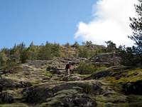
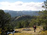
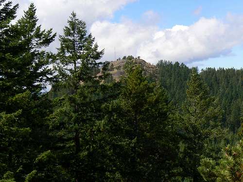
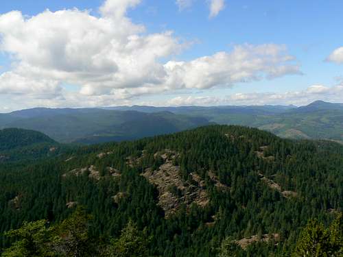
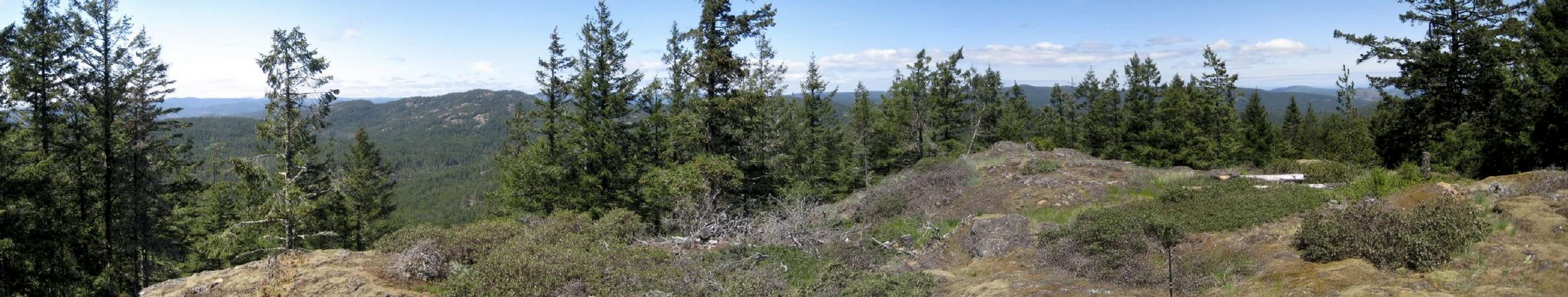
The Urban Mountains of the CRD
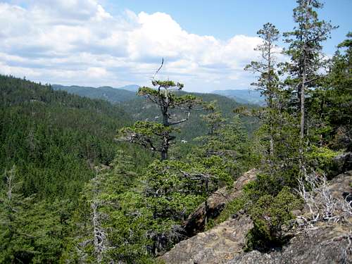
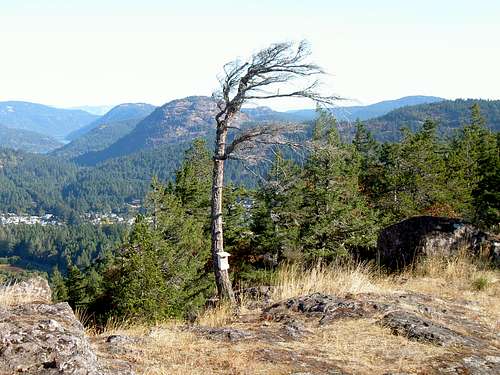 CRD Summits from Mt Wells CRD Summits from Mt Wells |
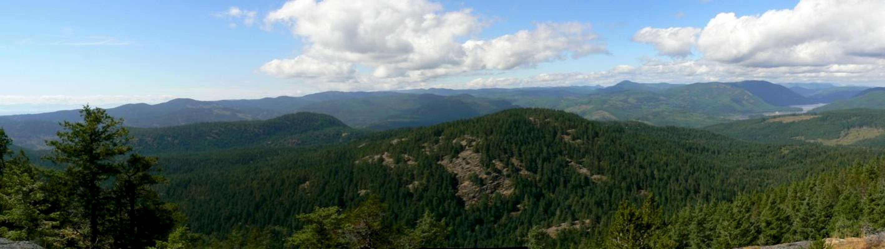
 The reverse view looking south towards Mt Wells The reverse view looking south towards Mt Wells |
Victoria, the capital of British Columbia, Canada, is located at the southern tip of Vancouver Island. The city is grouped together with several other municipalities and together the whole conurbation is known by the rather grand title of the Capital Regional District - or CRD - and is home to almost 350,000 people.
The CRD is surrounded on three sides by water and on the fourth by a series of low mountain ranges up to a height of 600 metres or so. As a consequence of such convoluted terrain, there are just 3 paved roads out of the city: northeast up the Saanich Peninsula to the BC Ferry terminal at Shwartz Bay, west on highway 14 to the road end at Port Renfrew (and the famous West Coast Trail) and northwest on the Trans Canada highway over Malahat Mountain to the north Island. A happy consequence of the terrain is the limit the landscape imposes on building. The city is growing but growth has been slowed by the difficulty and expense of installing housing and services in the rugged hinterland. Given such a unique urban environment, and mindful of the mistakes made by Vancouver, local interests have lobbied hard and relatively successfully for the preservation of green space around the city.
Some lost battles are apparent, such as the dreadful golf course and sub division on Bear Mountain right opposite Mt Finlayson.
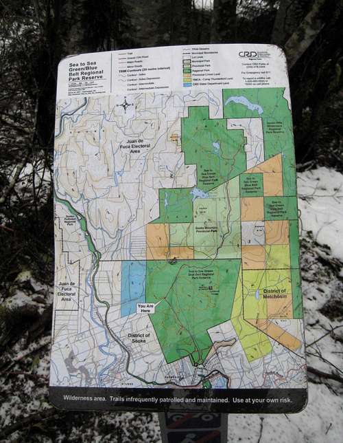
By and in large, however, both the province and the CRD have behaved with admirable civic responsibility and established a series of parks and protected space around the city that should be the envy of similar sized cities anywhere in the world. The latest development in this ongoing effort was the May 2010 establishment of the long awaited Sea to Sea Park encompassing most of two watersheds east of the Sooke River to just east of the Harbourview Road corridor and north to Crabapple Lake and beyond.
Long abused by logging and by motorised recreationists the Sooke Hills are not all pristine wilderness. In establishing the new park, however, the CRD has reaffirmed and now established in law its continuing ban on motorised access and the area should now be allowed the respite it needs to recover fully from these excesses.
This presentation illustrates the beauty of the Sooke Hills but also the areas that have too long been subject to illegal and abusive motorised use. |
Some of the parks have well developed trails right up to the summits. Others, just 30 minutes or so from the city centre are undeveloped, trackless and one would be well advised not to forget map, compass and GPS when venturing, say, into some areas of the Sooke Hills. Even the developed areas have carefully guarded routes to the summits rarely accessible to visitors without local knowledge.
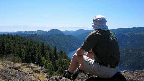
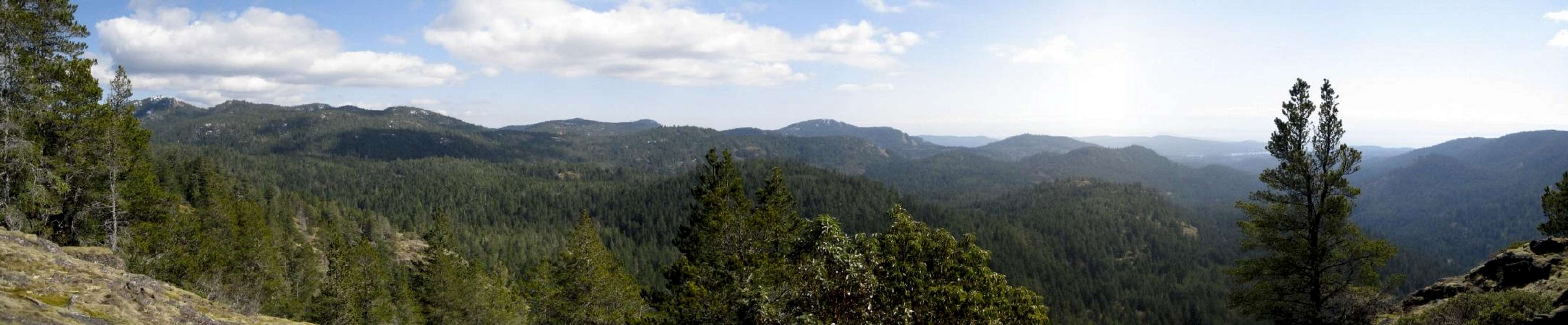
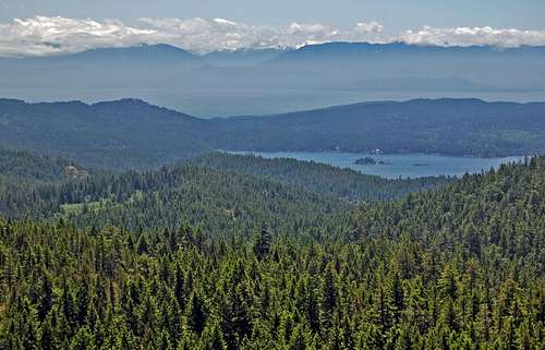
The hills fall into two main areas divided by the Goldstream River watershed. To the east of Goldstream is the Gowlland range plus the lower hills on the east side of the Saanich Peninsula and to the west the Sooke Hills run up to and beyond the boundaries of the CRD. Both areas were extensively logged at the turn of the century and before but the second growth itself is now mature enough to be a worthy mantle for the lower slopes. Here and there, such as at the base of Mt Finlayson, some old growth has been preserved and is mightily impressive. Higher up the big trees generally give way to native species such as arbutus, hairy manzanita bushes, alder, fir, cedar etc with lots of dense west coast salal in the sunnier spots. Travelling off-trail, the going can be up open slopes one minute and into dense bush the next. It's part of the uniqueness and charm of the area. Rock bluffs are common and present the climber with sporty diversion if required. There are developed rock climbing areas on Mts Wells, McDonald and Sugarloaf as well as others that the local rock climbing community keeps to itself. Summits are usually broad granite platforms and almost all offer extensive views of the surrounding hills and across the Strait of Juan de Fuca to the Olympic Mountains of Washington State
The mild marine influenced climate of southern Vancouver Island means that the mountains are accessible year round. This in turn means that they're a tremendous winter training ground. It's common at this time to see folks toting big packs up the local peaks as they prepare for the upcoming season.
By July the annual summer draught is regularly apparent and everything gets tinder dry. At these times the authorities are on the lookout for anything and anyone that may pose a fire hazard.
Flora
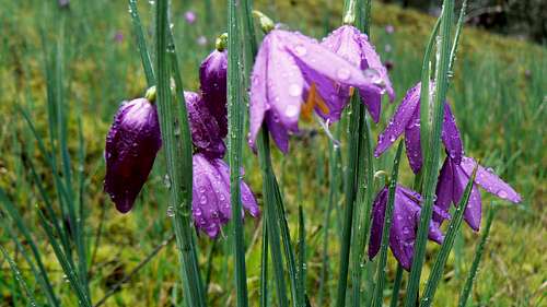
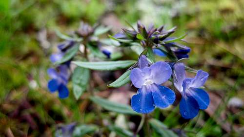
As early as mid-March the first spring flowers appear: camas, shooting stars, ladies slipper, larkspur and many many more. The shows are particularly good on Mt Wells and Mt McDonald and around Holmes Peak and usually peak in late April or early May.
 Great Camas Great Camas |
 Rusty-Haired Saxifrage Rusty-Haired Saxifrage |
 Meadow Death Camas Meadow Death Camas |
 Menzies Larkspur Menzies Larkspur |
 Ladies Slipper Ladies Slipper |
 Shooting Star Shooting Star |
 Trillium Trillium |
 Pink Trillium Pink Trillium |
 Spring Gold Spring Gold |
 Sea blush Sea blush |
 Woodland star Woodland star |
 Tiger lily Tiger lily |
 Satin Flower Satin Flower |
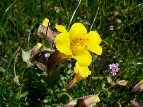 Monkey Flower Monkey Flower |
 Blue Eyed Mary Blue Eyed Mary |
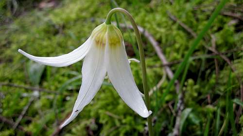 Fawn Lily Fawn Lily |
Fauna
Tick activity can be unpleasant in the early spring - April and May - so remember to wear long sleeves and pants during these times. Fauna more welcome than ticks are also in abundance everywhere. Black footed deer, native red squirrels, bald eagles (and the occasional golden eagle), humming birds in season; all may be seen. I've even seen feral peacocks on Mt Work! The presence of local ravens, particularly on the thermals above Mt Work and Lone Tree Hill, make visits to these locales worthwhile just to watch their antics.
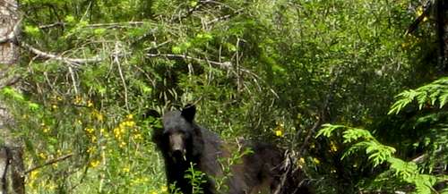 Black Bear near the Charters River
There are assuredly wolves, black bear and cougars in the Sooke Hills. I've seen scat from all three species frequently although live sightings this close to the city are a rarity. Two black bear sightings is my total to date.
The compilation that follows will always be a work in progress. I will be adding more detail and new peaks as and when I cover old and new ground alike. Check back every so often, particularly in winter when I'm usually tramping the local hills. In the meantime, if business or pleasure brings you to Victoria and you'd rather be out hiking than traipsing round all the tourist kitsch in town, there should be more than enough here to keep you happy.
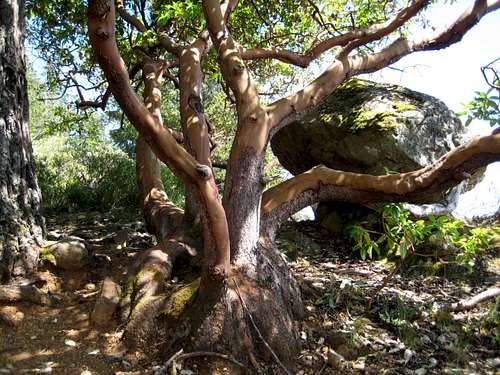 Five stemmed arbutus on Bluff Mountain
Getting There
Victoria can be reached directly by air from Toronto, Calgary, Vancouver, Seattle, San Francisco and many other North American cities.Several ferry operators offer service. BC Ferries sail hourly from Tsawwassen near Vancouver. Washington State Ferries offer service from Anacortes via San Juan Island to Sidney. Black Ball Ferries run a single ship, The MV Coho, back and forth between Port Angeles and downtown Victoria up to four times daily in summer and twice per day in winter. Clipper Navigation Inc. runs a passenger-only fast catamaran service between downtown Seattle and Victoria.
Summary of Peaks by Area
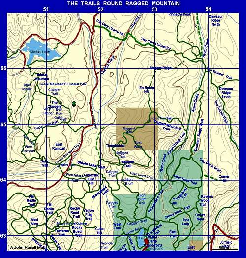
Government of Canada 1:50 000 topographical maps required: 92 C/9, 92 B/11 and 92 B/12. Note that I have placed the lat/long reference in the article header on the summit of Empress Mountain as the highest point within the area covered.All coordinates given in the table and in the following descriptions are based upon the NAD83 datum - the basis for the government maps noted above.
1. Sooke Hills area and west of Goldstream
| Bluff Mountain | 534 | N 48° 25.9' W 123° 45.5' |
| Peden Ridge | 530 | N 48° 27.2' W 123° 42.7' |
| Empress Mountain | 682 | N 48° 27.9' W 123° 40.4' |
| Emperor Mountain | 625 | N 48° 28.2' W 123° 41.1' |
| Screen Peak | 620 | N48 27.726 W123 40.263 |
| Monument Mountain | 463 | N 48° 26.6' W 123° 40.9' |
| Sooke Mountain | 524 | N 48° 26.6' W 123° 39.8' |
| Ragged Mountain South | 550 | N 48° 25.9' W 123° 38.7' |
| Ragged Mountain | 578 | N 48° 26.4' W 123° 38.2' |
| Pinnacle Peak | 520 | N 48° 27.3' W 123° 37.7' |
| Mount Manuel Quimper | 546 | N 48° 25.2' W 123° 39.6' |
| Crow's Nest | 385 | N48 25.271 W123 37.428 |
| Sugarloaf Mountain | 363 | N 48° 24.9' W 123° 36.2' |
| Mount Braden | 479 | N 48° 26.8' W 123° 35.9' |
| The Amigos | 245 | Multiple |
| Mount McDonald | 439 | N 48° 26.5' W 123° 34.1' |
| Mount Wells | 352 | N 48° 26.3' W 123° 33.4' |
2. Gowlland range and east of Goldstream
| Mount Finlayson | 419 | N 48° 29.0' W 123° 32.3' |
| Holmes Peak | 329 | N 48° 31.0' W 123° 31.8' |
| Jocelyn Hill | 434 | N 48° 32.2' W 123° 31.7' |
| Lone Tree Hill | 364 | N 48° 31.2' W 123° 30.8' |
| Mount Work | 449 | N 48° 31.8' W 123° 28.8' |
| Partridge Hill | 295 | N 48° 33.3' W 123° 29.1' |
| Mount Douglas | 213 | N 48° 29.6' W 123° 20.8' |
| Mount Newton | 305 | N 48° 36.7' W 123° 26.7' |
| Horth Hill | 136 | N 48° 41.0' W 123°25.9' |
John Hasell
Readers will notice the frequent inclusion in what follows of such comments as "locally known as" or "generally known as" or similar phrases. Almost of the names referred to derive from a single source.Soldier, Adventurer, Outward Bound Director, avid outdoorsman; John Hasell loved the countryside around Victoria and together with his friends in "The Wednesday Wonderers" and "Thursday Thrashers" spent all the time he could exploring it right up until a few weeks before his death in December 2011. John was an inverate organiser and collater of facts and he loved documenting all of his hikes. It was a given that after every new exploration, he'd dash home to construct or add to his enormous collection of home made trail maps of the hills, old roads and byways around the city. Since very few of the high points reached had official names, John simply used those of group members, geographical features or simply things spotted along the way or in the vicinity. Trails created were named similarly.
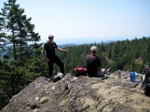
 John Hasell on Ragged Mountain John Hasell on Ragged Mountain |
 John Hasell Ragged Mountain Map John Hasell Ragged Mountain Map |
 John Hasell on The Gem John Hasell on The Gem |
Only 7 or 8 years ago, very few local people had much knowledge of the hills around Victoria other than those documented by regional or provincial authorities, such as Mt Finlayson, Mt Doug, Mt Work etc. John's maps were soon, therefore, in demand and we'd often spot them in the hands of hikers we'd never met before as they were handed off from group to group. You don't see them as often nowadays but the names have stuck. Go to any mountain bike or geocacher website or visit trailpeak.com, victoriahiatus.com or any site to do with hiking in the area and you'll see all of John's names in ubiquitous use. Larkspur Mountain, Rick Peak, Puzzle Peak, David's Delight, the Amigos, Monument Mountain, Emperor Mountain, The Gem, Hydro Ridge, Lunch Hill and on and on.
Beginner Sooke Hills hikers these days simply use the names without knowing their origin - although I'm sure that some do. But in case you have ever wondered where the names come from, here's the explanation. It's a legacy John would have been rightly proud of. He'd be delighted to see his memory preserved in this way.
If you'd like your own copy of a Hasell map for any area of the region that you're interested in hiking, send me an email or private memo and I'll do my best to oblige.
Individual Descriptions
Approach directions in each case assume the reader starts from Victoria. Descriptions are complemented by GPS based route maps in the collection at the end of the page.Bluff Mountain
(current, April 2016)
Views are very restricted from the summit but occasional glimpses are possible from odd points along the ridge hike to the true summit if you keep your eyes peeled.
Access is through Scouts Canada’s <href= http:="" www.victoria.cascadia.scouts.ca="" index.php?module="pagemaster&PAGE_user_op=view_page&PAGE_id=12&MMN_position=21:21">Camp Barnard on Youngs Lake. Formal permission to enter the camp is not normally necessary but, for politeness sake, it would be prudent to call “Willy” on 250 642-5924 or 250 415-1619 and declare your intentions.
To reach Camp Barnard approach on highway 14, the west coast road, via Langford and Metchosin to Sooke. Roughly in the centre of the village find Otter Point Rd and turn right. Drive 5 km to Youngs Lake Road and turn right. Drive through the camp past the reception shed and park in a large gravelled lot on the left side of the road.
From the parking lot walk 300 metres north on the road you entered the camp on and find an open grassy picnic area on the right. Go right to the back of this area and find the (unmarked) Bluff Mountain trailhead at N48 24.605 W123 45.622. Hike the wide well marked trail 30-45 minutes up onto a high open bluff at N48 24.970 W123 45.176 where the trail ends.
The onward route from this point used to be quite a bushwhack. The sparsely flagged route travelled to the west of a swampy pond in the neighbourhood of N48 25.204 W123 45.321 and crossed half dozen or so salal and deadfall choked gullies en route.</href=>
<href= http:="" www.victoria.cascadia.scouts.ca="" index.php?module="pagemaster&PAGE_user_op=view_page&PAGE_id=12&MMN_position=21:21">
Pick up flagging just north of the end of the Scouts trail and follow it north all the way to an open area at N48 25.836 W123 45.443. The new route sometimes gets close to the old one and older flagging can occasionally be seen off to the left (west).
From the open area continue north 50 metres to a cairned high point and then NW across one last gully to arrive at the summit cairn at N48 25.960 W123 45.527 and about 520 metres elevation in 5-10 more minutes. There’s a tin can in the cairn but I don’t think it’s the summit register :-)
Little more than an hour is required from the end of the Scouts’ trail to the summit versus 1.5-2 hours for the old route.
There’s not a shred of a view from the summit but you can walk to the edge of the bluffs just to the east of there to get quite extensive views north and east from this part of the mountain. Or across quite a steep gully 100 metres to the west is an open bluff with limited views north and south.
If you feel that no trip into the Sooke Hills would be complete without a good bush thrash I have retained the old route on the tracklog/map included the "CRD Tracklogs" section at the end of this page. This is meant as a guide only and should not take the place of in situ use of the correct navigational tools.
Alternatively, eschew the Scout’s trail altogether as follows.
Walk 650 metres past the trailhead noted above – past the disk golf area and archery butts -and find another picnic area on the right. Walk across the field to the biffy on the edge of the woods and find a grassy road. The road isn’t on any maps. Walk 800-900 metres up this road to the neighbourhood of N48 25.024 W123 46.035 and head off NE into the bush. Follow your map and/or GPS directly to the open area noted above at N48 25.836 W123 45.443. This isn’t as bad as it sounds in that, although steep on occasion, there are lots of open phases to enjoy and not too many gullies to cross.
Retrace your steps from either upward choice OR make the trip a loop hike as follows.
From the view bluff 100 metres to the west of the summit make a steep descending traverse SW and find a VERY old road right in the valley bottom. The road is barely discernible in most places and absent in others. Deadfall is everywhere. Thrash your way down the “road” and in about an hour make the welcome discovery that it’s the same one you left on your way up the mountain. Walk down the remainder of it and back to your vehicle.
Peden Ridge is a high, bluffy east/west ridge found between the valleys of the Sooke River to the west and Maryvine Creek to the east. To the north of the ridge crest is a summit known locally as “Black Bear Mountain” that may be reached across a connecting ridge and plateau.</href=>
 Youngs Lake from Bluff Mountain Youngs Lake from Bluff Mountain |
 Empress Mtn from Bluff Mtn Empress Mtn from Bluff Mtn |
 Bluff Mountain View N Bluff Mountain View N |
 Bluff Mountain Summit View S Bluff Mountain Summit View S |
 Ragged Mountain and Mt Manuel Quimper from Bluff Mountain Ragged Mountain and Mt Manuel Quimper from Bluff Mountain |
<href= http:="" www.victoria.cascadia.scouts.ca="" index.php?module="pagemaster&PAGE_user_op=view_page&PAGE_id=12&MMN_position=21:21">
</href=>
In spring 2010 a new route was cleared and flagged to the east of the swamp and travels north towards the summit much closer to the ridge edge thereby avoiding many of the gully crossings. A use trail is already beginning to appear in quite a few places along the way.</href=>
Pick up flagging just north of the end of the Scouts trail and follow it north all the way to an open area at N48 25.836 W123 45.443. The new route sometimes gets close to the old one and older flagging can occasionally be seen off to the left (west).
From the open area continue north 50 metres to a cairned high point and then NW across one last gully to arrive at the summit cairn at N48 25.960 W123 45.527 and about 520 metres elevation in 5-10 more minutes. There’s a tin can in the cairn but I don’t think it’s the summit register :-)
Little more than an hour is required from the end of the Scouts’ trail to the summit versus 1.5-2 hours for the old route.
There’s not a shred of a view from the summit but you can walk to the edge of the bluffs just to the east of there to get quite extensive views north and east from this part of the mountain. Or across quite a steep gully 100 metres to the west is an open bluff with limited views north and south.
If you feel that no trip into the Sooke Hills would be complete without a good bush thrash I have retained the old route on the tracklog/map included the "CRD Tracklogs" section at the end of this page. This is meant as a guide only and should not take the place of in situ use of the correct navigational tools.
Alternatively, eschew the Scout’s trail altogether as follows.
Walk 650 metres past the trailhead noted above – past the disk golf area and archery butts -and find another picnic area on the right. Walk across the field to the biffy on the edge of the woods and find a grassy road. The road isn’t on any maps. Walk 800-900 metres up this road to the neighbourhood of N48 25.024 W123 46.035 and head off NE into the bush. Follow your map and/or GPS directly to the open area noted above at N48 25.836 W123 45.443. This isn’t as bad as it sounds in that, although steep on occasion, there are lots of open phases to enjoy and not too many gullies to cross.
Retrace your steps from either upward choice OR make the trip a loop hike as follows.
From the view bluff 100 metres to the west of the summit make a steep descending traverse SW and find a VERY old road right in the valley bottom. The road is barely discernible in most places and absent in others. Deadfall is everywhere. Thrash your way down the “road” and in about an hour make the welcome discovery that it’s the same one you left on your way up the mountain. Walk down the remainder of it and back to your vehicle.
Peden Ridge
(current, October 2016)Peden Ridge is a high, bluffy east/west ridge found between the valleys of the Sooke River to the west and Maryvine Creek to the east. To the north of the ridge crest is a summit known locally as “Black Bear Mountain” that may be reached across a connecting ridge and plateau.</href=>
<href= http:="" www.victoria.cascadia.scouts.ca="" index.php?module="pagemaster&PAGE_user_op=view_page&PAGE_id=12&MMN_position=21:21">
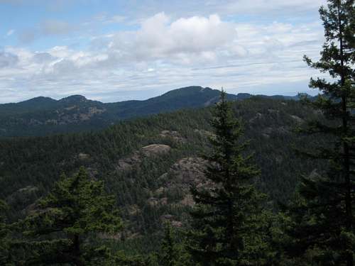
![Peden Bluffs and Black Bear Mountain]() Peden Bluffs and Black Bear Mountain
Peden Bluffs and Black Bear Mountain
Approach on highway 14, the west coast road, via Langford and Metchosin to Sooke. Just prior to reaching Sooke village take the marked right turn onto Sooke River Rd at the sign for Sooke Potholes Regional Park. Drive right to the top of the road and park in the last lot. There may be a parking fee from May-October.
There are many ways to reach the top of Peden Ridge and Black Bear beyond. Within the intended scope of this page, I will deal with three routes and two starts. Refer also to the collection of tracklogs at the end of this page.
Start 1 From the parking lot at the top of Sooke River Road walk north across the Galloping Goose cycle path and on to a good dirt path on the right. Follow the path north along Maryvine Creek for 600-700 metres at which point it turns northeast and meets the old flowline after a further 200-300 metres. A well travelled left branch in this path just below the flowline leads to a lovely waterfall.
Start 2 At the point you entered the parking lot is an old hut on the Galloping Goose. In days gone by, this had to do with the rail line whose disused road bed is now the basis of the Goose. Across the cycle path from the “waiting room” is a flagged route leading up through the trees. Take this to arrive in less than 10 minutes at the flowline. Turn left and walk ~ 10 minutes along the pipeline itself to the neigbourhood of N48 26.764 W123 42.940 where the route along lower Maryvine Creek described above comes in from the left.</href=>
 Peden Bluffs and Black Bear Mountain
Approach on highway 14, the west coast road, via Langford and Metchosin to Sooke. Just prior to reaching Sooke village take the marked right turn onto Sooke River Rd at the sign for Sooke Potholes Regional Park. Drive right to the top of the road and park in the last lot. There may be a parking fee from May-October.
There are many ways to reach the top of Peden Ridge and Black Bear beyond. Within the intended scope of this page, I will deal with three routes and two starts. Refer also to the collection of tracklogs at the end of this page.
Start 1 From the parking lot at the top of Sooke River Road walk north across the Galloping Goose cycle path and on to a good dirt path on the right. Follow the path north along Maryvine Creek for 600-700 metres at which point it turns northeast and meets the old flowline after a further 200-300 metres. A well travelled left branch in this path just below the flowline leads to a lovely waterfall.
Start 2 At the point you entered the parking lot is an old hut on the Galloping Goose. In days gone by, this had to do with the rail line whose disused road bed is now the basis of the Goose. Across the cycle path from the “waiting room” is a flagged route leading up through the trees. Take this to arrive in less than 10 minutes at the flowline. Turn left and walk ~ 10 minutes along the pipeline itself to the neigbourhood of N48 26.764 W123 42.940 where the route along lower Maryvine Creek described above comes in from the left.</href=>
<href= http:="" www.victoria.cascadia.scouts.ca="" index.php?module="pagemaster&PAGE_user_op=view_page&PAGE_id=12&MMN_position=21:21">
Route 1 From either of the start options find a well flagged and very well used trail leading off the flowline northeast. This follows upper Maryvine Creek all the way up to Peden Lake, a distance of about 1.5 km.
Cross Maryvine Creek at its outlet from Peden Lake and follow continuing well made trail first north and then west to the top of the ridge. The point is marked by a substantial cairn atop a large boulder.
Route 2 Continue along the pipeline from the Route 1 start point roughly 150 metres to a wooden platform built below the pipeline. Go just past this point – 20-25 metres – and look for another set of flags going up to the right.
Follow good flagging and sometimes trail on mostly open slopes to a well cairned route junction at N48 27.058 W123 42.912. Beyond this point the easier option lies to the left and follows a forested gully NNW to meet the ridge crest in the neighbourhood of N48 27.425 W123 42.913, roughly 500 metres to the northwest of the cairned high point. Turn right and follow flagging along the ridge to the cairn. This route is known to some as the “tin can route” in that you will see red tin can lids nailed to trees as markers.
Route 3 This route takes a right turn from the junction at N48 27.058 W123 42.912 and heads almost directly to the summit cairn. Follow flagging and mostly open hillside due north up to the foot of the bluffs. Scramble through the bluffs bypassing difficulties by traversing first left and then back right and onto the ridge crest at about N48 27.256 W123 42.752. Turn right and make the brief walk up the remainder of the ridge to the summit cairn. Note that there is a little exposure in one or two spots on this route.</href=>
 Lower Maryvine Falls Lower Maryvine Falls |
 Peden from Maryvine Creek Peden from Maryvine Creek |
 Open going up Peden Open going up Peden |
 Peden Ridge route junction Peden Ridge route junction |
Route 1 From either of the start options find a well flagged and very well used trail leading off the flowline northeast. This follows upper Maryvine Creek all the way up to Peden Lake, a distance of about 1.5 km.
Cross Maryvine Creek at its outlet from Peden Lake and follow continuing well made trail first north and then west to the top of the ridge. The point is marked by a substantial cairn atop a large boulder.
Route 2 Continue along the pipeline from the Route 1 start point roughly 150 metres to a wooden platform built below the pipeline. Go just past this point – 20-25 metres – and look for another set of flags going up to the right.
Follow good flagging and sometimes trail on mostly open slopes to a well cairned route junction at N48 27.058 W123 42.912. Beyond this point the easier option lies to the left and follows a forested gully NNW to meet the ridge crest in the neighbourhood of N48 27.425 W123 42.913, roughly 500 metres to the northwest of the cairned high point. Turn right and follow flagging along the ridge to the cairn. This route is known to some as the “tin can route” in that you will see red tin can lids nailed to trees as markers.
Route 3 This route takes a right turn from the junction at N48 27.058 W123 42.912 and heads almost directly to the summit cairn. Follow flagging and mostly open hillside due north up to the foot of the bluffs. Scramble through the bluffs bypassing difficulties by traversing first left and then back right and onto the ridge crest at about N48 27.256 W123 42.752. Turn right and make the brief walk up the remainder of the ridge to the summit cairn. Note that there is a little exposure in one or two spots on this route.</href=>
<href= http:="" www.victoria.cascadia.scouts.ca="" index.php?module="pagemaster&PAGE_user_op=view_page&PAGE_id=12&MMN_position=21:21">
A route is possible from the top of the bluffs to the summit of a ~570 metres high point known locally at “Black Bear Mountain” at N48 27.990 W123 42.867
Go a few metres east of the large boulder on the summit adorned with lots of cairns and pick up a flagged route heading northeast. After ~50 metres the flagging assumes a generally north heading and crosses several gullies and two intermediate high points to a lightly forested plateau. Continue north across the plateau to a swampy pond at the foot of a short steep step to the top of Black Bear. About 100 metres before reaching the pond, look for flagging in the trees off to your right. This indicates a well worn use trail on a fairly gentle gradient that leads to an open view bluff at N48 27.910 W123 42.793. The summit lies 200 metres to the NNW of this but is in the middle of a large patch of blown down trees and offers no views.</href=>
 The foot of Peden Bluffs The foot of Peden Bluffs |
 Climbing through Peden Bluffs Climbing through Peden Bluffs |
 Descending through Peden Bluffs Descending through Peden Bluffs |
 Descending below Peden Bluffs Descending below Peden Bluffs |
A route is possible from the top of the bluffs to the summit of a ~570 metres high point known locally at “Black Bear Mountain” at N48 27.990 W123 42.867
Go a few metres east of the large boulder on the summit adorned with lots of cairns and pick up a flagged route heading northeast. After ~50 metres the flagging assumes a generally north heading and crosses several gullies and two intermediate high points to a lightly forested plateau. Continue north across the plateau to a swampy pond at the foot of a short steep step to the top of Black Bear. About 100 metres before reaching the pond, look for flagging in the trees off to your right. This indicates a well worn use trail on a fairly gentle gradient that leads to an open view bluff at N48 27.910 W123 42.793. The summit lies 200 metres to the NNW of this but is in the middle of a large patch of blown down trees and offers no views.</href=>
<href= http:="" www.victoria.cascadia.scouts.ca="" index.php?module="pagemaster&PAGE_user_op=view_page&PAGE_id=12&MMN_position=21:21">
As a sporty alternative, continue from the standard trail, go around the swampy pond on the left and then turn right through a short patch of salal to the foot of the bluffs. Scramble directly through the buffs to the viewpoint.</href=>
As a sporty alternative, continue from the standard trail, go around the swampy pond on the left and then turn right through a short patch of salal to the foot of the bluffs. Scramble directly through the buffs to the viewpoint.</href=>
<href= http:="" www.victoria.cascadia.scouts.ca="" index.php?module="pagemaster&PAGE_user_op=view_page&PAGE_id=12&MMN_position=21:21">
As may be obvious from the foregoing as well as from the tracklog, any of the above suggestions except Black Bear can be combined into a loop hike starting and finishing at the old flowline.</href=>
As may be obvious from the foregoing as well as from the tracklog, any of the above suggestions except Black Bear can be combined into a loop hike starting and finishing at the old flowline.</href=>
<href= http:="" www.victoria.cascadia.scouts.ca="" index.php?module="pagemaster&PAGE_user_op=view_page&PAGE_id=12&MMN_position=21:21">
Empress Mountain now has its own separate and detailed page on SummitPost. The following provides a detailed description of what, for many, is the most direct and least complicated way to reach the summit as well as an overview of the other options. For these click on the preceding link.</href=>
  |
Empress Mountain
(Current, October 2016)Empress Mountain now has its own separate and detailed page on SummitPost. The following provides a detailed description of what, for many, is the most direct and least complicated way to reach the summit as well as an overview of the other options. For these click on the preceding link.</href=>
<href= http:="" www.victoria.cascadia.scouts.ca="" index.php?module="pagemaster&PAGE_user_op=view_page&PAGE_id=12&MMN_position=21:21">
</href=>
</href=>
<href= http:="" www.victoria.cascadia.scouts.ca="" index.php?module="pagemaster&PAGE_user_op=view_page&PAGE_id=12&MMN_position=21:21">Empress is the highest point in the CRD. The usual route is mostly on old, disused logging roads along Todd Creek. Don’t think of this is a simple road walk though. It’s quite a long way and the roads are little more than rough trails with one potential river crossing. No maintenance of the route takes place other than by local volunteers.
Allow about 6 hours car to car including a half hour for lunch on top.</href=>
Allow about 6 hours car to car including a half hour for lunch on top.</href=>
<href= http:="" www.victoria.cascadia.scouts.ca="" index.php?module="pagemaster&PAGE_user_op=view_page&PAGE_id=12&MMN_position=21:21">
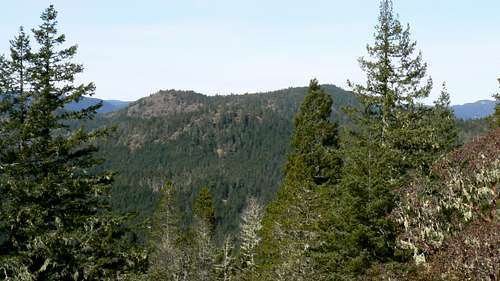
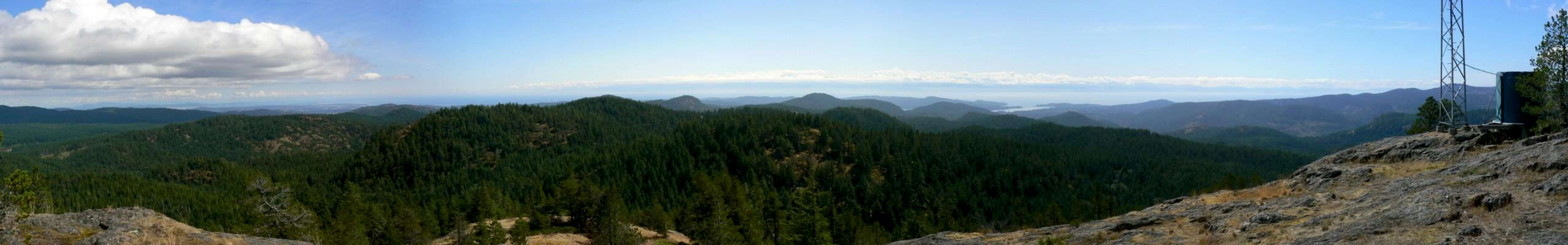
![Empress Mountain]() Empress Mountain from Peden Ridge
Empress Mountain from Peden Ridge
Approach as for Peden Ridge and set your odometer to zero as you turn off Highway 14 onto Sooke River Road. At 4.70 km, just before entering Sooke Potholes Regional Park, look for a gated old logging road leading off to the right. It’s marked with a redundant sign “No Motorized Vehicles” but there’s no indication that this is the way to Empress. Park here by the side of the road. Starting altitude is about 50 metres.
Go up the old road and in 5 minutes cross the Galloping Goose cycle path. The route now slowly gains 500 metres in altitude over the next 2.5 hours as you negotiate what remains of the road. Side trails lead off to the left and right but the main through route is largely unmistakable.
For the first 30 minutes the road follows Todd Creek and offers easy going. At 40-45 minutes note the wreck of an old red car on the left above the river and shortly thereafter cross Todd Creek. After heavy rain this might have to be waded. </href=>
 Empress Mountain from Peden Ridge
Approach as for Peden Ridge and set your odometer to zero as you turn off Highway 14 onto Sooke River Road. At 4.70 km, just before entering Sooke Potholes Regional Park, look for a gated old logging road leading off to the right. It’s marked with a redundant sign “No Motorized Vehicles” but there’s no indication that this is the way to Empress. Park here by the side of the road. Starting altitude is about 50 metres.
Go up the old road and in 5 minutes cross the Galloping Goose cycle path. The route now slowly gains 500 metres in altitude over the next 2.5 hours as you negotiate what remains of the road. Side trails lead off to the left and right but the main through route is largely unmistakable.
For the first 30 minutes the road follows Todd Creek and offers easy going. At 40-45 minutes note the wreck of an old red car on the left above the river and shortly thereafter cross Todd Creek. After heavy rain this might have to be waded. </href=>
<href= http:="" www.victoria.cascadia.scouts.ca="" index.php?module="pagemaster&PAGE_user_op=view_page&PAGE_id=12&MMN_position=21:21">
Proceeding north from the creek crossing, two trails lead off to the left – to the south and north ends of Peden Lake respectively, before at about 90 minutes from the car and at 355 metres, a well-flagged trail leads off to the right. This is the so-called "Tent Pole Trail" that goes SE to the north end of Grassie Lake. Your route lies straight ahead.
At about 120 minutes and 415 metres the route reaches a fork at N48 27.893 W123 40.907. This is the only place where you might go wrong. Look carefully and there is an arrow indicating the correct right fork carved in an alder at the junction.
Walk up the road until, at about 150 minutes from the start and at 585 metres, just before the road reaches its high point and begins to descend to the east, you can see the open, mossy slabs of Empress’ south slopes on the left. Go through the break in the trees here and out onto open hillside. Follow the well worn path north to the summit in about 15 minutes.</href=>
 Empress route start Empress route start |
 Empress Mountain. Critical trail fork Empress Mountain. Critical trail fork |
 Final leg to the top Final leg to the top |
 Empress Mountain S slopes Empress Mountain S slopes |
Proceeding north from the creek crossing, two trails lead off to the left – to the south and north ends of Peden Lake respectively, before at about 90 minutes from the car and at 355 metres, a well-flagged trail leads off to the right. This is the so-called "Tent Pole Trail" that goes SE to the north end of Grassie Lake. Your route lies straight ahead.
At about 120 minutes and 415 metres the route reaches a fork at N48 27.893 W123 40.907. This is the only place where you might go wrong. Look carefully and there is an arrow indicating the correct right fork carved in an alder at the junction.
Walk up the road until, at about 150 minutes from the start and at 585 metres, just before the road reaches its high point and begins to descend to the east, you can see the open, mossy slabs of Empress’ south slopes on the left. Go through the break in the trees here and out onto open hillside. Follow the well worn path north to the summit in about 15 minutes.</href=>
<href= http:="" www.victoria.cascadia.scouts.ca="" index.php?module="pagemaster&PAGE_user_op=view_page&PAGE_id=12&MMN_position=21:21">
![Empress Mountain from the SE]() Empress from the SE
Empress from the SE
The summit of Empress is unfortunately crowned with a communications tower but it’s easy to ignore. There is also a F.C Swannell's 1937 BC Control Survey bolt right on the summit.
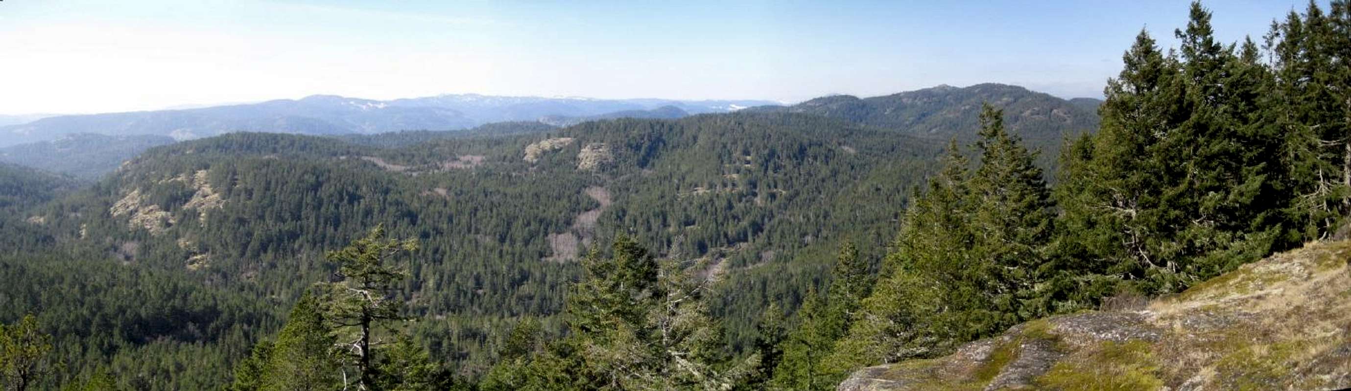
The flat rock summit area is quite large, mostly open and offers superb views over the Sooke Hills in all directions, particularly east to downtown Victoria and south across the Strait of Juan de Fuca to the Olympic Mountains of Washington State.</href=>
 Empress from the SE
The summit of Empress is unfortunately crowned with a communications tower but it’s easy to ignore. There is also a F.C Swannell's 1937 BC Control Survey bolt right on the summit.
The flat rock summit area is quite large, mostly open and offers superb views over the Sooke Hills in all directions, particularly east to downtown Victoria and south across the Strait of Juan de Fuca to the Olympic Mountains of Washington State.</href=>
<href= http:="" www.victoria.cascadia.scouts.ca="" index.php?module="pagemaster&PAGE_user_op=view_page&PAGE_id=12&MMN_position=21:21">
Return to the car by reversing the above.
Empress may also be approached via a long walk up Harbourview Road, round the north end of Crabapple Lake and down to join the road described above at its east end. Walk up from there west to the same high point and the start of the same 15 minute walk to the summit.
It’s also possible to approach from the southeast along the ridges north of Grassie and Sheilds Lakes and thereby avoid any walking on crumbly old roads. This approach, however, requires patience and navigational skills and is outside the intended scope of this page.
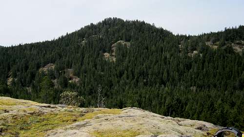
Screen Peak lies almost due south of Empress Mountain and less than 400 metres away. From most angles, the hill is lost in the bulk of Empress – hence the name. From the west, in particular the ridges above and to the west of Peden Lake, Screen can be appreciated as a separate and prominent summit. It makes a fine objective in its own right but can also be taken in as part of a longer trip to Empress.</href=>
 |
 |
Return to the car by reversing the above.
Empress may also be approached via a long walk up Harbourview Road, round the north end of Crabapple Lake and down to join the road described above at its east end. Walk up from there west to the same high point and the start of the same 15 minute walk to the summit.
It’s also possible to approach from the southeast along the ridges north of Grassie and Sheilds Lakes and thereby avoid any walking on crumbly old roads. This approach, however, requires patience and navigational skills and is outside the intended scope of this page.
Screen Peak
(Current, October 2016)Screen Peak lies almost due south of Empress Mountain and less than 400 metres away. From most angles, the hill is lost in the bulk of Empress – hence the name. From the west, in particular the ridges above and to the west of Peden Lake, Screen can be appreciated as a separate and prominent summit. It makes a fine objective in its own right but can also be taken in as part of a longer trip to Empress.</href=>
<href= http:="" www.victoria.cascadia.scouts.ca="" index.php?module="pagemaster&PAGE_user_op=view_page&PAGE_id=12&MMN_position=21:21">
Start from the Charters River pumphouse as described for Sooke Mountain or Monument Mountain. Hike up to Grassie Lake and continue beyond towards “Puzzle Pass” on the trail to Sheilds Lake. Just before Puzzle Pass, the high point between Grassie and Sheilds, at N48 26.992 W123 40.628, look for a junction with a large cairn on the rhs of the trail. This marks the start of the Bert Lake Trail. Turn left (north) here.
Hike north for about 700 metres to another junction – marked #3 on the map in the collection at the end of this page – at N48 27.324 W123 40.530. The most direct route to Screen goes right here. Take this or head left towards Bert Lake if you want to do a loop. Assuming the latter, continue up to tiny Bert Lake and beyond to a well flagged junction at N48 27.611 W123 40.733 – marked #1 on the map. Your turn for Screen lies to the right. Going left takes you to the spur road that leads to the foot of Empress. For Screen, continue up and east for 300 metres to a less well marked junction at N48 27.608 W123 40.539 – marked #2 on the map. Turn northeast here, following good flagging, and arrive at a salal filled gully between the east and west summits of Screen. Follow good trail to either. The east summit is the higher and has a cairn whereas the descent route down the bottom of Empress goes off the west summit.
Enjoy the views from either, then head on towards Empress or return to junction #2, turn left and complete the loop south to junction #3 and out to your vehicle from there.
Even without Empress, this a good day-long hike of 6-7 hours. Add at least an hour to tack on Empress.
Approximately 1 km to the northwest of Empress Mountain as the crow flies is a twin summited hill that is only a few metres lower than the queen of the Sooke Hills herself. Curiously the hill has no official name but being close to Empress and quite impressive in its own right, it’s generally known as “Emperor Mountain”.</href=>
 Screen Peak Screen Peak |
<href= http:="" www.victoria.cascadia.scouts.ca="" index.php?module="pagemaster&PAGE_user_op=view_page&PAGE_id=12&MMN_position=21:21">
</href=>
Any approach that works for Empress, works for Screen. At the base of the final approach to Empress ie in the neighborhood of N48 27.803 W123 40.313, turn south instead of north and you’re on your way up Screen. The most satisfying approach, however, is by way of the Charters River and Bert Lake, the smallest named lake in the Sooke Hills. This is described in detail as follows. Needless to say, this can be used as a route to Empress Mountain too.</href=>
Start from the Charters River pumphouse as described for Sooke Mountain or Monument Mountain. Hike up to Grassie Lake and continue beyond towards “Puzzle Pass” on the trail to Sheilds Lake. Just before Puzzle Pass, the high point between Grassie and Sheilds, at N48 26.992 W123 40.628, look for a junction with a large cairn on the rhs of the trail. This marks the start of the Bert Lake Trail. Turn left (north) here.
Hike north for about 700 metres to another junction – marked #3 on the map in the collection at the end of this page – at N48 27.324 W123 40.530. The most direct route to Screen goes right here. Take this or head left towards Bert Lake if you want to do a loop. Assuming the latter, continue up to tiny Bert Lake and beyond to a well flagged junction at N48 27.611 W123 40.733 – marked #1 on the map. Your turn for Screen lies to the right. Going left takes you to the spur road that leads to the foot of Empress. For Screen, continue up and east for 300 metres to a less well marked junction at N48 27.608 W123 40.539 – marked #2 on the map. Turn northeast here, following good flagging, and arrive at a salal filled gully between the east and west summits of Screen. Follow good trail to either. The east summit is the higher and has a cairn whereas the descent route down the bottom of Empress goes off the west summit.
Enjoy the views from either, then head on towards Empress or return to junction #2, turn left and complete the loop south to junction #3 and out to your vehicle from there.
Even without Empress, this a good day-long hike of 6-7 hours. Add at least an hour to tack on Empress.
Emperor Mountain
(Current, October 2016)Approximately 1 km to the northwest of Empress Mountain as the crow flies is a twin summited hill that is only a few metres lower than the queen of the Sooke Hills herself. Curiously the hill has no official name but being close to Empress and quite impressive in its own right, it’s generally known as “Emperor Mountain”.</href=>
<href= http:="" www.victoria.cascadia.scouts.ca="" index.php?module="pagemaster&PAGE_user_op=view_page&PAGE_id=12&MMN_position=21:21">
![Emperor Mountain from Empress Mountain]() Emperor from Empress
Emperor from Empress
Emperor can be approached via Todd Creek as described above for Empress Mountain by keeping left at the junction at N48 27.893 W123 40.907 where the arrow is carved in the alder. Walk 200 metres up the old road to N48 27.977 W123 40.849 and find a well flagged and booted-in route heading up northwest through the trees. The route soon breaks out onto open hillside and continues northwest and then north to the cairned summit in 20-25 minutes from Todd Creek.
Most people regard this as the main summit of Emperor and it does offer nice views east across the valley to its higher consort over there. However, better views to the north and south are available from the north summit which my two altimeters measured at the same elevation as the south summit. The flagged and occasionally booted-in trail from this point takes about 10-15 minutes, is very reasonable and the diversion well worthwhile. Just head north off the south summit and then swing round to the northwest after crossing a 20 metres deep gully. The north summit sees far fewer visitors but also has a cairn and, as mentioned, lovely views particularly north to Sooke Lake and Survey Mountain. </href=>
 Emperor from Empress
Emperor can be approached via Todd Creek as described above for Empress Mountain by keeping left at the junction at N48 27.893 W123 40.907 where the arrow is carved in the alder. Walk 200 metres up the old road to N48 27.977 W123 40.849 and find a well flagged and booted-in route heading up northwest through the trees. The route soon breaks out onto open hillside and continues northwest and then north to the cairned summit in 20-25 minutes from Todd Creek.
Most people regard this as the main summit of Emperor and it does offer nice views east across the valley to its higher consort over there. However, better views to the north and south are available from the north summit which my two altimeters measured at the same elevation as the south summit. The flagged and occasionally booted-in trail from this point takes about 10-15 minutes, is very reasonable and the diversion well worthwhile. Just head north off the south summit and then swing round to the northwest after crossing a 20 metres deep gully. The north summit sees far fewer visitors but also has a cairn and, as mentioned, lovely views particularly north to Sooke Lake and Survey Mountain. </href=>
<href= http:="" www.victoria.cascadia.scouts.ca="" index.php?module="pagemaster&PAGE_user_op=view_page&PAGE_id=12&MMN_position=21:21">
</href=>
</href=>
<href= http:="" www.victoria.cascadia.scouts.ca="" index.php?module="pagemaster&PAGE_user_op=view_page&PAGE_id=12&MMN_position=21:21">
For more fun and challenge approach Emperor via Peden Lake and climb the trackless ridges north of the lake direct to the north summit. This route is infrequently travelled so make sure your navigational skills are well honed for this one!
Approach via the Maryvine Creek trail as if heading for Peden Bluffs on “Start1/Route 1” described above. At the lake outlet keep right and walk along the east shore of the lake on the old road and around to its north side. At N48 27.426 W123 41.979, or thereabouts, flagging at a small 1-2 metre rock step, about 1 km from the point you left the Maryvine Creek trail, indicates the start of the route.
Take an initial course due north for about 800 metres. The ridge is quite well defined and, once beyond the first bushy phase, quite open. After 800 metres on this initial course, swing round to the northeast and cross a bushy flat-ish area. Beyond this area is a very old road. Turn right on this for 50 metres to where you can leave it on the left and cross a small stream. Climb northeast from this point and scramble out onto a lovely open ridge with the summit ridge now in view. From here it’s just a matter of continuing another 800 metres northeast keeping to open ground wherever you can find it. This course puts you on the summit ridge 250 metres west of the north summit. Turn right and stroll up the last bit in less than 5 minutes.</href=>
 Emperor Mountain South Route TH Emperor Mountain South Route TH |
 Empress from Emperor Empress from Emperor |
 Emperor Mtn N summit Emperor Mtn N summit |
 Emperor Mtn view NW Emperor Mtn view NW |
For more fun and challenge approach Emperor via Peden Lake and climb the trackless ridges north of the lake direct to the north summit. This route is infrequently travelled so make sure your navigational skills are well honed for this one!
Approach via the Maryvine Creek trail as if heading for Peden Bluffs on “Start1/Route 1” described above. At the lake outlet keep right and walk along the east shore of the lake on the old road and around to its north side. At N48 27.426 W123 41.979, or thereabouts, flagging at a small 1-2 metre rock step, about 1 km from the point you left the Maryvine Creek trail, indicates the start of the route.
Take an initial course due north for about 800 metres. The ridge is quite well defined and, once beyond the first bushy phase, quite open. After 800 metres on this initial course, swing round to the northeast and cross a bushy flat-ish area. Beyond this area is a very old road. Turn right on this for 50 metres to where you can leave it on the left and cross a small stream. Climb northeast from this point and scramble out onto a lovely open ridge with the summit ridge now in view. From here it’s just a matter of continuing another 800 metres northeast keeping to open ground wherever you can find it. This course puts you on the summit ridge 250 metres west of the north summit. Turn right and stroll up the last bit in less than 5 minutes.</href=>
<href= http:="" www.victoria.cascadia.scouts.ca="" index.php?module="pagemaster&PAGE_user_op=view_page&PAGE_id=12&MMN_position=21:21">
![Emperor Mountain from Black Bear Mountain]() Emperor from Black Bear Mountain
Emperor from Black Bear Mountain
A nice loop is possible by continuing across to the south summit, down to Todd Creek and then carrying on south past the “arrow-in-the-alder” junction. At a junction at N48 27.196 W123 41.757 turn right, walk down to Peden Lake in 5 minutes and rejoin your up-track there. Allow about 4-5 hours for the complete circular route and and a further 1-2 hours from the parking lot at the top of Sooke River Road to reach and return from the route start.
Manuel Quimper is, perhaps, the easiest hill to access in the Sea to Sea Regional Park Reserve and is now officially open to hikers, equestrians and mountain bikers. CRD has installed maps and trail signs at all major junctions such that the information I wrote originally for this mountain is pretty much redundant. There is a heavy emphasis on mountain biking in the park with several trails being shared between biking and hiking but most designated as biking only. Hikers use these at your own risk. Bikers will be coming down them at speed and may not be able to stop or avoid you!! Also noteworthy is that CRD has designated the park as a dog-on-leash area. Please cooperate with this policy. Not everyone likes dogs and there is a reporting system in place with fines for abuse of the byelaw.
Approach on Highway 1 and take the Veterans Memorial Parkway exit through Langford to the junction with Sooke Road. Turn right towards Sooke. Exactly 4.2 km after "17 Mile" pub, watch for Harbour View Road on the right. Turn here and drive ~1 km to the parking lot. There is an information sign and trail maps at the parking area as well as toilets and a mountain bike washing station. Starting altitude is about 60 m.
</href=>
 Emperor from Black Bear Mountain
A nice loop is possible by continuing across to the south summit, down to Todd Creek and then carrying on south past the “arrow-in-the-alder” junction. At a junction at N48 27.196 W123 41.757 turn right, walk down to Peden Lake in 5 minutes and rejoin your up-track there. Allow about 4-5 hours for the complete circular route and and a further 1-2 hours from the parking lot at the top of Sooke River Road to reach and return from the route start.
Mt Manuel Quimper
(Current, December 2016)Manuel Quimper is, perhaps, the easiest hill to access in the Sea to Sea Regional Park Reserve and is now officially open to hikers, equestrians and mountain bikers. CRD has installed maps and trail signs at all major junctions such that the information I wrote originally for this mountain is pretty much redundant. There is a heavy emphasis on mountain biking in the park with several trails being shared between biking and hiking but most designated as biking only. Hikers use these at your own risk. Bikers will be coming down them at speed and may not be able to stop or avoid you!! Also noteworthy is that CRD has designated the park as a dog-on-leash area. Please cooperate with this policy. Not everyone likes dogs and there is a reporting system in place with fines for abuse of the byelaw.
Approach on Highway 1 and take the Veterans Memorial Parkway exit through Langford to the junction with Sooke Road. Turn right towards Sooke. Exactly 4.2 km after "17 Mile" pub, watch for Harbour View Road on the right. Turn here and drive ~1 km to the parking lot. There is an information sign and trail maps at the parking area as well as toilets and a mountain bike washing station. Starting altitude is about 60 m.
</href=>
<href= http:="" www.victoria.cascadia.scouts.ca="" index.php?module="pagemaster&PAGE_user_op=view_page&PAGE_id=12&MMN_position=21:21">
</href=>
 Briefly Lived Manuel Quimper Trail Map Briefly Lived Manuel Quimper Trail Map |
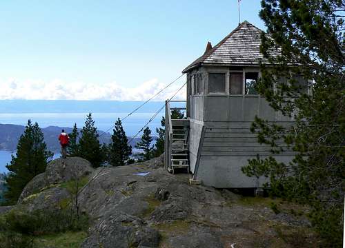 Mt Manuel Quimper Summit Firetower Mt Manuel Quimper Summit Firetower |
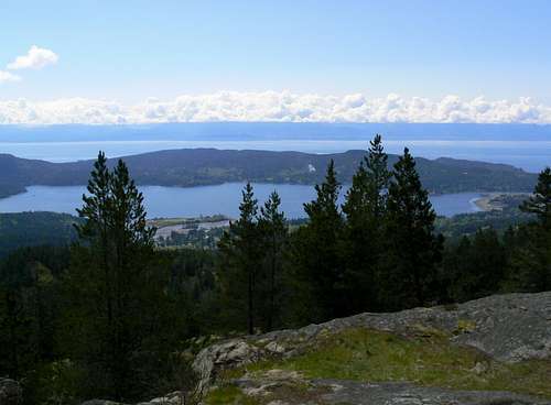 Mt Manuel Quimper Summit View S Mt Manuel Quimper Summit View S |
CRD have designated just one trail for hikers only. Happily this removes any need to walk Harbourview Road.
<href= http:="" www.victoria.cascadia.scouts.ca="" index.php?module="pagemaster&PAGE_user_op=view_page&PAGE_id=12&MMN_position=21:21">
</href=>
</href=>
<href= http:="" www.victoria.cascadia.scouts.ca="" index.php?module="pagemaster&PAGE_user_op=view_page&PAGE_id=12&MMN_position=21:21">Almost immediately after passing through the first gate, note a second yellow gate on the right. Follow the signs but maybe take the following description with you to be on the safe side. Go through the yellow gate rather than heading up Harbourview. Hike up the road, cross under the powerlines and reach the old flowline. Go straight ahead on good trail through nice open forest. There are several spurs that might take you off-route during this phase. The only one at which you might go wrong is about 500 metres travel from the point at which you crossed the flowline. Keep left and slightly downhill here. if you've got it right you'll soon emerge onto an old crumbly road right at a very distinctive old, dead fir tree. Turn right and hike this road east and then north to where it peters out at the foot of open slopes. Continue north along the well used trail, up and over a knoll - from where the summit is visible - and down to another old road. Turn right on this and within a few minutes pass the foot of the steep south slopes route designated for MB's only. For the CRD Trail continue east and then north up to a flat area where you will meet a trail junction with a route coming up from the Glintz Lake/Ragged Mountain area. Turn left at the junction and hike up 2 or 3 switchbacks to open slopes directly below the summit. Walk slightly past the summit before turning back right and up to the top. The summit is crowned with an old fire watchtower. This is no longer in use but it's in pretty good shape and makes a perfectly adequate emergency shelter. Return the way you came. Or follow MB trails at your own risk.</href=>
<href= http:="" www.victoria.cascadia.scouts.ca="" index.php?module="pagemaster&PAGE_user_op=view_page&PAGE_id=12&MMN_position=21:21">
</href=>
</href=>
<href= http:="" www.victoria.cascadia.scouts.ca="" index.php?module="pagemaster&PAGE_user_op=view_page&PAGE_id=12&MMN_position=21:21">The summit is fairly heavily forested and offers uninterrupted views only to the south - down to the Sooke Basin and across the Strait of Jan de Fuca to the Olympics. Look around, however, and you'll soon spot Mt McDonald to the east and Empress Mountain to the northwest through the trees.
Mt Manuel Quimper is named after an 18th century Peruvian naval officer in the service of the Spanish crown. He was part of an expedition sent north in 1790 to explore and chart the Pacific Northwest in order to assert Spanish sovereignty in the face of increasing British and Russian incursions. Manuel Quimper is credited with being the first European to see Mount Baker. His eventual namesake mountain, however, turned out to be much more modest.
Mt Manuel Quimper is named after an 18th century Peruvian naval officer in the service of the Spanish crown. He was part of an expedition sent north in 1790 to explore and chart the Pacific Northwest in order to assert Spanish sovereignty in the face of increasing British and Russian incursions. Manuel Quimper is credited with being the first European to see Mount Baker. His eventual namesake mountain, however, turned out to be much more modest.
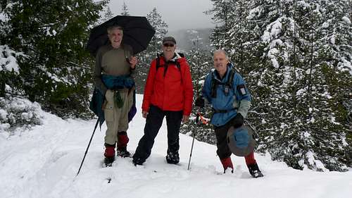
Ragged Mountain South/Thunderbird Mountain
(Current, October 2016)
</href=><href= http:="" www.victoria.cascadia.scouts.ca="" index.php?module="pagemaster&PAGE_user_op=view_page&PAGE_id=12&MMN_position=21:21">
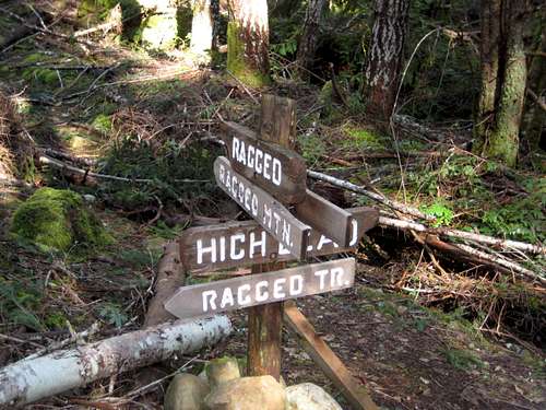
The easiest approach to the twin summits of Ragged Mountain is via trails from the YM/YWCA Camp Thunderbird at the end of Glintz Lake Road. This probably explains why the south summit is also known locally as Thunderbird Mountain. However, this is privately owned land and access from this (east) side is with the permission of the YMCA. Current policy - during the camp's season and/or when the gate is open - is to allow hiking provided you sign in first. Once parked, find "Peter" and complete the formalities.</href=>
The easiest approach to the twin summits of Ragged Mountain is via trails from the YM/YWCA Camp Thunderbird at the end of Glintz Lake Road. This probably explains why the south summit is also known locally as Thunderbird Mountain. However, this is privately owned land and access from this (east) side is with the permission of the YMCA. Current policy - during the camp's season and/or when the gate is open - is to allow hiking provided you sign in first. Once parked, find "Peter" and complete the formalities.</href=>
<href= http:="" www.victoria.cascadia.scouts.ca="" index.php?module="pagemaster&PAGE_user_op=view_page&PAGE_id=12&MMN_position=21:21">
![Ragged South/Thunderbird]() Ragged South/Thunderbird
Ragged South/Thunderbird
The mountain can also be approached from the west after a long hike up Harbour View Road. Readers should be aware, however, that once off the gravel road, the route is quite convoluted with many "sucker" options to both left and right of the correct route. What follows is as accurate as I can make it but I would strongly advise anyone trying this for the first time to go with a knowledgeable local.</href=>
 Ragged South/Thunderbird
The mountain can also be approached from the west after a long hike up Harbour View Road. Readers should be aware, however, that once off the gravel road, the route is quite convoluted with many "sucker" options to both left and right of the correct route. What follows is as accurate as I can make it but I would strongly advise anyone trying this for the first time to go with a knowledgeable local.</href=>
<href= http:="" www.victoria.cascadia.scouts.ca="" index.php?module="pagemaster&PAGE_user_op=view_page&PAGE_id=12&MMN_position=21:21">
You're soon right under the high bluffs on Ragged South's south side. Good trail weaves a nice line through them to the summit in 20-30 minutes.
There's quite a bit of bush right on the summit but a few seconds to left or right brings you to the top of the bluffs and uninterrupted views in all directions except due north. The views of Manuel Quimper, Sooke Basin and the hills to the west of Harbour View Road, particularly Empress Mountain, are very fine indeed.</href=>
 Camp Thunderbird Trail Sign. Camp Thunderbird Trail Sign. |
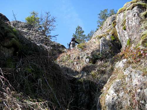 Scrambling the South Bluffs Scrambling the South Bluffs |
 Threatening Weather Over Mt Manuel Quimper Threatening Weather Over Mt Manuel Quimper |
 Thunderbird view south. Photo by dreardon Thunderbird view south. Photo by dreardon |
Starting from the Y-Camp, the nicest route to Thunderbird is the "High Bluff" trail. From the parking lot head north along the lake shore on wide trail. Follow the trail around the top of the lake, left at the first junction and across a bridge to a junction at 10 U 452862 5363318. Stay left here and hike up the hill for 200 metres to a well flagged route on the right and signposted for the High Bluff Trail. Continue on this trail north and then west and out onto a lovely open ridge. Walk along the ridge until the trail turns right and drops down into the forest and arrives at a 4-way junction with a wooden signpost erected by the YMCA. Follow the direction for Ragged Mountain/Sheilds Lake for 2 minutes to another signpost and stay left. Continue for another 2 minutes to the next signpost. Turn right and head up steeply.
You're soon right under the high bluffs on Ragged South's south side. Good trail weaves a nice line through them to the summit in 20-30 minutes.
There's quite a bit of bush right on the summit but a few seconds to left or right brings you to the top of the bluffs and uninterrupted views in all directions except due north. The views of Manuel Quimper, Sooke Basin and the hills to the west of Harbour View Road, particularly Empress Mountain, are very fine indeed.</href=>
<href= http:="" www.victoria.cascadia.scouts.ca="" index.php?module="pagemaster&PAGE_user_op=view_page&PAGE_id=12&MMN_position=21:21">
</href=>
</href=>
<href= http:="" www.victoria.cascadia.scouts.ca="" index.php?module="pagemaster&PAGE_user_op=view_page&PAGE_id=12&MMN_position=21:21">If starting your hike from Harbourview Road, proceed as follows. Park in the lot at the end of the public section of Harbour View Road and proceed as described above for Mt Manuel Quimper. Walk the road for 60-70 minutes to a flagged trailhead at N 48° 25.6', W 123° 39.4' and 380 metres altitude. Follow flagging east to a junction at N 48° 25.6', W 123° 39.1' in about 15 minutes. Thunderbird can be seen through the trees to the left. However, turn right and go down and around the knoll on your left then back up to another critical junction at N 48° 25.5', W 123° 38.7' also in about 15 minutes. Turn left.
The next section has some dense salal in places and little deadfall to negotiate but is well flagged and a use-path can be followed most of the way. If you've got it right, after about 15-20 minutes you will suddenly arrive at the 4-way junction with its wooden signpost described above. You're now on the route in from Camp Thunderbird. Proceed as described above.
</href=>
<href= http:="" www.victoria.cascadia.scouts.ca="" index.php?module="pagemaster&PAGE_user_op=view_page&PAGE_id=12&MMN_position=21:21">
Retrace your route back to your vehicle. Round trip time 5-6 hours from Harbourview; 3-4 hours from the Y-Camp including breaks. </href=>
 |
Retrace your route back to your vehicle. Round trip time 5-6 hours from Harbourview; 3-4 hours from the Y-Camp including breaks. </href=>
<href= http:="" www.victoria.cascadia.scouts.ca="" index.php?module="pagemaster&PAGE_user_op=view_page&PAGE_id=12&MMN_position=21:21">
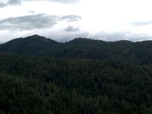
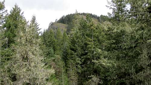
Seen from most aspects the main summit of Ragged Mountain would appear to be heavily forested with little prospect of views to reward the effort of getting there. This is not the case. The summit is privately owned and, as evinced by a sign on top, is being offered for sale as a microwave tower site. Prospective buyers for the site clearly don’t make the long hike in here. The sign referred to points skyward so that it can be read by any passing helicopters! This does mean, however, that the owners have partially cleared the north side of the summit area, which, as a result, opens up views to the north and east, which encompass a more or less unimpeded panorama from Empress Mountain to Mts Work, Finlayson and Newton. I know of no other point in the Sooke Hills from which these summits can be seen from the same spot. </href=>
Ragged Mountain
(Current, October 2016)Seen from most aspects the main summit of Ragged Mountain would appear to be heavily forested with little prospect of views to reward the effort of getting there. This is not the case. The summit is privately owned and, as evinced by a sign on top, is being offered for sale as a microwave tower site. Prospective buyers for the site clearly don’t make the long hike in here. The sign referred to points skyward so that it can be read by any passing helicopters! This does mean, however, that the owners have partially cleared the north side of the summit area, which, as a result, opens up views to the north and east, which encompass a more or less unimpeded panorama from Empress Mountain to Mts Work, Finlayson and Newton. I know of no other point in the Sooke Hills from which these summits can be seen from the same spot. </href=>
<href= http:="" www.victoria.cascadia.scouts.ca="" index.php?module="pagemaster&PAGE_user_op=view_page&PAGE_id=12&MMN_position=21:21">
</href=>
</href=>
<href= http:="" www.victoria.cascadia.scouts.ca="" index.php?module="pagemaster&PAGE_user_op=view_page&PAGE_id=12&MMN_position=21:21">A</href=>s with Ragged Mountain South, the easiest approach to the main summit of Ragged is from Camp Thunderbird and the two summits often form part of the same trip.
From the top of the gully between the two summits of Thunderbird make your way down in a northeasterly direction. The time was when this was strictly a bushwhack. Now there are flags to follow and a well established path in places. After 200-300 m travel NE the path turns east through salal and down a crumbly gully before reaching a very old road. Turn left on this, uphill briefly and then steeply down. Bear right at the bottom and uphill again. Swing back left to arrive at the start of the route up Ragged at 10 U 452539 5364872. Good flagging and a boot path head up east and shortly thereafter northeast. Follow the path and flagging to the summit in 15-25 minutes. This might sound convoluted but the route is well marked and, in the main, follows the intuitive direction.
<href= http:="" www.victoria.cascadia.scouts.ca="" index.php?module="pagemaster&PAGE_user_op=view_page&PAGE_id=12&MMN_position=21:21">
</href=>
</href=>
<href= http:="" www.victoria.cascadia.scouts.ca="" index.php?module="pagemaster&PAGE_user_op=view_page&PAGE_id=12&MMN_position=21:21">For a trip from Harbourview Road taking in both summits of Ragged Mountain, allow 7-8 hours from cars. For the same trip starting at the Y-Camp allow 4-5 hours.</href=>
<href= http:="" www.victoria.cascadia.scouts.ca="" index.php?module="pagemaster&PAGE_user_op=view_page&PAGE_id=12&MMN_position=21:21">
The main summit of Ragged can also be reached from Veitch Creek area as follows.
Park at the mailboxes on Sooke Road and proceed as for Mt Braden. Go past the flagged point at which the Mt Braden route heads off the old road, carry on up Veitch Creek for another 10-15 minutes and cross the river. Carry on northwest for 10 minutes to a T-junction with another old road. Turn left. Follow this old road for just over a kilometer SE up to the swampy high ground between the Veitch and Ayum Creek drainages and then NE down to the latter and a sign post at N48 26.706 W123 37.371. Turn left and walk down the track for 1.2 km crossing Ayum Creek on a slippery log bridge in the process. Find the very well flagged trailhead for Ragged Mountain at N48 26.105 W123 37.622.
Follow the well marked trail NW through a short section of blow-down and out onto open hillside. The track ascends steeply NW before turning SW up to a subsidiary high point. It then carries on NW up less steep ground and over a couple more high points before swinging south and up to the broad summit.
Reverse the above to return to your vehicle (~16 km, 5-6 hours).</href=>
 Manuel Quimper and Thunderbird from Ragged Manuel Quimper and Thunderbird from Ragged |
 Sheilds Lake from Ragged Sheilds Lake from Ragged |
 Mountain for sale! Mountain for sale! |
The main summit of Ragged can also be reached from Veitch Creek area as follows.
Park at the mailboxes on Sooke Road and proceed as for Mt Braden. Go past the flagged point at which the Mt Braden route heads off the old road, carry on up Veitch Creek for another 10-15 minutes and cross the river. Carry on northwest for 10 minutes to a T-junction with another old road. Turn left. Follow this old road for just over a kilometer SE up to the swampy high ground between the Veitch and Ayum Creek drainages and then NE down to the latter and a sign post at N48 26.706 W123 37.371. Turn left and walk down the track for 1.2 km crossing Ayum Creek on a slippery log bridge in the process. Find the very well flagged trailhead for Ragged Mountain at N48 26.105 W123 37.622.
Follow the well marked trail NW through a short section of blow-down and out onto open hillside. The track ascends steeply NW before turning SW up to a subsidiary high point. It then carries on NW up less steep ground and over a couple more high points before swinging south and up to the broad summit.
Reverse the above to return to your vehicle (~16 km, 5-6 hours).</href=>
<href= http:="" www.victoria.cascadia.scouts.ca="" index.php?module="pagemaster&PAGE_user_op=view_page&PAGE_id=12&MMN_position=21:21">
Another excellent option if you can arrange a car shuttle is to leave a vehicle at Harbourview Road, take another to the mailboxes on Sooke Road and follow the above directions to the summit of Ragged Main. Thereafter, traverse Ragged South and down to the Y-Camp 4 way signpost. From there pick up further Y-Camp signs for Mt Manuel Quimper, follow these to the top and then back to Harbourview as described in the Manuel Quimper section above. About 16 km, 6-7 hours.</href=>
 Mt Finlayson from Ragged Mt Finlayson from Ragged |
 Winter view towards Mt Finlayson Winter view towards Mt Finlayson |
 Ragged Mountain summit group. Ragged Mountain summit group. |
 Ragged Mountain winter summit? Ragged Mountain winter summit? |
Another excellent option if you can arrange a car shuttle is to leave a vehicle at Harbourview Road, take another to the mailboxes on Sooke Road and follow the above directions to the summit of Ragged Main. Thereafter, traverse Ragged South and down to the Y-Camp 4 way signpost. From there pick up further Y-Camp signs for Mt Manuel Quimper, follow these to the top and then back to Harbourview as described in the Manuel Quimper section above. About 16 km, 6-7 hours.</href=>
<href= http:="" www.victoria.cascadia.scouts.ca="" index.php?module="pagemaster&PAGE_user_op=view_page&PAGE_id=12&MMN_position=21:21">
Continuing almost due north from Ragged Mountain, along the ridges on the west side of the Ayum Creek valley is, by the standards of the Sooke Hills at least, a steep sided and mostly forested hill known locally as Pinnacle Peak.</href=>
 |
Pinnacle Peak
(Current, October 2016)Continuing almost due north from Ragged Mountain, along the ridges on the west side of the Ayum Creek valley is, by the standards of the Sooke Hills at least, a steep sided and mostly forested hill known locally as Pinnacle Peak.</href=>
<href= http:="" www.victoria.cascadia.scouts.ca="" index.php?module="pagemaster&PAGE_user_op=view_page&PAGE_id=12&MMN_position=21:21">
![Pinnacle Peak]() Pinnacle Peak
Pinnacle Peak
Pinnacle is not visited very often and consequently there’s not much more than a flagged route to the summit, although use-path is beginning to appear in a few places. The initial climb up from Ayum Creek is not too steep, there are a few open spots and the route lies through several bush and dead-fall choked areas. The final phase to the summit is the steepest part of the climb and is mostly through salal where there is recent (Oct 2016) evidence of a cleared path.
Approach from the mailboxes on Sooke Road as described above for Ragged Mountain and walk over the drainage divide between the Veitch and Ayum Creek valleys to the signpost at N48 26.706 W123 37.371. Or approach this point more easily from the Y Camp. Having arrived at this point, a loop hike can made to the summit and return as follows.
Turn right (north) at the signpost and walk 250 metres up the remains of the old road to about N48 26.790 W123 37.428 - waypoint 001 on the loop map below. This is the beginning of the "Connector Trail" to Harbourview Road and on to Sheilds Lake. Go a few metres up this trail and look to your right for the first flag on the far side of the bush choked creek. Thrash across there and thereafter pick up the well flagged route first northwest and then north to the summit platform. About half way to the summit on an open bluff at N48 26.790 W123 37.428 look to your left through the trees and spot two cairns on another open bluff about 100 metres away - waypoint 002 on the map. This will be your return route.</href=>
 Pinnacle Peak
Pinnacle is not visited very often and consequently there’s not much more than a flagged route to the summit, although use-path is beginning to appear in a few places. The initial climb up from Ayum Creek is not too steep, there are a few open spots and the route lies through several bush and dead-fall choked areas. The final phase to the summit is the steepest part of the climb and is mostly through salal where there is recent (Oct 2016) evidence of a cleared path.
Approach from the mailboxes on Sooke Road as described above for Ragged Mountain and walk over the drainage divide between the Veitch and Ayum Creek valleys to the signpost at N48 26.706 W123 37.371. Or approach this point more easily from the Y Camp. Having arrived at this point, a loop hike can made to the summit and return as follows.
Turn right (north) at the signpost and walk 250 metres up the remains of the old road to about N48 26.790 W123 37.428 - waypoint 001 on the loop map below. This is the beginning of the "Connector Trail" to Harbourview Road and on to Sheilds Lake. Go a few metres up this trail and look to your right for the first flag on the far side of the bush choked creek. Thrash across there and thereafter pick up the well flagged route first northwest and then north to the summit platform. About half way to the summit on an open bluff at N48 26.790 W123 37.428 look to your left through the trees and spot two cairns on another open bluff about 100 metres away - waypoint 002 on the map. This will be your return route.</href=>
<href= http:="" www.victoria.cascadia.scouts.ca="" index.php?module="pagemaster&PAGE_user_op=view_page&PAGE_id=12&MMN_position=21:21">
 Pinnacle Peak from Mt Braden Pinnacle Peak from Mt Braden |
 Mt Braden from Pinnacle Peak Mt Braden from Pinnacle Peak |
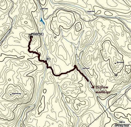 Pinnacle Peak Tracklog Pinnacle Peak Tracklog |
 Pinnacle Peak Loop Pinnacle Peak Loop |
<href= http:="" www.victoria.cascadia.scouts.ca="" index.php?module="pagemaster&PAGE_user_op=view_page&PAGE_id=12&MMN_position=21:21">Views are somewhat limited from the summit cairn but walk a few metres to the east where an open mossy bluff offers good views east to Mt Braden and the City of Victoria beyond.</href=>
<href= http:="" www.victoria.cascadia.scouts.ca="" index.php?module="pagemaster&PAGE_user_op=view_page&PAGE_id=12&MMN_position=21:21">
</href=>
</href=>
<href= http:="" www.victoria.cascadia.scouts.ca="" index.php?module="pagemaster&PAGE_user_op=view_page&PAGE_id=12&MMN_position=21:21">After your break/lunch on the summit, return to waypoint 002 and walk across to the cairns you noted earlier on the way up. Head left (south) from the cairns down a lightly treed ridge. As the ridge begins to drop off into the forest follow flagging as it swings down to the right (west) and then left (south) and eventually meets the Connector at N48 26.790 W123 37.428 - waypoint 003 on the map - in about 10-15 minutes from the cairns. Turn left and head down the trail to waypoint 001 in about 15 minutes. Head out to the mailboxes or the Y Camp from there.
From the mailboxes allow about 6 hours return for the above or 5 hours return from the Y Camp.
“Sooke Mountain Provincial Park” was established in 1928 by the government of BC to protect the area from encroachment by industry. It now lies roughly in the centre of the CRD’s new (2010) Sea to Sea Regional Park but, of course, retains its provincial park status.
Sooke Mountain is a rather un-spectacular moss covered knoll but since it’s the highest point within the provincial park, you have to visit it at least once. The mountain is situated roughly in the centre of a triangle defined by Monument Mountain in the west, Empress Mountain to the north and the Ragged twins to the east. Sheilds Lake lies at the foot of the mountain to the immediate north.
The usual and most direct access is via a long walk up Harbourview Road. Approach as for Mt Manuel Quimper and the Ragged twins by parking in the lot at the end of the public section of Harbourview.
Walk up the road for 80-90 minutes past the access points for Mt Manuel Quimper and the Ragged twins to a faint spur road on the left at N 48.434° W 123.652°. As an indicator, 5 minutes before reaching the spur you cross the Charters River via a bypass to the left of the road.</href=>
From the mailboxes allow about 6 hours return for the above or 5 hours return from the Y Camp.
Sooke Mountain
(Current, October 2016)“Sooke Mountain Provincial Park” was established in 1928 by the government of BC to protect the area from encroachment by industry. It now lies roughly in the centre of the CRD’s new (2010) Sea to Sea Regional Park but, of course, retains its provincial park status.
Sooke Mountain is a rather un-spectacular moss covered knoll but since it’s the highest point within the provincial park, you have to visit it at least once. The mountain is situated roughly in the centre of a triangle defined by Monument Mountain in the west, Empress Mountain to the north and the Ragged twins to the east. Sheilds Lake lies at the foot of the mountain to the immediate north.
The usual and most direct access is via a long walk up Harbourview Road. Approach as for Mt Manuel Quimper and the Ragged twins by parking in the lot at the end of the public section of Harbourview.
Walk up the road for 80-90 minutes past the access points for Mt Manuel Quimper and the Ragged twins to a faint spur road on the left at N 48.434° W 123.652°. As an indicator, 5 minutes before reaching the spur you cross the Charters River via a bypass to the left of the road.</href=>
<href= http:="" www.victoria.cascadia.scouts.ca="" index.php?module="pagemaster&PAGE_user_op=view_page&PAGE_id=12&MMN_position=21:21">
Follow what is left of the old road for 5 or 6 minutes first southwest and then northwest until you come across flagging heading off the right side of the road. An empty "stubby" marks the spot if it hasn't been taken for a souvenir by now. Follow the flags northwest over a flat-topped subsidiary hill known as “East Clapper”, down and around a swampy area and finally up to the indistinct (but cairned) summit of Sooke Mountain. It’s about a 45 minute hike from the turn off Harbourview Road. The flags continue for a further 200 metres to the north to a second high point with a cairn. The true summit is the first you come to.</href=>
 Peden Ridge from Sooke Mountain. Peden Ridge from Sooke Mountain. |
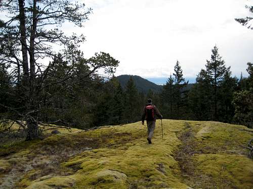 Manuel Quimper from East Clapper Manuel Quimper from East Clapper |
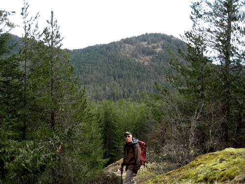 Ragged Mountain South Ragged Mountain South |
<href= http:="" www.victoria.cascadia.scouts.ca="" index.php?module="pagemaster&PAGE_user_op=view_page&PAGE_id=12&MMN_position=21:21">
</href=>
</href=>
<href= http:="" www.victoria.cascadia.scouts.ca="" index.php?module="pagemaster&PAGE_user_op=view_page&PAGE_id=12&MMN_position=21:21">Alternatively, approach the mountain by a long and circuitous but much more satisfying route from the Charters River valley as follows.</href=>
<href= http:="" www.victoria.cascadia.scouts.ca="" index.php?module="pagemaster&PAGE_user_op=view_page&PAGE_id=12&MMN_position=21:21">
</href=>
</href=>
<href= http:="" www.victoria.cascadia.scouts.ca="" index.php?module="pagemaster&PAGE_user_op=view_page&PAGE_id=12&MMN_position=21:21">Approach as if for Peden Bluff or Empress Mountain and find the waterboard's pump station 3.5 km up Sooke Potholes Road at N48 24.835 W123 42.621 just after the bridge over the Charters River. There is a sign for the new regional salmon interpretive centre. Turn right here to good parking in the gravel lot. Hike up the road for approximately 1.5 km and through 2 gates to the upper pumphouse. Turn left here. The route now becomes a trail rather than a road. Walk up the valley for 2 km, through a third gate to an old wrecked car and the remains of the Bloggs' cabin. The most noteworthy aspect of the remains in the almost intact river rock chimney. Continue for a couple of minutes past this site to N48 25.810 W123 40.709 and turn right. This is the "Ramparts" trail. Walk down to the Charters River in a minute or so and get across by your best option. Once across, don't go straight ahead up the remains of the old road; instead trend left up the short hill and find another old road. The correct option is well flagged. Follow the flagging east and then north and finally south across two notable salal choked gullies. After the second gully the route starts to climb east and traverses across the face of the west Rampart before eventually turning northeast and crossing a gully. Continue beyond the gully crossing and shortly make a brief descent to a flat area and an old road. Follow the road north for about 350 metres to N48 26.064 W123 39.828 or thereabouts where there is a seasonal pond/swamp.</href=>
<href= http:="" www.victoria.cascadia.scouts.ca="" index.php?module="pagemaster&PAGE_user_op=view_page&PAGE_id=12&MMN_position=21:21">
</href=>
</href=>
<href= http:="" www.victoria.cascadia.scouts.ca="" index.php?module="pagemaster&PAGE_user_op=view_page&PAGE_id=12&MMN_position=21:21">Honestly said, I've never done the next bit the same way twice. You're aiming for a cairned high point at N48 26.160 W123 39.960. To reach this engage the friendliest looking bush you can find and head slightly west of north from the area of the seasonal pond. Any flagging you find is likely to be confusing or wrong, so just make a beeline for the waypoint given via the path of least resistance. You will break out onto open slopes well before reaching it, so be patient. Once at the cairn, the first reliable flagging appears. Follow it almost due north to the summit in about 1 km of travel. Just before the little summit ridge comes into view you should see flagging coming in from the right. This is the route from Harbourview.</href=>
<href= http:="" www.victoria.cascadia.scouts.ca="" index.php?module="pagemaster&PAGE_user_op=view_page&PAGE_id=12&MMN_position=21:21">
</href=>
</href=>
<href= http:="" www.victoria.cascadia.scouts.ca="" index.php?module="pagemaster&PAGE_user_op=view_page&PAGE_id=12&MMN_position=21:21">If you have trouble with the initial phase or don't fancy a bush bash, you can always carry on down the old road from the seasonal pond to the junction with the route from Harbourview at the stubby beer bottle. This is shown in red on the route map in the collection at the end of this page.
Summit views from Sooke Mountain are principally to the west, particularly to Peden Ridge. However, there are nice views east across the valley to Manuel Quimper and the Ragged twins on the way up to “East Clapper” from Harbourview Road.
Make the hike into as loop by finding a well flagged route that leaves the north summit west and then north down to the old roads on the west side of Sheilds Lake. From here follow the roads around the north shore of the lake and down to their junction with Harbourview at N48 27.057 W123 39.024 and out from there - blue on the map. Or turn left at the prominent junction just past Sheilds and follow the old road over "Puzzle Pass" and down to Grassie Lake - red on the map. From Grassie a well worn trail heads south and in about 2 km of travel intersects your up-route at the Ramparts trail.</href=>
<href= http:="" www.victoria.cascadia.scouts.ca="" index.php?module="pagemaster&PAGE_user_op=view_page&PAGE_id=12&MMN_position=21:21">
</href=>
</href=>
<href= http:="" www.victoria.cascadia.scouts.ca="" index.php?module="pagemaster&PAGE_user_op=view_page&PAGE_id=12&MMN_position=21:21">Either loop option represents a full day of hiking of 7-9 hours.</href=>
<href= http:="" www.victoria.cascadia.scouts.ca="" index.php?module="pagemaster&PAGE_user_op=view_page&PAGE_id=12&MMN_position=21:21">
Above Grass Lake and roughly 1.5 km due west of Sooke Mountain is the long north-south ridge known locally (but not officially) as Monument Mountain. </href=>
Monument Mountain
(Current, October 2016)Above Grass Lake and roughly 1.5 km due west of Sooke Mountain is the long north-south ridge known locally (but not officially) as Monument Mountain. </href=>
<href= http:="" www.victoria.cascadia.scouts.ca="" index.php?module="pagemaster&PAGE_user_op=view_page&PAGE_id=12&MMN_position=21:21">
Seen from most angles the hill is a rather nondescript knoll that seems to offer nothing much in the way of making a visit worthwhile. What is not immediately apparent, however, is a long open ridge that descends more than 200 vertical metres over almost a kilometre from near the last high point of the ridge right into the forest and which gives splendid views south to the Strait of Juan de Fuca and the Olympics the whole way down. A loop hike can be made which combines a visit to tranquil Grassie Lake with a hike up and over Monument Mountain. I recommend going to Grassie first and returning over Monument. this way you get to enjoy the views all the way down the south ridge.
Start from the Charters River pumphouse as described above for Sooke Mountain. Go past the old wrecked car, river rock chimney and Ramparts trail junction a further 300 metres to another trail junction. Either branch works but that to the right is preferable. It goes right by a seasonal waterfall as well as offering trail travel rather than steep crumbly old road. Approximately 1 km of sometimes steep travel on this trail brings you back to the old road but above the lower unpleasantness. Note that about 50 metres below this trail junction (ie a left turn) a route goes up to the ridge crest of Monument and offers a shorter day if desired. This is part of the red trail on the map in the collection at the end of this page. Normally, however, the hiker would turn right.</href=>
<href= http:="" www.victoria.cascadia.scouts.ca="" index.php?module="pagemaster&PAGE_user_op=view_page&PAGE_id=12&MMN_position=21:21">
</href=>
</href=>
<href= http:="" www.victoria.cascadia.scouts.ca="" index.php?module="pagemaster&PAGE_user_op=view_page&PAGE_id=12&MMN_position=21:21">Continue about 400 metres on the old road and take note of a trail on the left at about N48 26.699 W123 40.805. This will be the start of the route up Monument Mountain. Assuming you'll want to visit Grassie, however, carry on past this point to arrive at the usual view promontory in another five minutes via a short, marked spur on the right. The area has has been rather spoiled by illegal camping on the site where a hut once stood but is still a very pleasant place particularly when the water lilies are in bloom. The promontory juts out into the lake at the north end of the spot and makes a great place for lunch.
</href=>
</href=>
<href= http:="" www.victoria.cascadia.scouts.ca="" index.php?module="pagemaster&PAGE_user_op=view_page&PAGE_id=12&MMN_position=21:21">
</href=>
</href=>
<href= http:="" www.victoria.cascadia.scouts.ca="" index.php?module="pagemaster&PAGE_user_op=view_page&PAGE_id=12&MMN_position=21:21">
Returning to the trail junction noted above, turn right and then right again. This trail has been built by mountain bikers and so climbs gently about 40 vertical metres to a prominent cairn. This is the true summit of Monument Mountain and is known locally as "455" for its height. There's almost no view. The time was when the onward route from here was a full-on bushwhack. Not any more. The mountain bikers have seen to that. Excellent and impossible-to-miss trail winds about 1.5 km south down the forested ridge before emerging at the top of the long, open slope back down to the Charters River. About half way along the shorter loop option referred to above comes in from the left at a high point. Just before reaching the final south slope you will pass right by a memorial plaque lying by the trail which, obviously, gives the hill its local name.
It's a stunning walk down the ridge and back into the big trees. Go right to the bottom of the trail to an old road and turn left. Go a few metres further along here and take a right branch to arrive almost immediately at your up track along the Charters River. Return to your vehicle from this point.
Note that just east (left) of the spot at which you re-join your out route, a trail heads off downhill. This goes down to and across the river and allows access to Harbourview Road and the possibility of starting and/or ending the hike there. This route is shown on the map. In winter or early season the Charters River may be in spate and the crossing may prove dangerous. If this turns out to be the case take the safe option starting at Sooke River Road.
</href=>
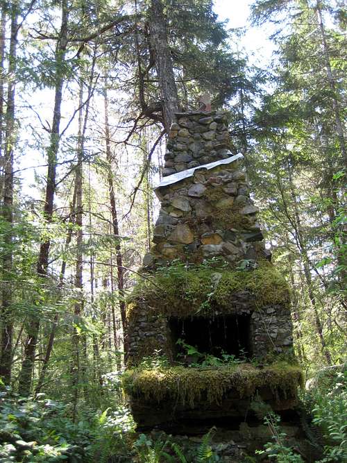 Settlers Remains Settlers Remains |
 Monument Mountain Memorial Monument Mountain Memorial |
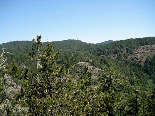 Monument Mountain View East Monument Mountain View East |
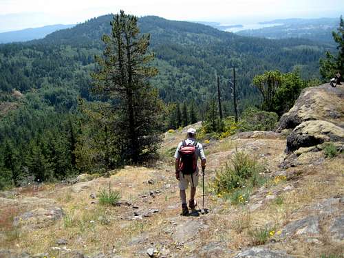 Monument Mountain S Ridge Monument Mountain S Ridge |
It's a stunning walk down the ridge and back into the big trees. Go right to the bottom of the trail to an old road and turn left. Go a few metres further along here and take a right branch to arrive almost immediately at your up track along the Charters River. Return to your vehicle from this point.
Note that just east (left) of the spot at which you re-join your out route, a trail heads off downhill. This goes down to and across the river and allows access to Harbourview Road and the possibility of starting and/or ending the hike there. This route is shown on the map. In winter or early season the Charters River may be in spate and the crossing may prove dangerous. If this turns out to be the case take the safe option starting at Sooke River Road.
</href=>
<href= http:="" www.victoria.cascadia.scouts.ca="" index.php?module="pagemaster&PAGE_user_op=view_page&PAGE_id=12&MMN_position=21:21">
</href=>
</href=>
<href= http:="" www.victoria.cascadia.scouts.ca="" index.php?module="pagemaster&PAGE_user_op=view_page&PAGE_id=12&MMN_position=21:21">For the loop hike starting and ending at the pump station, allow about 5-6 hours with a nice break at Grass Lake.</href=>
<href= http:="" www.victoria.cascadia.scouts.ca="" index.php?module="pagemaster&PAGE_user_op=view_page&PAGE_id=12&MMN_position=21:21">
</href=>
</href=>
<href= http:="" www.victoria.cascadia.scouts.ca="" index.php?module="pagemaster&PAGE_user_op=view_page&PAGE_id=12&MMN_position=21:21">
Note: Mt Braden now has its own page on SummitPost describing the standard route that follows as well as many more hikes on this very popular mountain.</href=>
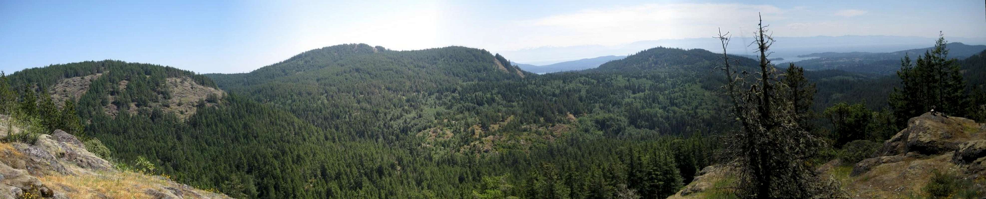 |
Mt Braden
(Current, October 2016)Note: Mt Braden now has its own page on SummitPost describing the standard route that follows as well as many more hikes on this very popular mountain.</href=>
<href= http:="" www.victoria.cascadia.scouts.ca="" index.php?module="pagemaster&PAGE_user_op=view_page&PAGE_id=12&MMN_position=21:21">
</href=>
</href=>
<href= http:="" www.victoria.cascadia.scouts.ca="" index.php?module="pagemaster&PAGE_user_op=view_page&PAGE_id=12&MMN_position=21:21">Mt Braden makes a fine half-day excursion and can be combined with summits such as McDonald and Sugarloaf to make a longer trip.
Approach on Highway 1 and take the Veterans Memorial Parkway exit through Langford to the junction with Sooke Road. Drive 5.5 km and note Humpback Road on the right. Drive a further 1.5 km to a wide parking area by a set of community mailboxes and park here. Starting altitude is about 110 metres.</href=>
Approach on Highway 1 and take the Veterans Memorial Parkway exit through Langford to the junction with Sooke Road. Drive 5.5 km and note Humpback Road on the right. Drive a further 1.5 km to a wide parking area by a set of community mailboxes and park here. Starting altitude is about 110 metres.</href=>
<href= http:="" www.victoria.cascadia.scouts.ca="" index.php?module="pagemaster&PAGE_user_op=view_page&PAGE_id=12&MMN_position=21:21">
![Mt Braden]() Mt Braden from ~500 metres on the standard approach from the SW
Mt Braden from ~500 metres on the standard approach from the SW
Walk back along the highway for 6 hydro poles (about 300 metres). Immediately past the 6th pole - at the point where the power lines cross the highway - you should find a path leading into the woods. Take it. If you've got it right, you'll come across an old blue wrecked car almost immediately. Go ahead for 5 or 6 minutes and cross Veitch Creek.
Go up the far bank of the creek to an old logging road and turn right. Walk along the nicely brushed out and pleasant road until, about 35-40 minutes from the car, it re-crosses the creek on an overgrown bridge. Just beyond the crossing - about 200 metres - Veitch Creek Road takes a left turn off what appears to be the main route as it continues to follow the creek. Proceed up the turn off for 2 minutes and look for a worn and sometimes flagged path leading up and right. Altitude at this point is about 200 metres.
The route heads generally a few points east of north. A boot path guides you most of the way and there are enough flags and a few cairns at critical places to make route finding not too much of a problem. You're mostly out of the trees in 5 minutes anyway and thereafter the way is open and obvious enough. Although the summit comes into view quite quickly, the route frequently seems to divert from the intuitive direction as it crosses 3 gullies on the way to the summit ridge. </href=>
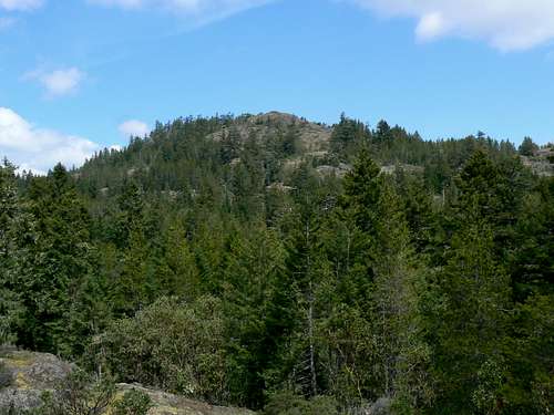 Mt Braden from ~500 metres on the standard approach from the SW
Walk back along the highway for 6 hydro poles (about 300 metres). Immediately past the 6th pole - at the point where the power lines cross the highway - you should find a path leading into the woods. Take it. If you've got it right, you'll come across an old blue wrecked car almost immediately. Go ahead for 5 or 6 minutes and cross Veitch Creek.
Go up the far bank of the creek to an old logging road and turn right. Walk along the nicely brushed out and pleasant road until, about 35-40 minutes from the car, it re-crosses the creek on an overgrown bridge. Just beyond the crossing - about 200 metres - Veitch Creek Road takes a left turn off what appears to be the main route as it continues to follow the creek. Proceed up the turn off for 2 minutes and look for a worn and sometimes flagged path leading up and right. Altitude at this point is about 200 metres.
The route heads generally a few points east of north. A boot path guides you most of the way and there are enough flags and a few cairns at critical places to make route finding not too much of a problem. You're mostly out of the trees in 5 minutes anyway and thereafter the way is open and obvious enough. Although the summit comes into view quite quickly, the route frequently seems to divert from the intuitive direction as it crosses 3 gullies on the way to the summit ridge. </href=>
<href= http:="" www.victoria.cascadia.scouts.ca="" index.php?module="pagemaster&PAGE_user_op=view_page&PAGE_id=12&MMN_position=21:21">
The final leg to the summit cairn is up a rocky ridge that is open on all sides and has the feel of being in the alpine rather than at less than 500 metres.
Braden occupies a central location in the Sooke Hills and offers views over many neighbours both greater (eg Empress) and smaller (eg Sugarloaf).
Reverse the foregoing to return to your car
Sugarloaf Mountain is located approximately 2km SW of Mt Braden. Access is as described above for Mt Braden.
I can only assume that Sugarloaf was named for its shape when viewed from the northeast - see the photographs in the Mt Braden section above. Like Braden, Sugarloaf enjoys a central position in Sooke Hills Regional Park Reserve and offers great views of the whole area. Being closer to the coast it also enables the climber to look into the east end of the Sooke Basin.
In addition to a hiking route to the summit, Sugarloaf has a developed rock climbing area on the impressive 50 metres high bluffs on the south west side of the mountain. Both trad and sport enthusiasts are catered too.
Like many trips to the Sooke Hills, a walk up Sugarloaf can be made into a circle hike. Allow about 3-4 hours for the following including breaks.
Approach as described for Mt Braden. Approximately 30-35 minutes from the car along the old road by Veitch Creek, just after the road meets the creek and then climbs up a small hill, look for a spur road off to the left at N48 25.736 W123 35.874. Take this spur into the valley between Sugarloaf and a lower knoll to its northeast known locally as "The Gem". The route is well flagged and is usually brushed out. Follow the trail for approximately 25 minutes almost to the end of the valley where it makes a sharp turn left (roughly south) and heads up. Coloured tapes around several prominent trees usually indicate this point. </href=>
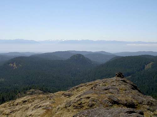 Mt Braden Summit Mt Braden Summit |
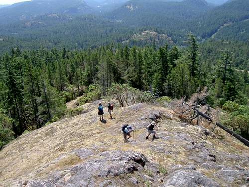 Approaching Braden's summit Approaching Braden's summit |
 Summit View S in Winter Summit View S in Winter |
 Summit View NW in Winter Summit View NW in Winter |
Braden occupies a central location in the Sooke Hills and offers views over many neighbours both greater (eg Empress) and smaller (eg Sugarloaf).
Reverse the foregoing to return to your car
Sugarloaf Mountain
(Current, October 2016)Sugarloaf Mountain is located approximately 2km SW of Mt Braden. Access is as described above for Mt Braden.
I can only assume that Sugarloaf was named for its shape when viewed from the northeast - see the photographs in the Mt Braden section above. Like Braden, Sugarloaf enjoys a central position in Sooke Hills Regional Park Reserve and offers great views of the whole area. Being closer to the coast it also enables the climber to look into the east end of the Sooke Basin.
In addition to a hiking route to the summit, Sugarloaf has a developed rock climbing area on the impressive 50 metres high bluffs on the south west side of the mountain. Both trad and sport enthusiasts are catered too.
Like many trips to the Sooke Hills, a walk up Sugarloaf can be made into a circle hike. Allow about 3-4 hours for the following including breaks.
Approach as described for Mt Braden. Approximately 30-35 minutes from the car along the old road by Veitch Creek, just after the road meets the creek and then climbs up a small hill, look for a spur road off to the left at N48 25.736 W123 35.874. Take this spur into the valley between Sugarloaf and a lower knoll to its northeast known locally as "The Gem". The route is well flagged and is usually brushed out. Follow the trail for approximately 25 minutes almost to the end of the valley where it makes a sharp turn left (roughly south) and heads up. Coloured tapes around several prominent trees usually indicate this point. </href=>
<href= http:="" www.victoria.cascadia.scouts.ca="" index.php?module="pagemaster&PAGE_user_op=view_page&PAGE_id=12&MMN_position=21:21">
Follow the flagging up to the summit from here in about 15-20 minutes of steep going. As you arrive in the summit area, the top of the rock climbing bluffs is to your right and the actual summit to your left. The summit is marked by a cairn and a couple of metres away is a BCS survey marker.
Complete the circle by going off the summit to the south between two rock walls. The entrance to these "gates" is mid way between the top of the bluffs and the summit and is pretty obvious. A spindly lone arbutus marks the spot if it isn't flagged. Descend steeply on the left (climber's right) of the climbing bluffs and right to their base to intersect the climbers' path. The right fork goes to the bluffs and the left leads out to the road. Follow the trail to the left down to the Veitch Creek road in about 35-40 minutes and turn left. Join your outward route where you crossed Veitch Creek about 10 minutes later. When choices appear the wrong turn is "blocked" by branches or rocks.</href=>
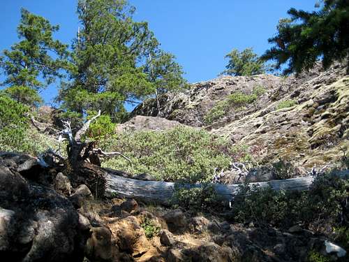 Sugarloaf Mountain Summit Sugarloaf Mountain Summit |
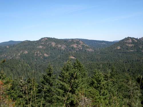 Summit View NE to Braden Summit View NE to Braden |
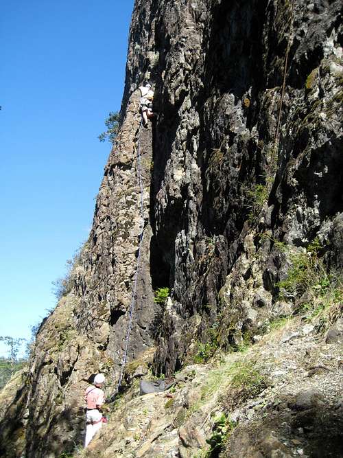 Trad Climbing on Sugarloaf Mountain Trad Climbing on Sugarloaf Mountain |
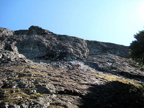 Sport Climbing on Sugarloaf Mountain Sport Climbing on Sugarloaf Mountain |
Complete the circle by going off the summit to the south between two rock walls. The entrance to these "gates" is mid way between the top of the bluffs and the summit and is pretty obvious. A spindly lone arbutus marks the spot if it isn't flagged. Descend steeply on the left (climber's right) of the climbing bluffs and right to their base to intersect the climbers' path. The right fork goes to the bluffs and the left leads out to the road. Follow the trail to the left down to the Veitch Creek road in about 35-40 minutes and turn left. Join your outward route where you crossed Veitch Creek about 10 minutes later. When choices appear the wrong turn is "blocked" by branches or rocks.</href=>
<href= http:="" www.victoria.cascadia.scouts.ca="" index.php?module="pagemaster&PAGE_user_op=view_page&PAGE_id=12&MMN_position=21:21">
![Sugarloaf Mountain Summit View W]() Summit view W to Manuel Quimper & Ragged
Summit view W to Manuel Quimper & Ragged
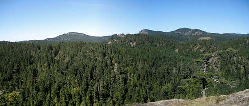 Summit view W to Manuel Quimper & Ragged
<href= http:="" www.victoria.cascadia.scouts.ca="" index.php?module="pagemaster&PAGE_user_op=view_page&PAGE_id=12&MMN_position=21:21">
</href=>
</href=>
<href= http:="" www.victoria.cascadia.scouts.ca="" index.php?module="pagemaster&PAGE_user_op=view_page&PAGE_id=12&MMN_position=21:21">
</href=>
An alternate trail off Veitch Creek via "Townsend Ridge" offers a variation in the loop described, either as an outward or return route. </href=></href=>
<href= http:="" www.victoria.cascadia.scouts.ca="" index.php?module="pagemaster&PAGE_user_op=view_page&PAGE_id=12&MMN_position=21:21">
</href=>
</href=>
<href= http:="" www.victoria.cascadia.scouts.ca="" index.php?module="pagemaster&PAGE_user_op=view_page&PAGE_id=12&MMN_position=21:21">Start as above, cross Veitch Creek to the old road above and turn right. Walk up the hill immediately after gaining the old road, around a left hand bend in the trail and find a flagged route on the left - about 300-400 metres after crossing the Veitch. The well flagged path gradually turns south and out onto open slopes, with Mt Braden in view to the east. Proceed SW up these slopes to the ridge crest ahead. A tiny rock ridge with a cairn marks the high point. Proceed south from the cairn on well flagged trail to a junction at N48 25.024 W123 35.601. This is well characterised by a large erratic in the trees. Continue past the erratic and west along old roads and trails across a relatively flat area right to the base of Sugarloaf and climb up steep slopes south from here.
The Crow's Nest lies 1 km due east of Glintz Lake and 1.7 km northwest of Sugarloaf above a deep, unnamed valley that runs eventually down to Sooke Road 2.4 km to the south. It's a short, easy objective from Camp Thunderbird but a much more satisfying trip starts from the mailboxes and accesses and then travels along the ridge system of which Crow's Nest is part.
Start as for Mt Braden and Sugarloaf by walking along the Veitch Creek Trail. Just after the turn for Sugarloaf the old road widens into a newer gravel thoroughfare. BC Hydro have done this to allow service access to their hydro corridor in the area. The new road swings uphill on the left immediately you arrive at it. Don't go up. Instead carry on 200 m to an older road on the left and go up there. This is the "Secret Trail". Follow this trail under the hydro lies and continue about 1 km across one stream and then a second. Immediately after the second crossing look for a trail on the left. This is the "Ambulatory Patients" or AP Trail. Proceed along here, close by the banks of a swamp on the left, to N48 25.703 W123 36.756 and look for a route heading up a wide-ish gully on the right. Marking is minimal, so keep your eyes peeled. Go up the gully steeply until the route swings left and out onto open ridge. Proceed along the ridge with lovely views to an obvious high point. Perched above the valley below, this is a great spot for a break. </href=>
Crow's Nest
(Current, October 2016)The Crow's Nest lies 1 km due east of Glintz Lake and 1.7 km northwest of Sugarloaf above a deep, unnamed valley that runs eventually down to Sooke Road 2.4 km to the south. It's a short, easy objective from Camp Thunderbird but a much more satisfying trip starts from the mailboxes and accesses and then travels along the ridge system of which Crow's Nest is part.
Start as for Mt Braden and Sugarloaf by walking along the Veitch Creek Trail. Just after the turn for Sugarloaf the old road widens into a newer gravel thoroughfare. BC Hydro have done this to allow service access to their hydro corridor in the area. The new road swings uphill on the left immediately you arrive at it. Don't go up. Instead carry on 200 m to an older road on the left and go up there. This is the "Secret Trail". Follow this trail under the hydro lies and continue about 1 km across one stream and then a second. Immediately after the second crossing look for a trail on the left. This is the "Ambulatory Patients" or AP Trail. Proceed along here, close by the banks of a swamp on the left, to N48 25.703 W123 36.756 and look for a route heading up a wide-ish gully on the right. Marking is minimal, so keep your eyes peeled. Go up the gully steeply until the route swings left and out onto open ridge. Proceed along the ridge with lovely views to an obvious high point. Perched above the valley below, this is a great spot for a break. </href=>
<href= http:="" www.victoria.cascadia.scouts.ca="" index.php?module="pagemaster&PAGE_user_op=view_page&PAGE_id=12&MMN_position=21:21">
Go off this point west down ledges to a salal filled gully. There is a single flag round a tree at the base of the descent. Continue west out of this trough and up to the next high point. There is boot path to follow at this point. Descend once more to the west to a flatter area. Flagging from this point is plentiful and accurate. Continue north west and then west, following the flags across some minor ups and downs to arrive at a trail junction at N48 25.665 W123 37.351. Turn left (south) here and hike 700-800 metres to arrive at the wide open trail coming up from the Y-Camp. Turn left and continue up to the summit in 10 minutes.
Start your return route by leaving the summit on the right as you approached it. Almost immediately swing round to the left and pick up grass ledges heading east and down to the floor of the valley. The route is not overly clear but enough use-path and flagging is in evidence to get you down without too much trouble. If in doubt, aim for N48 25.210 W123 37.213 which is the point at which the route emerges onto another hydro service road.
Once on the road, look to your left to find the continuation of the AP trail that you left earlier - green on the route map in the collection at the end of the page. Proceed along here to close the loop at the point at which you went up the gully and proceed along the AP trail, Secret Trail and Veitch Creek trail to the mailboxes. Allow 5-6 hours with breaks.
Situated between Sooke Road, Veitch Creek and the “Bumps” between Mts McDonald and Braden is a range of low hills collectively known locally as “The Amigos”. Originally there were 3 – hence the name. Unsurprisingly, when a fourth was added, it became known as “The 4th Amigo”. A trip around all 4 hills makes for a nice 5-6 hour jaunt. There are many ways to do this but the following is my favourite.</href=>
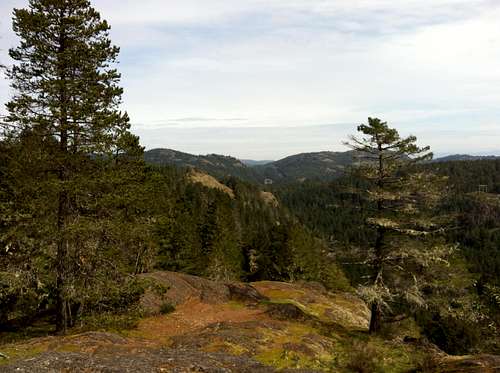 View North East from Crow's Nest View North East from Crow's Nest |
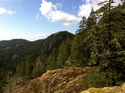 Crow's Nest from the NE Crow's Nest from the NE |
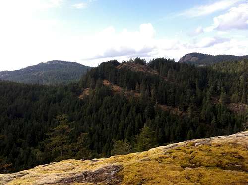 Crow's Nest East Aspect Crow's Nest East Aspect |
Start your return route by leaving the summit on the right as you approached it. Almost immediately swing round to the left and pick up grass ledges heading east and down to the floor of the valley. The route is not overly clear but enough use-path and flagging is in evidence to get you down without too much trouble. If in doubt, aim for N48 25.210 W123 37.213 which is the point at which the route emerges onto another hydro service road.
Once on the road, look to your left to find the continuation of the AP trail that you left earlier - green on the route map in the collection at the end of the page. Proceed along here to close the loop at the point at which you went up the gully and proceed along the AP trail, Secret Trail and Veitch Creek trail to the mailboxes. Allow 5-6 hours with breaks.
The Amigos
(Current, December 2016)
<href= http:="" www.victoria.cascadia.scouts.ca="" index.php?module="pagemaster&PAGE_user_op=view_page&PAGE_id=12&MMN_position=21:21">
</href=>
</href=>
<href= http:="" www.victoria.cascadia.scouts.ca="" index.php?module="pagemaster&PAGE_user_op=view_page&PAGE_id=12&MMN_position=21:21">
![Three Amigos]() Three Amigos
Three Amigos
Start from the mailboxes as for Mt Braden. Go up the hill on the way to Veitch Creek but just past the high point before the descent to the creek, watch for a well worn trail on the right. Go up here.</href=>
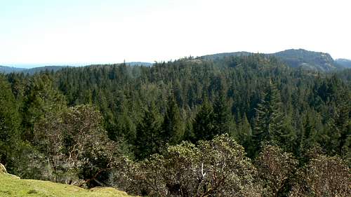 Three Amigos
Start from the mailboxes as for Mt Braden. Go up the hill on the way to Veitch Creek but just past the high point before the descent to the creek, watch for a well worn trail on the right. Go up here.</href=>
<href= http:="" www.victoria.cascadia.scouts.ca="" index.php?module="pagemaster&PAGE_user_op=view_page&PAGE_id=12&MMN_position=21:21">
After a short climb the path crosses some nice level ground in and out of arbutus groves. After 5 minutes or so the path turns downhill to the right and crosses the usual salal filled gully. Go up the other side and follow good path to a small mossy bluff. Easy trail through this takes you to a flat bench. Look for an exit on the right through some manzanita bushes. Thereafter follow gentle open slopes to the flat and wide summit of “Alan’s Alp” the first Amigo. If the weather is clear there are lovely views of the Olympics from here.</href=>
After a short climb the path crosses some nice level ground in and out of arbutus groves. After 5 minutes or so the path turns downhill to the right and crosses the usual salal filled gully. Go up the other side and follow good path to a small mossy bluff. Easy trail through this takes you to a flat bench. Look for an exit on the right through some manzanita bushes. Thereafter follow gentle open slopes to the flat and wide summit of “Alan’s Alp” the first Amigo. If the weather is clear there are lovely views of the Olympics from here.</href=>
<href= http:="" www.victoria.cascadia.scouts.ca="" index.php?module="pagemaster&PAGE_user_op=view_page&PAGE_id=12&MMN_position=21:21">
A steep descent route goes off to the west from here but this misses out the next objective, so instead, head down the hillside in front of you to the east. This is almost all open going. After about 300 metres travel a distinctive dead tree comes into view. Watch for a leftward branch in your route (another route does go straight down the ridge into the trees) at about this point. Take the branch and descend through fields of satin flowers in March and into the forest. A brief stint in the trees brings you to an old road known as the “AT Trail”. Go directly across the road and follow a well marked route northwest across open slopes and up the summit of “Tony’s Triumph”, the second Amigo. Tony offers you a wonderful view of the ground covered on the McDonald to Braden Traverse – see the section below. The panorama of the route included there was taken from this spot. </href=>
A steep descent route goes off to the west from here but this misses out the next objective, so instead, head down the hillside in front of you to the east. This is almost all open going. After about 300 metres travel a distinctive dead tree comes into view. Watch for a leftward branch in your route (another route does go straight down the ridge into the trees) at about this point. Take the branch and descend through fields of satin flowers in March and into the forest. A brief stint in the trees brings you to an old road known as the “AT Trail”. Go directly across the road and follow a well marked route northwest across open slopes and up the summit of “Tony’s Triumph”, the second Amigo. Tony offers you a wonderful view of the ground covered on the McDonald to Braden Traverse – see the section below. The panorama of the route included there was taken from this spot. </href=>
<href= http:="" www.victoria.cascadia.scouts.ca="" index.php?module="pagemaster&PAGE_user_op=view_page&PAGE_id=12&MMN_position=21:21">
</href=>
</href=>
<href= http:="" www.victoria.cascadia.scouts.ca="" index.php?module="pagemaster&PAGE_user_op=view_page&PAGE_id=12&MMN_position=21:21">
Take the well marked trail due south and back to the continuation of the AT Trail and turn right. Go down the old road and through a brief swampy phase at the bottom. Immediately after the swamp find a trail on the right heading up into the trees. Note a trail coming down the opposite hillside on the left. This is the steep descent route from Alan referred to above. </href=>
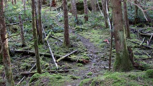 Amigos Start Point Amigos Start Point |
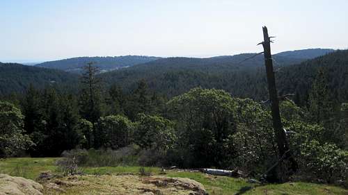 Alan's Alp Dead Tree Marker Alan's Alp Dead Tree Marker |
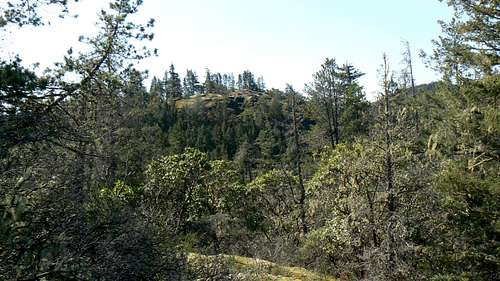 Alan's Alp from Tony's Triumph Alan's Alp from Tony's Triumph |
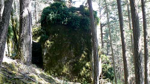 The "Cenotaph" The "Cenotaph" |
<href= http:="" www.victoria.cascadia.scouts.ca="" index.php?module="pagemaster&PAGE_user_op=view_page&PAGE_id=12&MMN_position=21:21">
Take the right turn and head through a brief forest phase and out into more open woods. This is the scene of an old aircraft crash. Note the large moss crowned “Cenotaph” rock in front of you. Search around the base of this and you’ll find debris – although less and less is evident as the years go by. Continue up beyond the Cenotaph where the trail turns left and climbs again before turning right and out onto open slopes. Climb these northwest and up to the summit of “David’s Delight” the third Amigo. Enjoy a break with great views because it’s a good way from here to the last hill.</href=>
Take the right turn and head through a brief forest phase and out into more open woods. This is the scene of an old aircraft crash. Note the large moss crowned “Cenotaph” rock in front of you. Search around the base of this and you’ll find debris – although less and less is evident as the years go by. Continue up beyond the Cenotaph where the trail turns left and climbs again before turning right and out onto open slopes. Climb these northwest and up to the summit of “David’s Delight” the third Amigo. Enjoy a break with great views because it’s a good way from here to the last hill.</href=>
<href= http:="" www.victoria.cascadia.scouts.ca="" index.php?module="pagemaster&PAGE_user_op=view_page&PAGE_id=12&MMN_position=21:21">
Head west off the summit of David and follow well used trail down a wide rocky gully to N48 25.589 W123 35.458 and watch for a branch to the right. Take this. The route to the left – light blue on the map - goes down to Veitch Creek and may be used for an early exit if required. Continuing to the right, cross ledges above the forest below before making a brief descent and then up to the flat bench known as the “Paterhorn”. Bear right across the bench and find ledges leading down into the forest. Be careful!! To your left is a 20 metre cliff. Once in the trees follow a wide path heading down and straight ahead. Continue on good trail with some ups and downs to emerge at a small rocky ridge. Just beyond this is a trail junction at N48 25.811 W123 35.493. Turning right here takes you through to the Aggressive Road. However, take the left branch. Continue more or less west across mixed ground to a final subsidiary high point known as "Shaun's Summit". Turn right and go directly across this following good flagging but not much in the way of trail. </href=>
Head west off the summit of David and follow well used trail down a wide rocky gully to N48 25.589 W123 35.458 and watch for a branch to the right. Take this. The route to the left – light blue on the map - goes down to Veitch Creek and may be used for an early exit if required. Continuing to the right, cross ledges above the forest below before making a brief descent and then up to the flat bench known as the “Paterhorn”. Bear right across the bench and find ledges leading down into the forest. Be careful!! To your left is a 20 metre cliff. Once in the trees follow a wide path heading down and straight ahead. Continue on good trail with some ups and downs to emerge at a small rocky ridge. Just beyond this is a trail junction at N48 25.811 W123 35.493. Turning right here takes you through to the Aggressive Road. However, take the left branch. Continue more or less west across mixed ground to a final subsidiary high point known as "Shaun's Summit". Turn right and go directly across this following good flagging but not much in the way of trail. </href=>
<href= http:="" www.victoria.cascadia.scouts.ca="" index.php?module="pagemaster&PAGE_user_op=view_page&PAGE_id=12&MMN_position=21:21">
Continue north and after a brief phase in the bush a use-path will appear which emerges eventually onto open slopes at a distinctive erratic with great views to the north east. Head north from here on easy ground to the summit of the fourth and final Amigo. The hill lies right beside the hydro corridor and can be clearly seen when passing under the hydro lines on the way to Mt Braden.</href=>
Continue north and after a brief phase in the bush a use-path will appear which emerges eventually onto open slopes at a distinctive erratic with great views to the north east. Head north from here on easy ground to the summit of the fourth and final Amigo. The hill lies right beside the hydro corridor and can be clearly seen when passing under the hydro lines on the way to Mt Braden.</href=>
<href= http:="" www.victoria.cascadia.scouts.ca="" index.php?module="pagemaster&PAGE_user_op=view_page&PAGE_id=12&MMN_position=21:21">
To complete the hike, head north east down the new (July 2016) service spur road down the hydro corridor. Either go all the way to the red gate at the head of the Aggressive Road, or find a well marked, wide path at the back of the second pull out off the hydro road. This leads directly down to the main hydro road directly opposite the start of the southwest and south direct routes up Mt Braden. From either option turn left and hike the main hydro road/Veitch Creek Trail back to the mailboxes. OR</href=>
|
Three Amigos |
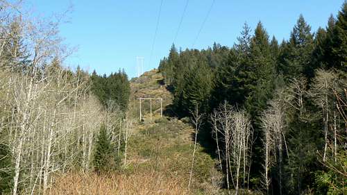 The Fourth Amigo The Fourth Amigo |
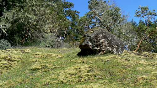 Fourth Amigo Erratic Fourth Amigo Erratic |
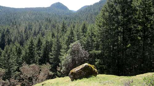 Sugarloaf from the Fourth Amigo Sugarloaf from the Fourth Amigo |
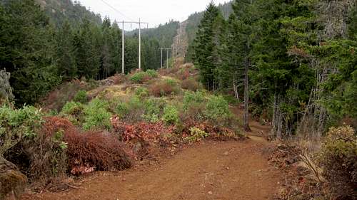 4th Amigo Hydro Road 4th Amigo Hydro Road |
<href= http:="" www.victoria.cascadia.scouts.ca="" index.php?module="pagemaster&PAGE_user_op=view_page&PAGE_id=12&MMN_position=21:21">
</href=>
</href=>
<href= http:="" www.victoria.cascadia.scouts.ca="" index.php?module="pagemaster&PAGE_user_op=view_page&PAGE_id=12&MMN_position=21:21">Reach the Veitch Creek trail directly via a steep descent down the hydro corridor to the south west. This goes nicely down benches and ledges as far as the big flat area under the first set of poles. Thereafter descend the left side of the corridor on the edge of the forest. The river crossing at the foot of the hill is unpleasant and may not be the way to go if water levels are high.
Mt McDonald
(Current, October 2016)</href=><href= http:="" www.victoria.cascadia.scouts.ca="" index.php?module="pagemaster&PAGE_user_op=view_page&PAGE_id=12&MMN_position=21:21">
The least complicated route to the usual start point for Mt McDonald is to approach on Highway 1 and take the Veterans Memorial Parkway exit through Langford to the junction with Sooke Road, just as for Braden and Sugarloaf. Drive 5.5 km and turn right on narrow Humpback Road. Drive 2 km to N48 26.474 W123 33.563 and park in the best spot you can find by the roadside. Many routes up McDonald start and end from this spot. Consistent with the aim of this page, the following describes the standard and well travelled route to the summit as well as a less travelled return route that loops anti-clockwise from the top and back to the start point.</href=>
The least complicated route to the usual start point for Mt McDonald is to approach on Highway 1 and take the Veterans Memorial Parkway exit through Langford to the junction with Sooke Road, just as for Braden and Sugarloaf. Drive 5.5 km and turn right on narrow Humpback Road. Drive 2 km to N48 26.474 W123 33.563 and park in the best spot you can find by the roadside. Many routes up McDonald start and end from this spot. Consistent with the aim of this page, the following describes the standard and well travelled route to the summit as well as a less travelled return route that loops anti-clockwise from the top and back to the start point.</href=>
<href= http:="" www.victoria.cascadia.scouts.ca="" index.php?module="pagemaster&PAGE_user_op=view_page&PAGE_id=12&MMN_position=21:21">
The summit is mostly clear of bush and offers lovely views across to Mt Wells and south to the Olympics. Although this is the highest spot on McDonald, most maps show the summit (wrongly I believe) 600 metres away to the north west. Don't be confused by this.</href=>
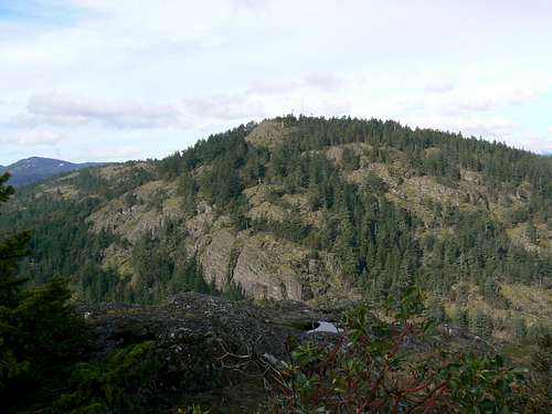 Mt McDonald from Mt Wells Mt McDonald from Mt Wells |
<href= http:="" www.victoria.cascadia.scouts.ca="" index.php?module="pagemaster&PAGE_user_op=view_page&PAGE_id=12&MMN_position=21:21">
</href=>
From your parking spot watch for a path leading off to the west of the road and marked by a "no public access" sign. I have also included the photo below to help you find the right spot. Mt McDonald (and most other places in the Sooke Hills) is not officially open to the public, so the "trailhead" is not marked other than by this sign. After a minute of flat going through the big trees the route heads west and up steeply. There are several Class 2-3 sections to negotiate up rocky gullies and bluffs. Two fixed handlines are in place to assist on the descent. The route is well booted-in and hard to miss. The hardest part of the route finding is locating the right trailhead. On occasion you may notice flagging heading away from the obvious line of ascent. This marks various alternate routes that locals have put up over the years. Take these if you're comfortable travelling off-trail. All involve some Class 2-3 scrambling but nothing more difficult than the main route. </href=>
The summit is mostly clear of bush and offers lovely views across to Mt Wells and south to the Olympics. Although this is the highest spot on McDonald, most maps show the summit (wrongly I believe) 600 metres away to the north west. Don't be confused by this.</href=>
<href= http:="" www.victoria.cascadia.scouts.ca="" index.php?module="pagemaster&PAGE_user_op=view_page&PAGE_id=12&MMN_position=21:21">
A well flagged route leaves the summit in a westerly direction and leads down open mossy slopes to the defunct service road for the transmitter station on McDonald. Don't go this far. Once at the bottom of the last open slope and just before entering the trees, look for flagging and a path off to the left (south). Follow the path south, east and then north as it circles around the mountain above through a mix of arbutus and evergreen forest and finally down open slopes. During the southerly phase you will see the debuilt remains of the old transmitter road below. The route finally rejoins the out route just a couple of hundred metres west of Humpback Road and your vehicle there. Refer to the route map in the collection at the end of the page.</href=>
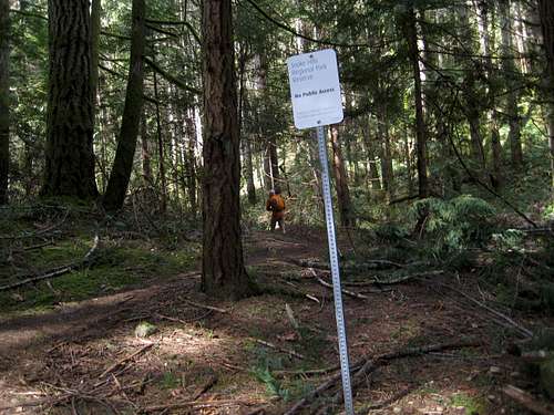 Mt McDonald Trailhead from Humpback Road Mt McDonald Trailhead from Humpback Road |
 Steep gully with handline Steep gully with handline |
 Open bluffs Open bluffs |
 The Olympics from McDonald The Olympics from McDonald |
 Ragged & Manuel Quimper from McDonald Ragged & Manuel Quimper from McDonald |
<href= http:="" www.victoria.cascadia.scouts.ca="" index.php?module="pagemaster&PAGE_user_op=view_page&PAGE_id=12&MMN_position=21:21">
Mt Wells
(Current, August 2016)</href=><href= http:="" www.victoria.cascadia.scouts.ca="" index.php?module="pagemaster&PAGE_user_op=view_page&PAGE_id=12&MMN_position=21:21">
Approach as for Mt McDonald and continue past there for a further kilometre to find Mt Wells Regional Park on the left. Park here. Follow the sign out of the parking lot to reach the well signed trailhead on the left and follow the excellent and well maintained trail to the top in less than an hour. </href=>
Approach as for Mt McDonald and continue past there for a further kilometre to find Mt Wells Regional Park on the left. Park here. Follow the sign out of the parking lot to reach the well signed trailhead on the left and follow the excellent and well maintained trail to the top in less than an hour. </href=>
<href= http:="" www.victoria.cascadia.scouts.ca="" index.php?module="pagemaster&PAGE_user_op=view_page&PAGE_id=12&MMN_position=21:21">
</href=>
</href=>
<href= http:="" www.victoria.cascadia.scouts.ca="" index.php?module="pagemaster&PAGE_user_op=view_page&PAGE_id=12&MMN_position=21:21">
</href=>
 Mt Wells from Mt McDonald Mt Wells from Mt McDonald |
 Mt Wells climbing area Mt Wells climbing area |
<href= http:="" www.victoria.cascadia.scouts.ca="" index.php?module="pagemaster&PAGE_user_op=view_page&PAGE_id=12&MMN_position=21:21">Descend the way you came up or make your way off the summit following a path to the southwest before looping back north down bluffs, ledges and gullies to regain the big trees under the rock-climbing area. This is not a maintained route and the faint path soon gets even fainter as it disappears into deadfall etc. First timers many need some patience and the willingness to backtrack a few times before they get this one nailed. Once under the climbing cliffs follow the climbers' trails out to the road to emerge 100m south of where the route up Mt McDonald takes off to the west.
Mts McDonald and Braden can be connected as part of a 6-8 hours traverse. There are a number of ways to do this, only some of which are described below. Refer to the separate Mt Braden page and see if you can't design your own variation. Most but not all routes are flagged right across from the summit of McDonald and all involve over 1,000 metres of total ascent as well as a bit of bushwhacking on occasion.
Leave a vehicle at the mailboxes as described in the Mt Braden section above and drive back down Sooke Road to Humpback Road and turn left. Park as near as you can to the Mt McDonald "trailhead".
Go up McDonald and then find the flagged route described in the Mt McDonald section above that heads west. Continue down beyond where the McDonald loop trail described above takes off to the south, into the forest and right to the old transmitter station road. The road has not been de-built in this area. Go straight across the road and continue 300 metres west to a new road. Go across this and find the continuation of the flagging west and up to the highest of "The Bumps" known locally as "Stickbump". For years this had a weathered stick in the summit cairn that gave it it's name. Everyone knew and respected this and left it alone. Sometime in summer 2016 it has disappeared. Whoever took it - you're a jerk! However, tradition has triumphed and in October 2016 a new, suitably weathered stick - "Son of Stick" - has appeared on the summit. Good on whoever did this!
The bluffy east aspect of Mt Braden comes into view at this point. Descend west off the top of Stickbump, into a deep salal filled gully and up the other side to the top of the last Bump. Here you're confronted by an obvious drop off down into a deep valley to the east with Mt Braden beyond. There are two options from this point.
Option 1. Braden East Face.</href=>
McDonald to Braden Traverse
(Current, October 2016)Mts McDonald and Braden can be connected as part of a 6-8 hours traverse. There are a number of ways to do this, only some of which are described below. Refer to the separate Mt Braden page and see if you can't design your own variation. Most but not all routes are flagged right across from the summit of McDonald and all involve over 1,000 metres of total ascent as well as a bit of bushwhacking on occasion.
Leave a vehicle at the mailboxes as described in the Mt Braden section above and drive back down Sooke Road to Humpback Road and turn left. Park as near as you can to the Mt McDonald "trailhead".
Go up McDonald and then find the flagged route described in the Mt McDonald section above that heads west. Continue down beyond where the McDonald loop trail described above takes off to the south, into the forest and right to the old transmitter station road. The road has not been de-built in this area. Go straight across the road and continue 300 metres west to a new road. Go across this and find the continuation of the flagging west and up to the highest of "The Bumps" known locally as "Stickbump". For years this had a weathered stick in the summit cairn that gave it it's name. Everyone knew and respected this and left it alone. Sometime in summer 2016 it has disappeared. Whoever took it - you're a jerk! However, tradition has triumphed and in October 2016 a new, suitably weathered stick - "Son of Stick" - has appeared on the summit. Good on whoever did this!
The bluffy east aspect of Mt Braden comes into view at this point. Descend west off the top of Stickbump, into a deep salal filled gully and up the other side to the top of the last Bump. Here you're confronted by an obvious drop off down into a deep valley to the east with Mt Braden beyond. There are two options from this point.
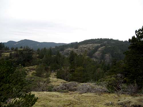 Mt Braden from the "Bumps" Mt Braden from the "Bumps" |
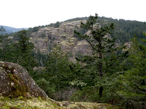 Mt Braden from the last "Bump" Mt Braden from the last "Bump" |
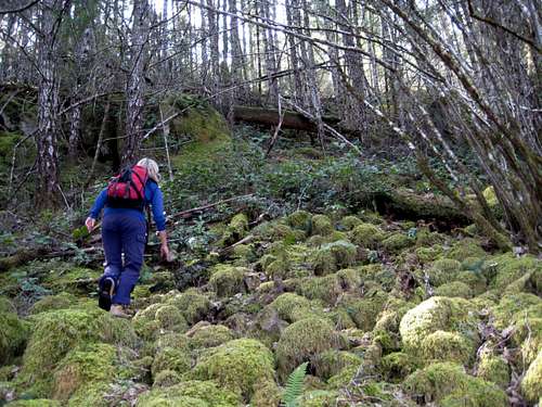 Mt Braden East Side Mt Braden East Side |
Option 1. Braden East Face.</href=>
<href= http:="" www.victoria.cascadia.scouts.ca="" index.php?module="pagemaster&PAGE_user_op=view_page&PAGE_id=12&MMN_position=21:21">
</href=>
</href=>
<href= http:="" www.victoria.cascadia.scouts.ca="" index.php?module="pagemaster&PAGE_user_op=view_page&PAGE_id=12&MMN_position=21:21">Go down steeply due west and into the bottom of the valley where you will meet a road. Turn right and walk 100 metres to a junction with another road labelled "3J". Turn left and walk a further 50 metres on 3J until you find a faint trail and then the continuation of the flagging that heads left off the road and southwest up into the trees and across a seasonal stream. </href=>
<href= http:="" www.victoria.cascadia.scouts.ca="" index.php?module="pagemaster&PAGE_user_op=view_page&PAGE_id=12&MMN_position=21:21">
Climb up steeply through a lot of deadfall and bush and out onto open hillside once more. There is one bump - known as Plateau Peak - to cross with a hanging valley on its west side across which you can see the summit of Braden. It looks close but takes a good half hour to negotiate. Hidden from this aspect is the fact that you have three gullies to cross to reach the summit.</href=>
Climb up steeply through a lot of deadfall and bush and out onto open hillside once more. There is one bump - known as Plateau Peak - to cross with a hanging valley on its west side across which you can see the summit of Braden. It looks close but takes a good half hour to negotiate. Hidden from this aspect is the fact that you have three gullies to cross to reach the summit.</href=>
<href= http:="" www.victoria.cascadia.scouts.ca="" index.php?module="pagemaster&PAGE_user_op=view_page&PAGE_id=12&MMN_position=21:21">
</href=>
</href=>
<href= http:="" www.victoria.cascadia.scouts.ca="" index.php?module="pagemaster&PAGE_user_op=view_page&PAGE_id=12&MMN_position=21:21">Option 2. Braden South Routes.</href=>
<href= http:="" www.victoria.cascadia.scouts.ca="" index.php?module="pagemaster&PAGE_user_op=view_page&PAGE_id=12&MMN_position=21:21">
</href=>
</href=>
<href= http:="" www.victoria.cascadia.scouts.ca="" index.php?module="pagemaster&PAGE_user_op=view_page&PAGE_id=12&MMN_position=21:21">From the top of the last bump find a well marked route descending to the southwest. This is much less steep and, therefore longer, than Option 1 and offers great views. Good flagging and a use-path drop you comfortably right down to the valley under Braden's south side to the well-known Red-Gate junction. Turn left here, walk down the hill, around a left hand bend and find your Braden access point 50 metres further on on the right.</href=>
<href= http:="" www.victoria.cascadia.scouts.ca="" index.php?module="pagemaster&PAGE_user_op=view_page&PAGE_id=12&MMN_position=21:21">
</href=>
</href=>
<href= http:="" www.victoria.cascadia.scouts.ca="" index.php?module="pagemaster&PAGE_user_op=view_page&PAGE_id=12&MMN_position=21:21">Hike up the trail to a junction at N48 26.348 W123 35.836. Stay left for the Southwest Trail, which used to be the standard route on Braden. Follow this across a lovely open meadow and up some steep bluffs. Continue north up mostly open hillside to a junction with the new standard route and on to the summit. This is mostly easy to follow with a reasonable boot path plus flags and some cairns. Or:</href=>
<href= http:="" www.victoria.cascadia.scouts.ca="" index.php?module="pagemaster&PAGE_user_op=view_page&PAGE_id=12&MMN_position=21:21">
</href=>
</href=>
<href= http:="" www.victoria.cascadia.scouts.ca="" index.php?module="pagemaster&PAGE_user_op=view_page&PAGE_id=12&MMN_position=21:21">Keep right at the junction for the South Route Direct. Head up through some spindly trees due north following flags and signs of travel where you find them. Eventually the route breaks out of the trees and heads up open bluffs directly to the summit joining the Standard and SW routes at the large arbutus just below the rocky ridge to the top.
From the summit of Braden follow the reverse of the Standard Route described above down to the old Veitch Creek road and then out to the mailboxes and your second vehicle. Refer to the collection of route maps for all of the foregoing and ask me for a working file for your GPS if you need one.</href=>
From the summit of Braden follow the reverse of the Standard Route described above down to the old Veitch Creek road and then out to the mailboxes and your second vehicle. Refer to the collection of route maps for all of the foregoing and ask me for a working file for your GPS if you need one.</href=>
<href= http:="" www.victoria.cascadia.scouts.ca="" index.php?module="pagemaster&PAGE_user_op=view_page&PAGE_id=12&MMN_position=21:21">
A favourite local hiking destination of Victorians for generations. People also come from miles around to watch the annual salmon spawning run in the Goldstream River from October into November.</href=>
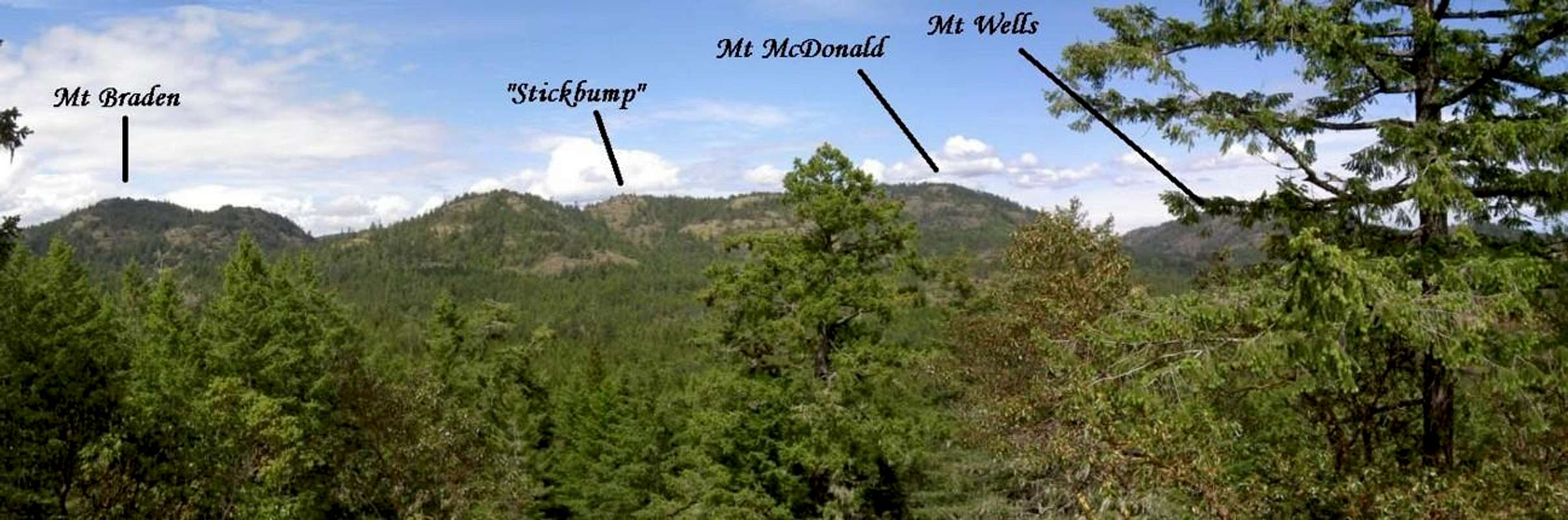 |
Mt Finlayson
(Current, April 2016)A favourite local hiking destination of Victorians for generations. People also come from miles around to watch the annual salmon spawning run in the Goldstream River from October into November.</href=>
<href= http:="" www.victoria.cascadia.scouts.ca="" index.php?module="pagemaster&PAGE_user_op=view_page&PAGE_id=12&MMN_position=21:21">
![Mt Finlayson from Mt Wells]() Mt Finlayson from Mt Wells
Mt Finlayson from Mt Wells
Leave Victoria on the Trans Canada Highway 1 and drive ~20 km to Goldstream Provincial Park. Being a provincial park, there is $3/day parking fee. Many people object to this and park on the highway where there is certainly lots of room. Make your choice then walk out of the lot, over the Goldstream River and find the well-signed trailhead 200 metres down Finlayson Arm Road on the right.
SPer CharlesD has written up this description of the standard route on Finlayson. There are, however, other ways to go up and down.
1. Alternate descent route
Walk off the summit north east and into the trees following the continuation of the orange plates that mark the way up and find the "back side" descent route. The path goes down old fire roads to arrive at a trailhead on upper Finlayson Arm Rd in about 3 km. Walk back 5 km on the road to Goldstream. Boring but at least this offers a circular route. It's also possible to go up this way of course, including driving to the upper trailhead.
2. Alternate ascent route - the West Face
A steep and uncompromising scramble with exposure and loose rock. NOT for the beginner or faint of heart. I've known people carry a rope on this one.
Walk along Finlayson Arm Rd past the standard trailhead 300 metres to a paved U-shaped pull-out/parking lot on the right. The park boundary sign is 50 metres past this spot, so if you reach this you've gone too far. Pick up a faint path leading out of the back of this area and straight up a steep scree-filled gully. Thereafter, make your way up as best you can following a boot path in places, by the path of least resistance in others and recently yellow flagging. The steepness never relents until you step off the last mossy ledges onto a rock bluff at the top of the route.</href=>
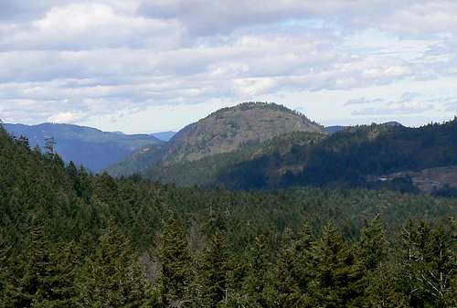 Mt Finlayson from Mt Wells
Leave Victoria on the Trans Canada Highway 1 and drive ~20 km to Goldstream Provincial Park. Being a provincial park, there is $3/day parking fee. Many people object to this and park on the highway where there is certainly lots of room. Make your choice then walk out of the lot, over the Goldstream River and find the well-signed trailhead 200 metres down Finlayson Arm Road on the right.
SPer CharlesD has written up this description of the standard route on Finlayson. There are, however, other ways to go up and down.
1. Alternate descent route
Walk off the summit north east and into the trees following the continuation of the orange plates that mark the way up and find the "back side" descent route. The path goes down old fire roads to arrive at a trailhead on upper Finlayson Arm Rd in about 3 km. Walk back 5 km on the road to Goldstream. Boring but at least this offers a circular route. It's also possible to go up this way of course, including driving to the upper trailhead.
2. Alternate ascent route - the West Face
A steep and uncompromising scramble with exposure and loose rock. NOT for the beginner or faint of heart. I've known people carry a rope on this one.
Walk along Finlayson Arm Rd past the standard trailhead 300 metres to a paved U-shaped pull-out/parking lot on the right. The park boundary sign is 50 metres past this spot, so if you reach this you've gone too far. Pick up a faint path leading out of the back of this area and straight up a steep scree-filled gully. Thereafter, make your way up as best you can following a boot path in places, by the path of least resistance in others and recently yellow flagging. The steepness never relents until you step off the last mossy ledges onto a rock bluff at the top of the route.</href=>
<href= http:="" www.victoria.cascadia.scouts.ca="" index.php?module="pagemaster&PAGE_user_op=view_page&PAGE_id=12&MMN_position=21:21">
 West face; first obstacle West face; first obstacle |
 The vegetated dihedral The vegetated dihedral |
 Last step off the west face Last step off the west face |
<href= http:="" www.victoria.cascadia.scouts.ca="" index.php?module="pagemaster&PAGE_user_op=view_page&PAGE_id=12&MMN_position=21:21">
</href=>
There are three or four particularly notable points on the climb depending on which finish you choose. An exposed 4 metres high bluff with a crack which goes at Class 3 about 20 minutes from the start and halfway up. A rocky Class 2 groove 5 minutes above that and finally the (locally) famous 25 metres "vegetated dihedral" (see photo) quite close to the top. This is the crux of the route. Steep, exposed and Class 4. If you're alone I don't recommend this. Go round the obstacle on climber's right; there is a path, which shows how many folk choose the easier option. </href=>
After reaching the top of the dihedral by either choice, trend upwards and left on mossy slabs to reach a corner where you make a high step onto a last ramp to the top. Look down directly on the roof of the visitor centre 400 metres below you.
An alternate finish to the West Face route involves more Class 3 or 4 climbing.
At the top of the mossy slabs and a minute before reaching the finish above look for a ~ 30 metres high corner system and examine the right wall closely. If you've found the right place, you'll notice a weakness heading up and to the right with obvious signs of travel - but no marking. Take this at Class 3 or 4 up to the top of the bluffs. There is some exposure and, again, this isn't a route I would take alone. If in doubt go all the way left up the mossy slabs described above and exit that way. The advantage to the alternate finish, besides being enjoyable, is that it puts you on a well trodden path and within 5 minutes of the summit of Finlayson without the need for the bush bash described below.</href=>
<href= http:="" www.victoria.cascadia.scouts.ca="" index.php?module="pagemaster&PAGE_user_op=view_page&PAGE_id=12&MMN_position=21:21">
 View E from Finlayson W face View E from Finlayson W face |
 West Face alternate finish West Face alternate finish |
 Victoria from Finlayson Victoria from Finlayson |
To descend from the West Face route after the standard (mossy slabs) finish proceed as follows. From the exit point contour east through the woods, around the crown of the mountain and intersect the alternate descent route described under 1. above. There is no path and I don't believe I've ever trodden the same ground twice when going this way. Go down directly down the back side or up to the summit and down the standard route with the crowds.
The last choice, of course, is to descend the West Face route the way you came up. I don't recommend this and have never done it.
Holmes Peak and Jocelyn Hill
<href= http:="" www.victoria.cascadia.scouts.ca="" index.php?module="pagemaster&PAGE_user_op=view_page&PAGE_id=12&MMN_position=21:21">(Current, October 2016)</href=>
These two summits are high points on the ridgeline of the Gowlland Range which runs north from Finlayson Arm Rd and down the east side of Finlayson Arm itself. Spectacular views down the Arm to the outlet of Goldstream River and to the Olympics beyond.
Start from the trailhead at Caleb Pike. Approach from Victoria on Highway 1 and exit at Millstream Rd. At the junction with Millstream Lake Rd keep left and drive 1km further to Caleb Pike Rd. Turn left and drive into the parking lot at the end of the road. Walk the easy and well-marked trail to arrive at Holmes Peak in 20 minutes and Jocelyn in a little over an hour. Return the way you came with some minor variations possible as outlined on this map</href=>
<href= http:="" www.victoria.cascadia.scouts.ca="" index.php?module="pagemaster&PAGE_user_op=view_page&PAGE_id=12&MMN_position=21:21">
</href=>
Lone Tree Hill
(Current, October 2016)</href=>
<href= http:="" www.victoria.cascadia.scouts.ca="" index.php?module="pagemaster&PAGE_user_op=view_page&PAGE_id=12&MMN_position=21:21">Lone Tree sits right in the middle of the higher ridges of the Gowlland range and Mt Work. Approach as for Holmes Peak and Jocelyn Hill but at Caleb Pike Rd keep straight on to reach the signed parking lot in ~3 km. It's an easy 15-20 minutes to the top. The local ravens love this place and it's a great spot to watch them playing. Unlike the higher points on the Gowlland Range and Mt Work, there are no trees to the east of the summit and this allows views as far as Mt Baker, Glacier Peak and even Mt Rainier on a clear day.</href=>
<href= http:="" www.victoria.cascadia.scouts.ca="" index.php?module="pagemaster&PAGE_user_op=view_page&PAGE_id=12&MMN_position=21:21">
The subject of much wordplay amongst locals. As in "I like going to Work", "Work was fun today", "Work before play" etc. The mountain, in fact, is named after a John Wark. Everyone has always called it "Work" however, and at some point the incorrect appellation stuck.</href=>
 Lone Tree Hill summit Lone Tree Hill summit |
 The "lone tree" The "lone tree" |
<href= http:="" www.victoria.cascadia.scouts.ca="" index.php?module="pagemaster&PAGE_user_op=view_page&PAGE_id=12&MMN_position=21:21">
</href=>
The hill is named for the 200 year old bonsai-like Douglas fir that used the grace the summit. The remains of this local icon can still be seen.</href=>
Mt Work
(Current, April 2016)The subject of much wordplay amongst locals. As in "I like going to Work", "Work was fun today", "Work before play" etc. The mountain, in fact, is named after a John Wark. Everyone has always called it "Work" however, and at some point the incorrect appellation stuck.</href=>
<href= http:="" www.victoria.cascadia.scouts.ca="" index.php?module="pagemaster&PAGE_user_op=view_page&PAGE_id=12&MMN_position=21:21">
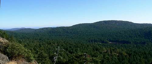 Mt Work from Lone Tree Hill
<href= http:="" www.victoria.cascadia.scouts.ca="" index.php?module="pagemaster&PAGE_user_op=view_page&PAGE_id=12&MMN_position=21:21">
</href=>
The mountain is the focal point of Mt Work Regional Park and a VERY popular destination for locals.</href=></href=>
<href= http:="" www.victoria.cascadia.scouts.ca="" index.php?module="pagemaster&PAGE_user_op=view_page&PAGE_id=12&MMN_position=21:21">
Climb from either the north (Durrance Lake) or south (Munn Rd) trailheads. For the Durrance Lake approach on West Saanich Road. From West Saanich Road, turn left on Wallace Drive, and left again on Willis Point Road. After 4 km turn left on Ross-Durrance Road, which leads to the park entrance on the left in 30 m. For Munn Road approach initially on the Trans-Canada Highway from Victoria, and take the Helmcken Road exit. Turn left on Burnside Road West, then right on Prospect Lake Road. Turn left on Munn Road, which leads to the park entrance on the right. If in doubt, refer to this map</href=>
Climb from either the north (Durrance Lake) or south (Munn Rd) trailheads. For the Durrance Lake approach on West Saanich Road. From West Saanich Road, turn left on Wallace Drive, and left again on Willis Point Road. After 4 km turn left on Ross-Durrance Road, which leads to the park entrance on the left in 30 m. For Munn Road approach initially on the Trans-Canada Highway from Victoria, and take the Helmcken Road exit. Turn left on Burnside Road West, then right on Prospect Lake Road. Turn left on Munn Road, which leads to the park entrance on the right. If in doubt, refer to this map</href=>
<href= http:="" www.victoria.cascadia.scouts.ca="" index.php?module="pagemaster&PAGE_user_op=view_page&PAGE_id=12&MMN_position=21:21">
From either trailhead follow the occasionally steep but well built trails to the summit. For the odd occasions when the trail in under snow or otherwise obscured by windfall etc, the way is also marked by yellow metal plaques. This is the local ravens other favourite spot and I've also seen golden eagles from here. A bluff 3 minutes north of the summit plaque gives the best views north offered by any of the CRD summits, whilst a similar one 3 minutes south enables one to peer into (with binoculars) the Navy's yard in Esquimalt. It's an easy hour up from the north and an equally leisurely 50 minutes from the south. The north route has a 10 minute flat section after the first 20 minutes or so that makes a nice breath catcher.
Partridge Hill is the high point of a compact range of hills found due north of Mt Work directly above Durrance Lake between Willis Point Road to the south and Tod Inlet to the north. The usual access along the north shore of Durrance Lake lies within Mt Work Regional Park, while the bulk of the area is formally part of Gowlland Tod Provincial Park..
The range has unfortunately been badly abused by illegal ATV use in the lower areas and by mountain bikers higher up. However, since the hills are now legally open to mountain biking, we must expect this unfortunate trend to continue. MB trails have made a veritable maze of the area and a few visits are normally required to learn all the various permutations and interconnections.
The summit of Partridge Hill itself is located in a picturesque but viewless arbutus and Garry Oak grove but unexpectedly lovely views to the south and north can be had on a circular walk around the range taking in the high points.
A secondary high point within the range, Cole Hill, is situated on Department of National Defense property and may not be approached legally. Warning notices indicate the limits of the area and sentries, I’m told, will warn you off, particularly when the firing range is in use.
Approach as for Mt Work as described above. Just before the left turn onto Ross Durrance Road and Mt Work north parking, turn right instead following the sign for Durrance Lake. Park here.
The following describes a 3-4 hour tour of the range that takes in all the best views whilst trying to avoid the worst of the ATV and MTB abuse. I emphasise, however, that many more possibilities exist within the area.
From the parking area at the northwest corner of Durrance Lake walk 550 metres southeast along the lakeshore and find the well used trail heading up into the hills on the left. Head up the wide trail 500 metres to a prominent junction at N48 33.122 W123 28.564 and turn left onto what is generally known as the “south trail”.
Follow the trail right around the southern periphery of the hills 1.4 km to a junction at N48 33.332 W123 29.333 and keep right. Proceed 200 metres to a second, much less prominent junction at N48 33.392 W123 29.231 and turn right again onto trail, as opposed to the ATV/MTB tracks you’ve been walking to this point. Climb the hillside generally south and after only a few minutes, you’ll break out into lovely open meadows. Make your way to N48 33.282 W123 29.221 and a superb view south across to Mt Work and the Gowlland Range.</href=>
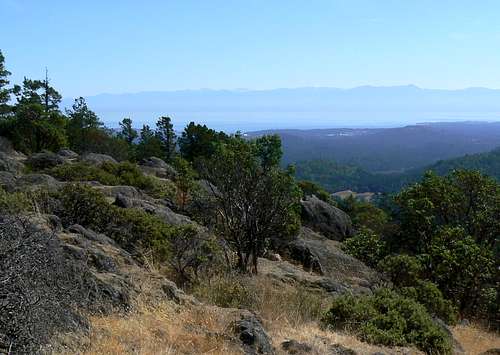 Mt Work view south Mt Work view south |
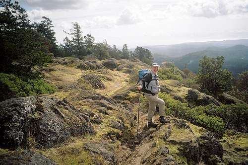 Mt Work in winter Mt Work in winter |
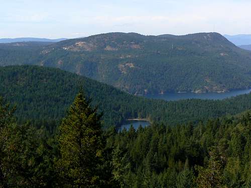 Mt Work view NW Mt Work view NW |
Partridge Hill
(Current, April 2016)Partridge Hill is the high point of a compact range of hills found due north of Mt Work directly above Durrance Lake between Willis Point Road to the south and Tod Inlet to the north. The usual access along the north shore of Durrance Lake lies within Mt Work Regional Park, while the bulk of the area is formally part of Gowlland Tod Provincial Park..
The range has unfortunately been badly abused by illegal ATV use in the lower areas and by mountain bikers higher up. However, since the hills are now legally open to mountain biking, we must expect this unfortunate trend to continue. MB trails have made a veritable maze of the area and a few visits are normally required to learn all the various permutations and interconnections.
The summit of Partridge Hill itself is located in a picturesque but viewless arbutus and Garry Oak grove but unexpectedly lovely views to the south and north can be had on a circular walk around the range taking in the high points.
A secondary high point within the range, Cole Hill, is situated on Department of National Defense property and may not be approached legally. Warning notices indicate the limits of the area and sentries, I’m told, will warn you off, particularly when the firing range is in use.
Approach as for Mt Work as described above. Just before the left turn onto Ross Durrance Road and Mt Work north parking, turn right instead following the sign for Durrance Lake. Park here.
The following describes a 3-4 hour tour of the range that takes in all the best views whilst trying to avoid the worst of the ATV and MTB abuse. I emphasise, however, that many more possibilities exist within the area.
From the parking area at the northwest corner of Durrance Lake walk 550 metres southeast along the lakeshore and find the well used trail heading up into the hills on the left. Head up the wide trail 500 metres to a prominent junction at N48 33.122 W123 28.564 and turn left onto what is generally known as the “south trail”.
Follow the trail right around the southern periphery of the hills 1.4 km to a junction at N48 33.332 W123 29.333 and keep right. Proceed 200 metres to a second, much less prominent junction at N48 33.392 W123 29.231 and turn right again onto trail, as opposed to the ATV/MTB tracks you’ve been walking to this point. Climb the hillside generally south and after only a few minutes, you’ll break out into lovely open meadows. Make your way to N48 33.282 W123 29.221 and a superb view south across to Mt Work and the Gowlland Range.</href=>
<href= http:="" www.victoria.cascadia.scouts.ca="" index.php?module="pagemaster&PAGE_user_op=view_page&PAGE_id=12&MMN_position=21:21">
Proceed east for 250 metres from the viewpoint to the true summit of Partridge Hill (marked by a cairn) and then generally north via one of any number of possibilities to N48 33.439 W123 29.002 and turn left.
Descend back into coniferous forest aiming for N48 33.479 W123 28.893 and turn left. Head 400 metres northwest from this point to the “Eagle Lookout” at N48 33.573 W123 29.070. From here you get the best views in the Partridge Hills. An expansive north to east arc from the Cowichan Valley to Mt Tuam on Saltspring Island, down to Tod Inlet and the village of Brentwood Bay and beyond to the distant Tantalus Range and the northern Cascades on the mainland.</href=>
 Jocelyn Hill & Finlayson Arm Jocelyn Hill & Finlayson Arm |
 Cowichan Hills Cowichan Hills |
 N Cascades & Brentwood Bay N Cascades & Brentwood Bay |
Proceed east for 250 metres from the viewpoint to the true summit of Partridge Hill (marked by a cairn) and then generally north via one of any number of possibilities to N48 33.439 W123 29.002 and turn left.
Descend back into coniferous forest aiming for N48 33.479 W123 28.893 and turn left. Head 400 metres northwest from this point to the “Eagle Lookout” at N48 33.573 W123 29.070. From here you get the best views in the Partridge Hills. An expansive north to east arc from the Cowichan Valley to Mt Tuam on Saltspring Island, down to Tod Inlet and the village of Brentwood Bay and beyond to the distant Tantalus Range and the northern Cascades on the mainland.</href=>
<href= http:="" www.victoria.cascadia.scouts.ca="" index.php?module="pagemaster&PAGE_user_op=view_page&PAGE_id=12&MMN_position=21:21">
Complete the loop by following your best choice of routes southeast and then south back to the junction at N48 33.122 W123 28.564 where you turned left on the way out. Retrace your steps to your vehicle from here.
In the "CRD tracklogs" section below, I have included GPS tracks covering the above description to help you navigate this route. Contact me for the actual field data if you need it.
 Mt Tuam Mt Tuam |
 MTB damage on Partridge Hill MTB damage on Partridge Hill |
Complete the loop by following your best choice of routes southeast and then south back to the junction at N48 33.122 W123 28.564 where you turned left on the way out. Retrace your steps to your vehicle from here.
In the "CRD tracklogs" section below, I have included GPS tracks covering the above description to help you navigate this route. Contact me for the actual field data if you need it.
Finlayson to Work Enchainment
(Current, October 2016)</href=><href= http:="" www.victoria.cascadia.scouts.ca="" index.php?module="pagemaster&PAGE_user_op=view_page&PAGE_id=12&MMN_position=21:21">
This makes a great day out particularly in winter when looking for things to do locally that keep the fitness levels up. It involves nearly 25 km distance and over 1,100 m of ascent. Two cars are necessary of course. Allow 7-8 hours including breaks.
Start by leaving a car at the south (Munn Rd) parking lot for Mt Work and then make your way to Millstream Lake Road, then left on Millstream Road and finally right on Finlayson Arm Road. Drive this very narrow road 8 km down to the Goldstream parking lot and pay your $3.
Start at sea level and ascend Finlayson by the standard route or the west face route described above. Go down the "back side" trail from either as far as the upper trailhead on Finlayson Arm Rd. Turn right and walk up the road for 300 m to Rowntree Rd and turn left. Go up Rowntree to the end and locate a fire road on the right side of the cul de sac. Walk the fire road for 2 km to the Caleb Pike access to the Gowlland range described above under Jocelyn Hill and Holmes Peak. Proceed along the ridge top trail to the top of Jocelyn Hill and then down the Timberman Trail 6 km to Ross Durrance Rd. Turn left and walk 200 m north on Ross Durrance to the north parking lot for Mt Work described above. Go up Mt Work and then down the continuation of the trail to Munn Rd and the vehicle you left there.</href=>
<href= http:="" www.victoria.cascadia.scouts.ca="" index.php?module="pagemaster&PAGE_user_op=view_page&PAGE_id=12&MMN_position=21:21">
 Jocelyn Hill and Holmes Peak Jocelyn Hill and Holmes Peak |
 View N from Holmes Peak View N from Holmes Peak |
 North Finlayson Arm North Finlayson Arm |
East Side of the Saanich Peninsula
<href= http:="" www.victoria.cascadia.scouts.ca="" index.php?module="pagemaster&PAGE_user_op=view_page&PAGE_id=12&MMN_position=21:21">(Current, October 2016)</href=>
Of the three notable high points in this heavily populated area, you can drive almost to the top of two. An early Victoria mayor, Bert Todd, had the foresight to see the tourist potential of the views from Mt Douglas and was instrumental is getting a road built up it. You can also walk up of course. Visit the Mt Doug website for more information.</href=>
<href= http:="" www.victoria.cascadia.scouts.ca="" index.php?module="pagemaster&PAGE_user_op=view_page&PAGE_id=12&MMN_position=21:21"> </href=>
<href= http:="" www.victoria.cascadia.scouts.ca="" index.php?module="pagemaster&PAGE_user_op=view_page&PAGE_id=12&MMN_position=21:21">
Mt Newton is in John Dean Provincial Park right on the edge of a large subdivision. There are many options to get to the historic survey point near the radar dome on top. Refer to the trail map.
Horth Hill is the last high point on the Saanich Peninsula before the tidewater of Satellite Channel and the only hill in this area that you have to walk up. Drive up Highway 17 towards the BC Ferry terminal at Schwartz Bay and take the second last exit before the ferries signed for McDonald Park and Wain Road. Take Wain 500m to Tatlow Rd and turn right. The park entrance is 1km down Tatlow on the right. Take any of the signed options for the "summit loop". The summit is actually in the trees but there is a viewpoint on the south edge of the round top that is worth visiting. Refer to the park brochure for a map and the history of the area. It is also worth noting that this is a mixed-use park, so watch out.
</href=>
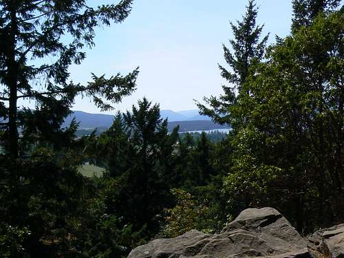 View south from Horth Hill View south from Horth Hill |
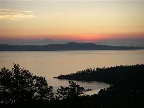 Mt Baker from Mt Douglas Mt Baker from Mt Douglas |
Horth Hill is the last high point on the Saanich Peninsula before the tidewater of Satellite Channel and the only hill in this area that you have to walk up. Drive up Highway 17 towards the BC Ferry terminal at Schwartz Bay and take the second last exit before the ferries signed for McDonald Park and Wain Road. Take Wain 500m to Tatlow Rd and turn right. The park entrance is 1km down Tatlow on the right. Take any of the signed options for the "summit loop". The summit is actually in the trees but there is a viewpoint on the south edge of the round top that is worth visiting. Refer to the park brochure for a map and the history of the area. It is also worth noting that this is a mixed-use park, so watch out.
</href=>
<href= http:="" www.victoria.cascadia.scouts.ca="" index.php?module="pagemaster&PAGE_user_op=view_page&PAGE_id=12&MMN_position=21:21">
The compilation below illustrates what most people would regard as the standard and most direct route to the summits of the CRD mountains described in the foregoing. The maps therein should be used as guides only and used on your hike only in conjunction with in situ navigational tools – GPS and compass.
If you would like the actual accurate and field proven tracklogs used to produce the illustrations below, feel free to send me an email or PM.
Long before geocachers began hiding little treasures in the hills for folks to find, surveyors have been out there leaving monuments on the spots from which they conducted their measurements.
Most peoples’ first thought on reading this might be “nerd alert” and, once upon a time, I would have been in the vanguard of such reasoning. What could be less interesting than a metal disk? Look into the provenance of the artifacts, however, and you’ll uncover a wealth of history about the area in which the monuments are installed and about the surveyors themselves.
Usually metal disks bolted to the rock or cemented in place but sometimes nothing more elaborate than a spike driven into the ground, the evidence of surveyors work can be found in most places in the world and the CRD is no exception. Many of the hills above were used as triangulation points and have monuments on their summits but marks can also be found on benches and along old roadways too if you know where to look.
Click on the images in the following collection to learn a little more about the monuments I’ve found in the hills of the CRD. What is the history of that old, old mark on Empress Mountain? Why is the Jocelyn Hill mark missing? See what you can find out there yourself and attach your own benchmark images and their story and I’ll include them here.
The Alpine Club of Canada, Vancouver Island Section organizes regular trips into the Sooke Hills.
</href=>
CRD Tracklogs
(last edited October 2016)The compilation below illustrates what most people would regard as the standard and most direct route to the summits of the CRD mountains described in the foregoing. The maps therein should be used as guides only and used on your hike only in conjunction with in situ navigational tools – GPS and compass.
If you would like the actual accurate and field proven tracklogs used to produce the illustrations below, feel free to send me an email or PM.
 Bluff Mountain Routes Bluff Mountain Routes |
 Peden Ridge Peden Ridge |
 Mt Manuel Quimper Mt Manuel Quimper |
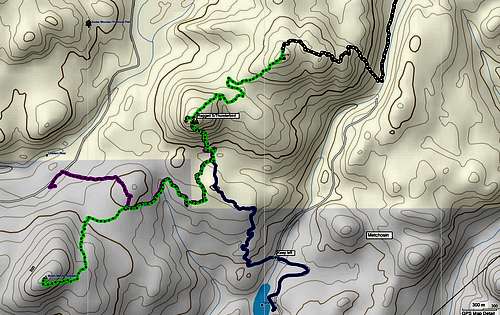 Ragged Mountain Routes Ragged Mountain Routes |
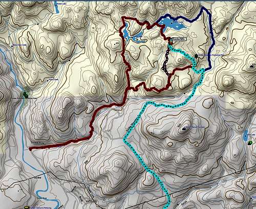 Sooke Mountain Tracks Sooke Mountain Tracks |
 Monument Mountain Monument Mountain |
 Empress Mtn standard route Empress Mtn standard route |
 Emperor Mtn loop Emperor Mtn loop |
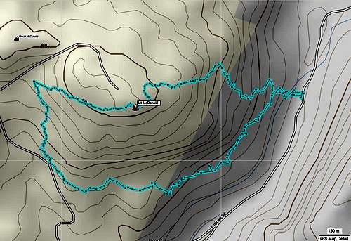 Mt McDonald Loop Mt McDonald Loop |
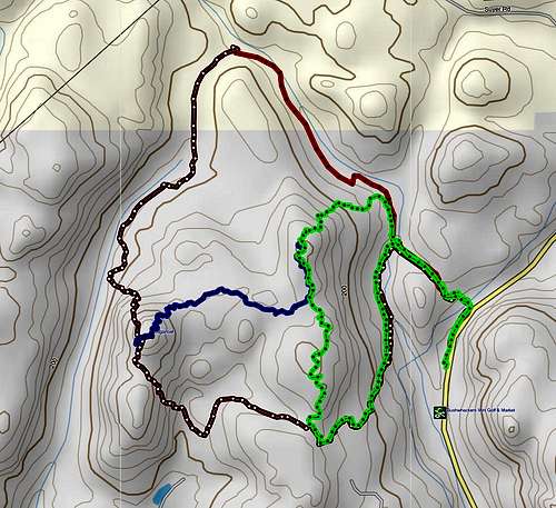 Sugarloaf Mountain Routes Sugarloaf Mountain Routes |
 Partridge Hills loop track Partridge Hills loop track |
 Caleb Pike to Mt Work Caleb Pike to Mt Work |
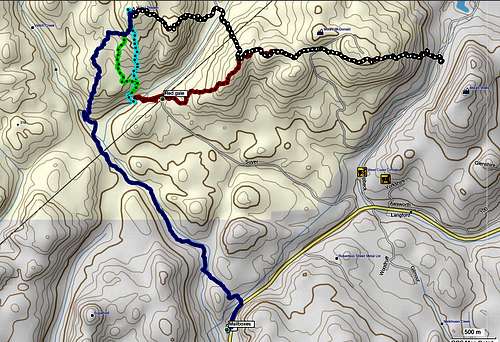 Mt Braden with McDonald Traverse Routes Mt Braden with McDonald Traverse Routes |
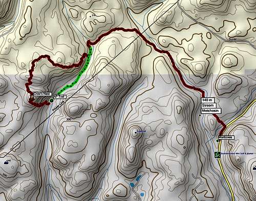 Crow's Nest Loop Crow's Nest Loop |
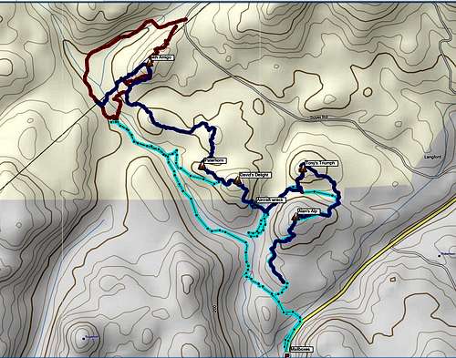 Amigos Routes Amigos Routes |
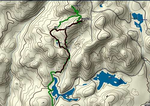 Screen Peak Screen Peak |
CRD Benchmarks and Survey Monuments
(As of October 2016)Long before geocachers began hiding little treasures in the hills for folks to find, surveyors have been out there leaving monuments on the spots from which they conducted their measurements.
Most peoples’ first thought on reading this might be “nerd alert” and, once upon a time, I would have been in the vanguard of such reasoning. What could be less interesting than a metal disk? Look into the provenance of the artifacts, however, and you’ll uncover a wealth of history about the area in which the monuments are installed and about the surveyors themselves.
Usually metal disks bolted to the rock or cemented in place but sometimes nothing more elaborate than a spike driven into the ground, the evidence of surveyors work can be found in most places in the world and the CRD is no exception. Many of the hills above were used as triangulation points and have monuments on their summits but marks can also be found on benches and along old roadways too if you know where to look.
Click on the images in the following collection to learn a little more about the monuments I’ve found in the hills of the CRD. What is the history of that old, old mark on Empress Mountain? Why is the Jocelyn Hill mark missing? See what you can find out there yourself and attach your own benchmark images and their story and I’ll include them here.
 Empress Mtn BCCS Empress Mtn BCCS |
 Ragged Mtn South BCCS Ragged Mtn South BCCS |
 Sugarloaf BCCS Sugarloaf BCCS |
 Mt Wells CGS Mt Wells CGS |
 Mt McDonald BCCS Mt McDonald BCCS |
 Mt Braden S slopes BC Legal Mt Braden S slopes BC Legal |
 Mt Braden S slopes CRD Water Mt Braden S slopes CRD Water |
 Lone Tree Hill BCCS Lone Tree Hill BCCS |
 Jocelyn Hill BCCS remnant Jocelyn Hill BCCS remnant |
Weather
Nearest points current conditions and forecast.Useful Links
CRD’s Sea to Sea Regional Park Reserve.The Alpine Club of Canada, Vancouver Island Section organizes regular trips into the Sooke Hills.
</href=>
<href= http:="" www.victoria.cascadia.scouts.ca="" index.php?module="pagemaster&PAGE_user_op=view_page&PAGE_id=12&MMN_position=21:21">
</href=>
</href=>
<href= http:="" www.victoria.cascadia.scouts.ca="" index.php?module="pagemaster&PAGE_user_op=view_page&PAGE_id=12&MMN_position=21:21">Victoria Regional Public Transport System
</href=>
</href=>
<href= http:="" www.victoria.cascadia.scouts.ca="" index.php?module="pagemaster&PAGE_user_op=view_page&PAGE_id=12&MMN_position=21:21">MASCOT, (MAnagement of Survey Control Operations and Tasks), the searchable data base of provincial geodetic control monuments maintained by Crown Registry and Geographic Base of the Integrated Land Management Bureau of BC.
 </href=>
schutte_robert@hotmail.com - Oct 3, 2015 9:37 pm - Hasn't voted
Mt McDonald CircleThanks to the author of this page. Met you climbing the north side of your Sugarloaf Mountain circle trail about two years ago, along with our Springer Spaniel Molly, who was barking us out over the delay in getting on up to the top. We have done that circle regularly ever since. Just had a look over your Mt McDonald trail copy and I want to add that we have extended the existing trail from the summit so as to make a circle without going down the boring road that leads to the communications installation at the top. Our new trail was initially flagged in blue, but subsequent users have added orange/salmon coloured flagging as well. Leaving the summit, crossing a small ravine and climbing to a rocky point looking South, you can descend toward the trees further down and pick up flagging and some small cairns that follow the ledges South-eastward, descending from ledge to ledge. Have to admit that we were just following Molly's nose to do and flag this part of the circle. Several ledges down, you come to a point at the South-west end of the long cliff frequented by the rock-climbing fraternity and there is a passable gully trail there which leads at bottom to an existing climbers' trail back to the Humpback road to complete this circle walk. Before descending this gully however, it is apparent that the the rock climbers who frequent it have installed rock climbing ring bolt anchors at the South-East corner of the cliff top for their purposes. Our Molly was more interested in other things however, so we have built a dry-stone picnic bench and table there to celebrate her leadership for this trail extension. Cheers, Bob