
-
 33021 Hits
-
 96.87% Score
-
 63 Votes
|
|
Area/Range |
|---|---|
|
|
16.90016°N / 101.78696°E |
|
|
Hiking, Sport Climbing, Scrambling |
|
|
Spring, Fall, Winter |
|
|
5154 ft / 1571 m |
|
|
Overview
Thailand is located in Southeast Asia. It is a country that is full of history. There are mountains, waterfalls, cliffs, and beaches. It shares borders with Myanmar on the north and west, Laos on the north and east, Cambodia on the southeast, and Malaysia on its southern end. Thailand is about the same size as the country of France or slightly smaller than the state of Texas. It is ruled by an elected government that is inspired by the world's longest reigning monarchy. The main religion of the country is Theravada Buddhism. Thailand has friendly and generous people and is often called the land of smiles. In 1939, the name Siam was officially changed to Thailand, meaning the Land of the Free.
The largest city in Thailand is Bangkok. It has a population of about twelve million and is kind of like its own little world. To give you an idea of how big the city is, one out of every six Thai people live there. Bangkok's full name would take a whole paragraph to spell out but in English translates to City of Angels. It is the international gateway to much of Southeast Asia. For tourists, it is their first stop from the airport. Bangkok is Thailand's capital and most famous city. It contains some of the most beautiful temples and shrines. There is a lot of history to be discovered here and most people can not walk away without being impressed with places such as the Grand Palace and the Temple of the Emerald Buddha. In reality, Bangkok bears little resemblance to the rest of the country. Most of Thailand is a rural patchwork of rice fields, villages, and forests.
Several books have been written about rock climbing in Thailand and it has become quite popular. There are mountains in every area of the country with the North being the most mountainous region. Although they are not high in elevation, it is a very rewarding experience to be able to climb some of them. Some peaks are nice trails to the top while others are rarely climbed and require hiking through dense jungles. The word, Phu, means mountain. In Northern Thailand the word, Doi, is used but is not used often in the northeast or Isan. The word, Khao, also means hill or mountain. The word, Pha, is used to describe some mountains because they have cliffs on them. This may be for an entire mountain or just the steepest part.
After making an area/range page for Northern Thailand I received some emails asking if I could also make a page for Northeastern Thailand. I decided to make a page that would provide an overview for this area. Much of this information is from my own personal experience from hiking and exploring this region. This area is probably the least visited by tourists and that is probably why I like it. There are numerous mountain ranges in Thailand but little has been written about them. A map is helpful to locate most of the ranges. I did notice that a few of the tourist areas were also signed in English so this shows that more farangs are visiting Isan.
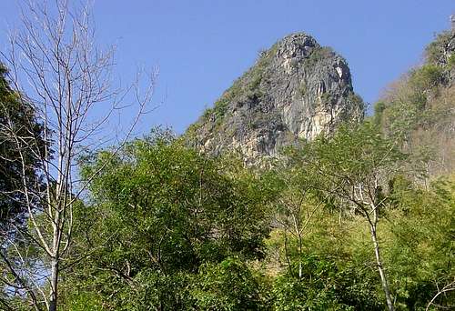 Limestone Mountains above Tham Erawan
Regions Overview
Thailand is generally divided into four regions. Here are the other three regions.
Northern Thailand - This is where the highest mountains are located. The largest city in the area is Chiang Mai. Another well-known city is Chiang Rai near the border of Thailand, Myanmar, and Laos. Even though it is located 450 miles north of Bangkok, the region is quite accessible by driving or air travel. There are two distinct areas. They are the wide plains of the lower north from Nakhon Sawan up to Sukhothai. Sukhothai was the old capital of Thailand. It lasted from the year 1238 till 1438 and has many ruins and temples in amazing condition. This area leads into the mountainous upper north that has long borders with Myanmar and Laos. Trekking is popular along with elephant riding and river rafting. These mountains are home to several hill tribes. There are also many national parks.
The Central Plains - This is where Bangkok is located. Central Thailand is the basin of the Chao Phraya River. It is fed by a large network of canals and rivers in a lush, fertile valley supporting vast fields of rice, sugar cane, pineapples and other fruit. It is the richest and most extensive rice-producing area in the country and has often been called the "Rice Bowl of Asia". Two places that you should see are Erawan National Park and Sai Yok National Park which are well known for many of their spectacular waterfalls. The former capital of Ayutthaya is located to the north and is something that should not be missed. The old temples and ruins in this city date back to the year 1350. Another place to visit is the city of Kanchanaburi which is located west of Bangkok. It has the Death Railway Bridge used in WWII, more commonly known as The Bridge on the River Kwai, made famous by the movie of the same name.
The Southern Peninsula - This region is south of Bangkok and extends down to the Malaysian border. This region has something for everybody, marine national parks, endless beaches, and several resort towns. Tourists are always having fun here and enjoying the cheap accommodations that are available. Popular rock climbing areas can be found in the province of Krabi. Winter is the best time to visit this area. On December 26, 2004, a magnitude 9.3 earthquake, erupted on the floor of the Indian Ocean. Along Thailand's Andaman coast, a tsunami struck six provinces. In Thailand, the toll was 8,000 people confirmed dead or missing. Since then, Thailand has slowly rebuilt itself out of the disaster. Tourists are encouraged to visit these areas. The country has successfully recovered.
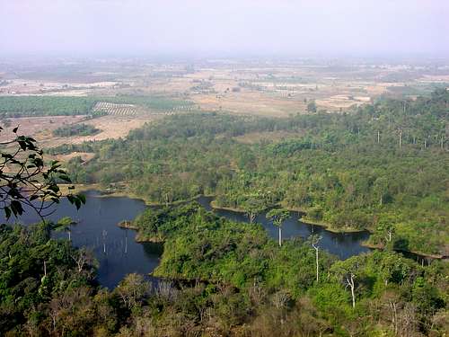 View from the summit of Phu Tok
Northeastern Thailand
Northeastern Thailand is thought to be a mysterious place by many tourists. It isn't surprising since the area is away from the mainstream of traffic. You won't see very many tour buses here. Most people describe visiting this region as seeing traditional Thai life and culture. It is called by names such as Isan and the Khorat Plateau. Thai people use the term Isan to classify the area's people, language, and food. The name derives from the early Mon-Khmer kingdom that lived in what is now northeastern Thailand and Cambodia. This region is where the greatest Khmer temples and monuments in Thailand are located.
This is often considered to be the poorest region of Thailand. Farmers make up the majority of the population. The main language of the region is Isan, which is similar to Lao, but Thai is also spoken by almost everyone. Isan can also been seen spelled as Isaan. Their food is known for being hot and spicy where peppers and chillies are prominent. Sticky rice is a staple of Thai northeastern cuisine, and accompanies almost every meal. Fish is another favorite food. The people in this region love to cook and eat roasted chicken which you can find in every town.
This is an arid region characterized by rolling terrain and undulating hills. Harsh climatic conditions often result in this region being subjected to floods and droughts. Mountains are predominantly made of sandstone, limestone, and granite. The highest mountain is Phu Luang, 1,571 meters. It is located in the Loei Province, which is one of the most mountainous areas in Northeastern Thailand. The region is bordered by Laos and the Mekong River to the north and east, and by Cambodia to the south. It is separated from Northern and Central Thailand by the Phetchabun Mountain Range.
Northeastern Thailand was the site of seven air force bases during the Vietnam War. They were used by the U.S. military to launch airstrikes on Laos and Vietnam in the 1960's and 1970's. This included the cities of Nakhon Ratchasima (Khorat) and Udon Thani (Udorn). It is still dangerous to travel off-road near the borders of Laos and Cambodia due to land mines left from the Vietnam War era.
Here is a map of Thailand and the Northeast Region
Phu Wua
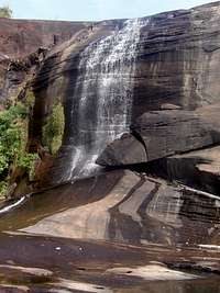
Phu Tham Phra Waterfall

Phu Wua Potholes
Phu Wua
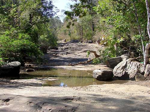
Phu Wua is about 170 km east of the city of Nong Khai. It is located in Phu Wua Wildlife Sanctuary. You can get to the Sanctuary by car from Nong Khai or take a bus along the highway and then take a tuk tuk to the Kham Pia village for the last 3 km. There are accommodations available in the nearby village Ban Kam Pia. Here visitors can stay overnight with local families learning about the lives of Thai villagers and local culture too. Phu Wua translates into "Cow Mountain." The Sanctuary was created in 1975 to protect the forests, rocks, and animals. It is ideal for one or two days trekking and visitors also have a chance to see wild animals.
It is adjacent to the Laotian border where the two borders run parallel to the Mekong River. The area is about 150-300 meters above sea level and comprises many beautiful waterfalls. In Thailand, "Nam Tok" means waterfall. Phu Wua has several including Nam Tok Chanaen, Nam Tok Tham Fun, Nam Tok Tham Phra and Nam Tok Chet Si. There are numerous potholes in the bare bedrock. They are very cool but could easily swallow up any person who might fall in. The best time to see the waterfalls are in the late rainy season from September to November when water is overflowing onto the rocks below. Although it will be flowing strong anytime during the monsoon season.
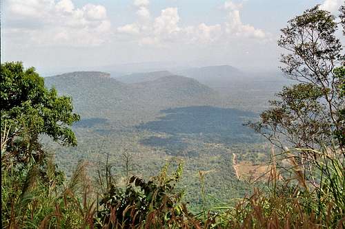
Phu Tok

Phu Tok

Phu Tok Trail
Phu Tok
Phu Tok is located at the extreme northeastern corner of Thailand. It is 140 km east of the city of Nong Khai and known commonly as the lonely mountain. It is an impressive sandstone peak that stands over the surrounding plain. Buddhist monks come from all over the region to meditate here. There are seven levels of hiking on the peak that represent the seven factors of enlightenment in Buddhist psychology. The mountain has two summits with one that is open to the public. Wat Phu Tok was used by Ajahn Juan who died in a plane crash in 1980. It was his idea to build the staircase up the mountain which took five years to complete.
It is not a strenuous hike but it is one of the most interesting mountains I have ever climbed. The regular route to the top can be done by most people. There are several alternative routes that go all the way around the side of the mountain. People who are afraid of heights may not like this. The trail was built on the side of cliffs along wooden pathways. I found this part to be fun but it was a little unnerving too. The final climb to the summit is on a dirt trail where can you pull yourself up with tree roots. There is a sign that says to watch out for cobras. Hopefully, you are not afraid of snakes. There are great views of the Mekong River valley below.
Phu Rua

Phu Rua

Phu Rua Trail
Phu Rua
Phu Rua is a great mountain to climb in the Loei Province. It can also be seen spelled as Phu Ruea. Its name translates to "Boat Mountain" for its distinct shape when viewed from far away. Some say it was named for a cliff that protrudes out of the peak in the shape of a Chinese junk. The mountain overlooks the Hueang River and Khong River. The drive from the town of Loei is very scenic. It follows a windy road through the mountains of the Loei Province. During winter the mist and clouds come down to the valley. We were surprised when we got to the trailhead early in the morning to see the temperature around 38 °F.
The trail starts from the park headquarters parking lot. It is a nice 2.5 hour hike to the summit. It passes through three forest zones. They include tropical forest, evergreen forest, and pine forest. On the summit is a beautiful Buddha surrounded by flowers. There is also a sign that says Phu Rua 1,365 meters. On a clear day you can see all the way to the Sainyabuli Province in Laos. Along the rim are trails that go to cliff overlooks that are worth checking out. Other hikes in the park include Huai Phai Waterfall. Pha Sam Tong is a high meadow with great views. Its name comes from the golden-colored lichen.
Phu Kradueng

Phu Kradueng

Phu Kradueng
Phu Kradueng
Phu Kradueng is perhaps the most popular mountain to climb in Northeast Thailand. It is located in the Loei Province. Phu Kradueng translates into "Bell Mountain." The mountain is in Phu Kradueng National Park which became the second national park in Thailand. Generally, it is a sandstone mountain, but there are also granite cliffs on top of the plateau. The most obvious thing that stands out about the peak is its huge plateau which stretches for miles. You'll be able to see the mountain from far away because of its size. In winter, Phu Kradueng is usually covered in clouds and fog. The temperature on top of the plateau can reach freezing.
It is a scenic hike through forests with views of the surrounding area. There is a maintained trail that climbs a steady grade all the way to the summit. It has a good amount of elevation gain and some people have porters carry their gear for them if they are staying overnight. Near the last part of the hike are several steep parts with stairs that have been built into the trail. There are local villagers who have set up "sams" where you can buy food and drinks along the way. This makes it one of the most unique mountains that I have visited. The villagers are friendly and happy when they see foreigners who have come to climb their mountain.
Khao Yai
Khao Yai
Khao Yai National Park is located in Nakhon Ratchasima Province. This is the oldest and most visited national park in Thailand. Khao Yai means “large mountain” and is part of the Dongrak Mountain Range which forms part of the border of Thailand and Cambodia. The park is so large that it is located in four provinces. This is also where the largest intact monsoon forest in inland Asia is located. The park is known for its waterfalls and beautiful scenery. Khao Rom, 1,351 meters, is the highest mountain in the area. The park has plenty of hiking trails, some of which were formed by animals. Many trails are well signed and maintained, but it is easy to get lost on the longer trails. For this reason, it is recommended that you hire a guide to take you to the less-traveled areas. Bring a good pair of boots to keep your feet dry.
There are around 200 to 300 wild elephants that live in the park. Other animals include barking deer, Malayan sun bears, Asiatic black bears, serows, gibbons, and wild pigs. The best time to have a chance at seeing these animals is from June to October. Most visitors go to the park during the winter season. Khao Yai is also where the largest population of great hornbills birds. In Thailand they are known as the elephant tusk bird. There are three wildlife watching towers in the park. Caves are home to several rare species of bats. There are many other mountains located here: Khao Lam; 1,326 meters, Khao Keaw; 1,292 meters, Khao Sam Yod; 1,142 meters, Khao Far Pha; 1,078 meters, Khao Kampang; 875 meters, Khao Samor Poon; 805 meters and Khao Kaew; 802 meters.
 Thailand border looking at the Dangrek Mountains in Cambodia
Other Mountains
Phu Pha Jit
Loei and Phetchabun Provinces. The highest mountain, 1,271 meters, in Nam Nao National Park. It sits on the border between the North and Northeastern regions. The entrance is located at 69 km along state highway number 12 (Don Lomsak - Chum Pae). It is a 10 km walk to the summit and takes 6-7 hours. The mountain has a large plateau with pine forest and stands alone in the middle of a flat plain similar to Phu Kradueng but smaller in size.
Phu Chong Si

Udorn Mountains
Mukdaharn Province. This peak is located in Phu Pha Turm National Park. It is a rocky mountain consisting of a high cliff with different rock layers overlapping each other. There are many other mountains located in the Park. The area is made of sandy soil which is the source of many streams such as Huai Taluak, Huai Sing and Huai Ruar.
Phu Kra Sa
Mukdaharn Province. This is the highest peak in Phu Sa Dok Bua National Park. Other peaks in the park are around 350-450 meters high. These mountains provide the water sources for many rivers and streams. There are many kinds of plants and stone fields that local people call “Dan” that are surrounding the peak.
Phu Pha Lek
Sakhon Nakhon Province. This is a large mountain with several points. It is located in Phu Pha Lek National Park. Suriyan Cliff is a high cliff on the highest peak of Phu Pha Lek Mountain. The area is a good viewpoint and favorite for enjoying the sunrise in the morning. The park is part of the Phu Phan mountain range. There are several cliffs with scenic overlooks in the area. Phu Ang Sor is the highest mountain in the park.
Phu Foilom
Udon Thani Province. This is a small friendly mountain that is great for the whole family. This was an area where dinosaurs and other prehistoric animals lived. The park has a small museum and several large statues that kids love to play around. The word dinosaur is one of the few words in the English language that is the same in the Thai language. There are some waterfalls that can be seen during the rainy season.
 Phu Foilum creek near Thanngam Waterfall
The Fauna
Thailand is a country with a tropical climate that is rich in wildlife. Some of the animals have evolved over millions of years into some of the most beautiful and interesting in the world. These ecosystems are fragile and include such wildlife as the Asian elephant, moon bears, leopards, water buffalo, plus a multitude of other mammals, birds, reptiles, amphibians, and insects. The population of wildlife has decreased over the years for a number of reasons. This includes human population growth and poaching and encroachment in protected areas. These have taken their toll and the country's flora and fauna. These wild places are now a smaller percentage of the magnificent ecosystems of the past.
Asian Elephant
No other animal is symbolic of Thailand as the Asian Elephant. It can be found in forest habitats in low elevations and higher in the mountains. A male Asian Elephant can weigh up to 11,900 pounds. An adult eats about 330 pounds per day. This is mostly grasses, leaves, and bamboo. They also like cabbage, lettuce, sugar cane, apples, bananas, papaya, and other fruits and vegetables when they are available. They feed during the morning, evening, and night and rest during the afternoon. In hot weather they look for shade and water to keep from overheating. Elephants cannot go for long without water. They need 19 to 24 gallons a day. Mature male elephants may live alone, and females usually live in family groups consisting of mothers, daughters and sisters, together with immature males. Elephants can live to be over fifty years old.
Elephants helped build the country of Thailand. For decades, they were a key to the valuable teakwood timbering industry. The elephant's unique ability to carry logs through narrow forest paths and traverse steep mountainous areas made them indispensable. In 1989, the worst flooding in the Thai history caused the death of thousands of people. The flood was a direct result of excessive timber harvesting. In reaction, and to protect the rapidly diminishing forests, the Thai government outlawed timbering. This left over three thousand domesticated elephants with no means of supporting themselves.
In Thailand, and much of Southeast Asia, elephants are now endangered. There are an estimated 3,500 to 4,500 of them in Thailand. Many of those are "domesticated". The largest group of wild elephants is only about six hundred. They inhabit a tract of protected forest along the border with Myanmar. Female Asian elephants are not affected by ivory poaching due to their lack of tusks. The overall population of Asian elephants has not decreased as drastically as it has in the case of the African elephant. The main problem is the higher ratio of female to male Asian elephants. Elephants have also been affected by persecution due to the crop damage they are perceived to cause. The single most important cause of the decline of the Asian elephant has been the loss of habitat.
Asian Black Bear

Phu Kradueng
Asian black bears are closely related to the North American black bears. They are also called moon bears, or white-chested bears, because of the sickle-shaped marking on their chest. Asian bears are omnivorous, feeding on both plants and animals. Their diet varies with availability and location and includes buds, fruits, nuts, berries, small animals and birds, carrion, insects and honey. They may also take livestock or feed on crops if in the vicinity. Asiatic black bears are medium-sized with a stocky build. They average about 198 to 254 pounds. Large males can weigh up to 400 pounds. Males are larger than females.
These bears are similar in appearance to brown bears, but are more lightly built and slender limbed. The skulls of Asian black bears are smaller but they have a particularly large lower jaw. Asian black bears tend to live in mountain forests at altitudes of 1,000 to over 3,000 meters, moving to lower-lying areas in the winter. They climb trees often and with great skill, building "nests" in which they sleep at a height of up to forty meters. In colder areas they usually sleep during the winter. The bears frequently set up their den under the roots of trees which have toppled over. The Asian black bears are considered endangered as hunting and increasing logging and agricultural activity, and other factors, are causing its numbers to decline worldwide.
Water Buffalo
Water Buffalo are also known as Asian Buffalo. Almost all of the water buffalo in Southeast Asia are domesticated but there is a small number in Thailand which are still wild. Asia is the native home of the water buffalo, with 95% of the world population of water buffalo. The wild Asian buffalo originally ranged from eastern Nepal and India, east to Vietnam, and south to Malaysia. Its numbers were substantially reduced and eliminated from much of its former range. Currently, the total world population of wild Asian buffalo is almost certainly less than 4,000 animals and may well be less than 200 animals. It is even possible that they may be extinct. Population estimates are hampered by the difficulty in distinguishing wild buffalo from domestic, feral, and hybrid buffalo.
Many Asian countries depend on the water buffalo for use in labor. It is also valuable for its meat and milk. Asian buffalo weigh between 1,500 to 2,600 pounds. They are large animals with a wide horn span of more than two meters. The wild Asian buffalo is very dependent on the availability of water. They prefer habitats with alluvial grasslands, riparian forests, and woodlands. The wild Asian buffalo eats grass and leafy aquatic vegetation. They feed in the morning and evening and stay in wallows during midday. Wild Water Buffalo are an endangered species. Their biggest threats are interbreeding with feral and domestic buffalo, habitat loss and degradation, and hunting. There are diseases and parasites that are transmitted by domestic livestock.
Monkeys

Macaque
Monkeys in Thailand include gibbons, macaque, and langur. In Northeast Thailand you will see macaque monkeys. The two most common species are the rhesus monkey and the long-tailed monkey. The rhesus monkey is very well known and have brown or grey hair and pink faces. The long-tailed macaques are also known as crab-eating macaques. This is because they enjoy eating shellfish and crab. These macaques usually travel in communal groups of twenty to sixty monkeys. Most females remain with the group which they are born in and male macaques tend to move between different groups. Macaques are smart and often use rocks to open things or to break fruit. Some monkeys are accustomed to seeing humans and are not afraid. It's not a good idea to feed them. Many tourists may not know this and if they are not careful they may lose their camera, or lunch, or hat...
Wild monkeys found in the hills and mountains are usually scared of people and won't approach too closely. Thai people believe monkeys are descendants of Hanuman, the Monkey King of the mythic Hindu figure Rama, so they respect and tolerate them. This story is based on the Indian Ramayakien. The monkey Hanuman and his army helped Rama to take his wife Sita back. She has been kidnapped by the demon Ravana. The aid of Hanuman explains why monkeys are so worshipped in Thailand. Many monkeys can be seen around temples. They are usually not chased away. Some of these monkeys can be very aggressive when they are in large groups. If you are bitten by one go to a hospital immediately as there is a risk of rabies.
Poisonous and Dangerous Animals
Here are animals that most of us do not want to encounter in Northeast Thailand. The chance of seeing a lot of poisonous animals while hiking is low. You should still use caution when walking in areas of undergrowth, dense jungles, wet vegetation, and rocky boulders. Watch where you are walking and where you put your hands. Open-toe shoes are not recommended when hiking. It leaves you vulnerable to all kinds of animals.
Snakes can be found in all areas of Thailand. There are many species and several of those are venomous. The snake that comes to the mind of most people when they think of Thailand is the King Cobra. This snake’s bite has killed water buffalo and elephants because of the amount of poison transferred. If you are bitten by a snake, seek medical attention immediately. Hospitals stock Anti-venom for the most common snake bites. Different snake species require specific anti-venom to treat the snake-bite victim. See the following list of dangerous snakes.
Less Dangerous Snakes - Small-spotted Coral Snake, Speckled Coral Snake, Red-Necked Keelback, White-lipped Pit Viper, and Large-eyed Green Pit Viper. Very Dangerous Snakes - Chain Viper, Malayan Pit Viper, Banded Krait, Blue Krait, Spitting Cobra, and King Cobra.
The ants in Thailand will attack you. Try not to disturb any giant ant piles while you are hiking. There are more species of ants in Thailand than anyone even knows about. The larger varieties are bigger than the ones I have seen in the U.S. They usually rely on brute strength to take down their insect enemies. These ants will only give you a small bite. The smaller ones have all sorts of poisons and allergens to inject. After a day or so, the worst bites can feel like someone poking you with a needle. Of course, in Thailand they eat ant eggs and larvae.
Giant centipedes and millipedes are found all over Thailand. They are kind of gross looking but their bites do not result in death. A person will probably need medical attention though. This usually requires anti-tetanus and painkillers. For several days the victim will be in a lot pain and will need to rest. The bite marks are similar to those of a small snake and centipede bites can be mistaken for snake bites in the dark. In urban areas and in the hills they can grow to the size of your forearm. During monsoon season, giant centipedes like to come indoors to avoid drowning. Your shoes or backpack can be a nice place for them to hide.
The most common scorpion in Thailand is the Black Scorpion. They rarely have a fatal sting and aren't thought to be a serious health risk. Actually, scorpions in other countries like Mexico or Iraq are more lethal compared to the ones in Thailand. The scorpions are large and can be the size of your hand. They may not look smart but they can move surprisingly fast. The smaller ones have a more painful sting since the poison in their tails is usually more concentrated. Go to the hospital if you are stung since some people may have an allergic reaction.
Thailand has a lot of big scary-looking spiders. Many people get bit by them every year. No need to worry because most spiders are not poisonous. Luckily, spider bites result in only a few deaths, but some people have allergic reactions. The most dangerous spiders are mainly found in forested areas. Some Tarantula species in Thailand have a reputation for aggression and the bites are painful. They are best treated in hospital with anti-venom. Symptoms can include swelling, exhaustion, muscle cramping, difficulty breathing, and fever. Sometimes symptoms occur days after the bite.
And I must mention leeches. They can be found anywhere in Thailand. They are common in water and wet vegetation. If they find contact with skin, they quickly attach themselves. They have tiny razor-sharp teeth that slice an opening. Then they take up to seven times their body weight in blood before leaving. In water, they swim towards any disturbance that they sense. On land, if they detect the presence of a human being or an animal they stand up and wave from side to side in a searching motion. There are leech socks aka anti-leech socks that you can buy. They look like gaiters but you put them on like a sock all the way up to just below your knee. They seem to work since they are available for trekking in some National Parks.
Mosquitoes
Everyone will encounter mosquitoes when they visit Thailand. They are not any worse here than in other tropical countries but you should still take precautions. In cities and tourist areas they are not very high risk but they are in mountainous and rural areas especially near the border. Mosquitoes are the worst during the rainy season. Malaria is carried by some mosquitoes which are most active at dawn and dusk. This isn’t the only thing you have to worry about though. There is Dengue Fever which is transmitted by the Aedes mosquito which typically bites during the day time. It usually results in fever with rash in the skin, severe headache, and muscle pains. It is usually not fatal if you are already in good health but no vaccine is currently available for Dengue Fever.
A more dangerous form of the disease is called dengue hemorrhagic fever which usually requires hospitalization and can be life-threatening. There is also Japanese encephalitis which is a viral infection of the brain. This may be contracted through mosquito bites in rural areas. Vaccinations are recommended if you plan on spending a lot of time in rural areas. Mosquito repellent with deet can be bought at many stores and is a good thing to have.
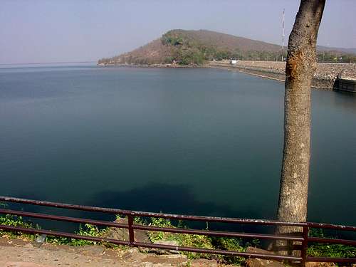 Ubolratana Reservoir in the Khon Kaen Province
The Flora
Thailand is associated with two basic types of forest including tropical forest and monsoon forest which has a distinctive dry season of three months or more. Monsoon forests amount to about a quarter of all remaining natural forest cover in the country. They have deciduous tree varieties that shed their leaves during the dry season to conserve water. About half of all forest cover consists of rainforests.

Phu Phrabat
There are thousands of species of plants. They range from bamboo to fruit trees. The Ratchaphruek is the country’s national flower. It is also known as the Golden Shower Tree. The flower is also known as "Chaiyaphruek". The reason that the Ratchaphruek is used to symbolize the nation lies in color. The yellow blossoms match the yellow of Buddhism. Thai people also regard yellow as the color of the King as well. Moreover, all golden shower trees bloom at the same time; this unity in flowering is felt to reflect the unity and identity of Thai people. Rhododendrons derive from the Greek word rhodos, meaning rose, and dendron, meaning tree. They are diverse plants because they can grow as trees, bushes, or as low ground cover.
Thailand is home to hundreds of types of orchids. The Thai word for orchid is "Gluay Mhai". Orchids are one of the most famous and beautiful flowers in Thailand. The white or pink lotus, seen floating on ponds or depicted in Buddhist art, is a sacred symbol of wisdom, purity, peace, and compassion. Another plant sacred to Buddhism is the Rose Apple. Many visitors will have seen, and perhaps tasted, the rose apple as it is available at fruit and vegetable markets. Another well-known tree in Thailand is the Jambu or Chom-poo Tree. It is a large tree that can grow 40 feet or more. With its thick, leathery leaves and long branches, the Jambu Tree offers great shade and coolness against the sun. The Bho Tree is known to botanists as Ficus Religiosa and it is commonly known as the Boddhi or Peepul Tree. It is believed that Buddha attained enlightenment in the shade of the Bodhi tree.
The Bat Plant is native to Thailand. It is also known as the "devil flower" or "tacca chantrieri". This purple-black flower looks like a flying bat. Some people say it looks like a mean cat with lots of whiskers. It usually blooms in late summer and early fall. It's a complex plant that has shiny green and white leaves. Frangipane is known as “lantom” in Thailand. It is used mostly used in Buddhist temples for worshiping. Frangipane is a deciduous plant and comes from the genus Plumeria. It can grow to a height of about 8 meters. It blossoms in three different colors including pink, white, or yellow. Most of the time, it has pink flowers. The flowers are most fragrant at night. Curcuma petiolata - Emperor is also known as "Hidden Lilly" or "Hidden Ginger". It blooms in June and is found in different colors including near white, pink and white. It comes from the family Zingiberaceae and often has tuber-bearing roots. Steams are usually short and are replaced by pseudostems formed by leaf sheaths. It is a perennial and terrestrial herb.
 Phu Phan Mountains
Early History
The area known as Thailand has been populated ever since the beginning of civilization in Asia. The earliest inhabitants were hunter and gatherers. Around 4000 BC they began farming. They grew rice. Later they learned how to breed livestock. People began metal casting and pottery making as their skills developed. Cast bronze technology in the northeastern Thailand area dates from around 3600 BC. The prehistoric settlements in Thailand were as advanced as those of China and India. Ban Chiang has been the most significant historical site in Thailand. There were hundreds of artifacts found in this area. The Ban Chiang people were very prosperous in the agriculture of Northeastern Thailand. They are known for their early bronze metals, clay pottery, and especially for pots and vases with burnt swirl designs. Archeologists would later study rock paintings in several areas of Thailand that date back 3,000 years ago

Cave Paintings
Rice growing communities were established and areas were divided into small states called Meuang. They lived in the fertile plains in what is now central and western Thailand. Some of the areas where they lived include Lopburi, Nakhon Pathom, Khu Bua, and Phong Tuk. These people shared a culture that was part of the Mon civilization during a period that was called Dvaravati between the 9th and 11th centuries. The Mons came from the same linguistic lineage as the Khmers.
The area where they settled came to be known as Syam which means golden land in Sanskrit. Syam would eventually be known as Siam. Mon dominance over central Thailand would later be replaced by the power of the expanding Khmer Empire from the east by the 11th to 12th centuries. The capital of their empire was Angkor in Cambodia. Kingdoms also formed in the North. Lanna developed into a well organized and powerful state based out of Chiang Saen. The capital was later moved to Chiang Mai in 1296. The center of the Hariphunchai Kingdom was Lamphun which pre-dates this settlement.
The Khmers controlled most of the trade routes in the Thailand and Indochina region. They were located in the area covering the northeastern region and much of the central area. The Khmers were skilled at building stone temples. Some of them can be seen in northeast Thailand today most notably at Phimai and Phanom Rung. They have a distinctive style with stone sculptures depicting Hindu gods and Buddha images. They also have prangs on their buildings which are tall, intricately carved, spires. This was a common feature of Khmer religious architecture and was later adopted by Thai builders. In Thailand, they usually only appear on the most important religious buildings. The Mons, Khmers, and Lawas, who were similar to Thais, all lived in The Chao Phraya River Basin. Khmer power eventually began to decline in the area. New kingdoms in the Mekong River valley started to emerge which were dominated by the Thai people.
Several small Thai states united to form a kingdom called Sukhothai. The kingdom existed from 1238 to 1438. Sukhothai means "The Dawn of Happiness”. The nearby city of Si Satchanalai is considered the sister city of Sukhothai, which existed at the same time. Direct family members of the Kings of Sukhothai usually ruled nearby Si Satchanalai. King Ramkhamhaeng ruled Sukhothai Kingdom from 1279 to 1298, during its most prosperous era. He is credited with the creation of the Thai alphabet and the firm establishment of Theravada Buddhism as the main religion of the kingdom.
During the reign of King Li Thai, from 1347 to 1368, many temples were built and restored at Si Satchanalai. The incredible architecture of the Sukhothai Kingdom can still be seen today. They constructed beautiful temples. Sukhothai style Buddha images are distinctive for their elegance and beauty. The graceful form of Buddha was introduced into Buddhist sculpture. The kingdom of Sukhothai ended when it was conquered by Ayutthaya. Sukhothai would later be incorporated into the Ayutthaya Kingdom as a province.
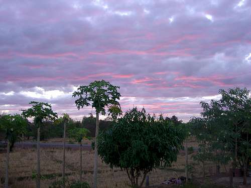 Sunset in the Udon Thani Province
Places of Interest
There are many places to visit in this region. Here are a few that I recommended.
Ban Chiang
Udon Thani Province. This is the location of the ancient Ban Chiang civilization. It is the most significant historical site in Thailand. There are hundreds of interesting artifacts and some dated from 3600 BC. There is a museum with many informational exhibits and the original excavation pit. The Ban Chiang people were prosperous in the agriculture of Northeastern Thailand. They are known for their early bronze metals, clay pottery, and especially for pots and vases with burnt swirl designs. This area was declared a Unesco World Heritage Site in 1992.
Tham Erawan

Tham Erawan
Udon Thani Province. In Thai, tham means cave and this one was named after Erawan, the triple-headed elephant in Thai mythology. The cave is located on the side of a huge cliff in a beautiful limestone mountain. The trail starts behind Wat Tham Erawan and there is a long winding staircase that you must climb in order to get to the entrance. This is where a large Buddha and cave shrine are located. It is a nice cave that you can follow all the way to the other side which ends in at the side of a large cliff with a good view of the area.
Thai - Lao Friendship Bridge
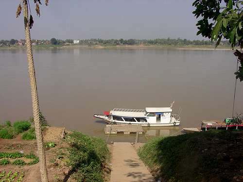
Nong Khai Province. This was the first bridge to be built over the Mekong River to connect Thailand with Laos and improve relations between the two countries. It opened to the public in 1994. Tourists can walk to the middle of the bridge, which is also the border, and take pictures. During low water levels in winter you can walk down below the bridge and buy food and eat down by the beach. If you wish to visit the country of Laos, foreigners are required to have a passport and visa.
Mukdahan Province. The second Thai - Lao Friendship Bridge has been built. It connects Thailand with Savannakhet in Laos. It was open to the public in January 2007. If you wish to visit the country of Laos, foreigners are required to have a passport and visa.
Nong Khai Sculpture Park
Nong Khai Province. This is also known as Sala Kaew Sculpture Park. It is a unique and strange place. The park is filled with over a hundred huge statues and figures of both Buddhist and Hindu images. Luang Pu Bunleua Sulilat was born in northeastern Thailand. He built a sculpture park in 1958 on the other side of the Mekong River in Vientiane, Laos. He fled back to northeastern Thailand in 1975 after the communist takeover in Laos. He then built a similar sculpture park in Nong Khai, Thailand over a period of 20 years. Sulilat died in 1996.
Historical Parks
Phanom Rung Historical Park

Phu Phrabat Highpoint
Buriram Province. Phanom Rung is the largest and most restored of all Khmer temple monuments in Thailand. Phanom Rung is the Khmer word for "big hill." It is located on top of an old volcano of 1,320 feet elevation high above the fields below. Phanom Rung was built sometime between the 10th and 13th centuries in sandstone and laterite. You should definitely see it if you are in the Buriram Province.
Phimai Historical Park
Nakhon Ratchasima Province. This is an important Khmer temple in Thailand that was started in the 11th century and finished in the early 12th century. The temple has a distinct Khmer design. But it is interesting to note that the Khmer were Hindu at that time, and it was built as a Buddhist temple. It is one of the most complete and beautiful temples in the area and is a great place to visit especially during quiet weekdays.
Phu Phrabat Historical Park
Udon Thani Province. The park is situated on the Phu Phra Bat hill of Phu Phan Mountain. There are over a hundred archaeological and cultural sites offering prehistoric rock paintings from 3,000 years ago. The area is full of large and impressive rock formations. Each rock has a plaque that tells a story. The trail takes about two hours to hike at a leisurely pace. The highpoint of Phu Phrabat gives a good view with the mountains of Laos to the north.
 The Mekong River is the border between Thailand and Laos
Local Food
Most people are familiar with the country of Thailand because of the food. Each region has its unique way of cooking its food and ingredients. To some foreigners, the types of food are described in two categories, hot and less hot. But there is much more than hot and spicy food. Northeastern food reflects the influences of the neighboring country of Laos in a number of dishes. This blending is also known as Isan food. You'll find several types of Thai noodle and soup dishes. Glutinous rice, aka sticky rice, is the staple food in every meal. It is traditionally kneaded into small balls and eaten with the fingers. The rice is usually combined with fish sauce, a common ingredient in Thai cuisine.

Fish
It is here where you'll find food that is highly seasoned with peppers and chilies. Larb is made with spicy minced meat or chicken. There is som tum which is green papaya salad, and kai yang which is barbecued chicken. Fish and shrimp are the principal sources of protein which are sometimes fermented. They enjoy eating fish with rice that they either bought at the market or caught on their own. If you are looking for something a little more out of the ordinary, many markets in Isan also sell deep-fried grasshoppers, crickets, bee larvae, silkworm, and ant eggs and larvae.
The most important crop in Thailand is rice. It is so important that the Thai word for eat is “kin khao” which literally means eat rice. The rice is usually kept in a bamboo basket. Jasmine is the most common type of rice in the country. Rice also has religious significance. It is celebrated as an example of nature’s powers of sustenance. Early each morning, mainly in smaller villages, residents leave an offering of rice for the Buddhist monks who collect donations of food and basic daily necessities in a practice known as Binderbaht. These offerings are particularly significant during harvest festivals, timing varies by region, when it is customary to celebrate all of earth’s living things and the human labor that brings them into the home.
If you visit Thailand you have to eat a durian. This spiky shaped fruit is a favorite here. Some say it has an acquired taste. Oh yeah, I almost forgot to mention, it stinks! Well, eating it is just fine, it’s just the actual smell of the fruit deters many people. It’s so bad that some places have banned it from popular areas. But seriously, you have to try it at least once. Fruits in Thailand include mangoes, papaya, jack fruit, durian, rambutans, mangosteens, pomelos, bananas, cantaloupe, watermelon, strawberries, custard apple, longan, guava, oranges, coconut, pineapples, grapes, jujube, santol, and litchee. Vegetables in Thailand include corn, tomatoes, lettuce, pumpkin, cucumber, asparagus, onion, cabbage, mushrooms, garlic, ginger, sweet peas, spinach, and hot peppers.
Beer was originally introduced to Thailand by visiting Europeans. Thais have been brewing their own beer since 1933. Many people drink beer with ice because it can be a little on the strong side as compared to beer in the U.S. The oldest and most popular Thai beer is Singha meaning Lion and is pronounced as “Sing”. Beer Chang is another brand that is quite popular. The name “Chang” means elephant. Other good beers include Leo Beer and Tiger Beer. Many people like to drink herbal tea or coffee in the morning. You can also try the mixed fruit drinks that are available. The most popular sodas in Thailand are Coke, Pepsi, and Sprite. Fanta is also very popular especially with younger people. It comes in several varieties of flavors here.
Forest Parks
Forest Parks in Thailand
There are over a hundred forest parks in Thailand. There are twenty-eight in Northeastern Thailand. I’m not going to list them all. I’m just going to mention why they are important. One thing you may notice about national parks in Thailand is that many of them started as a forest park. Then their status was updated to a national park later. Forest Parks usually focus on one or two attractions. It may be a peak, cave, waterfall, cliff, or viewpoint.
The main difference between the two is that a national park is managed by the central government that enforces protection regulations. A forest park is less protected and governed by the provincial administrations. Forest parks are also smaller in size. In Northeastern Thailand, the provinces with the most forest parks are Loei with six and Udon Thani with five. One of the most popular is Phu Phra Bat Buabok near the historical park. I think forest parks are just as interesting as national parks. Many of them are not well known but are worth seeing.
Wildlife Sanctuaries
Wildlife sanctuaries provide protection for species from poaching, predation or competition, and loss of habitat. These reserves welcome visitors, both foreigners and Thai, to promote awareness. I have been to Phu Wua Wildlife Sanctuary but haven't made it to Phu Luang Wildlife Sanctuary yet. Phu Luang is at a higher elevation and has a cool mountain climate. Phu Wua is lower in elevation. I was there in January and it was warm but not too hot. There was a lot of water there too. Accommodations are available for hikers and tourists.
Phu Luang Wildlife Sanctuary was established in 1974. This wildlife sanctuary is located in the Loei Province. It was named after the highest mountain in the reserve which reaches 1,571 meters. The large tabletop mountain covers the entire area. It has a mixed deciduous forest and dry Dipterocarp forest, savannahs, and terraced ridges. Phu Luang is well known because it is home to about a hundred wild elephants. In Thailand, their population is low but a large group of them live here. They have an elephant rehabilitation project under the patronage of the queen of Thailand.
On the east side of the mountain are dinosaur's footprints on the rock dating back 120 million years. The reserve is also famous for its wildflowers specifically over a hundred species of orchids like the lady's slipper orchid. Some other flower species include rhododendrons, white heather, magenta balsams, and blue gentians. The best season to visit is during the months of October through May. The sanctuary is closed during the rainy season.
Phu Wua Wildlife Sanctuary was established in 1975. It is located in the Nong Khai Province. It's not far from the country of Laos near the border. Phu Wua was originally surveyed in the 1960s but communist insurgency forced its establishment to wait until over ten years later. The reserve is located in forest hills and sandstone terrain along the Mekong river. The area reaches an elevation of 448 meters. The highest hill is named Phu Wua Lang Tham Sung.
There is a dry and wet environment with bamboo forests and grasslands. There were several streams and waterfalls. The water has a strong flow during the rainy season. Even in winter, there was water, and enough to go swimming. The most popular thing at Phu Wua is the herd of wild elephants which can be seen from observation platforms built in the trees. Other wildlife at the sanctuary includes leopards, deer, bears, monkeys, and gibbons, and pheasants. Phu Tok is in the same area and we visited both places. I recommended staying overnight and spending two or more days because of the amount of driving and hiking.
Peak List
The highest mountains in Northeast Thailand reach above 5,000 feet elevation. They are located in the Loei Province. The highest peak is named Phu Luang which translates into large mountain or Mountain of the King which seems appropriate. It is located in Phu Luang Wildlife Sanctuary. The most well-known mountains are probably Phu Kradueng and Phu Rua. They are hiked by many people, Thai and foreigners, each year. They both have maintained trails to their summits. Khao Rom is the highest in Khao Yai National Park which is in the Nakhon Ratchasima Province. The words “Phu” and "Khao" mean mountain and "Pha" means cliff.
Phu Pha Jit1,271LoeiPha Lom Pha Kong1,134Loei
| NORTH-EAST THAILAND : NOTABLE MOUNTAINS | ||
| Mountain | Elevation (meters) | Province |
|---|---|---|
| Phu Luang | 1,571 | Loei |
| Phu Suan Sai | 1,408 | Loei |
| Phu Rua | 1,365 | Loei |
| Khao Rom | 1,351 | Nakhon Ratchasima |
| Khao Lam | 1,326 | Nakhon Ratchasima |
| Pha Lon Noi | 1,320 | Loei |
| Phu Kradueng | 1,316 | Loei |
| Khao Khiao | 1,292 | Nakhon Ratchasima |
| Khao Sam Yod | 1,142 | Nakhon Ratchasima |
| Khao Fa Pha | 1,078 | Nakhon Ratchasima |
| Phu Sun | 1,035 | Loei |
| Phu Lung Son | 1,008 | Chaiyaphum |
| Phu Ku | 1,000 | Loei |
| Khao Lamang | 992 | Nakorn Ratchasima |
| Khao Kampaeng | 875 | Nakhon Ratchasima |
| Pha Nok Khao | 850 | Loei |
| Khao Samor Poon | 805 | Nakhon Ratchasima |
| Khao Kaew | 802 | Nakhon Ratchasima |
| Phu Khor Yai | 800 | Loei |
| Phu Pha Man | 800 | Khon Kaen |
| Phu Lan Ka | 725 | Chaiyaphum |
| Phu Pha Lom | 700 | Loei |
| Phu Pha Lek | 700 | Sakhon Nakhon |
| Phu Ang Sor | 695 | Sakhon Nakhon |
| Phu Langka | 641 | Nakhon Phanom |
| Phu Bo Bit | 600 | Loei |
| Phu Pha Yon | 600 | Sakhon Nakhon |
| Phu Ya-u | 588 | Udon Thani |
| Phu Pran Nuch | 579 | Buriram |
| Khao Ban That | 543 | Ubon Ratchathani |
| Phu Kra Sa | 481 | Mukdahan |
| Phu Pha Fag | 475 | Kalasin |
| Phu Wua | 448 | Nong Khai |
| Phu Da Sok Bua | 423 | Mukdahan |
| Phu Chong Si | 420 | Mukdahan |
| Phu Pha Taek | 420 | Mukdahan |
| Phu Pha Daeng | 400 | Nongbua Lamphu |
| Phu Phrabat | 400 | Udon Thani |
| Phu Paeng Ma | 399 | Ubon Ratchathani |
| Phu Mee Yium | 392 | Ubon Ratchathani |
| Phu Pra Srai | 362 | Ubon Ratchathani |
| Phu Sing | 300 | Amnat Charoen |
| Phu Pha Wua | 300 | Kalasin |
| Phu Pak Wan | 282 | Ubon Ratchathani |
| Phu Foilum | 250 | Udon Thani |
| Phu Tok | 225 | Nong Khai |
National Parks
There are over twenty National Parks in Northeastern Thailand. If you ask me which National Park you should visit, I would tell you all of them. Of course, no one has time to visit all of them in one trip. Khao Yai National Park is one of the most visited parks in Thailand and is on many people's list. Least visited National Parks that deserve more attention include Tat Ton National Park in Chaiyaphum Province. It has eight beautiful waterfalls including its most well known Nam Tok Tat Ton.
There are also some nice viewpoints. The least known park in the Loei Province is Phu Suan Sai National Park. Phu Wiang National Park is the place to visit if you enjoy dinosaurs. It is located in the Khon Kaen Province. Dinosaur bones were first discovered in 1976. More bones and fossils were found and the park was established. There is a small museum with life-sized models of the dinosaurs there too. A list of Northeastern Thailand National Parks is below.
Phu Kradeung National Park1962Phu Kradueng is a well-known mountain in Isan. Many people hike up to its summit each year. On top is a giant plateau which leads to other hikes. The area has a lot of flora and fauna. There are cliffs, savannas, and streams. Falls include Penpobmai Waterfall, Phon-Phop Waterfall, Tat Hong Waterfall, Tum So-nor Waterfall, Wang-Kwang Waterfall.
| NORTH-EAST THAILAND : NATIONAL PARKS | |||
| National Park | Year Created | Comments | |
|---|---|---|---|
| Loei Province | |||
| Phu Ruea National Park | 1962 | The highest peak is Phu Rua. The mountain is usually covered in clouds and fog. Other peaks include Phu Sun and Phu Ku. There are several viewpoints in the park. Falls include Hin Sam Chan Waterfall, Huai Tuai Waterfall, and Huaiphai Waterfall. Phu Rua is surrounded by interesting rock formations in which some of them have been named. | |
| Phu Suan Sai National Park | 1991 | This park was named after Phu Teen Suei Sai scenic spot in honor of the birthday of Princess Sirindhorn. There are many waterfalls including Tard Huong Fall and Nam Pah Fall. There is a viewpoint called 1408, for its elevation, where you can see Ban Muang Noi and Ban Saeng Pah. Four Stones are located in the Pu-Teen Suan Sai Mountains. | |
| Nam Nao National Park | 1972 | Named after Nam Nao Cave. Two pine forests include Suan Son Dong Paek and Suan Son Phu Goom Kow. Waterfalls include Heaw Sai Waterfall, Sai Thong Waterfall, and Tad Pran Ba Waterfall. From December to January the trees in this area change color. Phu Pha Jit is the highest peak in the park. It is a 10 kilometer hike to the summit. Pha Lom Pha Kong is a cool limestone peak that you can hike to. Phu Khor is a good viewpoint to see in the park. | |
| Buriram Province | |||
| Ta Phraya National Park | 1996 | This area is located in the Bantat Mountain Range to Dangrek Mountain Range. It is the connecting point between Thailand and Cambodia. The highest peak is Phu Pran Nuch. There are several reservoirs including Huai Yang, Lam Chung Hun, Lam Namg Rong, Lam Pra Tia, and Me Kha. Lan Kra Jiew is a rocky plain which has many Kra Jiew flowers. | |
| Chaiyaphum Province | |||
| Pa Hin Ngam National Park | 1994 | Named after a rock garden with oddly shaped rocks. Phu Pung Haui,and Khao Panom Dom are two mountains in the park. The area is the source of water of Chi River and Sonthi River leading to Parsak River. Falls include Thep Pana Waterfall and Pornpatan Waterfall. | |
| Phu Laenkha National Park | 2007 | This park is known for its rock formations and viewpoints. Notable cliffs include Keng Cliff, Orchid Cliff, and Pair Cliff. Phu Lan Ka Mountain is the highest peak. Other mountains include Phu Lan Ka, Phu Kiew, and Phu Khum Noi. There is Pra Cave and several waterfalls. | |
| Sai Thong National Park | 1992 | Named after Sai Thong Waterfall which has a large pool. The area is located in the Pung Huei Mountains. Other waterfalls include Chuan Chom and Klong Sai. There are Kaew Cave & Pra Cave and Khao Pung Huai Viewpoint. Pha Hum Huet is a photogenic rock overhang. | |
| Tat Ton National Park | 1980 | Named after Tat Ton Waterfall. The park is located in the Phu Lanka Mountains which is near the Lum Pa Tao River. Some of the peaks include Phu Kaset, Phu Dee, and Phu Youk. There is Phu Kong View Point and several other waterfalls including Pha Eang and Tat Fa. | |
| Khon Kaen Province | |||
| Nam Phong National Park | 2000 | Named after the Nam Phong River which flows into Ubolratana Reservoir. In the northern part of the park is the Phu Phan Mountain Range and in the southern part is the Phu Meng Mountain Range. There is Phu Meng mountain and Hin Chang Si viewpoint which has a formation shaped like a skull. Pha Sawan is a nice hike to a rocky viewpoint overlooking the park. The Famue Daeng Cliffs is another good hike in the area. | |
| Phu Kao - Phu Phan Kham National Park | 1985 | This park is named after two mountain ranges located near Ubolratana Reservoir. Phu Kao, in the Phu Kao Mountain Range, has a large plain in the center. The outer ridge consists of high mountains and the inner ridge consists of lower mountains. Phu Phan Kham, in the Phu Phan Mountain Range, is a long mountain range lying northeast and southwest. The southwest part is near the big valley of Lam Nam Phong. | |
| Phu Pha Man National Park | 1991 | Located in Khon Kaen and Loei Provinces near the Nam Phong River. The park is known for its many caves and waterfalls. Pa Ya Nakarach Cave is probably the most well known.. Other caves include Pha Puong Cave, Phu Ta Lor Cave, Lai Thang Cave, and Kang Kow Cave. Waterfalls include Tad Yai, Tat Hong, Tad Fha, and Plan Thong. | |
| Phu Wiang National Park | 1991 | Named after the Phu Wiang Mountains. This park is known for its dinosaur fossils. There is a trail which goes to several of the sites. There is the Phu Wiang Dinosaur Museum which you can visit. The first dinosaurs fossils were found here in 1976. There is also Hua Phu Chon Reservoir and waterfalls including Tat Pha Falls and Thap Phaya Sua Falls. | |
| Mukdaharn Province | |||
| Phu Pha Turm National Park | 1988 | Phu Pha Turm is also known as Phu Pha Terb. This park has many interesting rock formations that overlap each other. Phu Mano is a peak with a great view. Phu Chong Si is the highest mountain. Other peaks include Phu Nang Hong, Phu Thum Pra, and Phu Hin Terb. There are historical caves called Phamua Dang Cave and Phu Tam Pra. | |
| Phu Sa Dok Bua National Park | 1992 | This park is named after Phu Sa Dok Bua which is located on the border of three provinces. The mountain has natural ponds containing colorful lotus. The park has a stone field with Bonsai Shorea Trees. The highest mountain is Phu Kra Sa. Other peak include Phu Mu, Phu Phangma, Phu Mai Sang, Phu Khong, Phu Akkarachat. | |
| Nakhon Phanom Province | |||
| Phu Langka National Park | Phu Langka is the highest peak in the park. The mountain is surrounded by cliffs. This area has three mountains that overlap each other running north to south. Waterfalls include Tard Kham Waterfall, Tard Phor Waterfall, and Kinaree Waterfall. Phu Langka also has a large plain of neatly shaped rocks. Some are named and have carvings. | ||
| Nakhon Ratchasima Province | |||
| Khao Yai National Park | 1962 | This was the first national park in Thailand. It is one of the most popular in the country for trekking and seeing wildlife. There are several trails to choose from. You can go hiking on your own with permission. You can also hire a guide to go trekking for several days. The park has animal observing towers that can be used from morning to evening. There are numerous waterfalls. Khao Rom is the highest mountain. Other peaks in the park include Khao Lam, Khao Keaw, Khao Sam Yod, Khao Far Pha, Khao Kampang, Khao Samor Poon, and Khao Kaew. | |
| Sakhon Nakhon Province | |||
| Phu Pha Lek National Park | Located in the Phu Phan Mountain Range. Ho Song Dao is located on Phu Pha Lek and is a good place to watch the stars and is popular for seeing meteor showers at night. The mountain is surrounded by cliffs including Dong Ko Cliff, Nam Chok Cliff, and Suriyan Cliff. There are several waterfalls and reservoirs in the park. | ||
| Phu Pha Yon National Park | 1987 | Named after a big cliff in this mountain range that is two hundred meters in height. Rock art on the face is about 3,000 years ago. There are reservoirs and caves. The Khum Namsang is the highest waterfall. There is also Kaeng Po Waterfall and Huai Lout Waterfall. | |
| Phu Phan National Park | 1972 | Named after the Phu Phan Mountains. The range is well known but not visited as much as other places. The ruins of Phra That Phu Phek are located on the mountain. There are two cliffs named Nang-mern and Savoye with good views. Waterfalls include Pree-cha Suk-san, Kreng Ka-arm Waterfall, and Kam Hom Waterfall. | |
| Sisaket Province | |||
| Khao Phra Wihan National Park | 1998 | Located in the Dangrek Mountains on the border of Thailand and Cambodia. Preah Vihear is a Khmer temple situated atop a 1,722 foot cliff. The cliff is known as Pha Mor E-daeng. Most of the temple was built during the 10th and 11th centuries. It is located in Khao Phra Wihan National Park and is more safely accessible from Thailand. | |
| Ubon Ratchathani Province | |||
| Kaeng Tana National Park | 1981 | Named after Kaeng Tana Rapid, a sandstone rapid in the middle of the Moon River. Don Tana is a small area that separates the Moon River into two lines. Falls include Tad Ton Waterfall, Rak Sai Waterfall, Huay Kwang Waterfall and Huay Mark Creek and Waterfall. | |
| Pha Taem National Park | 1991 | This park is known for its rock art. One rock wall has paintings dated 3,000 to 4,000 years old. There are impressive cliffs such as Pha Taem Cliff, Chek-Moei Cliff, and Pha Chanadai Cliff. You can see Sao Chaliang Rock Pillars and Phu Krabo which is a sandstone cliff. | |
| Phu Chong Na Yoi National Park | 1987 | This park is close to the border near Laos and Cambodia. It is located in the Dangrek Mountains. Huai Luang is a beautiful waterfall on a cliff face. Other Falls include Praown Raor and Kreang Mae Fong. Two viewpoints are Phu Hin Drang and Pa Piew View Point. | |
| Udon Thani Province | |||
| Na Yung - Nam Som National Park | 2004 | This national park was named after Na Yung-Nam Som Forest located in the Phu Phan Mountains in the Udon Thani Province. Yung Thong Waterfall flows 25 meters off a cliff. The falls was named after the Green Peafowl which has since become extinct. The Pha Daeng viewpoint can be reached by hiking along the Namtok Yung Thong nature trail. | |
Getting There
Thai Airways International operates flights in the United States from the city of Los Angeles. Most people will be flying into Bangkok. For more information go to the website for Thai Airways.
By Air - There are several provinces in northeast Thailand that can be reached by air. They include Nakhon Ratchasima, Sakon Nakhon, Khon Kaen, Udon Thani and Udon Ratchathani.
By Car - Isan is easily accessible with four major highways connecting it with other regions. Inter-provincial transportation are also among the best and most convenient. From Bangkok, take Highway 1 (Phaholyothin) to Saraburi, at Km. 107 take Highway 2 (Friendship Highway) through Nakhon Ratchasima and Khon Kaen provinces.
By Bus - Air conditioned coaches and non-air-conditioned buses leave Bangkok's Northeastern Bus Terminal (Mo Chit) on Kamphaengphet 2 Road every day between 5.00 AM. and 10.00 PM.
By Train - Bangkok railway station at Hua Lamphong, Rama 1V Road is the center for trains to northest provinces. The northeastern provinces that can he reached by train are Nakhon Ratchasima, Buri Ram, Surin, Si Saket, Khon Kaen, Udon Thani, Nong Khai and Udon Ratchathani.
The Weather
The northeast has a three season climate: Winter, Summer, and the Rainy Season.
Winter is the best time to visit this region. This is from November through February. Nights can be chilly but by afternoon temperatures are comfortable. This region experiences the most extreme temperature changes in the country. During summer, the lowlands have the hottest temperatures. In contrast, during winter, the mountainous areas have the coldest temperatures.
Thailand has a warm, tropical climate affected by a seasonal monsoon. The summer period, or hot and dry season, is from March to June. Try and avoid April because this is the hottest month across the country.
The rainy season is from June to October. The monsoons finish when the wind direction changes. This season can be described as unpredictable and not the constant downpour of rain like you would expect. The middle months of this season may hold particularly heavy rains in the northeast region.
Red Tape
A Passport is needed for any foreigners staying in Thailand for less than 30 days. If you plan on staying longer a visa is required. Anyone who wants to travel over the border into Laos and Cambodia will need a visa. They can be obtained from the Laotian Embassy or Cambodian Embassy in Bangkok, The consulate at the city of Khon Kaen, and at offices near the Friendship Bridge in Nong Khai.

Be Careful of Land Mines near the border
The currency of Thailand is called baht. The exchange rate fluctuates each year. Currently, about 33 baht = 1 U.S. dollar. Coined money is called satang. There are 100 satang in 1 baht. The cost for entrance into a national park is usually 200 baht for foreigners and 20 baht for Thai citizens. This two tiered system is common in Southeast Asia.
Laos was isolated from the rest of the world for almost two decades. In 1992, the country decided to open its doors to tourism. The Thai-Laos friendship bridge near Nong Khai in northeastern Thailand has increased relations between these two countries. Travelers should be aware that there have been occasional incidents of violence on Thailand’s northern and eastern borders with Laos. Caution should be exercised because of land mines near the border.
Cambodia is one of the most heavily mined countries in the world. There are millions of mines left over from wars. The country is also littered with a lot of unexploded ordinance. These are left over from all of the bombs dropped on Cambodia in the late 60s and early 70s. Just walking anywhere into the jungle on your own is not a good idea. Tourist areas near the border of Thailand and Cambodia are usually well posted for land mines.
In recent years, there has been ongoing political conflict in Thailand. This has been between the People's Alliance for Democracy (PAD), also known as the Yellow Shirts and the United Front for Democracy against Dictatorship or (UDD) and Democratic Alliance Against Dictatorship or (DAAD), also known as the Red Shirts. It has caused protests and riots which have resulted in injuries and death. Most of these conflicts have happened in Bangkok but it has also happened in other areas. Before going on a trip, check current conditions to see if there are any conflicts which may be dangerous for tourists traveling to Thailand.
Books & Maps
1) Lonely Planet : Thailand (Country Guide) : 13th edition
By China Williams, Mark Beales, Tim Bewer, Catherine Bodry, Austin Bush, and Brandon Presser. I’ve always found Lonely Planet guides to be helpful. This book covers all areas in Thailand. Several national parks are also mentioned in the book.
2) Fodor's Thailand : 11th edition
With Side Trips to Cambodia & Laos. This Fodor’s guide has a lot of information and is full of color photographs.
3) Thailand : Nelles Maps : Folded Map
By Nelles Verlag. This is a detailed map that shows major and minor roads and mountainous areas in Thailand.
4) Thailand Deluxe Atlas : 3rd edition
By Thinknet. Bilingual English and Thai - 1:550,000. This is the best atlas available for Thailand. Large Format 13.5 x 10 inches and 156 pages.