

-
 52301 Hits
-
 96.75% Score
-
 62 Votes
|
|
Area/Range |
|---|---|
|
|
15.81591°S / 68.54334°W |
|
|
Hiking, Mountaineering |
|
|
Spring, Summer, Fall |
|
|
20997 ft / 6400 m |
|
|
Overview
Cordillera Real
The Cordillera Real is a mountain range belonging to the Andes, exactly to the Cordillera Oriental. It is located in Bolivia, to the East of La Paz, and in Ecuador. It's separated from the Cordillera Occidental by the highlands. When the Spanish conquerers (Conquistadores) arrived in the mid 16th century in that area of South America, they were so stunned by the beauty of the mountains that they called this range "Cordillera Real" (Real meaning Royal... and not "real"). In the ancient time, these mountains were adored by the local Aymara civilisation, but were not climbed as they are covered with glaciers (unlike high summits in Peru or Argentina which were climbed by Inca and Pre-Inca ethnies).
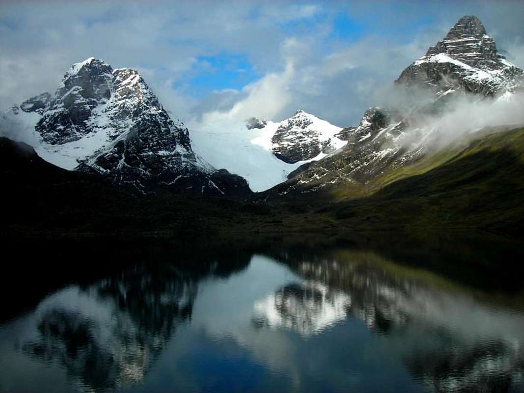
Nowadays this range is one of the prime destination for climbers from all over the world, for a good reason : altitude, alpine climbing, accessible routes and rather good weather conditions throughout the year (apart from January to March when it may snow heavily). The highest mountains belonging to the Cordillera Real exceed 6000 meters above sea level and are:
Illimani 6438 m
Ancohuma 6427 m
Illampu 6368 m
Huayna Potosì 6088 m
Chachacomani 6074 m
Pico del Norte 6070 m
 |
 |
 |
 |
 |
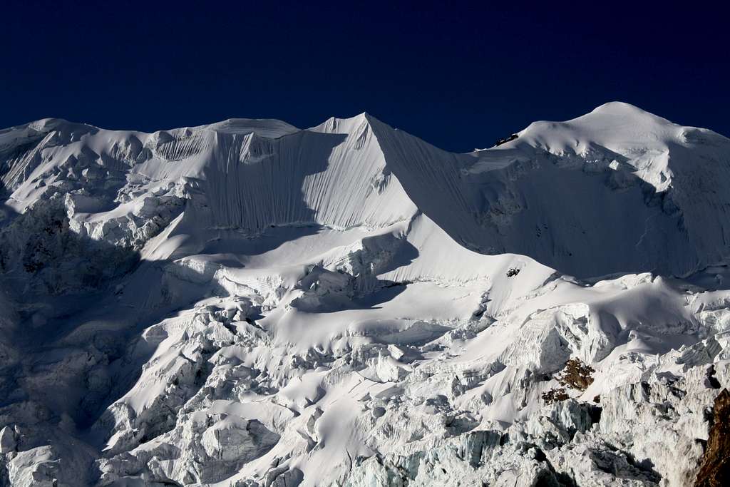
From left to right: Illimani - Ancohuma - Illampu - Huayna Potosì - Chachacomani
Cordillera Real also provide a magnificent landscape for hiking (ideal for acclimatising).
The ranges goes from almost Lago Titicaca (on its North West tip) down to the suburbs of La Paz (on its South East tip), and is about 150 kms long.
Getting There (La Paz)
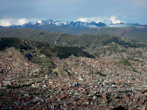
The big town is of course La Paz. To reach it you can either :
-> fly with American companies, as the national company (LAB) ran bankrupt in April 2007.
-> take a bus from Peru (direct services from Cusco and Puno / from Chile (direct service from Arica).
In both cases try not to take a Bolivian company as their quality is usually poor.
If you are already in Bolivia :
-> from Sucre, Cochabamba and Santa-Cruz : you can fly with Aerosur (always safer to fly than take a long ride by bus)
-> from Uyuni or Potosi : only buses are available
From La Paz, then you will have different options depending on the area of the Cordillera Real.
Access is described below, for each group of the Cordillera.
Mountain groups within the Cordillera Real
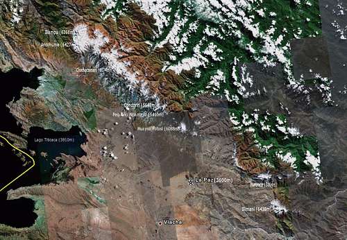
1. Illampu / Ancohuma Group :
On a clear day a spectacular view of this part of the Cordillera can be seen from Isla del Sol, on Lago Titica. It offers some of the most technical climbs in Bolivia.
The access town is Sorata. There are several daily direct buses from La Paz to reach it.
| ______Mountain______ | Altitude | Climbing Level | ________Photo________ |
| Ancohuma | 6427m | PD / AD |
 |
| Illampu | 6368m | AD/D |
 |
| Pico Schulze | 5943m | PD/AD |
 |
| Umalajanta | 5723m | F | |
| Viluyo | 5540m | PD |
2. Chearoco / Chachacomani Group
This area is the less accessible of the whole Cordillera.
You will need to hire a 4x4 transportation to reach Peñas and then Lloco Lloconi.
| ______Mountain______ | Altitude | Climbing Level | ________Photo________ |
| Chearoco | 6104m | AD/D | |
| Chachacomani | 6074m | AD/D |
 |
| Jallawaya | 5670m | PD | |
| Janco Laya | 5545m | F | |
| Janco Huyo | 5512m | F | |
| Negruni | 5468m | F | |
| Culin Thojo | 5368m | F | |
| Wila Llojeta | 5244m | F |
3. Condoriri / Huayna Potosi Group
Located North East of La Paz, it is the faster range to reach.
Condoriri, Pequeño Alpamayo and the South Face of would be accessed from Tuni (about 2h by 4x4 from La Paz).
For the normal route of Huayna Potosi, the access is much faster through Miluni, where there is a hut for base camp.
| ______Mountain______ | ____Altitude____ | Climbing Level | ________Photo________ |
| Huayna Potosi | 6088m | PD |
 |
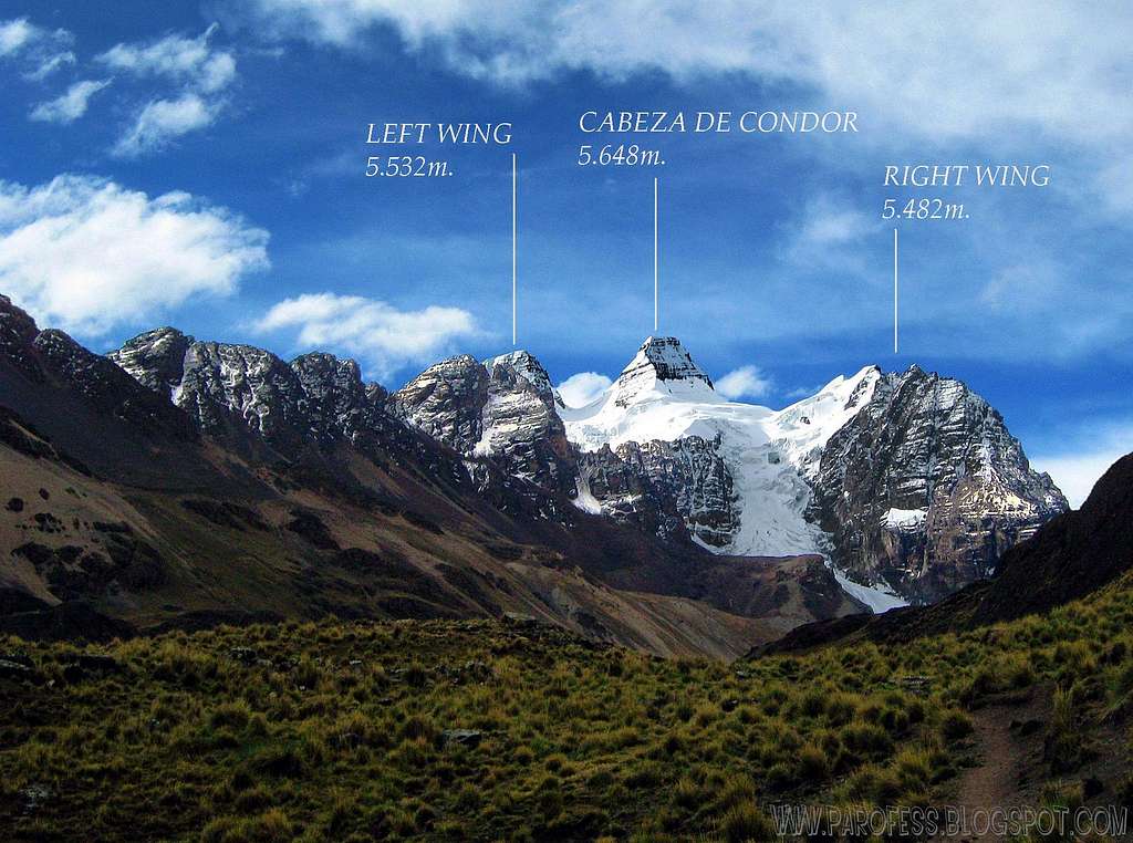
| Condoriri | 5648m | AD/D |
 |
| Maria Lloco | 5522m |
 |
|
| Pequeño Alpamayo | 5410m | PD |
 |
| Chacaltaya | 5395m | F |
 |
| Aguja Negra | 5336m |
 |
|
| Khala Huyo | 5324m | PD | |
| Piramide Blanca | 5230 m | PD |
 |
4. Illimani Group :
Located South East of La Paz, 4x4 transportation will also be required as no public transportation is going there.
The main entry point is Palca.
| ______Mountain______ | Altitude | Climbing Level | ________Photo________ |
| Illimani | 6438m | PD/AD |
 |
| Mururata | 5864m | F |
 |
| Serque Qollu | 5546m | ||
| Jati Qollu | 5421m | PD/AD | |
| Huacani | 5321m |
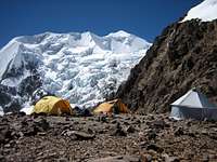
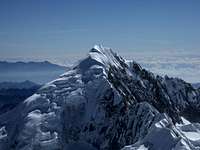
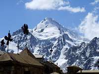
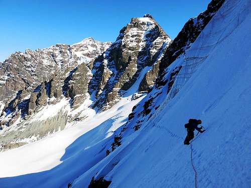
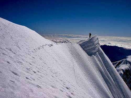
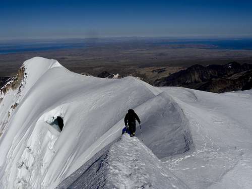
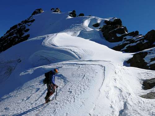
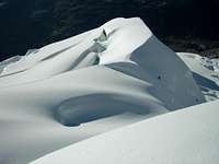
Climbing images
When To Climb
The best time to climb in the Cordillera Real is between May and September, when the weather is dry. Usually June, July and August are the best months anyhow. This period is the Bolivian winter, which is dry and when normally the weather is quite stable. Possible some fresh snowfalls sometimes. The wind starts in July and as the season progresses more crevasses appear in the glaciers and the "penitentes" in the snow grow. From November to March, the temperature is higher, but the rain will make any climb unpleasant and dangerous, since the cocktail of hot weather plus rain plus snow is not very appealing.
Hiking in Cordillera Real


Apart from climbing, Cordillera Real is a beautiful place for hiking. It will provide incredible landscapes with high mountains, glaciers, and lakes. Walking there is a great way of acclimatising before attempting a summit, as you will go through 5000m passes.
The most common hikes are :
-> the 3/4-day trek from Tuni to Huayna Potosi base camp
-> the 7-day trek around Illampu
-> the 3-day hike to Laguna Glacial (within the Illampu range)
More information on the maps below :
 |
 |
 |
Meteo
Useful information

"Bolivia, a Climbing Guide" - Brain, Yossi, The Mountaineers, 1999
"La Cordillera Real de los Andes - Bolivia" by Alain Mesili (www.andes-mesili.com), comes in English under the title "Andes of Bolivia"
"Lonely Planet Bolivia" - Swaney, Deanna, 4th ed.
As far as weather forecast and climate are concerned :
You can watch a 5 min video of Illimani here: A video of Illimani (youtube)
There are plenty of hotels and agencies in La Paz.
Agency Alberth Bolivia on Illampu 773 (can organise all sorts of treks and ascents in Bolivia, for a very competitive price)
Bolivian Journeys Bolivia climbing specialists based in La Paz, expeditions and logistics throughout the bolivian Andes. www.bolivianjourneys.org mail:boljour@entelnet.bo
Kanootours