
|
|
Area/Range |
|---|---|
|
|
59.58441°N / 158.76343°W |
|
|
Hiking |
|
|
Spring, Summer, Fall, Winter |
|
|
Overview
Alaska's Wood-Tikchik state park (map) is the largest and most remote state park in the nation, at 1.6 million acres, 2500 square miles, it's bigger than Delaware. It takes it's name from two major river-connected lake systems within the park. In total there are twelve major lakes. The lakes are between 7 and 45 miles long and tend to be very deep but the rivers are shallow and swift. The Western half of the park is dominated by the Wood River Mountains.The park is adjacent to Togiak National Wildlife Refuge, which in turn is adjacent to Yukon Delta National Wildlife Refuge. The combined size of these contiguous public wilderness areas is over 38,000 square miles. Big, Alaska style big, 13 states including states like Maine are smaller than this wilderness. This entire area is amazingly remote, undeveloped and unpopulated.
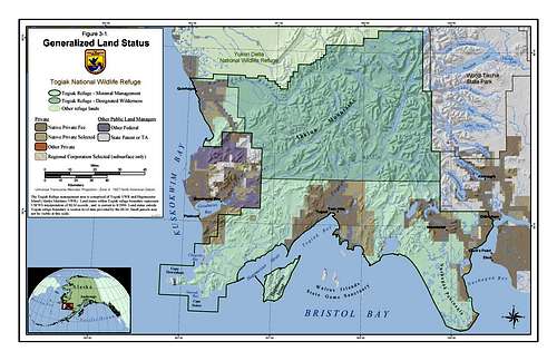 Togiak National Wildlife Refuge is adjacent to Wood-Tikchik State Park
This is not a high elevation mountaineering destination with the tallest peak at around 5000', but if you want to do a FA of a peak, there are still some here, that no one has ever climbed. The river trips in this park just can't be matched anywhere else in the world.
The Wood River Lakes Trail (map) is comprised of five lakes from 20 to 45 miles in length and are connected by short rivers. About 115 miles in total length, the trail starts at Lake Kulik then descends, in order, the Wind River, Mikchalk Lake, Peace River, Lake Beverley, the Agulukpak River (a world class Rainbow Trout river), Lake Nerka, The Agulowak River, and Lake Aleknagik. These lakes and rivers are adjacent to the Wood River Mountains. Short stretches of Class 2 whitewater can be found on several of the interconnecting rivers.
Tikchik River Trail(map)
60 miles in length, the Tikchik River originates in both Nishlik and Upnuk Lakes. Both forks begin above treeline and provide swift, class I, boating until they join approximately 10 river miles below Upnuk Lake. Tikchik Lake is noted for its numerous large granite domes raising up to 1,000 feet in sheer cliffs from the lakes southern shore
The Nuyakuk lakes system
This system is six lakes interconnected by rivers.
(quote from Alaska DNR)
Extreme caution is recommended when approaching the upper Nuyakuk River rapids and falls, just below Tikchik Lake outlet. Portage is advised. The Allen River, which drains Chikuminuk Lake into Lake Chauekuktuli requires several portages around Class V+ rapids.
Getting There
The best way to get to the Wood-Tikchik State Park is through Dillingham. It's about 350 miles from Anchorage to Dilligham and there are daily flights.Since there are no roads to get around this park, in the summer traveling is either by plane or boat. From Dillingham you have choices, if you have a schedule, and want the most direct way to get to your destination charter a bush pilot to fly you in to where you want to go. Call Tom at Bay Air, take his advice, he knows what he is doing and he's the best around, I have flown with him a lot and trust him with my life. When you hire a bush pilot it is like taking on a partner, make sure you have a safe one.
 Float Planes are the best way to get around.
In the summer landing in the bush means finding an unimproved landing "spot", usually on water (more predictable) or a gravel bar in a river (take your chances on finding one within miles of where you want to go).
You also can drive from Dillingham to the lowest lake in the system, Lake Aleknagik. It is about 20 miles on improved road, one end of the road is at Lake Aleknagik the other is in Dillingham, that's it, you can't go anywhere else, there are no roads connecting to any other town. If you just want to get to the lakes in the cheapest way possible, hitch-hike, you will easily get a ride, although it may be in the back of a truck in the rain.
The other way is to hitch-hike by river. The Wood river is several miles long and goes along side Dillingham, it also will get you to Lake Aleknagik. I would plan on offering to pay, at least for gas and maybe more to get ride up the river. Depending on the time of year and you luck and resourcefulness you might spend a day or a few days trying to get a lift.
Either driving or by boat can get you to the edge of the Park in Aleknagik. After that you will still need to get around, there are no improved trails to by boat is still the preferred method. There is quite a bit more boat traffic on the lake than in the Wood River. In the summer you could probably get a ride to the upper end of the lake without too much trouble for free. Smile and ask nicely, someone will give you a ride.
It is possible to go up the Nushagak River and other rivers to get to the upper lakes in the system, but not very practical, it would be a very long trip. You could hire a jet boat but there are no services that I am aware of and you could spend days traveling up.
External Links
Alaska Department of Natural ResourcesNushagak, Mulchatna, Wood-Tikchik land trust
National Geographic photo gallery
I have a great deal of experience with this Bush Pilot and can guarantee he is the best.
Camping and fishing
You may be thinking of Wood-Tikchik like other parks in the lower 48 states. If you are, then you are wrong. No roads, no development, and for most of the year almost no people. During the salmon runs there will be a few fishermen around but that's about it. This is truly a huge chunk of completely undeveloped wilderness.Most people come here to fish. Fishing here is world-class, it is home to all five species of Pacific salmon. In July, the world's largest run of red salmon run from the Pacific up the rivers to spawn. It is not unusual for over 1 million salmon to migrate up the Wood river in the summer. And of course where there are salmon there are bears, grizzly bears are a common site along the salmon rivers in the summer.
The vast majority of the park can only be accessed by float plane, boat, or foot.
Red Tape
The entire park is open to camping. However, several locations in the Upper Tikchik Lakes require a permit. Nishlik, Slate, Upnuk and Chikuminuk Lakes, in addition to Tikchik River float trips require a permit prior to camping or floating. Camping and river float trip permits are limited and require a $100 fee. Please call the Dillingham Parks Office, Alekangik Ranger Station (907) 842-2641 for additional information and current permit availability.Camping at a specific location in the park is limited to 10 consecutive days, after which the camp must be relocated a minimum of one mile distant from that location. Campfires are restricted to beaches or gravel bars.
Chikuminuk Lake is closed to the use of motorized watercraft, but is accessible by aircraft. All other lakes in the park are open to motorized boats.