
|
|
Area/Range |
|---|---|
|
|
41.51179°N / 19.83917°E |
|
|
Hiking, Mountaineering, Trad Climbing, Sport Climbing, Toprope, Bouldering, Ice Climbing, Aid Climbing, Big Wall, Mixed, Scrambling, Via Ferrata, Canyoneering |
|
|
Spring, Summer, Fall, Winter |
|
|
I. Mountain and Rock Climbing in Albania
Ne bjeshke, ne vrri e ne kujri, si te katundit si te flamurit gja s'i shitet e pjese zotnimi nik mundet me pase kurr; sa per kullose e per dru e almiste i nepet lirija e perdormit per ndere.Nothing may be sold or become private property in the upland or lowland pastures or in the common property of the Village and Banner, because these are free for the use of everyone...Kanuni i Lek Dukajinit, LV.229
Sketch of Contents Below
The materials below provide details how to to access and enjoy some of the major rock and mountain climbing areas in Albania, viewed against the context of its unique and ancient cultures of highlanders and mountaineers. It works geographically out from the capital region of Tirana and its nearby mountain town Kruje northwards and eastwards into the 'Albanide' or Albanian 'alps.' These are perhaps most properly the southern portion of the Montenegrin limestone plateau of the Dinaric Range of jagged limestone mountains which from Albania reach north into Montenegro, Bosnia and Herzegovina (where the formation from which the name 'Dinaric' derives), and the other new nations of the former Yugoslavia. The table of contents to the right indicates the various chapters of the text according to the region or district of Albania covered. Some of the areas are associated with annotated maps, and the relevant photographs have asterisks and italics to indicate the annotatations on the associated numbered maps. Thus, italics followed by a number and asterisk indicate that this image or area is marked thusly on the relevant numbered topo. Many of the photographs, especially those introducing areas or gorges or mountain basins, indicate their locations via the Google Maps tele-atlas associated with SummitPost. Where position of features in terms of degrees and minutes North and East are provided, these can serve to locate the feature in the center of a quad on Google Earth, Panoramino, etc. at those enumerations. For quick orientation, as descriptions begin in terms of District borders and their chief towns, a map is provided at the end for those who don't have Albanian geography in perfect memory, with district towns marked and district borders in green. AMapy.CZ provides a useful road map, marking the main routes and the main towns described below which could be opened in a separate tab while reading for orientation purposes.
Note on Communication and Spelling
In asking directions, it is useful to keep in mind that Albanians nod 'no' by shaking their head up and down, and 'yes', a much more frequently seen expression, by nodding their head sideways, with a slight figure eight bob and generally a smile, reminding one of the Indian subcontinent perhaps. The Albanian language is odd to pronounce and spell, as much due to the strange orthographic form it took when it was written down under the influence of 19th century central European nationalism as the circumstance that, it constitutes its own unique branch of the indo-germanic languages. But like languages with recent orthography, it is at least completely consistent. Unfortunately, local differences in Albania and general unacquaintance with the language outside means that spelling, especially of territorially relevant proper names, can be confusing, particular since many of the territorial names are either ancient or of foreign extraction, and all the languages in the area have complex word-ending patterns that will then 'appear' different when transliterated. For simplicity's sake, I generally use Albanian words, albeit without their linguistic accent marks, and only include the Slavic or Greek terms in parentheses on the first occasion where the relevant peaks are in the immediate vicinity of the relevant border; where there is real lack of clarity or substantively different names or name dispute relating to Albanian, to the other regional languages (Serbo-Croat, Macedonian, Greek), or to translating this in to English, attempt has been made to indicate the issue so that a word search to the first or most important usage provides clarity.
==
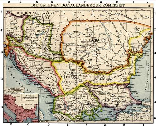
An old map of the lands south of the Donau during Roman times. Illyricum amongst the Roman Provinces
==
SummitPost already has a useful table of some expressions charted in Albanian, German, English, Italian and Serbian (which itself is similar to Macedonian). Mal (often with an ending, e.g., '-i' for singular and '-a' for feminine) is 'Mount'. Maj, likewise, is 'peak', fushe is 'field', and qaf is 'pass'. Since 'peak' in English nearly always refers to a related subsidiary summit (e.g., Mt. Wilson, Wilson Peak), its more common use in Albanian for major summits should be kept in mind, related to the fact that more than usually Albanian mountains are pointed at the top rather than rounded. Thus the Maja Jezeres, the tallest peak in the northern Accursed Mountains, is more precisely 'Jezerce Peak', with 'Jezerce' derived from the Serbo-Croat word for 'lake', jezero; it has traditionally been called 'Jezerca' in German and 'Crête du lac' in French. Literally in English this would be 'Peak of Lakes', given the beautiful glacial lake basin from which it is most spectacularly viewed, just to the north and just inside the Montenegrin border from which the peak has been most often approached via the Ropojana. But for the purposes of recognition, whether you read this name as 'Mount Jezerce' or 'Jezerce Peak', with or with out Slavic or Albanian endings, one is speaking about the same item, as long as the '-ë' ending is pronounced with a short 'a' sound, thus 'Ye-Zer-Cha.' The definite singular ending '-i' is also, as in many European languages, used as a familiar, like Joan 'Joni' Mitchell, or Daniel 'Der Dany' Cohn-Bendit - thus e.g. the Albanian first name Bledar as 'Bledi.' Names appear on the map infinitively, but a spoken definitively, thus 'Kukes' and 'Kukesi.' Finally, 'Albania' is derived from Latin, indeed is for instance also the old expression for 'Scotland' even though of course it is also a much older expression for Albania; the Albanian word for 'Albania' is Shqiperi and for Albanian is Shqiptar, which also means 'eagle' - thus 'land of the eagles', which will of course be more meaningful at some point when the species recovers to more than token size...
==
Mt. Kokkervates in the Jezerza Group as seen from the Montenegro approach.
==
Introduction to Climbing in Albania
Geography and Geology
Albania is a small mountainous coastal republic lying on the Adriatic Sea. It is bordered in the south by Greece and in the north by the countries of former Yugoslavia -- by Montenegro in the northwest, by Kosovo in the northeast, and by Macedonia in the east. Seventy percent of the country is mountainous, frequently rugged and inaccessible. Administratively, the country is divided into twelve Quark or 'prefects'/'counties' and 36 Rrethe or 'districts.' The Rrethe are roughly comparable in size and to their equivilent in the United Kingdom or to what are called 'municipalities' in the countries of the former Yugoslavia, but with more strongly felt differences. Where an Englander from an obscure town or village would be from their 'county' to establish recognition, or a Greek from their Prefect or even Perifery, an Albanian is more likely to specify the District, which also provide a more precise unit for characterizing the distinct and changing mountain environment of the region.
 Albania in Roman Times
The mountainous character is evident by viewing a chart of the high-points by District: insofar as while no peaks are over 2800 meters(m), only two of the twelve Prefects have highpoints lower than 2000 meters (6500ft) and many many peaks are in the 2500m (8200ft) range. A full third of Albanian territory is over 1000m (3300ft). Most of this mountain material is Dinaric or Hellenide limestone that constitutes the essence of the climbing environment, though through much of the central uplands in from the coast, a serpentine base to the geology is predominate; and this is then often mixed sharp limestone and sandstone outcroppings which rise out of the dull green, spotted and rounded appearence of serpentine based formations.
However, insofar as the limestone mountains of the Balkan peninsula constitute the central aspect of Balkan highlands, whether 'Dinaric' or 'Hellenide', this character stretches right through Albania, with the highland and mountainous border with Macedonia down its Western side and into Greece constituting one continuous mountain formation, broken only by the cut path of the Black Drin river, and thus forming the central backbone of the range in this part of the Peninsula, the same backbone which to the south becomes the 'spine' of Greece through the Pindus (Pindos) Range in Greek Ioannina and Epirus.Running south, this spine includes the peaks of Maja e Tommorit (2415m), Vithkuq (2383m) in Albania, the spectacular Grammoz (2520m) on the border with Greece, Smolikas (2637m), Astraka (2432m) and Tymfi Oros (2497m) on the Greek end of the same 'spine.' Going north this includes the ridge of the of the Jablanica mountains dividing Macedonia from Albania south of the Drin, and the Korabi Range rising north of the Drin along the same international border line to Velivar (2375m) and the heights of Mt. Korabi (2764m) - the highest peak in the Dinaric range - on to Gjallica (2486m) and Koritnik (2384m). Here geologic formation splits off: north-east it becomes the somewhat different Sar Planina(Shar Planina) reaching north along the Kosovo/Macedonia border above Tetotva (Tetovo). The Dinaric formation proper, however, angles eastwards where Albania meets the border of Kosovo, via the Mali e Hasit and Malesi e Djakoves into the 'Accursed Mountains'(Bjeshket e Namuna in Albanian, Prokletije in Serbo-Croat) north-east of Bajram Curri - the wild and beautiful 'northern Alps' in the borders of Albania with Kosovo and Montenegro including such peaks as Shkelzen(2409m), Gjeravica/Deravica (2656m), Tromedja (2366m), Jezerce (2693m), and the lower but spectacular Karanfili (2119m).
The rugged limestone character in the Albanian portions is most distinct in the north, with the 'white' of this geology mixing with the more broken 'green' serpentine and 'red' sandstone as one goes south.Though its main mountains are limestone extensions of the Montenegrin Plateau, Albania's northern mountains are more folded and rugged than most of that plateau. The rivers have deep valleys with steep sides and arable valley floors. Thus, though the successive north-south ranges of uplifted carst and limestone rarely reach over 2500 meters, the steeply ridged and steep sided nature of these mountains, combined with the precipitous gullies carved through the underlayers of flysch, provide an unusual geological environment unique in Europe. Some of these places where streams have carved through the limestone backbones of the country are so smooth and vertical, they appear cut as if by a gigantic jigsaw. Albania owes its involved structure and intricate features partly to the complicated folding of its rocks, but chiefly to its copious rain and snowfall. The accompanying drainage patterns have given rise to a remarkable river system, combining long trough valleys eroded in the softer beds, with precipitous gorges cut through the harder rocks between them. It is in the superfluity of such gorges and in the dolomite-style limestone ridges and faces carved geologically by the same forces that Albania provides good rock climbing possibilities.
==
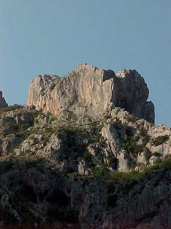
Mt. Stogut - a distinctive part of the Radohimi group - first recorded ascent by Austrians via a chimney in the north side.
==
Style of Rock Climbing
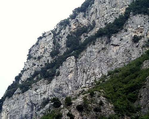
Nearly all the rock climbing is on the steep limestone faces and ridgelines carved out by this geography. Long but steep broken backbones of rock and accompanying cracks or gullies cut across the limestone faces, providing the typical lines of first interest in the formations. Between these, the limestone frequently drops in vertical faces of varying quality, with the overhanging portions generally visible by the extremely abrasive limestone covering caused by water drainage and leaving such portions of stone a distinctive dark reddish or dark brown. Long fourth and easy fifth class lines can, depending on the rock character, be broken by short overhang steps forcing detours or sometimes exciting traverses where the broken crack-ledge systems disappear into steeper rock or cross harrowingly above it. Probably the most 'cragging' fun can be had moving swiftly up the long limestone ridge lines, especially when they disappear over the horizon or end up in some broken partial summit with awkward or confusing descents. Though of varying solidity in places, there is much rock dropping right down to road beds which is steep and offers muscular liebacking and crack climbing of a much more committing sort. Protection is sometimes sparse, and much of the face climbing is unprotected. Vegetation and crack systems, as well as horns and spikes of limestone on the ridgelines provide more options when following the more obvious lines. A crag hammer or some other kind of substantive gardening implement is quite useful, together with many slings and some common sense.
In the summer an ice ax is rarely essential in most places, but even a little bit of snow, if it sticks for any length of time and freezes, can make the steep crumbling limestone hillsides positively terrifying, especially the rather common sorts with long steady fall lines, and when the limestone starts mixing with the much more uncertain flysch sandstone layers of the geology.
If proper care and appreciation of the rugged conditions is taken into account, the possibilities for exploring and developing new lines of many lengths and in all degrees of difficulty are manifold. In particular, long half-day or all day fourth and fifth class ridgelines rise up the sides of the steep limestone peaks are a characteristic option for this region. Many prospects require long and sometimes harrowing approaches up steep hillsides and even steeper shoulders of crumbling limestone, carst, and those especially when mixed with sandstone and serpentine. Some such areas appear as scree fields but turn out to be solid bands of rock whose surface is composed of sluffing off sheets of sharp edged limestone pebbles. Where proper care on approach or descent is taken, inspiring, sometimes easy but frequently devious, long and meandering lines of ascent can be found. The entirety of highland Albania is criss-crossed with goat and livestock trails. While the roads are still remarkably and nearly universally in the most terrible conditions, the manner in which they – whether unused mining track or main thoroughfare – cut through and across steep escarpments and precipitous gorges guarantees many places throughout the country with spectacular routes up unclimbed limestone straight off the road-bed. Through most of highland Albania covered in the pages below, cragging, bouldering, and scrambling is readily available in every shape and variety.
Overview and Some Details on the History of Climbing in Albania
The main advantage of climbing in Albania is the rugged and completely isolated nature of the environment, combined with the fact that almost none of these rocks have had their potential developed or their lines ascended. During its first two decades of existence as an independent state, Albania fell more or less within the Italian sphere of influence; and this is reflected in the large numbers of neo-classical government buildings in the capital and the role of Italian mountaineers who scoped out and ascended the more inaccessible of the northern 'Accursed Mountains' (Bjeshket e Namuna or Prokletije). In general, exploration of the mountains has related to the imperial priorities of the various surrounding European states but this really did not begin until the 20th century.Though local mountain clans have occupied the arable mountain valleys for three millennia or more, Albania has been for ages remarkably unknown in the highland. The Albanian cities of Durres and Shkodra have classical foundations, and for centuries were independent or semi-attached commercial cities integrated into or allied with the Venetian Republic, known then respectively as 'Durrazo' and 'Scutari.' But much of the Albanian coastland, like elsewhere in the Mediterranean, was infested with malarial swamps, and this kept the highlanders relatively isolated from coastal traffic, and also unknown to outsiders. As the contemporary mountain author Tomislav Cezener has amusingly pointed out, the Austrian military maps of the Accursed Mountains from the crucial years of the 1912-1913 Balkan Wars were almost completely bereft of details. For years, Mt. Shkelzen, distinctly visible high above the town of Tropoja on the commercial road into Kosovo over Qaf Morine, was considered the highest summit of the range. One of the first researchers of the area, Hungarian geologist Franz Nopcsa, visited the central Bjeshket e Nemuna in 1905, as the country was slipping out of Ottoman control, and into the eyes of the also already shaky Austro-Hungarian influence. He picked out the much more inaccessible Mt. Jezerce, located on the high ridge line between the high mountains Districts of Malesi e Madhe and Tropoja, and just inside the border of Albania from Montenegro, as the highest mountain of the whole range. Nopsca was also a Hungarian Baron, at one point sought the Albanian throne (later given to a useless German Prince), and published during his lifetime some 50 articles and monographs on Albania concerning linguistics, folklore, ethnology, history, and the kanun, the key text of Albanian tribal based folk law (Gezim Albion, Franz Nopcsa and his Dream for the Albanian Throne[2002]). He revisited the area in 1907 with instruments and confirmed his claim that Jezerce was higher than Shkelzen. In the wake of Nopsca's first adventures, Albania largely fell into an Austro-Hungarian sphere of influence, and as a result it was explorers and mountaineers from these areas which took the lead in the early 20th century. By early summer 1929, all major summits in the Bjeshket e Nemuna range had been climbed and measured by Italian surveyors. A week or two later, the first mountaineers, three British climbers (Sleeman, Elmalie and Ellwood), summited Mt. Jezerce on July 26th 1929 via its hard 2nd class or easy 3rd class standard route. A couple of years after that the peak was scaled by group of Austrians who also progressively surveyed and traversed the ridges of the Albanian accursed mountains, and climbed the main peaks, outlying peaks and towers systematically including the Radohimines group, Mt. Viavet, Mt. Boshit, Mt. Popluks, Mt. Shkurz, Maja Briaset, Maja Rogomir, and other the peaks in the Thethi and Valbona basins. (Egon Hofmann, 'In den Nordalbanischen Alpen', Oesterreichisches Alpenzeitung, Vol. 54 , 1932, pp. 171-187.)
Besides a series of expeditions sponsored by the Austrian Alpine Association, several German groups made trips in the late 1920s and early 1930s, and somewhat later, Italian mountaineers were also active.
==
Maja Briaset - alpenglow on the main or Valbona Face, first climbed by Pimper and Poppe in 1959
==
Some Early Ascents - Peaks Party Date UIAA
| Maja Zuri | Schaller and Schaefer | June 1934 | V |
| Maja Arapit, East Ridge | Hoffman, Feinsheimer and Schatz | June 1930 | I |
| Maja Boshit, Main Summit and traverse to secondary summit via north-south ridge line | Hoffman, Feinsheimer and Shatz | June 1930 | III |
| Maja Vinchen | Bauer, Huettig, Martin | June 1934 | I |
| Maja Papluk, North Ridge | Bauer, Huettig, Martin | June 1934 | II |
| Maja Radohimes, North Wall, Southern Summit | Fink, Tinsobin | Aug 1933 | V |
| Maja Briaset | Bauer, Huettig, Martin, | June 1934 | I |
| Maja That, Northwestern Ridge | Bauer, Huettig, Martin, Obersteiner | June 1934 | IV |
(Hoffman, 'Albanienexpedition 1931' Austrian Alpine Journal, vol. 53, pp. 327-334; Obersteiner and Hoffman, 'Fahrtenbericht aus den Nordalbanischen Alpen', Austrian Alpine Journal, no. 57, 1935, pp. 18-22.)
==
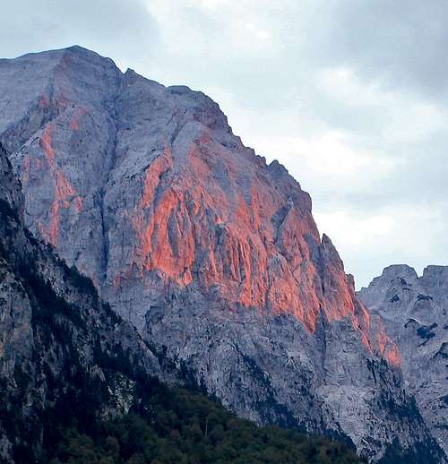
The upper sections of Mt. Jezerce viewed from the north, and showing the character of the 2nd-3rd class 1929 walk up route of this, the highest peak in the Accursed Mountains. Photo courtesy Petter Bjorstad.
By the late 1930s, however, mountaineering in the Accursed Mountains tailed off. The Croat, Branimir Gusic, creator of the first Dinaric mountain movie, ‘Durmitor’, a human geographer by profession, spent considerable time between mid 1930s and late 1960s researching the massif. He scaled Maja Kokervhake (2508m) just north of Jezerce and collected large and unique collection of Malisorian craft and art samples as well as various items of everyday use. His ‘Malisorian collection’, was exhibited for years in the Zagreb Museum of Ethnography, before disappearing in more or less mysterious manner. He was, as Cezener notes, an ‘unsung hero of the Dinaric Alps.’ Sometime on the eve of World War II, the area was visited by Italian mountain climber Pietro Ghiglione - better known as an one of the innovators of ski mountaineering in the Alps and Himalaya with his friend Ottorino Mezzalama, as well as his climbing in the African Ruwenzori when he was well over 70 years old. Ghiglione wrote Montagne d'Albania (Edizioni Distaptur, Tirana, 1941), perhaps still, in Cezener’s view, ‘the best Albanian mountain guidebook.' (See Cezener's excellent Maja Jezerces SummitPost page from where most of this material is drawn.) Later, during World War II, there are, amusingly, various reports from H.W. Tilman’s colleagues in the guerrilla liaison ‘Special Operations Executive’ or SOE operating in the Balkans. Tilman, more famous for his exploits on Mt. Kenya, Nanda Devi and Everest before World War II, was one of the operatives traveling in 1943 through the mountain areas of Albania on donkeys laden with radios and bags of Napoleonic era gold sovereigns. His main job helped organize partisan opposition to the Italians and the Germans. SOE, though legendary, had mixed success in Albania in contrast to Tito’s Yugoslavia due to the growing and radically Stalinistic xenophobia of the Enver-Hoxha-led partisans together with the greater influence of Tory-sympathizing operatives in the SOE groups that were operating in the north sections of Albania and Kosovo out of Greece. But Tilman, who seemed less than interested in guerrilla war and most sympathetic to the scattered Vlach nomadic herders of the Southern Albanian mountain ranges, did manage to maintain a regular weekend exercise regime in his spare time from being a guerrilla band organizer -- by bagging Albanian peaks on his own (Tilman, When Men and Mountains Meet, London, 1946).
 Mt. Boshit (2416m) guards the pass between the Thethi and the Valbona Valleys. The western wall (UIAA VI-) was done in July 1959 by Harry Duerichen, Harald Loebe and Minella Kapo. The Northern Pillar (UIAA V-) was done in July 1960 by Eberhard Nitzwche, Vassili Wreto, and Joachim Soehler.
Once the British left, however, the historical record of mountaineering and especially rock climbing, is sparse until a series of East German summer expeditions in the Summers of 1959 and 1960 led by such well known climbers as Harry Duerichen, Christel Stuntz, Fritz Eske and Rudi Pimper. These initiatives combined with the development of local Tirana based Alpine Association which ran two week courses in the Theth Valley during the summer times.
The east Germans ascended most of the major limestone features in the valleys of Theth, Rapolinia and Valbona during these Summers. Schmidt, Duerichen, Eske and Loebe, along with Albanians Minella Kapo and Petrop Kuli climbed the south western, north east and north western faces of Mt. Arapit, as well as well as two lower portions of the main Southwestern face. They also climbed the north and north western ridges of Mt. Papluk, the West face and north pillar of Maja Boshit, the two peaks of Viavet, the northern face and northwest pillar of Radhohimes, as well as the huge north west and valbona faces of Maja Briaset and Maja Gruk e Hapt in the Valbona Valley. These two summer still constitute the single most intensive period of mountaineering development and advances in the entire history of climbing in Albania, as the summary of the achievements below illustrates. (See Peter Popp, 'Zarabitwand', Unterwegs, no. 10 [1960]; Hans Pankotsch, 'Nordalbanische Alpen 1959/1960', Elsasserstr. 3, Dresden; Peter Popp, Bergfahrten im Land der Skiptaren, Goes, 200, 23pp.)
==
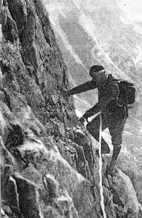
Maja Briaset - Renowned East German mountaineer Fritz Eske seen here on the first ascent of Briaset's huge north-east face in 1960.
==
Notable Ascents Party Date UIAA
| Maja Boshit, Westface | Duerrichen, Loebe, Kapo | July, 1959 | VI- | |
| Maja Boshit, North Pillar | Nitzsche, Soehler, Wreto | July 1960 | V- | |
| Maja Vinchens, Northwest Ridge | Daeweritz, Schoenberger,Wreto | July 1960 | III | |
| Maja Vinchens, Northeastpillar | Soehler, Nitzsche, Schmidt | July 1960 | V | |
| Maja Rushkull (2560m), East Face | Duerrichen, Stuntz | June 1960 | V | |
| Skiptar Tower, East Crack | Poppe, Pimper | July 1960 | V | |
| Skiptar Tower, Northeastern Face | Stuntz, Duerrichen | July 1960 | IV+ | |
| Maja Kolet, Southwestern Dike | Soehler, Nitzsche | July 1960 | IV | |
| Maja Radohimes, North Face | Eske, Loebe | July 1960 | VI | |
| Maja Radohimes, Northwest Pillar | Pimper, Popp | July 1960 | VI | |
| Maja Gruk e Hapt (2425m), South Face | Pimper, Popp | July 1960 | V+ | |
| Maja Briaset, North East Dike | Nitzsche, soehler | July 1960 | IV | |
| Maja Briaset, Northwest Gully | Eske, Loebe | July 1960 | V | |
| Maja Briaset, Valley or Valbona Face | Popp, Pimper | July 1960 | VI |
After the Albanian government broke with the Eastern Bloc in the early 60s, the Albanian Alpine section continued its summer and its winter camps in the Accursed Mountains, and eventually did many independent ascents both by themselves, and with later Chinese collaborators. Most notable of these was the grade VI 'Master's Route' up the south face of Arapit by Ilir Tapir and Sokel Dokel in 1985.
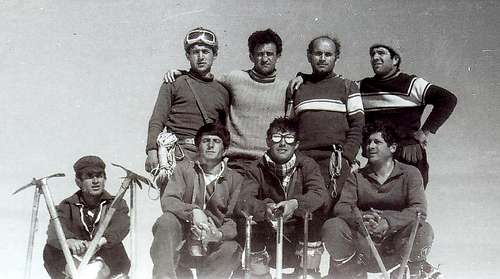 Albanian Alpine Association, Mt Papluks, Summit, 1977
The Albanian Special Forces Military Base was located during te 1980s on the Zall Herr Road, and various pitons and bolts have been found in the valley above, where they developed some of the cli bming for training purposes. But with the exceptions of the main peaks, and the traditional places on Mt. Daiti and in the Thethi and Valbona Valleys, very little of the immense climbing potential of Albania has been really explored, muich less developed. It remains even today almost completely unexplored and undeveloped as a rock climbing area.
 FK Partisani - Shoulderpatch of the main Tirana Club
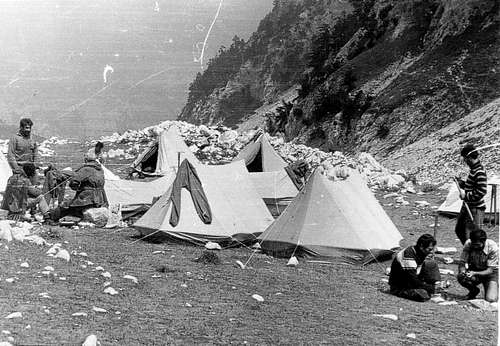 Theth Summer Camp
The steep hillsides, fracturing limestone ridges, and lack of climbing traffic means that much of the terrain is extremely exposed, with copious precarious rock - from pebbles to giant blocks - perched about in the most spectacular places. Particular care on steep talus and scree fields of the crumbling limestone, carst, or composite hillsides is merited. Only a few small stones can start spontaneous rockslides loosening large blocks and falling hundreds of meters upon goat paths or mountain roads below.
==

A pinnacle at the entrance to Bovilla gorge. Circa. 2001 this contained the only piece of fixed protection I found in Albania. It protects a 5.9 move off a shelf from the back. It has since been destroyed by open pit lime mining operations.
==
The Evolving Park System in the Mountains - Beginnings and Development
Many of Albania’s mountains now lie in established national parks. The first of these was the 4000 hectare Tomorr National Park, established (strategically) south of the Skhumbi River in 1956 in the Tomorr Range in middle of the country just east of the beautiful museum-city of Berat in 1956, and overlooking the notorious secret arms production city of Polican.
==

The medieval castle of the museum town of Berat, with the Tomorrit Range rising in the background - a typical hazy Albanian day. - photo Bethany Sanders
==
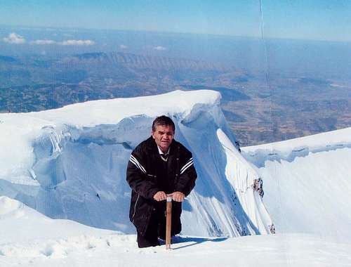
Mt. Tomorrit in Tomorr National Park - Hassan Duro of the Tirana Section of the Albanian Mountaineering Association, at the Summit in the 1970s.
==
In 1966, three more parks were established in Albania’s mountain ranges:
1)Daiti National Park, 3300 hectares of the mountain overlooking the capital, Tirana (also in the vicinity of military installations),
2)Theth National Park in the Shale basin around Theth (2630 hectares), and
3)Valbona National Park, in the Valbona Gorge from the gorge entrance through to Rrogram and the surrounding mountains (3237 hectares).
Since the end of the Cold War, the Albanian government has been busily detaching its beautiful national parks from such military installations, and working with various national and international civil society partners to widen the parameters of preservation for its beautiful mountain heritage. Many NGOs have been active in the area, particularly as the recent conflicts have subsided - so many indeed that some schools are peppered with mulitple and competing placards of various donors.
Certainly from a mountaineering perspective, one of the most noteworthy has been the work of the German Society for Technical Cooperation (GTZ) in both the the Theth area of Albania and the Gusinje area of Montenegro(see links below). But perhaps the most intriquing project in this regard is the idea of a Balkans Peace Park modeled on the idea of a Multinational Park like the Waterton/Glacier Park system straddling the border between Alberta in Canada and the Montana in the United States in western North America. This would attempt to integrate in a much larger scope the already existing national parks of the Accursed Mountains, the Valbona and the Theth in Albania, with the equally beautiful mountain regions of Plav-Gusinje area in Montenegro and Decani-Belaje area in Kosovo. This latter, indeed, includes the northern part of the Accursed Mountains. The summit of Mt. Gjeravica or Deravica, at 2656m, is the third highest peak in this part Dinaric range - next to Jezerce in nearby Albania, resting alongside Mt. Marijas (2530m), Maje Rops (2501m) and Mt. Koprivnik (2460m). In this project, the non-governmental organization (NGO)Balkan Peace Park Project has been working together with groups like the United Nations Environmental Program (UNEP), the SOROs Foundation, and various incipient local ngos such as Action Group Environmental Responsibility in Valbona and the HRID Mountaineering Sports Club in Plav, Montenegro, to help develop and realize this idea – with the collaboration of a host of other organizations both local and international including the UIAA and the World Conservation Union. Originally started by a group in the United Kingdom, the Balkan Peace Park Project has been gaining more traction, sponsoring annual gatherings in the mountain town of Theth, acquiring the sponsorship of Members of the European Parliament, and serving even as the inspiration for some of the first major climbing routes in the Accursed Mountains, such as the seven pitch ‘Balkans Peace Park’ route (UIAA VII- A0/AF) up Mt. Lagojvet by a team of SummitPost members, the first ascent of this 5th class peak in August 2009.The original idea of a Peace Park came from Morokulian Park between Norway and Sweden in 1914, at a time of great tension between those countries. A permanent monument to peace was built and inaugurated in the same year.Those interested in enjoying the Accursed Mountains in support of the Peace Park initiative should visit the Peace Park web page link above and consider joining in the annual July-August summer program in Theth.
II. Traveling and Staying in Albania
Touring Albania: The Last True Adventure in Continental Europe
Much of the experience in Albania results from the rugged natural and social surroundings. After fifty years of ultra-totalitarian rule, Albania has emerged from revolution, upheaval, economic collapse, ethnic warfare, banditry, black marketeering, and refugee crises to become an increasingly stable and economically viable, while nonetheless continually interesting and uniquely adventurous, part of Europe. It now has a vital press, a growing economy, a somewhat exuberant party system of two party government and opposition, but with a modern and progressive proportional system. To be sure, this is composed of a center-right 'Democratic Party' which has emerged from ponzi schemes to just be Berlusconiesque and an ex-Communist Party which is full of interesting intellectuals and now looks like a run-of-the-mill albeit shady east European variant of Social Democracy. But all of this is quite striking is a majority (Sunni) Muslim country with significant Catholic and Orthodox minorities, and a strong Bektashi influence. (The Bektashi are a Sufi branch of Islam which in Albania actually established itself separately and were recognized ever after as a distinct Islamic sect rather than a branch of Sunni Islam, as are most other Sufi orders.) Historically, amongst the mixed cemetaries of Muslim and Christian deceased appears as well the gravestones of the Bogomils, ancestors of the Cathari who stirred up the violent genocidal reaction of the Catholic Church in Crusader era France, but who continued on in relative peace in mountainous Albania.
Most notably, in contrast to much of the rest of the Balkans, Albania has spent so much time as a nation coming to terms with its own totalitarian past that it has felt little need to externalize its difficulties on other oppositional religious-ethnic divides, in striking contrast to the countries surrounding it. In contrast to the Islamic character of the connservative politcal parties and nationalist identity of Bosnia-Herzegovina or Kosovo, or even Erdogan's policies in Turkey, the conservative 'Democratic Party' and its sclerotic leadership reminds one of Berlusconi with lots of ritalin added in; and the sub-currents of a pre-modern blood feud tradition negatively affect the evolving legal-constitutional state surprisinly little. A sober observer might view Albania, of all the nations in the world with majority Islamic populations, as the one having the strongest institutions of representative government, in a country with near Malaysian standards of ethnic and religious diversity. Albania's mountains are sparsely but thoroughly populated due to the policies of the old regime - which privileged the wierd idea of an industrial-military mountain redoubt; as a result terraces of underproductive agricultural land are ubiquitous, shepherds can be found at work around nearly every precipice and gorge cut, and there are many aquaducts and other industrial cuttings that break up the climbing environment. At the same time, there is no one else much to bother the car-camping visitor who comes prepared for rough conditions, brings a four-wheel drive vehicle, and takes the necessary precautions against theft. (One possible hazard are wild dogs, which can be found roaming in packs from just outside the capital city to the highlands and ridges of some of the most inaccessible peaks. In most cases, simply circumnavigating their locations at a very safe and prudent distance seems to solve the problem, though I must admit that while doing so on occasion, I was happy to be carrying my ice ax just in case.) The roads are treacherous and winding, and in nearly all cases strongly imply 4-wheel drive. In many places, arrangements should be made to park cars during the day and at night. In some, a local guide or informant is still quite recommended. Generally, an expense of ca. 100-250 New Lek or a few Euros per night for ‘protection’ of vehicle or more for ‘camping fees’ can be expected. Since property relations are still not clarified and since there is a tradition of xenophobia as well as a highly developed host-guest culture in the Albanian highlands, it is best to exercise caution. When in doubt, having local connections via a guide or a property owner with ‘bed & breakfast’ arrangements or the like is recommended. Many towns have such helpful people, and they can frequently help manage a situation with family or friends in other parts of the mountains. Such arrangements grant one the nearly sacrosanct ‘guest’ status protecting one from the otherwise usual forms of banditry and highway robbery that are a well-known part of Albania highland history. Albania must be seen as the last true adventure left in continental Europe. The second poorest European state, it is terraced with tiny dirt roads, obscure and isolated mountain villages slowly draining of people, living on subsistence agriculture and remittances.
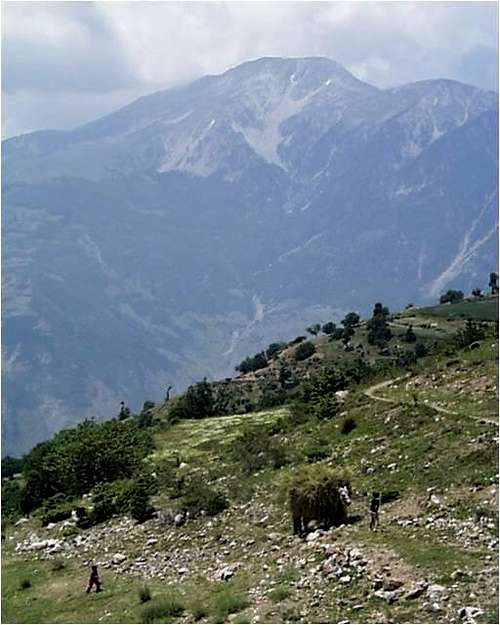 Rural life in north-east Albania - a moving haystack drawn by one school boy as another plays in the terraced fields, here nearly two hours gravel drive to Kukes, the nearest substantive mountain town. Orjost is right up against the Kosovo border; Mt. Gjallica rises in the background.
It still contains active bands with assault rifles and purloined Daimlers from the EU countries. Even though much of the magazine stores were hawked to the Kosovo Liberation Army in 1997, this or that farmer might still be willing to show you their cache. But like Europe in general, guns are actually illegal, so Albania is assuredly not Texas. (The vehicular situation, on the other hand, is becoming greyer, but still colorful. Indeed, nearly all the vehicles in Albania in the years after the end of the old regime were Daimler sedans - providing Albania with a private automobile fleet subsidized by the German Automobile Insurance Fees and profit-oriented Italian customs officers. My favorite example was a Daimler mini-bus which still proudly and informatively retained the bumpersticker of a 'Snow Shoe Club' from a small township in German Lower Saxony.) Old tribal-influenced ways of life continue, especially in rural areas, amidst a largely Muslim population - though especially in the north west spreading out from Shkodra, in the area Edith Durham documented, there is still a significant Catholic population reaching up into the highlands. In some areas of the north, the tradition of the ‘blood feud’ is still quite active, and most of the inhabitants get by via subsistence farming, herding and remittances from family members working abroad.
 A Kulla in Dragobi - traditional dwelling in this wild part of the north where the blood feud is still active, and where square fortified defensive dwellings can provide security for male family members caught up in legal vengance of the feud that can go through generations.
Albania politically and culturally is somewhat the opposite of Italy; its north is more conservative and poorer while the south, with historical ties to Greece, is where key early nationalist intellectuals came from, where the Communist Party developed most strongly, and from where the institutions of modernization, including the predominance of Tosk elements in the dialects, were most strongly felt and influential across the country.
The diverse religious and cultural traditions, indeed the mix of the unique Albanian language with its obscure phonetic system and the proliferation of traditions from Roman law and Latinate/Romanian words of a very old character mixing in the Kanun of Lek through to a variety of 'Albanianized' Turkish and Slavic expressions provides a polyverse linguistic and cultural background. Most of this adds color and spice to a vacation without involving any serious dangers or hassles. Serious crime is hardly a problem, as long as precautions are taken to protect vehicle and camping gear. With proper graces on the part of the traveler, Albanians in the mountains are typically as polite to visitors as they are proud of their own local and national traditions.Roadmaps are frequently unreliable, signposts poor to non-existent, and thoroughfare turns-offs or lack thereof obscure or disingenuously uninviting. The geography is distinctive enough, however, that one is usually well oriented after a day or two in any one locale; a short question of the many pedestrians using the roads or watching passers-by is usually enough to sort out a confusion.In many respects one is reminded of Latin America. In Albania, the state is frequently weak or ineffective in rural and remote areas; but as long as care and courteous arrangements with the local inhabitants are maintained, the ranges and wild alpine terrain in such areas are in their totality available to the visitor. Compared with the rest of Europe, Albania is a region free of rules and regulations. In contrast, for instance, to Montenegro and Macedonia, there is at present no 'permit' system from an 'interior' department regulating access. With regard to the northern mountains, criminality and smuggling were a problem after ca. 2001 only in the Bajram Curri area (Tropoje District), a part of Albania which for this reason perhaps may still require particular precaution if it is to be made part of a planned itinerary.Hotels are sparse and frequently unattractive dilapidations leftover from the totalitarian era, but are improving rapidly from the period 1996-1999, and tolerable accommodation is available in most areas with short drives of major crags. A 4x4 vehicle – rented or driven in – is preferable, but transport is also possible in the cheap, efficient and regular system of minibuses that criss-crosses the country, even on the most obscure and deserted mountain roads. Most of the main climbing destinations could in fact be reached by a sturdy VW or Renault with relatively high clearance, but such means will certainly slow down progress to and from trailheads and crag approaches. Many remote villages and destinations have farmers with extra buildings or primitive ‘bed & breakfast’ like accommodations. These are typically comfortable, interesting, and ‘authentic’, particular if one is served lamb together with the potent local form of rakjia or fruit brandy around the tin wood stove on a floor covered with sheepskins. Probably the best option is to arrange for long-term use of a legal four-wheel drive vehicle that could be driven into Albania via the ferry from Bari to Durres. Alternately, one could travel by highway via Zagreb-Belgrade-Pristina or Podgorica in Montenegro. Vehicles could be rented either in Montenegro or Kosovo, Macedonia or Greece, as long as arrangements were made to cross the border. One can fly into the capital of Tirana, or drive in through Montenegro to Shkodra, or through Macedonia or Kosovo into the north east to find the best rock climbing areas. Alternatively one could fly into Podgorica in Montenegro or Prishtina in Kosovo and rent a four-wheel drive for the short trip into Albania. It is also possible to drive easily in through Greece from Thessoloniki via Lake Prespa and/or Korce, but as most of the climbing is in the northern part of the country, this is probably less convienent unless one is already in Greece.Most of the excellent rock climbing is within a day trip of the towns of Tirana, Shkodra, or Kukes, with the exception of the Cem Gorge and Vermosh area, and the Theth-Valbona region. But be warned: distances do not appear great on maps, but become so over rutted, winding, unpaved mountain roads. If your headed to these regions and do not have prior arrangements for overnighting, be sure to bring your camping gear and sufficient food supplies, as there is no convienent 'Aldi' at the end of these long dirt road canyons. Bed & breakfast arrangements can, however, be made in these areas.For more detailed information on Albania, the ‘Blue Guide’ written by James Pettifer is strongly recommended. Though Pettifer is not a particular devotee of high mountain environments and alpinism so much as Albanian culture and traditions, he is one of the best English language historians of the country, and his guide is well written and provides a wealth of detail and generally reliable information. Road maps are readily available, and excellent topographical maps can be purchased from the Albanian Armed Services and the Geographic Institute for ca. 1500 Lek a piece (more for on-line versions) in varying sizes for all of the country; and they are recommended navigation tools. Free older topos of the entire country in 1:50,000 are available from the Univ. of Calif. at Berkeley and at the website Bunker Trails, as long as one can read Russian; these must be combined, however, with very good road maps as there are now many more roads, not to mention artificial bodies of water, than was the case during the 1940s-1970s. Also, the Russian maps have an annoying habit of 'extending' international borders in obscure areas in this or that direction according their their historic percieved geo-political interests. This generally on these maps seems to make the Albanian border extent bigger and those of the former Yugoslavia, especially along the Montenegrin border, smaller. Actually running into an angry non-Albanian border officer in these high mountain areas is extremely unlikely, but there are reports of left over unexploded ordinance - from the Greek civil war in the area of Mt. Gramoz, and the from the recent Balkan conflicts in the areas of Mt. Korabi and along the Albanian-Kosovo border. The Soviet era maps, however, follow a tradition of military cartography, which includes many civilian uses and thus provides much more detail than NATO variants on vegetation and other issues of interest to trekkers and climbers.
III. Tirana-Kruje Area Central Coastal Range
A. Kruje Town
==

Kruje Castle and the cliffs behind - where the war leader Skenderbeg held off the Ottomans in the 15th century. - photo Bethany Sanders
==

Kruje minaret
==
Kruje is a mountain town located at the northern end of the Kruje-Daiti Range of mountains on the western slope facing the Adriatic, complete with a famous castle and excellent views. Kruje Mountain (1150m) to the north is followed looking southwards successively by Mt. Gamtit (1268m), Mt. Bastarit (Berarit)(1403m), and Mt. Daiti (1612m), with steep limestone gorges cut into the ridgelines of the range between each peak, and limestone escarpments running along especially the seaward or western slopes of the range.
At Kruje, there is a gorge as well at the north end of town can be reached by the lower of the two roads that lead inland from the town; it is notable for its vertical keyhole shape cut into the limestone cliffs; and the characteristic long limestone ridge which climbs to the summit of the mountain north of Kruje Mountain. The lower Kruje road, the Rruga Burreli, can be followed to Burrel (though the main road to Burrel and Peshkopi is via the coast road and Mat river).
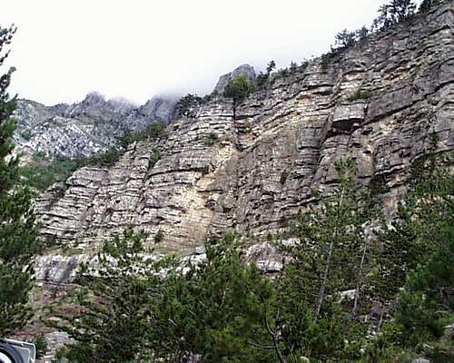
Just out of town, the road transverses several steep limestone faces just after leaving Kruje. The Kiktafe stream below, north of Kruje town, disappears here into a cavern in the limestone, and there is much carst surface with dolines. The upper road leads to the top of Kruje Mountain, and cuts through three successive limestone buttresses on the way up the mountain. A third road leads along the base of Kruje Mountain’s western side past a series of overhanging limestone bluffs and pinnacle formations to a new prison complex some three km South of Kruje Town. The formations along the road fine face climbing but would be difficult to protect, and difficult, steep and hard-to-protect limestone faces constitute the best part of the other climbable terrain around Kruje.
==
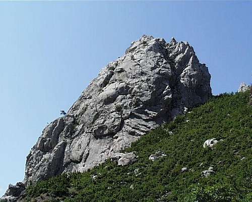
Mt. Kruje - The line up to the top limestone point on the right is a scramble with a spritely 3rd class section at the top. Steps down from Kruje mountain are found to the left.
==
B. The Coastal Range with Bovilla Gorge Between Mt. Daiti in the South and Mt. Gamtit in the North
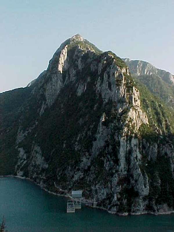
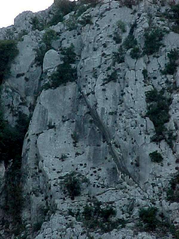
Entrance Area Bovilla Gorge between Tirana and Kruje contains the best rock climbing available in the greater Tirana area. It can be reached via a twenty minute trip down the road to Zall-Herr that turns right at the Bathore intersection one kilometer south of the town of Kamez (pronounced 'kam-ze') on the Lezhe-Shkodra Road. The badly rutted dirt road follows the Herr I Bastarit River past the Albanian Army Commando Base and a gravel pit. The road rises as the road cuts through the gorge on the north side after crossing a bridge at the entrance to the gorge and then rises, passing the Bovilla Dam. This dam holds the drinking water for the city of Tirana in the reservoir.The entrance to the gorge is marked on the south side a pair of distinctive limestone pinnacles in the front of a set of steep limestone crags. These rise in a series of archlike ridges up the front face of Mt. Bastarit (1403m) on the right and Mt. Gamtit (1268m) on the left.
==
The northern shoulder of Mt. Bastarit runs up and south, viewed from the Western entrance to Bovilla Gorge.
==
Mt. Gamtit's Western Side
==
The Entrance to Bovilla Gorge from near the Albanian Commando Base. The three crags of Gamtit’s south shoulder appear on the left, the vertical faces of Bastarit’s north shoulder on the right, and the back ridge of Bastarit rising from Bovilla Dam visible in the center of the picture.
==
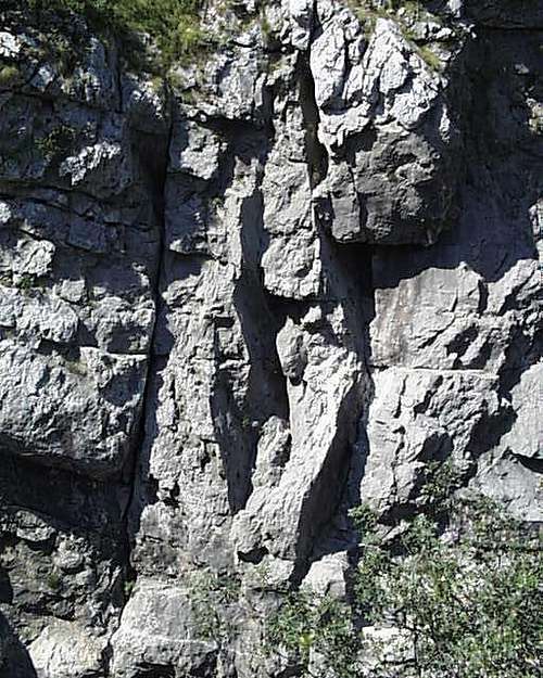
On the north side of the entrance, three crags rise up east side of Mt. Gamtit. The first crag – marked a large orange face rising above the road -- contains an easy fifth class ridge route that can be reached by vegetated fourth class ledges at the base of the large orange face. A third class ledge rises on the face to the left, dividing broken lower sections from the steep face capped with overhangs above. The second crag is to its left and can be reached through the gully on its right, which also provides descent from all three crags. Two major fifth class cracks, the left hand in a large north-facing corner, provide the most obvious of several lines. The third crag is the largest and can be reached by following the olive terraces stretching down towards the road. It offers steep free routes leading up the steep buttresses lying between overhanging sections; and three-four pitches of fourth and easy fifth class take one up the right hand ridgeline.
 The first crag on Mt. Gamtit viewed from the Bovilla gorge entrance
 The third or left most of the Lower Gamtit Crags has the most interesting possibilities - hard lines starting left of the round cave area, and easier routes on the ridges to the left.
Bovilla Gorge – Dam Area The entire interior of the gorge is mottled with ridge systems and crags reaching down to the streambed. A couple of faces along the road can be top roped, while closer to the dam, longer problems rise up to the left, including a capstone crag about twenty minutes walk uphill from the road. A number of crags, including a fifteen meter pinnacle, are formed down southern sides of the gorge from broken carst formations ending in the area of the dam runoff.
 Bovilla Gorge Upper Cliffs - A long walk gets you away from the crowds.
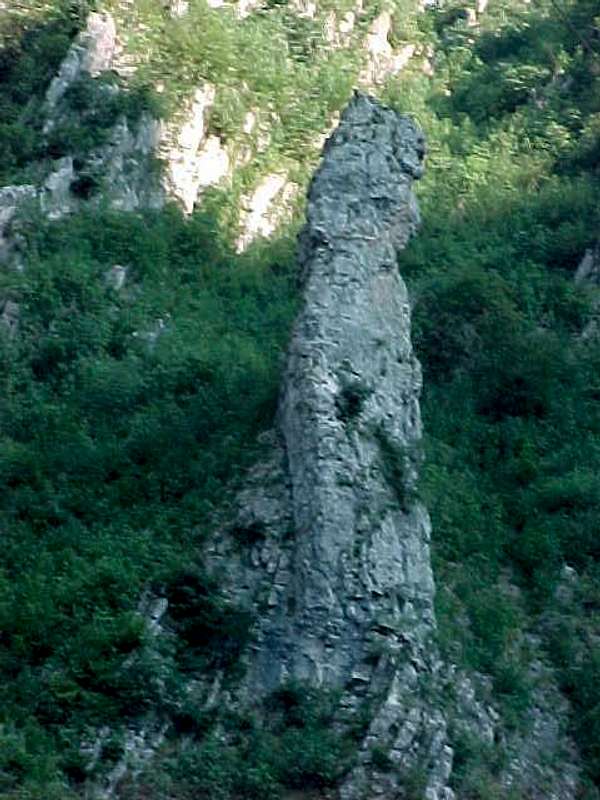 Pinnacle Below Bovilla Dam
Mt. Bastarit drops in two distinct ridges down directly onto the reservoir Dam. Both ridges offer good multi-pitch afternoons; the second can be reached by following the goat trail along the reservoir shore that begins just beyond the tunnel leading to the reservoir intake units.
 The lower and upper ridge rising on the back side of Mt. Bastarit over the Bovilla Reservoir
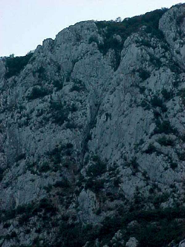
 Above the 3rd and largest of the Gamtit crags, there is more rock to climb on the way to Gamtit's summit.
Mt. Gamtit – Backside or Eastfaces Beyond Bovilla Dam, the road turns left in a series of switchbacks up over the reservoir and along the backside of Mt. Gamtit, which contains three separate distinctive rock formations. (1) Gamtit Slabs: a small crumbling limestone ridge rising from the dam breaks off eventually into a series of steep limestone slabs, and eventually a series of high corners formed by the drainage funnels in the cliffs rising above the slabs.
 Beyond the dam above the road limestone slabs appear, with some 5th class corners in the formations above them.
 Gamtit Back Side Slabs - with a Fine Corner to Climb at around 5.10 done by Maria Rodin and Brian Robinson
(2) Gamtit Back Crag: A limestone crag rises some 350 meters high to two points on the same ridge line 1.5 km further up the road above a parking lot formed by an abandoned factory, providing several multi-pitch fifth class lines. - no development in this area yet.
 Beyond the slab area, the east side of Mt. Gamtit contains a main crag, broken in the center by a 4th class fissure, but with harder lines, especially on its northern face.
(3) Gamtit Back Ridge: A large and broken ridge of limestone reaches down from Mt. Gamtit towards the east three km north of the reservoir.
 Beyond the main crag on the east side of Mt. Gamtit is a northern, more ridge-like formation
 Gamtit Back Side Northern or Ridge Crag - beyond the Bovilla Dam on the left
C. Mount Daiti and Babru Gorge Up the Tirana River to Brar
Mt. Daiti (1612m) rises directly east of the Tirana metropolitan area. Traces of pre-historic settlements have been found on its highlands, and the most common theory is that the name derives from the Greek mountain nymphe Diktynna. A road leads to a National Park on the summit, from which a number of crags can be reached. (Since 2005, a gondola has been put in place, which offers a good perspective of the main climbing potential to the left as one goes up.)
==

Mt. Daiti viewed from its new gondola. The main cliffs for rockclimbing can be seen in the upper left.
==
While it is quite irritating to have military installations which thus prohibit climbing to the summit, this does not affect the rock climbing, which is on cliffs below and to the left of the Fushe e Daiti or Daiti Meadows where the gondola ends and the restaurants are found. Others can be found by turning left of the road up Mt. Daiti on the Rruga Dibres that passes the hamlet of Babru before entering a limestone gorge separating Daiti from Bastarit.
==

Mt. Daiti Upper Cliffs - down and right several hundred meters from the Summit Restaurants - Lamb and Raki after some very steep rocks
==
A series of ridges run from the entrance of this gorge up the side of Mt. Daiti, in which a pair of easy fifth class ridge routes can be followed. Alternately, approaches by foot are available to the steep palisades of vertical and overhanging limestone ringing the northwest sides of Mt. Daiti. The central buttresses - lower angle in character - that lie underneath the summit can be reached from an access road a few hundred meters beyond the Chateau Linze complex on the Mt. Daiti road.The road which goes straight when the left turn leads up to the park and military installations at the top of Mt. Daiti tranverses the southern shoulder of Daiti and leads back through shattered serpentine highlands to the Malesi me Gropa, or 'Mountains of Holes', named such due to the huge number of dolines which are found in the region. It was here that the Hoxha partisans and the British SOE had their nearest outposts to the capital city during the period of World War II German occupation. Despite being close to the capital, within a few kilometers past Daiti this region becomes very obscure.
D. Erzenit Gorge
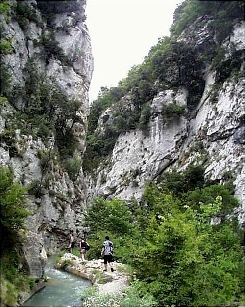
Erzenit River Gorge and Cave South of Tirana on the Rruga Elbasanit, a left hand turn at a large white stone adjacent to a long concrete aquaduct some 15km from the city center leads uphill along the southern bank of the Erzenit River. The large escarpments to the right forming into the Erzenit North and South Cliffs in the gorge formed by the river are visible from the Elbasan Road. Follow the road up to the village of Pellumbas, on the south hillside of the Erzenit Gorge, where one can park.Follow the distinctive goat trail up to the large limestone cave and 60-150 meter cliffs on the south side; or alternatively walk down and follow the aquaduct - including through the tunnels of running water - on the other, northern side of the gorge up through it to the reservoir at its mouth - a striking view of the dolines and river below.
 Inside the Erzenit Gorge - following the Aquaduct, carefully not to fall into the dolines below
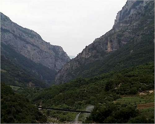 Erzenit Gorge Entrance. The picture illustrates the line of cliffs rising on both the North and South Side of the Erzenit Gorge, with dam and reservoir behind the last set of visible cliffs — the North Cliffs -- rising to the left. Pellumbas Butte is formed by the ridge rising to the right.
The river flows through a series of deeply cut waterfalls that provide climbing opportunities, as does the large limestone cliffs that rise from the gorge cut up the mountain to the north and south.
South of the Erzenit River cut, a series of steeper and overhanging cliffs rise to a long rocky capstone of a large butte of limestone rising for a kilometre above the hamlet of Pellumbas and dropping down to the south into the town of Krrabe and the path of the Murdhardit River. Accessible either directly up the path from Pellumbas or up the steep scree pile from the Erzenit gorge cut just below the dam, one can see the entrance to a large, 100m deep limestone cave with striking stalagtites and stalagmites, and some steep and difficult climbing lines on these Erzenit South Cliffs in the limestone faces just uphill from the cave entrance.
 Erzenit - Upper South Bluffs - the cave entrance is in the lower left of the central band of cliffs.
 in this picture the Cave entrance is visible.
Just before the turnoff to the village of Pellumbas, the road turns right and south up to this headland, cutting after a few switchbacks through the southern escarpments of Pellumbas Butte overlooking Krabbe. This series of the Krabbe Escarpments offer some climbing possibilities, though much of this portion along the road cut is of broken and uneven quality. The main set of cliffs leads below the road where the road itself cuts across the escarpments near the top of the Pellumbas Headland.
E. Shkopet Reservoir Rocks and Mat River Gorge
About six kilometers up the Mat River from the point where the Mat flows into the Fan, a large hydroelectric dam contains the smaller and lower of two Reservoirs at Shkopet - at the point where the Mat River gorge is cut into two rocks, North and South Shkopet Rocks. The area is roughly 1.5 hr. drive from downtown Tirana, and 20 minutes down the road from Burrel.
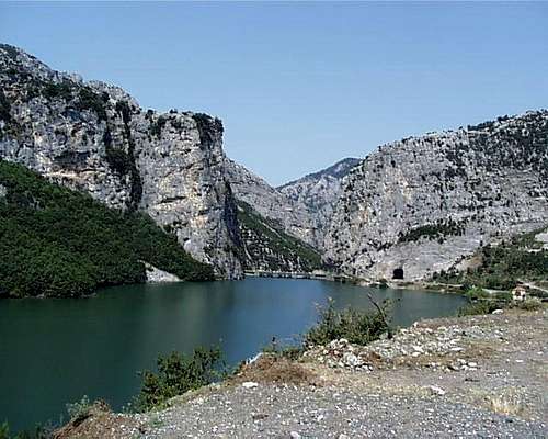 Shkopet Dam - Shkopet Reservoir on Mat River - Left (South) and Right (North) Rocks
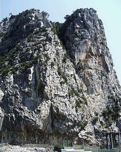 Shkopet Dam - North Rock
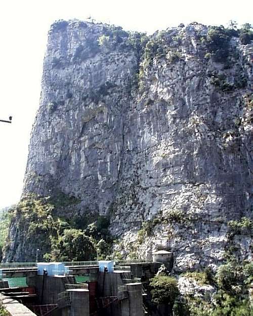 Shkopet South Rock on the other side of the Dam drops into the water
Below the Shkopet rocks in the gorge canyon of the Mat are a series of crack-lined cliffs, while rising above this complex to the north rise the Dervent Ridges and to the south the Mount Mallezit (1113m). Especially the Dam Cracks in the reservoir canyon and the North and South Shkopet Rocks offer spectacular and completely unexplored climbing possibilities.
 Shkopet Dam - Cracks in Reservoir Sluice Area
IV. Mirdita Highlands
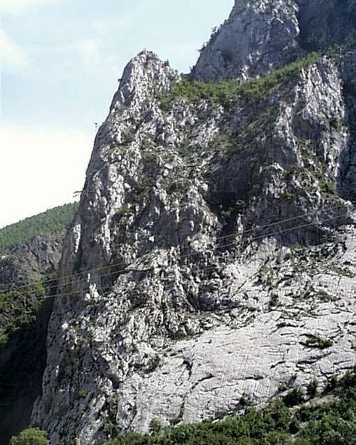
Mirdita Mirdita is a famous area in Albania due to its historical role in clan dominance and blood feuds, and serves as the locus for Nobel Prize winning author Ismail Kadare's most esteemed novel, Broken April. It is now a real backwater, rapidly loosing its population to the urbanizing areas on the coast, filled with endless forests, and traversed by the Fan River. A few crags in the middle of nowhere and an adventurous camping trip are what is to be found, not a plethora of opportunities. The series of crags in the Mirdita area can be accessed via the main road between Tirana/Lezhe and Fierza/Kukes. After driving past a series of broken composite crags ca. 10 km after leaving the town of Rreshen, a road turns right down into the Fan (I Vogel) River valley at Blinisht just beyond the police station perched on the scenic overlook. As one descends this ‘improved road’ leading to an abandoned copper mine at Reps visible in the distance, the river valley below and the crags in the area can both be clearly viewed as long as the sky is not overcast.

Two secondary dirt roads traverse Mirdita: i) one north-east along the Fan i Vogel from Reps through the village of Klos and ending eventually on the primary Puke-Kukes road near the village of Kalimash, and ii) another parallel north-eastern path through the Orosh highlands, past the hamlet of Bulshar and up the sides of Mt. Gurit te Cikut (1413m) and Mt. Gurit te Kuq (1511m) along the Shenjtit moutain ridgeline. The pine forested mountain terrain is highlighted by the reddish color of the earth, giving this area of Mirdita in the Fan River drainage its characteristic aspect. A large scree field scoring the mountainsides directly behind a large complex of abandoned copper mines indicates a gorge cut in the Fan revealing excellent crags rising out of the riverbed.
 A large pillar of limestone cuts through the southern side of the Fan i Vogel river 3 km upstream from the village of Klos.
Just downstream along the Fan i Vogel riverbed is this stack. The back side is third class.
Looking up and to the right, a series of limestone cliffs rise on the plateau above. The former can be access by driving up the Fan River past the abandoned copper mine in the direction of the village of Klos. The latter are accessed on the more difficult but spectacular mountain road that leads right up two km upstream from the abandoned copper mine.
Following on the southern side of a steep streambed opposite the village of Gryke-Orosh, the road continues past logging operations upwards, eventually running along the base of a long terrace of limestone crags forming the Mal e Gurit de Cikut area. After the series of ca. 40-60 meter crags uplifting in a series of jagged rows above the road, a long cockscomb crag rising above a couple of farmhouses offers additional cragging in this upper area. Both areas provide local camping opportunities and are ca. 4 hours by vehicle from central Tirana.
==
Beyond the pedestal crags of Mt. Gurit te Cikut, the Shenjtit highland road passes this limestone cockscomb of the formation (Cikut = 'rim' or 'edge') - average 35 m high and rising as one travels the Orosh logging road north past Male Gurit te Cikut.Shenjtit Highlands - Above the Reps abandoned copper mine runs the Shenjtit Highlands road past the two visible ridge formations of Mt. Gurit te Cikut and Mt. Gurit te Kuq. Down to the left runs the Fan i Vogel valley.
==

Limestone crags on the high road south of the Fan river valley through forested and isolated Mirdita. A row of such crags forms the pedestal terraces of the Mt. Gurit te Cikut rising above the Fan river beyond the villages of Gryke-Orosh and Bulshar. This crag are part of a long escarpment visible from the main road to Kukes which are serviced along their entirety by a logging road.

==
Trip Report of Kayak Trip down the Fan i Vogel
For a trip report (in Italian) kayaking the Fan i Vogel River in this area, see Anna Ferrari at 'architetura di pietra'.Beyond the Gurit te Cikut formations, a left turn down the mountain brings one to Klos in the Fan River valley. A complex 52 km road leads to the main road to Kukes along the base of Mt. Zebe (1987) and then east over a pass just south of Mt. Kacinarit in the depths of a forested region, albeit with limestone ridge lines and escarpments running of the sides of Mt. Zebe.
 Mt. Zebe Escarpments - Orosh Mirdita
 Escarpments of forested Mt. Zebe - Mirdita
Remark on Unknown Large Rock Formation Visible from Mirdita
The main road to Kukes and the north-east continues to wind along the shattered composite ridge line to north of the Fan. From this road, on occasion, across the valleys of Mirdita to the south west one can see an apparently huge buttress-like steep formation facing north - think of the forehead and cap of a Gulliver lying on the ground from north to south. However, this formation does not come into view on any of the Mirdita highland roads, or indeed from the Drin Valley between Kukes and Peshkopi, though it would appear to ly nearest to the Drin north of Peshkopi but unaccessibly in neighboring Mirdita. Perhaps only a vast piece of dirt or shale, it is certainly intriquing from a rock climber's point of view.
V. Mountains to Climb in Southern Albania - South of the Shkumbin River
This text focuses for the most part on the north of Albania, thus the 'southern' Dinaric Alps, especially around the Tirana capital region and the North East. As a rule, alpine and rock climbing potential are found north of the Shkumbin River - which transverses Albania from the Bay of Karavastase to Lake Ohrid along the lines of the old Roman via egnatia and divides the language dialect distinct Gheg north from the Tosk south. However, while the mountains in the south are lower, more composed of serpentine, sandstone, and tufa, and contain less of the characteristic Dinaric limestone, they still merit interest. This section looks at several of the more interesting mountains and the hiking and climbing potential they offer in the south of the country.
Climbing Mt. Tomorri (Mt. Partisan) in the Mali i Tommorrit
Mt. Tommori (2414m), renamed Mt. Partisan during the years of Hoxha's state socialism, is a large and marked feature in the center of Albania, and as a symbolic central mountain redoubt in a state founded on a kind of mountaineer Marxism-Leninism or Maoism, became the first 'national park' of Albania, near the beautiful museum town of Berat, and lying below the huge one time top-secret munitions production town of Polican on the road south of Berat.

The Tommorrit Range as viewed from just south of the town of Gramsh
On a clear day, Tommori, the highest and most northern point of a long and beautiful though not particularly steep ridge line, can be seen as far away as the city of Elbasan, and is also clearly visible from Gramsh, from Berat, and from the valleys surrounding it.Access to the TrailheadDriving south out of museum town of Berat, take a sharp right about five km out of town where the road crosses the Karkanjozit stream. The road follows the stream for about three km till the road leaves the stream bed and begins to rise. Continue to follow the bad four wheel drive road up the mountain side for another seven km until it crosses another stream bed and makes seven marked switchbacks immediately after this crossing. Stop at the end of the last switchback while one can still see the stream bed and park.
 The Tommorit Range viewed from the town of Berat, with Mt. Tommor or Partisan on the left side.
To the SummitThe stream bed, or the trail just to its north, can be followed to the point where it allows one to access the broad shoulders of Tommorit that rise above the southern most of the two great canyon-gullies that divide the mountain in a north south direction up its sides viewed from the north as it is seen from towns of Elbasan or Gramsh. Continue up but contouring to the south to avoid going down into this canyon until one reaches the summit.
Climbing Mt. Kendervices in the Griba Range
Mt. Kedervices (2121m) is located in the Griba Range of Albania that divides the Vjose River valley flowing north from Tepelene with the coast, part of the same long ridge line that further south forms the Mali i Gjere peaks on the western side above Gjirokaster.

Access to the Trailhead To reach the trailhead, drive south east out of Tepelene, a town known for its bottled water springs and its castle home of the famous ‘Ali Pasha’ about seven km to the village of Bence. Continue eleven km further to the village of Pregonat, keeping straight there and avoiding a possible right turn. Pass through the village of Gusmar, and then, 32 km out of Tepelene, the village of Nivic. After Nivic, four wheel drive is required. Turn left there at the main square and stay left aft a fork one km further. The trail head is 5km further, 39 km from Tepelene. [Mujo Gjoni runs a small restaurant in Nivic and welcomes hikers in the future. He is willing for a small price to look after vehicles and can help with services and support in the village. Phone: +355 (0)682951906]
To the Summit From the trailhead follow the trail towards the mountain, passing a rock with a memorial inscription and then heading up a small valley curving to the right. Here you can leave the trail and ascend directly up the slope above, eventually traversing (second class) a band of cliffs broken into natural steps via a shallow but distinct gully or by following easier terrain to the right. A broad summit ridge follows leading thro three humps, each marked by cairns with the eastern most cairn being the highest point. It takes 2-3 hours to reach the summits from the trailhead.
Climbing Mt. Valamara in the Valimares Range
Maja e Valamara (2373m) is a bare topped and rounded peak in the Valemare mountains separating the Devollit River valley and the town of Gramsh on its western flanks from the Skumbin River and Lake Ohrid watersheds to the east.Driving to the TrailheadA first class walk up, Mt. Valamara is best climbed from the hamlet of Grabova, with its isolated hotel. Grabova can be reached by road from the town of Gramsh by driving south and turning left off the main road after about 16km at the village of Bulcar. It is roughly 26 km further on a four-wheel drive dirt and gravel road to the lodge at Grabova, which appears soon after a dramatic limestone cut in the otherwise rounded surrounding features, some two hours drive from Gramsh.To the SummitFrom the hotel at Grabova, follow the good trail up the valley to the east along the left side of the river.
After about an hour’s walk the trail cuts back and up to the left to a small valley which in turn leads to the summit ridge. The summit is about two hours walk from the hotel at Grabova.
Note: the route descriptions and photography of Valamara and Kendervices are from Petter Bjorstad descriptions on his interesting websiteand have been used gratefully with his permission.
 Mt. Valamara as it is seen rising behind the Grabova Hotel. Photo courtesy Petter Bjorstad.

Climbing Mt. Papingut in the Nemercka Range
==
Maja e Papingut (2185m)is the highest peak in the Nemercke ridge line of mountains which rise south of the town of Permet along the Vjose River. - Kolonje District - photo: Milan/Galeria Shqiptare
==
The Mali Nemercka Range is an extension southwards of the Mali Dhembel Range and Mt. Papingut, at 2185 meters, is the highest point of this striking ridge line.
Both are part of the same ridgeline above the Vjoses river to the south-west as one drives from Kelcryre to Leskovik. They mark a really magificent formation including faces on Papingut of striking steepness, but like much of the geography in this area, of questionable quality rock from the point of view of climbing.
Driving to the Trailhead Drive south east on the road from Permet to Leskovik eight km to the intersection of Vjsose River with Lengatices River at Petran. Roughly eleven km farther at a bend in the river, a sharp right turn off the road leads to a bridge crossing the river and providing access to the villages of Pellumbar and Strmebc on the other side.
To the SummitThe road peters out near Strembcec but a distinct goat path leads up into the moraine at the base of Nemercka/Drities/Papingut. From the moraine, a variety of 3rd, 4th and even 5th class paths to the top are possible.
VI. Kukes to Peshkopi Area - North East Albania
Sketch of the Kukes Area/NorthEast Albania
Kukes became famous during the 1999 Kosovo refugee crisis as one of the two main border crossings out of Kosovo over which the Serbian military forces pushed their campaign of ‘ethnic cleansing.’ (Indeed, it is still the only town to have been nominated for the Nobel Peace Prize for it efforts in accepting refugees during the Kosovo crisis.) Besides a beautiful alpine environment, the town of Kukes has little to recommend for itself. But it is located within a short drive of several large masses of limestone in sharp gorges, as well as the alpine peaks of the western frontier range separating Albania from Kosovo and Macedonia. This range runs from Mt. Koritnik (2394 m) on the border with Kosovo and neighboring Mt. Gjallica (2486 m) – both strikingly visible from Kukes Town – south to Mt. Kolosjan and Mt. Kasllabkut (2173m), where the highlands, in the Shishtavec plateau, meet the border with Macedonia. The peaks then run due south along this border to the Mt. Korabi group. This divide includes a row of high summits and false summits bi-secting the border, running through the Mt. Korabi group(2751 m) - whose main peak tip also bisects the countries and is the highest in both Albania (Maje e Korabit) and Macedonia (Golem Korab) - due south to Mt. Velivaret (2374m), with the town of Peshkopi nestled in its foothills. The Korabi group lies on the frontiers of Albania, Kosovo and Macedonia, with the the Palaeozoic rocks of the Macedonian Sar Planina mountains and highlands (themselves rising to 2500 m) dividing Kosovo from Macedonia also running north and east from the same highland point. The Sar Planina range -- massive, strongly folded and independent of the Drin Valley structures -- likewise offers few technical opportunities, though fabulously beautiful highlands for treking and traveling.
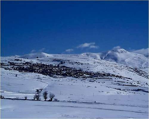 The Goran Village of Shishtavec in Winter - an highland town just in the Northern border of Albania at the edge of the extensive Sar Planina alpine meadowlands
The peaks south of Korabi located in Diber District around Peshkopi offer less in the way of technical climbing, with the exception of a small but interesting gorge near the trout farm of Arrez between Peshkopi and Kukes. Korabi itself, located at end of a canyon leading upwards from the village of Radomir, is a striking setting, and offers much rock climbing potential on its Albanian side. The Black Drin Canyon south of Kukes on the road to Peshkopi, however, is wild and interesting for those with four-wheel drive. Those portions of this canyon in Kukes District offer more rock climbing possibilities. From the villages of Skavice, Resk, Kolosjan, and Bushtrice, spectacular mountain scenery of the bare rocky uplands and numerous limestone crags characterize the landscape. Beyond this area, the main climbing is in two gorges draping the sides of Mt. Gjallica formed by the Lumes River on its northern and the Tershanes Creek on its southern shoulder. For scenic views, the small hillside mountain villages on the eastern sides of Mt. Gjallica and Mt. Koritnik and the highland regions beyond are worth a visit - villages such as Brekje on the eastern side of Gjallica, Orjost on the eastern side of Mt. Koritnik near the border with Kosovo, and the mountain hamlets of Strez, composed of Lumes Albanians, or Shishtavec and Borje, composed of slavic speaking Muslims known as Gorans. Some nine villages on the Albanian and twenty-two villages on the Kosovo side of the border are entirely or in majority constituted such ethnic Gorans.
While there is some question as to whether this slav heritage is Macedonian or Serbian, since the dialect of Goran is an evident mixture of both language variations, the Gorans are in socio-political terms, like the Muslim slavs or 'Bosniaks' in Bosnia, or the Muslim inhabitants of the Serbian ‘Sandzak’ between Montenegro and Kosovo, ethnically and linguistically Slavic and thus ‘nationally’ different from Albanians; and yet as Muslims frequently understood to be radically different from Orthodox slavs like the Serbs or Catholic slavs like the Croats.
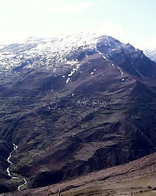 The Village of Cernelev (* topo 3) is visible on the hillsides east of the eastern side of Mt. Koritnik. Terraced agricultural land lies below down to the Lumes river, and grazing meadows reach above the village. A close look at the north slope in the lower right shows the only road to the village snow covered, and thus accessible only by foot or donkey.
There is no great social or political divisions or tensions which characterize Goran-Luman or Goran-Albanian relations (as in contrast for instance is the case south in Himare among Greek speaking minorities), but in the various conflicts over identity and ethnicity, the Muslim slav enclaves like those of the Gorans or in the Sandzak or in Bosnia proper frequently have divided and mixed loyalties depending on the historic circumstances of rule and subjecthood.
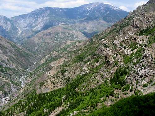 Mt. Koritnik - eastern side looking from the village of Kollovoz - the Albanian side is to the left; on its right side the shoulder descends into Kosovo (Photo - Jonaz Kola)
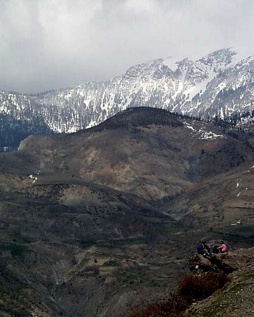 School children stop for a conversation on the way home from the Cernelev Village school with Koritnik rising in the background.
Mt. GjallicaMt. Gjallica itself makes a spectacular exercise. The sharp gradient from the summit into the town of Kukes constitutes the largest single visible geological formation in this part of Albania. Its steep, relentlessly uniform, and seemingly endless northwest slopes drop right into Shtiqen and Nange, the satellite villages of Kukes. Gjallica can be ascended up a spectacular but secure third class ridge line reached by following the hillside directly behind the 77 meter stack of the abandoned copper mine just before the entrance to the Lumes River gorge. Or one can climb directly up one of the gullies or approaches from the village of Shtiqen just to the south.
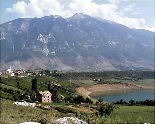 Mt. Gjallica from Kukes (*topo3)
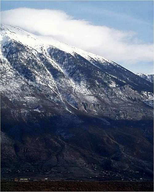 Mt. Gjallica - Western or Kukes side in Winter
A simple and shorter walk-up leads from the village of Topojan/Brekje high on the northeast shoulder, and after driving through the gorge and turning right along the less steep eastern slopes.
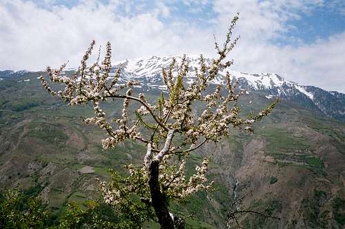 Mt. Gjallica Eastern Side - viewed from Kollovoz Village (photo: Jonaz Kola)
 Alternatively, one can follow the mountain road south of Bicaj left up the sides of Mt. Kolosjan past the village of that name, making sure at ca. 1600 m to keep left around the village of Tershane in the gorge below to stay on the sides of Gjallica. This road, when taken to the top of the col above, is the best way into the alpine meadows of the Albanian portions of the Sar Planina.
Note on Explosive Mines (Unexploded Ordinance or 'UXO') in the Mt. Koritnik and Mt. Korabi Areas
Mt. Koritnik at the northern end of this range borders Kosovo and Albania, and was mined and showered with rocket propelled explosive cluster munitions during the Serbian conflict over Kosovo.
Indeed, there are mines (uxo) located in much of the border region (particularly in Has District where it borders Kosovo between the Tropoje and Kukes Districts); and though progress was being made, a serious recent accident killing several deminers slowed down the clean up considerably. Mined (uxo) areas can be viewed on maps and reports available from the United Nations 'Relief Web', and do not affect climbing interests in this area - with three exceptions: 1) One must be careful to approach Koritnik from the Kukes side and avoid the actual summit - a rolling hillside - as well as the area below on the Kosovo-Albania border, and the entire meadow highlands stretching from the villages below the peak on the border, Orjost in Albania, and Orcusa and Globovica in Kosovo, southwards to Borje, Novosei and Shishtavec (see map to left for orientation).2) The Has mountainlands require up-to-date information before treking into them. There was a uxo cluster mine problem below the village of Myc-Has and a dangerous but localized mined (uxo) area on the road to Cahen vilage from Krume town. Anywhere within a couple kilometers of the border between Has and Kosovo must be checked out before making plans (again see the map on left for a preliminary orientation.)3) During the brief out break of fighting during 2001 in Macedonia and Southern Serbia around the Presevo Valley, highland traffic over the historic herding trails around the Korabi led to mines being placed in specific zones on the Macedonian sides of that mountain which are still there. This uxo do not effect climbing Mt. Korabi from the Albanian side, but ascent from the Macedonian side involves entering the Macedonian-Albanian boundary area, for which a special permit is required from the Macedonian Ministry of Internal Affairs.
==

The Mine (UXO) Situation on the Kosovo-Albania border circa 2002 - illustration by Bethany Sanders
==
A. The Gryka e Vanave into the Lumes River Gorge
The Lumes River gorge divides Mt. Gjallica from Mt. Koritnik, and may offer some of the best overall rock climbing in all of Albania.
It has a road following the Lumes River running west to east, beginning just north of Kukes on the road to Kosovo right after the reservoir bridge. This road cuts along the northern bank of the gorge. After a preliminary set of broken carst hillsides, two tunnels through limestone formations reaching down the south face across the roadway mark the most distinctive landmarks in the gorge. The first tunnel is .75 Km from the bridge, the second is 2 Km past the first; and two subsequent markings are constituted by the only Hoxha-bunker along the road 1 Km from the second tunnel (with the number 39 painted on it in red), and the visible serpentine formations at the base of the South-East Buttress one kilometer further at the west entrance to the gorge.
This gorge offers a tremendous amount of rock climbing in all classes of difficulty and in all grades between I & IV. The climbing possibilities arise from the multiple ridges of limestone and faces formed between and on the sides of these ridges, rising in fins, pinnacles, and crags. The single largest formation is the ridge of Koritnik, running 1000 meters up to a 1352 meter subsidiary peak called Koritnik (or, on some maps, 'Koritnikut') Peak.
==
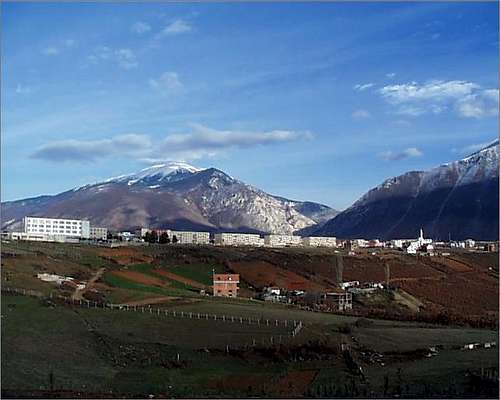
Mt. Koritnik view from Kukes - a clear view of the summit of Mt. Korinik, and the lower Koritnikut Peak and its long limestone ridge lines
==
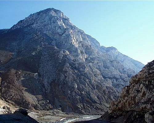
Lumes Gorge - The West Entrance View of Koritnikut Shoulder arriving from Kukes (*topo 3) The road is visible on the north side, with a typical Hoxha-bunker on the left. Koritnikut Peak on the shoulder of Mt. Koritnik, and the main ridgeline of the peak are visible in the sunlight. It is the vast and repeated serrations of ridgelines reaching down in places into the riverbed that offer a cornucopia of routes of all sorts and abilities. The Tower Area rises on the ridge immediately in front of Koritnikut Ridge just above the small sunlit rock in the middle of the lower third of this photograph.
==
1. The Gorge South SideThe entrance to the Lumes Gorge is visible just left of the bridge beyond the old run down Chinese built copper smelter on the sides of Mt. Gjallica, used during the refugee crisis as a tent city. - source Wikipedia auf deutsch
Tower Pinnacles AreaFollowing the second tunnel, several limestone ridges run down the south face of the gorge to the roadside – available after a short by dizzying approach up the steep carst scree fields beneath and separating each of the ridge formations. Along each of these ridges, a series of faces are available for route development, averaging one to three pitches, and with, in many cases, roadside belay stations. These Tunnel Buttresses are steep, and partially broken in places, offering some easier fifth class routes, but consisting mostly of shallow cracks in broken corners and steep faces.
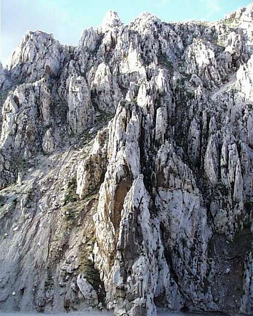 Lumes Gorge - North Side - Towers Area
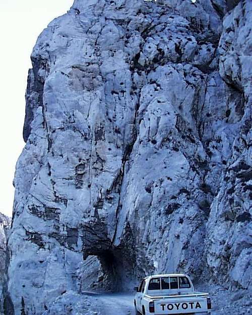 Lumes Gorge Tunnel Buttress - The road through the Gorge travels on the north side of the stream and is cut by on large butress. Here it is viewed looking west from the eastern side along the road.
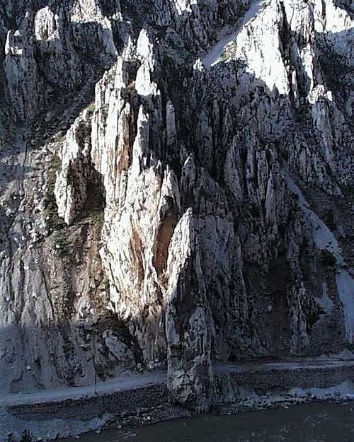 Lumes Gorge Tunnel Buttress - The road through the Gorge travels on the north side of the stream and is cut by on large buttress just past the Towers area.
There are several limestone ridges directly before this tunnel, all of which offer moderate 4th and 5th class ascents, while the steeper faces of these ridges offer progressively hardly free climbing possibilities. All of these ridges lead to two large (‘tower’) pinnacles of limestone some 350 meters over the road on the ridge just in front of Koritnikut Peak ridge.
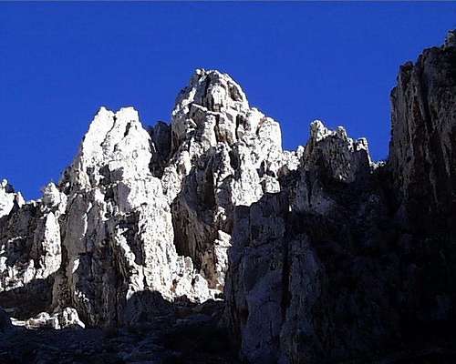 The two towers in the sunlight viewed from the road.
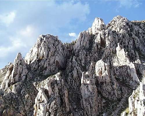 A wider shot of the towers area viewed from the Gjallica side of the Lumes Gorge. The two towers in the photo left adjacent are the 2nd and 4th knobs on the skyline in this picture. The others are less distinct from the roadbed below.
At least one easy fifth class and several more difficult crack systems break each face. Descent is found to the north -- down a steep cow pasture past a pumphouse, which can also serve as approach to upper routes on Koritnikut Ridge.The rock stretch below the pumphouse can be seen distinctly from the road as three ‘beehive’ like formation containing a small pinnacle. This small crag - 'pumphouse rock' - makes an obvious and accessible teaching location. Each of these beehives is separated by a fissure - by a crack with a 5.9 move on the left, and with by an easier alternative up one of the two cracks on the right. A 3rd/4th class ridgeline on the right leading up right past a pinnacle.
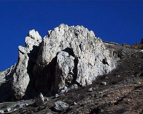 Pumphouse Rock - in the Lumes Gorge just before the Towers area. Short and safe learning area.
The Upper South FaceThe upper south face is cut by several ridges which jut out, especially at the north and south entrances of the gorge, in large buttresses. The most distinctive is the north-east ridge of the Koritnikut Peak itself, visible on the way in the gorge, while at the east entrance, the south east buttress or the Quelesh is the most evident feature, as it rises the full height of the rock formations. The largest rock routes, however, are formed by the ridgelines and faces of the northeastern area. This whole formation rises above the towers area described above.
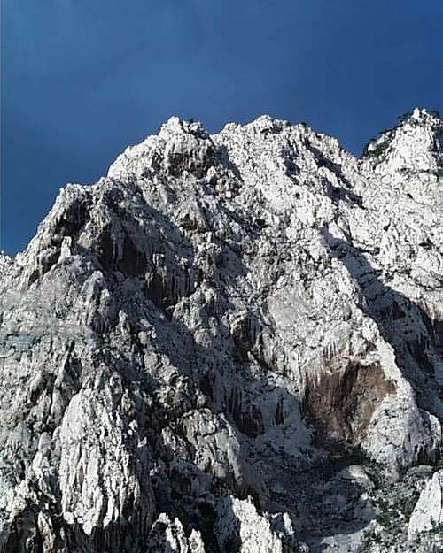 Koritnikut South Face Shoulder - close up of lower portion (*topo 3)
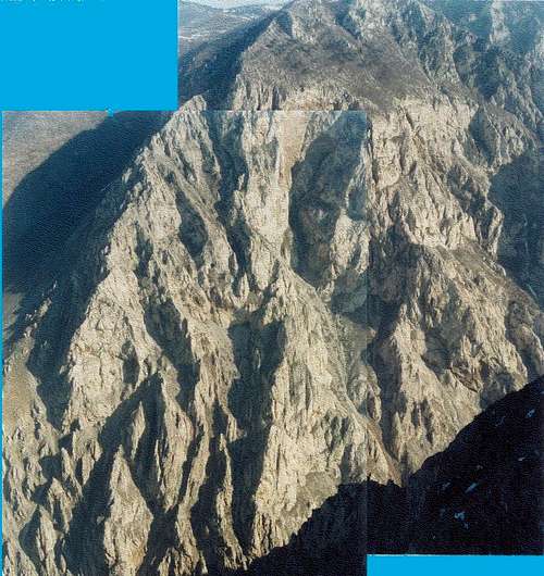 The Koritnikut South Shoulder Ridge Lines (*topo 3) composite photo viewed from Mt Gjallica's shoulder - long 5th class, easier from the center ridge, leads to the peak, and then to the rounded mountain top - a long day. The center upper red portion is overhanging and can be accessed from the right up the 3rd class gully which also runs along the base of 'Cave Rock' below.
Equally broad arrays of ascent possibilities are available on the upper face to the right of the north-east ridge and the faces formed by its eastern side. Several of these can be seen in the second picture of Koritnikut Peak’s upper face directly below. Beyond the overhanging upper parts of the central face, a series of broken limestone areas of varying quality rock and elaborate route finding also allow access to the top of the cliff area. After the 'towers' area in the lower portion of the gorge is a large slab area. To its right, the scary 3rd class gully leads to the overhanging upper portion of Koritnikut South Shoulder; to the left one can see the independent lower formation of 'Cave Rock', which also includes a worthwhile limestone cave for exploration.
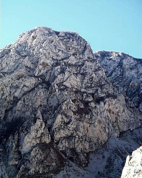 'Cave Rock' - Lumes Gorge
Quelesh or the North-East ButtressThe largest single piece of rock in the lower parts of the Lumes Gorge is the North-East Buttress, rising beyond 'Cave Rock' formation, and essentially forming the eastern exit of Lumes Gorge. From below along the road at the eastern gorge entrance, the formation looks like a 'quelesh' (*topo3), that is, the traditional white rounded felt caps of the Albanian mountaineer in the northern Gheg regions. The west face is steep enough that many lines would be artificial as is evident from the brown color of the overhanging rock, while easier fifth class lines can be found on the lower east face leading up to the long 3rd class ridge line. The upper parts of the east face are longer and more broken, and exude many more difficult fifth class possibilities.The main routes on Quelesh can be approaches most easily from the fields that lead up to the goat paths along its base, leaving from just above the gorge at the suspension bridge by the west entrance. From this approach, the three great dikes of broken limestone rising from left to right across the face and many fourth and fifth class multi-pitch ascent options are readily apparent. The last and largest of the ledge systems at its base, accessed from the right, is roomy enough to contain an entire herd of goats and its keeper. This ledge edges into the middle of the face, with some interesting fifth class ascents leaving from the right had side of through the rim of the main headwall. These routes can be seen in the last picture leaving up to the right from under the right hand brown patch that appears under the right-hand skyline.
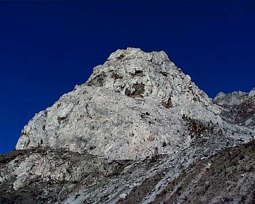 Quelesh Rock from below - showing large ledge splitting the rock and accessible from the right *topo 3)
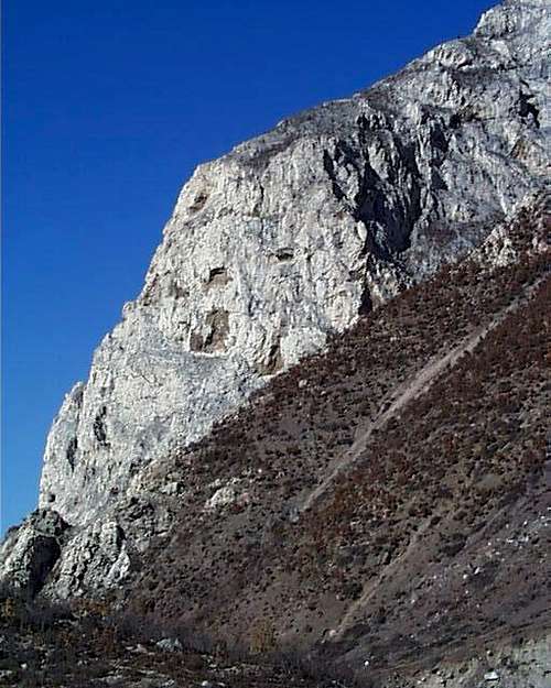 Quelesh Rock from the Lumes Gorge eastern entrance, show the long rising 3rd class ridge to the top.
2. The Gorge North Side
Entrance CracksThe northern face of the gorge is broken by a series of uplifted crags with distinctive crack systems at the entrance. Many of these, including the two formations of ‘Hoxha’s Head’ and Split Rock, are continuations of the Tunnel Buttress ridges, but up the northern shoulders of Gjallica rather than the southern shoulder of Koritnik.The right hand side of Hoxha’s head can be ascended via the obvious corner, including a tricky overhanging portion, which leads to the back ridge of the ‘head.’ On the face further right are easier fifth class alternatives, while on the left side, a blocky corner can be followed leading up to steep layback just left right hand profile.Split Rock contains a grimy and wide chimney up its right hand side dividing it in two, with a more interesting corner that rises to its right. The face left of the chimney and the large chimney in the middle of split rock are moderate 5th class, as is the buttress to the left of the main chimney.
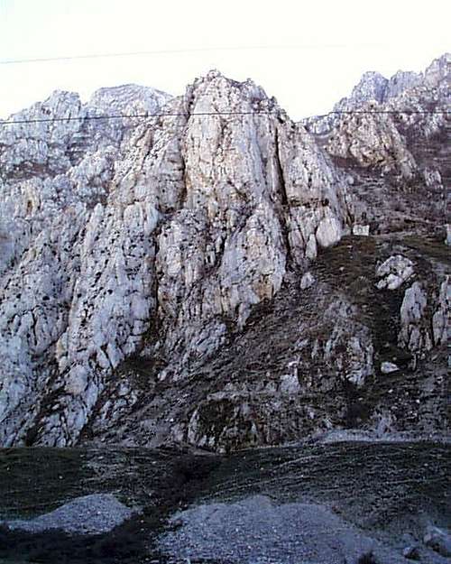 Split Rock formation - Lumes Gorge. A cut ledge divides the upper half of this interesting formation. The lower half contains to ridges that can be climbed directly from the lower aquaduct, all 4th or easy and 5th class. The two chimneys leaving from the upper ledge are flared and more difficult, as is the beautiful corner visible on the upper right. Harrowing moves lead from the ledge onto the upper face between the two chimneys.
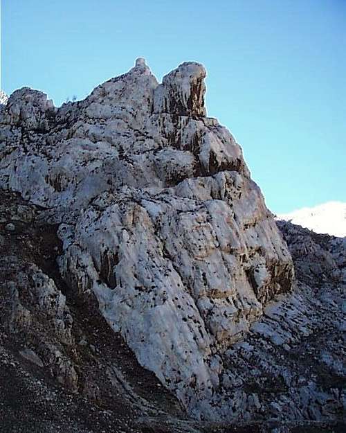 Lumes Gorge - Next to Split Rock is the 'Hoxha's Head' formation.
Aquaduct TerracesTwo large ridges of limestone which jut from the top of the gorge down into the Lumes river. Where they come down to the river, they form a series of terraces combining steep and overhanging portions with broken faces. Along this section, several climbing areas are accessible by a goat and miners trail which has been hewn into the carst, and by an aqueduct system which runs along the base of the gorge some 20 M above the river bed. The first or Lower Terrace appears first driving from west to east; and the second or Higher Terrace a few hundred meters further.
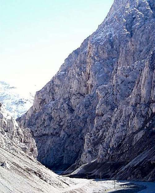 The bottom portion of Gjallica's North-East Buttress in the Lumes Gorge is chopped up by two engineered cuts, giving varying access but breaking an already steep but broken formation into one more difficult to climb enjoyably.
North-East ButtressThe last major formation on the south side is the North-East Buttress (*topo 3). This ridgeline runs directly down to the road where some striking steep grooves break the face of the buttress. Above it rises in a long ridgeline that is also broken by a 250 meter face higher on its upper east-facing side.
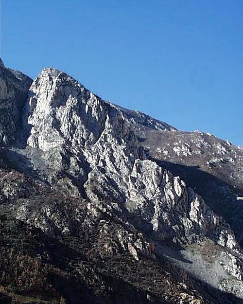 The long north east buttress of Mt. Gjallica with its clean upper face rise from the Eastern end of the Lumes Gorge (*topo 3). The North shoulder of Mt. Gjallica marks the longest ridge formation out of the north side of the Lumes Gorge. The rock is cleaner and the views more spectacular the higher one climbs.
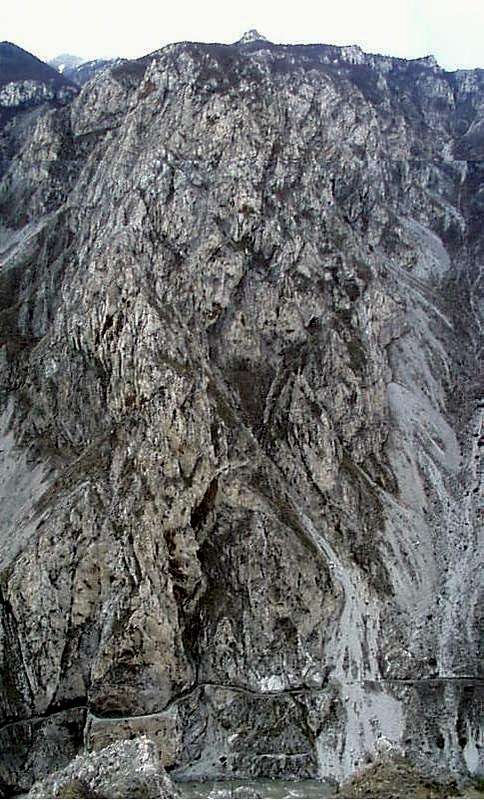 The North-East Buttress of Mt. Gjallica drops into the Lumes Gorge at its eastern end - here viewed from above on the Koritnikut Peak side. This view from the other side of the gorge illustrates the length of the central to sections and the broken fourth and fifth class sections which pass through the final canyon rim headwall. The aqueduct cut through the lower gorge is visible in the lower part of the picture.
Remarks on climbing on the way into the Lumes GorgeLeaving the town of Kukes, it is possible, before crossing the bridge over the Lumes river, to drive up and right, past the abandoned Copper Smelter, to a longish bluff under some old military storage bunkers which forms visible southern rampart to the Lumes Gorge entrance. Here the bluffs are of a softer and more fractured limestone mixture, but have a series of interesting crack problems rising up the row of 20-40 meter high bluffs. Unless one manages to get a vehicle to the top of the ramparts however, upper belay anchors are lacking. (These crags are clearly visible in the photograph of the copper smelter as refugee camp.)The north side of the entrance gorge, before the abandoned pumphouse, is a much larger rock formation. The only safe approach is from the right looking up, nearer to the pumphouse end up the steep 3rd class 'scree', but the upper cliffs offer several 4th class fissures to the top including a main corner formation. 5th class rock of 2-3 pitches can be found inbetween these fissures.
B. Bicaj Gorge
Eight kilometers south of Kukes on the road to Peshkopi, a sharp gorge following the Tershanes creek cuts dramatically through the lower south shoulder of Mt. Gjallica in a 'jigsaw' formation just above the town of Bicaj. Behind the two-story white school building, a road leads a half kilometer to the hamlet of Mustafe.
 Annotated Topo 5 - Bicaj - Kolosjan - Tedjrine Area
 The Upper North Face of the Bicaj Gorge as viewed from the Mt. Kolosjan Road
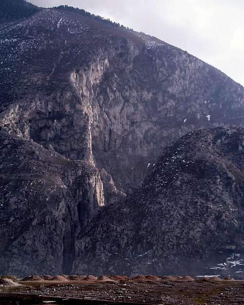 Bicaj Gorge Showing Upper Faces (*topo 5). This view of the Bicaj Gorge entrance from Bicaj shows its keyhole cut with amphitheatre behind. The gorge offers some striking and spectacular rock climbing, though rock conditions vary in quality and the approaches are difficult. Offwidth and hand-width cracks and corners shooting up the vertical corners formed by the lower cut, while above overhanging limestone eaves call for elaborate mixes of fifth and sixth class techniques. Further inside the gorge, the jagged shark fins and ridges of rock offer cragging opportunities of a less demanding character.
Very steep lines run up both sides of the sharp keyhole cut in the side of the mountain. Above, longer and steeper lines run 150 meters or more up the limestone ridge behind the keyhole entrance to the gorge and in the amphitheater cut into the side of Gjallica behind.
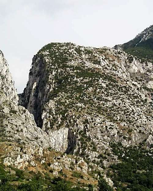 Bicaj Gorge - Wide View
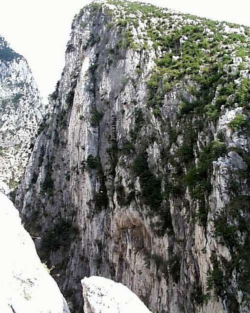 Bicaj Gorge. This close up view illustrates sharp blades of exposed limestone rising just inside Tershane Gorge on the right hand side. Curved amphitheaters of overhanging limestone with sharp buttresses of rock dividing them rise from her up the south side of Mt. Gjallica, offering many possibilities for those able to manage the complex approach.
Bicaj is the old tribal center of the Luma, who were the dominant political force in this area historically; and the area is populated and requires a local guide to avoid irritations from the local children. The gorge can be accessed, always with difficulty, three ways: (1) via the entrance by going down through a few farmers fields from the village of Mustafe, (2) from this village up along the steep goat path over the southern lip of the gorges precipices towards the village of Tershane, or (3) from the Mt. Kolosjan road downwards past Tershane into the gorge. Much of the limestone is extremely steep and broken, and there are for many of the features, questionable and difficult approaches, but the environment of this gorge is as strange and spectacular as any in Albania.
The Kolosjan road, a left turn south of Bicaj on the main dirt road between Kukes and Peshkopi, also provides access to the Albanian portions of the Sar Planina, a vast wide highlands with little in it but goat herds and the remains of Albanian military installations from the Hoxha era. Besides access to Mt. Kolosjan (2050m), virtually a 'drive up' with a 4x4, the area above is essentially a vast highland plain. It is unpopulated excepted for masses of old military bunkers, and is beautiful as a base for treking, cross country skiing or mountain biking, either east into the Macedonian Sar Planina in an area free of mines (uxo), north towards the Shishtavec highlands, or south along the Albanian/Macedonian border, where the Mt. Korabi massif lies some 20 km to the south.
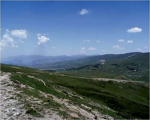 From the Mt. Kolosjan Road on the upper north side of Mt. Kolosjan the alpine highlands of the Sar Planina stretch out into Macedonia.
C. Kolosjan, Bushtrice and Tejdrine
South the Bicaj Gorge on the road past Bicaj Town, a series of crags rear up in the vicinity of the mountain villages of Kolosjan, Bushtrice, and Tejdrine. Kolosjan lies on the main road to Peshkopi 15 km south of Kukes, and the turn-off left to Lusen and Bushtrice is 2 km further down the road. The three Kolosjan Crags (South-Middle-North or One-Two-Three)appear on the shoulders of Mt. Kolosjan (2050 m) south of the village of that name, and along the road to Bushtrice (* topo 5).
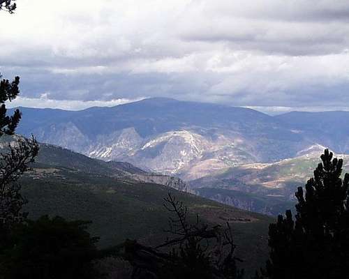 From the Shenjtit highland road, it is possible at several points to look into the Black Drin canyon. This view shows Mt. Kolosjan and the three Kolosjan Crags at its base.
After the third crag, the road turns up the side of a canyon towards Bushtrice. Before this road drops down into Bushtrice Canyon, there are several crags that are visible and can be reached from the tiny hamlet of Lusen on the north side of Bushtrice Canyon. Follow the aqueduct from Lusen in direction of these crags. Several large pillars and corners drop right into the creek of Bushtrice Gorge, and these can be reached by following the road down to Bushtrice, from which the road leads later up to Radomir and Mt. Korabi following the turn off just past the canyon to the right. The left turn leads up past the series of Bushtrice pillars rising above up the Bushtrice canyon on its left hand hillside to Fshat and the Fshat Wall in the other. Throughout this area, the climbing can be excellent. The vast scars caused by the faces of Kolosjan Crags 1 & 2 offer routes along both sides, as well as overhanging crack and boulder problems of all sizes, while the south side of both crags, as seen in the picture below, offer multi-pitch ascents of varying fifth class difficulty. Kolosjan Crag 3 drops to the side of the hill where the road turns east to Lusen, where a series of difficult and steep faces rise right from the road cut, with a palisade of varying limestone pillars rising above. The main path of ascent is a striking moderate 5th class route begins at the detached pillars to the right of these slabs by following the main angular cut in the face from right to left. After some five pitches, it finishes with a slightly harrowing traverse over a sluice gully of shattered overhanging limestone at the top of the crag. Left of this, several fourth class options follow right of the shattered gully, and to the right a manifold of moderate and difficult fifth class routes are evident beyond the two pillars at the base of the first scree piles.
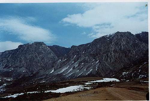 The First or Northern and the Second or Middle of the Three Kolojan Crags (photo - Jonaz Kola)
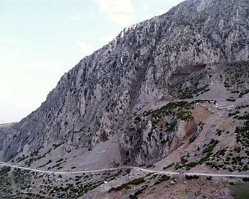 Third Kolosjan Crag (*topo5). Viewed from the south: the main routes leaving near the slabs in the lower left of the picture, and then on the crags rising to the left up between the various scree chutes. The road cut and that caused by the aqueduct are visible on the left; descent is via to the right at the top via the back side down to the aqueduct cut.
Bushtrice Gorge and the Lusen Escarpments
The crags of Bushtrice Gorge (* topo 6) can be reached by scrambling down and left from Lusen, or up through the gorge along the river. The upper crags of the Lusen Wall, which rises just up river from the village of Lusen, are best reached by following the aqueduct from Lusen.
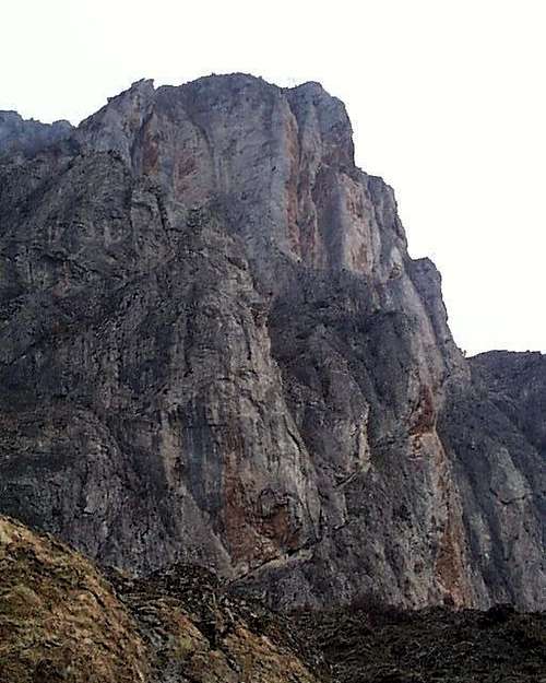 Lusen Upper Crags - rising above the village of Bushtrice
The gorge can be entered by driving 2 km down the road from Lusen on the road to the villages of Bushtrice and Radomir.
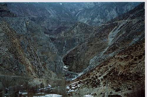 Bushtrice Gorge - Entrance (Photo - Jonaz Kola)
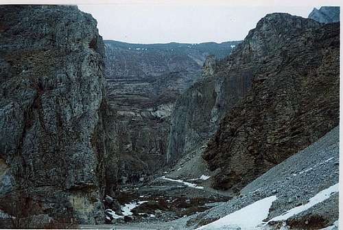 Bushtrice Gorge Entrance - Close Up (* topo 6), Photo - Jonaz Kola)
Routes of varying difficulty rise to right and left, with easier cracks and faces to the right and steep blades of limestone along the base of the village of Lusen as the gorge rises towards the Lusen Wall.
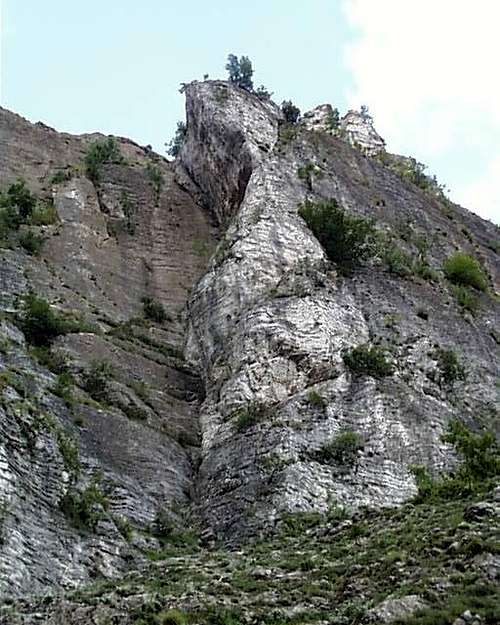 Bushtrice Gorge - Cracks
 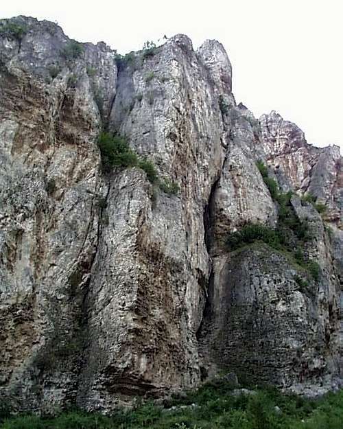 Bushtrice Gorge - More Crack Climbs
About two kilometers up the gorge from its entrance on the Bushtrice-Fshat road, the buttresses of the Lusen Wall rise up to the full height of the cliff. Their best approach of one seeks to climb the entirety is through the gorge, and then up one of the steep vegetated cracks or gullies leading to the upper ramparts. Rock quality is a clear issue in this area, however.Two of the several Upper Bushtrice Crags are accessible via Lusen. The lower portions of the Bushtrice gorge form the lower part of the same face as these towers; and the entirety is accessible from the gorge entrance 3 km down the road from Lusen. The Lusen Wall abuts the Fshat Wall.
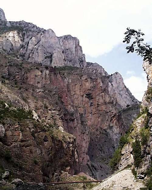 Lusan Escarpments from inside Bushtrice Gorge.
Fshat Wall
Up the road from the Bustrice gorge routes, a steep and harrowing mountain passage with massive drops into the gorge below leads, after five kilometers, up to the village of Fshat. The bluffs of the Bustrice gorge rise up on the mountainside directly north, with the same formation developing into the 2-300 meter limestone formations above the mountain hamlet of Fshat. The large upper bluffs can be reached via Lusen, while the lower are approached via the gorge. Lusen and Fshat are connected by a two-hour goat trail leading along the base of the main Fshat wall, and providing a convienent means of descent from the crags all along the 4 kilometer walk up the Bustrice gorge to Fshat. The rock in this gorge is of mixed quality (piles of steep to vertical limestone choss in places), with the most noteworthy feature being the large funnel, chimney and crack systems that make great incisions down the overhanging limestone faces.
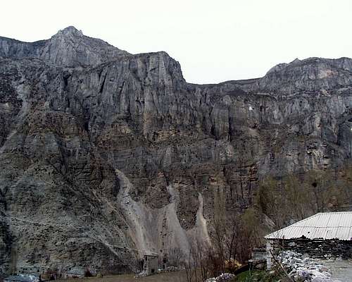 A left turn a half a kilometer or so past the entrance to the Bushtrice gorge leads five kilometers up hill to the village of Fshat (* topo 6) , where across Vaut de Cajes stream cutting through the gorge, a set of large but fracture limestone cliffs rises. The goat trail cut left and up across the base leads to the village of Lusen.
Tejdrine Towers
The last and most striking of the limestone formations in this area lies near the town of Tejdrine in a set of towers rising from the Black Drin up to the town. These are reached by turning right 2 km after Kolosjan and remaining on the main road to Peshkopi, following the switchbacks some 6 km more down into the bottom of the Drin Canyon. Tejdrine Towers appears on the other side as one drops into this canyon.
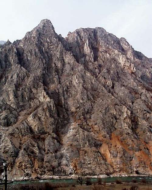 Tejdrine Towers (* topos 5 & 6)
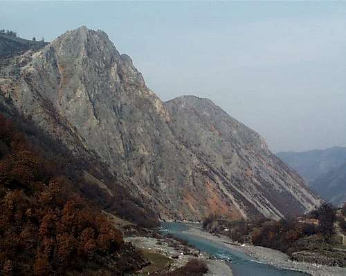 Tejdrine Towers - Looking north and downstream from near the bridge crossing the Black Drin in the vicinity of the village of Resk.
Note on Kayak Access to the Black Drin
The town of Tejdrine, perched on the hillside above the towers dropping down into the river, can be reached by a bridge which crosses the Black Drin from the north. The main road to Peshkopi continues here south along the upper sides of the East side of the Black Drin canyon, but access is also possible at this point along the westside near the river itself. Indeed, south of Kukes, this river crossing is one of the few access points to the lower section of the Black Drin canyon. (Boats could be put into the river here given proper levels, and it is probably a long day or two back down and north to the Kukes reservoir, but in between there are virtually no road heads, and I have no personal knowledge of the passability of this canyon by boat-foot passage!)
D. Radomir and Mt. Korabi
Mt. Korabi and its range lies right on the border of Kukes and Diber provinces in Albania on one side, and on Macedonia on the other. From the Albanian side, it is most easily accessed from the village of Radomir, the highest of the several villages in the Kale e Dodes basin lying between the Velichces and Grames streams which issue into the Drin below.
 Annotated Topo 6 Bicaj - Kolosjan - Bushtrice - Radomir - Korabi
 Driving south from Kukes, one reaches the village of Radomir and the Mt. Korabi complex by following the road into the valley beyond that of Bushtrice, in the process crossing the border from Kukes into Diber Districts. The road in this direction is not bad, but distances are typically not marked on Road Maps below Bushtrice. The following intervals are worth keeping in mind: From where the road turns right down the hill at Lusen, it is eight kilometres to the next important intersection at Ploshtan (* topo 6), where the road goes left up the hill around a Café-Bar which divides Kukes from Diber district and the Vaut te Cajes basin running from Fshat through Lusen to Resk through the Bushtrice Gorge from the Velishice drainage on the Diber District side; from this intersection it is another eight kilometres to a left hand turn at Cerem which leads up two kilometres to the village of Radomir (* topo 6). From here, the magnificent limestone cliffs of the three Radomir Rocks and the complex formation constituting Mt. Korabi can be easily accessed (* topo 6). They rise in a long ridge line just above the Stonaraki or Radomiri creek which below runs into the Velishice drainage below, with its steep earthen escarpments running along the northern side.
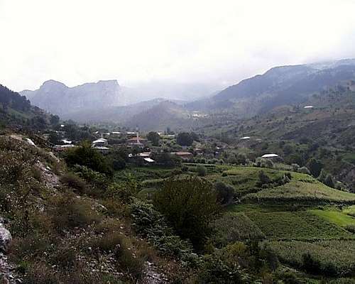 Radomir Village and the trail to Korabi (* topo 6)
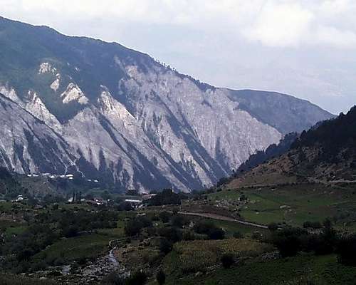 Looking from the Korabi Fair at the village of Radomir and the north facing unclimbable shale escarpments of the Veleshices drainage into the Drin below
Parking is found on the road just beyond the village mosque, and here the broad livestock trail leads up into valley through the Korabi Fair towards Mt. Korabi. The largest part of the rock climbing in this area can be found on the three Radomir Rocks which rise on the same ridge line as Mt. Korabi itself directly up the valley out of town. Following up beyond the town is the 'Korabi Fair' area, known as such because it is the historic market place for auctioning herds which are kept during the summer on the Korabi plains above and serving as part of the livestock market pathes historically using the passes over Korabi between Albania and Macedonia. Access the rocks, or the Ridge ascent of Mt. Korabi via the goat trail visible at the base of these rocks; while following the stream bed allows access to easier ascents of both Mt. Korabi (2751m) as well as the fractured limestone pillar broken by scree fields that constitutes the slightly lower Mali Korab or 'Korabi Gates' (2683 m) lying to the south, the large peak which is broken by a giant snow gully on its south side, facing Peshkopi. Access to Radomir is also possible south from Peshkopi, but unless one is coming in through Greece or Macedonia, more climbing is found in the portion of the Drin river valley between Radomir/Mt. Korabi and Kukes, and very little between Radomir and Peshkopi. Few people seem to make the drive up the Drin Valley from Peshkopi north to Kukes. It is roughly 35 km on the road to Radomir from Peshkopi. When travelling in the Drin valley between Kukes and Peshkopi in general, it would be wise to allow virtually an entire day driving between the two towns until one has the roadway clear in one's head. For information on access to the Korabi region from Peshkopi, see the website of the Peshkopi 'Ecological Association'.See also Norwegian Petter Bjørstad's trip report of his ascent of Mt. Korabi from Peshkopi, including interesting pictures.For climbing Mt. Korabi from the Macedonian side, see the Mt. Korabi mountain page at SummitPost.
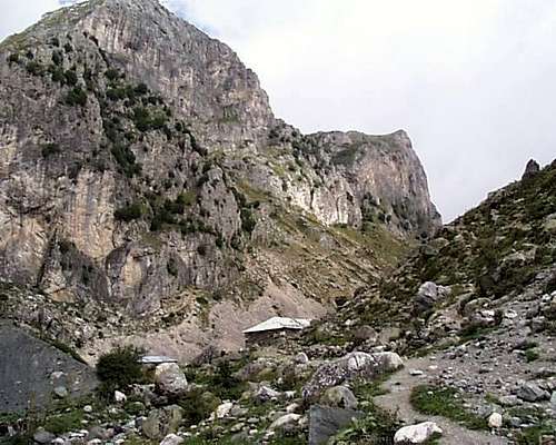 The View from the Base of 'Korabi-Fair' of the first of the three Radomir Rocks. The profile of much larger and more intimidating second or middle Rock is visible on the right skyline.
Besides the Three Radomir Rocks (Left-Center-Right or one, two, three as one ascends towards the Korabi ridge), the complex cirque of massive limestone pillars that forms Mt. Korabi offers many possibilities for rock climbing in exposed alpine conditions and at all levels of difficulty (*topo 6).All three of the Radomir Rocks offer distinctive possibilities. Cragging of all sorts can be found on the first, and as well on the set of 1-2 pitch pillars just beyond them.
==

Lower Radomir Rock - View from uphill on the Korabi goat trail with smaller crags separating the lower from the middle Radomir Rocksl.

Looking Up the Face of Lower Radomir Rock
==
The second or middle Radomir Rock is a massive steep and fractured affair which has one or two distinctive traditional lines, and acres of space for more elaborate sport or artificial activities, all evidently in the Grade IV range (* topo 6). The main weaknesses are in the center of the face and the large corner on the upper part of the face; the right hand lower face is mostly overhanging and largely unclimbable, but the domed face above offers possibilities. As evident in the view of the entire face above left, the reddish areas indicating overhanging and largely unprotectable limestone pose obstacles to most other lines on the 800 meter wide face.
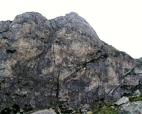 The Main Face of Radomir Middle Rock (* topo 6)
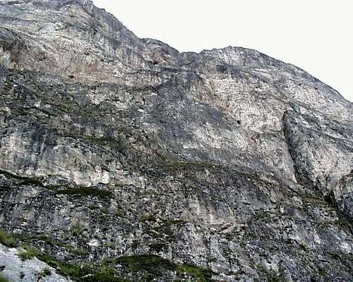 Looking Up the Main Face of the Middle Radomir Rock
The upper or third Radomir Rock has three excellent fifth class lines breaking its otherwise sheer face, the most attractive being a moderate corner as enjoyable as the broken faces above. It also has an extremely forbidding looking overhanging chimney rising out of the cave in the upper eastern end of the rock. The massive limestone pillars can be approached best by following the stream bed up past the Radomir Rocks, following the goat trails right around the waterfalls, and scrambling up the scree fields out of the pastures ca. 1-2km further up the valley. These are about a two-hour approach from the roadside.
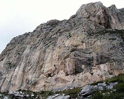 Radomir Upper Rock (* topo 6)
The summit of Korabi, the highest peak in Albania/Macedonia, on the border with Macedonia, can be reached by continuing up the rather beautiful limestone ridge which continues from the Radomir rocks right up to the summit. To avoid a forth class section of this ridge, it is possible to drop down into the scree fields and back up a notch leading to the eventual summit. Alternately, keeping wider above and to the left of the Radomir Rocks leads one to a broad meadow from which a walk up and around some more big limestone formatations leads one on a longer but easier path to the top.
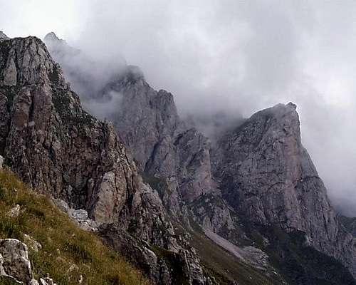 The path to the summit leads along the top of this crescent of escarpments to the summit ridge
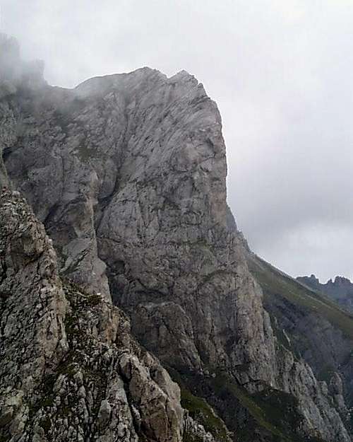 The western of the two large limestone pillars on the side of the main Korabi ridge offers a fifth class route up the main ridge
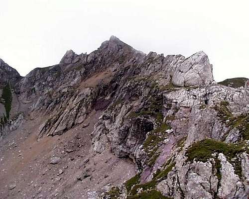 Korabi Summit Ridge - the second class approach drops into the scree gully on the north eastern side (* topo 6)
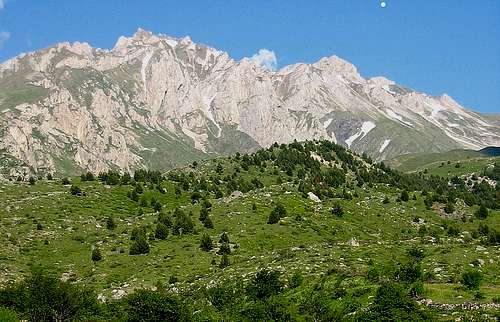 A wider view of Mt. Korabi's Summit from further south beyond the top of the Radomir Rocks approaching from the Albanian side. Ascending the meadows on the right hand side just right on the long snow gully allows one to cross over the two large rock buttresses, and attain the summit ridge, visible in the picture. (The large rock under the cloud in the picture is the same larger or more south-western of the buttresses on this east facing view, as visible in profile in the second photograph above.) -- source - Wikipedia/Albinfo
VII. Has Mountainlands
Has District is a in a mountainland basin lying between Kukes District and Tropoje District deriving its name from these mountainlands (Malësia e Hasit). 'Has' in Albanian means 'chance encounter' or 'bump into', but can also express a hard side, in the sense of has ne shkemb, 'to collide against a rock' or hasem, 'bias' or 'envy.' The Has area is modest in scope, has a low population (20,000 for the whole district by 2006 est.), and is poor. This is largely due to the dry conditions - the highlands are also known as Has i thatë or 'Arid Has'- and the fact that after World War II, it was cut off from its historic commerical ties to Kosovo. Not even Edith Durham, in her explorations at the beginning of the last century, made it to Has.
==

A view from Vransiht Village of the Has Basin, composed of mountainlands along the Has-Kosovo border, and the relatively dry and poor farm and grazing lands draining in the Fierze-Koman reservoir system.
==
 Has Road at Myc-Has in Winter with school traffic
Driving from Kukes, one crosses the White Drin driving north along northern side of the Fierza reservoir some 1000 meters above it and providing a striking view straight down the mountain side into that reservoir right across from the Kalimash village peninsula on the Kukes side. After passing the village of Myc-Has and the shoulder above it at the 700m line, the road passes through the village of Vranisht along the characteristic dry terraced farm and grazing land and thence to the town of Krume, the largest town and District government seat in Has, in the middle of the Has highland basin.
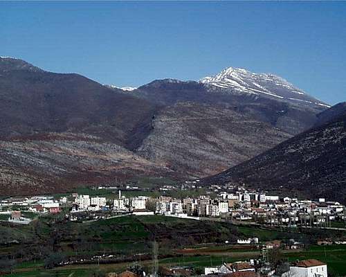 The view of Kranam Peak from the town of Krume gives one a sense of the mountainlands of 'Arid Has.' The snow covered Pashtrikut group peeps out in the center upper right.
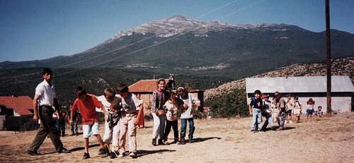 The view of Mt. Pashtrikut on the border between Albania and Kosovo as viewed from the schoolyard in the Kosovar village of Dobrushe.- photo Bethany Sanders
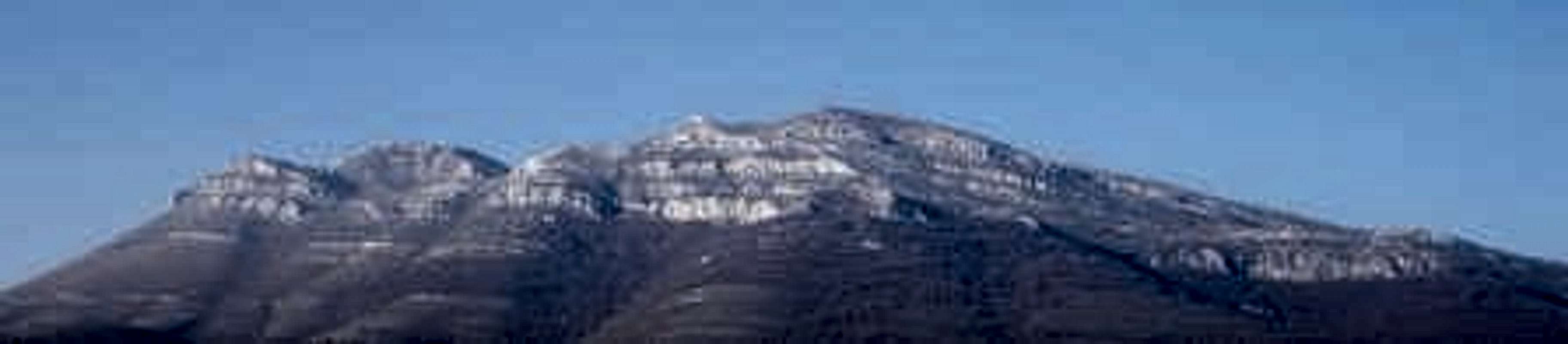
One can continue along this road past Golaj either right and north to the Morine Pass Kosovo border station, or left on a long and widing road past the village of Pac and Bytyc to the Bajram Curri-Tropoja-Kosovo road. (This road is not further than the Fierza Dam route to Bajram Curri from Kukes, but is not recommended without four wheel drive.)
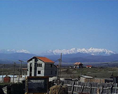 This view of Mt. Pashtrikut is from near the Morine Border crossing between Kosovo and Albania on the Prizren-Kukes Road. The long set of limestone cliffs are difficult to access.Malesi e Gjakoves in Tropoje District - viewed from the Has Road
There is no rock climbing in Has, but the Malesi e Hasit provide a long dry and wild ridgeline for backpacking or treking. From the south, this line can be reached from Myc-Has, and which travels past Mt. Tregtanit (1172m) overlooking Myc-Has past Mt. Rrases se Bregut (1306m) along the ridge overlooking Krume to the mountain village of Cahan (1100m). The main peak of the Mt. Pastrikut (1988m) massif, lying on the Kosovo border, can be easily accessed from Cahan, as well its subsidiary summit (Kranum Peak 1398m), which overlooks the town of Krume. To climb either or both peaks in one day, leave the vehicle either at Cahen up the canyon from Krume, or drive up the valley to Vlahem (right hand turn 6 km northeast of Krume on the Has Road to Tropoje).
VIII. Shkodra Area and North Western Albanian Alps
A. Malesia e Madhe: Hoti to Vermosh
This area of Northern Albania, the Malesia e Madhe (or 'Great Mountains') District, along the Montenegro border is perhaps some of the most beautiful in Albania, and it also probably holds the most spectacular rock climbing in the country as well - defined by the approaches up two great canyon systems from Hoti to Vermosh and from Koplik to Theth respectively. The northern road line goes from Hoti to Vermosh along the border canyon following the Cem River; and the road line immediately to its south goes North-East from the town of Koplik, half-way between the Montenegrin border and the city of Shkodra, through the Shkrel and Kastrat region over the Terthores Pass to Theth and the 'Accursed Mountains' proper, which begin at Mt. Bridashes and Mt. Radohimes, lying north above the villages of Boge and Theth respectively, and run NorthNorthEast through Mt. Jezerce, the highest peak in the region, and along the Albanian- Montenegrin border to Mt. Tromeda in the north.
 Annotated Topo 1 - Cem Valley, Vermosh, Shales Valley and Theth, Valbona
 Looking back at Lake Skhodra from near Hoti on the switch-back road to the Cem Gorge. The climate changes dramatically from the dry eastern side facing the lake to the much more overgrown and Byronic Cem River gorge.
Hoti to Vermosh through the Cem River Gorge
A turnoff into the Hoti Valley west off the Podgorica-Shkodra Road is found a few hundred meters south of the Montenegrin border. The road meanders up the hill past the valley village of Hoti to the stone town of Rrapsh formed in a flat col composed of odd formations of broken limestone. (Along the way, the road is broken by a series of 3-8 meter limestone rocks jutting up out of the gorse bushes like sharks teeth and providing for an interesing bouldering interlude of mostly moderate problems with exciting landings formed by the aggressive plant life and tettering limestone proto-talus.)
 Hoti's Limestone Tooth Garden - photo Karla Christensen
After Rrapsh the road descends dramatically in a series of twelve large switchbacks some thousand meters in two conjoining valley sides (* topo 1).
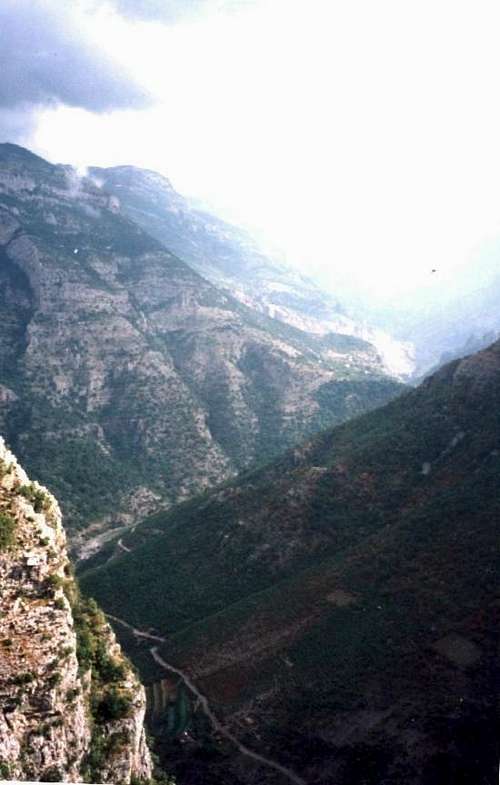 Cem Valley Entrance - Looking upstream toward Tamare at the descent from Rrapsh into the Cem Gorge - with the road to Tamare visible below. (*topo 1)
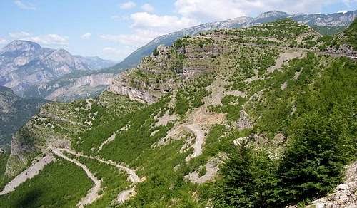 Another view of the switchbacks into the Cem Gorge looking upstream.
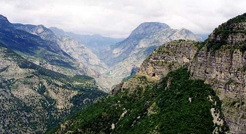 Cem Gorge Looking Eastwards Upstream from near the switchback descent. 'The view east towards Vermosh is truly stupendous, with fold after fold of bare mountains stretching into infinity, and the almost vertical limestone walls of the...gorge plunging thousands of feet deep to a narrow river bed.' - Pettifer, Blue Guide
Large limestone cliffs rise all along the road path in a series of overhanging buttresses of solid limestone abounding in possible one-to-four pitch lines up the corners and faces with access and descents made possible by proximity of the road. The road drops into the Cem River gorge, and then follows the river upstream. Sharp limestone cliffs drop down to the riverbed, especially on the south facing sides of the gorge.
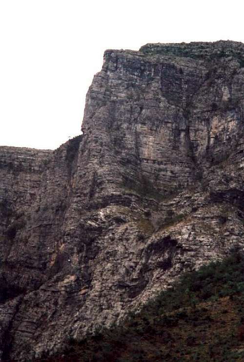 One of several limestone buttresses close to the road on the descent into the Cem Valley (* topo 1)
Among the key formations are:Limestone Aprons – Some 2.5 km downstream from Tamare, aprons of calcified lime deposits appear on the northern or left-hand side of the gorge, formed by drainage funnels down between limestone escarpments. Forbidding alone is the steep approach.Tamare Wall – Out side of the tiny village of Tamare, in the drainage gorge forming the village’s resting point, a large rectangular and layer-caked limestone wall rises (* topo 1).
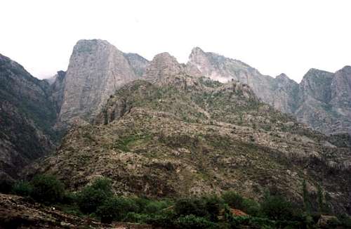 Tamare Escarpments - Wide Shot (* topo 1)
It is cut with a large obtuse corner dividing a near vertical face from a smaller overhanging right face. It is ca. 300m high and 150m across. It is part of a formation that also includes a long limestone ridgeline rising some 250-350m, together with large 1-200m corners, cracks and pillars in the adjoining formation to its right.
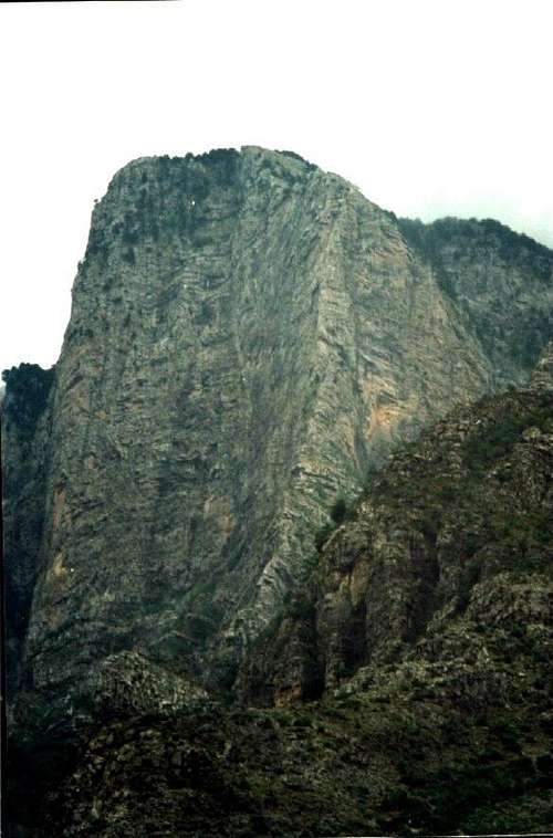
The Large Left Face of the Tamare Escarpments
==

Limestone Buttress Over the Village of Selce - Cem Valley (* topo 1). The Vermosh Road leading upstream towards Selce with both sides of the Selce Buttress visible upper right together with the steep approaches up the steep and crumbling bush covered approaches.
==
From the Tamare Wall, the south facing limestone cliffs run eastward for several kilometers. Selce Buttress – The most striking portion rises over the following village of Selce. Outside the village, a large cliff reaches out of the upper cliffs, in a corner with two distinct sides: (A) The Southern face includes upper parts vertical limestone that are some 5-600 meters in length.(B) The East Face is longer, steeper and shorter, and runs roughly one kilometer wide and some 300 meters in height.
Above Tamare rise the limestone peaks of Koshtices (1760m), Studenica (1909m), Mal I Viles (2093m), and Mal e Kertolit (1920m); each constitute third class ascents above and beyond reaching the gorge rim, and Mt. Vila in particular has a large limestone headwall which rises above the cliffs of Selce.After Selce, the limestone formations dropcloser to the road while the gorge narrows with large overhanging and damp, vegetated cliffs dropping on the north facing side under the Maj e Galishit (2023m).
==
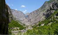
The Road to Vermosh as it passes Selce before it leaves the Cem River. Acres of limestone for rock climbing....
==
 Pattern of Agricultural Settlement in the bottom lands of the Cem gorge.
The southern face, though also vegetated, contains a buckets of possible routes in the steep, sometimes overhung limestone at high standards of free climbing. After this point, the road rises up towards the pass of Qaf e Predelecit, at which point the road turns due north and joins the Lepushe River, dropping under the shadow of the escarpments of Mal i Trojanit (2183m) to the confluence with the Vermosh River. South Fork of the Cem - Vukel - Nikc Valley and Climbing Mt. Shenikut
At Tamare, the main road to Vermosh follows the river course north east, while a right hand turn follows a branch of the Cem east. This road rises up past the towns of Vukel (10km from the turnoff) and ends at the hamlet of Nikc (3 km further).
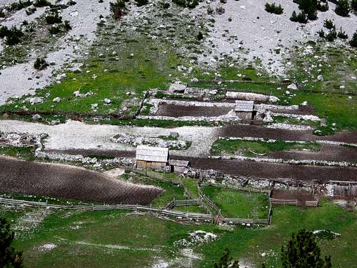 The small strip agriculture in the pr. i Cem river between the hamlets of Vukel and Nikc illustrate the ancient pattern of small planting strips which was characteristic of the ancient Roman model and which probably has not changed much since ancient times. (photo: Attila Gulyas/Zsuzsanna Kravalik)
Along the way it is possible to look back and left at the row of cliffs along the southern side of Mal e Dobines (1762m), a long mountain formation which rises up at the junction of the north and south forks of the Cem.
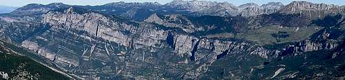 Mt. Dobines - a long row of cliffs cut across its southern face.
This mountain contains a long series of interesting cliffs on its southern side above the Vukel-Nikc road (42 28' 23.82N 19 40' 41.44 E).
Here the road ends at a charming Catholic Church, and the trailhead is found for access to the Qaf Dobrantsh-Qaf Peje access to the top of the Accursed Mountains, as well as the walk-up ascent of Mt. Shenikut (Mt. St. Nickolas, 2554m), as well as access to the fantastic limestone formations of Mt. Stogut (2246m), with its striking North-West pillar, and the near-by teethlike limestone towers of Mt. Reskulit(2496m).
==
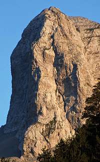
Closeup shot of Stogut's towering North-West Pillar. (Photograph detail courtesy: Attila Kovacs (Gekko), Hungary)
==
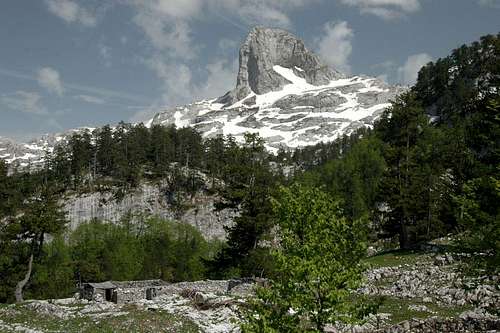 The sharp peak of Mt. Stogut rises alone as viewed from the approach to Qaf Peje from Nikc near the Dobrantshes watering hole. The striking near vertical pillars on the North-West side are visible from this view. (photo courtesy: Attila Gulyas/Zsuzsanna Kravalik)
The small church in Nikc marks the beginning of the trailhead up towards Qaf Dobrantshes, and thus into the basin between Maja Shenikut (Mt. St. Nicholas) and the Maja e Radohimes Group. (photo: Attila Gulyas/Zsuzsanna Kravalik)
==

Mt. Lagojvet in the upper left in the sun and the limestone towers below it - view from Ropojana approach. (photo - Attila Gulyas/Zsuzsanna Kravalik)
==
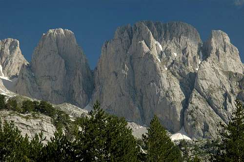
A group of interesting rock formations in the basin below Maja Lagojvet, which can be seen in the upper left, as viewed from the approach from Ropojana. (photo - Attila Gulyas/Zsuzsanna Kravalik)
==
The way to Dobrantsh and Qaf Peje follows up the canyon, while the walk-up for Shenikut goes north up the steep hillside, and is neatly described on Rado Pavlovic's SummitPost page complete with a precise map. From the last houses of Nikc, close to the church, there is a footpath/road heading up and North. Ask directions for 'Dobrantshes.' After about 1.5km and 100m before the path reaches a few houses, go right and to the east, where the relatively easy and clearly visible pass appears above on a steep slope with bushes under a steep rock wall of the mountain forming the north wall of the valley. After about 2km, the path reaches the end of the valley, levels and turns right and goes in a beech forest. After a while it starts to descend. At this point the path leads left, ascending about 250 meeters to a waterfall. There are troughs built for animals here and a flat area suitable for a tent. From here it is another 50m ascent where a large plateau like deep valley starts, that runs to the East. We soon found a few ruins of wooden houses, with some stalls behind where shepherds plant potato in the summer. From here a smaller valley (with barely detectable path) leads to the East. After 4-5km the way crosses a deep bowl with extremely scarred rocks, and, eventually, a view to Stogut peak. Keeping high and passing Stogut to the north, the conical form of Mt. Arapit appears beyond it. A steep 300m karst hillside leads down to the main passage between the Ropojana valley in Montenegro and Theth just to the south over Qaf Peje(directions courtesy Attila Gulyas).
Vermosh
The charming alpine village of Vermosh lies at the Montenegrin border eight kilometers west.
 Vermosh Valley - looking toward Montenegro. Photo Karla Christensen
Though in general lacking rock for climbing, there is one solid 250 meter double buttress of limestone on the lower shoulder of Maja Matdules (2188m) which can be reached via the trail along the west side of the Jacices Brook two kilometers out of the Village of Vermosh (* topo 1, 42 36' 40.68N 19 36' 32.92E). This steep valley leads to the summit of Mt. Madules and the adjacent peaks, offering spectacular views of the Crna Gora or Black Mountains of Montenegro, on the northern border of Albania. (Also, at least according to the strange report of a somewhat uncertain Welsh OSCE field officer, the forest on the southern portion of this streambed holds the ancient tree bole in which Rowena Ravenclaw's craven daughter stashed her tiara - until, at least, it was reclaimed and transformed into a horcrux by 'he who must not be named'...)
B. Koplik via Qaf Terthores to Theth - the 'Chamonix' of Albania
The second of the three major rivers flowing east out of the Accursed Mountains, the Prroni e Thate, is the one leading out of the town of Koplik, lying along nearby Lake Skhodra
11 km south of the Montenegro-Albania border crossing, and 18 km north from Shkodra.
==

The view of Mt. Arapit approaching from the north. From here one can see that the peaks rounded-conic shape, resting on a large limestone shelf. Like Halfdome in Yosemite, the 'conic' eastern, northern, and western sides are shorter and less steep. As one can see by comparing the photos, the right skyline viewed from the north is roughly 40% of the South Face. - Photo Balkan Peace Park Project/Todd Walters.
==
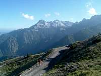 A view of the Theth-Boge Rd - photo - Vlado Vujisic
From Koplik, it is 52 km of difficult gravel road: 23 km to the village of Dedaj, 10 km further to the hamlet of Boge, 11 km after that to the Qafe e Terthores (1786m), and then 8 km more from the pass down into Theth, resting on a hillside at ca. 900 m above sea level. (This road is not passable through the winter and into late spring; an even worse road via Prekal-Kiri-Nikaj is more likely off season to be passable, but is 128 km.)A small town with agricultural settlements spreading down the valley below, Theth is arguably the ‘Chamonix’ of Albania, and is not surprisingly the most well documented part of the Accursed Mountains in SummitPost. It is positively circled with magnificent limestone faces reaching up to many of the most spectacular mountain climbs in Albania. Looking north, and from left to right, this includes:
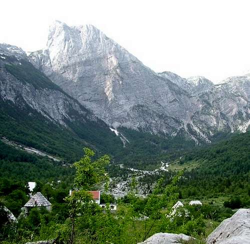 Mt. Arapit, the 'Matterhorn' of Albania, is perhaps most impressive in this view looking north at the south face from near the town of Theth. The Qaf Peje rises to the right (east). - Photo Balkan Peace Park Project/Hargreaves
Maja Radohimes(2570m)and its five associated peaks;Maja Arapit (Harapit) (the 'Matterhorn' of Albania);Qatat e verilla(2333m);Maja Malisores(2490m); Maja e Koervhake(2508m);Maja e Jezerces(2694m);Maja Rogamit(2472m);Maja Popluks(2569m);andMaja e Aljis(2471m).
The key pass to the north of Theth, the Qaf Peje (1709m) leads eventually into the top of the beautiful green glacial valley of Ropojana in Montenegro, with the Montenegrin trailhead just beyond the village of Vusanje 5 km south of the town of Gusinje. Qaf Peje, 14 km from Musanje in Montengegro, is also 2-3 hours from Theth carrying a heavy pack. From here, the impressive Mt. Arapit can be circumnavigated up and the the left; it is 2nd class to so, or to approach from Theth up the scree fields ab the base of the South Face. Qaf Peje is not only the starting point for the ascent of Arapit, Jezerce, Malisores, Popluks and Qatat e verilla. It also provides the trail north, with, in a long steep ridge line to the left or west as one goes north, the huge peaks of the Skhurts group: Maje e Prozmit (2452m), Maja Koprisht, Maja Skhurts (2499m), Maja Lagojvet(2540M), and Maja Vukaces (2450m).
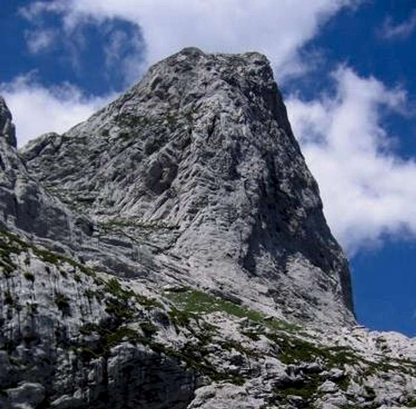 A closer view of Mt. Arapit from the north. The easiest, 3rd calss ascent and the descent is near the skyline to the left. - Photo Balkan Peace Park Project/Todd Walters.
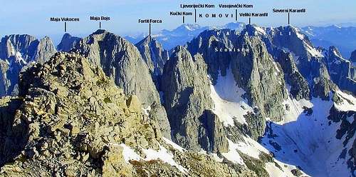 Bojs - Scokista - Karanfil Panorama Annotated Photo - Vlado Vujisic
All of these peaks offer new and exciting first ascent possibilities. A sample of such potential can be seen from SummitPost members Kamil & companions, who put up the route 'Balkan Peace Park' (7 pitches, UIAA VII- A0/AF) in the fall of 2009, described in detail on their excellent page describing Mt. Lagovet.Perhaps even more notable for technical climbing are the spectacular group of peaks which appear to the right or east going north from Qaf Peje and lying virtually on the Montenegrin border, namely those of the Maje e Bojes(2461m) and Maja e Cokistes(Scokista)(2396m).This group of peaks, like the comparable pillars, buttress and faces of the Karanfili just the other side of the Montenegrin border, offer the most striking potential for new and difficult technical rock ascents. But Maje e Bojs is also more accessible from the Montenegrin side, albeit with the requirement of permits. Its most striking technical climbing options are evidently on the long buttresses and pillars on either side of the main gully ascent routes up the south side and visible clearly from the summit of Jezerce. A few photos are included here from other SummitPosters with permission just so the reader does not leave this page without consulting the links above from which they come.
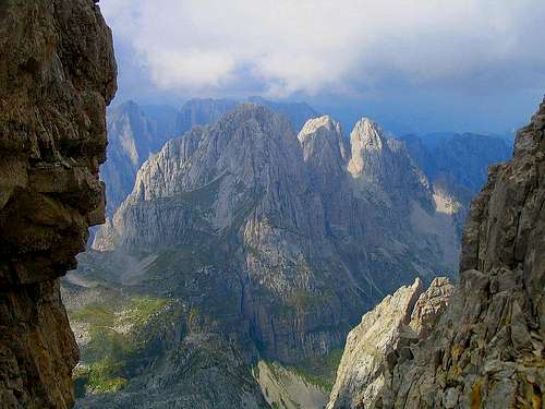 Maja Bojs from Jezerce - photo Vlado Vujisic
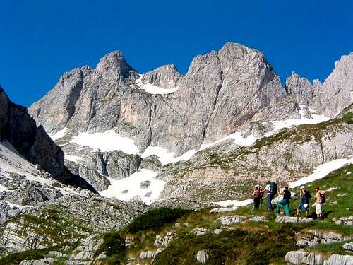 Wall of Mali Malisores - photo Vlado Vujisic
Staying In and Enjoying Theth
The Theth area has been inhabited steadily for over 3,000 years and Illyrian remains have been found in the valleys on both sides of the Terthores pass. The old communist regime declared the area a national park back in 1976, and recently it has been the scene of much tourist development. Thus it now has a number of overnighting arrangements available, and is beautiful not only for its scenery, but also for its mountain architecture, its kulla or defensive buildings to protect those threatened in blood feuds, and the charm and friendliness of its inhabitants. While Theth is thus hardly one of the more obscure areas in Albania, and has seen lots of hikers and mountaineers in the last decade, as well as increasingly well documented and thorough SummitPost pages, there is still slight record of significant technical rock climbing ascents. Much of this intercourse has been helpfully facilitated by the a project of the German Society for Technical Cooperation (GTZ), which has also developed trail maps. These are especially useful for the 2-3 hour approach to Qaf Pejes and Mt. Arapit (Trail #6 on their map), as well as the southern Valbona pass over to Rrogam in the Valbona valley (#8 on their map), as well and contacts for making overnighting arrangements.
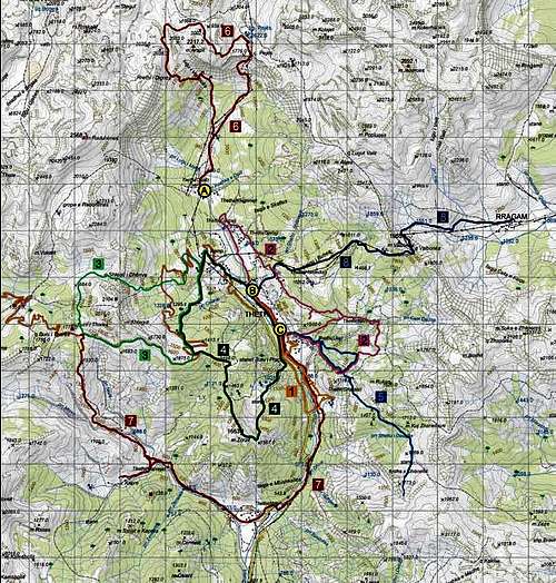 Key Approaches to the High Mountains from Theth - GTZ Theth Project
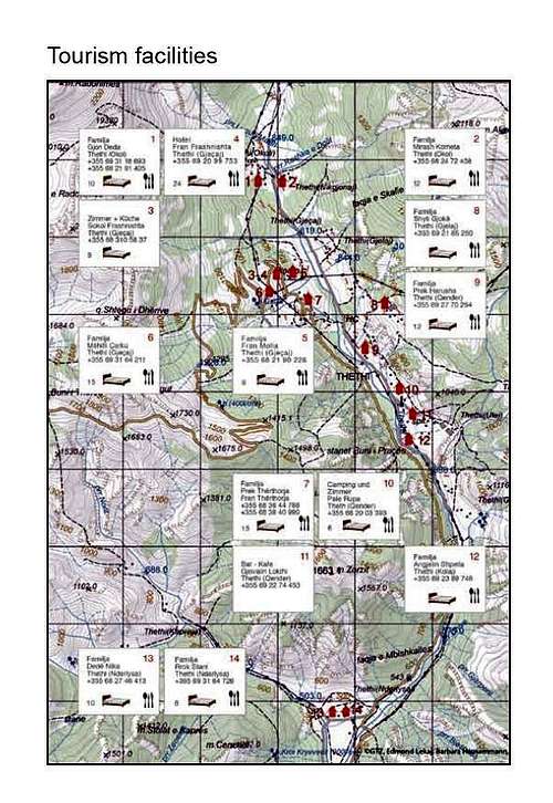 Topo Chart of Accommodations in Theth - GTZ Theth Project
C. Kiri Valley
The Kir River flows into the plain of the Albanian lowlands three kilometers east of the city of Shkodra, at the distinctive single arch of the Venetian era 'Mez Bridge.'
 Behind the famous Ottoman era Mez Bridge on the Kir River just east of the city of Shkodra rises the mountains of the Kiri Valley. Photo courtesy Attila Kovacs (Gekko).
A few crags pepper the entry canyon, but the best climbing possibilities in this spectacular gorge lie some 30 kilometers up the valley past the town of Prekal and the right-hand turn in the road towards the mountain town of Theth. Roughly seven kilometers past Prekal and along the road which stays right and continues to follow the Kir River, a sharp limestone monolith rises out of the river valley. On its west end, a steep pillar of limestone juts out in front of a larger rounded dome of curving limestone behind. Both can be reached by climbing down to the suspension bridge in the bottom of the Kir Canyon 1/2 kilometer east of the intersection with the Shlogut River just beyond the hamlet of Pog where the limestone formations cut across the road. An 3rd class approach can be made low along the river. East of the road, two large ridges of limestone stretch from high on the peaks above down onto the road in a series of shattered and overhanging pillars which are distinctively vegetated but nonetheless offer numerous climbing opportunities. Above these rocks rise the massive limestone spires and walls of the cirque of mountains formed by Bishkasit (1879m), Mahde (2011m), and Biges se Gimajt (2391m), a vast high ridge line which separates the the Kir Valley and the Postribe Dukagjin from the Prroni i thate River leading up the Kastrat and Skrel areas to the Qaf e Terthores. From Biges se Gimajt looking south, the ridge line separates the Kir from the Shale River basin on the other side of the Terthores pass, capped respectively by Mt. Elbunit and Mt. Boshit.
Climbing Mt. Bishkasit
The most notable feature of mountains visible from the town of Skhodra is the relatively low 600m high dry sandstone ridgeline of the Mali i Tabaroshit or Tarabosh - site of fortifications placed by the Montenegrins and Serbs in their showdown with the Ottoman empire during the Balkan Wars of 1912-1913. On the next ridgeline beyond, the limestone rises above the much more overgrown and forested sides of Mt. Bishkasit(1879m).
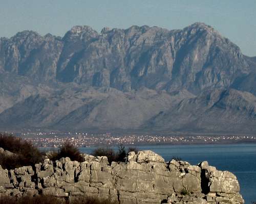 This telephoto perspective from the Montenegrin coast of Lake Skhodra (Skadarsko Jezero) shows the Albanian plain including the town of Koplik, the sandstone-serpentine foothills, and, behind, the rising features of the Maranajt - Bishkasit ridgeline which separate the relatively dry Kastrat and Skrel areas of the Thate River leading to Boge from the more forested Kir River valley on the far, southern side of this ridgeline. This ridge is also the separation of the Great Mountains or Malesi e Mahde District from Shkodra District. - photo courtesy Marija Jokanovic
This relatively low but striking limestone peak has a spectacular view of Lake Skhodra near the coast and the mountains to the east. It can be most easily ascended via the obvious 3rd class ridge from the northern side. This involves driving up the Thethi road from Koplik and making a right at Luhje e Sperme driving on to Repisht. The peak approach is visible from there after crossing the Rejoll stream near Repisht. Where the stream bed disappears into a mass of boulders past where it is possible to park, the route to Bishkasit is evident but involves bushwacking through parts to achieve the ridgeline. We saw our only Albanian eagle on this mountain; though they are more common in Kosovo apparently.
Trip Report on Kayaking the Kiri River
For a trip report (in Italian) kayaking the Kiri River in this area, seeAnna Ferrari at 'architetura di pietra'.
D. Traveling Up the Koman Reservoir from Shkodra via Koman to Fierze
Traveling south out of Shkodra one must be careful to go left over the Kiri River and the railway tracks to acquire the road to Puka and Fushe Arrez. Sixteen kilometers further, the road crosses the Drin River - in sight of the railway line to the right and the massive Vaut de Dejes Dam on the left. (Coming from Tirana and the south, it is important to turn right for Vaut de Dejes before arriving at Shkodra.) This dam is the first of three major dams, power stations and reservoirs in the system along the Drin between Skhodra and Kukes. At Kukes, the reservoir of the third dam begins to end at the point where the river splits into the White Drin going north-east into Prizren in Kosovo, and the Black Drin turns due south to Peshkopi before crossing the border into Macedonian Debar. While the generating technology is terribly inefficient and stems from the old regimes cooperation with the Chinese (1967-71) prior to Hoxha’s break with Mao, the complex is quite astounding from the point of view of the tourist and the mountaineer. This means above all the reservoir stretch of the second or Koman Reservoir between the Koman Dam at Koman and the Fierza Dam at the town of Fierza.Each of the reservoirs is named after the respective dams. To reach the ferry at Koman, pay attention just past the Vaut de Dejes Dam and its bridge. A left turn puts one on the road to Puka; and three kilometers past that a left turn leads to the Koman Reservoir, 29 kilometers further, including finally a harrowing 3 km through the narrow, dangerous and unlit tunnel that emerges at the Dam-Ferry station.
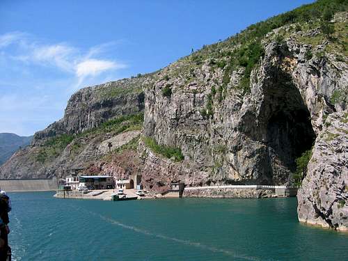 A wide shot of the Koman Ferry station - start of the journey to Fierza - and illustrating the cragging potential right in the vicinity of the dam. - photo courtesy albanien.ch
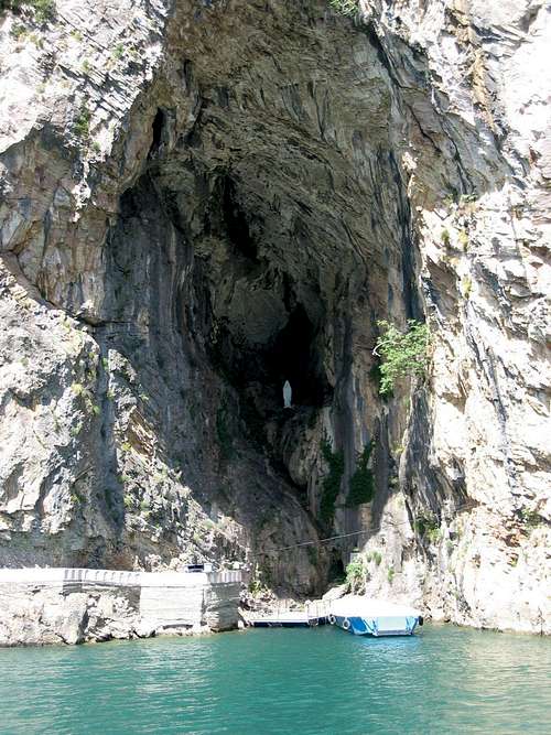 Keeper of the Komani Power Generator - photo courtesy albanien.ch
The ferry can be picked up here, and takes about four hours. Schedules are unclear, though in the summer the ferry usually goes twice a day, with the first departure scheduled as early as 7 AM by some versions of the schedule. Off season, getting to the departure point early is probably the best advice. In case you miss the boat, the village of Koman is just the other side of the dam and back downstream, and the dam area itself is percolated with limestone crags that are certainly worth exploring.
The real spectacular possibilities, however, are about mid-way in the ferry passage as the reservoir snakes through the gorge formed by the ‘mal e Mahde’ sub-peak (1260m) of Mal e Toplanes (1485m), appearing to the north just beyond the point where the Shale Valley and the Shale River flow in from the north.
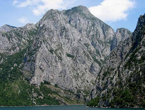 Just beyond the Shale River the main spine of the Accursed Mountains comes sharply down into the north shore of the Koman Reservoir, with the ridge line of Mt. Toplanes rising to the left. - photo courtesy albanien.ch
While there are astounding looking crag potentialities on both sides of the gorge, it is the northern side, in the wild and beautiful drainage of the Shale and Nikajt streams flowing in from the north which offer the most potential.
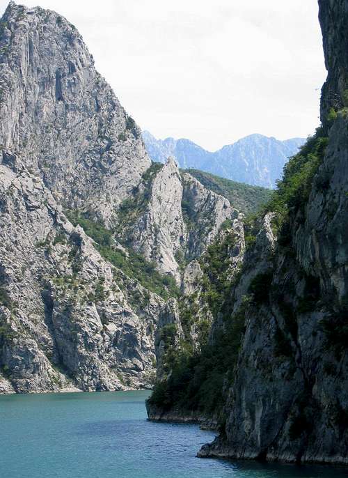 Beyond the spectacular notch in the gorge of the Koman Reservoir, the serrated peakes of the Accursed Mountains rise to the north. - photo courtesy albanien.ch
Between these two streams the Accursed Mountains drop in a ridge line from Mal e Boshit, visible from both Theth and Valbona due south across the peaks of Mal e Kakise (2355m), and Mal e Agrorit (1672m) straight into the Drin just past the Toplanes formation. [This area marks the southern border of the Balkan Peace Park proposal, and the geography and scenery makes it plain why it has been included.
To reach this area, it is probably not possible to use the ferry unless one were to bribe the captain along the lines of the Silverton-Durango rail line in Colorado, put an outboard fishing boat or big canoe in at Koman, or attempt to drive, following the Kiri-Theth road, down the Shale River past the hamlets of Nicaj to Pepsumaj and Seme-Toplane. One could also drive rather close to this area (2-3km distant) by going back from Fierze past Breg-Lume and Tetaj to the mouth of the Nikajt. Likewise the most likely path to the southern portion of this gorge in Puka District, near the hamlet of Mertur i Gorit, could be reached driving south out of the western end of the town of Fierza around the shoulders of Mal Shlumi i Merturit. Adventure awaits however one manages it.]
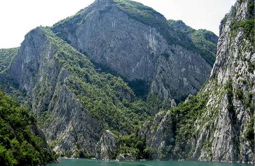 More Facets of the Limestone Sides of the Mahde Formation Rising from the Koman Reservoir. - photo courtesy albanien.ch
IX. Bajram Curri Area and Northern Tip of the Albanian Alps
A. Sketch of the Eastern or Gjakova Range of the 'Accursed Mountains' - Hekurave Group, Valbona, Shkelzen Massif
The entire core of the Albanian alps is constituted by a complex drainage system flowing in all directions. In the middle of the alpine plateau (long 19 50’ E.) the dark narrow Lum I Shales valley rises on the massif of Mt. Jezerce (2693 m), the highest peak in the district and just inside the border south of Montenegro, and flows from north to south until abruptly turning eastward to flow into the Drin/Koman reservoir. The sides of Jezerce and nearby Mt. Ethe are carved with vertical faces of limestone. East of Prroni i thate, a high narrow line of peaks – Maje e Radohines (2599 m) and Mal I Elbunit massif (19-2300 m) – has steep escarpments towards the Kir and Shale valleys. Beyond the Nikaj-Curraj basin, Maje e Hekurave (2560 m), with the town of Bajram Curri five kilometers down on its east facing shoulder, is the summit of a massive limestone block set on a serpentine base, connected with Kakinja and with Mt. Jezerce between the Shale and Valbona rivers. The Shale watershed is accessed via the Kir River or the road from Koplik to Boge in Malesi e Mahde from Shkodra.
==

The Town Square of Bajram Curri, a typical small scale socialist realist construct with its amphitheater, with the Hekurave Massif rising steadily in the background.
==
The Tropoja or Djakova side of the Albanian Alps is the most inaccessible portion of the Accursed Mountains. Called the 'Djakova Mountainlands' because of its historical association with Kosovo and its major town of Djakova (Jacovica), the slavic influence here is evident in the district name, 'Tropoje', derived from the expression 'three fields' in the slavic languages. The area includes the Mt. Hekurave group, the beautiful Valbona Gorge, the eastern part of the range dividing Albanian from Montenegro, and the Mt. Shkelzen group. This latter part of the Djakova group, at the far north-eastern stretch of the Albanian accursed mountains, in the group forming the three-country region dividing Albania from Montenegro to the north and Kosovo to the north-east. The Tropoja area is accessed from the South-East, via the ‘wild-eastern’ town of Bajram Curri, which replaced the village of Tropoja as regional government center in 1952. This run-down town of some 10-15,000 is the largest in the area of ca. 25,00 inhabitants - a region religiously compose of ca. 3/4 Sunni Muslim and 1/4 Catholic inhabitants. Directly behind it rises the Mal e Hekurave massif forms what is called the Malesi e Gjakoves ('Djakova Mountainlands'), while north of the Valbona River, the range is known by the slavic expression for the 'accursed' mountains, the 'Prokletije'. This latter portion range cutting from the meeting point of Kosovo, Montenegro, and Albania at Mt. Tromegja (Tromeda in Serbo-Croat) (2366m) along the border between Montenegro and Albania East-Southeast until in turns due south into Albania through the summit of Mt. Jezerce (2693m). This high rideline then runs through Albania due south until it drops into the Komanit reservoir system of dams along the Drin River east of the town Fierze, and dividing the Shale from the Valbona watersheds. South of Tromeda and just inside Albania on the point where it meets Montenegro and Kosovo is the Mt. Shkelzen (2406m) group of the Gjakova range, group rising abouve the small town of Tropoje, just off the main road from Bajram Curri to the Qaf Morine border station separating Tropoje from Kosovo leading down on the Kosovo side of the pass to the cities of Peja(Pec)and Djakova(Jacovica).
 Annotated Topo 4 - Bajram Curri, Tropoje, Valbona Valley, Mt. Shklezen Group
The area is better for mountaineering than for pure rock climbing, though many of the long ridgelines make beautiful lines of ascent and the views from these steepest and highest and Albania’s mountain ranges are spectacular. One must be careful only of the security conditions in and around the town of Bajram Curri, which has a famous history of lawlessness and banditry from the end of the old regime up to a few years after the new millenia. There is much climbing throughout the Bajram Curri area, but the most attractive is found in the Valbona Gorge. This region may compete only with the Cem Valley and the Theth basin for overall spectacular scenery. It offers many interesting and accessible crag formations as well as some of the largest rock faces and technical peak ascents in Albania outside of the Cem River gorge and Theth basin at the top of the Shale River, both on on the other side of the same range of mountains.
B. From Bajram Curri into the Valbona Gorge
The key entrance to the mountain regions here is the Valbona Valley, the road to which leads from the top of the town of Bajram Curri, built rising up a hillside, traveling due north until once can see the striking canyon entrance and its left hand turn. Going straight, the road to Bajram Curri continues on towards the town of Tropoje, providing access to the Valbona gorge entrance and the ridges of the Mt. Shkelzen-Mt. Radeshes upheaval just to their north via the left hand turn ca. 7.75 km out of Bajram Curri to a dead end at the villages of Shkelzen and Myhejan. From here the road continues Tropoje and the Qaf Morine border with Kosovo leading to Djakova (Jacovica), Prizren, and Prishtina.
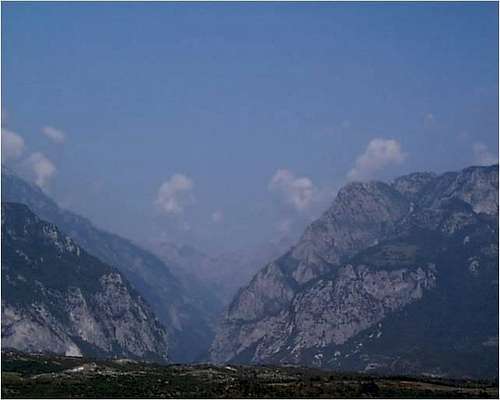 The Valbona Gorge Entrance - viewed from the Has road to Bajram Curri. 'The towering walls of the gorge are studded with clumps of trees and bushes, producing rock formations and patterns of vegetation of a truly Byronic character.' - Pettifer, Blue Guide
A right-hand turn off the main road leading up the market place in Bajram Curri leads 2km north past a bridge and a gorge to the entrance of Valbona gorge, which the road enters one switchback above on the north side. Crags line both sides of the gorge for several kilometers up to a characteristic notch dropping down into the river bed, with fabulous climbing possibilities available on the repeated right to left crack lines which slice across the main crag on the north side.
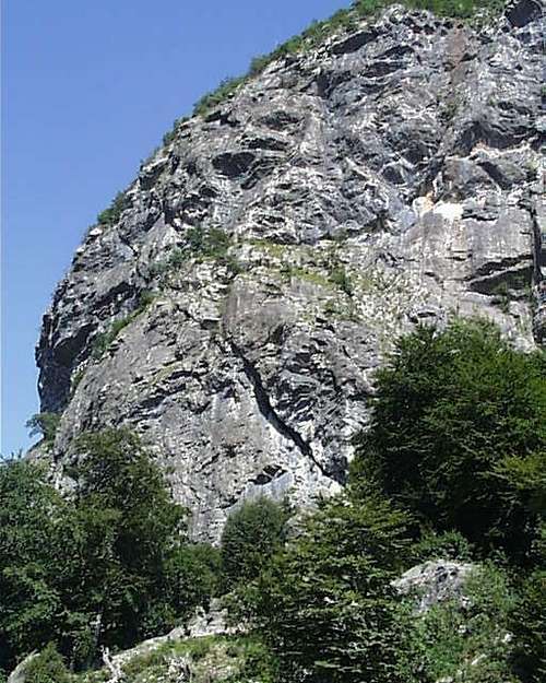 Valbona Canyon Notch Crag (* topo 4)
 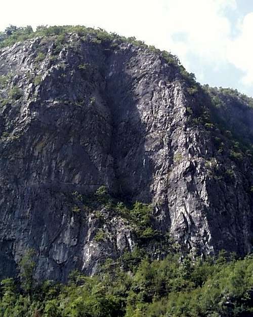 Across the canyon from the Notch Crag with its famous graffitti is this large corner crag (* topo 4)
Beyond this notch, the possibilities become ever more alpine in character, largely in the form of large limestone towers and spires. Many of these are guarded by significant and difficult approaches, which jut out of the gorge, rising in great magnificence either side of the valley beyond the town of Dragobi, with its Kullas, its cave where Bajram Curri met his end, and its notorious tradition as a center of Albanian blood feuds. Most striking of these formations are the large towers of Mt. Gjaperi, which rise like a row of teeth from the top of an difficult to access limestone ridgeline along the north side of the gorge as the most distinctive parts of the Kolates range.
==
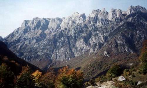
Gyperit Formation - a wide shot in the fall. The fin is visible on the far right, casting a shadow in the late afternoon on the rock behind(Photo - Jonaz Kola). This formation rises above the village of Dragobi, also famous for its cave - 'found in a high cleft in the rocks above the tree line to the left of the road north of the village, above an abandoned dwelling house.' According to tradition at least, continues Pettifer, the great Albanian rebel Bajram Curri, was eventually 'gunned down by King Zog's police in the cave in truly heroic circumstances, fighting his enemies to the last, a smoking pistol in hand, and with loyal followers from his fis (or tribal group) surrounding him...' - Pettifer, Blue Guide
This formation includes the Gjaperi fin, a large freestanding piece of limestone separated from the ridgeline amidst a selection of less spectacular free standing formations(42 28' 23.82N 19 15' 45.19E).
==
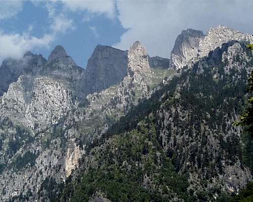 Gjaperit Fin in the middle of the Gjaparit formation (* topo 4)
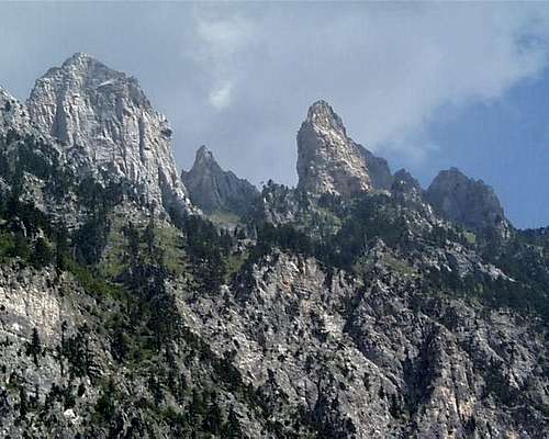 Gjaperit Towers - Close Up view veils the serious approach
Beyond Mt. Gjaperi in the same complex rises the striking sub-tower of Mt. Kolates, with towering limestone faces, and two long ridgelines reaching down in to the valley towards the village of Valbona. It has towering faces on both the western and eastern sides of the peak, which resembles a giant but multifolded cockscomb. The faces on the western side are easily visible from the road; those from the east are not as evident from below, but appear strikingly as one looks down from higher up the trail to the northern 'Valbona Pass' into Montenegro. Just past this village, the Valbona river divides into two branches. That rising to the north-east leads to the northern Qaf Valbona (Valbona Pass) in between the formations of Mt. Roshit (2524m) to the north on the border with Montenegro, and Mt. Jezerce (2693m) to the east. This is the main approach to climb the major peaks on the ridgeline dividing the Theth-Shale basin from the Valbona River Gorge.
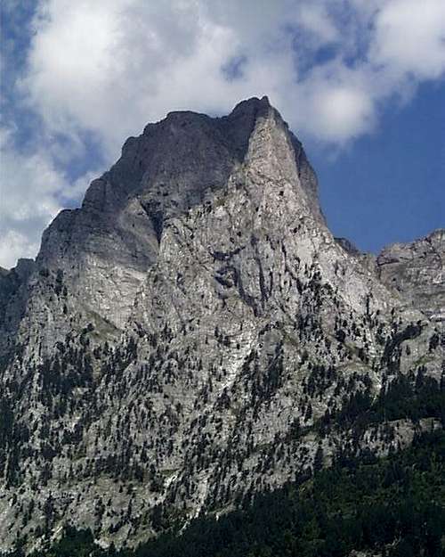 Spectacular Sub-Peak of the Mt. Kollates Group (2209m) (* topo 4)
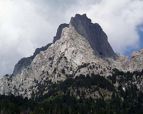 Another view of the Mt. Kollates formation illustrating the substantial west face of this complex cockcomb peak.
Major peaks also rise from the branch of the Valbona going south-west to the hamlet of Rrogam, from which the dirt road eventually turns into a donkey trail leading due west up and over the ca. 1800m pass over south into the Theth-Shale basin. (This trail is illustrated in the section of Chapter VII above on Theth.) In this direction, after this Gjaperi formation, on the road to Rrogam, the most noteworthy further upstream are found on the southern side as valley widens and rounds into an glaciated shape, from which massive pieces of solid limestone rise out of the more gently sloping sides.
A nearly 13 km wall of limestone includes some ten peaks over 2400m in that part of the Gjakoves Range known as the Majet e Zabores. Most striking are the formations of the Qetet e Arushes, and the massive limestone faces of Maja Briaset and the Maja e Boshit, whose ridge line divides Tropoja District from Malesia e Madhe District and the Valbona basin from the valley of the Shale River with Theti at its upper end, and draining south into the Koman Reservoir.
==

Viewed from the descent from Jezerce into Valbona, that is, from the north-west, the large steep-slabby face of this spectacular formation below Mt. Kollates is most evident. The rock quality on this side seems uncertain.
==
This rise as part of the Gjakoves range north of the Koman Resevoir and north east of Bajram Curry, but this range is just a branch, south of the Valbona canyon, of the 'Accursed Mountains', the Bjeshket e Namuna or Prokletije, which rise out of the Shale River basin, and divide, going north west along the Albanian-Montenegrin border north of Valbona, and generally known by the slavic name Prokletij, while the groups south of the Valbona River are known as the Gjakoves Range. Maja Briaset is the main feature in this sweep of the Gjakoves Range, which is also called the Majet e Zabores group(Zabores e Krasnices; Krasnicka Planina). The whole areas from a mountaineering and rockclimbing point of view, is completely untouched, including the massive but not so steep faces of Briaset itself (42 23' 45.20 N 19 40' 41.44 E).
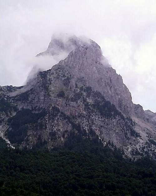 Mt Qatet e Arushes (2423m) (?) - view of the Malesis e Gjakoves group south of Valbona
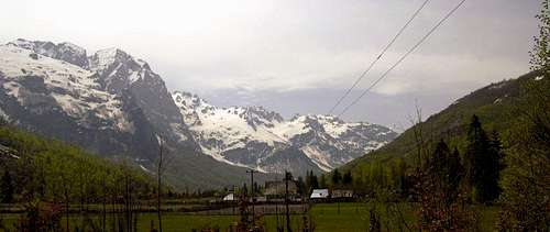 Valbona Valley - North Face of Mt. Briaset on the left(photo: Jonaz Kola)
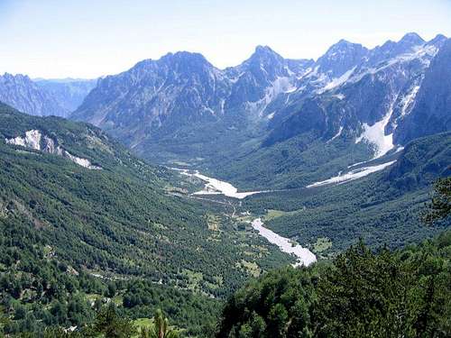 A view back into the Valbona Valley from the trail to the summit of the southern Valbona pass in to Theth and the Shale Valley. Mt. Qatet e Arushes (2423m) is the double pointed peak in the center right, the most noteworthy point in the long ridgeline of summits dropping down from the Hekurave group into Valbona. - photo Balkan Peace Park Project/Todd Walters
C. Shkelzen Group
North of Bajram Curri and the Valbona canyon entrance on the Tropoje Road, Mt. Shkelzen rises to the North-West, and reaches 2409 meters, with a very steep escarpment overlooking the Tropoje valley. The approaches to these escarpments are rather forbidding, but the ridgelines dropping from Mt. Radeshes, 2 km southeast on a curving ridgeline, are more accessible.Mt. Shkelzen's steep but fractured west face (* topo 4) may be one of the biggest and steepest ascent lines in Albania, but the rock looks very poor. No picture is available, due to camera malfunction, but the face can be accessed through the Gashit river canyon past the villages of Begai and Bradoshnice just north of the entrance to Valbona Canyon.
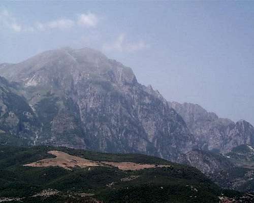 Mt. Shkelzen from the Tropoja Road - the steeper escarpments on the side of Mt. Shkelzen are visible on the right-hand skyline (* topo 4).
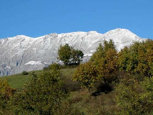 Mt. Shkelzen Eastern Sides viewed (photo: Jonaz Kola)
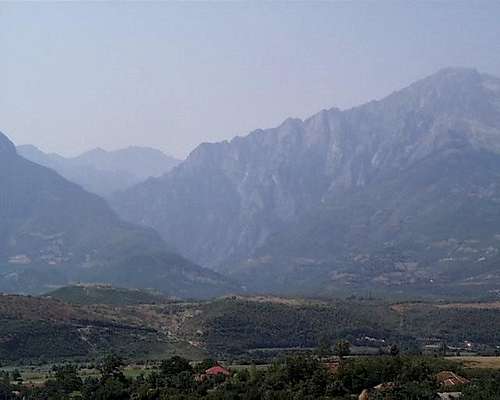 Gashtit River Canyon Entrance - Access to Mt. Shkelzen West Face (* topo 4)
X. Remarks on Sources and Links
The above is work in progress covering those parts of the Albanian mountains where I was able to visit and do some cragging during the years 2000-2002 in between times working for various humanitarian and refugee organizations in the greater Balkans. It is not at all comprehensive, but will eventually provide directions and images for accessing most of the big mountain gorges and approaches in the Albanian mountains, with some notable exceptions. It is meant as a general set of directions for rock and mountain climbers to help develop the possibilities of Albania - a 'where the cool rocks and mountains are' and 'how to get to them' sort of 'beta' source. Some Summit Post members have commented on the low resolution photographs. This is unfortunately due to the technology available to me at the time, and my interest in getting many images per trip so as to be as comprehensive as possible illustrating the rock climbing possibilities. Thanks to everyone for comments on these materials; I am integrating suggestions and corrections into the text as this is possible, and welcome any additional suggestions, corrections, or contributions.Reference to difficulty of climbing is loosely by the socalled 'Yosemite' decimal system common in North America composed of 'class' and 'grade': class 2 = scrambling, class 3 = scrambling with use of hands and care to take the safe lines, class 4 = use of rope and anchors for belaying, class 5 = use of protection by the leader, broken into easy (5.0-5.4), moderate (5.5 - 5.7) and more difficult (5.8-5.9). Grade I = a pitch or three, Grade II = half-day, Grade III = most of a day, Grade IV = full day with planning. (Obviously reference to one or more European grading systems would also be useful, but my feel for difficulty is not comfortable with interpretation; Chris McNamara's preview 'topos' at the web site 'Super Topo' has very useful translations from the North American 'Yosemite' system to other international grading formulas at the back of any of his free pdf sample topo guides.)
Remarks on other portions of Albania
The text focuses on the north of Albania, thus the 'southern' Dinaric Alps, especially around the Tirana capital region and the North East. It is at present lacking details of the evident big rock around the area of Mt. Shkelzen, and underrepresents the Boge-Theth approach to Mt. Jezerce group. Fortunately this latter area, forming the most well known part of the Albanian alps, has been substantively covered by others at Summit Post and elsewhere; most references here are thus from secondary sources only. As a rule, alpine and rock climbing potential are found north of the Shkumbin River - which transverses Albania from the Bay of Karavastase to Lake Ohrid and divides the language dialect distinct Gheg north from the Tosk south, but there are evident exceptions: - The most noteworthy in this regards is the third of the three major north south routes from the Shkumbin River. This third route travels south of Elbasan through the town of Gramsh, and as Tilman was active in this area during World War II, he reported big terrain in this area. - The same is true of the continuation of this geology in the stretch along the Albanian-Greek border between Korce and Permet, the Gramoz Mountains. These recover much of the craggy high snow-covered limestone character of the Korabi region or the Accursed Mountains, and are in fact a geological continuation of the same range forming the backbone from Mt. Koritnik south through Mt. Korabi until it is broken by the Black Drin where it crosses from Macedonian Debar into Albanian Diber. A final exception to note here is probably the area around the famous Osum Gorge near the pretty castle town of Berat; I unfortunately could not visit Osum. - The web has several trip reports of kayakers and cavers in the Osum area, but none of rock climbers. South of Berat and Osum, there is a long and beautiful dry highland area accessible only to four wheel drive leading to Permet, but this entire area appears largely bereft of rock climbing or mountaineering potential. - There are, east of Permet, some eye-popping bluff formations in the large scale Vjoses River gorge in the south between Permet/Kelcyres and Tepelina. But inspection of the rock (some wierd soft kind of sandstone looking tufa of rather dubious quality from a rock climber's point of view) suggests this stuff is for looking at rather than climbing (Albania's 'Smith Rock' at best).
 The scree piles rising above the beautiful stone castle of Gjirocaster.
The area around the beautiful stone town of Gjirokaster is quite mountainous, but most in the form of large dry and barren formations of shattered scree composed serpentine, interesting but the opposite of a technical climbing environment. Finally, though I saw only portions of the coastline of Albania, which can be quite beautiful in places, I saw almost nothing of the sort of gorgeous limestone formations that, for instance, populate miles of the roads between Split and Dubrovnik.
Sources and Additional Resources
It will take some time to fill it in it with details. Additional information in the meantime can be had at John Middendorf's 'Big Wall Climbing' site, where a PDF greater detail and additional photos of some of the materials from 2002 is available. Topos from the Albanian Government's Geographic Service based on the excellent soviet models are somewhat expensive on-line, but available.For those who can read Russian, a free and nearly complete set of 1:50,000 topos from the Soviet Military, circa 1974-1988, is available for download at the Univ. of Calif. at Berkeley library.There are 103 such topos, and their names and numbers are provided by the Albanian Geology Survey.
 The Soviet era 1:50,000 quad topographic maps for Albania come in a group of 102, all numbered and with names. (Source - Albanian Geological Survey.
Another, perhaps better source, is the new project 'Bunker Trails' at BunkerTrails.org. Entire sets of these topo maps are available there in both 1:50,000 and 1:100,000. BunkerTrails is a brand new data base focused on hiking excusions in Albania, and provides many useful resources.For details of Albanian geology, see the additional materials at the official website of the Albanian Geology Survey.Also besides the aforementioned and excellent 'Blue Guide' by James Pettifer, other helpful sources include:- M. Edith Durham, High Albania (1909),http://digital.library.upenn.edu/women/durham/albania/albania.html- M. Edith Durham, Albania and the Albanians, ed., B Destani (London, 2001), - Nazif Dokle, Kukesi: Veshtrim enciklopedik, Tirane, 1999,- Piero Ghiglione, Montagne d’Albania - con uno studio sui rapsodi della montagna albanese di Nicola Lo Russo Attoma (Tiranë: Distaptur,1941); translated into Albanian as Malet e Shuipnisë, me nji studium qi merret me rapsodët e malevet Shqiptare prej Nicola Lo Russo Attoma-s (Tiranë: Distaptur, 1942),- Egon Hofmann, 'Albanienexpedition 1931', Oesterreichische Alpenzeitung, Vol. 53 (1931), No. 1115, pp. 327-329.- Egon Hofmann, 'In den Nordalbanischen Alpen', Oesterreichishe Alpenzeitung, Vol. 54 (1932), No. 1122, pp. 171-188.- Egon Hoffman and Ludwig Obersteiner, 'Fahretenbericht aus den Nordalbanischen Alpen', Oesterreichischee Alpenzeitung, no. 57, 1935, pp. 18-22.- British Naval Intelligence Division, Albania - Geographical Handbook Series BR542 (UK, 1945), and- Hans Pankotsch, Nordalbanische Alpen, Elsasser Str. 3 Dresden, GDR, 1959/1969, 15pp.- Gerd Poppe, Bergfahrten in Lande der Skipetaren, 1959/1960, Goes, GDR, 20pp. - Miranda Vickers, The Albanians: A Modern History (London/NY: Tauris, 1997).
Internationality Pleases
'Nji dhi than nji vrrja' - Dhija asht fryme e keqe;shka te perkase me goje, e than. ('One goat withers a pasture.' Goats have malignant breath; whatever they touch with their mouths withers....') - Kanun of Lek.
 Goats in Erzenit Gorge Aquaduct, Albania
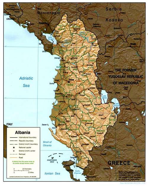 Albania by Distict (Rresh)