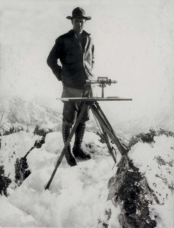
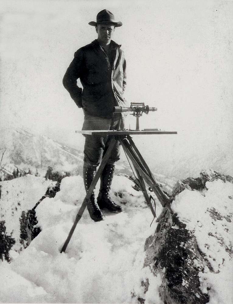
Arval L. Anderson standing atop a peak in the southern Sawtooths in autumn 1927. With him are the plane table and alidade he used while mapping more than 300 square miles of some of the most rugged terrain in Idaho over a five month period.
Photo courtesy of Roger Anderson.


