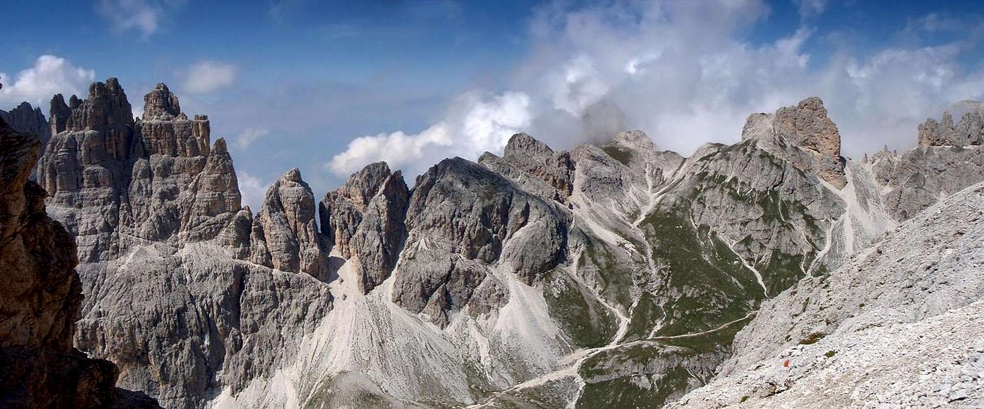
Introduction
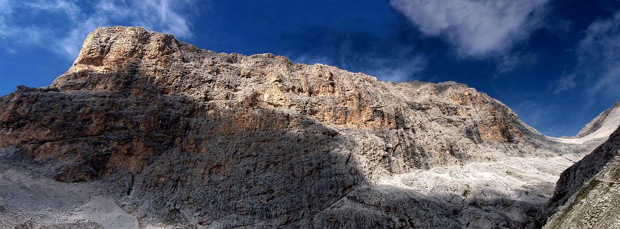
Panorama of Cima di Larsèc from east |
"Vaèl, ultimo alpeggio, resisti!
Ti guardo dal fondo della valle ed immagino la tua conca verde, al di sopra dello stallone, dove ci si può sdraiare sull'erba ed abbandonarsi alla luminosità delle tue Rode.
Vaèl, primo nome usato dai valligiani per indicare questa catena, solcata da avvallamenti e catini... toponimo passato in disuso e sostituito dai più affermati 'Catinaccio' e 'Rosengarten'.
Ora c'è quell'alpeggio, là in alto. Ogni anno mi informo se il progetto di funivia è stato approvato e in quella conca non troverò più montagna ma bensì self-service, ristoranti, terrazze e sdraio dove la maggior parte degli sciatori, con le loro creme, si abbronzeranno tra una discesa e l'altra. Lungo piste che richiederanno lo sbancamento dei tuoi bellissimi boschi.
(...)Vaèl, camminerò ancora per i tuoi valloni e continueremo a parlarci da buoni amici, ma penso che saranno sempre meno i luoghi dove ci potremo incontrare. Da lassù daremo insieme un'occhiatina a questo esercito di assalitori e tu mi dirai: 'Ho dovuto spostare il mio giardino delle rose e nasconderlo in questo nuovo angolino del gruppo, perchè me l'avevano saccheggiato un'altra volta'"
Luca Visentini, prefazione a "Gruppo del Catinaccio", 1982
![Larsèc bowl toward south]() Larsèc bowl, the heart of Larsèc group
Larsèc bowl, the heart of Larsèc group
The Alps are the most crowded mountain range in the world: in the Alps, Dolomites are one of the areas most visited by the tourists and, among the Dolomites, Catinaccio/Rosengarten is no doubt one of the most famous mountain groups. Nevertherless it's possible to find corner of wilderness in Catinaccio, even in august. However, you have to find it...
Even Catinaccio, "attacked" by hordes of tourists, hikers and climbers, can offer places, maybe not secret, but sure less known. This places are less popular because there aren't huts every 30mins of walk, or because the paths aren't well marked and signed with paint every 2 meters... It is a fact that these places are beautiful as the most famous locations; on the contrary, the loneliness and the lack of human works increase their appeal.
Therefore it needs to overcome the mental laziness that lead us on the usual paths (wonderful but over-exposed) and to go on the routes less known, to see the same mountains, but from different points of view.
![Larsèc bowl eastern part]() Larsèc bowl, towards east
Larsèc bowl, towards east
Anche il Catinaccio, preso d'assalto da orde di turisti, camminatori e scalatori, ha i suoi luoghi, non dico segreti, ma sicuramente meno popolari. Questo perchè, magari, non sono presenti rifugi ogni 30min di cammino, o perchè il sentiero che vi conduce non è molto marcato e segnato con bolli di vernice ogni 2 metri... Fatto sta che questi posti non hanno nulla da invidiare ai luoghi più famosi per bellezza, anzi, la scarsa frequentazione e l'assenza di manufatti ne accrescono il fascino.
Bisogna dunque vincere la pigrizia mentale che ci spinge sui soliti itinerari, splendidi ma inflazionati, e avventurarsi sugli itinerari meno battuti, a vedere le solite montagne da angolature diverse.
Crossing the Larsèc door: from Gardeccia to the Larsèc Bowl
![The Larsèc route]() The Larsèc route
The Larsèc route
I start alone, with the taxi-bus starting from Pera to Gardeccia. At 8.30 am I'm on the path. The people that was on the bus with me is going towards Vajolet hut, like I expected... I'm completely lonely, among the mugo-pine bushes, on the Larsèc route.
Usually, this is the most crowded part of the hike I'm going to do: anyway, the hikers that run this path are less than 10% of the people rising Vajolet valley or walking to Roda de Vaèl hut... In august, they are about some dozens of people every day: not few, but on the other paths they are several hundreds...
At his time of day, anyhow, there's nobody: I'm in a perfect loneliness. Evidently the average hiker doesn't like to wake up early: it's rare find the paths crowded before 11 a.m.!
Larsèc route goes through the mugo-pines bushes and the gravels, under the south side of Dirupi di Larsèc, among remains of landslides and dry creek beds.
After a stretch of path digged in the rock, I start to rise among sparse larches, in direction of the Scalette pass, the great Larsèc door.
Larsèc group is the easternmost part of Catinaccio/Rosengarten range: I can describe it like an huge castle, surrounded by very high walls builded to defend the internal bowl. The Larsèc bowl is a wonderful valley, that you can't imagine watching the group from the valley.
![The Làrsec door: Scalette pass]() The Larsèc "door": Scalette pass
The Larsèc "door": Scalette pass
Scalette pass is placed at the top of a steep couloir, with high rocky towers to the sides. Using a bit of imagination, the couloir could remind an immense drawbridge, placed to protect the entrance of the "castle"...
Maybe the legendary King Laurin's palace was there, and not on the near Rosengarten? But I'm indulging in fantasy too much: let's come back to the report...
![Scalette couloir]() The couloir leading to Scalette pass
The couloir leading to Scalette pass
Questa parte dell'itinerario è la più frequentata dell'escursione che voglio fare: normalmente, comunque, non viene percorsa che da un decimo degli escusionisti che risalgono la Valle del Vajolet o che si spingono verso la Roda de Vaèl... Si parla comunque, in agosto, di qualche decina di persone ogni giorno: non poche, ma rispetto alle centinaia che si trovano sugli altri itinerari...
A quest'ora, comunque, non c'è nessuno: sono perfettamente solo. E' evidente che l'escursionista medio non è molto mattiniero: è infatti difficile trovare la folla sui sentieri, prima delle 11 del mattino!
Il sentiero Larsèc attraversa in quota i mughi e i ghiaioni posti alla base del versante sud dei Dirupi di Larsèc, fra residui di frane e letti asciutti di torrenti.
Dopo aver percorso un tratto scavato nella roccia, comincio a salire tra radi larici, verso la grande "porta" del Passo delle Scalette.
Il Larsèc, infatti, costituisce la parte più orientale del gruppo del Catinaccio e potremmo descriverlo come un enorme castello, circondato da altissime mura poste a protezione della conca interna, un bellissimo vallone di cui non si immaginerebbe mai l'esistenza osservando il gruppo dall'esterno.
Il passo delle Scalette è posto al culmine di un ripido canalone, cui fanno da bordo alte torri di roccia, e che, con un po' di fantasia, può somigliare ad uno smisurato ponte levatoio, posto a protezione dell'interno del castello... Che fosse proprio qui, e non sul vicino Rosengarten, la reggia del mitico Re Laurin di cui narrano le leggende ladine? Forse sto fantasticando un po' troppo, torniamo a descrivere l'escursione...
![Gran Cront]() Gran Cront and Spiz delle Roe de Ciampiè rise like towers to defend Larsèc group
Gran Cront and Spiz delle Roe de Ciampiè rise like towers to defend Larsèc group
I'm wandering in mountain alone for the first time, and the feeling is very different. I'm more careful, on the easiest passages too: I know that a simple slip could be vey dangerous (and I don't want to call the alpine rescue for an ankle sprain!). As I'm climbing up the couloir, I become more confident with this status of loneliness. I appreciate at the best the environment around, the roughness of this steep rocks, and I feel very small...
The slopes become steeper and rocky and finally I reach the assured pitch: it's a short (few dozens of meters) and few exposed rocky step, with iron cables and some pegs. It's very easy and I overcome it without troubles, but with more attention than usual... The ferrata kit, that I took with me, can remain in the backpack.
Briefly I reach Scalette pass: in front of me I can see the green Larsèc bowl and the tower of Cogolo di Larsèc, looking like the prow of a giant vessel. The Larsèc bowl is the place most known by hikers of the group: I meet only a little group of hikers descending to Gardeccia, after have slept at Antermoja hut.
The Larsèc bowl is striking and I want to cross it slowly: I stop often to look around and I take many photos. A last steep slope lead me to the Làusa pass.
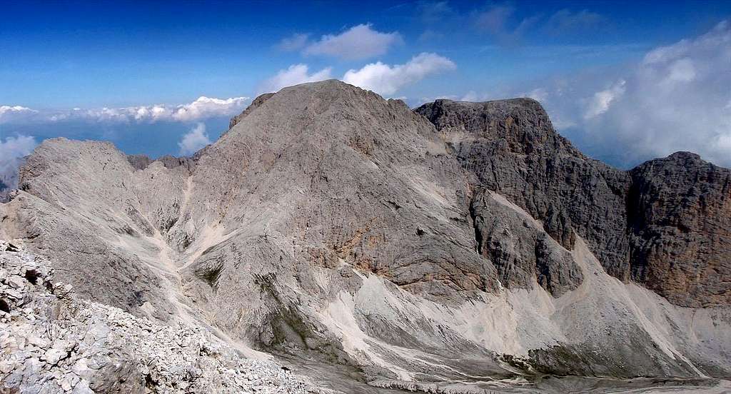
![Pala della Ghiaccia]() Pala della Ghiaccia
Pala della Ghiaccia
Il terreno si fa sempre più impervio e arrivo finalmente al tratto attrezzato: si tratta di poche decine di metri di cavo metallico e qualche gradino infisso nella roccia, posto per superare un tratto di roccette leggermente esposte. E' facilissimo e lo supero agevolmente, anche se con qualche attenzione in più del solito... Il kit da ferrata, che per precauzione avevo portato con me, rimane comunque nello zaino.
In breve, arrivo al passo delle Scalette: davanti a me si apre la verde conca del Larsèc e si alza la torre del Cogolo di Larsèc, come la prua di un'enorme nave.
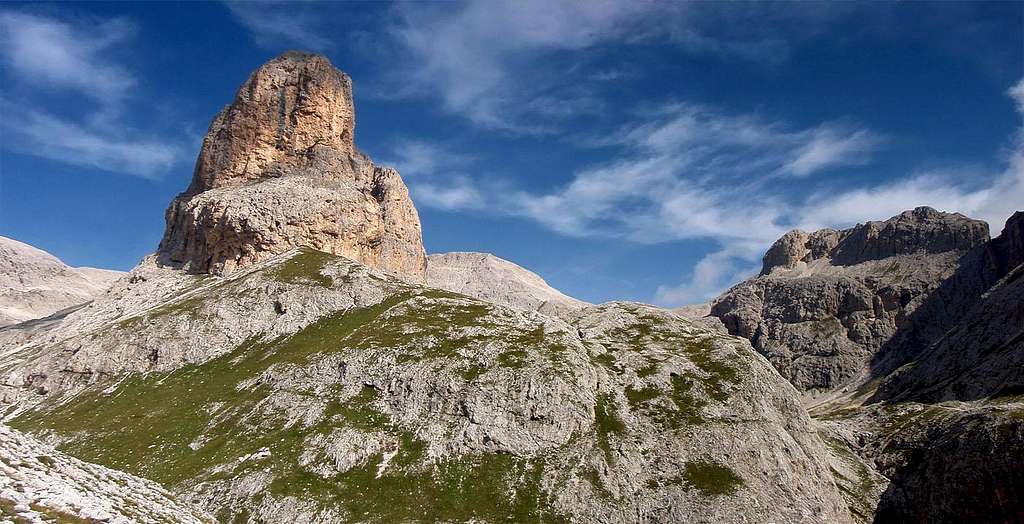
![Cogolo di Larsèc]() Cogolo del Larsèc rises like a vessel's prow
Cogolo del Larsèc rises like a vessel's prow
La conca del Larsèc è forse il luogo più percorso dagli escursionisti di tutto il grupppo: incontro solo un gruppetto di persone che hanno pernottato al rifugio Antermoja e che traversano verso Gardeccia. Ci scambiamo saluti, più calorosamente di quanto faremmo sul sentiero tra i rif. Vajolet e Re Alberto... Questa conca è molto suggestiva e la voglio attraversare lentamente: mi fermo spesso a guardarmi intorno e scatto moltissime foto. Un'ultima ripida salita mi porta al passo di Làusa.
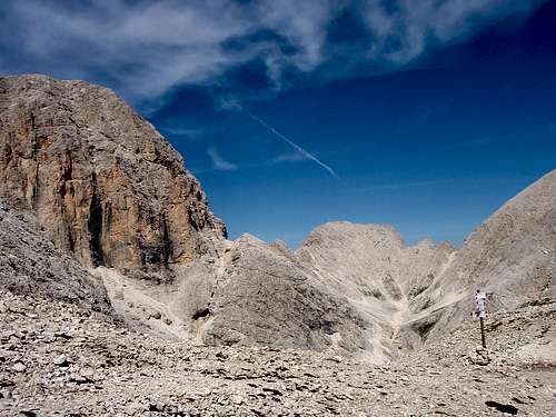
![Làusa pass]() Lausa pass
Lausa passA lonely summit: cima di Làusa
![Moon over Antermoja ridge]() Moon over Antermoja ridge
Moon over Antermoja ridge
Thus far I run a path few crowded but comfortable and well marked. Now, I'm going to cross Cima di Làusa from east to west. Cima di Làusa is an high and easy summit, but it's few visited. From there, there's no paint to sign the route and the path becomes a weak trail. Only some crains show the route, along a steep gravel.
To climb this summit, it's required to have a safe step and a good experience of hiking, nothing more... The only risk is to come on slopes steep and subject to landslide, but the crains are well. This kind of route, even if very simple, requires more attention than a via ferrata, where you follow the iron cable and haven't to look further than 2m from your feet... Here, instead, you are forced to look around, searching the better route. The reaching of the summit (even if very easy) give you a great satisfaction and you feel that you are aware of the mountain.
The large summit ridge offers wonderful and unusual views on the mountains around: the great solitude make me feel like the first climber, like I'm the first to see this place!
But it's only imagination: hundreds of people was there (chamois hunters, demanding hikers), but it's an unimportant amount in comparison with the hundreds of people climbing every day, in summer, on the near Antermoja summit...
![Crepe di Làusa]() Crepe di Lausa
Crepe di Lausa
I take a photo of myself on the summit using the self-shutter, then I descend toward Antermoja pass. A slope of gravels and easy rocks lead me to the crowded path, linking Principe pass to Antermoja hut.
![On Cima di Lausa summit]() Self shot on Cima di Lausa summit
Self shot on Cima di Lausa summit
L'unica capacità richiesta per salire su questa cima è avere passo sicuro e un po' di senso della montagna, per non sbagliare percorso e ritrovarsi su pendii troppo franosi... Gli ometti di pietra, comunque, fanno il loro lavoro egregiamente. Un percorso del genere, pur nella sua semplicità, richiede un'attenzione superiore a quella di molte ferrate, dove ci si attacca al cavo e non si spostano gli occhi a più di due metri dai propri piedi: qui, invece, sei continuamente stimolato a guardarti intorno, a valutare il percorso. Il raggiungimento della vetta, ripeto: assolutamente facile, è di grande soddisfazione e si ha l'impressione di aver compreso la montagna in maniera più completa, rispetto ai percorsi, anche di pura arrampicata, dove è quasi impossibile sbagliare...
![Antermoja valley]() Antermoja Valley, seen climbing to Lausa summit
Antermoja Valley, seen climbing to Lausa summit
La larga cresta sommitale offre panorami bellissimi e inconsueti sulle montagne intorno: l'estrema solitudine mi fa sentire quasi come fossi il primo salitore, e come se quello che vedo non l'abbia visto mai nessuno prima di me!
Ma sono solo fantasie: centinaia di persone sono sicuramente passate di qui, a cominciare dai cacciatori di camosci per finire ai pochi escursionisti più esigenti... Numeri irrilevanti, comunque, pensando che almeno cento persone ogni giorno salgono sul Catinaccio d'Antermoja, di fronte a me, nel corso della bella stagione...
Mi fotografo con l'autoscatto proprio sulla cima, e scendo verso il passo d'Antermoja. Un pendio di ghiaie e roccette mi riporta sul sentiero molto frequentato che, dal passo Principe, conduce al rifugio Antermoja.
![Crepe di Làusa]() Crepe di Lausa seen climbing on Cima di Lausa
Crepe di Lausa seen climbing on Cima di LausaCima Scalierèt
![Scalierèt north ridge]() Scalierèt north ridge
Scalierèt north ridge
At Antermoja pass I make a short stop: I immediately left the hikers groups walking towards Antermoja, and I bear toward Scalierèt pass, a tight notch placed between Scalierèt north ridge and Larsèc summit. From there, a trail leads to the north ridge and on the Scalierèt summit, where a big and bad-looking iron cross is placed. Here I find other hikers, and I make a little stop to eat. I don't remain there a long time a I go down towards the Pope pass, descending the steep gravel on the eastern slopes of Scalierèt summit. From Pope pass I bear toward Vajolet valley; I'm yet come down quite a lot, when I hear someone calling: a german hiker is running towards me, and seems like he want to say me something. I wait him. When he reach me, he tells me that I left my ferrata-kit on the summit! Damn! I have to rise up this steep and sunny gravel, back to the summit! I start the hard uphill, I reach the Pope pass and keep climbing.
After a while, two hikers from Vicenza descending from the top, give me a good news: they carried to me my ferrata-kit! I'm very happy to avoid the hard uphill and I keep descending with them: I can deduce that the loneliness, in the mountains, is good, but also a good company it's not bad!
![Antermoja south edge]() Antermoja summit seen from Scalierèt ridge
Antermoja summit seen from Scalierèt ridge![Cima Catinaccio and Passo delle Pope]() From Scalierèt summit, looking towards Pope pass
From Scalierèt summit, looking towards Pope passA Radler at Preuss hut
I continue the descent with the two new friends, telling each other about mountain experiences and other arguments. They are two nice and kind persons, so I don't mind if I have lost the opportunity to hike alone in this last stretch of trail.
Among gravel and rocks, we reach the bottom of Vajolet valley. We cross Soal creek and we are among the crowd of Vajolet and Preuss huts. There, also to repay their kindness, I offer them to drink.
From the huts to gardeccia the road is overcrowded, like usual: you could forget to be in the mountains, despite of the great panorama, always wonderful...
![Descending from Pope pass]() Descending with the friends from Vicenza
Descending with the friends from Vicenza
Correndo tra ghiaie e roccette, arriviamo in fondo alla valle del Vajolet: attraversiamo il ruscello e siamo tra la folla dei rifugi Vajolet e Preuss. Qui, anche per sdebitarmi dall'avermi recuperato il kit da ferrata, offro loro una radler al rifugio...
Dal rifugio a Gardeccia il percorso è affollato, come al solito: non si ha neanche la sensazione di essere in montagna, se non fosse per i panorami circostanti, sempre stupendi...
Panorama toward Antermoja valley |
Conclusion
Panorama from Scalette pass |
Therefore it's possible to hike away from the crowd, also in overcrowded place and during the high season. But it's fundamental start early in the morning and avoid huts, cableways, marked paths and every else comforts.
The trip I reported it's not so wild, except for the stretch between Làusa pass and Antermoja pass. In the Larsèc group and in other part of Catinaccio and Dolomites, there are dozens of routes, suitables to expert hikers, exploiting old trails and hunter-paths, signed only ny cairns.
These routes are avoided by the most part of the hikers. I advice to you to read the wonderful guide-book "Gruppo del Catinaccio"(also in german version) by Luca Visentini: this book, nowaday hard to find in the bookstores, but probably available in the Mountaineering Association libraries, reports all the wildest hikes and all the routes to the less known summits of Catinaccio range.
Summary of the hike:
Gardeccia (1950m) - Scalette pass (2348m) - Làusa pass (2700m): up to there, Larsèc route, marked and partially assured, nr. 583
From Làusa pass through the east ridge to Làusa summit (2876m) by not marked trail (crains),
From Làusa summit to Antermoja pass (2770m) by not marked trail
From Antermoja pass to Scalierèt summit (2887m) by the well marked trail, running on the north ridge
From Scalierèt summit to Pope pass (2720m) then to
Vajolet and Preuss huts (2243m) by a few marked trail
From Vajolet and Preuss huts to Gardeccia (1950m) by the "hiking autoroute" nr. 546.
Panorama from Scalierèt ridge |
Il percorso che ho descritto, tra l'altro, non è neanche dei più selvaggi, tranne per il tratto dal passo di Lausa al passo Antermoja. Nel gruppo di Larsèc (ma non solo) sono decine gli itinerari, accessibili all'escursionista esperto, che sfruttano tracce di sentiero e antichi percorsi di cacciatori, segnalati solo da ometti di pietra e, per questo, evitati dalle masse... Un consiglio che posso dare è quello di leggere la stupenda guida escursionistica di Luca Visentini "Gruppo del Catinaccio", ormai temo quasi introvabile, ma probabilmente disponibile nelle biblioteche delle sezioni CAI: in essa sono presenti tutti gli itinerari escursionistici, anche i più selvaggi e quelli che portano alle cime e valli meno conosciute.
Riepilogo dell'escursione: Gardeccia (1950m) - passo delle Scalette (2348m) - passo di Làusa (2700m): fino a qui sentiero Larsèc, segnato e in parte attrezzato, n. 583; da passo di Làusa, su traccia priva di segnavia ma con ometti di pietra, per la cresta est alla cima di Làusa (2876m); sempre per tracce di sentiero, al passo di Antermoja (2770m); per sentierino ben tracciato al passo Scalierèt e alla cima Scalierèt (2887m) per la cresta nord; al passo delle Pope (2720m) per tracce di sentiero segnato con ometti e qualche bollo di vernice; ai rifugi Vajolet e Preuss (2243m) per tracce di sentiero marcato con vernice; a Gardeccia (1950m) per autostrada escursionistica n. 546.
Higher point: Cima Scalierèt summit, 2887 m
Lower point: Gardeccia, 1950 m
Total distance: about 10 Km
Total elevation gain: about 1050m
Time: it took to me about 5 hrs 30min no counting stops.


Comments
Post a Comment