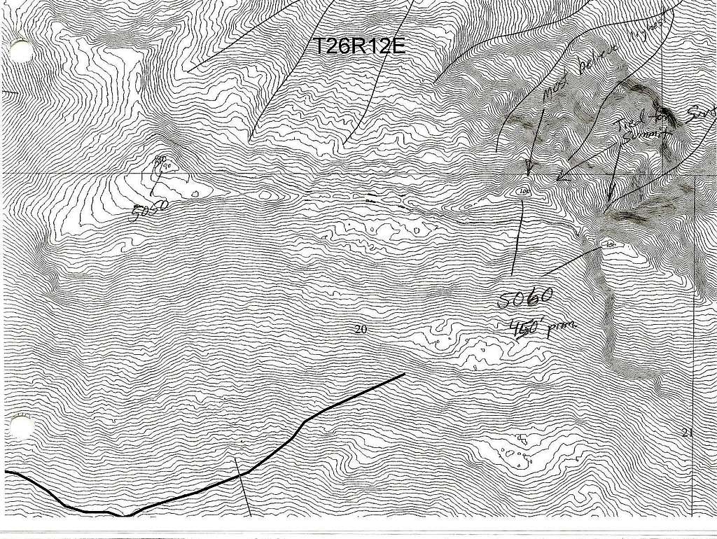
Beckler 10 foot contour map

Beckler 10 foot contour map

The west peak can be ruled out completely, it is at least 10 feet lower. The debate is between the middle and east peak only. Chances are the rock route is higher if both came up the same at 10 feet. I wish I had printed a 5 foot contour map but I didn't think it would be this close. Update: Now that I have visited the area, I saw that the middle peak has two summits. Only the bulkier sub-summit was picked up by the lidar. The higher rock pinnicle did not show up. Based on this, the middle peak has got to be higher.
ridgeguy
on Sep 19, 2011 1:25 pm
Image ID: 747443

Comments

Post a Comment
Viewing: 1-2 of 2
Redwic

Redwic - Sep 19, 2011 1:36 pm - Voted 10/10

Nice!

I like this map a lot!
It's a toss-up, much moreso than I would have guessed!

ridgeguy

ridgeguy - Nov 6, 2011 12:06 am - Hasn't voted

Very dissapointed!

Now that I've visited the area, I see that the Lidar picked up the Middle Peak Sub-summit. The larger rock pinnicle was not captured and does not show up on this map with anything more than one contour. This is dissapointing.

Viewing: 1-2 of 2