

|
|
Area/Range |
|---|---|
|
|
45.32710°N / 23.84641°E |
|
|
Hiking, Trad Climbing, Sport Climbing, Scrambling, Skiing |
|
|
Spring, Summer, Fall, Winter |
|
|
6988 ft / 2130 m |
|
|
LukZem Video
A tribute to the Căpăţânii Mountains after my three consecutive visits to this diverse area.
Overview
|
Munţii Căpăţânii (Romanian) Kapacina-hegység (Hungarian) |
NB Both writers of this page have had tense encounters with sheepdogs in the Romanian Carpathians, but only once has each of us been bitten by a sheepdog – both incidents took place in the Căpățânii Mountains. Those dogs have to be fierce as they have to cope with bears and wolves.
 |
The Căpățânii Mountains are an east-west trending range that is part of the Parâng group and spans about 40 kilometers between the Făgăraş and the Cozia mountains in the east, beyond the Olt River, and the Parâng Mountains in the west. The north boundary of the Căpățânii is formed by the Latorița and Lotru rivers, which separate the Căpățânii from the Latorița range (usually regarded as part of the Parâng Mountains) and the Lotru mountains. In the west, the main ridge of the Căpățânii is divided from the main ridge of the Parâng by the pass named Curmătura Oltețului at 1615 m. The southern frontier of the Căpățânii is the subcarpathian zone and the Polovragi-Horezu depression.
 |
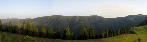
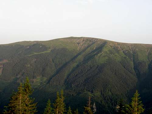
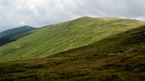
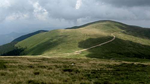
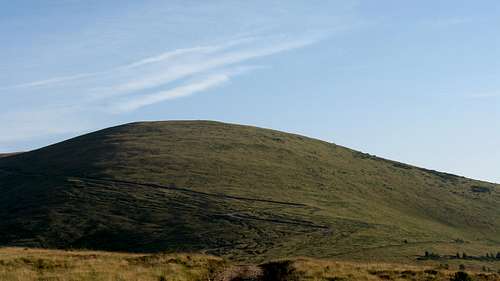
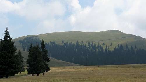
The main ridge of the Căpățânii Mountains, formed of metamorphic rocks, mainly crystalline schists, is rather gentle and grassy like the other ranges in the Parâng group except the Parâng Mountains. The rolling summits, long lateral ridges which trend south, timberline at 1800 m or less (as it has often been lowered by man) are conducive to intensive pastoral activity.
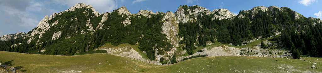
Despite this and the fact that the Căpățânii is one of the lowest ranges in the Parâng group, it is the second most interesting range in the group (after the Parâng Mountains), owing to large areas formed of limestone and dolomite, whose most spectacular sections are the Buila-Vânturariţa massif at 1885 m in the southeast and a smaller ridge of Târnovu (1880 m) in the northwest. Calcareous rocks breeding karst landforms also occur in the southwest corner of the Căpăţânii, between Olteţ and Horezu creeks (Olteţ canyon, Polovragi cave, Taraia and Cerna gorges). The northeast corner of the Căpățânii is an inhospitable maze of relatively low, but complicated in terms of geology (gneiss, conglomerate, limestone, marl) and morphology, heavily forested mountains - similar to the Cozia Mountains across the Olt River, but wilder and less visited - whose highpoint is Narăţu at 1509 m. Since 2017, its most valuable cluster of pristine woodland encompassing Lotrişor creek is on UNESCO's World Natural Heritage List as part of Ancient and Primeval Beech Forests of the Carpathians and Other Regions of Europe.
 |
 |
 |
 |
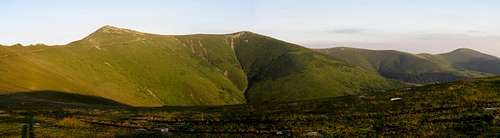
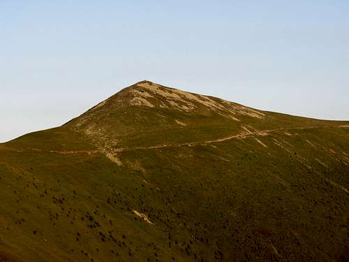
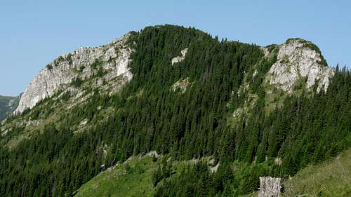
The main ridge of the Căpăţânii Mountains rises in the east, just below where the Lotru River empties into the Olt, to the summit of Foarfeca (824 m), then Sturii lui Pavel (1380 m) and Narăţu (1509 m). Then the ridge turns southwest to Sturii Olaneştilor (1415 m) to soon curve back north. From Vf.lui Stan (1450 m) the main ridge runs west via the following summits: Folea (1647 m), Gera (1886 m), Vf.Preota (1954 m), Ionaşcu (1979 m), Zmeuret (1938 m), Văleanu (1847 m), Cocora (1895 m), Ursu (2124 m), Coşana (2041 m), Căpăţâna (2097 m), Funicelu (1948 m) and Beleoaia (2036 m). There the main ridge veers north towards its highpoint, i.e. Nedeia (2130 m), from which it runs northwest, skirting the summits of Negovanu (2064 m), Turcinu (1963 m) and Boul (1913 m) to finally end after approximately 75 km at Curmătura Olteţului in the west. Slight traces of Pleistocene glacial activity can be found in the highest segment, especially around the summit of Ursu.
![The highest segment of the Căpăţânii]() N face of the highest chunk
N face of the highest chunk
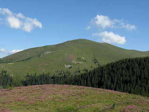
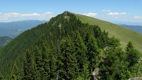
![Corşor spur]() The south slopes, Nedeia on the left
The south slopes, Nedeia on the left
 N face of the highest chunk
A south-north transect of the Căpăţânii would reveal an asymmetric structure – the lateral ridges (called plaiuri by the locals) branching off the main ridge to run north are steeper and shorter (max. 9 km) than the southern branches (max. 15 km). For the hiker, the most important of the side ridges is the one that runs southeast from Govora (1958 m, south of the town of Malaia) via Lespezi and Scânteia summits, thus linking the main ridge of the Căpăţânii Mountains with the Buila-Vânturariţa massif.
 The south slopes, Nedeia on the left
 Summits
The table below lists the highest and some other important summits except the Buila-Vânturariţa massif.
| A few words about | |||
|
The pyramid-shaped highpoint guarding the valley of Repedea, formed of crystalline schists. In the western part of the main ridge. Horizontal tracks traverse its sides and there is a red dot trail to its summit. | ||
|
The second highest peak. A cliffy north face and and a small cirque on the east side of the mountain. Perhaps the best vantage point in the range. In the central part of the main ridge. A red stripe traverse. | ||
|
This mountain, to some resembling a skull, gave the name to the entire range. A partly wooded north side, grassy south slopes, crooked woodland on the west side. In the central section. A red stripe traverse. | ||
|
A dome decorated with a necklet of tiny chutes. From the namesake saddle extends a ridge that connects the main ridge with the Târnovu massif. In the western part, about 2 km northwest of Nedeia. A red stripe traverse of the southern side, a blue stripe traverse of the western side. | ||
|
The highest summit of Zmeuret massif, south of the village of Malaia. In the eastern segment. A red stripe traverse. | ||
|
A rounded summit around 2 km northeast of Ionaşcu. A red stripe traverse. | ||
|
Rounded massif with Coasta Lacurilor lateral ridge stretching towards the south. In the western section. Red/blue stripes, a yellow cross traverse. | ||
|
The first summit of a namesake massif when seen from the west. In the eastern part. A red and blue stripe traverse. | ||
|
An impressive limestone crag with cliffs, couloirs, chimneys and caverns. A great viewpoint and a nature reserve. In the southwestern tip of the Târnovu massif, opposite the highest summit of the Căpăţânii. A red dot trail to its top, a blue striped traverse of its south side. | ||
|
A perfect illustration of human impact on the Carpathian flora: The gentle slope has been converted into a pasture while woodland has survived on the steep, craggy side. This mountain, with a limestone crag at its top, sits in the central part of the Târnovu massif. A red dot trail to the summit, a blue striped traverse of the southern side. |
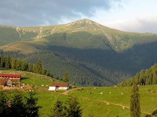
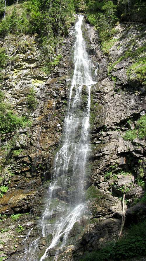
North of the main ridge, about an hour's walk-up southwest from the village of Malaia, is one of the tallest waterfalls in all of the Carpathians, Cascada Scoruşu (also known as Cascada lui Ciucă), whose height is estimated to be between 80 and 100 meters.
Interesting Sites
| Name | Photo | Status | Short description |
 |
|||
 |
|||
 |
|||
 |
|||
 |
|||
 |
|||
 |
|||
 |
|||
 |
|||
 |
|||
 |
|||
 |
|||
 |
|||
 |
|||
 |
|||
 |
|||
 |
|||
 |
|||
 |
|||
 |
|||
 |
|||
 |
|||
 |
|||
 |
|||
 |
|||
 |
|||
 |
|||
 |
|||
 |
|||
 |
|||
 |
|||
 |
|||
 |
|||
 |
|||
 |
|||
 |
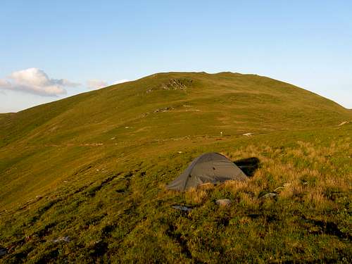
Camping & Red Tape
You can pitch your tent virtually anywhere except the Buila-Vânturariţa National Park, where several campgrounds have been designated. Some of the best, free camping sites (both designated and wild) can be found in the table in the above chapter. In the mountains there are also some unmanned refuges and a couple of mountain huts.| Refuge | Elevation (meters) | Photo | Distance from nearest source of water | Capacity (persons) | Location/Access |

|
|||||

|
|||||

|
|||||

|
|||||

|
|||||

|
Maps & Guidebooks
Online maps

Guidebooks
- A 2012 guidebook by Gheorghe Ploaie
- According to Gheorghe Ploaie's blog, a map and guidebook can be obtained at the Office of Vaideeni Commune.
The owner of this page happened to be given a map of the mountains at the foot of Funicelu summit. Thanks!
Getting There
 Transalpina
 Lotru at mouth
 LukZem in 2015 LukZem in 2015 |
 with his female viper :) with his female viper :) |
 yatsek in 1978 yatsek in 1978 |
 & his Rosalias :) & his Rosalias :) |