Welcome to SP!  -   
 
  MbPost.com -- It's SP for Mountain Biking!
Areas & Ranges·Mountains & Rocks·Routes·Images·Articles·Trip Reports·Gear·Other·People·Plans & Partners·What's New·Forum

Calf Robe Mountain

 
[ Sizes: Orig | Med | Small | Thumb ]
Calf Robe Mountain
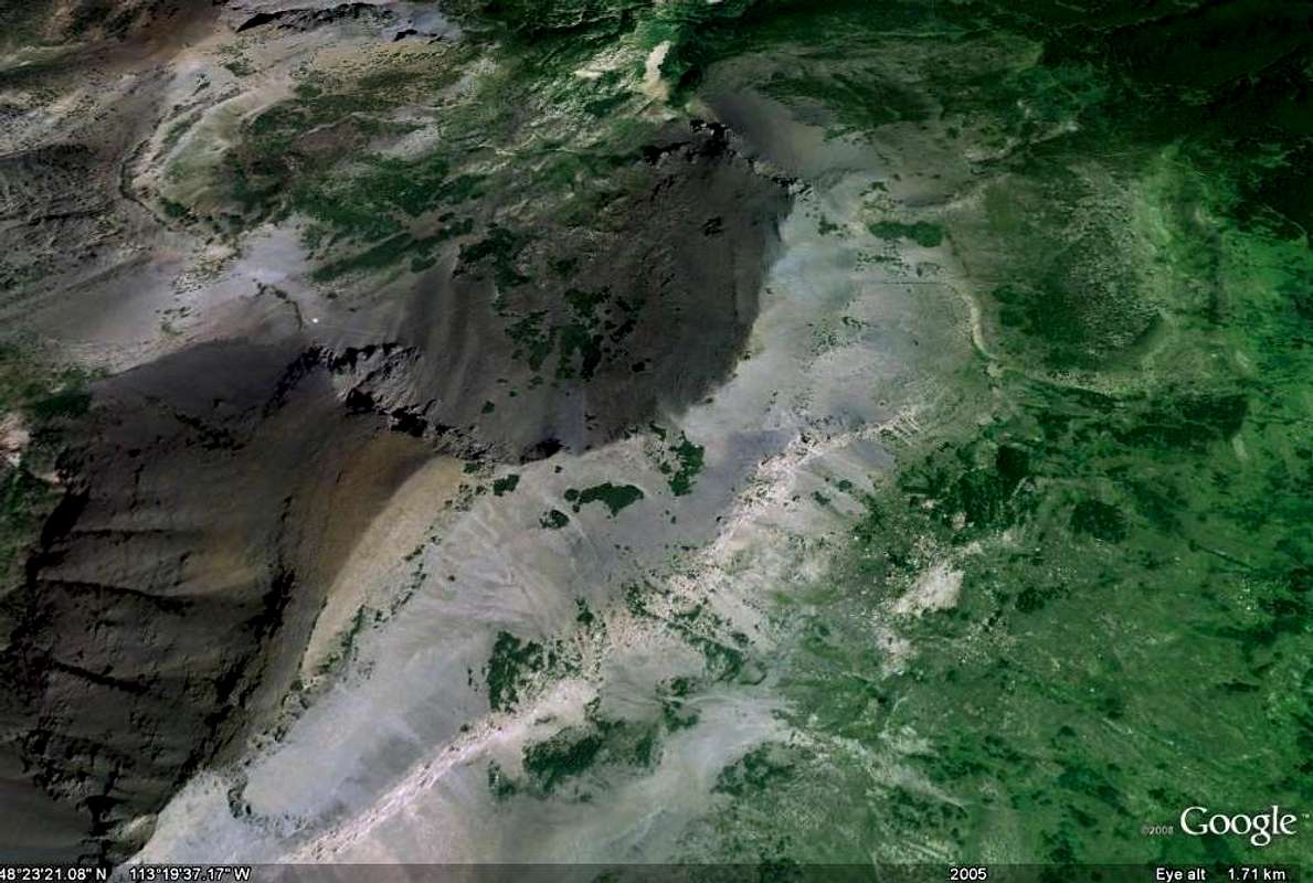
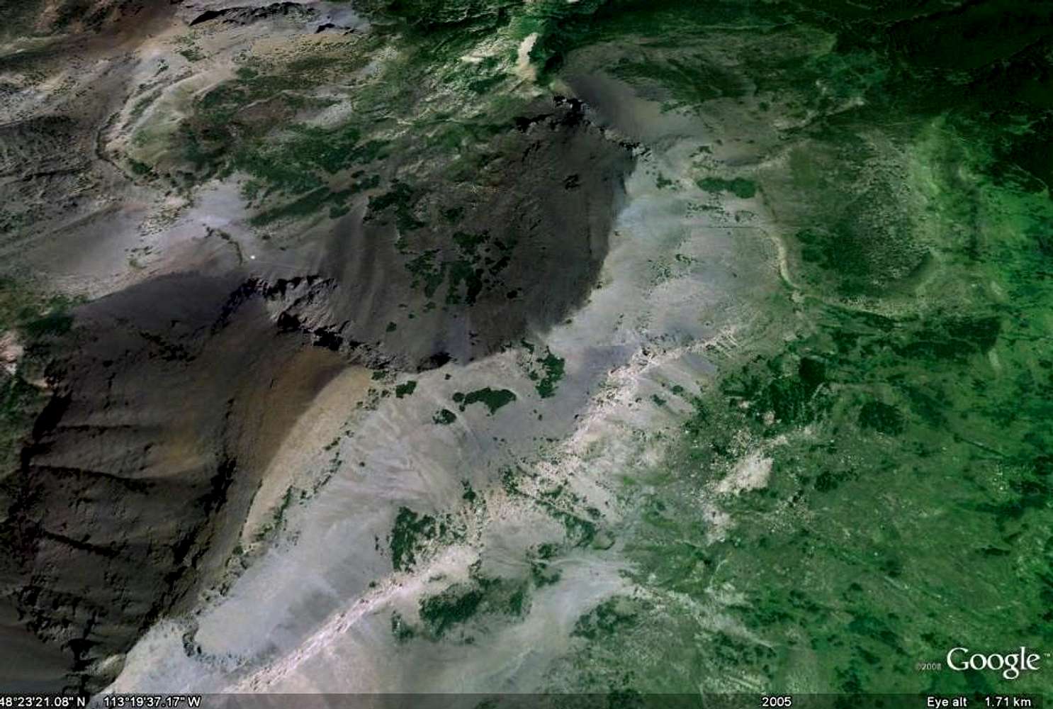
Calf Robe, Google Earth Image

Firebrand pass is located on the left side of this Google Earth image.

The trail can be seen crossing the talus slope at left center.

Calf Robe is the point with the brownish rocks. The Northeast Ridge is to the northeast of the peak.


Comments

No comments posted yet.


Sign in to post!

Don't have an account? Register now.


Rate This Image
Current Score: 0

Log In To Vote
 Calf Robe Mountain (GNP) (Mountain/Rock)

Route Image
« PREV

Viewing
#39 of 39
GALLERY

You are at
the Last
Image

 FlatheadNative's Image Gallery

Cataract Image
« PREV

Viewing
#1330 of 1380
GALLERY
The Backbone of the World
NEXT »
Image Data

FlatheadNativeSubmitted by FlatheadNative
on Jul 11, 2009 7:27 pm

Image ID: 528686
Hits: 232 

Image Type(s): Topo/Diagram


"Your love, O LORD, reaches to the heavens!"   --Psalms 36:5   

© 2006-2012 SummitPost.org. All Rights Reserved.