Welcome to SP!  -   
 
  MbPost.com -- It's SP for Mountain Biking!
Areas & Ranges·Mountains & Rocks·Routes·Images·Articles·Trip Reports·Gear·Other·People·Plans & Partners·What's New·Forum

Caprock Canyonlands

 
[ Sizes: Orig | Large | Med | Small | Thumb ]
Caprock Canyonlands
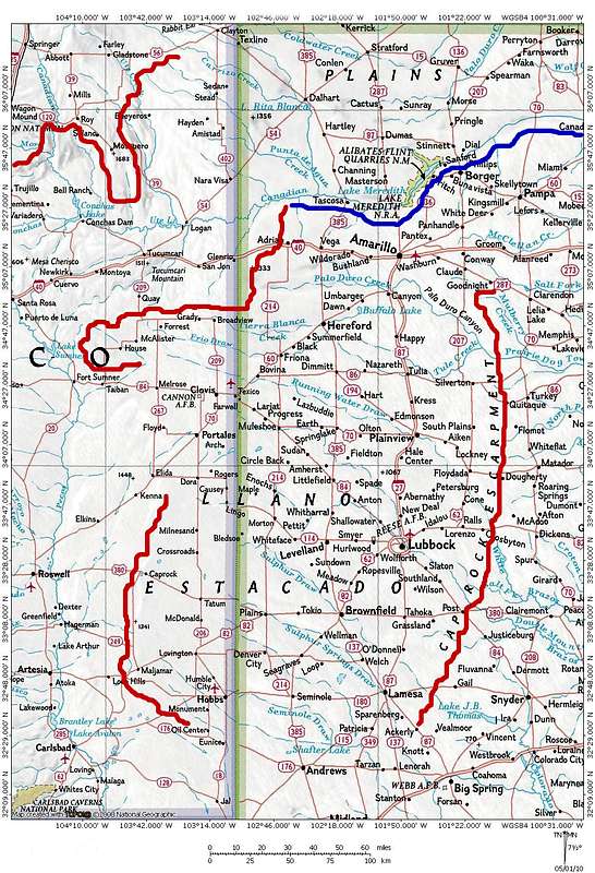
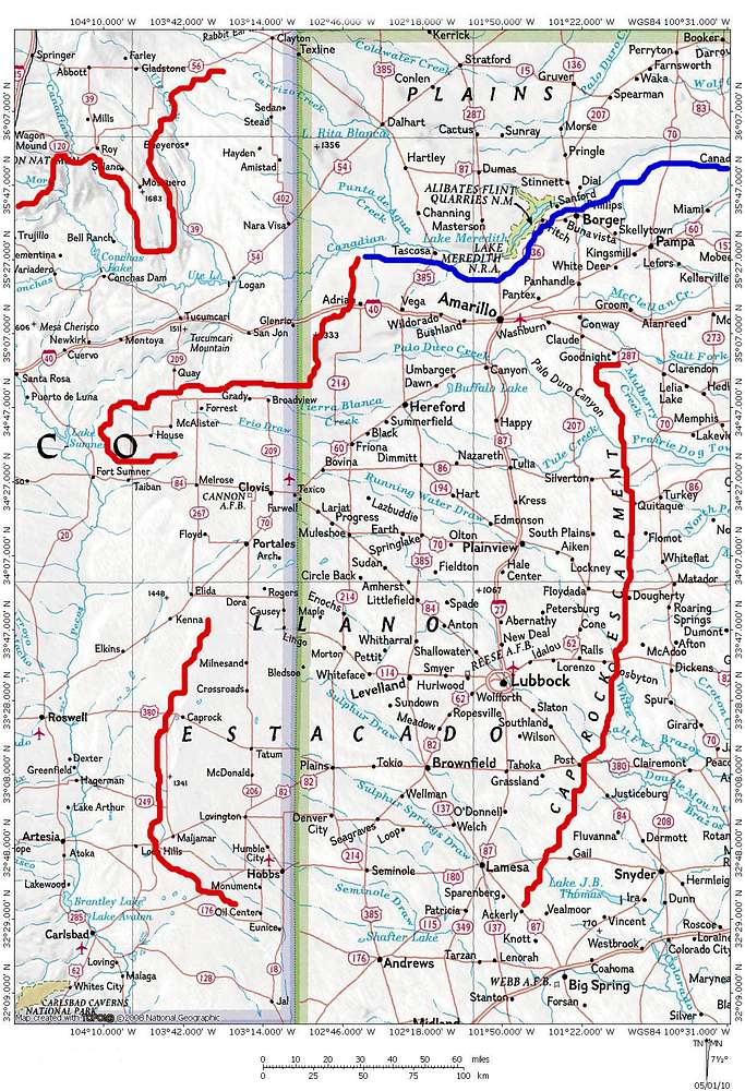
The Caprock Canyonlands. Clockwise in red: The Caprock Escarpment, the Mescalero Escarpment, the Caprock, and the Canadian Escarpment. The blue line marks the southern edge of the Canadian River Valley, which is the northern edge of the Llano Estacado.


Comments

No comments posted yet.


Sign in to post!

Don't have an account? Register now.


Rate This Image
Current Score: 86.37

Log In To Vote
Image Data

BubbasMapsSubmitted by BubbasMaps
on Apr 30, 2010 12:27 pm

Image ID: 617713
Hits: 742 

Lat/Lon: 34.08906°N / 103.00781°W


"Ack!"   --Bill the Cat   

© 2006-2012 SummitPost.org. All Rights Reserved.