Welcome to SP!  -   
 
 New features are here! - Read More... 
Areas & Ranges·Mountains & Rocks·Routes·Images·Articles·Trip Reports·Gear·Other·People·Plans & Partners·What's New·Forum

Caution: No More Signs!

 
[ Sizes: Orig | Large | Med | Small | Thumb ]
Caution: No More Signs!
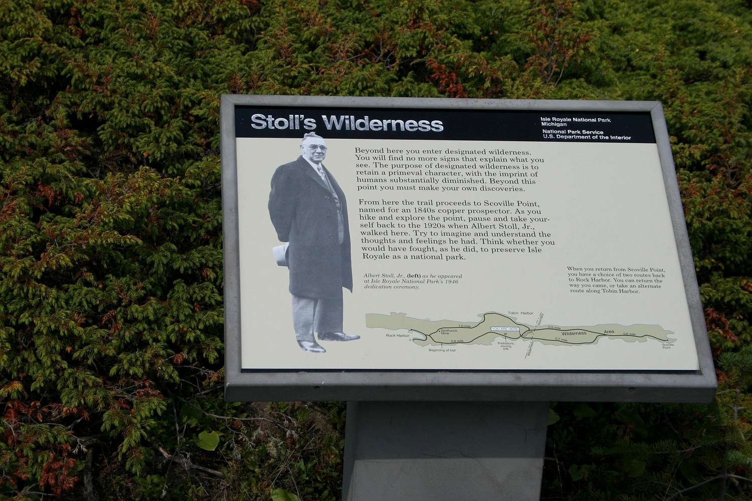
About 99 percent of Isle Royale is federally-designated wilderness. One exception is the developed area at Rock Harbor, with a dock, lodge, store and some other buildings. There's a nature trail from Rock Harbor to Scoville Point. The first part has interpretive signs to tell people what they are seeing.

About halfway out, you leave the "developed" area and enter the "wilderness" area. In its wisdom, the National Park Service has erected this sign to tell you that in a wilderness, you don't get any more signs.

Somehow we made it out and back without getting lost.

August 2007.


Comments

No comments posted yet.


Sign in to post!

Don't have an account? Register now.


Rate This Image
Current Score: 85.9

Log In To Vote
Image Data

Arthur DigbeeSubmitted by Arthur Digbee
on Nov 29, 2007 2:32 pm

Image ID: 361171
Hits: 893 

Lat/Lon: 48.16013°N / 88.45642°W

Image Type(s): Humor


"I understand that fear is my friend, but not always. Never turn your back on fear. It should always be in front of you, like a thing that might have to be killed."   --Hunter S Thompson   

© 2006-2012 SummitPost.org. All Rights Reserved.