Overview
Mt. Tam from the Chicken Shack Fireroad I've hiked all over massive
Big Rock Ridge for years. The main ridge is fed into by several sub-ridges coming up from north or south. The routes from Lucas Valley on the south side are the most popular and the shortest but steepest ways to the top. Yesterday (Aug 23 '13) I decided to try a new route from the northeast end starting next to Hwy. 101 in south Novato. It is the simple well graded and wide Chickenshack Fireroad that gradually climbs the northeast ridge up and around to the main ridge. It was refreshing to take a new approach to the main Big Rock Ridge Fireroad that goes to the top of Marin County's 2nd highest mountain.
Getting There
North from Big Rock Ridge Fireroad From Hwy. 101 between the Marinwood and Ignacio exits take the Alameda Del Prado/Nave Dr. exit over to the west side just south of Burger King. Park along the street of Clay Ct.. The route starts on the hillside going up to the west.
Route Description
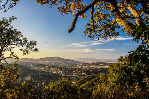
San Pedro Mtn. from Chicken Shack Just over a short wooden guard rail fence along Clay Ct. a use trail goes up a short distance to an abandoned tennis court. Take the Chickenshack Fireroad on the right. It winds up over and around with a few dips gradually gaining elevation and becoming the Big Rock Ridge Fireroad until it reaches the main ridge at 3 miles and 1,400' elevation. To get to the main summit towers (1,887') continue to the right and head northwest on the Big Rock Ridge Fireroad over 2 main highpoints another 2 1/4 miles.
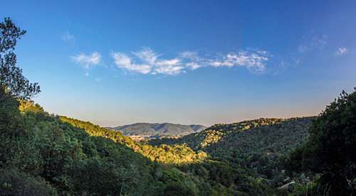
The high point at one mile is "The Sixteener" (1,640+') one of the best views in the northbay.
Retrace the route back.
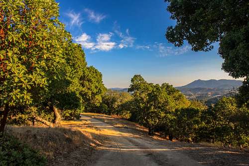
The full route to the summit towers is approximately 10.5 miles with about 2,500' gain round trip.
Essential Gear
Big Rock Ridge Fireroad Snacks or lunch, windbreaker and or raincoat, plenty of water especially on hot summer days.