
-
 32142 Hits
-
 83.1% Score
-
 16 Votes
|
|
Mountain/Rock |
|---|---|
|
|
46.75343°N / 121.73952°W |
|
|
Hiking, Skiing |
|
|
Spring, Summer, Fall, Winter |
|
|
6370 ft / 1942 m |
|
|
Overview
This small peak makes for an excellent day trip/hike while at Mount Rainier. It is a popular outing for all skill levels, and is a refreshing alternative to the crowded trails above Paradise. It is easily accesable from a turnout along HW 706, or can be done via a short hike from Paradise to the trailhead. The hike overall is simple, although it may be strenuous for those unaccustomed to steep trails or hiking in general. The last section, may require a small amount of scrambling and easy snow travel, but is still simple, fun and safe. This hike can easily be done in 5 hours or less, and is frequently done in tennis shoes and such. I would highly recommend it for anyone who wants an enjoyable hike with awesome views of Mount Rainier, Adams, Goat Rocks, St. Helens and the rest of the Southern Cascades. The mountain is named after Fred G. Plummer who was a Forest Service cartographer. He taught geography in Tacoma Public Schools.
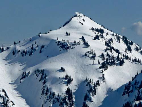 Plummer Peak under snow | 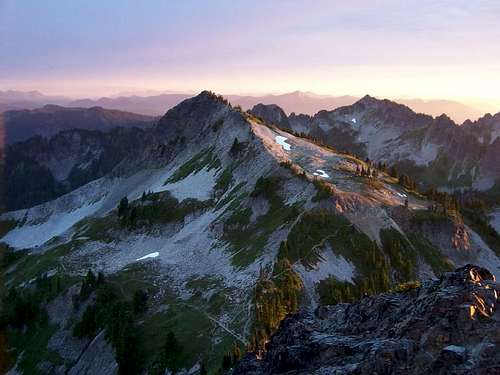 Plummer Peak from Pinnacle in fall | 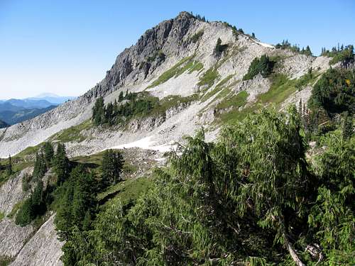 Plummer Peak in Summer |
Getting There - Pinnacle Saddle Trail
After entering the park via the Nisqually entrance, follow Highway 706 past Longmire and Paradise (continuing on the Stevens Canyon Road) to a roadside parking area overlooking Reflection Lake. Across the road is the trailhead for the Pinnacle Peak Trail at an elevation of 4,885 feet. Upon leaving the trailhead, the trail continues gaining elevation until the Pinnacle-Plummer Saddle at 5,950 feet over a distance of 1.3 miles. The first half is along a well beaten trail through the forest and brings you to some small run offs from the Pinnacle Glacier and other snow fields. The second half is a mix of a dirt and rock trail, involving a few switchbacks, finally reaching the Pinnacle-Plummer Saddle. At this point the "maintained" trail ends and you must head off to your right (west) and find a good boot path that takes you 400 more feet up to the summit of Plummer Peak. This last section takes 20 or less minutes and is considered an easy scramble. You may have to cross a small snowfield and continue up a small section of loose rock before reaching the big snowfield. Here you may either climb the rocky trail to your left or ascend directly up the field. Either way, you should meet up again with the trail at the top of the snowfield and tackle the last 100 or so of easy rock/trail scramble to the top. The summit is a 50 X 15 foot patch of rock with excellent views of Rainier to the north, the rest of the Tatoosh range around you, and Mt. Adams, the Goat Rocks Wilderness and other mountains to your south and east.
Note the Stevens Canyon road doesn't open until sometime around Memorial day most years. Therefore you must park at the Narada Falls trailhead and hike steeply for 300 feet up to the Stevens Canyon Road and walk the road to Reflection Lakes a distance of about 1 mile each way!
Also, Pinnacle Peak is easily accessed from the same saddle where the trail ends therefore you may want to climb it too. Instead of heading right towards Plummer Peak, head left (east) up Pinnacle Peak. Although it is considered a scramble, it is not as easy as Plummer and involves greater exposure and rock scrambling.
 Starting on the Pinnacle Peak trail | 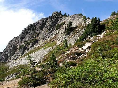 Plummer Peak seen from the saddle | 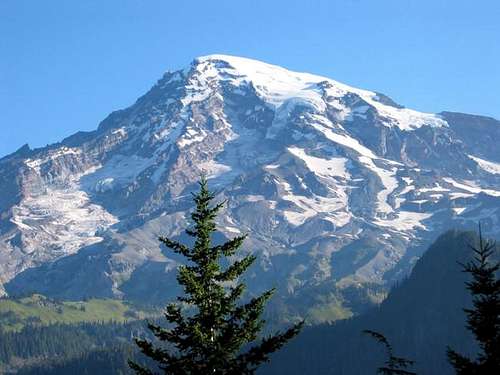 View of Rainier from the saddle |
Camping/Red Tape
A fee must be paid upon entering MT. Rainier National Park. Although the park does not entirely close during the winter, some of its locations do. During the winter, access is by the Nisqually Entrance in the southwest corner of the park only. Roads may be difficult for driving if not closed. Chains must be carried from November through April and the Stevens Canyon Road doesn't typically open until May sometime. Winter ascents should be taken only by those experienced with snow travel and avalanche training. That being said, the peak makes a great cross country ski outing.
Although this does not have to be an overnight hike, some individuals may chose to camp or stay overnight. Note that Backpackers, climbers and anyone else who camps outside of auto campgrounds, must obtain a free Wilderness Camping Permit before camping. Permits are required year-round and are issued in person only after you arrive in the park. The permits may be obtained at the Wilderness Information Centers at Longmire and White River, or at any ranger station during the summer. Winter permits are available at the Longmire Museum. See this page for more information.
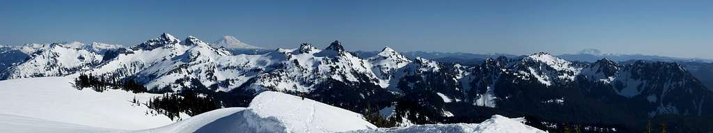
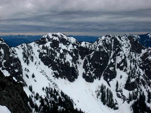
Tatoosh Range Panorama from the Nisqually Glacier
Map
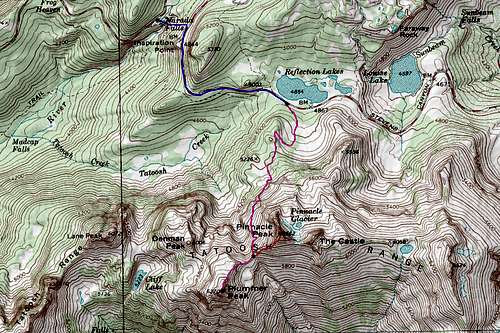
PINK: Pinnacle Peak Trail and Plummer Peak East Ridge - Class 1 & 2
RED: Pinnacle Peak South Standard Route - Class 3
BLUE: Winter/Spring Road Walk to the TH from Narada Falls - Class 1
Mountain Conditions
See this page for good webcams of the Mount Rainier area!

Tatoosh Webcam
External Links
Views from Plummer
rock-ice - Dec 18, 2003 4:02 pm - Hasn't voted
Untitled CommentMuch more fun in the winter. Asses avy conditions carefully. I've heard this trip makes for a great ski as well.