

mrh - Dec 21, 2004 12:56 pm - Voted 10/10
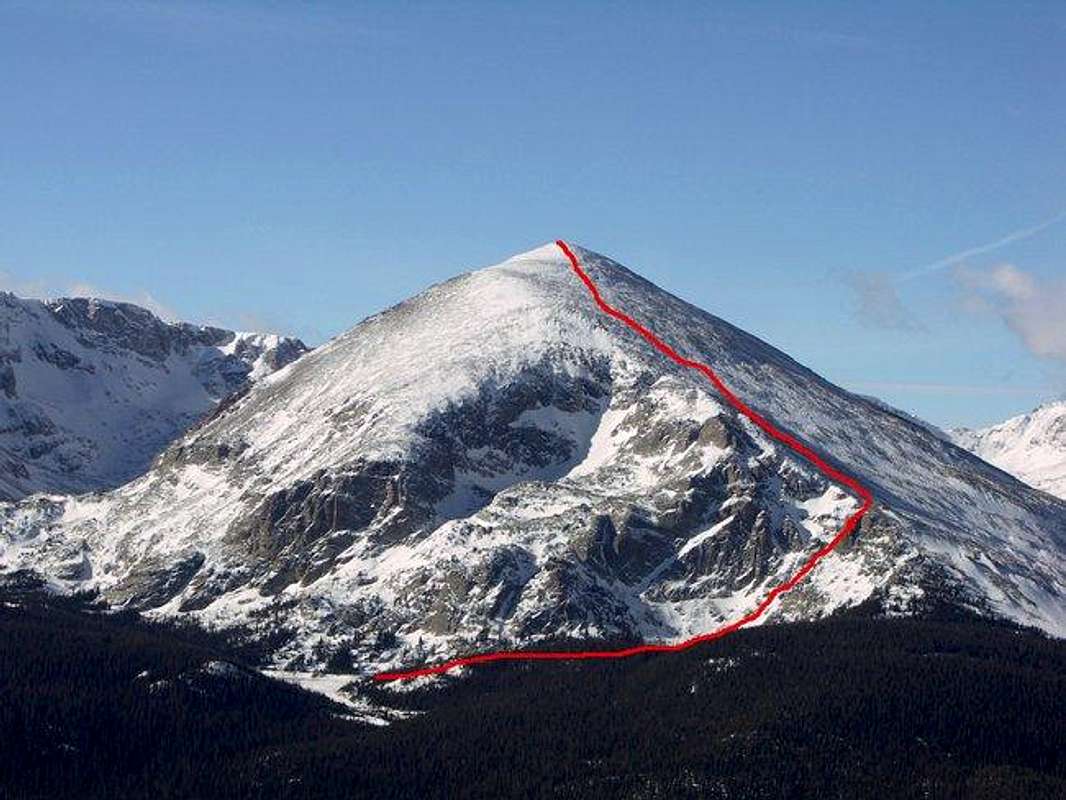
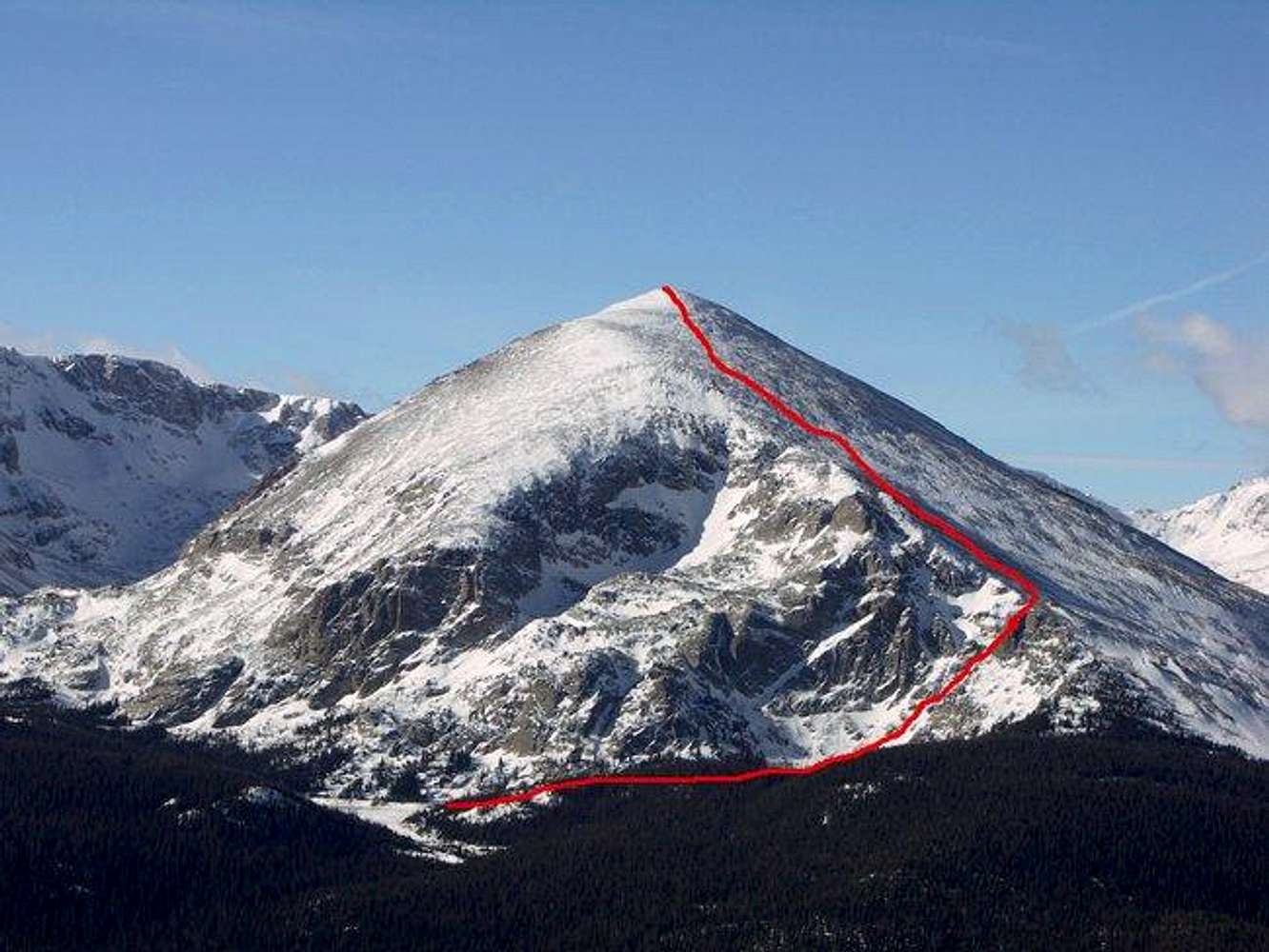
Route LinesSo how does one draw the lines onto a photo?

brenta - Dec 21, 2004 1:22 pm - Hasn't voted
Re: Route LinesIt depends on the tool you use. I use the GIMP, which runs on both Linux and Windows, and is open-source free software.
When you open an image in the GIMP, you can choose a tool from a menu. If you choose the pencil, you can draw on the picture my moving the mouse cursor along the desired line while pressing the left mouse button. Another menu item allows you to select the color of your line. You can also configure the width of the line and sundry little details.
I don't have enough experience with other tools to compare, but I know Adobe Photoshop and CorelDraw have similar facilities.

CharlesD - Dec 21, 2004 1:23 pm - Hasn't voted
Re: Route LinesI use a drawing program like Photoshop, GIMP, or a host of others. There are lots of tricks, but drawing a simple route like that is pretty straight-forward.
mrh - Dec 21, 2004 2:02 pm - Voted 10/10
Re: Route LinesThanks guys, I'll give it a try.

big_g - Jan 19, 2005 10:35 pm - Voted 10/10
Re: Route LinesGIMP runs on Mac OS X too.
cheers,
G
Linux geek first, Mac geek second


Comments
Post a Comment