Part 0 - Cycling and Scrambling from Calgary to Vancouver
In A Nutshell
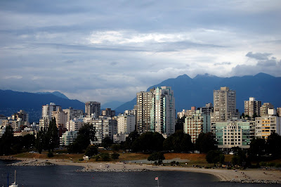
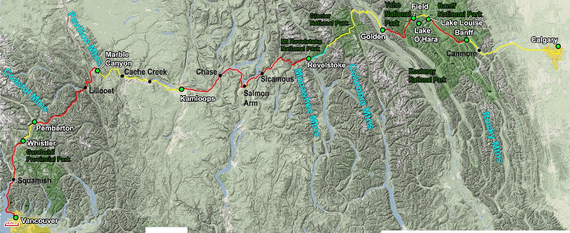
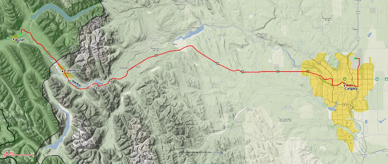
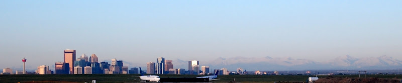
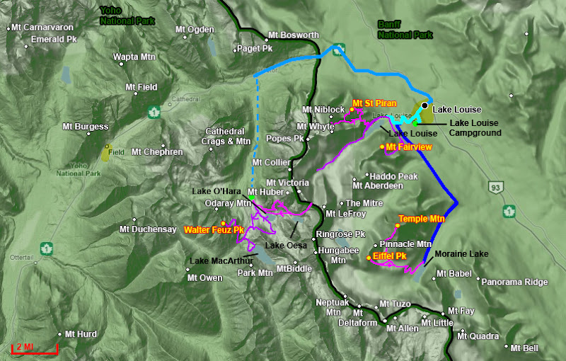
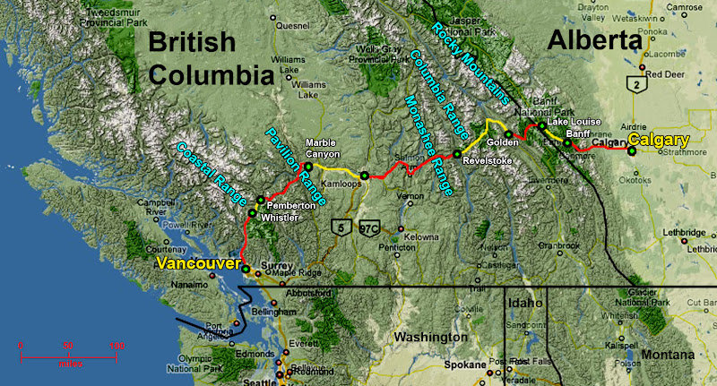 A rough map of the trip
This trip report is very long, partly because it was a very long trip (23 days), partly because I covered a lot of ground (cycled 770 miles and climbed over 10 peaks), and also because I’ve decided not to just write the standard “went there, did that” format. The trip was as much an inward journey for me as an outward one, so I feel that ignoring details relevant to my motivations and self-reflection would miss out on a lot of the adventure.
In a nutshell, from July 29th to August 17th I cycled solo across Western Canada, from Calgary, Alberta, to Vancouver, British Columbia via Banff, Kamloops, and Whistler. Along the way I hiked and climbed throughout the
Canadian Rockies and a small amount in the Coastal Range, summitting about 10 peaks. I cycled fully self-supported (apart from supply refills along the way) with camping gear and basic scrambling equipment, and this was to be my first ever multi-day cycling tour and first time ever combining cycling with scrambling on an approach. Although it was a very ambitious trip, in the end it was a wild success, and I had many interesting experiences along the way. For those that like stats, here they are:
Cycling (17 days)
- Distance: 767 miles (45 miles / day)
- Elevation Gain: ca. 41,000 ft (2,400 ft/day)
- Elevation Loss: ca. 42,900 ft (2,500 ft/day)
- Average Speed: 12 mph
- Weight Carried: ca. 82 lbs (nearly 90 lbs when maxed out on water capacity)
Hiking/Scrambling (8 days)
- Distance: 82 miles (10 miles/day)
- Elevation Gain: 36,010 ft (4,500 ft/day)
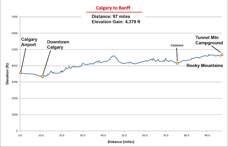
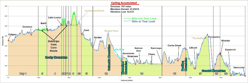 Diagrammed elevation profile of the trip
The Premise
The summer of 2008 was a pivotal summer for me. I was on the verge of completing my graduate studies in structural engineering, and I had just spent 6 months interning at a prestigious firm in New York City that worked on exactly the sort of projects that I had so ambitiously trained myself for over the past 5 years.
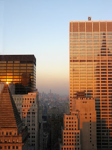 |
| Views from the office |
Although I loved New York City, the Shawagunks and the Adirondacks could barely begin to replace the outdoor lifestyle of the West that has become such a part of me. Despite being a dream job, I had turned down an offer to continue at the firm as a full employee, partly because I was insistent on finishing the optional extended portion of my degree and then contacting them, but also because I couldn’t decide what to do. I have always had a conflicting dichotomy of the love for big cities and the love for wilderness, and as my career track pulled me ever more strongly away from Nature, I have had a greater struggle between which passion to follow.
It was in this state that I began planning some summer excursions, partly with the idea that this might be the last time for many years that I would be able to get out in the mountains and deserts that I so loved. No summer job this year – it was to be my last hurrah before fully entering a full-time career, and I wanted to do a number of big trips that I had been dreaming to do for a while. Or perhaps the trips could help me be at ease with scaling down my career ambitions for the sake of the mountains. For June I would spend the month in Alaska, climbing Denali with a group of climbing friends on a self-led expedition. With this trip already set in stone, I decided to take the month of July “off” to “rest” and recover from Denali and get in good cycling shape for my next big summer objective: cycling across Western Canada.
Cycling has always been very therapeutic for me, both physical and emotional, so I guess part of the idea of this trip was to be a symbolic therapy for my current angst about my future.
The Trip
![Valley of the 6 Glaciers]() Valley of the 6 Glaciers (Banff National Park)
Valley of the 6 Glaciers (Banff National Park)
I first got the idea of doing a cycling trip in the Banff/Jasper area in 1999 when I took a road trip through the area with my father. At the time I was barely getting into climbing peaks, and on the trip we didn’t venture far from the car as I was still recuperating from a major reconstructive knee surgery. The region left a strong impression on me – some details in particular were the great combination of extremely rugged roadside beauty and surprisingly mild road grades through the mountains, perfect conditions for a great cycle touring route. Ever since that trip, I had casually toyed with the idea of someday cycling through there, maybe ambitiously, as a loop from Calgary.
 The trip in the early planning stages. working out day divisions and noting prevailing wind directions as I was debating West-to-East vs. East-to-West
Over the years as I have fallen in love with mountaineering, one major influence in my interests and ambitions in the mountains has been
Bob Burd and his
Sierra Challenges. Not only did they expand my awareness of what I could accomplish in single-day mega hikes, leading to my idea to day hike Gannett Peak, but in 2006 when I managed to do the full 10 days of the Challenge I learned a lot about multi-day ultra-endurance events and how to go about attempting them.
 |
| Vancouver |
From this background, in 2008 when I decided to finally do a cycling tour in Banff, I got really ambitious. First, the trip wouldn’t just be about cycling in the area. I would also hike and scramble up peaks. I was confident that if I paced myself, I could go continuously for many days, and that the effort of doing day hikes in the Canadian Rockies wouldn’t tire me out too much for such a pace. Also, I theorized that hiking days could be “rest” days for my cycling days, and vice-versa, since the activities use slightly different muscles.
Then I just went off the deep end. I had always wanted to see Vancouver and had been learning more about Whistler and the Vancouver area, so I began to get interested in linking up my cycling trip from Calgary all the way to Vancouver. I had the time, so what the hell – if only cycled 50 miles a day, taking all day if I wanted to, I would have time to do this. And so the idea for my uber-ambitious mega-cycling-climbing trip was born.
Partners, Planning, and Preparation
Still, the idea was a little crazy since at the time 50 miles was my all-time cycling record for one day, on an unloaded bike, and it left me wasted for a few days after. Also, I wasn’t about to do this alone just yet. I had never solo-toured before (or done a cycling tour for that matter), and I had done very little soloing in the mountains.
For the partner problem, I knew just who to call – my friend Joel Wilson, who had joined me for the
Gannett Peak day hike sufferfest. He likes these sorts of trips, and he was very interested in the idea. Still, he had research to do that summer, but expected to be able to take at least a week off. So we tentatively planned for him to join me at the very least in the Banff area. This allowed the nice possibility of trying to climb Mt Assiniboine along the way, since we could afford to bring the weight of a rope and light rack on our bikes as Joel wouldn’t need to carry as much gear for the trip and wouldn’t be riding as far with it.
Sadly, in the end Joel couldn’t take enough time off to do the whole trip, and then he got a girlfriend, so I was left friendless for the trip. At this point I was enthusiastic enough about the trip that I decided just to go solo, but Mt Assiniboine would have to wait. And my newly purchased SPOT Personal Locator Beacon could be used to let family know on a regular basis whether I was making progress on my route, so at least someone could call in a rescue if I needed one.
I would fly to Calgary with my bike packed up in a box. Then I would assemble it at the airport and begin my ride. In Vancouver I would get another box to pack up my bike, and ride a Greyhound bus to Seattle to meet some friends and visit a prospective employer before shipping my bike back to Salt Lake City flying back to school in Berkeley via Los Angeles (for further job interviews). Busy month! Plus there was still the possibility of my friends in Seattle driving up to meet me in Whistler with extra climbing gear to tackle Mt Garabaldi.
![Mt Garabaldi]() Mt Garabaldi
Mt Garabaldi
For planning and preparations, I made good use of the month of July staying at home in Salt Lake City. The planning was a major hurdle in and of itself. I had absolutely no idea what I was really getting into, and I couldn’t find any information readily available for doing such a cycling tour, as far as where to stay, quality of roads, suggested routes, distances to be covered each day, where to restock on food and water, etc.
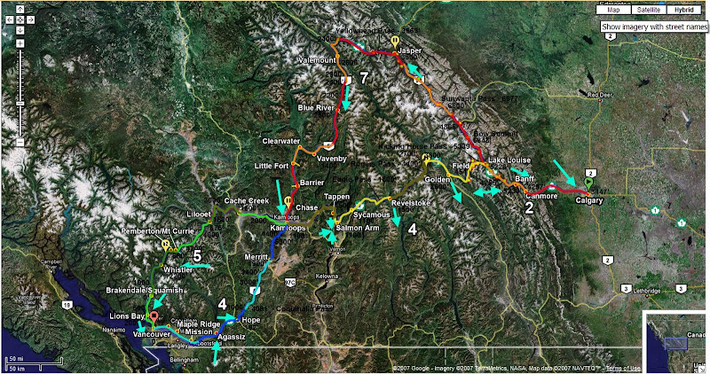
That and I needed to learn how to do a multi-day cycling tour. So I designed a custom trip from scratch based on internet searches, point of personal interest, and the joys of Google Maps and Google Earth. A few variations were planned, all of which passed handily through Kamloops, making a figure-8 centered on the town. I was very tempted with a northern route via Jasper and then down the backside of the Canadian Rockies. But then that was a major detour, and I would miss Yoho National Park, which I had yet to see. So I would take Canada Highway 1 from Calgary to Kamloops.
On the next leg, the more obvious route was to join Highway 5 and take it south and into the river valley that empties into Vancouver. This way is more well-traveled, but from what I read online, the there was a pass that was notorious for cycling tourists for its steepness and elevation gain from either side; plus, the idea of cycling through endless flat land and suburbs to get to Vancouver seemed less appealing to me.
By looking closely at maps, I picked together a northern route that took me to Cache Creek, over the Pavilion Range to Lillooete, and then over the Coastal Range in 2 hurdles, one from Lillooet to Pemberton, and then another main climb from Pemberton to Whistler. From there it was (mostly) downhill to Vancouver on the vividly-named Sea-to-Sky Highway. The idea of descending from the mountains to the ocean, cycling along a highway like California’s Highway 1, sandwiched between the mountains and the sea seemed too great to pass up. Plus, this route brought me in to Vancouver from the north, allowing me to get downtown with a minimum of cycling within the city.
![Howe Sound]() View along the Sea to Sky Highway
View along the Sea to Sky Highway
There was a big problem with the alternate route, though. Upon closer inspection, the stretch from Lillooet to Pemberton seemed to fade away. Topographic maps showed a nice valley linking the two towns, but this was filled with a reservoir and I could only find railroad tracks alongside the water. There was a road (that as far as I could tell from satellite photos was paved) that cut across the arc that the valley carved through the mountains, but this shortcut had a significant climb up and over the mountains. In addition to climbing over 3,000 ft in one push, I found the first 1,500 ft to be very steep – grades as steep as 10% and nothing less than 5%. This would not be pretty with a fully loaded touring bike at the end of a major cycling tour. I had no idea if I could even peddle up such a consistently steep grade with so much weight on my bike. Still, the picturesque descent on the Sea-to-Sky Highway ending with a sudden and dramatic entrance into Vancouver (similar to entering San Francisco via the Golden Gate Bridge) seemed too romantic of an idea to pass up. So it was settled.
My dad insisted that I was going backwards on the route, since it was against the prevailing wind, but I was set on having Vancouver as the endpoint. It seemed more rewarding and a much nicer way to end the trip by arriving someplace new. Also, research into typical wind weather data for August in the towns I was riding through showed that the winds were primarily directed by the mountains and not the prevailing current. Regardless which way I traveled, I would have headwind about half the time, tail wind the other half, and some cross-wind here and there.
 A detailed map of the route (actual, not planned)
With the route known, I then digitized the route (nerdy, I know, but helpful). Not only could I plan were I should stop based on distance and elevation gain, but I could have a breakdown printed out with me to know how much distance and elevation gain between various points, which proved very helpful in the trip when I had to deviate from my planned stops (which happened a lot!) and I wanted to make informed decisions. Because there were a lot of ways in which I could break up the route, by having the map digitized on a spread sheet, I could intelligently plan stops so that I could start small with elevation gain and distance, and gradually ramp it up.
As far as climbing, I spent hours poring over guidebooks and Google Earth piecing together potential peaks. Eventually I drew up a list of possible outings (more than I could do, but then allowing for a nice variety of options). One logistic to work out was how I would get to the peaks without a car, so finding routes with reasonable cycling approaches was key. I could cycle out from a “base camp”, climb a peak, and then head back. On peaks further out, but along my route, I could cycle over, climb the peak, and continue on to that night’s destination. The second concern was what I would do with the gear and food on my bike, being left unattended in Bear country.
Light camo- netting would protect my bike from theft (after it was stashed in the bushes, plus the netting could make ‘questionable’ roadside camping easier), but were there any bear boxes at the trailheads, or would I have to bring a bear canister? A call to the ranger office in Banff answered that question – no bear boxes, and the Canadians don’t trust bear canisters. My only option would be to hang food. I was also informed that I didn’t need to make campsite reservations as I should be able to find a site coming in on a bicycle and it being a slow year. When the ranger inquired as to my overall plans and I told him, he warned me that the stretch from around Kamloops all the way to the Coastal Range was a desert that could reach 100
o F during August. I had seen the barren areas on satellite photos, but just assumed it was barren and cool highlands – I hadn’t even considered that rain-drenched British Columbia would have a desert! I would have to get across that section of my route fast – and carry a lot of water.
In order to prep myself for the trip while trying to recover from Denali, I tried to cycle at least every other day, if not every day, for the entire month – and when I went out I aimed to punish myself. The emphasis would be hills galore, and as fast as I could take them. Of course I would also make sure my rides were initially at least 20 miles and then gradually increase the distance to 50 miles or so. The 10-mile 2,000 ft climb in Millcreek Canyon got routine and loops from my house in Holladay to Brighton and Alta ski resorts became reasonable outings.
Packing went less straightforward. By the time I had amassed all of the gear I thought I needed, it weighed over 90 lbs. After some thoughtful sorting and inventorying to see where the weight was, I managed to trim it down to 82 lbs – still not a very good number, but it was the best I could do with the unknowns. Spread-sheeting everything, as nerdy as it seemed at the time, was very helpful, since I could make sure the weight was balanced well between my 4 panniers and rear bag. Also, bringing a printout list with me made repacking every day very easy, since everything was packed so tightly and needed to stay balanced throughout the trip.
In the end I decided to go without a trailer (harder to control on down hills, and required more parts to bring for repairs) in favor of front panniers (messes with steering a tad, but otherwise lighter and simpler for airline travel), and going by what apparently is a North American preference of 70% weight on the rear and 30% weight on the front. Also, I chose my mountain bike, outfitted with slicks, over my lighter and faster road bike. The name of the game on this ride would be comfort, and I needed as low of a gear as possible for the ‘death pass’ near Lillooete.
Day 0 - Test Run
Planning and packing took much longer than expected, and my procrastination for actually loading up my bike and riding with it stretched until the day before my flight to Calgary. I planned to load it up exactly as I would ride, including wearing my climbing daypack carrying a full camelback of water, and then cycle from my house to the top of Immigration Canyon and back.This would give me a nice continuous 1,500 ft climb on grades similar to anything I expected to experience on the route except for the ‘death pass’.
The first run didn’t go so well, as it was very difficult controlling the bicycle, with extremely bad fluttering in the rear, especially whenever I turned. Moving weight lower solved this problem, and I was on my way.
Overall the ride was fine once I got used to the sluggish handling and riding slower. I knew I would need to practice self-discipline in focusing on perceived effort and not speed as my pace metric for the trip so that I wouldn’t burn myself out. The riding wasn’t too bad with the weight on my bike as long as I didn’t try to go fast, and to my surprise, I made the climb without it being that bad. In fact, I still managed to pass some cyclists on the climb.
Everything went fine until I got home. I hit the driveway a little fast, which has a sudden uphill slope from the road, and this dynamic shock caused my rear pannier rack to shear off the mounting screws. All I felt was a bump, and then there was a sudden snap as it felt like I just started tugging a block of concrete, stopping me cold. I went out for some last minute errands, including getting some stronger metal grade screws, and extra screws and other supplies.
Because the screw sheared off, half of the screw was still wound into the threads on my bike frame, and only after drilling a griping hole to unscrew this segment with some special tools was the bike mechanic able to free the hole for the replacement screw. There was no way I would be able to carry the tools needed to fix such a breakdown if this happened again on route, so if the screws sheared off while on my ride, I would have no way to remount the rack. I would have to be very careful on my trip to avoid this type of breakdown, especially since hitting holes and bumps at speed would be unavoidable on the trip. I made a note to always check the mounting screws before and after each ride and retighten them if they came loose to avoid subjecting them to an extra dynamic shock from any bumps.
As much as I had hoped to be better prepared, I was out of time, and things seemed to barely be ready enough to go through with the trip. So I set off.
Top & Table of Contents
-
Part 0 - Cycling and Scrambling from Calgary to Vancouver
-
Part I - Calgary through the Canadian Rockies
-
Part II - Lake Louise & Lake O'Hara Areas
-
Part III - Mishaps in the Middle Ranges
-
Part IV - British Columbia's Desert?!
-
Part V - Crossing the Coastal Range to Vancouver
-
Epilogue
-
Images
Part I - Calgary through the Canadian Rockies
Day 1 – Starting Out - Calgary to Banff
 By Bike:
Distance: 97 miles
Elevation Gain: 4,380 ft
My plan for the day was to take a red-eye flight from Salt Lake City to Calgary, so that I would arrive early in the day, giving me a full day to ride. My objective was to cycle some 65 miles or so to some campgrounds just short of Canmore. The idea was better in theory than in practice - a whining infant on the flight helped give me a 24-hour sleep deficit before starting my ride.
I touched down sometime around 5:30 am. I had carried two of my panniers, full, onto the airplane, and everything else was neatly packed inside my bike box or my Andanista Wild Things mountaineering pack, which were picked up without incident at the baggage claim. With a roller cart fully loaded with the gigantic bike box and all my equipment, I faced the next crux in the day’s plans – customs:
Customs Officer: “So how long are you planning on spending in Canada?”
Me: “About a month”
Customs Officer (looking suspicious): “Reeeeally? And where will you be staying tonight and what will you be doing during your stay in Canada?”
Me: “I don’t know exactly where I’ll be staying tonight; hopefully somewhere in the Rocky Mountains.
I’m planning on cycling and hiking my way to Vancouver.”
Customs Officer (raising an eyebrow): “Uh huh . . . well . . . on you go (waving me through)”
So far so good.
Assembling my rig, however, was another matter. I set up shop on the loading/unloading curb of the terminal, unpacking all of my bags and bike frame from the box, and I spent the next hour and a half repacking things for the ride and assembling my bike. Pumping the mountain bike tires with a hand pump was very trying, and something I really hoped I’d only have to do this once. Assembling the front rack with my small, awkward multi-tools was also tedious. At least I was providing entertainment for the Pakistani taxi drivers that had begun to gather around my scene, taking an interest in the mess. Naturally, they all thought I was crazy.
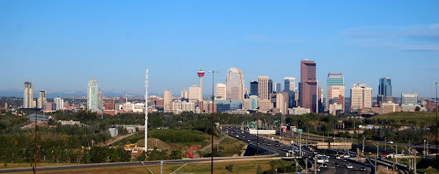
 Starting out from Calgary International Airport
By 7:30 I was set up and cycling my way out of the airport terminal and on the frontage road towards Calgary. The morning was amazingly clear, and it was surreal and somewhat intimidating to see downtown Calgary in the distance, and the Rocky Mountains, still further away, rising high above the Great Plains. I felt more than a little intimidated. This was my first trip to a foreign country completely alone with no one waiting for me (as foreign as Canada is), and the plans for my first day seemed huge. Biking all the way across Calgary as just a warm up seemed a large task. I felt a tad vulnerable and exposed. Could I really make it all the way to Canmore? What was I getting myself into? Well, I was finally committed, and this added to the suspense.
Once I got into a good cycling rhythm, I forgot about my worries and began enjoying the experience. I was gradually getting used to handling my bike with its heavy load, which was a good thing since I was about to experience my next challenge - Canada’s ambiguous freeway system. My understanding (Canadians, please correct me if I’m wrong) is that many of the freeways in Canada are distinctly different than U.S. freeways in that they aren’t limited access. Basically, large boulevards eventually had overpasses, underpasses, and onramps built onto them, and most of these routes still allowed pedestrians and cyclists. Plus, there wasn’t much of a good alternative route left once these boulevards had been converted.
 Approaching downtown Calgary, with my route in the foreground
So with the high rise buildings of Calgary looming large, I found my way onto the “freeway”, hugging the right shoulder as much as I could. I could really feel the wind from passing vehicles, not only from their size, velocity, and proximity, but also because with all of my gear, my bike had a lot more surface area to catch the side wind. As I approached the river crossing on my route through the downtown, it appeared I had no option but to go up the highway bridge that arced over the water. This felt sooo wrong, both because the shoulder got a lot smaller (although I still was able to stay out of the traffic lanes), and also the feeling of cycling on a narrow overpass felt like it should be illegal (anywhere in the U.S. it sure would be). I sprinted on this part to get it over with as fast as possible, and soon I was spit out onto the downtown streets and onto the riverside promenade.
 Calgary Riverside Promenade
The promenade offered both a very nice way to see some scenic parts of Calgary and a clear through-way through much of the city with no cars to contend with – only early morning joggers and skaters. My getup was very suspicious in this urban environment, and at one photo stop a cute woman in her late 20s, probably on her way to work, approached me to ask what I was up to:
Woman: “So where are you cycling to today?”
Me: “The Canadian Rockies, on my way to Vancouver.”
 |
| Prairie Cycling |
In a response that became typical along my trip, she was at first surprised, next questioned my sanity, then took interest, and finally wished me a pleasant journey.
Eventually I crossed the river, cycled up my first mild hill (ugggh!), and found a Denny’s near the West end of town where I had a leisurely and ample breakfast. This brought up another problem as there weren’t many places to lock up a bike on my trip, and even if I could, locks would do nothing to protect all of my valuable and vital equipment that I had in my panniers. As would happen on many of my stops, the employees where nice enough to let me wheel my rig partway inside where it was out of site outside and where I could keep an eye on it.
Next I was on my way out of town, entering the next critical point of my journey – finally leaving the city and hitting the open road. I had expected this leg of the journey to be rather straightforward – just a lot of flat ground and perhaps some bad headwind. What I hadn’t counted on was how much the terrain could roll at just a low enough relief that I missed it on my topo-map survey. Although the hills were mild, the ride from Calgary to the mountains was anything but flat, but rather, it was an endless series of 80-100 ft hills.
Still, they weren’t so bad if I shifted to the correct gear, and on this trip I was to follow a new, more meditative strategy that I would tell myself: “Ignore your speed, only focus on the now, and pace yourself so that you can go all day. Sustainability is key here, not time. If you feel like you are working hard, ease up or lighten the gear. Eventually you will get to where you are going. And NEVER use the granny gear – if you really need to use it, then you don’t have a prayer making it over the ‘death pass’.”
Another surprise along the road was experiencing the effects of traffic on a touring rig – especially the effects of semi-trucks, small trucks, and RVs. On an unloaded bicycle on most roads, these are just intimidating nuisances, but when they are moving at high speeds, the turbulence they kick up really packs a punch, especially on a touring rig. First, a front wave of compressed air being driven forward by the vehicle hits you, knocking you forward and then away from the vehicle as it passes you. Then you enter the low-pressure suction zone behind this wave, which sucks you sideways towards the vehicle.
 |
| My sweet rig |
Finally, there is the rear suction of the vehicle, which smacks you from behind again as the vehicle passes. This whole dance of wind forces plays out in about 0.5-1 seconds and with a touring rig it was strong enough to cause a crash. You have to counter lean and steer, while controlling the inertia of the touring rig as it inevitable just moving side to side. This was even the case when I was 5 or 6 feet away on the shoulder. Even passing RVs could cause a crash from a moment of carelessness.
Another unexpected hazard is the constant encounter with small cracks, holes, and debris on the shoulder. Such small hazards cannot be seen from far away and are invisible to cars. But they are large enough to cause a crash or a flat on a bicycle and you really can only see then a few seconds before impact, so you had to be ever alert of the road surface while riding. Between the road surface hazards, and vehicle hazards, cycling was not something that could be done carelessly. Constant attention had to be paid with lots of reacting. However, as the miles wore on in my trip, this attention and reaction became more automatic and part of the background, just as much of the hazard considerations are in climbing – sort of a semi-conscious attentiveness and reaction.
The miles reliably ticked by, and occasionally I would get glimpses of the Canadian Rockies getting ever closer – things were finally becoming real. I was making much better time than expected, and by early afternoon I was approaching Canmore. At the time of this trip I was ignorant of proper sports nutrition for ultra-endurance events, and since breakfast all I had eaten was 2 cliff Bars and a couple of GUs. Not only was I famished, but I began to hit the wall big time. I barely manage to crawl into a gas station a few miles short of Canmore, bought a lot of salty carbohydrate-loaded junkfood and Gatorade to clean out my palate and replenish my energy and pigged out in the back parking lot before falling asleep tangled in my bike in some shade behind the store.
 They're getting closer! I think?
 |  Mountain, just outside of Canmore
 |
 Gap Peak
 | 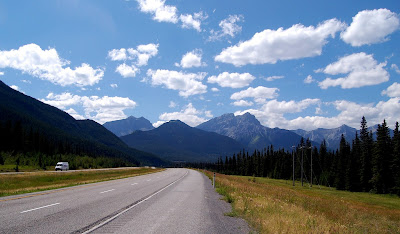 Nearing Canmore
 |
About an hour later I awoke and, feeling much better, decided to forgo the closer campsites and push on into Canmore for an early dinner. After a nice filling dinner and conversation with a random U.S. expat that I met at the fast food joint, I saw that it was still only 6 pm, and that the Banff campground was only another 15 miles or so away – I could easily make it there by nightfall. The prospect was too tempting and I was feeling too good to stop early, so I merged what I had conservatively planned for 2 days and continued on towards Banff. On my way out of town I came across another solo touring cyclist who was just finishing a ride of his own from Vancouver to Calgary! After getting some valuable beta on road conditions and the pass he cycled over to Kamloops (he didn’t come via the dreaded ‘death pass’, but one that was still notorious), I continued on to
Banff National Park.
 Mountains above Canmore
I made it to the turnoff from Canada Highway 1 as it started to get dark. After one last unexpected hill (painfully steep) to get up to the hilltop campground (and then another hill along the way), I made it into the campground about an hour before sunset. I felt really beat, but surprisingly fresh considering how much I had cycled. My previous distance record, set during my training rides in July, was 54 miles, unloaded. Today, my first day of the tour, I cycled 97 miles with around 80 lbs on my bike!
With no campsite reserved, and a desire to avoid the high price for a spot, I cruised the campground looking for some people willing to share a site. One benefit of touring solo is that it is much easier to do this if you’re alone. In no time I found a campsite that was being jointly shared by a number of solo and paired adventurers who were happy to have me as company. Technically there were too many people on the site, but we agreed I would sleep in my bivvy sack just over the hill crest and pack it up each morning so that it wasn’t obvious how many people were sleeping at the site. A couple of the people had just finished working for the summer and where cycling around Banff. Another guy had just finished his summer off in British Columbia, and hitchhiked out here on a whim to find work in Banff and explore the area before heading back to school in Ontario.
After getting settled, I got back onto my unburdened bicycle and continued cycling towards town. I was told there was a convenience store about 2 miles down the road, and I was desperate for tasty food and beer. At the store I met another touring cyclist who had just finished a ride down from Jasper. He showed me some video he recorded on his cameras of all of the bears he saw along the way. I hoped to see some wildlife, but hopefully not too much of that type!
After glorious beer, I came back to the campsite for a nice fire, more beer (my friends had invited more friends), and an early sleep in order to be rested f and up early the next day to climb Mt Rundle.
Day 2 – Rainbows in Banff - Rest Day
On Foot:
Destination: Tunnel Mtn
Distance: 8 miles
Elevation Gain: 1,020 ft
I awoke to cloudy skies and rain. Noooooo! It looked like Mt Rundle was out of the picture, since it is a good haul, and tempting fate with thunder or wet rock seemed like a bad idea. Today would be an unplanned rest day, and I guess I needed it.
 |
| Rainy day in Banff |
Being lazy, I took a campground shuttle into town where I spent most of the day wandering around doing errands and getting to know the place. At one point I stopped in at the ranger station to get some info on a possible day hike. Right before I left on my trip, my dad strongly recommended that I try to find my way into an area in Yoho National Park called Lake O’Hara. The lake was 10 miles away from the highway, but the road was closed to cars and bikes. The only way to get there was to hike, or take a reserved shuttle. Reservations often needed to be made weeks in advance. Once up there, the only camping available was available only by reservation 6 months in advance, and it usually filled up 6 months in advance. This makes the area relatively inaccessible to most people, but my dad suggested that I still try to find a way to get in there.
Hiking 20 miles on dirt road just to get to and from the Lake seemed like a raw deal, so I was considering hiking over the continental divide on a 20-30 mile day hike, but which route? My dad was certain that you could hike up to the Abbot Mountain Hut from Lake Louise, but from what I could tell from topo maps and Google Earth, this looked very unlikely. The ranger I spoke with said this way was not advisable since the canyon headwall to gain Abbot Mountain Hut from the East was called “The Death Trap”, as it was about 60-degree alpine ice, heavily crevassed, corniced, and within range of the regular rock and snow slides pouring off of Mt Victoria. I had another route in mind via Moraine Lake, but according to the rangers, this also required travel on a glacier that I would not want to do solo.
However, I was in luck. While the ranger was trying to discourage me from attempting to day hike to Lake O’Hara solo, a reservation at the Lake O’Hara campground was canceled. The ranger came back to me with an offer to take the site, which I did without hesitation. Based on my plans, I wouldn’t be finished in Lake Louise by then, but I could always come back before continuing West. The rangers in Yoho would even be nice enough to take my bike up in their pickup truck, despite bicycles not being allowed up there. This was for my bike’s security, and as long as I wasn’t caught riding it, they were fine with it up there.
Just to make sure I understood how to store food properly for some of my en route peak bagging, I checked with the ranger on this. It turned out, after explaining my unique bicycle situation, that this ranger was the one I had spoken to on the phone a few weeks earlier when I was planning the trip! I guess he didn’t think I would actually go through with the trip when he said I could hang food, just out of sight of the trailhead, because all of a sudden he said I couldn’t do that. The only option would be to leave food at the campground lockers, forcing me to make my peakbagging plans solely on basing out of campgrounds.
The ranger repeated the warnings about British Columbia’s desert but was happy to see that I had since prepared for it. After hearing about the weight of my bike, he also was really concerned about me cycling over Roger’s Pass, the next major pass after the Continental Divide. I knew it would be a doozy, but still nothing compared to the ‘‘death pass’’ later on. After showing him my printout of the route profile to prove that I knew what I was getting into, he seemed content, we chatted a bit more, I asked again about trying to reserve a campsite in Lake Louise (he insisted that I would have no problem getting a site, so no need to bother), and then I took off to wander more.
As I walked through town, I found a very nice riverside trail system. The system links up with marshes to the north, and follows the river down to some waterfalls just south of town. Along the way are some nice informative signs about the area and nice views of the Banff Springs Hotel across the valley.
By the time I reached the end of the trail at the rapids, I was close enough to Tunnel Mountain that I decided to wander up it for some panoramic views. Tunnel Mountain wasn’t really a mountain in my opinion, since it is just a small hill that rises 700 out of the town of Banff. The trail was steep but very well maintained, and I saw several train runners on my way up.
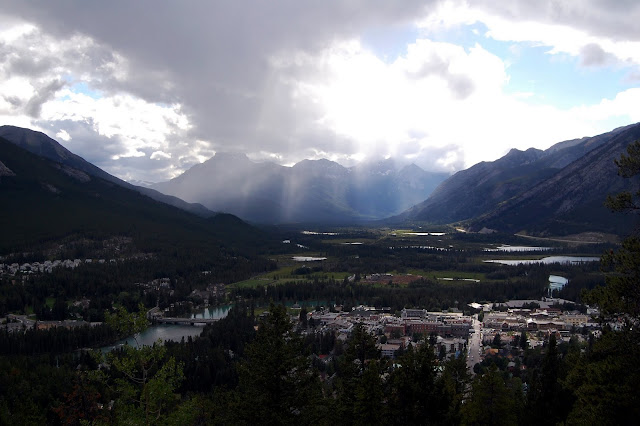
Once I gained the summit ridge I began to catch glimpses of nearby Mt Rundle through breaks in the trees. I came across one of these views just as a magnificent rainbow had formed in the valley below, its complete spectrum of vibrant colors stretching from the left side of the valley clearly across, terminating at the base of Mt Rundle. It was surreal to see such a perfect rainbow from up high, and especially with such nice composition! I had just enough time to snap a couple of photos before it disappeared – despite seeing many people on the trail that day, I think I was the only one who ever saw the rainbow.
![2008-07-30 - 05 - Banff]() Rainbow by Mt Rundle, seen from Tunnel Mtn
Rainbow by Mt Rundle, seen from Tunnel Mtn
After a short nap on the summit, I descended to the road and walked back to the campground. I arrived shortly before sunset. Rain had been on and off that day, but nothing too bad. The rest day was rejuvenating for me and I felt ready to tackle the next day’s objectives, weather permitting: Climbing Mt Cory and Edith. I turned in early so that I could be up before sunrise for an early start for a very long day.
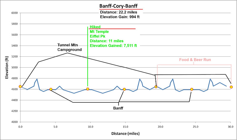
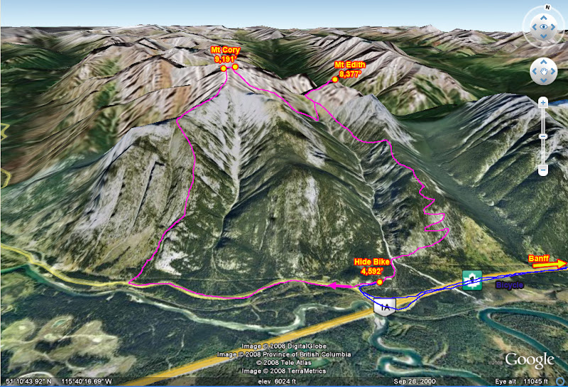
Day 3 – A Two’fer - Climbing Mt Cory & Mt Edith
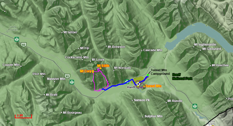
 By Bike
Distance: 22.2 miles
Elevation Gain: 1,000 ft
On Foot
Destinations:
Mt Cory (9,191’),
Mt Edith (8,391’)
Distance: 10 miles
Elevation Gain: 7,500 ft
Today I was up before sunrise to get an early start on my first day of climbing in the Canadian Rockies on my cycling tour. For today, I had decided to climb Mt Cory. It was a fairly easy but scenic
scramble, and looked to be a good warm up for getting familiar with the area. Looking in Alan Kane’s “Scrambles in the Canadian Rockies,” he had a brief mention of being able to drop down to Cory Pass from the summit of Mt Cory, which sounded straightforward. This would put me only a hop, skip, slip, and a jump from the summit of Mt Edith, so I decided to tack that one on for the day too. If all went well, I would try to
traverse as many of Edith’s 3 summits as I could.
I packed up camp and locked all gear that I didn’t need for the climb in one of the spacious campsite bear lockers and stowed the rest of the cycling and scrambling gear for the day in two lightly packed panniers. As I started riding, I still felt a little sore from my first day, moving painfully slow on the hills.
![View from SW Ridge of Cory]() View from the beginning of Cory's S Ridge
View from the beginning of Cory's S RidgeStill, the air was crisp and fresh, views were spectacular, and the 10 miles to my “trailhead” went by fast. I write this in quotes because there is no trailhead for the south ridge route that I took. It is entirely cross-country and one starts from a roadside pullout on Canada Highway 1a. Due to the loop I planned to make with Edith, and figuring walking along the road would be nicer at the start of the day rather than the end.
I stopped riding where the road to the trailhead to Cory Pass intersected Highway 1a and found a place to hide my bicycle a short ways off in the trees. Walked by bike about 30 feet away from the road through some bushes, locked the wheels to the frame, and draped my handy camo-netting over the bike and gear. From the road it was completely invisible – my system seemed to be working out perfectly.
I walked along the road carefully looking for the landmarks described for the start of the route. One had to be careful to pick the right spot, as too soon will miss the ridge, and too late will put climbers on a number of the other sub-ridges that are dead-ends. About a mile in I easily found it by matching what I saw from the road to my Google Earth printout (hooray for landmarks!) and took on up the slopes on a nicely defined use-trail. The brush wasn’t too thick, and loose scree was only encountered in a few places as I climbed the headwall of the ridge, which rose very steeply from the valley. The transcontinental railroad and highway fell away below me very quickly, and I had clear panoramic views of the surrounding peaks after about an hour of fast hiking.
![Banff and Mt Rundle]() Mt Rundle and Banff
Mt Rundle and BanffJust before I gained the ridge I caught up with two lady scramblers who had parked at the turnout below. They quickly fell from site as I passed tree-line and gained the barren rocky ridge.
For such an easy route, it is still very worth doing as it is very scenic. The texture and color of the rock strata is very nice as it repeats itself in seemingly endless parallel rays. The upturned layers have also eroded into some very interesting rock formations and give the ridge an interesting architecture. The ridge often looks a tad harder than class 2, but slots in the cliffs parallel to the ridge keep providing ways to wind through.
Being at a bend in the Bow Valley, the ridge also has a lot of prominence, providing stellar views of Cascade Peak, Mt Norquay, and the summits of Mt Edith to the east. To the south are nice views of Mt Rundle rising above Banff, and you can clearly see Mt Assiniboine. It is only an 11,000 ft peak, tiny by California standards, but it is so rugged, and the low valleys in the Canadian Rockies give special status to such peaks, as any 11,000 ft peak in this range has a huge prominence, often between 5,000-6,500 ft. To the north you could clearly see all of the summits above Highway 1 stretching as far north as Lake Louise, with the 11,000 ft Mount Temple being easy to spot.
| ![The South Ridge of Mt Cory]() Cory's S Ridge
Cory's S Ridge | ![South Ridge of Mt Cory]() Cory's S Ridge
Cory's S Ridge | ![Views from Mt Cory s S Ridge]() Cory's S Ridge
Cory's S Ridge | ![Mt Cory Summit View - NW]() Cory's S Ridge
Cory's S Ridge |
The route was going straightforward, but near the summit the ridge began to look more rugged and I was lured off the crest and onto a deceptively easier looking path on the east side of the slopes. This turned out not to be the way to go as I quickly found myself on my first bit of frighteningly loose and steep scree in the Canadian Rockies. Here the soil was hard-packed with rocks creating nice ball-bearings, and the slope seemed steep enough to really get going if you fell. I slowed down considerably as I nervously crawled through this section, gradually learning how to use my trekking poles to help move through such terrain.
I couldn’t get off the slopes as the way above got much steeper, so I pressed on, expecting to find a weakness back up to the ridge. Finally I found one, although it was a very thin class 3 scramble with very loose rock, with the nasty loose slopes beneath me, so I still climbed very cautiously back up to the ridge, topping out right on the West summit. Next I traverse to the East summit, which is a short ways away along a knife-edge ridge that is usually corniced. Today it wasn’t, but there was a very steep snow crest on it, and my ice axe was very helpful for safely ascending the face onto and across this traverse. I made the East summit just as the lady scramblers, who had stayed on the ridge and therefore didn’t waste time, were reaching the West summit.
The East summit was far more exposed than the equally high West summit, with drop-offs on 3 sides. How could one get to Cory Pass from here? The route down to Cory Pass was described as leaving from the East summit about 200 feet towards the summit saddle with the West summit, descending a chute to the pass, so I reversed my path back to the saddle and then began picking my way down the scree-covered slopes funneling into a chute below. The lady scramblers must have been wondering what I was up to here, as this turned out not to be a well-traveled route.
| ![Mt Cory Summit View - SE]() South East from Summit
South East from Summit | ![Mt Cory Summit View - NNW]() North West
North West | ![Mt Cory Summit View - N]() North
North | ![Mt Assiniboune from Mt Cory]() Assiniboine
Assiniboine |
It was very hard route finding down the slopes as there were many cliffs and slabby barriers in the way, and I had to be cautious not to get too close to those hazards, or boxed in where I would have to re-ascend the loose scree. As I knew I was a good ways West of Cory Pass, I kept expecting to see a break in the rocky ridge to the East where I could stop descending and traverse over. But no break appeared. I kept doing down, the terrain becoming steeper and route finding more complex as I went. This was not was I was expecting for the day, and the guidebook had made no mention of this. The only signs of life here was part of a deer skull melted out from some avalanche debris, and eventually I reached the bottom of the chute as it fanned out into the larger canyon for Cory Pass. At this point it was obvious that I had dropped far below Cory Pass. I saw the trail gradually ascending to it on the other side of the canyon, and it looked to be about 1,000 ft above me. Crap!
| ![Looking down the SE Face of Cory Peak]() The SE Face
The SE Face | ![the Southeast Face of Cory Peak]() Looking back up
Looking back up | ![Cool Strata]() Cool Strata
Cool Strata | ![The descent from Cory Peak to Cory Pass]() The 'little' detour
The 'little' detour |
In order to avoid losing any more elevation than I had to, I cut across a sliver of forest, taking care to not get into too thick of brush, since I was bushwacking alone in bear country far off the beaten track. I then ascended the main rocky was of the canyon and picked my way straight up a sandy ridge back up to the trail just below the pass. This added a hard extra 1,000 ft of gain for the day, which I was not expecting. Now the day was getting late and I had to hurry to summit Edith and make it down before dark, since I still had a 10-mile bike ride back that I didn’t want to do in the dark.
![The Sundance Range]() The Sundance Range from Cory Pass
The Sundance Range from Cory Pass
I could see why Cory Pass was a popular place to hike through. From the pass you have spectacular views of the Sundance Range and Valley, 40-Mile Creek, and rugged Mt Louis. Mt Edith’s highest and most northerly summit was only about 500 ft above the saddle, but time-wise it was much further away than I had expected. There was a nicely worn use-trail that cut up the ridge through the scree, approaching the exposed base of the summit block in a small alcove.
| ![Mt Edith North Summit Route]() Mt Edith Route
Mt Edith Route | ![Mt Edith Summit Traverse]() Mt Edith Traverse
Mt Edith Traverse | ![The summit block of Mt Edith]() Backside of the summit
Backside of the summit | ![Mt Louis and 40-Mile Creek from Mt Edith]() Mt Louis
Mt Louis |
There was one chimney in the alcove that looked doable for scrambling, except it was a 15-20 ft high off-width crack, and it didn’t look like the class 3 advertised for the summit. My guidebook said that the summit block crux was climbed via south-facing chimneys, so I picked my way down and around the summit block to the south side. Here the chimneys were flared, angled, and vertical to overhanging. They looked like hard 5.6-5.8 to me. Around the corner – well, there was no corner as there was only a very large cliff on the other side of the summit crest. I figured the guidebook had south-facing mixed up with north-facing and tentatively tried the first chimney that I found (which apparently is the right way).
The off-width chimney was just wide enough to wriggle into at the bottom, and then climb halfway embedded up the crack. My first attempt failed as I couldn’t do it with my pack on – too confining. I left my pack and (sadly) camera at the base and tried again, sweeping gravel off holds inside the crack and kicking out loose gravel and scree on footholds. The top transitioned into some nice stemming and then some crimpy face climbing to get out of the crack, followed by easy scrambling to a false summit.
The real summit is very exposed – one has to down climb off the steep backside of the false summit into a notch (crimpy and edgy class 3), and then up some steep slabs with some slightly more secure thin cracks to the high summit. This entire section has good exposure, fractured loose rock, and bad fall consequences, and as I was climbing solo out here, it took me a little while to work up the nerve, ignore my fear of heights, and sneak over to the summit and back.
On the descent I found rappel slings on the side where the guidebook said you should ascend – definitely not the way to go, but a good option for saving time for a traverse of the summits. At this point it was late enough in the day, I was moving slowly enough, and the loose rock had me nervous enough that I decided to forgo traversing to the other summits. Maybe it was because I was climbing completely alone, far away from any real security, that made me so tentative, or that I just haven’t been scrambling on loose rock in a while, but I was surprised at how loose the rock seemed to me here. It was worse than anything I had encountered in most of the Western ranges in the U.S., and seemed only slightly better than the rock in the Cascade Range!
Luckily, down climbing was easier and soon I was reunited with my pack and hustling down the trail, racing daylight. I turned on my I-Pod to some hustled down the trail, passing two backpackers heading up about halfway down to the valley. My feet were aching and I practically limped back to my bicycle. Today was a much longer and more tiring day than I had expected! Surprisingly, I felt much better being back on my bicycle, and I made it back to my campsite just after dark.
Exhausted, I was also famished and my touring food seemed inadequate and unappetizing at the time, so I asked my campmates about places to eat in town. They recommended a place, but warned me that the shuttle t town would stop running by the time I would be returning from dinner. So back on the bicycle I went, racing to town just in time to find to find all of the restaurants closing. My last hope was a bar, which surprisingly had good food and even better beer on tap. I thoroughly enjoyed my carb-loading beer fest, ate nearly 2 dinners, and once refreshed, biked back to camp and turned in around midnight. This was all right as the next day I had decided only to cycle the 40 miles to Lake Louise and forgo any plans to hike or scramble, so I could have a leisurely day.
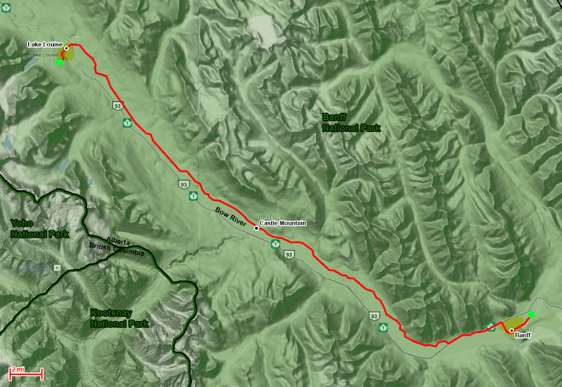
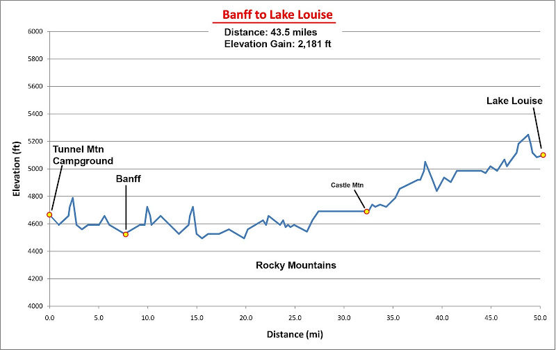
Day 4 – Moving on in Unsettled Weather - Banff to Lake Louise
 By Bike
Distance: 43.5 miles
Elevation Gain: 2,180 ft
Today was to be an easy day. I would pack up camp and set out again on my touring rig for a 40-mile ride to Lake Louise. Based on topos, the route looked really flat. Because I wanted to see some wildlife on my ride, and because I was getting tired of the noise and wind blasts along the main highway, I decided at the spur of the moment to ride on Canada’s Highway 1a, which paralleled the main highway but was much smaller and more heavily wooded.
When I woke up, it was apparent that the day wouldn’t be as straightforward as I had expected. The rains had returned, but today the sky looked much more threatening. I was determined not to get caught in a deluge on the way to Banff, since I would have very little protection from the rain and little reprieve to dry out and warm up as I had no vehicle, tent, or motel room to escape into. This could especially be a problem since it was still getting down to freezing at night.
Still, I only needed half a day of dry weather to make it, so I planned to sneak in my ride between bouts of bad weather. The Canadian at my campsite that was looking for work had found a job in town at an outdoor clothing store, and he was fine with me cycling into town and leaving my touring rig at his work while I got breakfast and waited out the weather. Then, if things looked better, I could pick up and go at a moment’s notice.
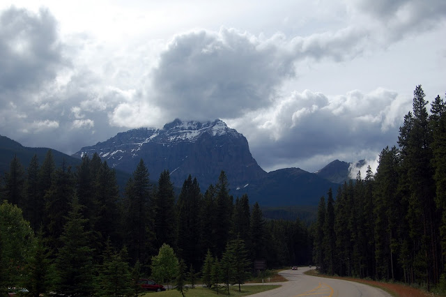
![Stormy weather near Lake Louise]() Uncertain weather
Uncertain weatherI spent the morning hanging out at a nice breakfast joint n town call Melissa’s Restaurant, recommended to me by the locals and buzzing with business. I had a nice chat with a lone man that was there for surgery (apparently Banff has some great surgeons drawn there for the outdoors) and was ready to go when a deluge started. So much for cycling! So I decided to hang around, reading and living off of coffee refills. Hanging out there, alone, in my unusual cycling clothes brought some attention. In addition to the lone man I talked with, I caught the attention of Jacquie, a pretty waitress that was serving me coffee. Gradually over the morning I told her about my trip, and also about my Denali climb (which another co-worker of hers took a great interest in). She was familiar with San Francisco after traveling there for some teaching seminars, was from Easter Canada, but spending her summers working in Banff and getting into the outdoors and vibrant art community there. When I finally decided to leave to avoid taking up too much space, she gave me her card to keep in touch. My, Canadians are friendly!
The rain had stopped and the sun was peeking out, but the clouds still didn’t look too friendly. I figured I’d wait an hour more and see how things were developing, so I hung out at a coffee shop across the street from where I left my bike. The weather stayed dry, the clouds were slowly getting better, and the road had dried out, at about 1pm I hopped on my bike and took off.
Oddly, the 7,500 ft day of hiking and scrambling the day before, while leaving my legs sore and tired for walking, didn’t do much to me for cycling. I felt refreshed from my traumatic first day and made good time. Occasionally the clouds would look more threatening, but I lucked out and never felt a drop of rain the entire day. Still, the day wasn’t without more surprises. One downside to taking the smaller side road to the main highway was that it followed the landscape more – lots of winding, which was nice, but there were also no road cuts.
The road would go pretty flat for a while then hit a ridge coming down from the mountains. Here the road would just angle slightly and climb straight up the steeply at 5-8% grades, dropping just as steeply down the backside as soon as the crest was reached. Similar to my ride across the plains, these hills were only about 200 vertical feet in height, just below the resolution of topo maps, but they were very intensive, psychologically demoralizing (since I descended as soon as I finished climbing) and added up to some 2,000 feet of elevation gain where I had expected only about 400 ft!
Near the end of my ride, these steep hills had taken their toll and I was tired, even though I had only been riding about half a day. I knew I was close to Lake Louise when I came across a lone cyclist that was doing a little foray out from town. The cyclist was having some problems with her cycling gears, so I welcomed the opportunity to stop and help out. After she was set on her way, I quickly made it into town and then over to the campsite.
 Mt Temple seen from Highway 1a
As I approached the campsite entrance, things didn’t look good. The road was lined with signs saying the campground was full! Damn that ranger in Banff! Apparently this was a major holiday weekend in Canada, which the ranger hadn’t considered when he told me not to worry about making reservations. The station attendant said Castle Mountain still had space, to which I gave him a look, told him about the ranger in Banff, and also pointed out that I had just cycled from Banff in my fully loaded touring rig, the campground was 10 miles back the way I came, and that sunset was in about 30 minutes. Ergo, this information would be helpful to someone driving in a car, but not to me. Then the ranger took pity and gave me permission to just wander the campground and see if I could find someone who wouldn’t mind sharing a spot. He gave me some recommendations on where to look and let me on my way.
Searching was a bit stressful as I was in a hurry to find a place to bed down before nightfall, and I made rounds to every campsite in the area, and the few that looked promising had campers that weren’t interested in sharing. I made a 3rd final loop and saw a new camper who had just got back, who was old (but not too old), male, and alone, so perhaps would be open to sharing the cost for his site.
The man’s name was Andre, a Swiss who was taking a year off from work to travel through North and South America. He had bought a car for the trip, which he planned to sell in the U.S. as he didn’t want to be driving it down through Mexico and South America, where expected to end his trip sometime in June 2009. He was more than happy to have the company for the next couple of days and we got along great talking about the U.S., Canada, Switzerland, my latest travels and plans, as well as his. Andre was an active guy, running at least 10 km a day, even on his long driving days, and he had been seeing a lot of the area on his runs. Apparently Andre had already been through Kamloops, so upon hearing my plans asked:
“Why on earth would you go through Kamloops? There is nothing to see there and the few trees there are all brown!”
Brown trees? Come on, it can’t be that bad . . .
Top & Table of Contents
-
Part 0 - Cycling and Scrambling from Calgary to Vancouver
-
Part I - Calgary through the Canadian Rockies
-
Part II - Lake Louise & Lake O'Hara Areas
-
Part III - Mishaps in the Middle Ranges
-
Part IV - British Columbia's Desert?!
-
Part V - Crossing the Coastal Range to Vancouver
-
Epilogue
-
Images
Part II - Lake Louise & Lake O'Hara Areas
Day 5 – More Climbing - Climbing Mt St Piran and Mt Niblock
By Bike
Distance: 7.6 miles
Elevation Gain: 700 ft
On Foot
Destinations:
Mt St Piran (9,761’),
Mt Niblock (DNF)
Distance: 9.7 miles
Elevation Gain: 3,620 ft
Today I was ready for another double peak day. On the agenda today was to cycle the short but steep climb to
Lake Louise. From there I would ascend Mt St Piran via the
main trail, and then traverse over to the
main route of Mt Niblock to link up the peaks. Today promised more wonderful views, good weather, and much less distance and elevation gain than my first scrambling day.
![Mt Whyte, Niblock, & St Piran]() Mt Whyte, Niblock, & St Piran
Mt Whyte, Niblock, & St Piran | ![Mt Whyte, Niblock, & St Piran]() Mt Whyte, Niblock, & St Piran from the Lake Louise TH
Mt Whyte, Niblock, & St Piran from the Lake Louise TH |
I left camp at 9:20 am, making it to the Lake Louise trailhead a half-hour later. The climb to Lake Louise was pretty intensive 6% grade for 700 ft, but still not nearly as steep as the ‘death pass’ that I so feared. Before I knew it the climb was over and I was setting off on the trailhead at the Lake Louise circus grounds. The place was packed! After being mostly by myself for the past few days, only seeing people in town, seeing so many tourists on the trails here was – well – annoying. I locked up my bike and took off as fast as I could (on this day and others I opted to leave panniers back at the campground and ride to the trailhead with all of my gear already stowed in my backpack, which worked much better for leaving my bike).
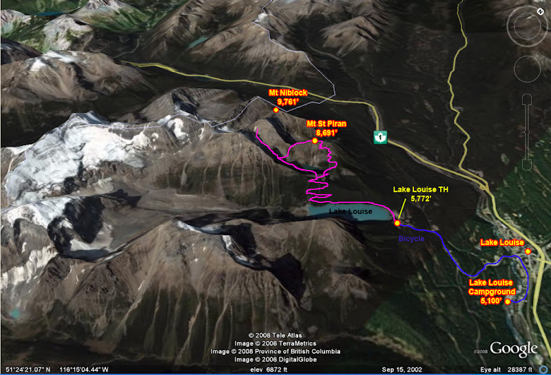
The most difficult part of climbing Mt St Piran was passing all of the tourists on the trail. Luckily, they mostly faded away after the Tea Hut, and the smaller trail (more of a use-trail really) to the summit was easy to find if you were looking for it. I made the 3,000 ft ascent to the summit in 1:45 from the lake, and the trail made it feel effortless. From the summit I had such dramatic views of the surrounding peaks that I felt like I had cheated. The mountains were so rugged, rising nearly vertical from the many glaciers below, and yet you could be well on your way to the summit after only a couple of hours of hiking or scrambling!
![Mt Aberdeen]() Mt Aberdeen seen from Piran's trail
Mt Aberdeen seen from Piran's trail | ![Pissed Ground Squirrel]() Pissed Ground Squirrel
Pissed Ground Squirrel | ![Ice Avalanche on Mt Lefroy]() Ice Avalanche on Mt LeFroy
Ice Avalanche on Mt LeFroy |
After being harassed by an overly aggressive squirrel that threatened to leap on my face from a rock windscreen (really, squirrel, you don’t want to eat this GU packet!) and enjoying a spectacular ice avalanche off of a hanging glacier on Mt LeFroy (it sounded like a jet airplane passing overhead) I continued down the backside toward peak #2, Mt Nibock. It seemed I would wrap up this day very quickly.
The descent looked questionable, but with some carefully route finding, it stayed at a chill 2nd class, only becoming really steep where the slope became grassy. I dropped down into a lower cirque and traversed across and up to the first class 3 section of the route on Mt Niblock. The scrambling went through a weakness in the cliffs separating the upper cirque from the lower one through a weakness carved by a waterfall. From a distance it looks very technical, but the cliffs actually had numerous catwalks linked together with moderate (if at times wet and exposed) class 3 sections.
![Mt St Piran summit panorama]() Whyte & Niblock from Piran
Whyte & Niblock from Piran
The route was fairly complex but straightforward, and soon I was climbing the upper cirque. Here the loose rock changed from irritating to frightening as everything began to slide. Also, many of the rocks were only a thin layer on top of slabs, and as I wandered into the upper set of cliffs, I became concerned about slipping off over the escarpments as the scree slopes approached about 40 degrees in steepness. I made ample use of my ice-axe in the dirt, using a trekking pole on my downhill side for stability as I climbed this vertical dirt.
![The Agnes Lake Tea House]() Lake Agnes Tea House
Lake Agnes Tea HouseI was beginning to have serious reservations again about scrambling alone on such bad rock in mountains I was unfamiliar with when suddenly a number of large rocks came bouncing down the chute I was about to come up. Helmet or no, this gave me a good excuse to turn around and come down (I had taken about 2 hours to get to my highpoint here from Niblock, so not much was invested here). After descending a short ways, two climbers emerged from the chute, being the cause of the rockfall. Still not too encouraging, and I figured I might as well call it an easy day and descend with them for some company. Reversing the lower class 3 section was plenty easy technically, but because the route wandered so much in the cliffs, it was very easy to get lost since it was hard to see over the ledges.
The older man was Adrienne, a financial analyst from Edmonton and an avid mountaineer. He had led many outings for the Canadian Mountain Club, and on our descent he filled me in a lot about the club’s activities. He was leading Barry, a visiting Irishman, young guy, who was the boyfriend of a co-worker of Adrienne’s. They had summitted Niblock and said I wasn’t too far from it (doh!) but that the linkup to Whyte, which I had considered, had considerably more loose rock and exposure. In light of my nervousness with all of the cruddy rock, as we descended we bantered back and forth about mountaineering accidents and close calls in the mountains (which Adrienne, as a regular trip leader, had many in the Canadian Rockies to talk about).
I made it back into town early, so I used the time to stop by the bike shop to address some bike issues. My bike had started to make nasty crunching noises, and as it turned out, my chain had become stretched, which was fixed, and the teeth on the chain ring were dulling, which couldn’t be fixed. Also, my index shifters had been getting stuck in the clicked position, requiring me to push them back into place. This would require new parts which the shop didn’t have, so I’d just have to live with the irritation. I asked the shop to look over my bike to make sure nothing else was wrong, since this would be a convenient place to work out newly manifest issues, but all else seemed well (as would be apparent later, was they weren’t).
![Mt Temple from Lake Louise Campground]() Temple Mtn from the Lake Louise campground
Temple Mtn from the Lake Louise campgroundDay 6 – Valley of the 6 Glaciers - And Climbing Mt Fairview
By Bike
Distance: 9.3 miles
Elevation Gain: 738 ft
On Foot
Destinations: Valley of the 6 Glaciers,
Mt Fairview (9,002')
Distance: 16.2 miles
Elevation Gain: 4,780 ft
Today I must have recovered a bit more from my cycling, as the climb to Lake Louise felt much easier. Today I had two planned destinations for a moderate day out. First, I would hike up to the Valley of the 6 Glaciers, which I had learned had spectacular views, as well as front-row views to The Death Trap that my day had tried to direct me to for reaching the Abbot Mtn hut. Because I knew this area had lots of avalanche potential, I started out early in hopes of seeing some of the mountains come down with morning warming from the sun. Next I would
hike Mt Fairview, which was supposed to have excellent summit views.
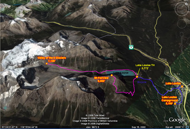
The trail from Lake Louise to Valley of the 6 Glaciers is very well maintained and littered with people all the way to the Tea Hut at its main terminus (so it was good I got there early!). Beyond the tea hut the trail becomes fainter and follows a moraine crest all the way to the cliffs at the base of Mt Victoria’s gigantic hanging snowfields and glacier. Once again I felt as if I had cheated, since the hike was only a mild warm up, and at the end I was treated to one of the most picturesque views I’ve ever had in the mountains.
![Valley of the 6 Glaciers]() The "Death Trap"
The "Death Trap"![Avalanche in the Death Trap]() Avalance in the "Death Trap"
Avalance in the "Death Trap" | ![Mt LeFroy at Valley of the 6 Glaciers]() Mt LeFroy
Mt LeFroy | ![The Mitre]() The Mitre
The Mitre |
Because I had planned an easy day, I just hung out at the end of the trail and enjoyed the views, watching the occasional avalanche roar off Mt Victoria and into The Death Trap. After about an hour I realized I was feeling really beat. Being 6 days into my ride, I knew my body was still adapting to daily punishment with no breaks. Also, I had no idea how many calories I should be consuming each day, and I think I was under eating.
![Mt Aberdeen]() Mt Aberdeen from Mt Fairview
Mt Aberdeen from Mt FairviewI wandered back down for more lounging at the Tea Hut, where I treated myself to some coffee and chocolate cake from a nice second-story porch views of Mt Victoria and Mt LeFroy. At one point there was another icefall on Mt LeFroy that sounded like a jet engine. I never saw the slide, but I saw the snow plume and shockwave blow out from the cirque by the Mitre. Once again, sitting in the Tea Hut, I felt really spoiled at how easy it was to get here and how comfortably I was experiencing it – definitely more a European style to experiencing the mountains than American!
Still feeling beat I read a book for a while and spaced out, all but giving up on plans to climb Mt Fairview. Still, I didn’t want to admit defeat, and I decided I should head down and just see how I feel at the trailhead. If I hiked back fast enough, then I might have just enough time to run up the peak and make it back to the town for dinner before the restaurants closed.
![Mt Fairview seen from Lake Louise town]() Mt Fairview
Mt FairviewOnce I made it to the trailhead I inexplicably got a second wind and decided to see if I could make the 3,300 ft ascent in less than 1.5 hours. I blasted the Nine Inch Nails on my I-Pod and took off as fast as I could. The last 500 vertical feet of trail was very steep, requiring a lot of high-stepping. I guess whatever was in the Tea Hut’s chocolate cake finally hit me, because while the other hikers here were moving at a snail pace, starting and stopping, I felt lighter than air, jumping up the high-steps and half-jogging up the trail and making the summit somewhere between 1-1:20 from the trail head – ascending over 2,500 ft/hr, not bad! I’m not sure of the time more specifically then because I met some very hospitable Canadians with beer and other fun on the summit.
![Mt Victoria from Mt Fairview]() Mt Victoria
Mt Victoria![Marmot on Mt Fairview]() Marmot
Marmot | ![Mt Fairview Summit Looking NE]() NE View
NE View | ![Climbers finishing the east ridge on Mt Temple]() Climbers on Mt Temple's NE Ridge
Climbers on Mt Temple's NE Ridge |
The guidebooks were spot on when they said that this summit had one of the best views in Banff National Park, and one of the best views per effort expended. Fairview is an understated way to describe the summit. The views reminded me of those from Temple Crag in the California Palisades – the peak itself isn’t grand, but it gives you an elevated, front-row 360 panorama of all of the larger peaks in the area. Hanging out on the summit I was even able to see climbers topping out on Mount Temple’s classic
East Ridge.
From the summit I could also seem some storm clouds brewing, so I headed down in haste to avoid the imminent rain shower. It was too late, as the first drops began falling on me just as I reached my bicycle. By the time I began coasting downhill the rain picked up in ferocity and became a full on deluge. I had come prepared, for this, though, and had donned a waterproof jacket and pants shell. However, since I had never done much cycling in the rain, it didn’t occur to me that my feet would need special rain protection. Between the water spraying off the road and tires, and the speed at which I was colliding with the rain drops, within a matter of minutes my shoes became saturated with cold water. Although the descent to the valley was only about 10 minutes, my feet were already numb by the time I made it down and out of the worst of the rain.
Almost as suddenly as it had started, the thunderstorm stopped, allowing the last alpenglow of the day to cast its pink shine on Mt Temple. Although brief, the rainstorm was violent and had left me soaked and numb, revealing a serious deficiency in my cycling clothing.
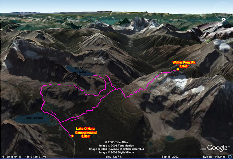
Day 7 – Lake O’Hara Environs - Lake Louise to Lake O’Hara
By Bike
Distance: 10.3 miles
Elevation Gain: 420 ft
On Foot
Destinations: Walter Feuz Pk (9,348'), MacArthur Lake
Distance: 10.6 miles
Elevation Gain: 4,500 ft
Today was the day I was leaving Lake Louise to camp and hike in the Lake O'Hara area. I was still set on climbing Mt Temple, which I hadn’t gotten to yet, so I planned to return for that before continuing West. I gave my farewells to Andre, who was great enough to not let me pay him my share for the campsite, and then I set off very early to make sure I made it to the pickup point in time for the shuttle.
Lake O’Hara is in Yoho National Park, on the other side of the Continental Divide from Lake Louise. However, this was the most anti-climatic divide I have ever crossed. I had to gain an incredible 420 vertical feet over a vast 8 miles, so this would require all of my patience to not get bored. Along the way I saw some other touring cyclists heading the other way on the highway, coming from Jasper National Park (the only other touring cyclists I would actually see on the road on my trip, oddly enough.) The final few miles up to the pass were memorable for me as it was like riding some kind of stagecoach or galloping horse. About every 15 feet there was an expansion joint in the road, giving me a mild bump. The bumps were small and regular enough that it created a kind of “thump-thump . . . thump-thump . . . thump-thump . . .” that lasted all the way to the summit.
I rode very carefully on the final quarter mile to the pickup, as it was on a bumpy dirt road and I was terrified of breaking my rear rack. I made it to the stop with plenty of time to pack up my gear off of my bike and get it ready for transport. I met a number of other nice travelers there from all walks of life, and one person who offered me some great advice for returning. Although the campsite reservations often fill up 6 months in advance, it is common for cancellations to occur within a week of the reservation due to unforeseen events, so one can reasonably count on getting lucky looking for a spot less than a week before the scheduled time. Soon the bus arrived, and the ranger and truck that would take my bike up. I delivered the bike and some thank-you chocolates for the favor they were doing me (since bikes technically weren’t allowed up there) and we were off.
![Transcontinental Divide]() The extremely steep continental divide
The extremely steep continental divide | ![Wiwaxy Peak]() Wiwaxy Peak
Wiwaxy Peak | ![Mt Huber]() Mt Huber
Mt Huber | ![The Goodsirs from McArthur Pass]() Goodsirs
Goodsirs |
Once I made it to the campsite I quickly set up, ate lunch and took off. I would only have the last 3/4 of the day here, and another half day tomorrow before the shuttle took me back, and I wanted to make the most of my time in the area. The first place I headed to was McArthur Pass in order to get a view of the Goodsirs. In some earlier Google Earth reconnaissance for the trip I couldn’t help but notice these gigantic peaks towering over the area. A quick spot check revealed the north faces rise nearly vertical over 4,500 ft from the glaciers at the base to the summit! I could see from topo maps that I should have line of site to the peaks from the pass.
The pass provided stellar views of the peaks, but more was to come. The Highline Trail, which split off here, went higher up some mountain slopes, but through a protected area. The area was currently open to only 10 people each day, and there was still space for me, so I wandered up to get some higher views of the area. I neared some cliffs where the maps showed the trail ending, and seeing a use trail and cairns continuing, I continued climbing.
![SE Ridge of Walter Feuz Pk]() SE Ridge of Walter Feuz
SE Ridge of Walter Feuz
Atop the cliffs where a series of rock plateaus and talus piles, and I kept following the cairns higher. Finally I reached a high point at the base of a ridge spur coming off of the main peak and sat down to enjoy the views. I didn’t plan to go higher, since I had no guide for the area, no idea what peak this was or what routes were on it, and from here it looked like 3rd class scrambling with a vertical 200 ft headwall stopping the ridge. Ridgeline cornices also looked huge, and something I didn’t want to tangle with solo – but wait! In the opening between two cornices I saw some climbers pass. I could follow their tracks, and their scale showed that the cornices weren’t as large as though, and the summit not as high as though.
![The Goodsirs from Mt Walter Feuz]() Goodsirs from Walter Feuz
Goodsirs from Walter Feuz![Unknown Pks in Kootenay Ntl Park]() Peaks in Kootenay from summit
Peaks in Kootenay from summit | ![Ridgeline between Bosworth & Paget Pk]() Bosworth & Paget Pk Ridge
Bosworth & Paget Pk Ridge | ![The Goodsirs]() Goodsirs & Yoho
Goodsirs & Yoho | ![Ringrose Pk & Hungabee Mtn]() Ringrose & Hungabee Mtn
Ringrose & Hungabee Mtn |
Figuring they came up my way, I continued up towards the main ridge. Here I scrambled on the best rock I encountered in the Rockies. It was surprisingly solid rock on delightful third class on the spur. At the headwall, I found a series of ledges that zig-zagged across the face, keeping difficulties low, and before I knew it, after a short steep snow headwall, I was at the top. The backside was completely melted out except for the cornices, so the final bit was a breeze. I passed the climbers, now descending from the summit. They were a group being led by a guide from the Alpine Club of Canada (ACA), who were staying at some club cabins at Lake O’Hara. They told me the peak I climbed was called Walter Feuz (or Little Odaray, since it was a smaller summit on a massif with the higher and more technical Odaray Pk). Also, there was a peak across the way above Lake McArthur, Shaffer Ridge, and they pointed out to me that you could see climbers from another party of theirs scrambling up it. It apparently had good rock and reasonable route finding too, so I made a note to go for it after stopping by McArthur Lake.
![Mt Biddle & Lake McArthur]() McArthur Lake
McArthur Lake
The summit provided breathtaking panoramas of the Lake O’Hara area, and an unobstructed view of the Goodsirs. To the south, Mt Assiniboine still looked surprisingly close. As I descended, I was struck by how varied and unusual the rock was in the area. Unlike the rest of the Rockies encountered so far, this rock was much more solid. Also, a lot of it didn’t appear to be limestone.
![Mt Goat & Baby]() Mountain Goat & Baby
Mountain Goat & Baby
I caught up with the climbing party at the snow headwall, where the guide was setting up a boot axe belay to belay the other climbers down. I thought this odd since the headwall was only about 40 degrees, no higher than 50 ft, and had a nice gradual runout and plenty of rock slab and boulders before the cliff, so falling on it wouldn’t lead to any injuring. I leapt down the way, glissading with my axe, holstered my axe between my back and pack, and quickly scrambled back down the cliff, which oddly enough, was easier descending than ascending (maybe it was a stress of uncertainty thing?). Once I made it to the base of the scrambling, I looked up to see the climbers still descending the upper snowfield.
A fast and short hike later brought me to Lake McArthur, which I would say has got to be one of the prettiest lakes I had ever seen. The lake is hemmed in on two sides by tall steep cliffs. These cliffs dramatically coalesce into the massive and fairly symmetric form of Mt Biddle, which looked like a classic Alpine peak. The lake was an unreal blue green, completely opaque and glass smooth. Along the shore was lush green short grass and rock slab perfect for lounging. If I’m ever back in the area, I will have to make sure to spend an entire day just hanging out here!
![Lake McArthur & Mt Biddle]() Lake McArthur & Mt Biddle
Lake McArthur & Mt Biddle
As I speed hiked over to the route on Shaffer Ridge, I ran into the ACA climbers on their way back to their cabins. They commented at their surprise at how fast and effortlessly I descended Walter Feuz, and were surprised to hear that I had gone by Lake McArthur on my way here. I my monster dayhikes and scrambles in the Sierra with other speed demons has had an effect on me.
Last was a steep headwall to gain the base of the ridge. A trail climbs this as it loops over a shoulder in the ridge and continues up the neighboring canyon. There I met two hikers from Chicago. The daylight seemed to be fading fast, and the ridge to summit Shaffer looked longer and more complex than expected, so I took in the excellent views of Lake O’Hara and then took advantage of some rare company and hiked down with my new companions just in time for sunset.
| ![Lake O Hara Area]() Lake O'Hara Area
Lake O'Hara Area | ![Mt Assiniboine from Walter Feuz]() Mt Assiniboine
Mt Assiniboine |
![Opabin Pass]() Opabin pass
Opabin pass | ![Lake O Hara & Wiwaxy Pks]() Lake O'Hara & Wiwaxy Pks
Lake O'Hara & Wiwaxy Pks | ![Lake O Hara at sunset]() Lake O'Hara at sunset
Lake O'Hara at sunset |
Day 8 – Abbot Pass - Lake O’Hara to Lake Louise
By Bike
Distance: 11.4 miles
Elevation Gain: 131 ft
On Foot
Destinations: Abbot Pass
Distance: 6.9 miles
Elevation Gain: 3,900 ft
Today I was rather tired, so I accidentally slept in, no leaving camp until 11am. I had to hurry, since the afternoon shuttle out of the area left at 4:30 pm. On the agenda today was to hike up the steep switchbacks to Wiwaxy Gap and traverse down and over to Lake Oesa. If there was time, I would scramble the rest of the way up to Abbot Pass and Mountain Hut for some views.
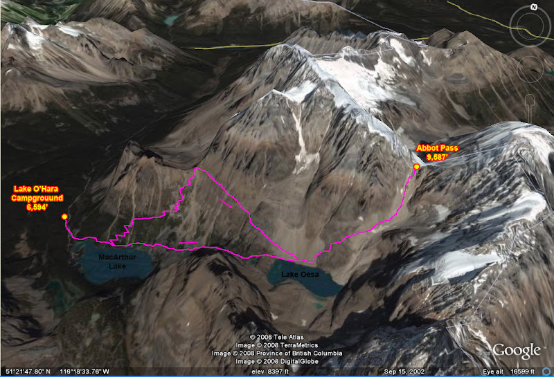
The trail to Wiwaxy Pass is very steep and narrow, but still very well maintained. I made the 1,700 ft climb to the pass in 45 minutes, where I took in the panoramic views of Lake O’Hara and the surrounding peaks. I also had an excellent view of the Alpine Ledges route across the canyon, which looks impassable for hiking but actually has a trail traversing through it. After entertaining myself with two very friendly marmots I continued on my way to Lake Oesa.
![Shaffer Ridge above Lake O Hara]() Schaffer Ridge & Lake O'Hara
Schaffer Ridge & Lake O'Hara
I have to say here that the trails in the Lake O’Hara area are wonderful. They are well maintained, and with very little hiking you are treated with absolutely stellar views. Take one of the “alpine routes” labeled on maps and you will follow trails through terrain that looks impassable to hiking with only the occasional class 2 up or down climb. Such was the case as I traversed and descended to Lake Oesa across terrain that normally would be slow and tedious travel.
![Alpine Ledge Route]() Alpine Ledges Route
Alpine Ledges Route | ![Wiwaxy Gap Trail]() Wiwaxy Gap trail
Wiwaxy Gap trail | ![Wiwaxy Gap]() Wiwaxy Gap
Wiwaxy Gap |
![LeFroy from Abbot Pass - so close!]() LeFroy from Abbot Pass
LeFroy from Abbot Pass | ![Abbot Hut at Abbot Pass]() Abbot Pass Mtn Hut
Abbot Pass Mtn Hut | ![Couloir to Abbot Pass - Screeeeeee!]() Screeee!
Screeee! |
I made it to the small blue lake situated picturesquely beneath Ringrose Peak by 12:30. So far so good, as it seemed I had enough time to run up to Abbot Pass. From here there is a steep and horrendously loose 2,000 ft couloir to the pass. There are some use-trails that make the going a tad easier, but I still had to travel very cautiously to avoid knocking lots of rocks down.
By 1:50 I had made it to the Hut. I had reached it just as a guided climbing party was getting back from a successful ascent of neighboring Mt LeFroy. It looked so close! After hearing that it only took them 4 hours round trip to summit via a short but of 5.4 climbing, I longed for a climbing partner and rope, but alas I would have to do without. The Pass is well worth a visit, both for views of the O’Hara area and also back down towards Lake Louise on the other side. It was quite surreal to be looking down at Valley of the 6 Glaciers, which I was at only 2 days ago, seemingly so far away.
Because there are virtually no mountain huts in the mountain ranges of the U.S., and the few there are usually small aluminum shacks, I had to check this place out. While the mountaineers enjoyed tea and cake, they let me wander around inside the luxurious stone shelter. Inside I was surprised to find: beds, books, board games, kitchen with stove, etc. Imagining approaching to this shelter, spending the night here, and having a 4 hr round trip summit seemed incredibly deluxe to me – quite a world apart from most mountaineering in the U.S.
I started back down the chute at about the same time as the other climbers. Although I started first, I moved slowly, taking care not to knock down loose rocks. The quickly caught up as the guide knew of a parallel chute that people do not ascend, that has scree the perfect diameter for scree skiing. Noticing their way down, I joined for a fun descent. Once we slowed down and began a descending traverse, suddenly the terrain around me shifted all at once (strangely reminiscent of the time I knocked down the SE face of Mt Wallace during the
2004 Sierra Challenge!). A microwave-size boulder about 20 ft above me began to roll, and I quickly moved aside and shouted “rock!” The climbers near me moved away easily enough, but there was a moment of drama as the guide, who had descended much further down, waited in anticipation as the boulder crashed down toward hum. It bounced left and right and he anticipated correctly, jumping the correct way just in time to avoid it. I was happy to be off this slope.
![Mt Biddle]() Biddle from Abbot Pass
Biddle from Abbot Pass | ![Mt Biddle and mega-ridge]() Mt Biddle and Schaffer Ridge
Mt Biddle and Schaffer Ridge | |
![Stone Trail with Bridge]() Stone path
Stone path | ![Stone Trail]() Stone path
Stone path | ![More Stone Trail]() Stone path
Stone path |
Now it was getting late in the day and I had to make it back and with my gear ready in time for the 4:30 shuttle, so I had to hustle. I left the guided climbers in the dust – all that is except for the youngest climber, who didn’t want to miss the 4:30 tea time down at the Lake O’Hara lodge. Half rushing independently, half-racing, we ran down the trail. When I did get ahead, the kid would usually catch up as I stopped to take a photo, and the chase would being again.
![Ringrose Peak]() Ringrose Peak
Ringrose Peak
I made it into camp at 4:20 pm, with just enough time to get my gear over to the pickup and hop on the bus for the ride out. The ride back to Lake Louise was straightforward, but sadly the campground was filled again. Luckily, this time there was a different ranger at the entrance station, and he told me of a campsite with some travelers looking to share.
Sure enough, I saw 3 campers that looked welcoming for more travelers. Deric and Monica were two Canadians from Ontario who were driving around Alberta for the summer. They were sharing the campsite with Andy, a solo traveler from London who was traveling by combination of bus and hitchhiking. He planned to head up the Icefield Parkway to Jasper, and eventually, over to Prince Rupert. That night they were expecting to have a party with 3 Hollanders who had just finished backpacking to Lake Louise from Banff via 40-Mile Canyon.
Although I needed to be up very early the next day for climbing Mt Temple (and if there was time and energy, Eiffel Peak too), I couldn’t resist the temptation to enjoy this company, as well as the music, fire, and beer provided. I cycled into town and got a 6-bottle pack of beer to share too, and returned just as the Hollanders arrived. They brought along a 3-person lawnchair/couch thing that apparently they had backpacked with all the way from Banff! One of the guys was from the equivalent of their special forces, so I guess for him it was just good training.
After a night of good conversation, food, beer, and fire, I was refreshed, relaxed, and turned in around midnight, ready for a big outing the next day.
Day 9 – Back for More - Climbing Mt Temple & Eiffel Pk
By Bike
Distance: 19.9 miles
Elevation Gain: 2,120 ft
On Foot
Destinations:
Mt Temple (11,624'),
Eiffel Pk (10,118')
Distance: 11 miles
Elevation Gain: 7,510 ft
I woke up at 6am, cleared frost off of my bivvy, and quickly downed a light breakfast before heading off again on my bicycle. Today’s objective: climb 11,300 ft Mount Temple and, if I had time and energy, also climb neighboring Eiffel Peak. As the final 3,000 ft
climb from Sentinel Pass had lots of loose scree and Mount Temple see plenty of scrambling traffic on most days, I wanted to get up to the pass early so that I wasn’t climbing beneath a lot of other people. Also, I was handicapped against the other climbers aiming to be up the mountain early since I had about 10 miles and 1,900 ft worth of cycling to do just to get to the trailhead!
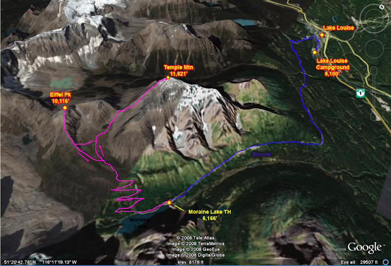
I cranked up the steep approach to Lake Louise for my third time in 5 days, and near the top took the branching road to Moraine Lake. Here the grade eased up somewhat, but still not very much – it was a good hard ride all the way to the trailhead. I pulled in about 8:15 am, locked up my bike, and hurried up the trail. Today I was lucky since the area is often closed to groups smaller than 6 people if there are bears present, but this morning there was no entry restriction in effect, so I was free to run up solo.
![Valley of the 10 Peaks]() Meadow below Sentinel pass
Meadow below Sentinel passThe trail was steep as it switch-backed up the mountainside, but there were few views as the forest was still very thick. I crested the headwall and there the pine trees gave way to a full forest of larch trees as I entered (guess where?)
Larch Valley. I recognized them by the slightly different appearance, mostly in the needles. Larch trees, unlike pine trees,
change colors in the fall, their needles turning a vibrant golden hue that makes for spectacular fall foliage. Such is one of the more popular reasons for people to head up to Larch Valley and Sentinel Pass.
Treeline gave way to flat, rolling meadows, and the picturesque Minestimma lakes. From here were excellent panoramic views of the Valley of the 10 Peaks, above Moraine Lake. I could already see a couple of people ahead of me at or above Sentinel pass, so I picked up the pace as I began gaining elevation again. By 9:35 I was at the pass, only 1:20 hiking from the trailhead. From the pass there is a prominent use trail that heads up the south side of the ridge crest towards Mount Temple. This was a welcome relief, as although the scree was very loose, if one took care to stay on the trail the remaining rock was fairly well settled, making walking easier and lessening the likelihood of kicking rocks down.
SW Ridge of Mt Temple
The trail entered a broad chute to the right, and here it became a network of many different variations, following deeper scree in the center and ascending more solid class 2-3 ledges on the left side. Just as the chute began to close off, the trail cut to the right across the chute and around a rocky rib. Around the corner the rock changed from a deep orange to a dark grey. The scree lessened and I found myself traversing on some cl.2-3 slab with thin cracks. The way up was clear, and where a headwall was reached, I merely traversed right to find a way through.
Finally the first crux was reached, a 20 ft vertical step of rock that is cl.3-4 which I have dubbed “The Grey Band”. The climbing is solid, but reachy and physical for one or two moves, like a bouldering problem. The rock was surprisingly good compared to what I had climbed in the area on other peaks.
Immediately after the Grey Band I came to the second crux, what I dubbed the “Gold Band” as the rock changed back to a very light orange again. The rock was more crumbly, but the scrambling stayed solid, ascending a series of ramps and ridges that seemed to buttress the band – it kind of reminded me of climbing the Golden Staircase on the Grand Teton, except this was an easy cl. 3.
Atop the Gold Band the rock changes color again to a very dark color, where the 3rd and final crux of the route is, which I dubbed (guess what?) the “Black Band”. The band was more of a very steep slab, which is bypassed by following the edge of it up and right to an apex. Here the rock is more broken (and wet), providing solid cl. 2-3 scrambling through the slab.
Above the final crux lay another 600 ft of fun scree slogging. Some sections became tricky as the soil was frozen solid, making for a nice slick ramp, but doable enough with a trekking pole. Here I caught up with the last of the leading climbers, passing them and making the first summit of the day by 11:10am. There was still some snow on top, and the highpoint was a short ways beyond the summit log. Normally I wouldn’t have wandered up there since it is corniced, but the footprints left by the climbing party that I saw finish the East Ridge 3 days prior were still here, so I followed them the last bit up to the very top.
Mount Temple Pictures
![Deltaform Mtn & Neptuak Mtn]() Mt Deltaform
Mt Deltaform | ![Mt Perren & Mt Allen]() Mt Perren & Mt Allen
Mt Perren & Mt Allen | ![Pinnacle Mtn and Eiffel Peak]() Pinnacle Mt & Eiffel Pk
Pinnacle Mt & Eiffel Pk | ![The Grey Band]() The Grey Band
The Grey Band |
![The Golden Staircase on Mt Temple]() The 'Golden Staircase'
The 'Golden Staircase' | ![Deltaform Mtn from the summit]() Mt Deltaform
Mt Deltaform | ![The Goodsirs]() The Goodsirs
The Goodsirs | ![Mt Victoria & Mt LeFroy]() Mt Victoria & LeFroy
Mt Victoria & LeFroy |
![Cloudy summit ridge]() Summit
Summit | ![Me on Mt Temple]() Me on the summit
Me on the summit | ![Panorama Ridge]() Panorama Ridge
Panorama Ridge | ![SW from Mt Temple]() SW from Temple
SW from Temple |
If I were to give recommendations for what 2 peaks to climb in Lake Louise that area, I would certainly say Mt Fairview for its excellent views of the nearby peaks, and Mount Temple for its mellow but still interesting route, and excellent panoramic views, since it is by far the tallest peak in the area. Once again I could see Mt Assiniboine to the south and the Goodsirs far to the West in British Columbia.
Although I had worked up a good sweat on the ascent, I quickly cooled off as the wind really picked up, and light flurries of clouds and windblown snow started to pour over the summit. At 11:40 I decided to get moving and head on to Eiffel Peak, as I had plenty of time and energy to get greedy in my peakbagging ambitions. Down climbing was fast and straightforward, and already the hordes were ascending the route – it was good I got up here early. There were even a few guys in short, tees, and no backpack or helmet who had just decided on a whim while at Sentinel Pass to go for the summit (they had virtually no scrambling experience).
Strangely, it took me about the same amount of time (2 hrs) to descend to Sentinel Pass as it did to climb Mount Temple. I had a quick lunch on some nice rock slabs at the pass and by 2 pm I was off at a half jog down to the Minestimma Lakes and the start of my
cross-country adventuring across the meadows to Eiffel Peak. I surmounted a little headwall to gain the ridge and picked my way uphill for a ways before finding a use-trail. Still, the trail was hard to follow and the routefinding not as straightforward as I had expected. I really slowed down once I reached sections of slab covered in loose rock.
Scrambling on Eiffel Peak
As the rock changed from orange to grey and I started to head into a chute, I traversed back up and right along a small band of cliffs before finding a steep class 3 chimney/chute to scramble through. Atop here I caught up with another scrambler on the peak, and we joined forces in picking our way up the remaining few hundred feet of cliffs and loose rock to the summit. Atop the first crux we turned left and re-entered the broad chute on its right side, wrapping around the corner to the right before angling up and left to the summit. Near the top there was a slabby section with very thin climbing, which can be bypassed by braving the loose crud in the trough of the chute (I went up the slab, and down the chute). Once again, my trekking pole and ice tool shaft useful climbing aids in the loose dirt and rock.
Within 2 hours of leaving Sentinel Pass I was enjoying another breathtaking view atop Eiffel Peak. I had a nearly full view of the route I had just climbed on Mount Temple, and views straight over to the passes I was considering hiking through to access Lake O’Hara. I enjoyed my time here for nearly an hour, leaving around 5pm. I down climbed much more quickly and confidently here than on my other scrambles or the ascent, so I think I was finally getting used to traveling through this loose terrain.
Eiffel Peak Pictures
![Eiffel Peak]() Eiffel Peak
Eiffel Peak | ![Mt Fay & Moraine Lake]() Mt Fay
Mt Fay | ![Rockslide on LeFroy]() Rockslide on LeFroy
Rockslide on LeFroy | ![The Eiffel Tower and Mt LeFroy]() The Eiffel Tower & Mt LeFroy
The Eiffel Tower & Mt LeFroy |
As the terrain opened up again I took off on my own once again, this time following the ridge much further down than my access, following a good use trail. I dropped down a final slope, crossed a stream and was right back on the main trail. Light was beginning to fade, and I didn’t want to do too much hiking alone in bear country, so I maintained my fast pace and rushed down the trail, reaching the trailhead by 6:50 pm.
![Mt Fay in the evening]() Mt Fay
Mt Fay
As I hiked out I noticed that warning signs had since been posted, stating that the 6 person minimum travel requirement was in effect. I’m glad that these signs weren’t posted earlier, or I wouldn’t have had nearly the full day I managed to squeeze in. I’m also especially glad that I didn’t run into any bears!
The long day and rough terrain had taken its toll on me, as my knees were aching and my shoes were beginning to fall apart from all of the scree gashing into them. It felt sooo good to get off of my feet and onto m bicycle. Surprisingly, despite being sore and tired from hiking, the bike ride home felt very good – even the 300 ft climb out of the Moraine Lake area.
I raced downhill, eager for sustenance and the comfort of my bivvy sack. To my surprise, there were new people in my campsite, and my stuff was gone! To my relief, before I could panic too much Andy, the Englishman, called me over from the neighboring campsite. Apparently the noise of last night’s fun had disturbed our neighbors, and Derick’s smart-ass retort got him, Monica, and the Hollanders kicked out of the campground. They were now taking refuge in the Lake Louise Hostel, working shifts to help reduce their lodging costs. Andy and I had escaped the flak, and Andy moved his stuff and mine into a new shared campsite while I was gone.
![Moraine Lake]() Moraine Lake
Moraine Lake
We enjoyed a nice relaxing evening shooting the breeze, and around 11pm some late night visitors arrived – the pariahs. We cautiously invited them to join us (they did bring more beer, so who could say no?) and we all cooked out again under the stars. Fortunately, this time our guests behaved.
![Mt Temple at sunset]() Mt Temple at Sunset
Mt Temple at Sunset
Top & Table of Contents
-
Part 0 - Cycling and Scrambling from Calgary to Vancouver
-
Part I - Calgary through the Canadian Rockies
-
Part II - Lake Louise & Lake O'Hara Areas
-
Part III - Mishaps in the Middle Ranges
-
Part IV - British Columbia's Desert?!
-
Part V - Crossing the Coastal Range to Vancouver
-
Epilogue
-
Images
Part III - Mishaps in the Middle Ranges
Day 10 – Moving On - Lake Louise to Field
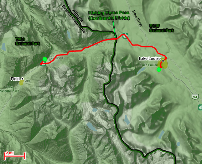
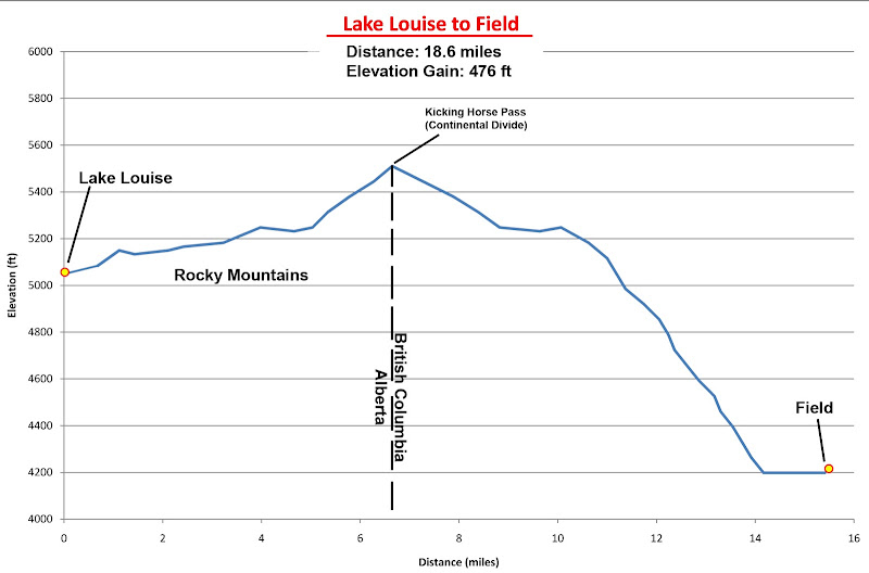 By Bike
Distance: 18.6 miles
Elevation Gain: 476 ft
After yesterday’s monster day-hike, combined with the cycling approach and return, I decided to nix my plans to climb Mt Bosworth and/or Paget Peak at the continental divide on my way to Field, British Columbia, in Yoho National Park. I expected an easy, straightforward 19 mile ride today – no tricky business. Today I would be traveling extra heavy, since with all of the free beer contributed by the pariahs, I still had 5 bottles of beer. Unable to throw them away, I stuffed them in my rear panniers for the ride.
An ample breakfast in Lake Louise later, and then I was off! My stay in the Canadian Rockies was coming to an end and finally I would be continuing on my cycling route in earnest (apart from plans to bag one more peak near Field). The skin on my left thigh was finally peeling from nasty sunburn I got on my first long day of riding (that leg faced south, and I learned the hard way that cycling pants are excellent at chafing off sunscreen). I departed with my feet still torn up, swelling up in my shoes, and an ample supply of gallon ziplock bags (my answer to the rain-soaking problem for my shoes).
Cresting the pass, I was disappointed to find a very strong headwind blowing up the pass. I had expected a fun fast ride down the steep drop to Field, but the winds were so strong that even on a 5% downgrade, I had to pedal hard downhill to barely sustain a 15 mph speed. Midway down the canyon I stopped at an excellent overlook of one of the more interesting sections of the transcontinental railroad, where two spiral tunnels had been built in a figure-8 linkup into the mountainsides to maintain a lower (but still very steep) grade for the train tracks. Before the spiral tunnels had been built, the grade was so steep (4.5%) that it was a common occurrence for trains to become runaway and crash somewhere down the canyon or into Field. The tunnels have since made the stretch a manageable and safe 2.2%.
 Map of the railroad 'loop'. You can also see where I nearly had my accident as the road crosses the canyon
The overlook also had some nice models of the arrangement, and some nice informative signs of the area. For example, I learned that the continental divide here was called
“Kicking Horse Pass” in honor of the horse that kicked one of the first white men to explore the region. Also, the pass was one of many considered for the transcontinental railroad.
I continued downhill into the strong headwind. Although mildly annoyed by the wind, I still thoroughly enjoyed myself as the mountains rose ever higher above me as I plummeted 1,400 feet into the valley below. The road abruptly flattens at the bottom, where it reaches the valley bottom and turns sharply cross-canyon to cross the flood plains, and it was here that the shit hit the fan. I learned a very interesting lesson for later cycle tours:
Strong winds + deep canyon = Very strong down-canyon winds at the bottom
Strong winds + deep canyon + turning across canyon = very very strong cross-winds
Strong winds + deep canyon + turning across canyon + narrow shoulder on river bridge crossing + semi-trucks = very very strong cross winds with very very strong turbulence and suction superposed = SUDDEN NEAR LOSS OF CONTROL OF BICYCLE
Near loss of control + narrow shoulder + semi-trucks honking = NEARLY SHITTING PANTS
Basically, when the road suddenly turned across the canyon, I had to fight very hard to not topple over, leaning heavily into the wind. This occurred right when the shoulder narrowed as I entered the viaduct crossing the river, forcing me close to the fog line. This happened moments before a semi-truck came behind me. The front blast of pressure from the semi forced me to lean harder into the wind to avoid getting knocked over into the shoulder. Then the suction came, which with the fast flowing cross wind, was itself exaggerated. The suction came so fast that I didn’t have a chance to stop leaning towards the semi when suddenly I was sucked very hard towards it. I jerked hard away from the semi to avoid falling into the road just before the tail-wind turbulence and the resumption of the cross-wind hit me, causing me to swerve left and right as I tried to control the weight of my rig while fighting the cross-wind. Another semi was right behind the one that caused me to nearly lose control, and this one blared its horn, scaring the shit out of me while I was trying to regain control and going through the whole blast, suction, turbulence, cross-wind blast cycle again.
The viaduct crossing probably only lasted a minute, but it felt like an eternity as I regained control and composure while battling the cross-winds and traffic winds. FINALLY I reached the other side, the shoulders widened, and I turned back into the headwind, WHEW!!!!
In a daze I cycled over to the walk-in campground I had planned to spend the night in, finding it very open and exposed to the wind, dust blowing everywhere. It was also completely empty. I found a small campsite protected in the trees (no car access), made myself at home, drank my 5 beers to celebrate life, and fell asleep utterly exhausted.
![Mt Stephen]() Mt Stephen towering above the valley
Mt Stephen towering above the valley | ![Kicking Horse River]() The river plains near Field
The river plains near Field |
Day 11 – Sleeping In - Field to Golden
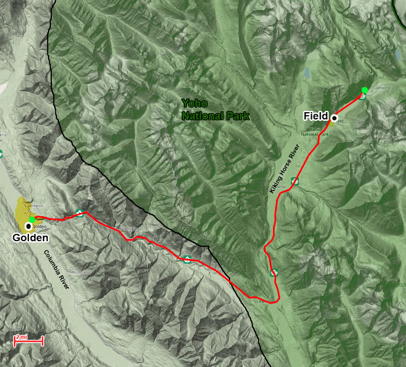
 By Bike:
Distance: 38.9 miles
Elevation Gain: 1,580 ft
Today’s plan: Hike/scramble Mt Field and Mt Burgess.
Tomorrow’s Plan: Cycle from Field through Golden to a campground in Glacier National Park
Today’s reality: Slept in until 11am, woke up feeling very out of it
Time to change plans. As it was too late and I was too tired to climb more peaks today, I decided to break up my cycling days a little differently. Using my hand spreadsheet chart to see distances and elevation gain of different combinations, I decided to break up my ride, and make use of today to cycle to Golden and spend the night there. Then I could skip the campground in Glacier and cycle all the way to Revelstoke, with further shifts in my plans beyond that.
As I prepared to leave the campground, I saw another cyclist sitting in the back of his truck, prepping his bike for a ride. Coincidentally, he was from Golden and had driven out here to cycle back for a good ride. He gave me some helpful beta for the day’s ride, and for the road beyond Golden – luckily everything sounded pretty hunky-dory to me. He even gave me an excellent recommendation for breakfast in Field – the Stuffed Pig.
![Mt Stephen from Field]() Mt Stephen rising 6,000 ft above Field
Mt Stephen rising 6,000 ft above FieldI found the Stuffed Pig easily enough, and feeling weak and famished (probably not eating enough calories), attempted to stuff myself like a pig while enjoying the breathtaking north face of Mt Stephen rising 6,000 ft nearly straight above the town. While eating brunch, my conspicuous getup sparked another conversation with a fellow traveler. The guy looked like just your run-of-the mill baby-boomer tourist, but apparently the guy had done extensive distance cycling in Europe in his younger years. I told him about my plans, and we had a nice chat about his cycling past. It’s interesting to see the type of connections you bridge with strangers when traveling alone and conspicuously (e.g. decked out in climbing gear, or cycling gear, etc.) – experiences that would have been missed in any other circumstance.
After I could eat no more, I continued on my way down the flat river plains of Yoho. Gradually, the mountains receded behind me, and the temperature began to rise. About an hour into the ride, I reached my first road construction zone, which turned out to be surprisingly pleasant. As traffic was stopped for alternate 1-way travel, I cycled past the long long line of cars and passengers lounging on the roadside until I reached the front of the line (hehe). The roadworker there was very chatty, pointing out various landmarks of the peaks and glaciers nearby. She was even nice enough to give me a few minutes head start through the construction zone before unleashing the rest of the traffic!
As I left the Rockies behind, my thermometer continued to climb. I kept it shaded, but still I recorded a (very brief) high of 104
o F that day (perhaps due to the road radiating heat?), and I felt more than a little feint and nauseas at time. Luckily I had plenty of water! Also, today there were still high headwinds that made the net downhill ride harder than expected, but at least it gave me occasional reprieve from the heat.
Leaving the Rockies behind
As I neared Golden the road enters a deep, rugged canyon. Here there was an impressive viaduct
(1*),
(2) that I crossed, which this time was a nice surprise, with spacious shoulders and a feeling of soaring over the canyon. The downside was the headwall to climb out of the canyon and into Golden. It was a very steep grade for several hundred feet and it nearly finished me off for the day. I stopped for a rest, ate some food, and lugged myself the remaining miles into Golden.
*
Photo by Nautical9 at flickr.com
Having no idea where I could sleep that night, I pulled into the visitor center on the near side of town, where I was directed to a trailer park that was nearby (and not uphill!). I also checked the latest weather forecast. It didn’t look good – a 50% chance of slight rain tomorrow. I wanted to avoid rain, especially when crossing Roger’s Pass and the avalanche tunnels en route. However, the forecast for Glacier called for only a 50% of scattered showers, with 1-2mm of precipitation – not too bad. Plus, throughout my time in the Canadian Rockies, nearly every day that rain was forecast turned out to be sunny (and vice-versa), so I had begun to take the forecasts more casually. I decided I would just see how the weather looked tomorrow, and if it wasn’t too bad, to attempt my 90-mile ride to Revelstoke while keeping a close eye on the weather.
After deciding what to do the next day, I checked in at the R.V. camp, set up my bivvy next to some interesting Swiss motorcyclists, and rejoiced as I did my first load of laundry for the trip (imagine lasting 11 incredibly sweaty days with only 2 shirts and 2 shorts!).
With a mind towards packing in more calories to prepare for the much longer day tomorrow (and the first real crux, surmounting Roger’s Pass), I walked over to a neighboring hotel just as rain started to fall. There I ate steak and drank good tap beer at the hotel bar. While eating, I met two Hollanders (different ones) who were traveling across Western Canada in an R.V. They had remembered me from the road earlier that day, and the Hollanders joked that if they saw me the next day as they drove over Roger’s Pass, they would tempt me with an offer for a ride over the pass to Revelstoke.
After a filling dinner, I retired to my freshly rain-soaked bivvy and enjoyed a good book before turning in for the night.
Day 12 – Bad Decisions & Bad Weather - Golden to Revelstoke
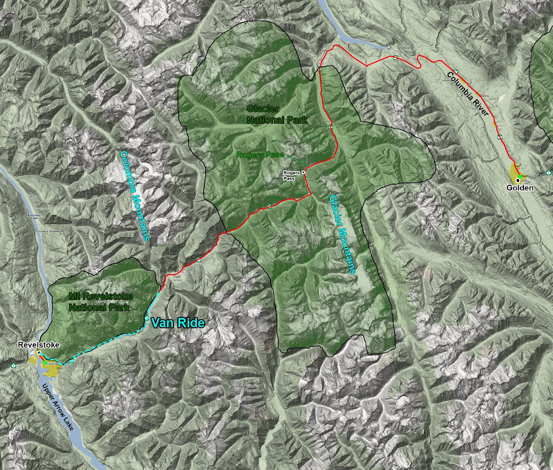
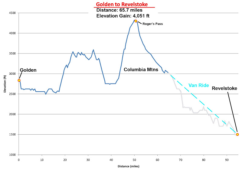 By Bike:
Distance: 65.7 miles
Elevation Gain: 4,050 ft
Today I awoke to uncertain weather. Looking to the north the sky was clear. To the south was somewhat mixed, but not too threatening. Meanwhile a valley fog was still rolling in bands across the landscape, but was sure to dissipate soon. Well, the weather wasn’t wonderful, but it wasn’t terrible either. I took my time eating an ample breakfast at the motel, and the fog had already started to burn off by the time I hit the road.
 |
| Foggy morning in Golden |
I had been experiencing a lingering and growing fatigue since the start of my trip. I hadn’t experienced any DOMS (delayed onset muscle fatigue), nor or other soreness on most days, and the fatigue didn’t feel like I was tiring myself out during the day. It was more of an underlying fatigue, occasionally leaving me spacey and lessening morale, but it usually got better whenever I got a chance to gorge myself. I realized that I had absolutely no idea how many calories I should be eating each day, and for the most part had been subsisting off of GU, Cliff Bars, and Peanut butter sandwiches, bagels, and the occasional dinner in town while spending hours a day on a heavily loaded bicycle or hiking for miles and climbing thousands of feet. Also, I wasn’t eating while on my bicycle.
I would have to make an effort to consume more calories. Today I strategized two ways to help do this. First, I would pack along Snickers candy bars, since they are much more appetizing and fattening than Cliff Bars. They could also be a good morale booster. Also, both for morale and regular eating, I decided I would experiment with riding the first 30-40 miles of my expected 90-mile ride without break (as usual), but beyond this I would stop every 10 miles to eat a GU or Cliff Bar (ca. every hour), take a good long sip of water from my camelback. Standing and stretching a bit while doing this could help the saddle soreness, back soreness, and hand numbness that inevitably worked up during the long riding days.
The ride out from Golden was nice and easy, with a short downhill, and then lots of flat terrain with only the occasional small hill. I made excellent time, cruising at a nice fast speed as passed through bands of thick fog and sunny clearings. The first major climbs of the day (and my largest continuous climbs of the trip) passed by fine – all I had to do was remember to slow down and focus on perceived effort and not on speed or how far I had to go. The fog was finally gone and the weather was mostly clear and sunny, even over the Columbia Range to the West.
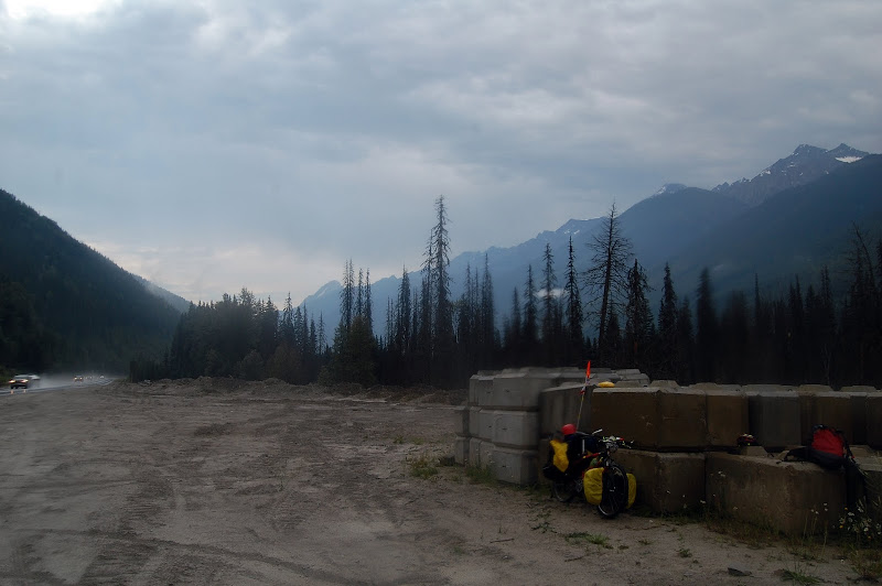 Waiting out the rain
I crested the first summit of the day and dropped down the backside into a canyon as I turned south towards Roger’s Pass. Just as I passed the entrance to Glacier National Park, storm clouds suddenly began to pour over the crest of the Columbia Range. Rain appeared to be imminent, so when I found a good roadside pullout, I pulled off, wrapped rain covers on my panniers, threw on my rain poncho, and took a beating from the first wave of rain as I stood out in the open, as no meaningful shelter was available. Still, I stayed mostly dry, as did my bike seat and gear. The rain appeared to be a small thunderstorm cell, so I waited for it to pass, and after about 20 minutes the rain had stopped. Another 20 minutes and it was sunny again and the road was dry.
I had reservations about trying to cycle over Roger’s Pass now. However, as things stood, I was 40 miles into my ride. Returning to Golden would mean that would have cycled 80 miles that day and would still be a day behind. Plus, I was almost halfway done with the ride, with the crest of Roger’s Pass only 10 miles away. After that, it would all be downhill from there and a very fast downhill at that. Plus, base d on the weather forecast, I had received all of the rain I was likely to encounter that day, or at least any more rain should be fairly light. So I decided to go for it.
So I began the long climb to Roger’s Pass, which would be my first real test-piece of the cycle tour for how I would handle the dreaded “death pass” in the Coastal Range at the end of my trip. From the East, Roger’s Pass climbs about 2,000 feet continuously over about 8 miles. It got very steep very fast and the grade never let up, but I was insistent on never dropping into my third chain-ring, since I had to reserve that for the “death pass” – if I used if here, I would have much less confidence later.
About halfway up the pass, the shoulder narrowed and got rough, forcing me to occasionally wander partway over into the road, so I was very attentive with my rear view mirror. The steepness was really getting to me, so after passing a blind turn with a narrow shoulder (yikes!), I pulled across the road to a turnout for a brief break, feeling very glad all the while that I had bothered to mount such a bright and tall safety flag on my bicycle. The grade of the road was so steep that after my brake, I couldn’t start straight up the road from a standing stop, forcing me to coast downhill and pull a U-turn.
A bothersome problem was starting to occur that also forced me to resume riding like this. Beginning the day before as I climbed the final headwall into Golden, I noticed that if I stopped on a hill and then attempted to start riding directly up the hill again, my pedals and crankshaft would disengage from chain ring and spin freely until I put my feet down to avoid tipping over. As this started to occur, I could only avoid it on lesser slopes, or if I reduced the starting tension by running the bike uphill first, or coasting downhill first. Then the crankshaft would catch again and I could resume pedaling. If I was lucky, I could get the same effect by briefly slowing my pedaling down, and staring up again slowly before I tipped over. It was a minor but very disturbing irritation that seemed to be getting worse, and was much more noticeable on uphills, making it very troublesome on Roger’s Pass.
 |
| Avalanche Shed
|
About halfway up the pass, it started raining again, but there was no good place to stop to take cover. It was a light rain, though, and I only had another 5 miles to go until the crest. As soon as I found a slightly wider part of the shoulder, I stopped to put my trusty gallon zip-lock bags over my shoes. With my toes shoved firmly into the toe clips, they stayed on and worked surprisingly well for keeping my feet dry – at first. Every now and then I would stop, either from fatigue, or losing my momentum from a swerve around an obstacle on the pavement (the shoulders in B.C. were littered with trash, holes and cracks, as compared to Alberta’s) or losing my concentration from the one or two cars that honked their horns at me despite me being well off the road at the time and visible plenty far ahead (to me it was obvious that the cars were timing their honks to harass me as this only happened on the straight-aways). Each time it was harder and harder to start again as my pedals disengaged and spun freely, and each time I stopped I managed to lose the zip-locks from one foot or the other, necessitating another stop and using another bag.
Finally I was nearly at the pass and began to feel relieved. Until I reached my first avalanche shed, that it. Because Roger’s Pass is so narrow, with steep mountains rising thousands of feet on both sides of the road, the road is extremely vulnerable to avalanches. Also, unlike the canyons in Utah’s Wasatch Range, no avalanche control work is done out here due to the large distances and small population. Instead, at each avalanche path, a shed is built over the road, creating a tunnel for the road and a bed for the avalanche to slide on, clear of the road.
The sheds were hundreds of feet long, and on the uphill this took some time to pass through, leaving me unnerved for a while, and pressured to cycle harder than I wanted to in order to speed through them. These sheds had several unanticipated problems for me on a bicycle, too. First, they weren’t lit. Although I had lots of reflective tape, a reflective flag, and 2 tail lights, I still didn’t like it. Second, the shoulder got very narrow. And 3rd, the shoulders had small rumble-strips carved into them, making for a bumpy and slow ride. So each tunnel provided a few minutes of hurried cycling and elevated stress before I could slow down and relax. But I only had a handful to pass through before the summit, and I expected no problem breezing through them at 20-25 mph on the downhill.
At last I reached the pass, where there was a large parking lot and gas station. I ate a full lunch, chugged a Gatorade and wolfed down 2 Snickers Bars, buying more of both for the rest of the ride. By now the rain had stopped, with the clouds clearing again, letting the sun shine brightly down. From here on it was all downhill from here – I thought the hard part of the ride was over.
Roger's Pass
As I pulled away from the gas station, I admired the emerging views of the glaciated peaks of the Columbia Rage. But downhill from me I saw a wall of low clouds. “No biggie” I thought – these are small clouds since they aren’t reaching very high, so I should be able to blast right through them. And that is when I began to lose control.
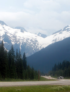 |
| Bad weather ahead, but it doesn't look that bad . . . |
As I descended, I rounded a hard corner, and I ran head on into a monster storm that had been lurking out of site behind the turn in the canyon. The sky quickly darkened and I was hit head on by an incredibly strong wind. Despite the slopes at the pass being 5% or greater, I had to cycle as hard as I could to not drop below 10 mph. At some times I was going nearly as slow as 5 mph on the downhill while cranking as hard as I could! As I battled the winds, a downpour started.
I stopped to put on my zip-lock bags, and had trouble starting again as my pedals spun freely. I got going, but lost a bag in the process. I realized this a while later and stopped to put on a fresh one. This happened multiple times. The wind blew the rain so hard that despite wearing waterproof shells, the rain was driven through every small opening or lapping of the shell layers, completely soaking me.
And then I reached the avalanche tunnels. Now they were dark and slick. I discovered on my first tunnel that the shoulder rumble strips, covered with so much water, became very slick, and I began to skid. After nearly crashing into the raised walkway wall, I got off my bike and awkwardly walked on the wall, bending over to walk my bike along the tunnel edge. In the process I lost some more zip-lock bags. After the initial skid, I did this on every tunnel with a raised walkway, often losing zip-locks in the process of walking the bike or attempting to start it again. Eventually I ran out of zip-lock bags and my feet became soaked.
Now I was soaked from head to toe in freezing rain. Winds were roaring incredibly hard, and I had descended over 5 miles away from and over 500 ft below the pass. Turning around wasn’t an option. I could have stopped, gotten out my bivvy, and waited out the rain, except the road had few shoulders and rose up or dropped off steeply on both sides. And if I had still been dry this could have seemed more appealing, but as I was already drenched, it seemed a bad idea to stop and let my body cool down in soggy clothes. Also, Revelstoke was all downhill from here, and this rain couldn’t last that much longer could it? I rationalized that my best bet now was to forge ahead and drop below the worst of the rain as fast as I could rather than digging in for shelter or turning back. This didn’t work out, but even now it isn’t clear to me which of the 3 options would have been the most dangerous at that point.
Finally, about halfway down to Revelstoke from the pass, only 25 miles from safety, I walked my bike through an avalanche shed, only to find that I couldn’t get the pedals to engage again. I tried and tried, and nothing happened. Now I was stuck on a roadside shoulder between two avalanche tunnels with no shelter and nowhere to go. I began to get really angry, frustrated, and frightened at this point as the bike failed to start. As I began to despair, a van passed by, slowed down, and pulled over onto the shoulder.
I ran over to the van with my bike as fast as I could.
“Hi,” the driver with an Italian accent said, “my name is Louie. Do you need a ride?”
The timing couldn’t have been better. I threw my bike into the back of the van and jumped into the warm, dry shelter of the front passenger seat as Louie started down the road again. He was heading to Revelstoke too, for work with an outdoor guiding group. He said he had done a fair share of cycle touring in Tuscany, and having experienced some nasty rainstorms there, and empathizing with my situation, took pity on me when he saw me in my sad state alongside the road.
As I decompressed from the adrenaline rush and frigid wet cold, I watched the canyon go by. It was disappointing and also strange to suddenly be riding in a vehicle, passing effortlessly and quickly through terrain I had expected to work my way through on two wheels. But still, Louie was a LIFE SAVER.
Down in Revelstoke, the town was wet from rain, but only mildly so. The clouds were clearing again, and it appeared the town had been going through this cycle all day, but in a much milder form than what I had experienced up higher. Louie was so great that he took me straight to where I planned to stay for the night, the SameSun Hostel. My day was over – no more distance to travel, and now I was safe, drying, and warming.
I hauled my bike and gear up into the hostel, every inch of me and my panniers dripping with water.
“Hello,” the girl at the front desk dryly declared, “how was your day?”
“Wet and cold,” I replied in a weak tone, half jokingly, half dejectedly.
“Well,” she said, dismissively, sitting at her warm, dry, comfy desk, pop music playing in the background, “it’s been raining all day here too. We’ve all been wet and cold today.”
WTF?!! Urge to kill, rising . . .
On the bright side, yes, there was room available, the hostel had safe bike storage, and it was fine for me to take over the backyard to dry out gear in the sunshine.
After getting settled, I spent the rest of the afternoon drying out every piece of gear I had, stringing up lines across the backyard and laying items out on the sun baked pavement. I finished drying the valuable items I was worried about getting stolen, and then I took off to find some food.
On the drive into town, Louie told me about a good Chinese restaurant in town. It just so happened that they had all-you-can eat buffets, but only one day a week. It also just so happened that that day was today.
![Mountains Above Revelstoke, BC]() Mt Begbie above Revelstoke
Mt Begbie above Revelstoke
I wandered over to the restaurant, still slightly wet, splattered with mud, and ravenous. The restaurant owners didn't know what hit them. I think I ate 3 or 4 meals worth. At least I was there eating for over 2 hours, and went through 4 or 5 heaping plates. I ate until I couldn’t eat any more. Still, even though I was stuffed, I felt a strong urge to keep munching on food. I think my body was finally beginning to feel the calorie deficit in ways beyond fatigue, because this experience of gorging until I was stuffed, and still feeling a strong urge to keep eating persisted for the next several days that I was stuck in Revelstoke with no hard physical labor to distract me.
As I headed back for the night, another torrential downpour washed through town. I escaped most of it, but it soaked the clothes I had drying back to the state they were in when I first got into town. Doh!
Day 13-14 – Stuck in Revelstoke - Rest Days
August 10th - Haaappy birrrrthday, too meeee . . .
Not quite the way I expected to spend my birthday. Yes, I expected to celebrate it alone, but under better circumstances. As things stand, I narrowly averted death in a torrential downpour at Roger’s Pass, escaping humbled and with my ass whooped. Now I had a bike that was broken, and I seemed to be marooned in town as the weather forecast had changed to a week of solid rain.
 |
| Revelstoke in postcard form
|
I wandered around town and had breakfast at a very nice Main Street café. They had very interesting styles of Mochas and Lattes that I haven’t seen anywhere else. Breakfast was very tasting with ample portions too. The day was sunnier than forecasted, but still cloudy of the Monashee Mountains to the West. After my experience yesterday, I was now more terrified of the rain than ever. I absolutely would NOT attempt to bicycle over the Monashee Mountains as long as it looked like there was any chance of rain.
Still, I held out hope that things would be better tomorrow, and perhaps my bike would magically work again. If so, I would press on. If not, then I might cry uncle and take a Greyhound, either a ways West to escape the weather, or just give up all together and take it to Vancouver and hang out there for a week. I was beaten down, demoralized, famished, and exhausted, and looking at my cycling map, it appeared that I was only about 1/3 of the way there, and I hadn’t even passed the hardest parts yet: The interior desert and the “death pass.” I was very close to giving up.
To lighten the mood, I spent the day wandering around town with my camera. Revelstoke is a very picturesque mountain town (albeit at a low 1,500 ft above sea level) perched on a small riverside deposit in a narrow mountain canyon.
A lot of the architecture felt old-town, and there was a beautiful truss bridge and suspension bridge crossing the river. I unleashed the inner nerd/engineer and made sure to get good photographs of the structural connections of the bridges for learning/reference – they were of a very different style and age from each other, and the small scale made access to good views of these connections very easy.
Bridges and river in Revelstoke
Looping back through town I found a bike shop that was open. The repair shop was closed for the week, but there was another repair shop that opened tomorrow. I would take my bike there. Here, though, I made sure to buy some special waterproof cycling covers for my shoes. Such an item does exist, and I’d say vital for any touring where there is a possibility of rain.
To top off the day, I went back to the Chinese restaurant for more food, although sadly there as no buffet that day. Still, my birthday came up in my conversation with the employees (I had no ulterior motive, really!), and they gave me a discount and complimentary drink.
Throughout the day there was patchy, light rain in town, and as evening wore on, the weather gradually cleared. Despite the uncertain weather forecast, I still held out hope for an opening in the weather. I went back to the hostel and enjoyed my first night’s sleep in a bed since I had started my trip.
August 11th - Bike Repair
I was at the bike shop first thing the following morning. I was even there before they opened. I wheeled my bike in and hung around as they put it on the stand to find out in depth what really was wrong with the bike, and to really MAKE SURE this time that there weren’t any other surprises lurking.
The diagnosis was that the bike cassette and free wheel were shot. These parts are what allow the rear wheel of a bicycle to spin freely without turning the pedals, but allow the pedals to engage the wheel and turn it when you pedal. Apparently, mine were completely worn out, and if I had managed to continue riding a few more miles, my rear wheel would have locked up solid.
Today was my lucky day, though, as they had the right parts to fix my bike, so they went about stripping the parts out from my rear hub and replacing them. There was no way I could have ever fixed this problem on the road – I wasn’t just lacking the technical know-how for this, but also much of the equipment needed would not be brought on a cycling tour.
Finally my bike was repaired, passed inspection, and was ready for more abuse. On the down side, the weather was worse today, but the forecast claimed tomorrow would be better. With nothing better to do, I spent the rest of the day in a café, reading and playing with a neat 3D wooden block puzzle my friend Nala had gotten for me at a crafts fair in London. The blocks form a cube in their basic form, but included was a sheet of other forms to build. This kept me busy all day, although I quickly discovered a logic to solving the forms rationally and methodically rather than by guessing, and I ended up solving all of the puzzles. With time to kill, I then re-solved them, illustrating a nice answer key to go with the game.
Top & Table of Contents
-
Part 0 - Cycling and Scrambling from Calgary to Vancouver
-
Part I - Calgary through the Canadian Rockies
-
Part II - Lake Louise & Lake O'Hara Areas
-
Part III - Mishaps in the Middle Ranges
-
Part IV - British Columbia's Desert?!
-
Part V - Crossing the Coastal Range to Vancouver
-
Epilogue
-
Images
Part IV - British Columbia's Desert?!
Day 15 – Uncomfortably Numb - Revelstoke to Kamloops
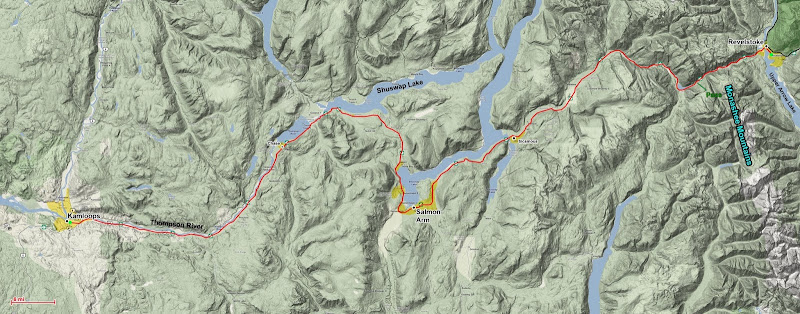
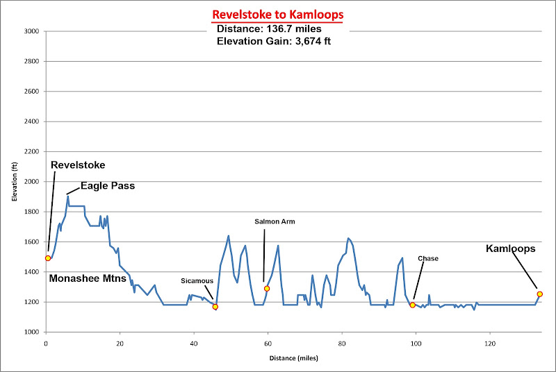 By Bike:
Distance: 136.7 miles
Elevation Gain: 3,680 ft
This morning I indulged in another good breakfast and coffee at the Main Street café. I still wasn’t sure if I would continue on today. I was all set, and all I needed was to convince myself that the weather was stable enough to try to sneak over the Monashee range and out to freedom. According to the weather forecasts, it was hot and dry with no precipitation expected further West, while Revelstoke was stuck in an endless cycle of rainstorms.
During breakfast some of the other customers told me the saw two cute 20-something-year old girls touring on the same route I was, following behind. They had camped in Glacier yesterday and would pass through town today. We joked that perhaps if I was lucky they would catch up to me, or me to them?
Wink,wink. (Sadly I never saw these mythological amazons). While waiting for the morning fog to burn off, and still on the fence about riding, I spent time teaching the daughters/servers of the café owner how to fold a cool flower out of their napkins – a nice presentation piece for them to use? At least we all were entertained by it.
Finally, I convinced myself that the weather looked good enough to attempt to cross the Monashee range, and at 9:20 am I resumed my ride westward. Today I would follow the same eating and resting strategy of my previous riding day, as it seemed to reduce my fatigue, especially later in the day. I had no solid goal for how far I would go today. At least to Salmon Arm. There was a hostel just short of Chase that was my main goal. And maybe, just maybe, I would push on all the way to Kamloops since the terrain in between was so flat.
 Haunted Chateau
Crossing the Monashee Range was a very strange experience. It was as if I was in Disneyland, except the Canadian version where it inhabited an enchanted forest rather than a concrete amusement park in the middle of a city. About every other mile I passed a tourist trap. There was an advertised enchanted forest. There was a tree-top sky walk – several in fact. There was a mini-Europe hidden in the trees, with windmills, cottages, and other miniaturized elements of European towns. I half expected to be attacked by Lilliputians along the way. At Eagle Pass, the flat mellow summit of the range, there are some lakes that converge at a place called
Three Valley Gap, where along the lakeside was a self-advertised haunted Chateau. The scariest part of the Chateau was the architecture: a gaudy red paint job and an awkwardly large form and proportions. Needless to say, I rushed through this place as fast as I could.
I rode the first 46 miles straight, arriving at Sicamous at 12:10, perfect time to stop for a good lunch. Sicamous was at another sort of threshold for my trip. I was officially leaving behind the continuous mountain country that I had been cycling in since I left the plains of Alberta. From here, I would be in hill country transitioning to desert. Along the way I would be riding along the gigantic Shuswap Lake, which is really a multi-pronged reservoir that stretches for miles.
 |  |
| Salmon Lakes | Chase |
I crossed the bridge over the first spur, ascending a mild hill. Sometimes the shoulder was torn up and narrow, but it was never all that bad compared to the earlier roads. With the 10-mile stops providing a great boost, before I know it I was going up the long slow include into Salmon Arm, and it was beginning to get blistering hot again. Another gas station break to chug Gatorade and eat Snickers, and then on I went, blasting downhill and around the tip of the next spur of the reservoir. I climbed another rise and entered a broad, semi-arid valley, popping out on the other side high above the reservoir’s main artery that eventually fed into an earth dam at Chase and then became the Thompson River.
![Thompson River]() Thompson River
Thompson RiverI made it to the hostel in Sorrento by mid-afternoon, but I felt so good that I just kept on going. I flew downhill as I dropped into the river valley at Chase, and the terrain became noticeable more arid. As I pressed on, a transcontinental train passed beside me next to the highway. It was full of recreational riders, many of whom were staring at me, and some were waving, so I waved back – I was feeling GOOD again.
One way that I wasn’t feeling good, though, was with numbness in my hands. I have always had a problem with this on any bike ride lasting longer than an hour, and despite my best effort to avoid leaning too hard into my handlebars, and my best attempts to constantly change hand positions, wear gloves, use padded handlebars, and rest on the meatier parts of the sides of my hands, my hands would still ultimately get some numbness in them on every ride on this trip over 30 miles long. Today the numbness got worse and worse, and despite efforts to get feeling back into them each time I stopped, inevitably they would go numb in the last 2 or 3 fingers before my next rest stop.
At this point the numbness was getting worrisome, and slightly painful. Also, the sun was getting low in the sky and I was far enough along the Thompson River to be committed to making it to Kamloops. I raced the sun, picking up the effort to get the day done and over with. It wasn’t until the last 10 miles that it got very hard psychologically to continue on, but by taking mental baby steps I made the last stretch into town just past sunset, pulling into a motel at 8:45 pm.
 Nearing Kamloops
The day’s total was 137 miles, as compared to my record before the trip of 50 miles and my current record on the trip of 97 miles on my first day – a gigantic leap in cycling distance. I had spent 11 hours today on my bicycle and my hands were incredibly numb, and the feeling was very bothersome as I had difficulty grasping things and my dexterity was compromised. I would have to work very hard tomorrow to not make this any worse than it already was, and I would battle this extreme numbness for the rest of my ride.
After checking in, I took my first warm, indoor shower of the trip, purchased ample junk food for a calorie and morale booster, and beer for that and helping soothe my soreness. Before I got too much into my celebratory feast, though, I fell asleep.
Day 16 – Sweating it Out - Kamloops to Marble Canyon
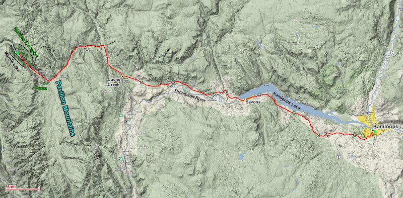
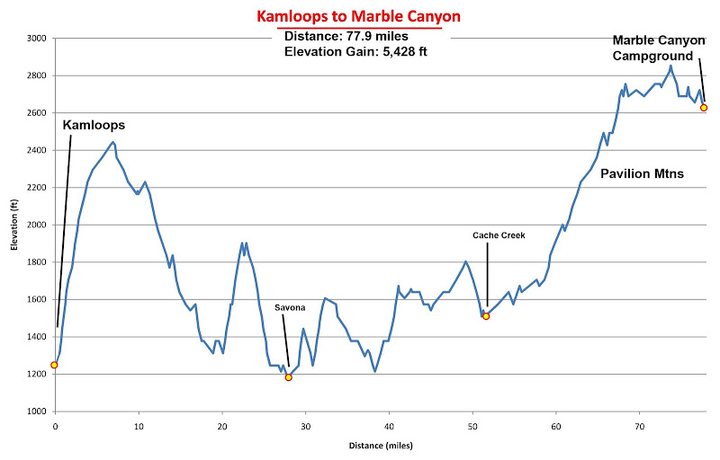 By Bike:
Distance: 77.9 miles
Elevation Gain: 5,430 ft
I woke up just in time to catch the tail end of the motel’s free continental breakfast. It was pretty well picked over by the time I got there, so I wasn’t able to gorge myself as planned, but it gave me an excuse to lighten my load by eating more of my own food. Not that this helped much because once again I only drank one beer out of the bottle 6-pack that I bought, and so once again I packed this valuable weight in my panniers, certain that it was worth the effort. Since I got to sleep so late the night before, I had slept in and was starting much later than planned and later than was ideal. I had a long ways to go, as I aimed to cycle about 90 miles to Lillooete, where I would be ideally positioned to attack the “death pass” fresh the next day.
Riding Around Kamloops
As I cycled out from the motel parking lot it was 9 am and already the thermometers outside were reading 95
o F! Uggggggh . . . Today there were a couple of hills I was dreading as they were as steep as 10%, but some of the hardest parts were unexpected, which was probably for the best. The first surprise crux was getting out of town. I had skimmed over this section during my preliminary planning, and I hadn’t fully appreciated that the climb out of town gained over 1,000 ft continuously, nor that it did so in about 8 miles. The first part, in town, was the steepest and it was unrelenting. The heat made it worse. I turned up my angry heavy death metal and sweated it out.
As I left town, the dry grasses of the previous day were gone, and in their place was sagebrush and – brown pine trees! Andre, my Swiss friend, wasn’t kidding! Speckled around the hills above Kamloops were many brown pine trees. They didn’t quite look like dead trees, and their sickly brown and gold colors, only a slight shade different from the brown and orange soil, made the landscape feel even more hot and arid.
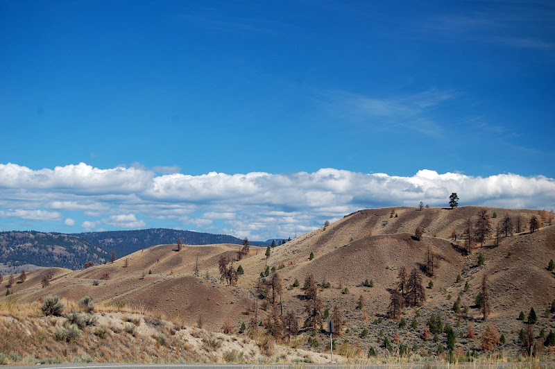 One of the city 'parks' in Kamloops
Atop the first climb I left the main highway, which continued on to Vancouver via the standard cross-country cycling route. The road I was on would continue to be Canada Highway 1 until I reached Cache Creek, but from here on out the traffic would be much better. Much less of it, and no more cross-country semi-trucks! Instead, most of the rest of the trip would be on true country roads.
As soon as I crested the summit I quickly lost all the elevation I had gained as the road dropped back down to Kamloops Lake. About as soon as I reached the shore of the lake, the road then climbed up again, steeply at about 5% to a road cut through a promontory above the lake. Another 500 ft of fun, and my thermometer was reading in the high 90s. At the top, I was rewarded with a nice viewpoint to stop at, with unexpectedly impressive views looking back along Kamloops Lake to Kamloops. Beyond the lookout the road dropped straight back down again about 600 ft to Savona, my only other town of the day to pass through other than Cache Creek.
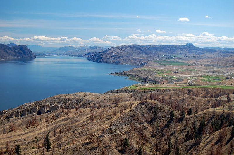 Looking back toward Kamloops from atop the promontory
As I left Savona I hit the first 8% grade hill. It was only 200 ft tall, but with my thermometer reaching 102
o F it was not the best place to practice steep hill climbing. The horizon rolled away above me, shimmering in the extreme heat. At a snail’s pace I worked my way up the hill, cresting the top and then . . . I immediately went straight back down the backside, losing all of the gained elevation. I had traveled 30 miles and gained 2,000 ft, yet I was still at the same elevation as what I had started at!
The next trough came quickly, too quickly as I was spending most of my time climbing and very little time on flats or coasting downhill. And then the hill climbed 400 ft at an 8% grade. Now my muscles were really aching from the heat and exertion, and I was feeling nauseas and burning through my 6 liters of water surprisingly fast. Finally I had reprieve as the next 5 miles was downhill as I returned to my benchmark elevation of 1,200 ft above sea level. The entire time my thermometer was hovering between 99
o F and 102
o F.
 Desert Country, Canada Style
 |  There are some mountains somewhere here . . .
 |
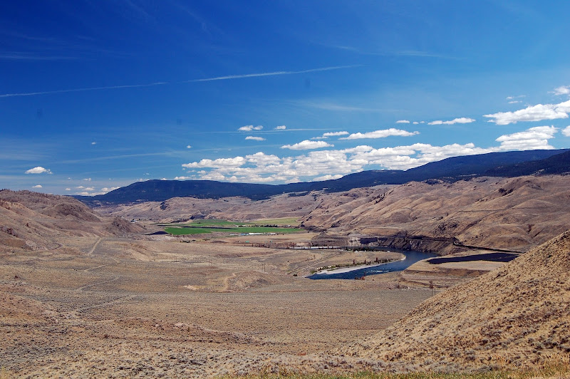 Lush British Columbia
Even with the warnings about this country, I was still shocked by it. The place looked and felt more like southern Utah than wet, mountainous British Columbia! The only signs of life here was the occasional irrigated farm alongside the broad Thompson River. According to the information signs, apparently the river was once a highway for boat traffic into the interior during Western Canada’s gold rush.
I climbed another steep 400 ft headwall and was feeling beat. I really didn’t feel that I had it in me to make it to Lillooete. I scaled back plans and decided to just make it to Cache Creek and find camping there. It was just too hot, and the steep ups and downs were just too demoralizing and taxing on my legs. I coasted into town and pulled into a Dairy Queen for luscious ice cream.
As I enjoyed my relief from the sun and pain of cycling, a road-tripper at the Dairy Queen struck up a conversation with me. He enjoyed mountain biking and he was fascinated with my trip ambitions. He had never considered someone cycling these types of distances, and as I told him more about my trip, he then inquired as to my methods.
Road-tripper: “So what is your secret? What sustains you on such long rides?”
Me (feeling a tad awkward and confused about this question): “Well, I usually have Gus about 1 an hour to keep hunger down and replace lost glucose. Snickers are very helpful too, as is Gatorade for replacing lost salt from sweating.”
Road-tripper: “No no, not that. I mean, how do you keep going and not tire out?”
Me: “I try to get into a good meditative rhythm, focus on the now and a sustainable pace and – “
Road-tripper: “No no, not that either. How do you keep your energy up? What is your secret?”
Me (Out of ideas of what he could be asking, feeling a little annoyed): “My I-Pod, rockin’ away to Nine Inch Nails, Tool, and Crystal Method.”
![Cycling to Marble Canyon]() Entering the Pavilion Mountains
Entering the Pavilion Mountains
This still didn’t satisfy the road-tripper with whatever he was asking for (perhaps he wanted to know what sort of drug/supplement I was using? None) so he finally gave up and left me alone.
![Sunset at Marble Canyon]() Sunset at Marble Canyon Lake
Sunset at Marble Canyon LakeJust as I was thinking of leaving the DQ to begin scouting for a campground or (as a last resort) a motel, a couple that was also road-tripping struck up a conversation. When I asked them about places to stay, they suggested a place called Marble Lake. Apparently it was along my route, except it was a ‘little’ ways out of town up in the hills where it was much cooler and more lush than the hot desert around Cache Creek. They said it wasn’t too far away and well worth pressing on to stop there. Of course, they made this judgment for cycling based on their driving the distance. It sounded nice to me, and although I needed to stop, promise of easy escape from the desert seemed too good to pass up, although if I actually knew how far away the campground was, I may have wimped out and stayed in Cache Creek.
![Marble canyon Sunset]() Sunset at Marble Canyon Lake
Sunset at Marble Canyon LakeIt was late-afternoon when I finally left Cache Creek, slightly rested and at least ready to go a bit further to reach this good campsite. Little did I know that I had another 30 miles to cycle and 1,400 ft to gain in order to reach this sanctuary in the Pavilion Mountains. I turned off the main highway and headed up into the hills. The air cooled quickly and soon the landscape became more lush again as I entered a new microclimate. This was nice. Apart from the occasional up and down that had me groaning, the riding was very nice. However, I kept expecting to find the campsite around the next bend, and the sun was once again getting low in the sky, with no campsite to be found.
Finally I crested the pass, and once again I pulled into my night’s camping spot just around sunset. The campsite was situated next to a beautiful lake in a small mountain canyon lined with some enticing-looking crags – apparently good for
rock climbing. As Marble Canyon was in a Provincial Park, there was a ranger there, Connie, who showed me to a good campsite and struck up a nice conversation. She lived the small town of Pavilion, just outside the Park, and was working here with her husband, Kim, also a ranger, who joined in on the conversation. Connie was very familiar with the “death pass” that I was so concerned about. Apparently the locals refer to it as “The Duffy”, named after the lake at its crest. She said that, yes, the first part is murderously steep, but eventually it eased up into a nicer road. Shoulders were decent, and the road was popular with cyclists, so cars would know to look out for me. Also, it was fairly well-shaded by pine trees.
Connie insisted that in the canyon I could easily access the river to refill water along the way, which was good news for me. I had planned to carry a full 6 liters of water on this segment since it was so long, but now I decided to reduce it to 3 liters and just refill from the river as I rode along. After hearing this good news, I once again drank the rest of my beers to lighten my load, ate up more of my food, and went to bed well fed and relaxed.
Top & Table of Contents
-
Part 0 - Cycling and Scrambling from Calgary to Vancouver
-
Part I - Calgary through the Canadian Rockies
-
Part II - Lake Louise & Lake O'Hara Areas
-
Part III - Mishaps in the Middle Ranges
-
Part IV - British Columbia's Desert?!
-
Part V - Crossing the Coastal Range to Vancouver
-
Epilogue
-
Images
Part V - Crossing the Coastal Range to Vancouver
Day 17 – Dying on the Duffy - Marble Canyon to Pemberton
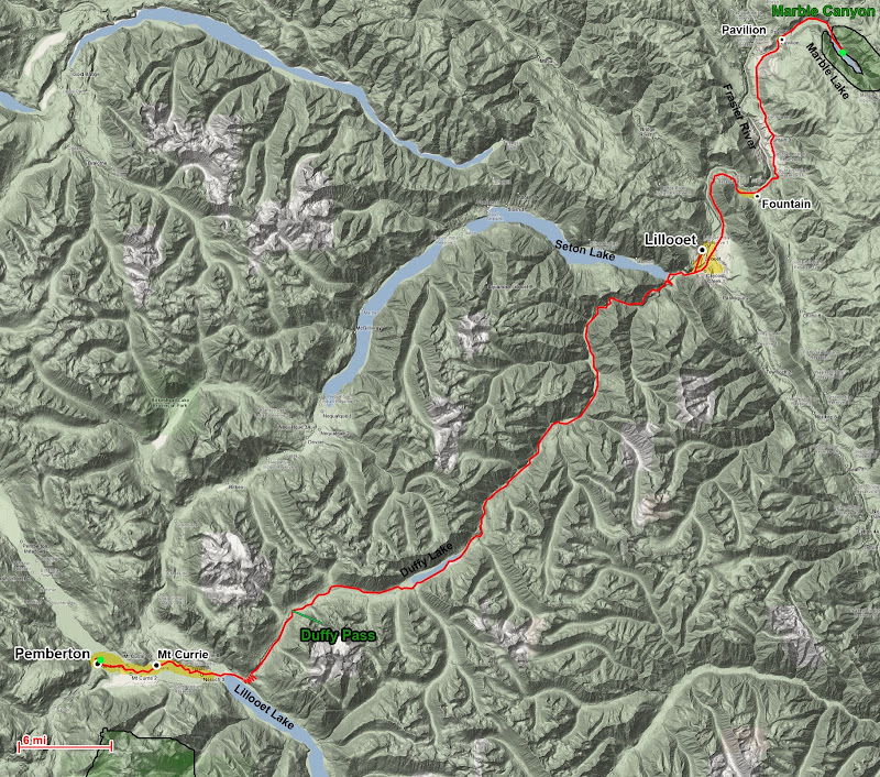
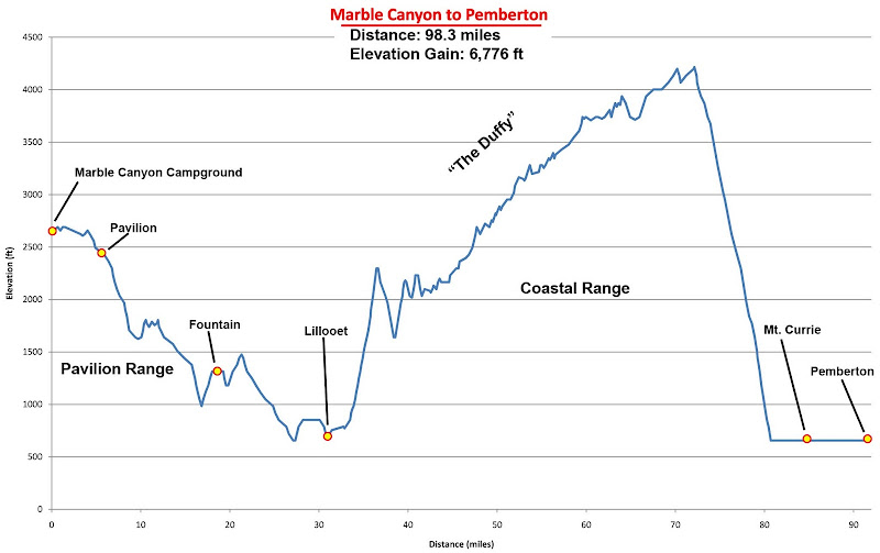 By Bike:
Distance: 98.3 miles
Elevation Gain: 6,780 ft
Today was the big day – I would finally meet my nemesis, “The Duffy” (aka. “The Death Pass”), for a fight to the death. The prize – seeing Whistler, riding into Vancouver, and completing my trip. And if I failed? Then I would have a sad, long retreat as I biked to the nearest town with a Greyhound station, probably a full days’ ride away.
Although I would have loved to avoid The Duffy, there was no way around it to reach Whistler. Whistler only has two roads leading to the outside world – Highway 99 (Sea to Sky Highway) to Vancouver, which was only completed in the 60’s, and the Duffy Lake Road. The Duffy Lake Road was created in the 1970s after it was realized that Whistler needed another road connection to the rest of British Columbia, as the rugged location of the Sea to Sky highway meant that it was regularly out of service due to avalanches and segments falling into the ocean in landslides.
There is a nice flat valley linking Lillooet with Pemberton, but this had already been filled with the Seton Lake Reservoir and a railroad. However, while a route for this backcountry access was being sought, a series of logging roads in the
Lillooet and
Cayoosh Mountains between Lillooet and Mt Curie grew together. So road planners just link together a route over the mountain range with the existing logging roads. As far as I know, the road was only paved in 1992. Beyond this and my research on Google Maps determining the elevation gain and road grades (many +10% slopes, none less than 5% for the first 1,500 ft), I had absolutely no information about the road or what to expect.
 Comparisons of the Duffy Lake Road to other cycling climbs
That was until yesterday when a local ranger at Marble Canyon eased my fears by saying the road had decent shoulders (so I could stop or walk by bike if things got desperate), somewhat regular cycling traffic, and that I could easily access the creek throughout the canyon to refill water. In light of this information, I traveled at half capacity with water. Since the pass looked to span the middle 1/3 of the Coastal Range, I also expected a lush, cool mountain pass. Between this information and expectations, and the fact that I had made it to here from Calgary without using my granny gear, I felt confident that I could make it over the pass, even with 80 lbs of gear. And once that was over, I only had a short ways on flat ground to reach the hostel in Pemberton.
I had hoped to make it to Lillooet the day before, as it is the last town before the pass, making it an ideal starting point. But I was wearing down enough from the long distances and intensive heat that I fell short, spending the night 30 miles away in the very nice Marble Canyon Campground. I rose early and was on the road by 8 am. As I descended out of the Pavilion Range through the town of Pavilion, the landscape changed again from cool green forests to hot dry and rocky grasslands and arid mountains. I had two good humps to get over as I reached Fountain, and then a nice long downhill towards the surprisingly arid town of Lillooet. Annoyingly, I had to climb a steep hill and backtrack up the canyon several miles after leaving the highway to reach Lillooet, but I couldn’t pass up an opportunity to have a good last meal before the crux of the trip.
Approaching Fountain
I had a large chicken teriyaki sandwich at Subway and a lot of sides to top off for the ride, chugging as much water as I could as I hung around the restaurant. I tried to procrastinate and delay the inevitable, but by 10:30 am I decided I had better get moving, so I headed out. By this time it had gotten very hot outside and my bike thermometer was already reading 95
o F! I learned later that despite appearing to be 1/3 of the way into the Coastal Range from the interior, Lillooete was actually one of the hottest towns in British Columbia! This was an added difficulty for the climb I had not expected.
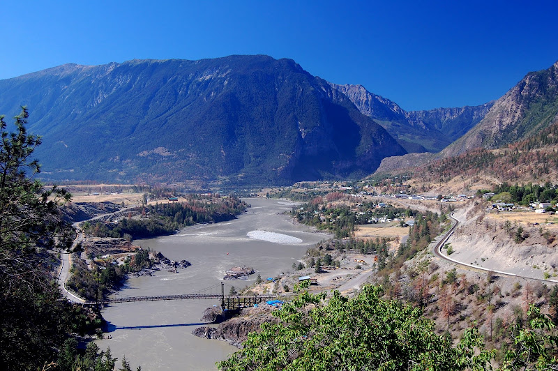 Lillooet
After I left town, it wasn’t long before I hit the start of the major hill climbing. I had a nice warm-up of a short 11% hill – my steepest yet. Here I finally broke out my secret weapon and switched to the third chain ring Granny Gear on my bike. This was as easy as it was going to get. The hill didn’t last very long before flattening at a viewpoint of the Seton Lake Reservoir, the watery barrier that blocked an easy flat route to Pemberton. I enjoyed my last few minutes of relative comfort for the day here, looking at the flat reservoir winding away through the mountains, and then up at the Duffy Lake Road as it switch-backed up a headwall to enter the canyon above. And then I launched into my assault in full force.
 |  |
| The Duffy Lake Pass | Seton Lake, blocking the easy way to Pemberton |
I dropped into my lowest gear, and despite attempting to go as easily as I could, the sustained steepness of the road soon began to get to me. I had to concentrate extremely hard on every muscle contraction to push through pedal revolutions. Creeping uphill at a depressing 3 mph, I tried my best to NOT pay any attention to reaching the top – I would get there when I got there. I began to take mini breaks every 5-10 minutes, and despite the intense pedaling an ensuing soreness and nausea, I didn’t stop for reason of fatigue. Instead, I stopped for the intense heat as temperatures were in the mid to high 90s and the road was NOT shaded here. I tried to ride slow mostly to keep from overheating, but despite my best efforts, nausea would creep in and my heart rate would rise into the high 180s. This was O.K., but as soon as I started to feel chills in my spine, arms, legs, or head, I immediately stopped and guzzled water to avoid the imminent onset of heat exhaustion.
I think Connie was thinking more about the majority of the pass and not the first headwall, which is passed quickly in a car, when she said the road was shaded and water was accessible. Ascending on the steep canyon wall, there was absolutely no access to water. Even though the first climbing only lasts for about 5 miles, it is so steep that I was on it for well over an hour. Between time spent on the climb and the intense heat, I soon ran out of water, cursing Connie’s suggestion to carry less as I sucked the last few drops out of my camelback.
At one point I reached one of the steepest sections of the road (about 15% is my best estimate based on topos and the road grade signs) as it wound through another series of 180 degree switch backs up the mountainside. The shoulder narrowed, and as I was wary of riding too far out in the road, I hugged the side, a few inches away from a concrete k-rail. At my slow speed on the steep slope, I couldn’t help but wobble a bit, especially when the (fortunately) rare car passed (no R.V.s here!).
![Walking the bike]() Walking my bike on the unpaved section. My 'incident' happened at the curve below
Walking my bike on the unpaved section. My 'incident' happened at the curve belowAs I neared the second switchback, I grazed the k-rail with my front right pannier, and in one slow “rrrrrrrip!” the concrete wall pried the entire pannier mount off my front wheel! Unbalanced, the front wheel swung outwards and I stood up on the road to avoid toppling over.
Crap! and a variety of other obscenities poured forth. This was NOT what I needed right now. I walked my bike up to the switchback where there was more space on the outside of the road to inspect the damage. A critical piece holding my pannier to my bike was a very long screw that was perhaps close to 2” long. Fortunately the screw had bent and then snapped in the center as the pannier was pried off, breaking far away from the threads in my bike frame and pannier mount, and nothing else was broken. Unfortunately, out of all of the spare parts I brought, I had neglected to bring such long screws for the front pannier mount (I had replacement screws for every other part of my bike, though).
It would be impossible to continue riding with this breakdown, and although I didn’t have any way to reattach the pannier, in lack of any better ideas, I plopped down on the roadside and began untwisting the bent pieces of screws out of my bike with pliers.
![Mountains above the Duffy]() Mountains above the Duffy Lake road.
Mountains above the Duffy Lake road.
In a second incredibly lucky break on my trip, it was only about 10 minutes before a van stopped on the pullout to see if I was all right. Riding in the van were Aniel and Mark, from Boulder, Colorado. They were physicists working at the university there, and Aniel was now moving to a position in Fairbanks, so Mark was driving Aniel up there, taking some detours along the way for a scenic road trip. Inside of their van, then, they just happened to have all types of spare parts for vehicle repair (their van was a piece of crap that had to be fixed several times already) and lab equipment. They might have some spare parts to fix my breakdown! After moving out of the way for a logging truck that was attempting to make the turn around the tight switchback, my saviors set to work helping me out.
Aniel and Mark also had gallons of extra water, and while Aniel tried various screws to find one long enough and the right diameter for my pannier, Mark filled up my camel back and two more liters of water bottles. And Aniel found a screw that worked! It was a little long, but barely short enough to fit in through the pannier mount and screw into the bike frame. Bizarrely, tearing off my front pannier was extremely fortunate for me, as it was quickly repaired and incidentally solved my serious water problem.
We said our farewells and parted ways. But I wasn’t on the move for long before I reached a short 100 yard section of road that was unpaved. The vehicles driving uphill had to slow down to gain traction in the soft soil, and even the cars had trouble driving up this section. There was no way I was going to even attempt to ride up that, so I dismounted and walked my bike uphill through it. Between the steep hill and my heavy bike, this was surprisingly tiring. Although my slow 3mph climbing speed on my bike was slow enough to tempt me to walk, it was apparent now that it was actually still faster and easier to ride my bike up these hills rather than walking it.
Shortly after I finished the dirt road section and resumed cycling, I came across a man lounging on the rear hatch of his pickup truck on a shady roadside pullout. He was really surprised to see me and my touring rig heading up the pass, and as I crawled by huffing and puffing, he said in astonishment, “You’re a better man than I.” By the minute I was feeling crazier and crazier for attempting the pass loaded down like this.
After what seemed like an eternity, I crested the hill and dropped down steeply on the other side. I crossed a 1-lane wooden bridge as the road crossed the canyon and resumed its ascent on the other side. The grade stayed high, but each hill was shorter and shorter, offering some short reprieve to rest up for the next climb. At the last steep hill, as I crawled over the crest and the valley below rolled away behind the crest off the road, I turned around to see a sign saying “Trucks Gear Down. 13% for 2 km,” and this section didn’t even feel like the worst one!
At last I was over the worst of the climb, and I knew that I was going to make it. I was going slow enough that I didn’t know if I could make it to Pemberton that night, but at least I was going to finish the ride eventually. I had finally climbed high enough that the air had cooled and I was once again surrounded by thick pine forest. The rest of the climb was bittersweet. The road grades had eased up to manageable levels again, and I only had to net 2,000 ft more climbing over 40 miles to reach the pass. But the road was not very fully developed, and it rose and fell with every undulation in the terrain, sometimes climbing high up on the side of the canyon before dropping back down again to follow the river or cross to the other side. These undulations were hard on the morale, especially the ones where the hills dropped down so far that the road disappeared from sight and I couldn’t see where it resumed climbing again.
 |  |
| Still climbing? | Still have more to climb! |
But I was enjoying myself, admiring the views and making good progress once again. At least the road was very picturesque, offering occasional views over the forest, and every now and then crossing the canyon creek over old 1-lane wooden bridges. By this time there was more road traffic as I began to pass trailheads and picnic areas. Many of the car travelers honked their horns and cheered as they passed by, congratulating me for making it up here loaded up as I was.
The old wooden bridges on the "Duffy"
Foliage on the Duffy

One highlight of the day was meeting the
beer goddess (sorry, I have lost her name since then). I was cycling along on a straightaway when an SUV pulled up alongside of me and matched my speed. The window rolled down and inside was a kid and his young mother. She hailed me and I took out my headphones to see what was up. She just wanted to chat, curious about what I was doing, so as I rode along on the road we visited, occasionally taking breaks to let cars pass.
 Beer Goddess and her son
![Chasing the sun on the Duffy]() Fading daylight on the Duffy
Fading daylight on the DuffyFinally the
beer goddess said she needed to get going on her way and tool off, but a few minutes later she came speeding back the other way, turned around, and pulled up alongside me again.
Would I like a beer to celebrate my imminent completion of The Duffy?
“Of course!” I said, “Although I can’t drink it now. I’m so exhausted and dehydrated that I don’t want to get drunk before the descent into Pemberton.”
Insistent on giving me the beer, the
beer goddess said she would find a pull-out where she could leave it for me to pick up, so she sped off to hide the beer. Then she sped back to report that she wanted to make sure I didn’t miss it, so she followed me a while longer and as she told me about things to do in and around Vancouver and how nice and accommodating everyone in the area was. Finally we found a pull-out, she awarded me my victory Guinness. What a day!
By now it was beginning to get shady as the sun was getting low in the sky again. I was getting close to the pass, but once again I had to race the sun. I didn’t dare do the extremely steep windy descent in the dark, so if it got dark before I reached the pass I would have to bivvy out in the forest. Tonight I was set on reaching the comfort of the Pemberton Hostel, so I picked up the pace.
Duffy Lake and Pass
I was blown away by the beauty of Duffy Lake. The view came up all at once, with no warning – a beautiful alpine lake lined with flowers, and rising in the distance, a rocky, ice-covered summit. I was officially in the Cascade Range.
![Racing Downhill]() Descending the Duffy
Descending the Duffy
The road followed the lakeside with wonderful views the entire way, and then went through a couple more false summits before the final rise. It was getting dark – maybe only another 15-20 minutes of visible light – but the descent would be very fast, dropping 3,500 ft in about 8 miles. It was time to go for it! I pulled hard on the brakes as I passed a sign saying “Caution. Extreme Grades Next 13 km. Brake Check.” The road really
dropped at this point, and my hands were staining under the effort to pull my brake levers, trying to keep my speed reasonable for the hairpin turns that I knew were coming.
Before I knew it I had descended from 4,200 ft to 750 ft above sea level just as it got dark. From here on the road was completely flat, and I raced to Pemberton in the fading light. Just as it seemed about to get pitch black, the sun came out from behind some thick clouds behind the horizon, and lit up the smooth, velvety clouds in the sky and creating one of the most impressive sunsets I have ever witnessed. The sky was an errie green-blue at the horizon, a silhouette of mountain peaks. Above this layer of color was a smooth sheet of clouds covering the sky and glowing fiery orange, gold, pink, and red as the sun set, fading into the blackness of the night sky above as one looked higher. I could hear the angels singing, so to speak, as this beacon of light shown above my destination for the night.
Mt Curie Sunset
I thought my day was over, but there was still more to come. As it turned out, the directions I had printed out from Google Maps to the hostel were incorrect. As I rode along in the dark, I found the road it was supposed to be on, only to reach a dead end and fields beyond. Just as I came to this, realizing that there was no hostel here, I looked to me right to see the backlit silhouette of a woman, waving to me from her front porch.
“Great,” I thought, “maybe she can help give me directions to the hostel.”
I turned around and rode up to the house to explain my situation. The blonde woman was in her early 30s and
very outgoing, probably aided by the drink in her hand. I explained my problem and she said that that address was actually on the other side of the highway, but there was a good shortcut through the field at the end of the road. Great, I would just head over there. But just then the woman’s younger blonde sister, in her early 20s, and her perky friend popped up at the door, also very outgoing and mildly drunk.
“What are you doing out here? . . . Really?! Wow, that is sooooo cool (imagine some valley girl talk here) “
I said I should get going to the hostel since I needed to get dinner and some sleep so I could press on tomorrow and one of the girls said “oh, come on. Come to the bar with us! You can get food there!” The older woman suggested we call the hostel to make sure there was room.
“Yes, they have space, but the lady sounded crazzzy. I don’t think you should stay there – she sounded really off and a little grouchy. You can stay here! Really!”
“Oh yes!” said the two younger girls. “You should stay with us! It’s just the three of here, so we have space – a hide-a-bed in the living room. You can get your food and some drinks at the bar with us and then come back here! Pleeeassse!”
Ummmmmmmmm . . . . is this for real?
 "Welcome to the Castle Anthrax. My name is 'Zoot'. Just 'Zoot'."
I felt a little bit like Sir Galahad the Pure in “Monty Python’s and the Holy Grail” being tempted into staying over, almost by force, while trying to politely refuse. Ultimately I gave in, as this was just too strange to pass up.
What followed was a feast of food and alcohol as I ate several heaping plates of virtually free chicken wings, about 4 or 5 beers, and several shots with the girls and their friends at the bar. No, nothing else happened – it was a sweet innocent night of R&R, mingling with locals in the bar. By the time we got back to the girls’ place, I was dead tired and fell right asleep.
Day 18 – Running Out of Steam - Pemberton to Whistler

 By Bike:
Distance: 23.5 miles
Elevation Gain: 2,440 ft
I slept soundly last night, utterly wasted from my ordeal on the Duffy. This morning I awoke with a mild headache from dehydration and last night’s drinking. Ugggg . . . I felt better after chugging water, but I was still completely exhausted and very sore, half-limping around the kitchen as I gathered my things. Today would normally be an easy day, cycling about 20 miles and gaining 2,500 ft to Whistler, where I planned to spend the next few days climbing out of the Lake Garibaldi area. I felt so sore and weak that I dreaded the thought of more hills, but excitement for hiking and scrambling in the Coastal Range drove me onward.
In an attempt to recover, I ate two full breakfasts at a restaurant in town, taking my time and starting out stuffed at around 11 am. As I cycled out of town, despite the ground being flat, it was slow and painful pushing the pedals – my legs felt as if they were seizing up. Although I had made it over the Duffy, the +300 miles covered over the last 3 days had been too much, and my physical condition was definitely deteriorating - definitely a good time to wrap up the trip! About a mile out of town I heard a sudden “whump!” behind me and my rear wheel locked up. Unable to peddle further, I stopped cold, turning around to see that my rear rack had just broken, dropping all of my gear onto the rear wheel.
 |
| Rack Damage |
Fortunately, this wasn’t a repeat of the dreaded screw-shearing incident. This time the metal underwent a clean, brittle fracture. My best guess is all of the bumpy riding (especially on the Duffy) caused a fatigue fracture in the metal, since the fracture wasn’t initiated by any sudden shock to the system. Unable to move the bike with 60 lbs of gear on the rear, I filled up my Andanista pack with as much as I could, balanced the rest of my gear on the bicycle seat, and walked back into town.
Once again I had a breakdown that would have been impossible to fix on the road, and once again I got very lucky. I saw a bike show in Pemberton on my way out, so I walked back there, purchased a new rear rack (which barely had sufficient capacity for the weight) and replaced the broken one. I thought it was interesting to see that I had beaten up my broken rack so badly that the screw threads in the clevis head was stretched from the heavy weight that had been bearing on the screw. Repairs went straightforward, and I continued a long, uneventful slog up into Whistler.
The canyon wasn’t too scenic, and once again I was riding on the shoulder of a highway, with traffic screaming by. It turns out that British Columbia also has a bad habit of marring scenic views from the road by strategically stringing high voltage power lines across the views. I then hit major construction as I reached Whistler. Apparently Whistler is next in line to hold the Winter Olympics (I had no idea!) and I found out that the Whistler area and the entire highway into Vancouver was undergoing major construction in preparations for the Olympics.
Tonight I planned to stay in the Whistler Hostel, which is across Alta Lake from the town. Picturesque yes, but also fairly isolated. I cycled over 2 last painful humps, and as I coasted up to the garage for the hostel, took a spill as I caught my feet trying to take them out of the toe-clips. I was tired.
At the hostel I found that it was full! M.C., the desk guy there, was really great as although there weren’t any vacancies, it was late in the day and there was a private room who’s occupants still hadn’t arrived. He thought it a safe assumption that they weren’t going to show, so he gave me the room for the night.
As I checked the weather that night, I was disappointed to see that the earlier forecasts for clear weather in the area had been replaced by a week of stormy weather starting in 2-3 days. Not good for mountain climbing, and I didn’t want to be caught in the rain when cycling along the Sea-to-Sky Highway, which was now one long construction zone. I would have to nix my plans to scramble up the Black Tusk and other peaks in the Lake Garibaldi area.
I decided that I would have a casual day around town tomorrow to recover, and then head into Vancouver early to beat the rain.
Day 19 – Hiking on Mt. Whistler - Rest Day

 By Bike:
Distance: 4 miles
Elevation Gain: 200 ft
On Foot:
Destination: Whistler Mtn, Piccolo Summit, Flute Summit
Distance: 9.5 miles
Elevation Gain: 3,180 ft
Today I slept in, wandering down to the dining hall at a comfortable 11 am. I took my time enjoying breakfast and admiring the nice view of Alta Lake and Whistler Peak rising above. I wasn’t in any hurry to get moving, and I was still unsure what to do with the remainder of my trip. I was too tired to do much today, and the imminent rainy weather put a stop to all of my plans for hiking and scrambling in the Coastal Range, leaving me in a downer mood. Also, I needed to figure out how I was going to get into Vancouver.
As I worked my way across Western Canada, I learned more about the Sea-to-Sky highway from locals, and the news wasn’t good for me, especially after my close call crossing Roger’s Pass. First, the entire length of the highway from Whistler to Vancouver was essentially one long construction zone in preparation for the upcoming Winter Olympics. Second, the road before the construction had very tight turns and bad shoulders. Apparently enough cyclists are hit by drivers rushing between Whistler and Vancouver that some people call the highway the “Sea-to-Die Highway”. On top of that, the forecast was for rain in 2 days, which could possibly break while I am en route to Vancouver.
Upon hearing my debate on what to do, one of the guests in the hostel strongly warned me not to do it. He was driving a van for hire and was already taking some clients into the city today. I could play it safe and join him. Still, he did have a conflict of interest since I would be paying for the ride. Also, it seemed a real shame to have come all this way only to stop short of reaching Vancouver, or even the West Coast.
M.C. helped me out here, suggesting that I could at least cycle to Squamish, and if the weather got bad or construction was too bad, I could then bus the last stretch along the coast. As to my reservations about the highway, a lot of the judgments I had heard were second-hand and casual observations from drivers and not cyclists. Yes, it could be dangerous, but was it really any worse than many of the miles I had already cycled? Although most cyclists in the area were mountain bikers, M.C. knew of a bike shop in Squamish rid employees that were into road cycling, and a call there confirmed that yes, the road was a little tight, but from the point of view of one guy who cycled it regularly, it was perfectly safe in good weather if you were careful and highly visible (e.g. my tall orange flag would help a lot). In the end I decided to go for it, and if the weather deteriorated early, then I would take a bus from Squamish as a backup.
![Overlord Mountain]() Overlord Mtn
Overlord Mtn
Some more problems to deal with were where I would stay the next few days. All of the hostels in Vancouver were full for the weekend (doh!) but some persistent internet searching eventually turned up a vacancy in the Gastown district downtown. Also, tonight there would be no room available at the hostel, but M.C. was fine with me sleeping discretely behind the employee cabin in my bivvy sack as long as I didn’t get caught by the manager.
M.C. was also very generous in giving me suggestions of what to do in town that wasn’t too taxing, since I wanted to get out but wasn’t sure how much I could do. He gave me some maps and said at the very least I should take the gondola to the summit of Whistler Mountain to hang around. The summit had excellent views of the area, including the peaks I had wanted to climb. I read up in some guidebooks at the hostel, M.C. lent me a trail map for the area, and I took off to salvage the day.
The ride into town as only 4 miles, but it felt much longer. I really hoped I recuperated soon, since I had 80 miles to cover the next day. Whistler was bustling with activity when I rode it. There was a BMX tournament going on and the area was packed with spectators and sponsors – quite the zoo! I enjoyed watching some of the acrobatics before taking the gondola up.
I really felt like I was cheating taking the gondola to a summit, and riding up in a crowded car with tourists really felt strange after hiking and cycling alone for the past few weeks. But I had no choice but to tolerate the crowds and enjoy the mountains in spite of them. One benefit of taking the gondola was that it gave great views of the Whistler ski resort. For summer the ski runs had been converted to mountain biking runs, with tight twisting tracks winding through the trees, and various obstacles set up for aerial tricks. Even the ski lifts had been modified to carry up mountain bikes! It was really entertaining watching the occasional mountain biking come flying out of the trees, take a jump, and then disappear back into the woods below.
![Whistler]() Whistler seen from Whistler Pk
Whistler seen from Whistler Pk
I arrived on the summit without any real plan of what to do. I figured I would just see what felt good. In a desire to escape the crowds, I hike hard and fast the remaining few hundred feet to the summit. As I had experience during my time in the Canadian Rockies, even though I was wasted for cycling, and in general physically I felt kind of ‘blah’, my legs where plenty fresh and strong for hiking and scrambling. I lounged for a while on the summit enjoying the panoramic views, and then decided to take the most remote trail I could find to get away from the crowds.
The Musical Bumps Trail
| ![Trail over Cheakamus Lake]() The Musical Bumps trail traversing above Cheakammus Lake
The Musical Bumps trail traversing above Cheakammus Lake | ![Castle Mountain on the Musical Bumps Trail]() Castle Mountain
Castle Mountain | ![Black Tusk from the NE]() The Black Tusk
The Black Tusk |
The Whistler area felt like one gigantic amusement park, with disclaimers galore and everything nicely packaged for a controlled environment of fun - even the trails were well signed, and rated according to a color-coded difficulty scheme like ski runs. According to the map, I was taking the black line, which was an ‘alpine‘ trail rated ‘most difficult,’ like a black diamond ski run. I was used to such ratings for skiing as
![Castle Mountain]() Castle Mtn
Castle Mtn
I grew up skiing in resorts, but seeing trails signed and mapped as such seemed very strange. I decided to link this trail with a route called “Musical Bumps” that followed the network of trails over Piccolo and Flute Summit. Just as I had wanted, the trails on this route were just long and rugged enough to deter most of the tourists from coming this way. Soon I was in a more natural and serene environment again. The route was just perfect for my rest day. Not too hard, and surrounded by blooming wildflowers. The views south to rugged Mt Garabaldi, the Black Tusk, and Castle Mountain rising out of the glaciers were incredible. Cheakamus Lake spread out below, its colors a uniform and unreal sheen of deep blue-green.
![Cheakammus Lake]() Cheakammus Lake
Cheakammus Lake
Before long I made it to Flute Summit, and then took loop back, this time following a network of trails on the east side of the ridge back to the gondola. I grabbed another full dinner in town, cycled back to the hostel just in time to catch the last of the alpenglow on Whistler Mountain fading away. I set up camp between the lake and employee cabins and went to sleep early, as I planned to sneak out early the next day.
![Whistler Pk at Sunset]() Whistler Peak at sunset
Whistler Peak at sunsetDay 20 – Sea-to-‘Die’ Highway - Whistler to Vancouver

 By Bike:
Distance: 82 miles
Elevation Gain: 4,830 ft
Today I hoped to beat the approaching rainstorms and cycle the last leg of my cycling tour, from Whistler to Vancouver via the
Sea-to-Sky Highway. In my direction, the highway descends 2,000 ft from Whistler through the mountains, reaching Squamish and the Pacific Ocean.
![Sea-to-Sky Highway along the Howe Sound]() The Sea to Sky Highway seen from Horseshoe Bay
The Sea to Sky Highway seen from Horseshoe BayFrom sea level, the highway straddles the steep mountainsides as it travels along the Howe Sound from Squamish to North Vancouver, crossing various seaside settlements along the way. Finally, the highway crosses the Lions Gate suspension bridge, passing through Stanley Park and right through downtown Vancouver. Today’s ride would take me from the mountains to the coast to a miniature Manhattan – quite the variety for 80 miles!
To give a sense of how rugged the terrain is that the highway passes through, until the 1950s the coastal settlements were only accessibly via ferry. The highway didn’t reach Whistler until the 1960s, creating Whistler’s first physical link with the outside world. The cliffside above the how sound is steep and unstable enough that the road is regularly shut down from landslide damage. In fact, at the start of my trip a
landslide had wiped out a stretch of the highway, which had since been rebuilt before I made it to Whistler.
![Morning on Alta Lake]() Alta Lake
Alta LakeI woke in time to watch the sun rise of the still waters of Alta Lake, and then quietly gathered my gear that was stored inside the hostel and was on the road by 7am. Although I was still really sore and tired from the previous day’s wear and tear, once I got moving on my bicycle I gradually loosened up, feeling better as I moved on. There was a light rain falling as I left Whistler, which cleared up as I lost elevation.
![Coastal Range West of Whistler]() Coastal Range West of Whistler
Coastal Range West of WhistlerAbout halfway to Squamish I hit road construction. Although it was slightly more stressful, the traffic along the highway was never too bad, and traffic was light. Unlike my experience with drivers on the interior of British Columbia, the drivers here were courteous and drove safely enough – no one came up from behind me honking their horns here! By the time I reached Squamish, the sun was shining in full force and the threat of rain seemed far away.
As I passed through Squamish, the Chief loomed high above.
![The Chief at Squamish]() The Chief
The ChiefThis is a large granite wall, a miniature El Cap, that has many excellent climbing routes on solid granite. As I neared the far end of town near the Chief, a road cyclist turned onto the road in front of me. Dressed to race, this guy looked ready for a nice workout riding to Vancouver. He turned off the road just before the Howe Sound, but later he caught up and passed me again.
![Howe Sound]() The Howe Sound
The Howe SoundI was blown away by the beauty of the Howe Sound. The mountains are gorgeous, and the water an almost tropical shade of light blue. Here and there, sailboats dotted the water – I would LOVE to sail here! The road would climb up a steep grade, traverse high on the cliffs, and drop down to the water at each beachside town. Every inch of the highway was scenic.
![Howe Sound from Porteau Cove]() Porteau Cove
Porteau CoveTo my surprise, I caught up to the cyclist again as I neared Porteau Cove. He was just barely pulling in, and I followed to check out the area. There was a sunken ship here and apparently some good snorkeling (cool). The water here was warm enough to wade in, really not any colder than the water off the coast of San Diego. As the waters off of San Francisco are frigid, I was really surprised to find such mild water this far north. I guess the water is shallower here and protected by the cold currents of the Pacific by Vancouver Island.
I continued on, making excellent time and stopping regularly along the way to take photos. The day was bright and sunny – absolutely perfect. As I neared Lions Bay I caught up with my cyclist friend again. It was almost as if we were jockeying for position as we headed into Vancouver. This time I guess he finally noticed me and didn’t appreciate me in my big burly touring rig catching up to him on his light racing bike. He seemed startled and then took off at a sprint to get away.
![Howe Sound and Coastal Range]() The Howe Sound and Coastal Range
The Howe Sound and Coastal RangeI pulled into Horseshoe Bay just as my right knee and quadricep started to burn out. It ached in the joints and deep in the muscle. It was sensitive enough that I had to switch to using my left leg for my starting stroke, and I became lopsided in my pedaling. I was finishing my cycling tour not a moment too soon.
Horseshoe Bay is a major ferry departure/arrival point for traveling from Vancouver to Vancouver Island and the numerous other islands along the West Coast of British Columbia, so it was really active. I enjoyed the hustle and bustle of Horeshoe Bay while I enjoyed my late lunch on the side of a fountain, and then pushed on to finish the last few miles. Here I left the highway as it became a double-decker freeway and instead followed roads along the coast.
As I rode along the dips and turns along the coast, I made sure to stop by Lighthouse Park. This park is on a promontory in West Vancouver and it contains some nice groves of coastal rainforest. Although cycling wasn’t allowed, I didn’t want to leave my bike unattended. I figured no one would have a problem if I walked my bike in rather than riding it. I dismounted and wandered around the lush forest, pushing my bike carefully along the way, up and over the occasional rocky section. I wandered around to the east side of the promontory and found an excellent rock slab to eat a snack on. Beyond, the modern high-rises of Vancouver rose up above the Burrard Inlet, itself an area of frenetic activity as dozens of cargo, tanker, and cruise ships passed in and out of the busy port.

The last few miles of my ride were just perfect. Terrain was easy, traffic light, and route finding straightforward. I paralleled the beach of West Vancouver, walked my bike up onto the Lions Gate Bridge, and then rode across as the sun set, coasting through the air over the Burrard inlet and the sea wall surrounding Stanley Park, passing right through the heavy forest, still in the air on the bridge.
 West Vancouver from Lions Gate Bridge West Vancouver from Lions Gate Bridge |  Stanley Park's Sea Wall Stanley Park's Sea Wall |
The separated bike path remerged with the highway as I wound through Stanley Park, coming right out of the thickly wooded peninsula straight into the downtown. Tall buildings galore, but despite density the traffic was light and cycling on the city streets was a breeze. The people here were very friendly too, helping me to direct me to the hostel. I rode in to the hostel just after dark.
 Vancouver at Dusk
Top & Table of Contents
-
Part 0 - Cycling and Scrambling from Calgary to Vancouver
-
Part I - Calgary through the Canadian Rockies
-
Part II - Lake Louise & Lake O'Hara Areas
-
Part III - Mishaps in the Middle Ranges
-
Part IV - British Columbia's Desert?!
-
Part V - Crossing the Coastal Range to Vancouver
-
Epilogue
-
Images
Epilogue
So in the end, despite the mishaps along the way and nixing some plans at the end, my trip was a resounding success. My idea of combing climbing with cycling worked perfectly, and I found that it is entirely feasible to alternate cycling days with climbing days, one being a rest from the other. I also got to experience the joy of climbing peaks completely by manpower alone, including the approach!
Experiencing the countryside is quite a different experience at 10-15 mph then in a car. You have a much fuller experience of the terrain you pass through. For example, I had no idea how smelly the highway gets from diesel or that logging trucks are nature’s air freshener, spreading pine freshness wherever they go. And as it was my first cycling tour, I learned a lot along the way as far as how to do things better next time, because there definitely will be a next time. One thing to count on is Murphey’s Law – I cycled over 700 miles and never got a single flat, yet I had several major breakdowns despite a pre-trip checkup that would have been impossible to fix on the road.
I made it to Vancouver the day before the rains started, but rain didn’t stop me from getting out and enjoying the city. It is an excellent city to spend a rainy day in, especially Stanley Park. The pain in my right leg finally eased up and didn’t slow down my wandering at all, although the numbness in my hands lasted another 6 weeks (I’ve always had this problem riding, which has since gone away, I think through better riding form).
I also had one last little adventure in town as I arranged departure plans of taking a Greyhound to Seattle to see a friend before jetting down to L.A. for a job interview and back to Berkeley to begin my last semester of graduate school coursework. I needed to get another bike box to pack my bicycle in for transport on the bus (and shipping in Seattle), so I biked with my loaded touring rig to a bike shop in Yale Town to pick one up. The problem was the bus station was several miles away next to China Town.
Now, how to get my loaded bicycle and the bike box over there? I lashed the 3.5'X4.5’X1’ cardboard box diagonally across my back with used bicycle tire tubes and cycled along False Creek. Quite the sight since the box looked larger than I was. As I pulled in to the bus station, by bike fully loaded, with the huge box slung across my back, I rode up to a guy waiting out front. Feeling playful, I happily proclaimed: “See, you really can take everything with you!”
![See, You Really Can Take Everything With You]()
![Sunset from Sunset Beach]() Sunset seen from Sunset Beach in Vancouver
Sunset seen from Sunset Beach in Vancouver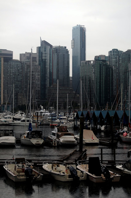 Post Trip Seattle Wandering
Top & Table of Contents
-
Part 0 - Cycling and Scrambling from Calgary to Vancouver
-
Part I - Calgary through the Canadian Rockies
-
Part II - Lake Louise & Lake O'Hara Areas
-
Part III - Mishaps in the Middle Ranges
-
Part IV - British Columbia's Desert?!
-
Part V - Crossing the Coastal Range to Vancouver
-
Epilogue
-
Images
Images not on Summitpost
I tried not to submit too many photos to SP that weren't mountain or climbing related, or redundant. If you want to see more photos of the trip, feel free to check them out in the following links (although most are in the report):
Links


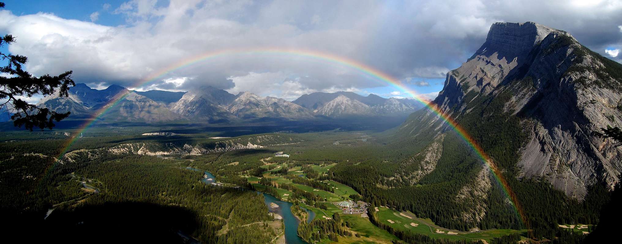


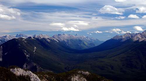


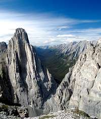


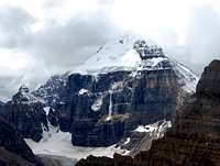
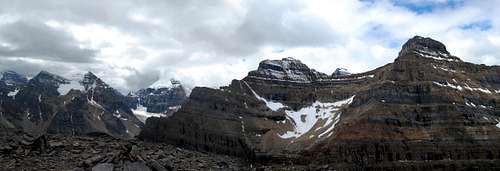

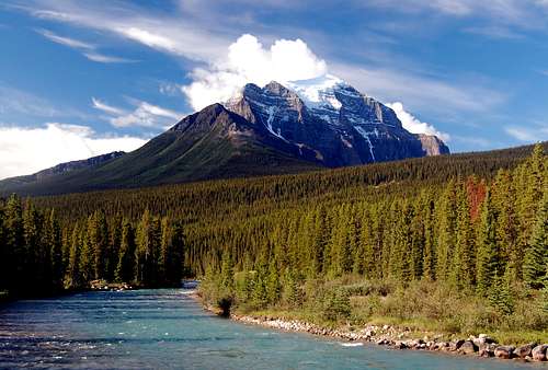


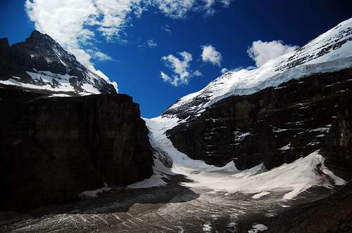


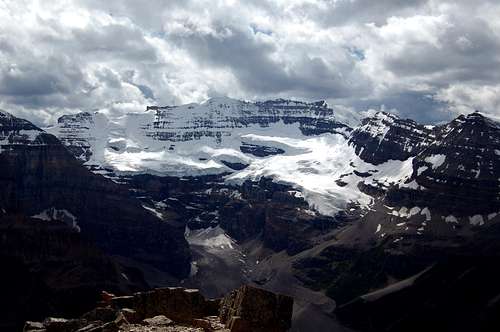


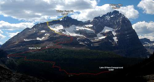
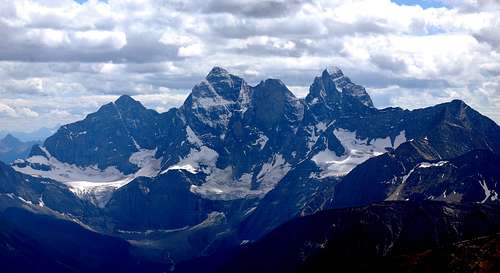


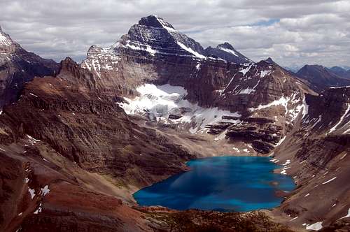

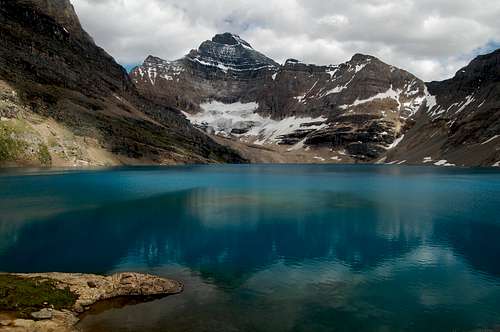


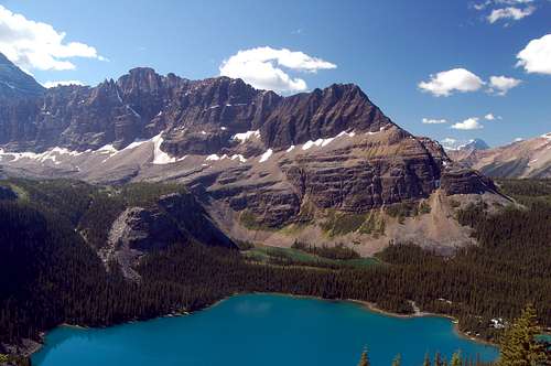


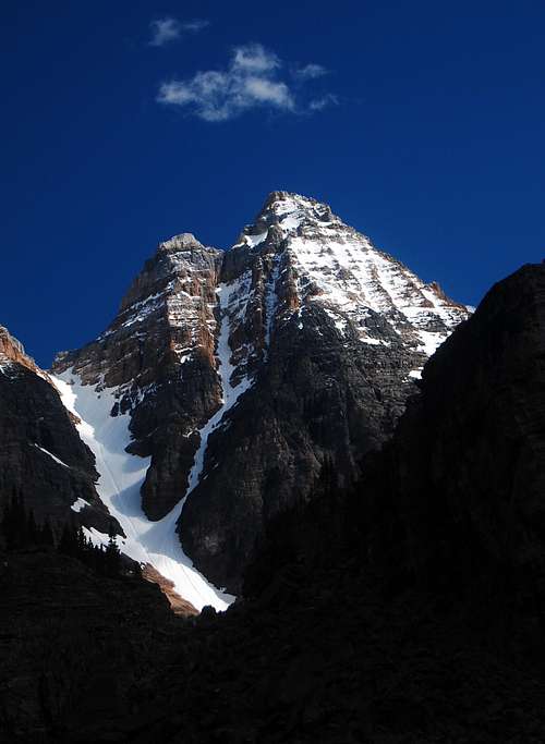
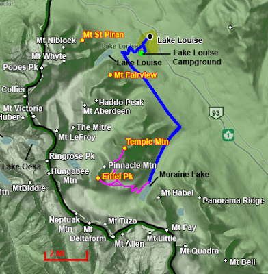


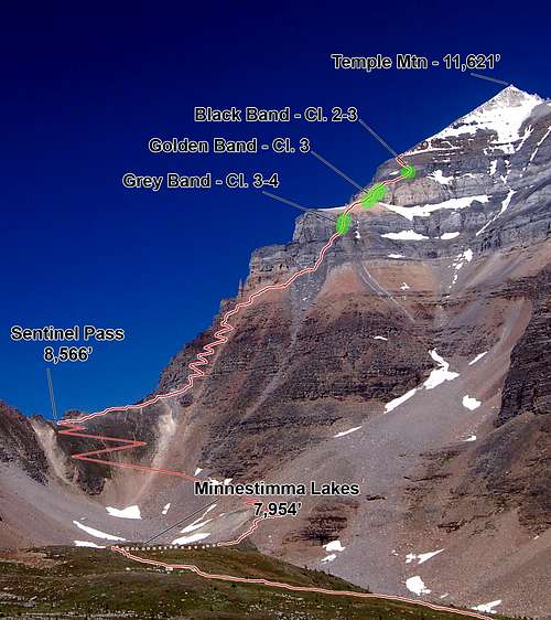


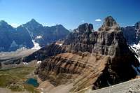


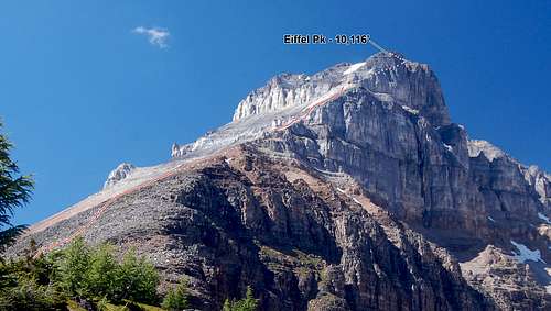
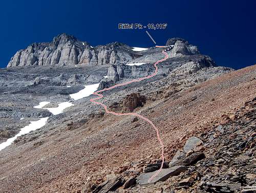


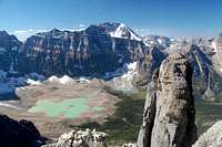


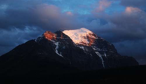


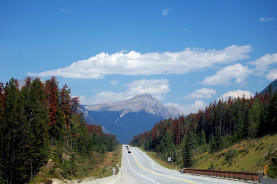

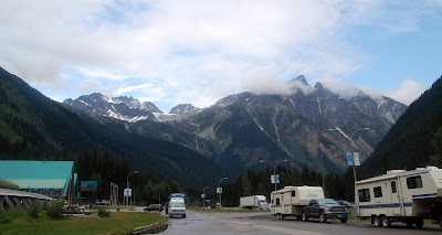
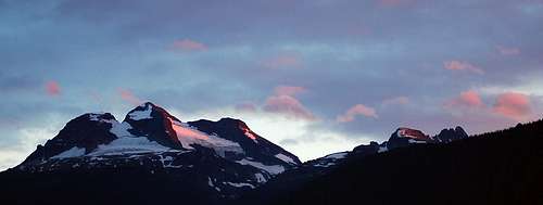


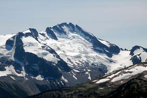
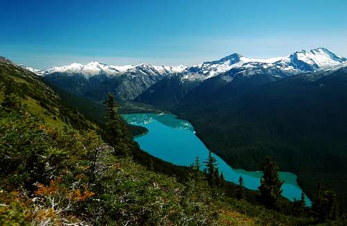


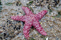
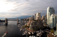


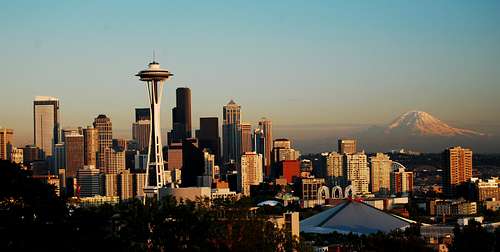


Comments
Post a Comment