Welcome to SP!  -   
 
  MbPost.com -- It's SP for Mountain Biking!
Areas & Ranges·Mountains & Rocks·Routes·Images·Articles·Trip Reports·Gear·Other·People·Plans & Partners·What's New·Forum

Deming Mountain topographic...

 
[ Sizes: Orig | Med | Small | Thumb ]
Deming Mountain topographic...
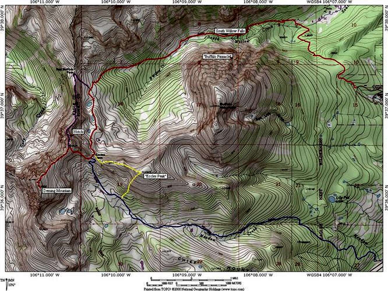
Deming Mountain topographic map. The red route is the 13.5 mile long South Willow Creek Route. The blue route is the 13 mile long Meadow Creek Route. In purple is the optional half mile scramble up Deming's North East Ridge. And in yellow is the easy hike up Eccles Peak. Software by National Geographic. Notations by jon.


Comments

No comments posted yet.


Sign in to post!

Don't have an account? Register now.


Rate This Image
Current Score: 86.97

Log In To Vote
Image Data

JonBradfordSubmitted by JonBradford
on Jul 2, 2005 4:25 pm

Image ID: 113062
Hits: 1699 

Lat/Lon: 39.60200°N / 106.1846°W


"Nothing in this world can take the place of persistence. Talent will not; nothing is more common than unsuccessful people with talent. Genius will not; unrewarded genius is almost a proverb. Education will not; the world is full of educated derelicts. Persistence and determination alone are omnipotent. The slogan "press on" has solved and always will solve the problems of the human race."   --Calvin Coolidge   

© 2006-2012 SummitPost.org. All Rights Reserved.