Toggle navigation
Mountains
Routes
Images
Trip Reports
Forum
What's New
People
Areas & Ranges
Articles
Trailheads
Canyons
Huts & Campgrounds
Albums
Logistical Centers
Fact Sheets
Lists
Custom Objects
Gear
Plans & Partners
WELCOME TO SUMMITPOST
SIGN IN
REGISTER
"Priord Peak"
Additional Parents
Image
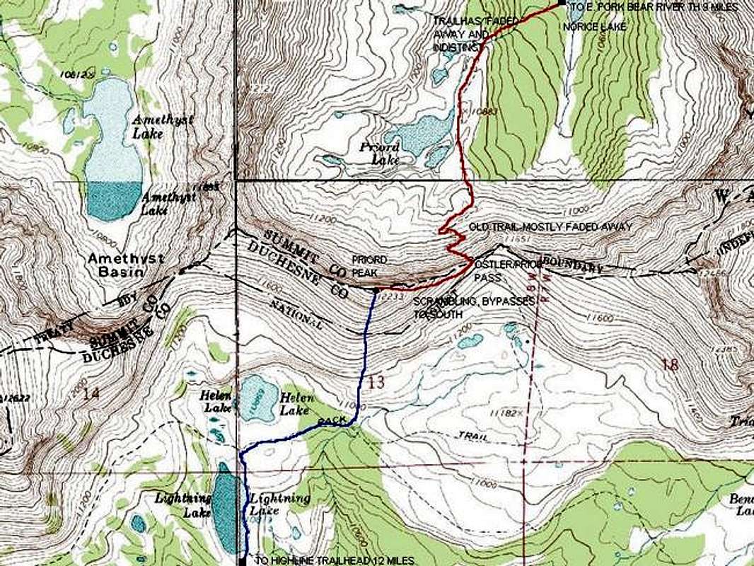
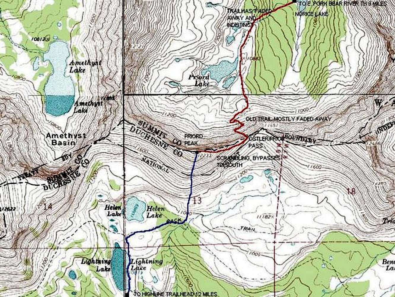
Detailed map of the final...
View High-Resolution Image
Detailed map of the final...
Detailed map of the final portions of the routes to Priord Peak. Blue =
ROCK CREEK AND SOUTH FACE ROUTE
Red =
PRIORD LAKE ROUTE
Credit: Topozone
« PREV
NEXT »
Scott
on
Jun 7, 2005 6:10 pm
Comments & voting
Other parents
Lat/Lon:
40.74500°N / 110.741°W
Image ID:
109078
4127 Hits
71.19
% Score
2
Votes
Log in to vote
Comments
No comments posted yet.
to post!
Don't have an account?
"Priord Peak"
(Mountain/Rock)
« PREV
Viewing
#31 of 32
GALLERY
NEXT »
Scott's Image Gallery
« PREV
Viewing
#5216 of 8082
GALLERY
NEXT »
×
You need to login in order to vote!
User Name
Password
Remember me
Forgot your password?
Log me out when I close my browser.
Keep me logged in all the time.
sign in as a user
Don't have an account?
Register now for FREE
Rating available
Suggested routes for you
People who climb the same things as you
Comments Available
Create Albums
Register Here


