Toggle navigation
Mountains
Routes
Images
Trip Reports
Forum
What's New
People
Areas & Ranges
Articles
Trailheads
Canyons
Huts & Campgrounds
Albums
Logistical Centers
Fact Sheets
Lists
Custom Objects
Gear
Plans & Partners
WELCOME TO SUMMITPOST
SIGN IN
REGISTER
El Misti
Additional Parents
My Misti adventures.
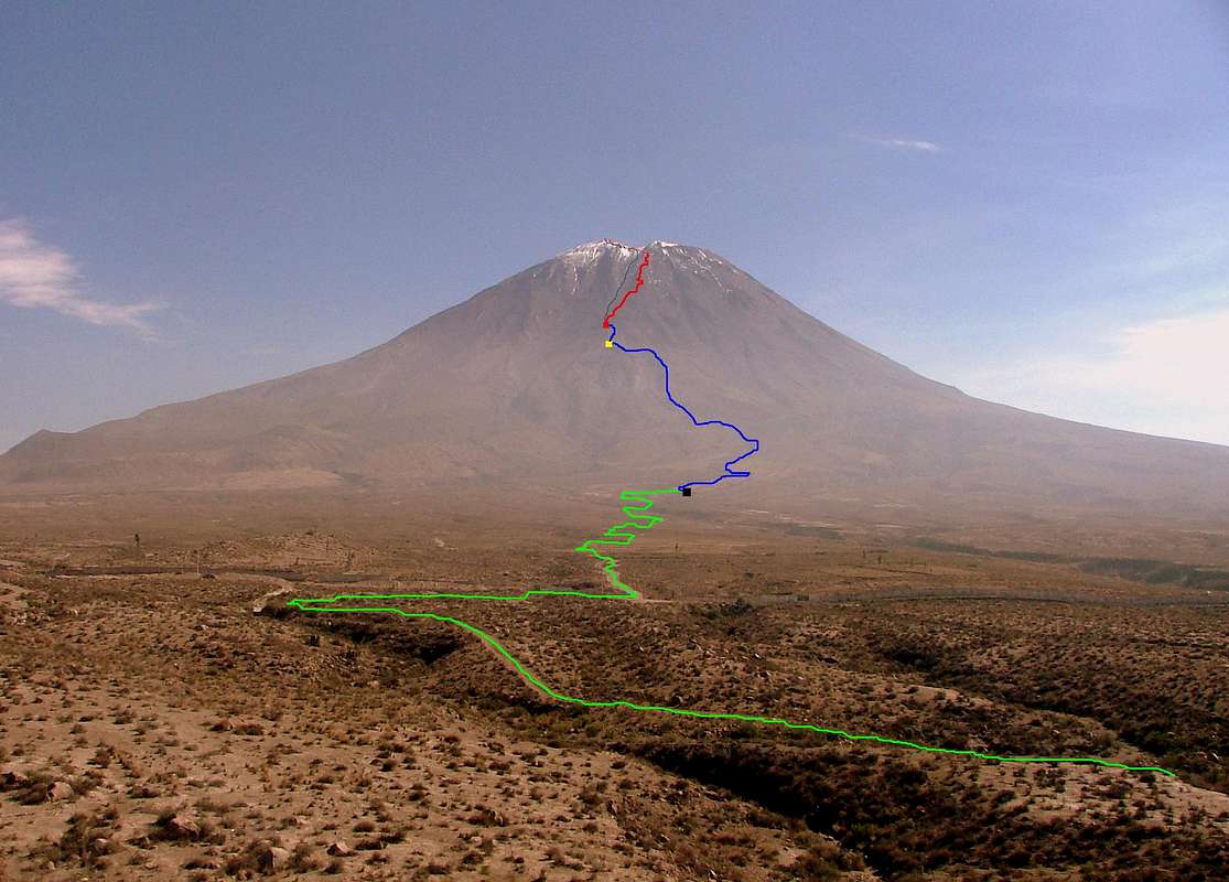
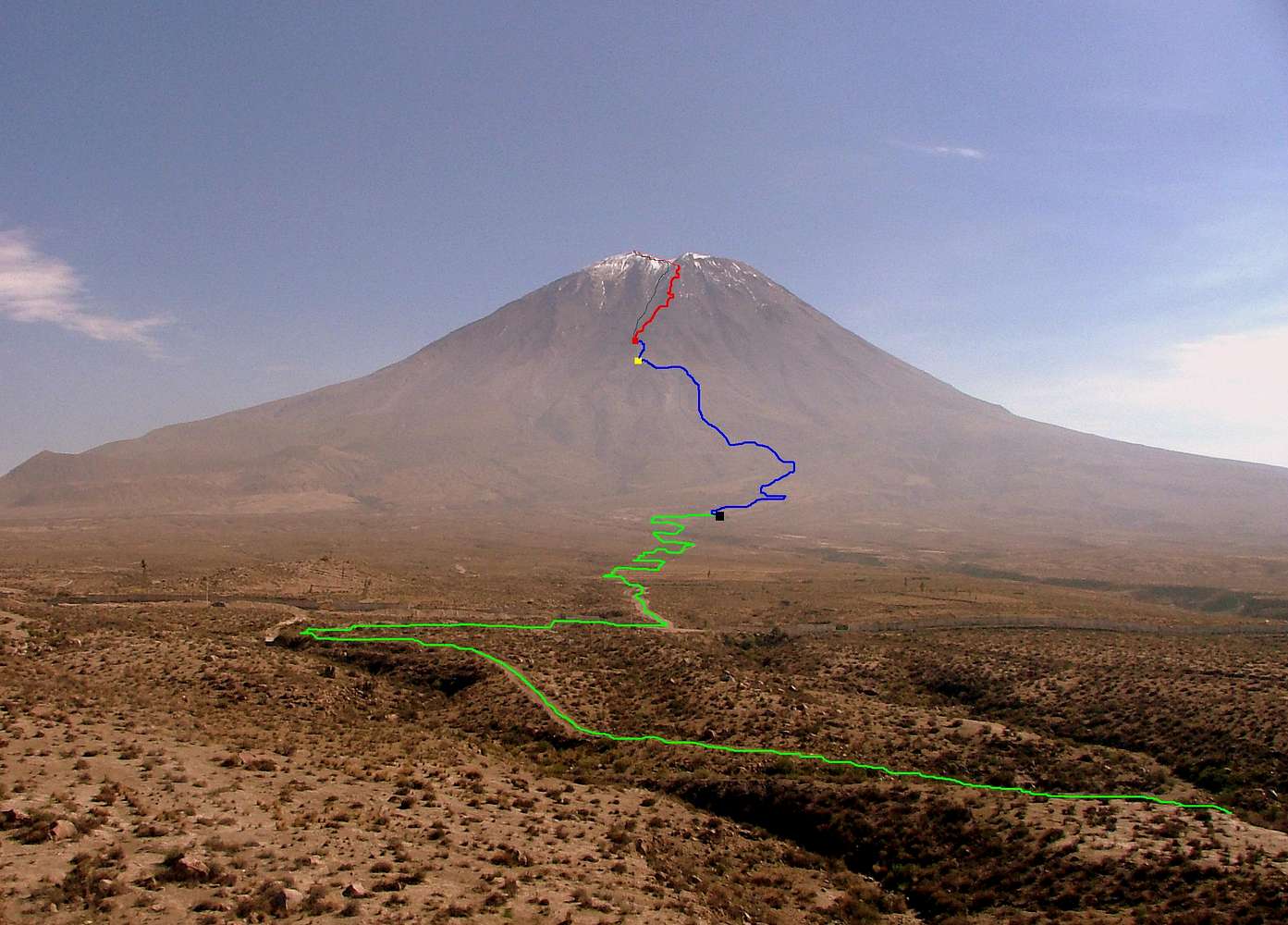
El Misti (5,822 m/19,096 ft). Peru
Image
El Misti Topo Photographic Map.
View High-Resolution Image
El Misti Topo Photographic Map.
El Misti
(5,822 m / 19,096 ft). The green line indicates the route driven with the 4WD. Blue line indicates trail to Campamento Piramide Alto. Red line indicates the climb to the crater rim and to the summit.
« PREV
NEXT »
Boriss Andean
on
Apr 5, 2010 4:30 pm
Comments & voting
Other parents
Image Type(s):
Alpine Climbing
Image ID:
610828
3813 Hits
72.08
% Score
2
Votes
Log in to vote
Comments
No comments posted yet.
to post!
Don't have an account?
El Misti
(Mountain/Rock)
« PREV
Viewing
#95 of 144
GALLERY
NEXT »
Boriss Andean's Image Gallery
« PREV
Viewing
#1771 of 2594
GALLERY
NEXT »
My Misti adventures.
(Trip Report)
Loading....
El Misti (5,822 m/19,096 ft). Peru
(Image)
Loading....
×
You need to login in order to vote!
User Name
Password
Remember me
Forgot your password?
Log me out when I close my browser.
Keep me logged in all the time.
sign in as a user
Don't have an account?
Register now for FREE
Rating available
Suggested routes for you
People who climb the same things as you
Comments Available
Create Albums
Register Here


