La montagna chiama i suoi figli, ed essi rispondono fedelmente al suo appello…
Osvaldo Cardellina, Diario alpinistico, 1964-65
Page texts: @ OsvaldoCardellina"Osva", passed away on May 2, 2022. Page owners: Christian Cardellina e Osvaldo Cardellina. Any updates from September 12, 2022: Antonio Giani, page administrator, friend and climbing companion.
Testi della pagina: @ OsvaldoCardellina "Osva", scomparso il 2 maggio 2022. Proprietari pagina:Christian Cardellina e Osvaldo Cardellina. Eventuali aggiornamenti dal 12 settembre 2022: Antonio Giani, amministratore della pagina, amico e compagno di salite.
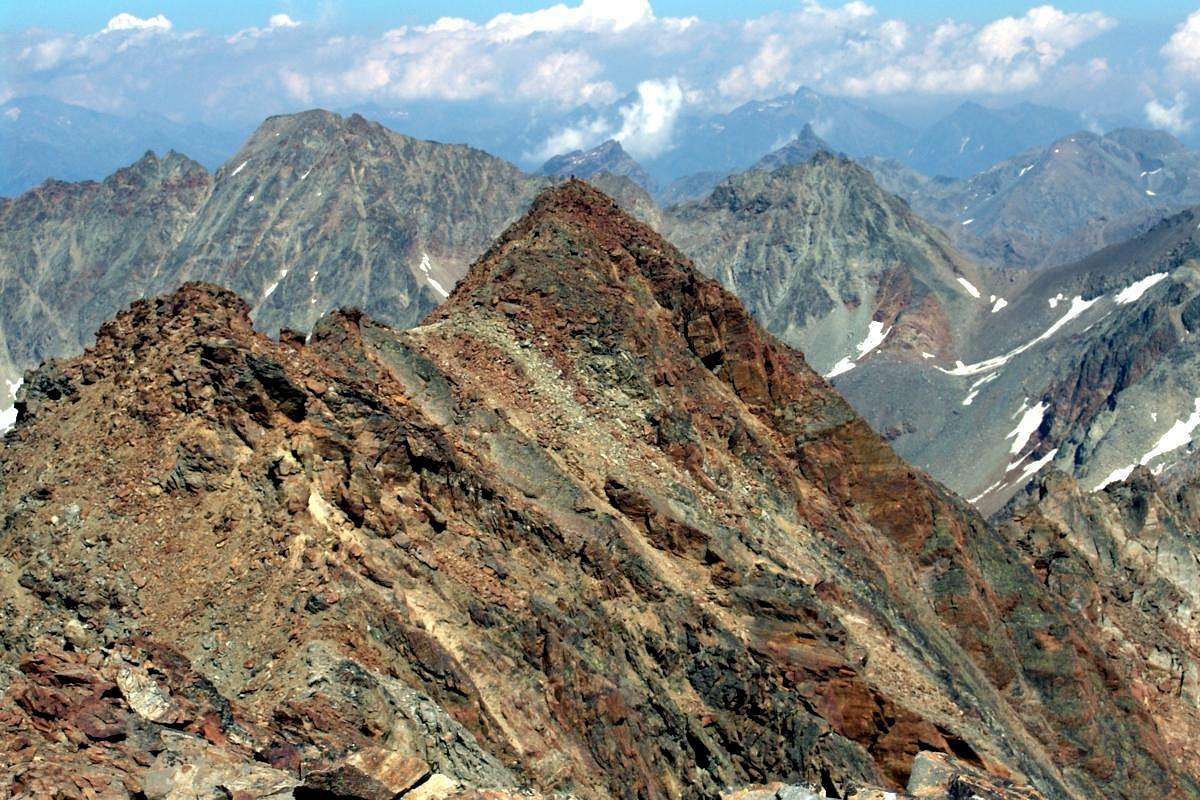
Reddish Overview Rousse
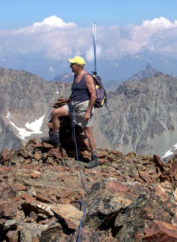
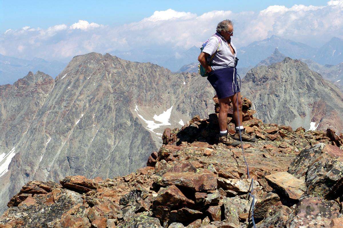
Punta Rossa or Punta also Pointe des Laures? We begin with establishing what the mountain we speak, as often in the past, the triple Emilius's Punta Rossa was being confused with the adjacent Punta des Laures, immediately towards Southeast. Both are located on the Southwest edge of the valley of the same name but are made of two different mountains: the first, higher (about 3.400m, 3.395m and 3.401m), it is the Punta Rossa and is positioned between the Arbolle or Arbole Pass (3.154m) to the Northeast and Pas du Valaisan (3.210m) South-southwest, just before the Mont Valaisan and Punta or Pic Garin (3.451m). The second appears to be an appendage of the Eastern Tip (3.400m) down to the Col des Laures (3.035m), located between the Vallons des Laures and Grauson/Lussert, Western branch, well above of the homonyms lakes on one (in North, Grand Brissogne Common) and the other slope (Southern, Cogne Valley). So it is kind a little confusing, but more formal than substantial so that it is not difficult to distinguish the history of the climbs towards their tops among other things very far apart in time and addressed to specific altitudes with the Punta des Laures much more low (3.367m). Punta Rossa of Emilius (to distinguish it from the numerous existing Red Spikes in the Alps) appears for the first time in "Oest AZ 1891", page 278, where it is listed an ascension of a famous roped W.B.A. Coolidge and Franz Gardiner with renowned Swiss Guides Christian Almer and Rudolf but calling the same Punta des Laures as then taken up by B & V in the "Western Alps Guide 1896", on page 64, where it is identified with the dual name but with altitude erroneous (3.340m). The description of the three routes to as many hills, however, excludes any doubt about it. Still persists in 1939 when on 11th and 12th March, Dr. "Ansel" Falcoz makes the first winter ascent, starting even from Peroulaz Fraction towards Vallone Arbolle with subsequent crossing of the Pas du Valaisan and Crest South-southwest; the same is to call the Western Peak as Punta Rossa (3.401m) and the Eastern Punta des Laures (3.400m). The descent by ski in Cogne also marks the first crossing, at least for the valleys, made in winter. The misunderstanding was finally solved with private information obtained by the summer of 1978 prior to the drafting of the "Guidebook of the Monte Emilius", pages 102/7. The September 14th, 1898 we find another climb as the "RM CAI 1898", page 488, by the famous Italian climber-writer Agostino Ferrari with a Mountain with a Mountain Bearer of Cogne B. Glarey, but is not yet a crossing since ascent and descent take place "from Comboé, Vallone Arbole, face West and the Pas du Valaisan ridge South in 4.45 hours to the summit ... ". To find the first true crossed we have to go to the "RM CAI 1910", page 150, where it is indicated the same, no further details on itinerary, by Gerolamo Segato, then fell in the same year on the North-northeast Ridge or "The Scimitar" of Grivola together the brother. Most likely with ascent from Col Arbolle via the Northeast Ridge and its descent towards the Pas du Valaisan with the South-Southwest. Among the various crossings between the three aforementioned hills and through the Northwest Corner, we choose this in memory of the two brothers Segato, young children of a General of the Italian Army. A crossing became famous in the Thirties (1936) thanks to the always Dr. Anselme Falcoz initiatives with path even from Pic Garin to Mount Emilius (3.559m) and then resumed from the same in 1947 and other climbers in 1976; currently knows a certain frequented almost exclusively in the part that relates to this mountain, even if the descent from Pas du Valaisan towards middle Arbolle Vallon is unwrapped for its remarkable hazard.
Punta Rossa o Pointe des Laures?Incominciamo con lo stabilire di quale montagna parliamo, poiché spesso nel passato la Punta Rossa dell'Emilius veniva confusa con l'attigua Punta o Pointe des Laures. Entrambe sono collocate al margine Sudoccidentale dell'omonimo vallone ma consistendo in due montagne nettamente differenziate: la prima triplice, più elevata (3.400 m, 3.395 metri circa e 3.401 m), é la Punta Rossa ed é posizionata tra il Colle di Arbolle od Arbole (3.154 m) a Nordest ed il Pas du Valaisan (3.210 m) a Sud-sudovest, appena prima del Mont Valaisan (3.307 m) e della Punta o Pic Garin (3.451 m). La seconda risulta essere un appendice della Punta Orientale (3.400 m) che scende verso il Col des Laures (3.035 m), posto tra i Valloni des Laures e Lussert nonché al di sopra degli omonimi laghi sull'uno (Grand Brissogne) e l'altro versante (Val di Cogne). Così é sorta un pò di confusione, ma più formale che sostanziale tanto che non é risultato difficile distinguere la storia delle salite verso le rispettive Cime tra l'altro ben lontane tra loro nel tempo ed indirizzate alle specifiche altitudini con la Punta des Laures nettamente più bassa (3.367 m). La Punta Rossa dell'Emilius (per distinguerla dalle numerose Punte Rossa esistenti nelle Alpi) appare per la prima volta in "Oest AZ 1891", pagina 278, dove viene elencata una ascensione d'una celebre cordata con W.B.A. Coolidge e F. Gardiner con le Guide Svizzere Christian e Rudolf Almer ma chiamando la medesima Punta des Laures, come poi ripreso da B & V in Guida delle Alpi Occidentali 1896", alla pagina 64, dove viene individuata con il duplice nome ma con altitudine erronea (3.340 m). La descrizione dei tre itinerari verso altrettanti colli però esclude ogni dubbio in proposito. L'errore persiste ancora nel 1939 quando nei giorni 11 e 12 Marzo il Dottor "Ansel" Falcoz compie la prima salita invernale partendo addirittura dalla Frazione di Peroulaz verso il Vallone di Arbolle con successiva traversata del Pas du Valaisan e Cresta Sud-sudovest; lo stesso consiste nel chiamare Punta Rossa la Vetta Occidentale (3.401 m) e Punta des Laures quella Est (3.400 m). La discesa verso Cogne in sci segna anche la prima traversata, almeno per quanto concerne i rispettivi valloni, effettuata in inverno. L'equivoco viene definitivamente risolto con informazioni private ottenute dallo stesso nell'estate del 1978 prima della stesura di "Guida del Monte Emilius", alle pagine 102/7. Il 14 Settembre 1898 troviamo un'altra salita come nella "RM C.A.I. 1898", pagina 488, ad opera del celebre alpinista Agostino Ferrari con il Portatore di Cogne B. Glarey, ma non é ancora una traversata poiché salita e discesa avvengono "dal Comboé, Vallone di Arbole, faccia Ovest del Pas du Valaisan e Cresta Sud in ore 4,45 alla vetta ... ". Per trovare la prima vera attraversata dobbiamo andare alla "RM C.A.I. 1910", pagina 150, dove viene segnalata la medesima, senza ulteriori precisazioni sull percorso, da parte di Gerolamo Segato, caduto poi nello stesso anno sulla Cresta Nord-nordest della Grivola, detta "La Scimitarra", insieme al fratello. Molto probabilmente con salita dal Col di Arbolle tramite la Cresta Nordest e relativa discesa verso il Pas du Valaisan con quella Sud-sudovest. Tra le varie traversate tra i tre colli predetti, nonché tramite lo Spigolo Nordovest, scegliamo questa in memoria dei due fratelli Segato, giovanissimi figli d'un Generale dello Esercito Italiano. Traversata diventata di famosa negli Anni Trenta grazie all'iniziative sempre del Dottor Falcoz con percorso addirittura dalla Garin fino all'Emilius e poi ripresa dallo stesso nel 1947 e da altri alpinisti nel 1976; attualmente conosce una certa frequentazione quasi esclusivamente nel tratto che riguarda questa montagna, anche se la discesa dal Pas du Valaisan verso Arbolle é da scartare per la sua pericolosità.
First Ascents
First traverse (probably NE/S-SW): Gerolamo Segato; summer 1910, in ascent from Arbolle Vallon.
First winter traverse (partially): Anselme Falcoz; March 11-12th, 1939, in ascent from Peroulaz-Comboé-Arbolle- Pas du Valaisan.
First Great Crossing (Pic Garin-Mont Valaisan-Punta Rossa-Monte Emilius): Anselme Falcoz, lone; August, 1936, in ascent from Fernier-Arbolle-Col Garin; Second: Anselme Falcoz, lone; Summer, 1947, from Pila until Three Capuchins Pass.
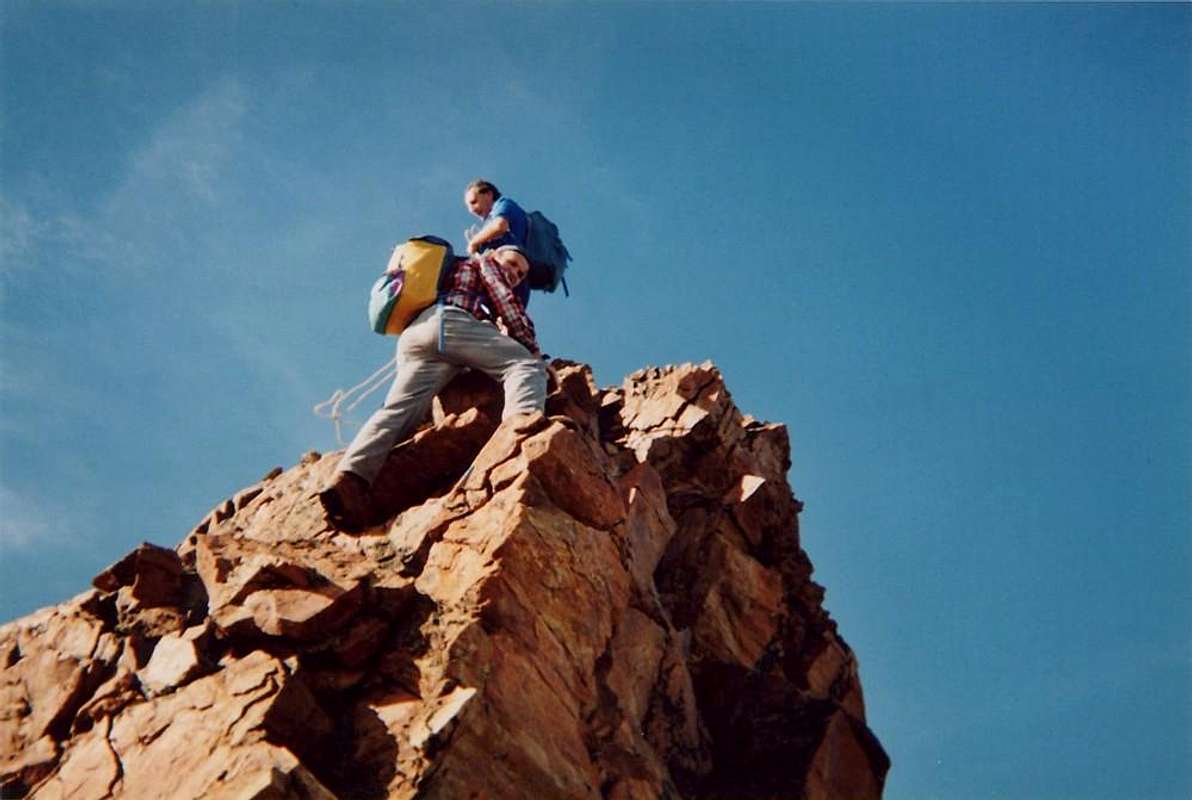
Complete and Integral Traverse (Mont Valaisan-Pic Garin-Mont Valaisan-Punta Rossa-Punta dei Tre Cappuccini-Monte Emilius): Osvaldo Cardellina, Marco Cossard and Giuseppe Lamazzi; June 29th, 1976, in ascent from Pila-Arbolle-Col and Lake Garin.
Getting There
BY CAR:
From Turin or Milan: Motorway A5. Exit in Aosta Ovest. Drive to the near Aymavilles; follow in the direction of Cogne Valley. Or Exit Aosta East to Gr. Brissogne and St. Marcel. From Switzerland: through the Grand St. Bernard Tunnel or the homonym Pass). Drive to Aosta, then follow Courmayeur direction on SS.26. Just after Sarre, turn to the left, in the direction of Cogne Valley. Also continue East towards Grand Brissogne and Saint Marcel, turn to the right near the brige above Baltea, neighbor Quart-Villefranche. From France: through Mont Blanc Tunnel or Petit St. Bernard Pass). It isn't necessary to enter in Motorway A5, you can drive through SS.26 Aosta direction. Before arriving at the Village of Sarre, follow the sign and turn right towards Valle di Cogne; also passing the town continue East to Quart Municipality.
Specific Roads
a) - After Aymavilles, the RR.47 crosses the Villages of Vieyes, Epinel and Crétaz and after about 25 Km. arrives at Cogne (1.534m). Follow the road signs for Gimillan and Lillaz; arrived at a round-about, recently built in proximity of the St. Anthony Chapel, go left along the scenic route leading to the Villages of Montroz and Gimillan (1.787m); 1,5 and 3 Km. after Cogne. Usually no parking problem neeighbor the bell tower of a little chapel in center, also near the bridge above Gimillan Torrent (small parking). b) - Exit out on Motorway A5 Aosta East (near Nus) to Grand Brissogne and Saint Marcel Communes; leaving East the Municipal Roads to the last, continue South on Regional Road to the the first at the beginning of Laures Vallon. From this go up through the private dirt road (no transit by cars) to Gremonenche Pasture and L'Arp (1.310m).
Better departure:
From Pont Suaz-Aosta (567m, 583m) before by the Cableway to Pila Resort (1.800m); after from this to Chamolé Lake and Hill 2.325m, 2.641m) with the Chair Lift towards Chamolé Upper Station (2.309m) and path. Also through the regional Road from Pont-Suaz towards Charvensod Commune, Pèroulaz, Les Fleurs and Pila.
Other possibilities of entering partially in the route starting from:
Pollein (575m; secondary road) or from Charvensod (746m; main road and connection) to Arpisson small Valley and Martsaouchy Damon (1.410m), through dirt farms road, and Arpisson Lower & Upper (1951m, 2.010m) Alpages with ancient path. Federigo Zullo Bivouac through moraines on Western Arpisson Glacier. Charvensod to Dard-Comboé-Arbolle Gorge and small Valleys towards Ponteilles(1.697m) Alp & Waterfall, through dirt road, Comboé Alp & Saint Ours private Shelter (2.114m), through dirt road, and Arbolle Refuge(2.516m), nearby two Lakes (2.495m, 2.497m). Aymavilles(646m) to Western Pila Conca, through Main Road to Cogne Valley, alternative to Ozein/Turlin Dessus Hamlets and dirt road to Pila-Posse. Aymavilles towards Cogne Valley with Regional Main Road: Vieyes (1.132m) Fraction; continue to Silvenoire, Epinel and Crétaz Hamlets, Cogne(1.534m) Resort, through Main Road. From Cogne towards Gimillan Village(1.785m): from this in North to Grauson-Lussert Vallon and Frog, Corona, four Lussert Lakes also in Northwest towards Arpisson Alp Franco Nebbia Bivouac, through path in Upper Arpisson Vallon to Garin Hill (2.815m) with descent to Arbolle Refuge into the homonym Vallon.
From Arbolle Vallon final descent towards:
from this to Chamolé Hill and Lake (2.641m, 2.325m), Chair Lift Chamolé Upper Station (2.309m), St. Grat Hermitage (1.773m), Pila-Resort (1.800m), Pont Suaz-Aosta (567m).
BY PLANE:
Aeroporto "Corrado Gex" Saint Christophe (Aosta).
Approaches & Routes Description
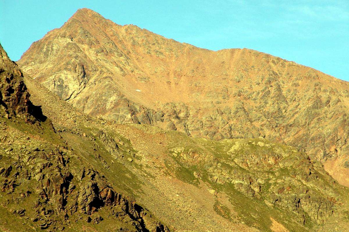
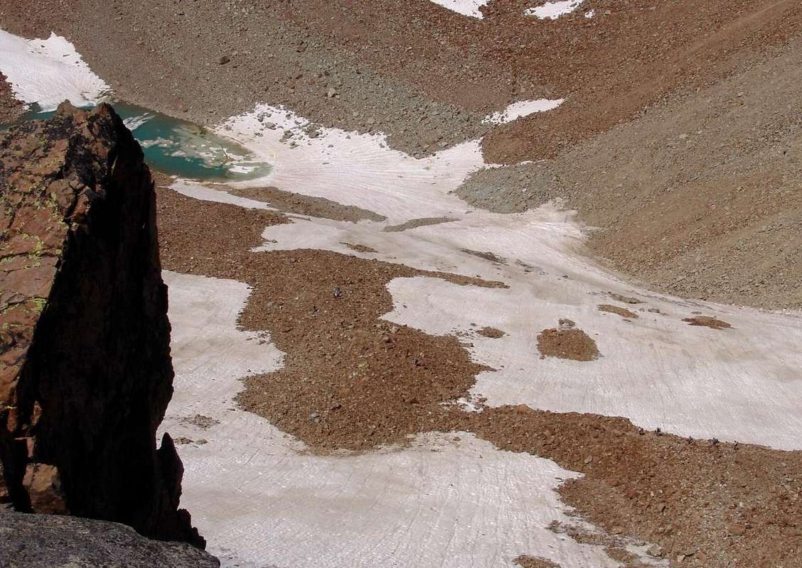
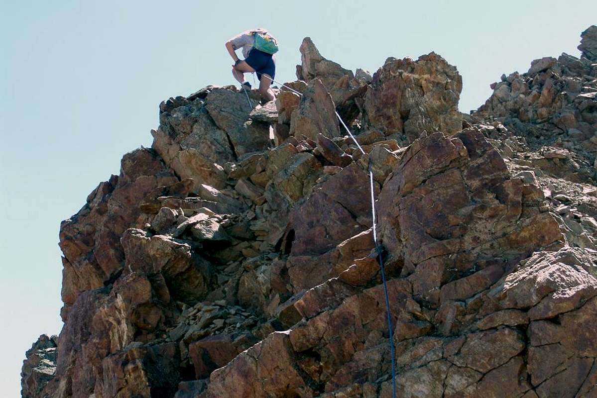
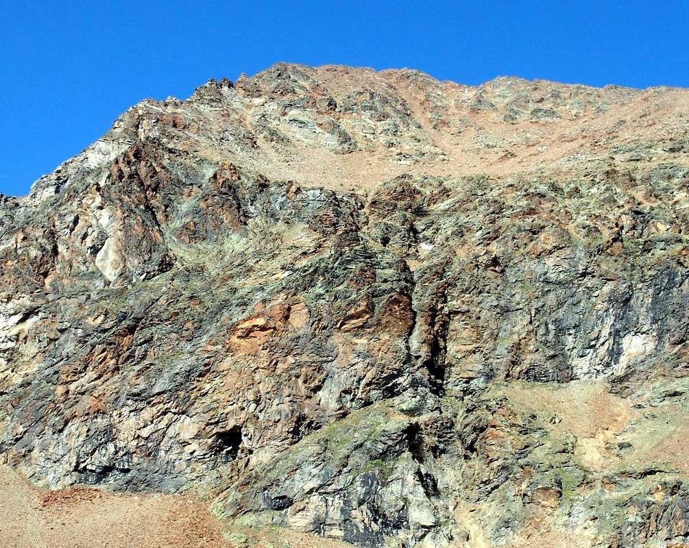
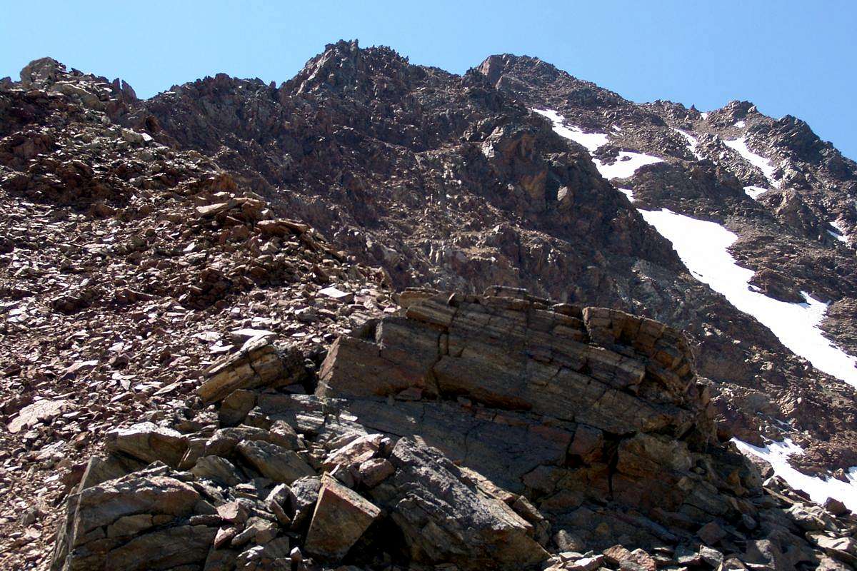
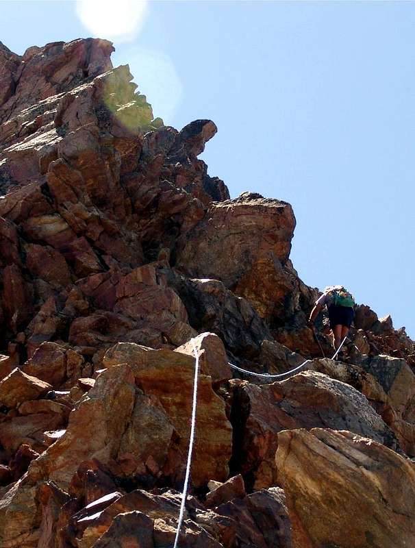
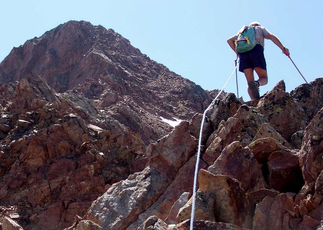
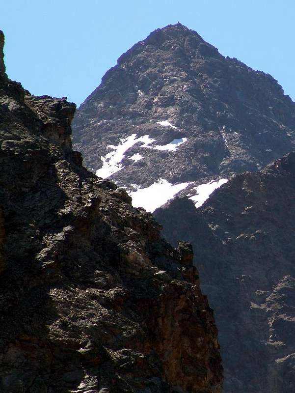
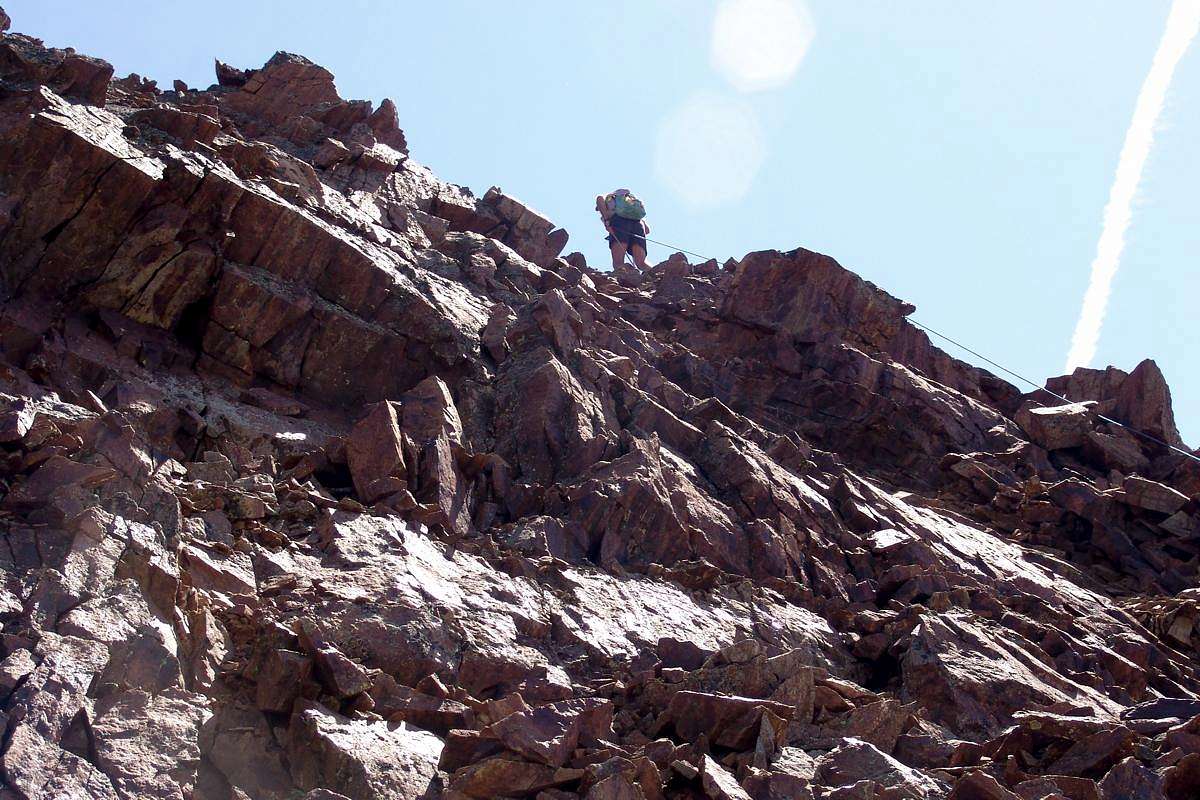
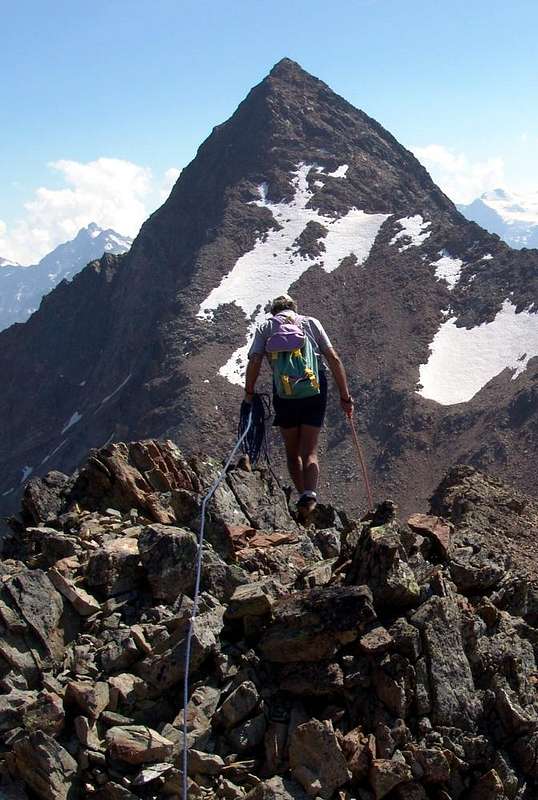
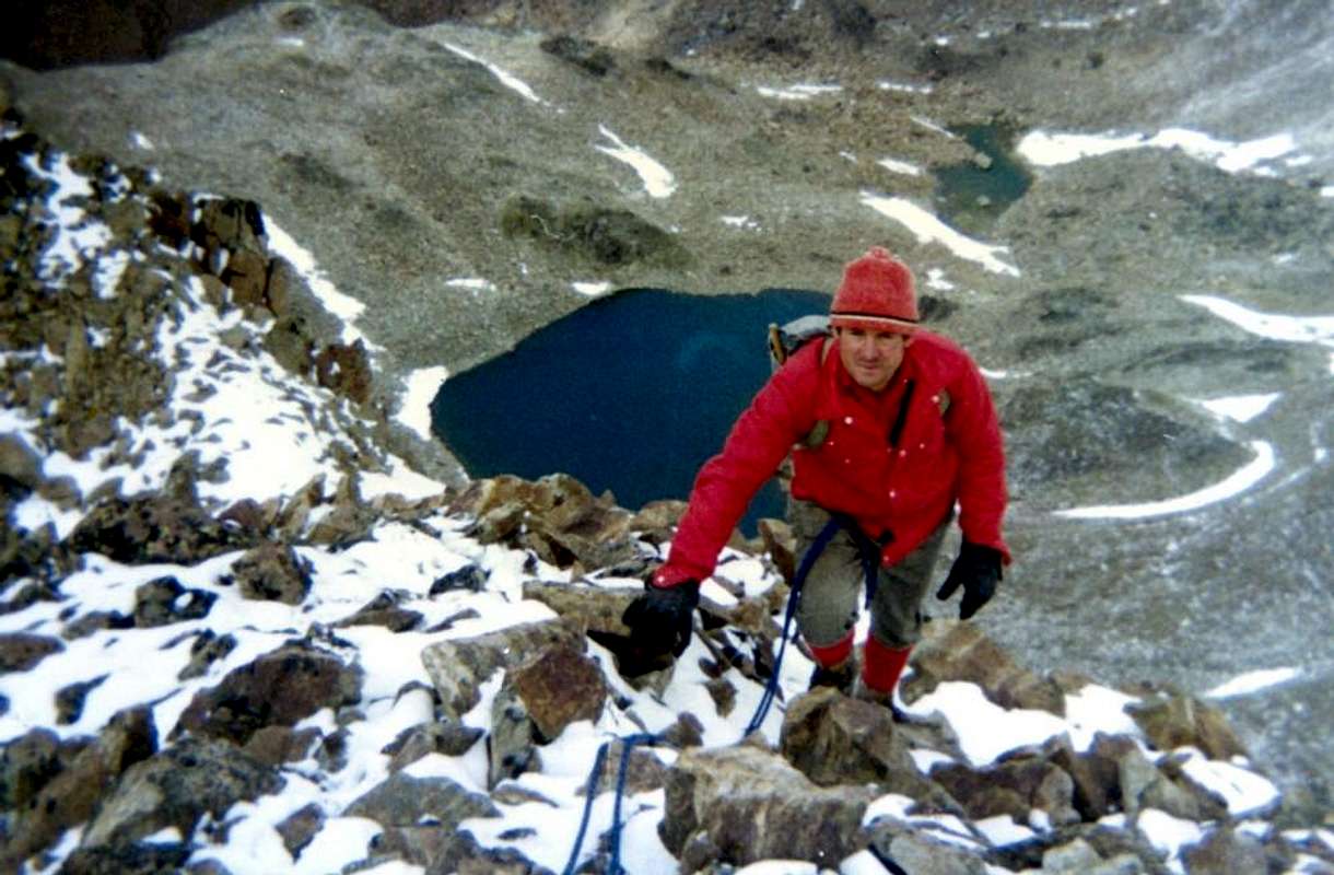
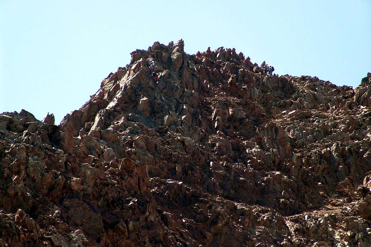
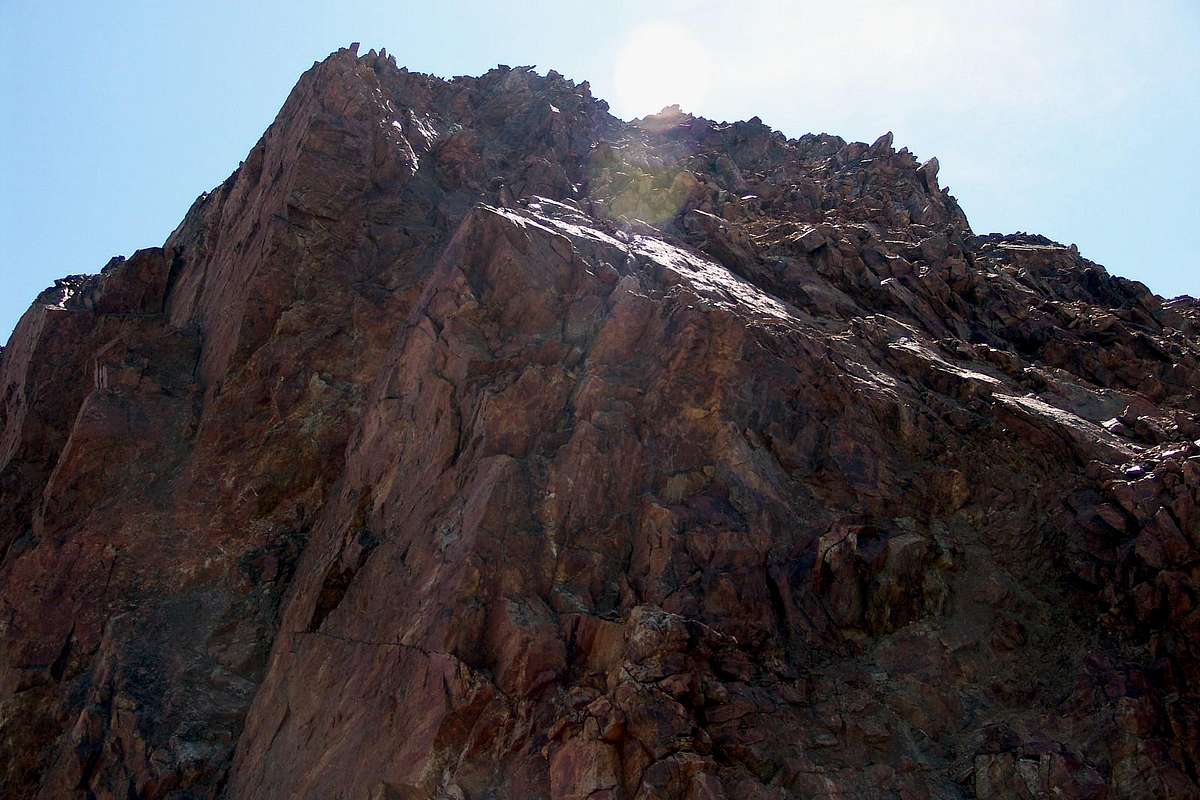
From Pila (1.800 meters or from the upper parking about 1.860 meters), renowned and crowded ski resort just above Aosta (Cableway or Bus service), to the Chamolé Lake (2.311m), using chairlift or on foot, and on to the homonymous pass (2.641m), through it go down to the new and comfortable Arbolle Refuge (2.510m) nearby Arbole's two Lochs (2.495m, 2.497m). Then towards East till the Lago Gelato (2.956m), from this point you must go up in direction of the now no more snow-covered North Face of the Punta Rossa. From the Refuge paths n° 14/102. The route goes up to the close Arbolle Pass (3.154m), then, along the blocks and debris making up the Northeast Crest, leads to the "false" Top or Eastern Summit (3.400m); climbing and bypassing a prominence or Central Summit (about 3.395 meters), first on North side then on East side, requiring attention (exposed and bad quality rock). Going on along the ridge towards West the route leads to the true Summit of Emilius's Punta Rossa (3.401m). It is recommended that, when the snow is still abundant and well established factor (now very rare) on the Northern Face of the just mentioned to go directly to the right of the snowy gully that flows between the North Wall of Western Top and the lower Central Summit; doing so resulting structure will a fun climb on snow and ice is not too steep for about 300 meters.
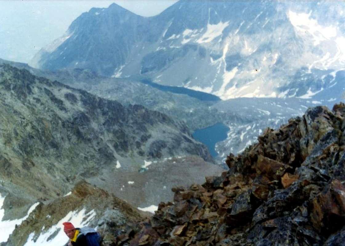
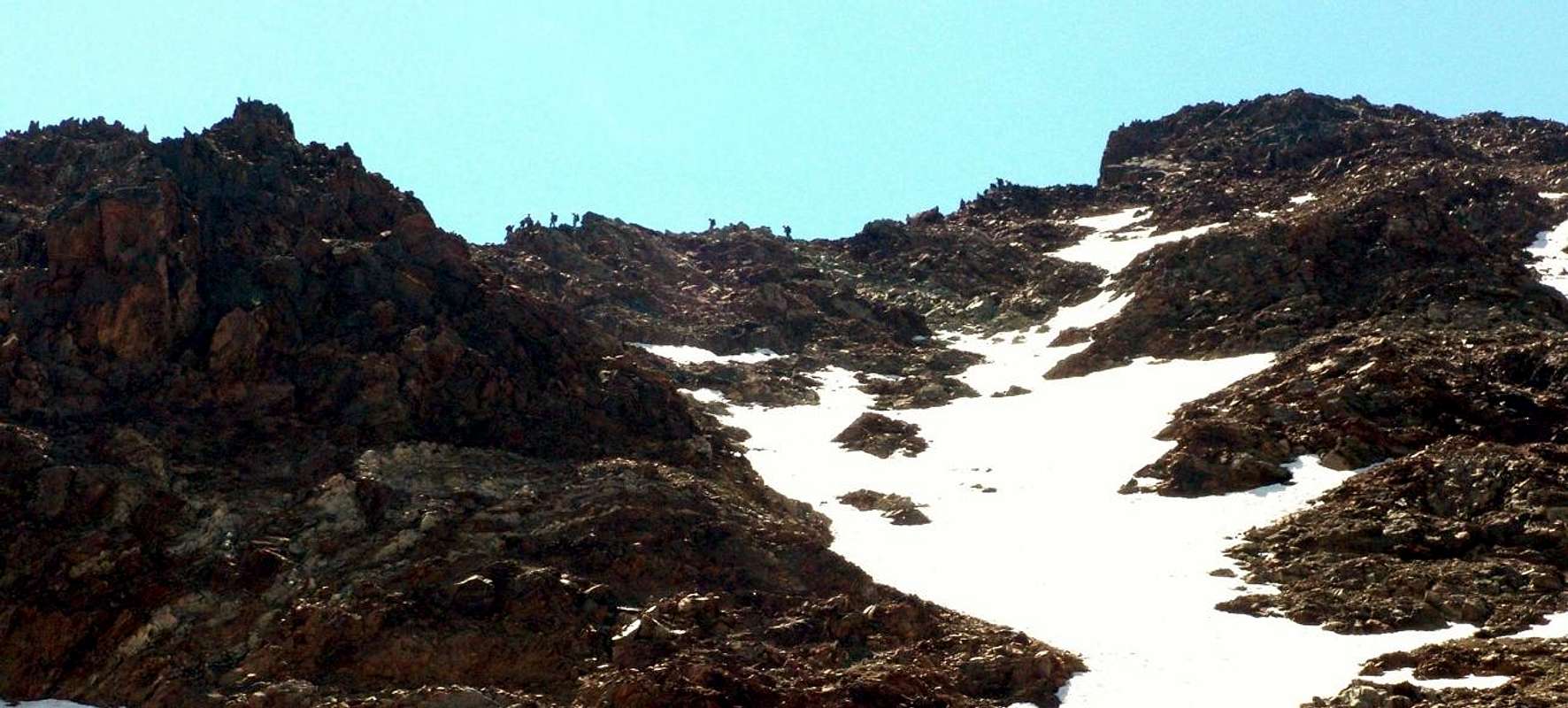
In descent towards the Western Face of Valaisan Pass and Arbolle Vallon through South-southwest Crest: not wanting to retrace the same route, should follow the Ridge South-southwest up to the Pas du Valaisan (3.153m) and then fall quickly after an initial stretch of hardened soil that forces a delicate traverse to the left against the North-northwestern Wall of the Mont Valaisan (attention to the very frequent fall stones!), towards the underlying stony dark red and arranged in a radial pattern (crossing infinitely difficult, dangerous due to the instability of the boulders very sharp and dull) and the new Shelter Arbolle (EEA/F+/PD-;7h'00/8h'00, round trip from Pila Resort).
Da Pila (1.800 metri o dal parcheggio soprastante a 1.860 metri circa circa), nota località sciistica (raggiungibile da Aosta in auto pullman o funivia) pervenire al Lago di Chamolé (2.311 m; anche qui in seggiovia o a piedi), e l'omonimo colle superiore (2.641 m), per il quale si scende al comodo Rifugio Alpe di Arbole (2.510 m) presso i due Laghi d'Arbole (2.495 m, 2.497 m). Indi dirigersi verso Est fino al Lago Gelato (2.956 m), donde salire in direzione della ormai non più nevosa Parete Nord della Punta Rossa. L'itinerario di salita per mezzo del sentiero n° 14/102 tocca il vicino Colle di Arbole (3.154 m), per poi proseguire su blocchi e detriti della Cresta Nordest sino alla "falsa" Cima o Punta Orientale (3.400 m); continuando sul crinale verso Ovest si raggiunge infine, dopo la Sommità Centrale (3.395 metri circa), la vera vetta della Punta Rossa (3.401 m). Si consiglia, quando la neve è ancora abbondante e ben assestata (fattore ormai più che raro) sulla Faccia Settentrionale di proseguire direttamente per l'appena accennato canalino nevoso di destra della Parete Nord che sbocca tra la Punta Occidentale e quell'attigua Centrale; sì facendo s'otterà una divertente salita su neve e ghiaccio non troppo ripida di circa 300 metri.
In discesa verso il Versante Occidentale del Pas du Valaisan ed il Vallone d'Arbolle tramite la Cresta Sud-sudovest: non volendo ripercorrere la via di salita tramite i due itinerari suddescritti, conviene seguire la facile Cresta Sud-sudovest, tenendosi sulla destra (Ovest) del crinale, sino al Pas du Valaisan (3.153 m) e da questo calarne velocemente, dopo un tratto iniziale su terriccio pericolosamrnte indurito che costringe ad una delicata traversata a sinistra contro la parete Nord-nordovest del Mont Valaisan (attenzione alla caduta di pietre!), verso la sottostante pietraia di colore rosso scuro e disposta a raggiera (traversata infinitamente faticosa, richiedente attenzione causa l'instabilità dei massi molto taglienti e noiosa) nonché il nuovo Rifugio di Arbolle (Complessivamente tra salita e discesa dal Resort di Pila EEA/F+/PD-; 7h'00/8h'00 circa).
In descent towards the Eastern Slope of Valaisan Pass and Lussert/Grauson Vallon through South-southwest Crest: always not wanting to retrace the same route, should follow the Ridge South-southwest up to the Pas du Valaisan (3.153m) and then fall quickly and easily in the small round basin amongst Pic Garin Northeast Northern Walls, Mont Valaisan, Punta Rossa and Southern Spur Punta des Laures. Through debris and small snowfields on remains of moraine reach the Western edge of ancient Lussert Glacier and from this the four namesakes lakes. At the third of these (2.906m) take the path n° 8A/102, which comes from Col des Laures (3.035m) and gradually down to the second and first (2.790m, 2.713m), to the various Grauson Dessus Alps (2.540m), Grauson Vieux (2.273m), Creuzet, Pila, Ecloseur (2.244m, 2.021m, 1.903m) or with little variation just further West n° 8 to Tchezeun (1.940m) Révèntì (perimeter ruins; 1.906m) Pastures until Gimillan Hamlet (EE/F+; altogether 8h'00/9h'00, round trip Gimillan).
In discesa verso il Versante Orientale del Pas du Valaisan ed il Vallone di Lussert/Grauson tramite la Cresta Sud-sudovest: non volendo ripercorrere la via di salita tramite i due itinerari suddescritti, conviene seguire la facile Cresta Sud-sudovest, tenendosi sulla destra (Ovest) del crinale, sino al Pas du Valaisan (3.153 m) e da questo calarne velocemente e facilmente nella piccola conca compresa tra Pic Garin-Punta Rossa e Sperone Sud della Punta des Laures. Attraverso detriti e resti di morena raggiungere il margine Occidentale del Ghiacciaio di Lussert e da questo i quattro omonimi laghi; dal terzo tra questi (2.906 m) prendere il sentiero n° 8A/102 che arriva dal Col des Laures e scendere progressivamente al secondo ed al primo (2.790 m, 2.713 m), alle varie Alpi di Grauson Dessus (2.540 m), Grauson Vieux (2.273 m), Créuzet, Pila, Ecloseur (2.244 m, 2.021 m, 1.903 m) oppure con piccola variante appena più ad Ovest n° 8 a Tchezeun (1.940 m) e Gimillan (1.814 m; tra salita e discesa da Gimillan EE/F+; 8h'00/9h'00 circa).
Other possibilities: furthermore it is possible to make this crossing, reaching the Col of Arbole from the East through the Vallone Laures (Grand Brissogne) through the path n° 4/102 that comes from the Shelter Ménabreaz (2.546m), reached from l'Arp (Brissogne) with the muletrack n° 1/1A, or from Col des Laures (3.035m). Or in the great crossing from Pic Garin (3.451m) to Mount Emilius or from Punta des Laures toward Garin. Conversely the opposite paths ie by Emilius (3.559m) to Pic Garin and from there down to the Punta des Laures (3.367m) are still outstanding and non made. So there is still a good space for research and discovery for young people of good will ...
Altre possibilità: inoltre é possibile effettuare questa traversata raggiungendo il Col di Arbole da Est attraverso il Vallone delle Laures (Grand Brissogne) con sentiero n° 4/102 che arriva dal Rifugio Ernesto Ménabreaz (2.546 m), raggiungibile da l'Arp (Brissogne) con la mulattiera n° 1/1A, o dal Col des Laures (3.035m). Oppure in grande traversata dal Pic Garin verso il Monte Emilius (3.559 m) oppure dalla Punta des Laures verso la Garin (3.451 m). Viceversa i percorsi opposti cioé dall'Emilius alla Garin e da quest'ultima in discesa verso la Punta des Laures non risultano ancor stati realizzati. Quindi esiste ancora un buon spazio di ricerca e di scoperta per i giovani di buona volontà ...
Essential Gear
DIFFICULTIES
From F+ to PD- for the Route A. From F to F+ for the Route B. From F/F+ to PD- for the Route C.
Descending between East Wall & North Face, by emilius
Da F+ a PD- per la Via A. Da F a F+ per la Via B. Da F/F+ a PD- per la Via C.
EQUIPMENT
For Hiking, better with rope, carabiners and some lanyard for the Via A.
Da Escursionismo, meglio con corda, moschettoni e qualche cordino per la Via A.
Descending towards the Pas du Valaisan, by emilius
Campings
Remember that free camping is forbidden (except for emergency reasons, over 2.500m, from darkness until dawn).
Mountain Condition
Meteo: you can find all the needed informations at the official site of the Valle d'Aosta Region:
"Guida delle Alpi Occidentali", di Giovanni Bobba e Luigi Vaccarone C.A.I. Sezione di Torino Volume II (parte II), 25 Maggio 1896.
"80 itinerari di Escursionismo Alpinismo e Sci Alpinismo in Valle d'Aosta", di Osvaldo Cardellina, Ed. Musumeci, Giugno 1977 (in Italian); seconda Ed. Luglio 1981; terza Ed. Luglio 1984; (in French), prima Ed. Febbraio 1978; seconda Ed. Marzo 1980.
"Guida del Monte Emilius", di Osvaldo Cardellina Editore in collaborazione con il Club Alpino Italiano Sezione di Aosta, Dicembre 1978 (in Italian).
"Rifugi e bivacchi in Valle d'Aosta", di Cosimo Zappelli aggiornata da Pietro Giglio, Musumeci Editore, Luglio 2002.
"Guida dei Monti d'Italia–Emilius Rosa dei Banchi Parco del Mont Avic", di Giulio Berutto e Lino Fornelli - Club Alpino Italiano/Touring Club Italiano, Marzo 2005 (in Italian).
"Ascensioni 1964-1969" Diario Alpinistico di Ilario Antonio Garzotto (unpublished).
"Diari Alpinistici", di Osvaldo Cardellina e Indice Generale accompagnato da Schedario Relazioni Ascensioni 1964-2019 (unpublished).
Kompass "Gran Paradiso Valle d'Aosta Sentieri e Rifugi" Carta Turistica 1:50.000.
Hapax Luglio 2000 "Les Sentiers" Comunità Montana Monte Emilius 1:25,000.
L'Escursionista "Conca di Aosta-Pila-Monte Emilius" Carta dei sentieri (n° 4) 1:25.000.
L'Escursionista "Valle di Cogne Carta dei Sentieri" (n° 10) 1:25.000.
Enrico Editore Ivrea-Aosta "Gruppo del Gran Paradiso" 1:50.000.
I.G.C. Istituto Geografico Centrale Torino "Carta delle Passeggiate ed Escursioni in V.D.A. Conca di Pila-Gressan" 1:20.000.


 2994 Hits
 83.1% Score
 16 Votes