First of all, forgive me: my yellow line doesn't go exactly to the summit on this topo, but pretend it does....
Keplinger's Couloir: 16 miles, 5,900 feet elevation gain.
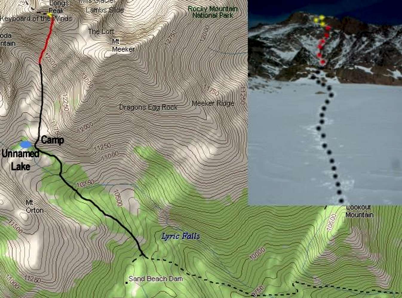
DOTTED: Sandbeach Lake Trail from Copeland Lake TH.
BLACK: Bushwhack from Sandbeach Lake Trail and across Hunter Creek, to upper basin. ("Camp" is where Georg and I camped 5-6 March 2005).
RED: Keplinger's Couloir: 12,000 to 13,600 feet.
YELLOW: Final push to the summit, via upper part of Keyhole Route and Homestretch.
Topo by DeLorme Topo USA 5.0, Photo and Embellishments by Brad Snider


