Continental Peak / Great Divide Basin
Having warmed up on Whiskey Peak the day before I really wanted to bag Ferris Peak, the highest summit in the dominant range of the Rawlins, Wyoming area. I had been fascinated by this peak, visible from miles away in any direction, with its noted limestone slabs, ever since first glimpsing it from the summit of Medicine Bow Peak in September, 2008. Tuesday was a bluebird day in the Great Divide Basin, but I got up late again. The weather would hold up all day, but with my planned route being closed off due to impassable sand dunes (along the 4WD access road) per the BLM, I had to seek alternative options. I got some good beta from SP’er jimmyjay on ascending via Youngs Pass, then traversing several miles along the ridge to the highest point. I probably had time and could have made it, but I ultimately decided against an attempt since I didn’t have a clear idea of the route. Looking back now, I wish I gave it a go.
My backup peak would be Continental Peak, deep in the heart of the Red Desert. I drove north from Rawlins through Muddy Gap, gazing longingly at the Ferris Range to the east. The slabby Granite Mountains north of Muddy Gap were cool and warranted further exploration in the future. As I crested a ridge I got my first ever glimpse of the Wind Rivers, and was instantly drawn to them as they grew larger and larger upon the horizon. I drove into Landers, my plans thrown to the seven winds. The town looked inviting, delightful, the mountains even better. I stopped in a few bookstores, looking for Turiano’s and any other guidebooks that may direct me to a summit reachable in a long dayhike the next day, Wednesday. I talked to the guy at the store for awhile and pondered a few options, but when looking up the weather he pulled up severe thunderstorms and hail for the next day. Had the weather report been different I would have stayed, but the adverse forecast meant the Winds would have to wait for another year.
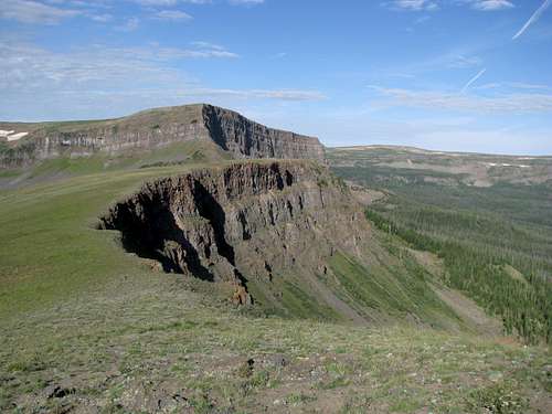
I thoroughly enjoyed the drive down through South Pass. Immediately south of the pass the landscape turned dry, and with the Winds still looming over behind me I took the dirt roads leading down into the heart of the Divide Basin. Quickly I felt like I had driven into another century. Pronghorns abounded along the dirt roads, the only evidence of civilization. The pyramidical form of Continental Peak loomed closer and closer, guarding an impenetrable and impeccable labyrinth of badlands at its base below its western face.
![Winds from near South Pass]() Wind Rivers Wind Rivers |
|
![Continental Peak]() Continental Continental |
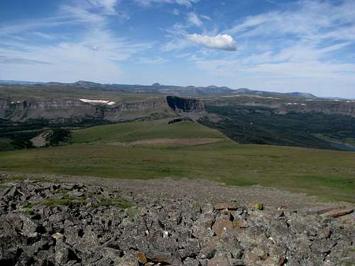
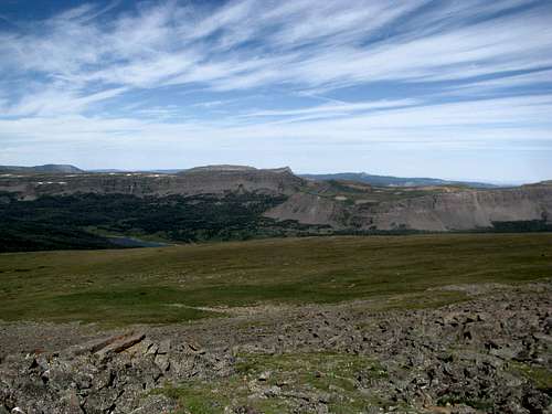
I followed Bob Sihler’s directions from SP and drove to a BLM WSA sign. The hike up to the summit, sometimes through surprisingly thick sagebrush, was steep but fairly uneventful. It was windy but bearable upon gaining the summit ridge. The views, as usual, were incredible. The landscape along the Basin rim seemed very similar structurally to the vistas from Whiskey Peak the day before, but tinted red instead of green. The Wind River Mountains still dominated the view to the north, with not a hint of civilization within sight.
|
|
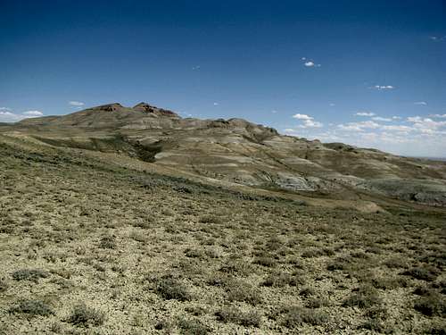
![Oregon Buttes]() Oregon Buttes Oregon Buttes |
|
|
|
As I walked across a broad plateau sitting above where I parked my car I saw a pronghorn standing warily at the opposite edge of the plateau half a mile away. Time seemed to stand still as I worked my way across the flat expanse, man and beast connected only by a thin line of vision. The antelope didn’t take its eyes off me the entire time. When I reached the rim I took one last glance back towards the antelope before beginning my final descent. It had only been seconds before when I last saw it, but these intervening seconds saw the creature’s speedy exit. It was gone, and I wondered if the early pioneers, the mountain men and cowboys who once walked these same open ranges, often experienced the same thing.
![A high plateau]() On a plateau On a plateau |
![Solitary Pronghorn]() Antelope at the other end Antelope at the other end |
I thought about trying to bag Steamboat Mountain on the southwestern corner of the basin, but it was getting late and I needed to be in Yampa, CO by nightfall. I drove southeast through the Basin in emancipating loneliness, stopping only to play around in the migratory sand dunes.
![Oregon Buttes]() Oregon Buttes Oregon Buttes |
![South Oregon Butte]() Oregon Buttes Oregon Buttes |
![Oregon Buttes]() Oregon Buttes Oregon Buttes |
The Flat Tops Wilderness
Wednesday found me back in the mountains. From Yampa I drove to a reservoir horseshoed on three sides by the cliffy ridges of the Flat Tops. Here was the trailhead for the infamous Devil’s Causeway trail, but that adventure will have to wait for another day. My destination was for the highest summit of the range, aptly named Flat Top Mountain.
![Flat Top Mountain]() Flat Top Mtn Flat Top Mtn |
|
The hike was easy going to a saddle between Flat Top and an unnamed massif (pt. 11,585, "West Flat Top") to the west.
![Saddle]() Saddle Saddle |
![Near the saddle]() Near the Saddle Near the Saddle |
From here it was about one and a half miles of a steady ascent to the top.
![Trail to Flat Top Summit]() Ridge Ridge |
![Flat Top Mountain]() Ridge Ridge |
The topography was unique, unlike any I’d ever seen, and made for excellent photo ops.
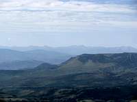
I got really excited when I recognized the sharp jagged summits of Capitol, Snowmass, Sopris, and Holy Cross to the south, as well as the Gores, my destination later this week.
![Elks, Capitol, Sopris]() Elks, Capitol, Sopris Elks, Capitol, Sopris |
![Zoom of Gores]() Gores Gores |
As I approached the trailhead on the way back I bumped into some hikers. This is significant because this was the first time all week I had ran into any other hikers along the trail ever since I flew west. The easy climbing was over though for me. I had a few summits left this vacation, but they would no longer be gained with such minimal effort.
Comments
No comments posted yet.

 Wind Rivers
 Continental
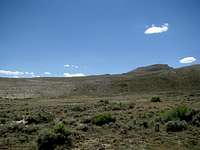


 Oregon Buttes
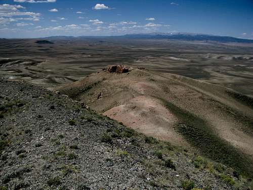

 On a plateau
 Antelope at the other end
 Oregon Buttes
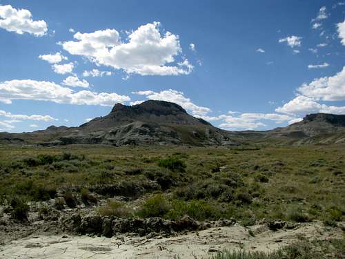 Oregon Buttes
 Oregon Buttes
 Dunes
Dunes Dunes
Dunes Dunes
Dunes Dunes
Dunes Dunes
Dunes Dunes
Dunes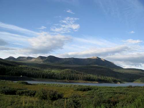 Flat Top Mtn
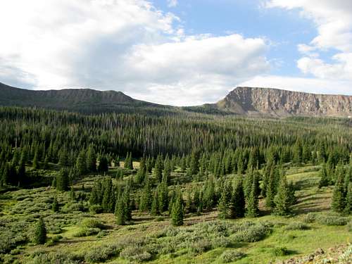 Saddle
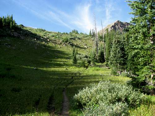 Near the Saddle
 Ridge
Ridge Ridge
Ridge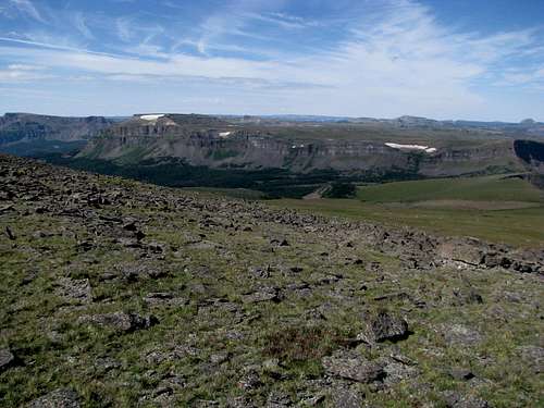

 Elks, Capitol, Sopris
 Gores
Gores