Comments
No comments posted yet.
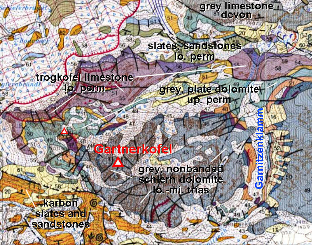
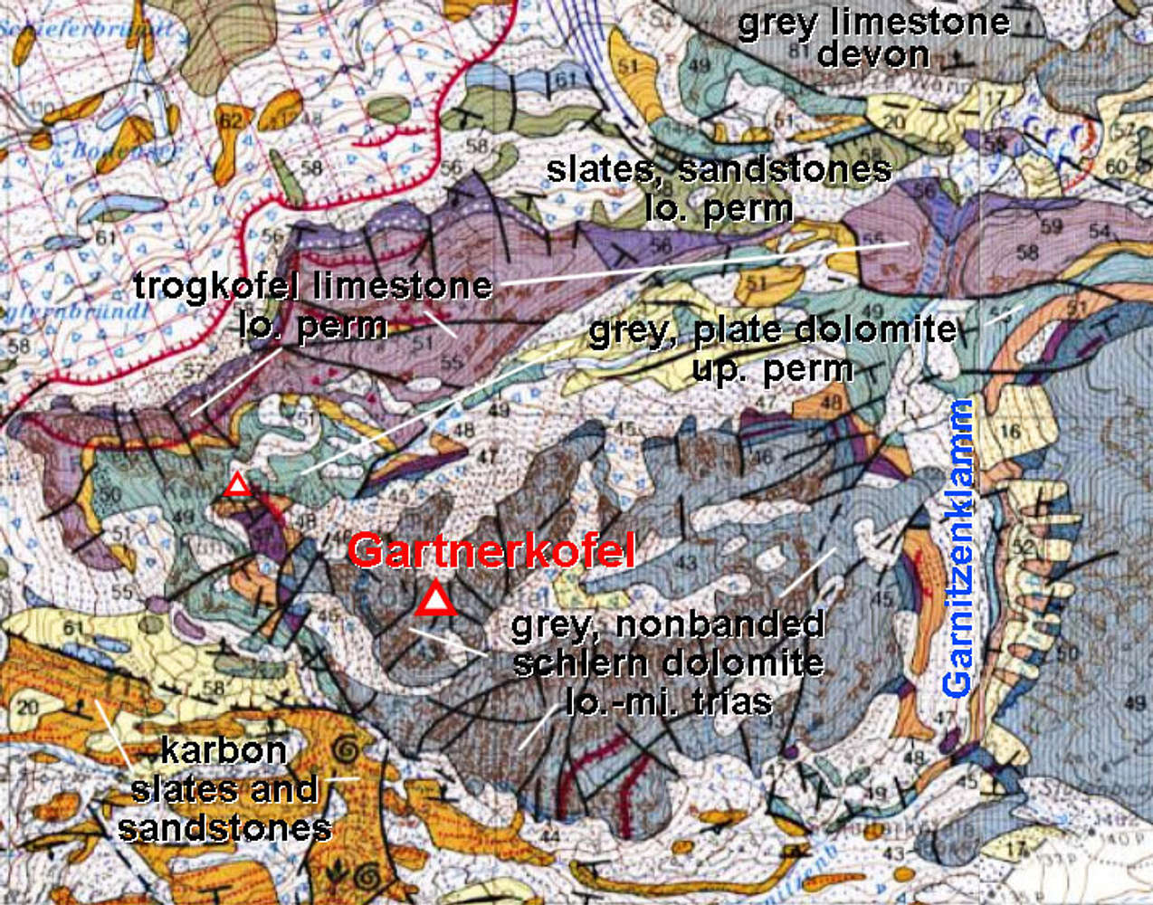
This image shows the geological structure of Gartnerkofel area. The upper part is too complex to discuss it more here, but it illustrates why the canyon of Garnitzenklamm has such a great rock diversity. The lower part is showing how the highest, most rocky part of Gartnerkofel is made of Schlern dolomite (Middle Triassic - Ladinian, some 230 million years old).


