Toggle navigation
Mountains
Routes
Images
Trip Reports
Forum
What's New
People
Areas & Ranges
Articles
Trailheads
Canyons
Huts & Campgrounds
Albums
Logistical Centers
Fact Sheets
Lists
Custom Objects
Gear
Plans & Partners
WELCOME TO SUMMITPOST
SIGN IN
REGISTER
Wildcat Mountain
Additional Parents
Image
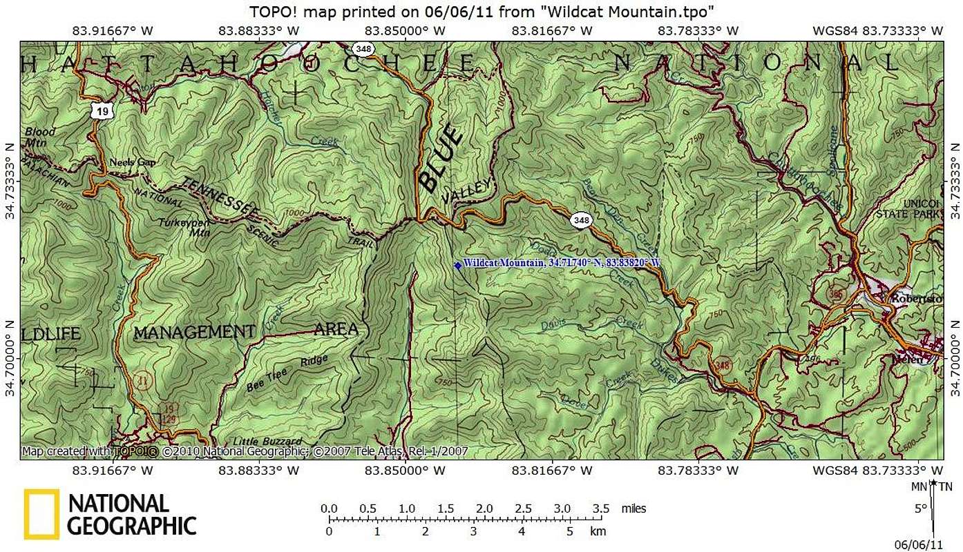
Getting There Map
View High-Resolution Image
Getting There Map
The nearest road to Wildcat Mountain is GA Route 348. Parking at Hogpen Gap off GA 348, the summit of Wildcat Mountain can be reached via a hike of less than 2 miles roundtrip and 300 feet of net elevation gain.
Map designed June 2011
« PREV
NEXT »
Sarah Simon
on
Jun 6, 2011 9:17 pm
Comments & voting
Other parents
Lat/Lon:
34.71740°N / 83.8382°W
Image Type(s):
Topo/Diagram
Image ID:
720539
2865 Hits
73.06
% Score
3
Votes
Log in to vote
Comments
No comments posted yet.
to post!
Don't have an account?
Wildcat Mountain
(Mountain/Rock)
« PREV
Viewing
#9 of 13
GALLERY
NEXT »
Sarah Simon's Image Gallery
« PREV
Viewing
#2754 of 5480
GALLERY
NEXT »
×
You need to login in order to vote!
User Name
Password
Remember me
Forgot your password?
Log me out when I close my browser.
Keep me logged in all the time.
sign in as a user
Don't have an account?
Register now for FREE
Rating available
Suggested routes for you
People who climb the same things as you
Comments Available
Create Albums
Register Here


