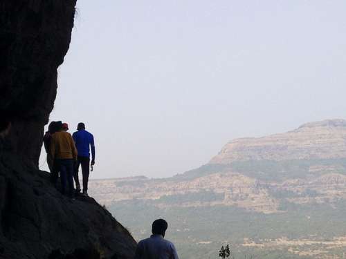
I had known many friends who had been to Ghangad, which served as a watchtower,
Navra, Navri and Karavli
along with Kailasgad, for looking out, if enemy is entering in the region from the Konkan area.
Tel-Baila
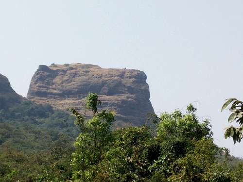
First view of Ghangad
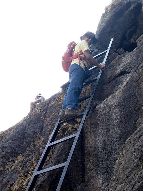
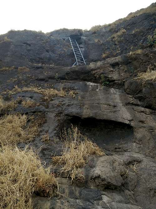
They all had told me that the fort was a small one, except there was one hitch – one patch where a group had installed a metal ladder was a bit tricky, where a fall could be fatal.
We usually travel to Konkan region, by crossing the Tamhini Ghat, and everytime we see the road going to Lonavla, we tell ourselves – we need to take that road someday.
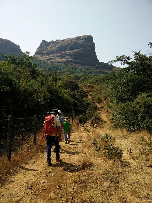
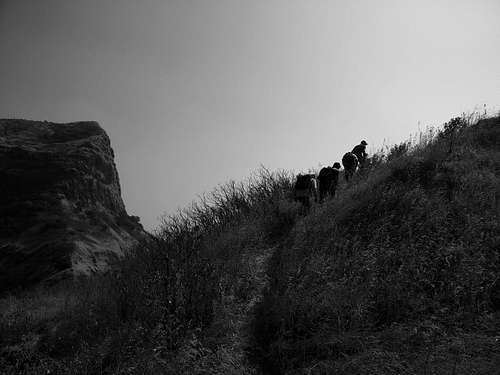
Started hiking up
And, so this time – we decided to take that road to Ghangad.
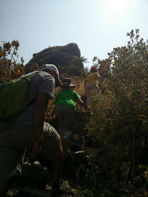
Some steep sections
Huge boulder
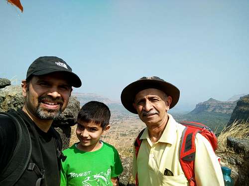
Amit agreed to come, but couldn’t make it on the last minute. Another friend of mine – Yogesh Thakar, who was my roommate in US, agreed to come along with his son.
Just before the ladder...
His son, Aarush was a good company for Yuvaan. And, in this group – my father in law also was present, as he is in great shape.
Kaka on ladder
Three of us...
However, he had had a surgery recently, so I was a little hesitant, but he himself being a doctor, said – it was OK.
We left a little late, due to many things.
Tel-Baila in a distance...
It was the Indian republic day, and we had to attend functions at our respective schools / colleges, so got a bit late.
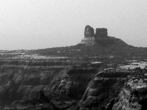
Close-up of Tel Baila
But, once we left – we only took a stop to buy some fruits at Paud, after which we stopped straight at the base of the fort, a village called Ekole.
Hikers going up...
Once you take a turn towards Lonavla from Tamhini, it is as if you are transported in a different world altogether! Trees lines up the road, and the temperature drops due to this greenery.
Indian Grand Canyon...
After driving about 8 km, we get a small bridge where we have to take a sharp left turn, to go towards Ghangad, and further to Tel-Baila and Lonavla.
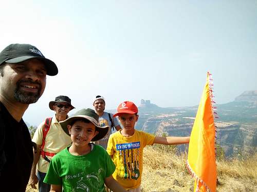
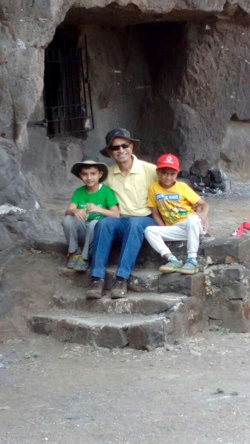
All of us at the top of Ghangad
Two of us...
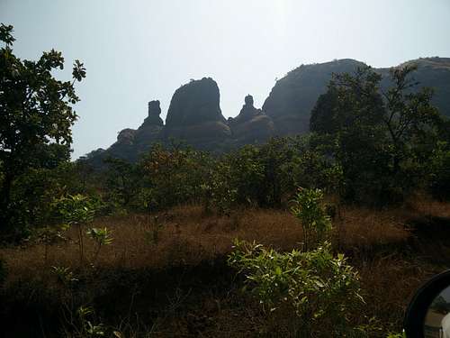
Once you take that left turn, you start seeing the three pinnacles of “Navra-Navri-Karavli”, which are not too high, but a lot of rock climbers climb these.
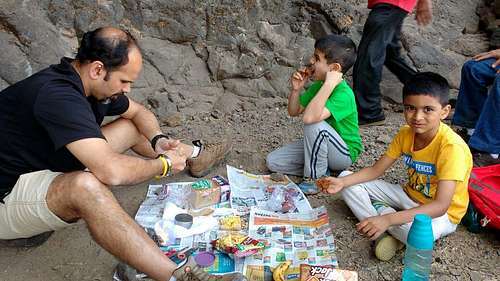
Meal time...
A road leads to Hirdi and Pimpri, from where one can descend into the famous Plus valley, and also climb the highest point in this region – Jhamblya, a name given to a mountain.
Ladder Patch...
Ciimbing Jhamblya is a challenge, with a rock patch that needs to be negotiated. Also, descending plus valley is considered quite a challenge, as it takes about 6 – 7 hours to descend this valley, which is very narrow.
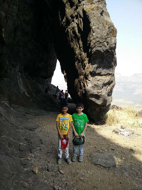
Kaka with both kids...
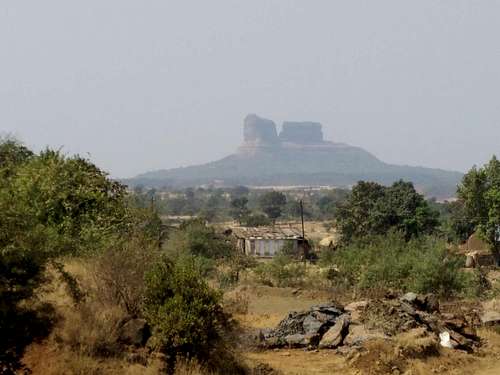
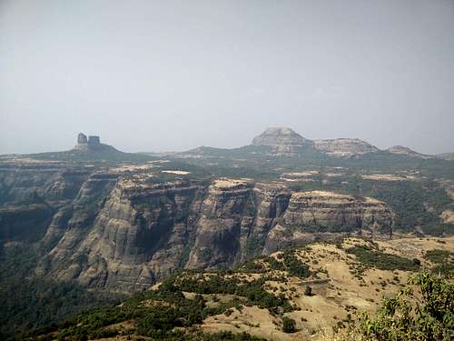
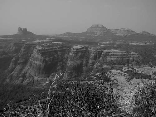
As you go towards Ghangad – you get to see Tel-Baila in all its glory and beauty. Tel-Baila is a set of two walls, with 4 climbing routes to go up. They stand there in the valley – all by themselves, as if guarding the valley. And, they look amazingly beautiful!
So, we headed past the pinnacles, to reach Ekole village, and parked our cars.
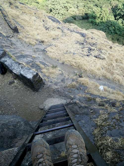
Looking down from the ladder!
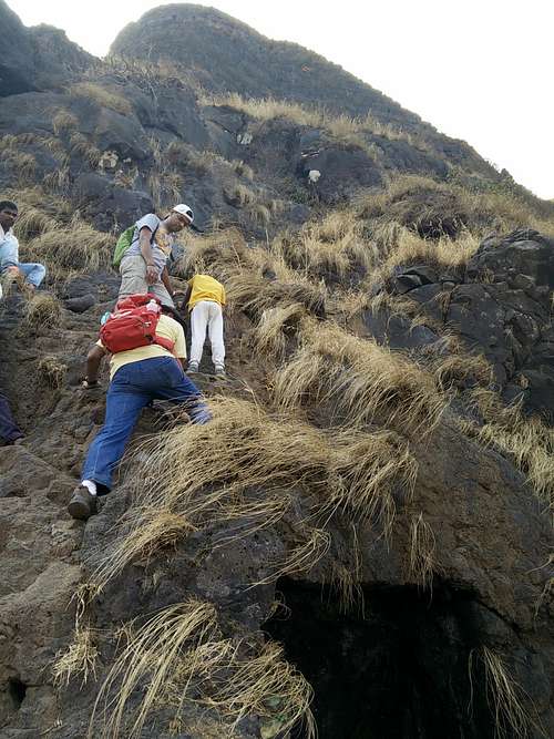
It was very hot and sunny, but we were well equipped with caps and lots of water and stuff to eat, so we weren’t worried. Once on the trail, Arush and Yuvaan led the pack upto the point where we climb the stairs cut in rocks, to reach a point where the steel ladder is installed.
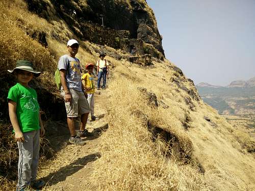
Others...
There were a couple of groups of people waiting there – and contemplating, whether to go up or not. The patch was tricky, and the ladder was risky, only if one falls. Because, at the base of the ladder, there was yet another drop of about 70 feet. So, in all, if somebody falls, he / she falls about 100 feet, which certainly is not good.
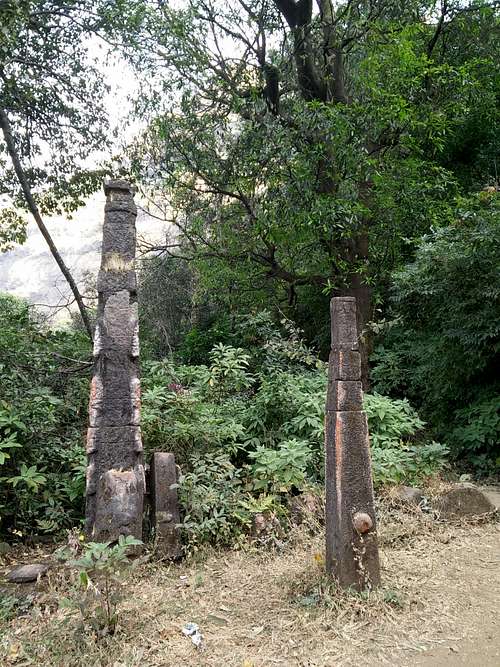
Deep-stambh near the temple, on way
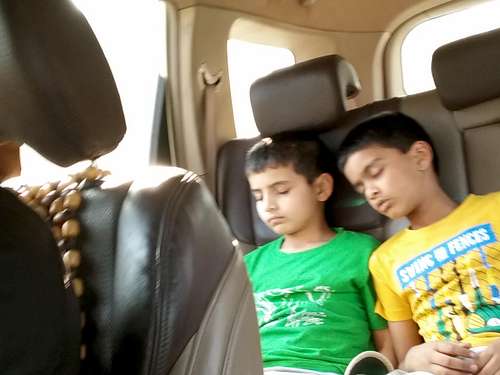
Tired...
Kaka was initially apprehensive about going up the ladder. But, after pursuation by myself and Yogesh, he agreed.
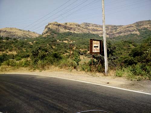
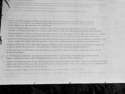
Information about the fort...
I stood on the ladder, and helped each of the kids go up. After going up as well, there was a small tricky step, but Yogesh was there to take care of the kids.
Tricky...
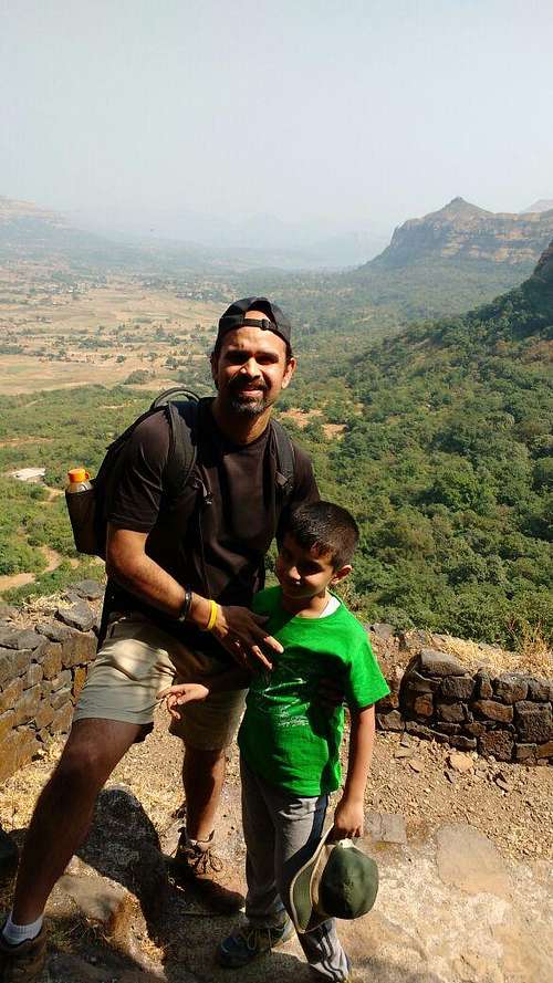
Once we were up – the view was just splendid! We could see Tel Baila and the rough terrain of Sahyadri from the top. Also, we could see the deep valleys which were so deep that we couldn’t see its bottom.
After roaming around on the top (which is not too big), and taking a few pictures, we descended down. Again, before the ladder patch and at the ladder patch, we took utmost care to get the kids safely down. And, once we all were down, we had a sumptuous lunch with whatever we had got.
Post lunch, we descended back to the car, and headed back to Pune. Initially, we had planned on doing Kailasgad also along with Ghangad, but it had started getting dark, so we dropped the plan.
Parents refers to a larger category under which an object falls. For example, theAconcagua mountain page has the 'Aconcagua Group' and the 'Seven Summits' asparents and is a parent itself to many routes, photos, and Trip Reports.