Toggle navigation
Mountains
Routes
Images
Trip Reports
Forum
What's New
People
Areas & Ranges
Articles
Trailheads
Canyons
Huts & Campgrounds
Albums
Logistical Centers
Fact Sheets
Lists
Custom Objects
Gear
Plans & Partners
WELCOME TO SUMMITPOST
SIGN IN
REGISTER
Ötztal Alps
Additional Parents
Image
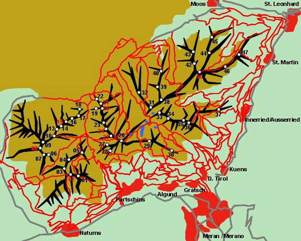
Hand drawn schematic map of...
View High-Resolution Image
Hand drawn schematic map of...
Hand drawn schematic map of the Texel Group subgroup of the Ötztal Alps. The red lines constitute the trails, lakes are denoted blue. The numbers refer to the listing in the text of the main page
« PREV
NEXT »
Gangolf Haub
on
Oct 4, 2005 5:11 pm
Comments & voting
Other parents
Image ID:
129632
3041 Hits
73.38
% Score
4
Votes
Log in to vote
Comments
No comments posted yet.
to post!
Don't have an account?
Ötztal Alps
(Area/Range)
« PREV
Viewing
#192 of 310
GALLERY
NEXT »
Gangolf Haub's Image Gallery
« PREV
Viewing
#5463 of 13940
GALLERY
NEXT »
×
You need to login in order to vote!
User Name
Password
Remember me
Forgot your password?
Log me out when I close my browser.
Keep me logged in all the time.
sign in as a user
Don't have an account?
Register now for FREE
Rating available
Suggested routes for you
People who climb the same things as you
Comments Available
Create Albums
Register Here


