
|
|
Mountain/Rock |
|---|---|
|
|
39.66250°N / 120.55111°W |
|
|
Sierra |
|
|
Hiking |
|
|
Spring, Summer, Fall |
|
|
8107 ft / 2471 m |
|
|
Overview
Haskell Peak is a bald mountain summit in Sierra County, California. Situated east of Sierra City, it is one of the rocky rolling ridges above the dense forest in the northern Sierra Nevada Mountain Range. Haskell Peak is the second tallest mountain in the area. The highest is Sierra Buttes at 8591'. Although only 484 feet higher than Haskell Peak, Sierra Buttes, and its staggering east face, vastly overshadows Haskell Peak, making it an afterthought to visitors to the area. Sierra Buttes from the summit of Haskell Peak.
Haskell Peak is a good side hike to do after Sierra Buttes. For one thing, it has great views of Sierra Buttes, which is less than 7 miles away. Further, because the primary trail to Sierra Buttes is only six miles, hikers will have plenty of time to hike Haskell Peak as well. If heading back east towards Reno or Lake Tahoe, Haskell Peak is actually on the way back. From the Haskell Peak trailhead, you can take forest service roads east towards Sierraville along highway 49. Once in Sierraville, you either continue on 49 back towards Reno and Susanville, or down highway 89 to Truckee.
The main Haskell Peak Trail is pretty short, only 1 1/2 miles to the summit with about 1,100 feet of elevation gain. It is a nice quick jaunt if you want some solitude after dealing with the crowds at Sierra Buttes. The views from the summit, like with Sierra Buttes, are quite expansive. Lassen Peak can be seen to the north, and the northern Sierra Nevada range can be seen to the south, including Mount Rose, Mount Lola, and Castle Peak.
Getting There
The main trailhead for Haskell Peak is located on the aptly named Haskell Peak Road, aka Forest Service Road 9. To get to Haskell Peak Road, the simplest way is to take highway 49 eastbound from Sierraville. Past Sierraville, there are two ways to get to the main trailhead. One is via Forest Service Road 52. This road is about 1 mile west of the junction between 49 and 89 North. Once you pass the 89 North junction, stay on 49 until you see the dirt road on the right. Take this road for a couple miles and it turns into Forest Service Road 9 (Haskell Peak Road). Follow the road looking for mileposts, as the numbers go lower (12,11, 10, etc.) The trailhead is just under 1/2 mile past milepost 9 and just over 1/2 mile before milepost 8. Parking is on your left. The trail is on your right.Another way is to take 49 eastbound from Sierraville to Bassets. This is the way to get to Haskell Peak if you hike Sierra Buttes first. You take Gold Lake Road about 2.5 miles north past the signed turn-off for Sierra Buttes. On your right is a sign, saying Haskell Peak Road. This is Forest Road 9. This is a well-graded forest road, that is well maintained in summer. Take the road for 8 miles. Watch for other cars since the road is narrow at points, and has some blind turns. Past milepost 8, you'll see a trail sign for Haskell Peak on your left. Parking is on the right. The trail sign says "Haskell Peak 2 Miles". In actuality, the hike to the summit is only about 1 1/2 miles, as mentioned above.
The hike starts with gradual elevation gain, with some meadowlike scenery along a rustic trail adorned with flowers and ferns in summer. After about 1/2 mile, the trail get steeper and the forest denser. After about a mile, the trail starts to open up, widens, and heads up to a ridge. You start to notice there are bald summits above you. Once you reach the saddle, you will see a small bluff, Point 7833, on the left. Continue up the trail for another quarter mile or so where you'll soon see two summits. The one of the right is the true summit. You are almost there. Just hike up the rocks where you'll be greeted with a huge cairn, that looks like a tower. You may now kick up your heels and enjoy the view!
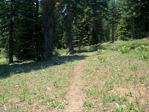 Early on the Haskell Peak trail
It is also possible to hike Haskell Peak from near the Chapman Saddle. Just past milepost 10 heading east, you'll see a sign saying "Haskell Peak 4 miles". You head north on the road and follow signs for Haskell Peak. Follow that road for about 1/2 mile to its first left. Take the left and follow the road for about 1/4 mile until you find a road/trail heading west. Find a place to park and take this as far as you can go. The windy road/trail will take you up to about 7,600 feet after 1 1/2 miles or so on the north side of the mountain. At this point, the slope is more open, providing a clearer path up the mountain. From here, continue west up the mountain for 1/3rd of a mile until you reach the summit.
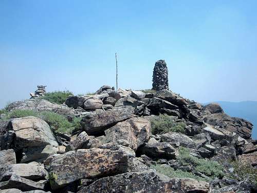 The bald summit of Haskell Peak
Red Tape
Haskell Peak is within the management of the U.S. Forest Service. There are no fees to park and no restrictions for hiking.External Links
Yahoo TravelGORP
Willoughby - Jul 9, 2018 5:46 am - Hasn't voted
Road signs are deceptiveI hiked this yesterday and was duped by the signs. Coming in from 49, after about 4-5 miles in there's a 4-way intersection with a sign pointing to the right for "Haskell Peak 4 (miles)." I took this, and found a place to park that was only about 500 meters distant from the summit. I climbed straight up a rocky cirque of sorts and up through steep mtn. hemlock to the ridge, and you're there lickety split. From the top I found the trail and figured it must take me back somewhere near my truck, but it deposited me way on the other side of the mtn, and it was a hot, long slog on a maze of fire roads back, which my girlfriend's dog didn't appreciate. If you want to take the trail, and you're coming in from 49, go straight past that sign for Haskell Peak. Soon, I believe, you'll see another sign for "Haskell Peak Trailhead" with mileage, and then the trailhead itself is a couple of miles beyond. Also, I didn't see any milepost signs along the road.
hgrapid - Jul 9, 2018 8:34 am - Hasn't voted
Re: Road signs are deceptiveI went by the mileposts, which is how I explained the best way to find the easier starting point. Were the mileposts not helpful? Or, did you not use my page to help guide to?