Toggle navigation
Mountains
Routes
Images
Trip Reports
Forum
What's New
People
Areas & Ranges
Articles
Trailheads
Canyons
Huts & Campgrounds
Albums
Logistical Centers
Fact Sheets
Lists
Custom Objects
Gear
Plans & Partners
WELCOME TO SUMMITPOST
SIGN IN
REGISTER
Hawkeye Point
Additional Parents
Image
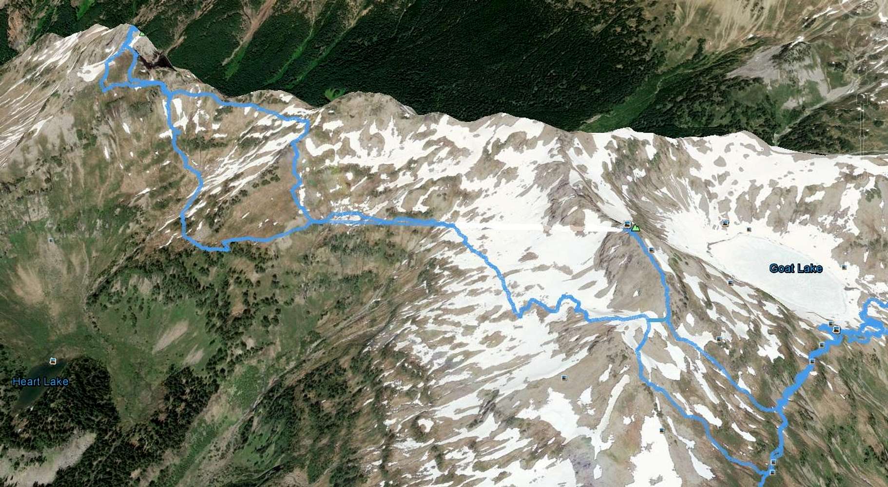
Hawkeye - Johnson Route (Google Earth)
View High-Resolution Image
Hawkeye - Johnson Route (Google Earth)
The route I took from Hawkeye Point to Johnson Peak viewed of Google Earth. Goat Rocks, WA 9-15-16.
« PREV
NEXT »
awilsondc
on
Sep 22, 2016 7:20 pm
Comments & voting
Other parents
Lat/Lon:
46.52810°N / 121.49726°W
Image Type(s):
Topo/Diagram
,
Informational
Image ID:
983291
2532 Hits
71.06
% Score
1
Votes
Log in to vote
Comments
No comments posted yet.
to post!
Don't have an account?
Hawkeye Point
(Mountain/Rock)
« PREV
Viewing
#21 of 22
GALLERY
NEXT »
awilsondc's Image Gallery
« PREV
Viewing
#472 of 495
GALLERY
NEXT »
Goat Rocks (WA)
(Area/Range)
Loading....
Johnson Peak (Goat Rocks)
(Mountain/Rock)
Loading....
Goat Rocks - Peak Bagging and Goats (Of Course)
(Trip Report)
Loading....
×
You need to login in order to vote!
User Name
Password
Remember me
Forgot your password?
Log me out when I close my browser.
Keep me logged in all the time.
sign in as a user
Don't have an account?
Register now for FREE
Rating available
Suggested routes for you
People who climb the same things as you
Comments Available
Create Albums
Register Here


