Here is a view of the Moapa...

Here is a view of the Moapa...
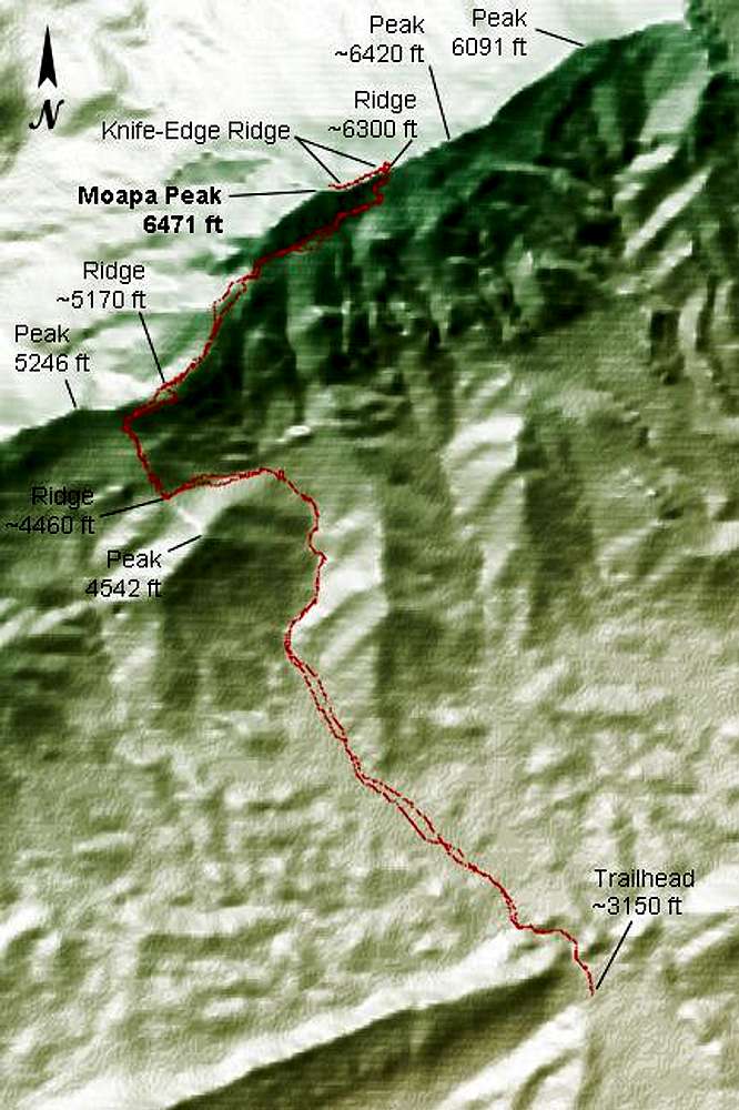
Here is a view of the Moapa Peak standard route, created with a program I wrote that uses USGS data. The resolution is somewhat limited by the 433x650-pixel image size, but hopefully this will give prospective hikers an idea how to follow the route. The data for the route path are GPS track data from our hike, so there are two paths shown -- one from our hike up and one from our hike down. Send me an e-mail if you would like the GPS data for this route.

Day Hiker
on Feb 10, 2005 3:40 am


Comments
Post a Comment