
-
 7275 Hits
-
 81.18% Score
-
 13 Votes
|
|
Mountain/Rock |
|---|---|
|
|
46.71244°N / 12.04514°E |
|
|
Hiking, Skiing |
|
|
Summer, Fall, Winter |
|
|
8340 ft / 2542 m |
|
|
Overview
 Hochalpenkopf / Cima dei Colli Alti behind Kaserkopf / Punta Kasera Hochalpenkopf / Cima dei Colli Alti behind Kaserkopf / Punta Kasera |
To the north the Prags / Braies Dolomites end in a line of mountain, aligned like pearls on a string: the Olanger Köpfe. Divided by Lapaduresjoch / Ju dies Slapadures there are two sets of mountains on the line: Pizzo delle Pietre / Piz de la Perez and Dreifingerspitze / Punta Tre Dita to the west and Flatschkofel / Col Valacia, Maurerkopf / Monte Muro, Hochalpenkopf / Cima dei Colli Alti and Kaserkopf / Punta Casera to the east. Of these Hochalpenkopf / Cima dei Colli Alti easily is the most popular mountain, mainly thanks to the short (but still strenuous) access route from Pragser Wildsee / Lago di Braies.
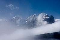
Named after the high alpine pasture Hochalpe, which during spring and summer is used to graze all kinds of domesticated animals, Hochalpenkopf / Cima dei Colli Alti is the second highest mountain of the subgroup. To its south, the pastures of Hochalpe gradually rise towards the summit in a slope of increasing steepness. Only near the top does the ascent get rocky. To the north, the mountain drops away in a huge face towards the Pustertal Valley / Val Pusteria. The face is of the poor rock quality, which is so common in the Prags / Braies Dolomites, a brittle limestone face, decomposing into a variety of towers and spires which apear to crumble underneath your eyes.
 |  |  |
To the east of the mountain, the only Via Ferrata of the whole Prags / Braies Dolomites leads along the east ridge of the mountain. It starts at neighbouring Kaserkopf / Punta Casera and follows the ridge towards a big step underneath the Hochalpenkopf Summit. The ferrata is hard to find and thanks to the low rock quality it also is prone to rockfall. Therefore, none of the Dolomites ferrata guidebooks recommend it.
 |  |  |
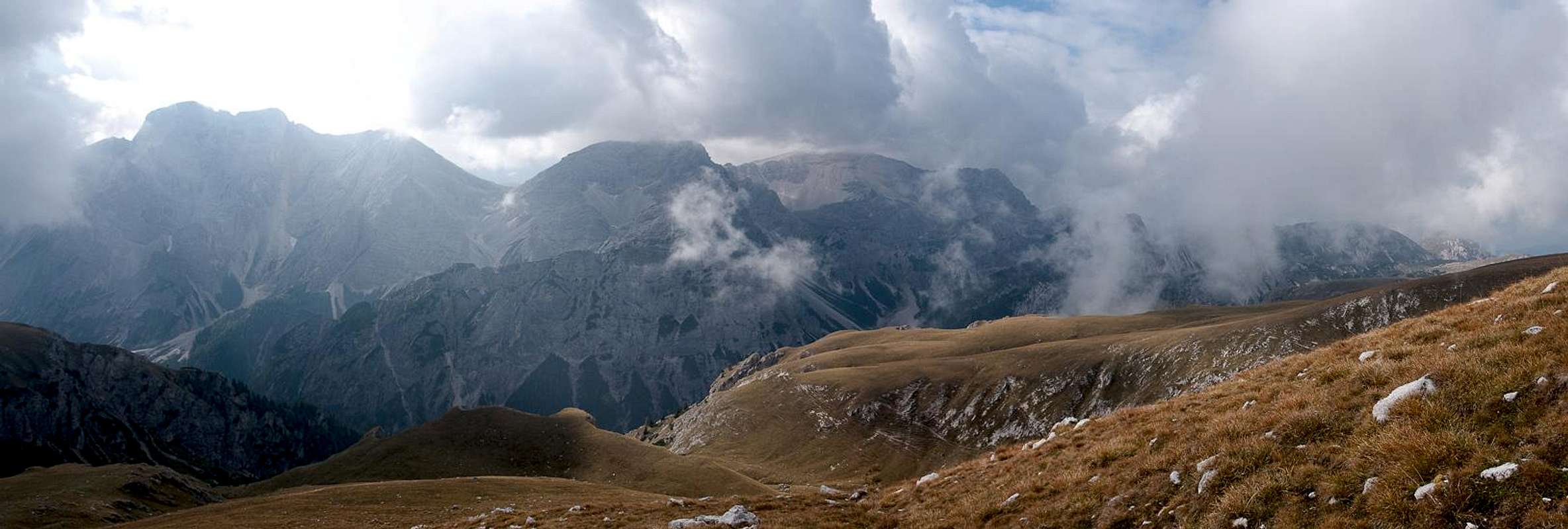
Thanks to its form and location, Hochalpenkopf / Cima dei Colli Alti is considered to be one of the premier lookout pulpits of the Prags / Braies Dolomites. The Seekofel / Monte Sella di Senes Group dominates southern views with its imposing (but also very brittle) north faces while to the north - across Pustertal / Val Pusteria the glaciated peaks of Hohe Tauern hover in the distance. And on a fine day in early summer the Hochalpe pasture will display a multitude of alpine flowers - a wonderful place to spend your day.
Summit Panorama towards the Prags / Braies Dolomites
  |
Getting There
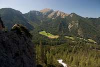
 Summit view into Pustertal / Val Pusteria
The best trailhead for Hochalpenkopf / Cima dei Colli Alti is at Pragser Wildsee / Lago di Braies in the east of the mountainIt can be easily reached from Toblach / Dobbiaco.
From The North
- Take A22 Brenner Motorway to exit Brixen / Bressanone
- Turn off onto SS49 east to Bruneck / Brunico or Toblach / Dobbiaco
From Austria (East)
- Take A12 Inntalautobahn to exit Kufstein.
- Turn onto B178, later B161 south in direction Kitzbühel.
- At Mittersill B161 turns into B108 which heads through Felbertauern Tunnel.
- Take B108 until Lienz were you turn right (west) onto E66 which on the border crossing turns into SS49 to Toblach / Dobbiaco and Bruneck / Brunico.
From Udine
- Take A23 north to exit Carnia.
- Turn off onto SS52 which leads through several detours to Innichen / San Candido
- Turn east on SS49 to Toblach / Dobbiaco and Bruneck / Brunico.
From Venezia
- Take motorway S27 north towards its end near Belluno.
- Turn onto SS51 towards Cortina d’Ampezzo and on to Toblach / Dobbiaco.
Red Tape
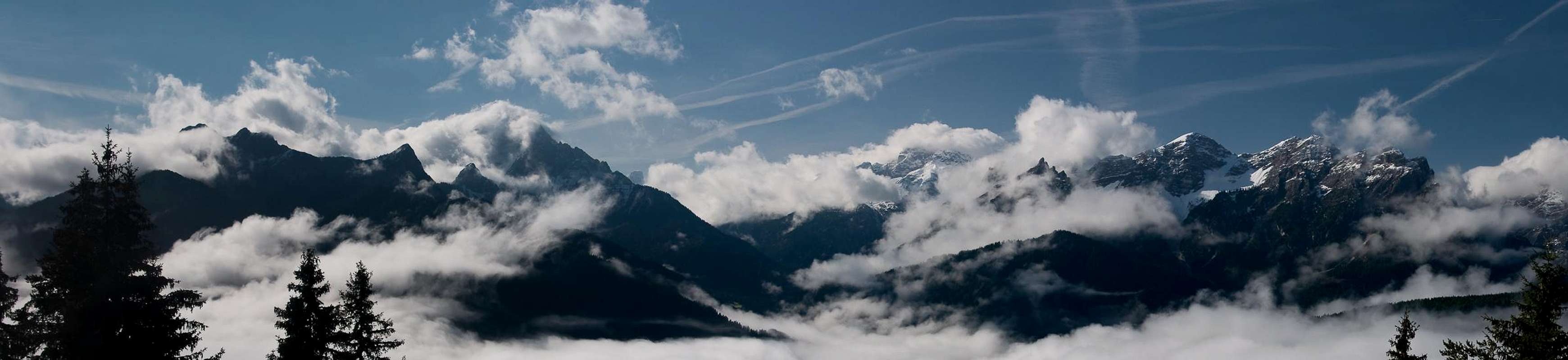
 Hochalpenkopf and Kronplatz
In 1980 an area of 25680ha has been set aside for the natural Park Fanes Sennes - Prags. You are required to treat the Natural Park with care: leave animals and plants in their place, use trails (especially when mountain biking), and take the official open roads with your car.
For more information you can look at the parks official website
Be prepared to pay small fees (3€) for the parking lot at the trailhead.
Accommodation
For hotels and apartments have a look at the websites of the towns and cities of the area:Weather Conditions
 |
Maps & Books
Books
The Prags Dolomites / Dolomiti de Braies are not as well covered in terms of Guidebooks. The list below offers the German books I know of dealing with the area but there certainly are more, especially Italian ones.
- Dolomiten 5 - Sexten - Toblach - Prags
F. Hauleitner
Rother Verlag
ISBN: 3 7633 4199 4
- Dolomiten
P. Fleischmann
Kompass Verlag
ISBN: 3 8705 1409 4
Sextener Dolomiten extrem - Alpenvereinsführer
R. Goedeke
Rother Verlag
ISBN: 3 7633 1255 2
Maps
The most commonly used maps are the ones by Kompass and by Tabacco. The Kompass one is good as an overview map while the Tabacco one offers more details.
- Bruneck - Toblach / Brunico Dobbiaco
Kompass Map WK 57
ISBN: 3 85491 064 9
Scale: 1:50000
- Dolomiti di Braies / Pragser Dolomiten / Marebbe / Enneberg / Plan de Corones / Kronplatz
Tabacco Map 031
Scale: 1:25000