Welcome to SP!  -   
 
 MbPost.com -- It's SP for Mountain Biking!
Areas & Ranges·Mountains & Rocks·Routes·Images·Articles·Trip Reports·Gear·Other·People·Plans & Partners·What's New·Forum

Here is a view of the... [ Sizes: Orig | Med | Small | Thumb ]
Here is a view of the...
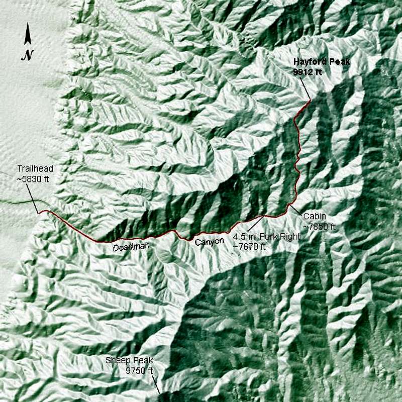
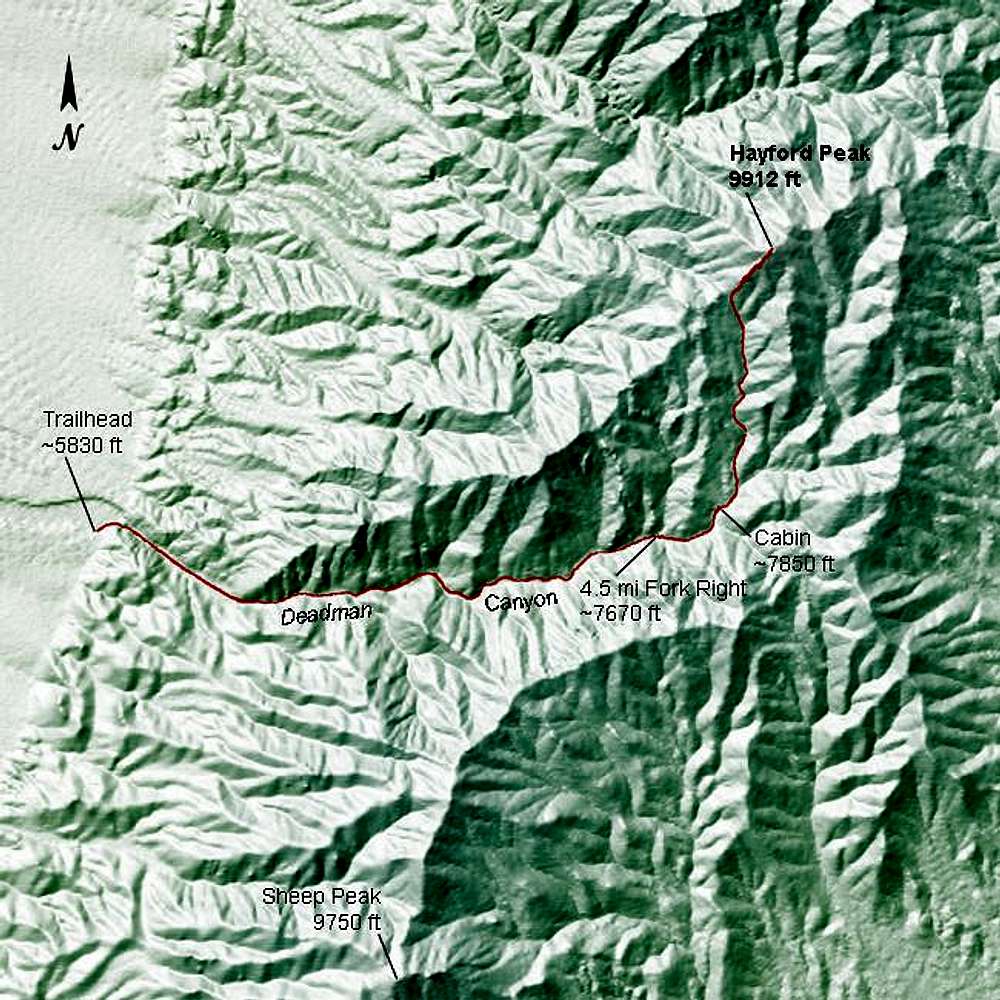
Here is a view of the "Deadman Canyon to Southwest Ridge" route to Hayford Peak, created with a program I wrote that uses USGS data. Some key landmarks and elevations are shown. The data for the route path are GPS track data from our hike on 09 April 2005. Send me an e-mail if you would like the GPS data for this route.


Comments

No comments posted yet.


Sign in to post!

Don't have an account? Register now.


Rate This Image
Current Score: 87.61

Log In To Vote
 standard - Deadman Cyn to SW Ridge (Route)


You are at
the First
Image

Viewing
#1 of 3
GALLERY

NEXT »

 Day Hiker's Image Gallery


« PREV

Viewing
#54 of 99
GALLERY

NEXT »


 Desert National Wildlife Refuge (DNWR) (Area/Range)


 Sheep Range (Area/Range)


 Hayford Peak (Mountain/Rock)


Image Data

Submitted by Day Hiker
on Apr 12, 2005 10:04 pm

Image ID: 100142
Hits: 1330 

Lat/Lon: 36.65700°N / 115.2°W


"After the first glass, you see things as you wish they were. After the second, you see things as they are not. Finally, you see things as they really are, which is the most horrible thing in the world."   --Oscar Wilde on Absinthe   

© 2006 SummitPost.org. All Rights Reserved.