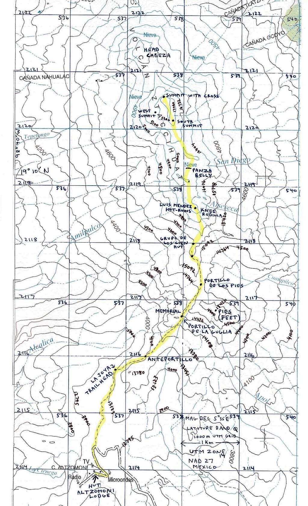
Iztaccihuatl Map

Iztaccihuatl Map

This map was made from the 1:50,000 topo that covers Izta & Popo. I enlarged it 2X on a photocopier and added some labels for features and contours. It was necessary for me to heavy up the UTM grid. Map datum is NAD27 Mexico. If you print this on 8.5 x 14 the scale should be close to 1:25000.
MountainHikerCO
on Jan 31, 2008 8:57 pm
Image Type(s): Topo/Diagram
Image ID: 377336

Comments

Post a Comment
Viewing: 1-2 of 2
SawtoothSean

SawtoothSean - Jan 21, 2009 10:31 pm - Voted 10/10

Thanks!

Very useful!

MountainHikerCO

MountainHikerCO - Jan 22, 2009 2:01 pm - Hasn't voted

Re: Thanks!

I glad you found it useful. My intent was to add some detail I found evasive before going there.

Viewing: 1-2 of 2