
-
 4648 Hits
-
 71.06% Score
-
 1 Votes
|
|
Mountain/Rock |
|---|---|
|
|
38.67717°N / 112.30549°W |
|
|
Sevier |
|
|
Hiking, Mountaineering, Trad Climbing, Sport Climbing, Toprope |
|
|
Spring, Summer, Fall, Winter |
|
|
9325 ft / 2842 m |
|
|
Overview
Joseph Peak is the highest of a cluster of 9,000-foot peaks in the southern portion of the Pahvant Mountains in Central Utah. It offers great views of the Northern Pahvant, Sevier Plateau, and Tushar Mountains. Wildlife are abundant in the area.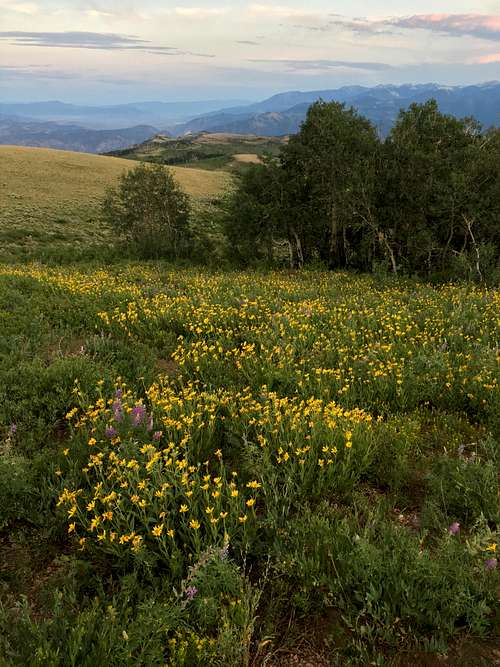
Southern Slope Wildflowers
Getting There
From the small town of Joseph, take East Main Street west. It turns into Highway 118, then Forest Road 110 (Rockwood Road) west of I-70. Continue straight on this road for about 9 miles from I-70. The dirt road is fairly well-maintained as should be passable to most vehicles.Route
The two routes below are fairly comparable.Joseph Peak Road - 0.76 miles; 421 feet of elevation gain. There is a locked gate passable by foot 200 yards up the road. The dirt road becomes faint after this.
![Routes of Joseph Peak]()
Routes of Joseph Peak
South slope - 0.42 miles. There is some bushwhacking; either sage or oak so choose your adventure.
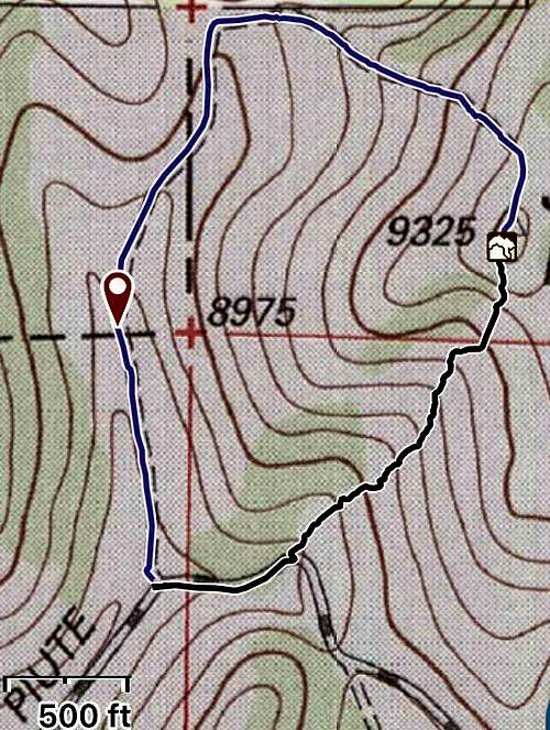
Routes of Joseph Peak