


Dmitry Pruss - Jun 7, 2005 11:34 am - Hasn't voted
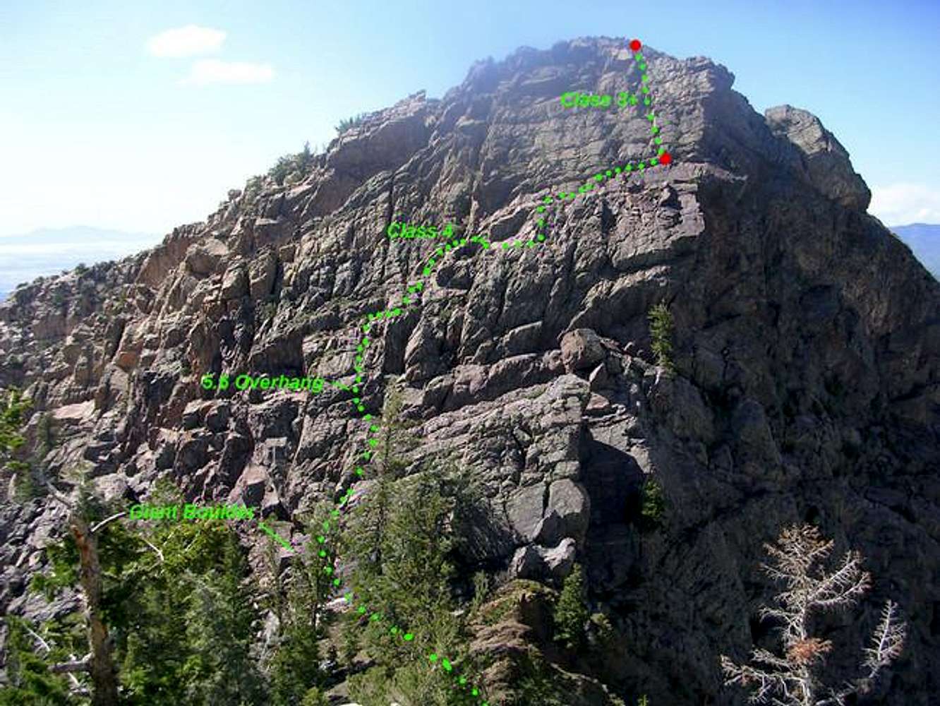
what about a tunnel route?I would suggest a tunnel variation. From the saddle just North of this nice summit, down a coloir to the West, tunnel under a chokestone, take a narrow ledge left (there may be more than one ledge but I can't recall if it makes a difference), cross the ridge towards Main Saddle, then it may be a few yards cl 5 down, or maybe easier if you are lucky / not too picky about loosing a bit elevation.

PellucidWombat - Jun 7, 2005 1:21 pm - Hasn't voted
Re: what about a tunnel route?from the saddle north of this summit it appeared that the chute to the west cliffed out. So these ledges bypass the cliff and allow you to traverse around the summit ridge lower down?
Dmitry Pruss - Jun 7, 2005 1:33 pm - Hasn't voted
Re: what about a tunnel route?I think so. But most probably the tunnel-ledge route still converges with yours right at the "5.6 overhang". Gotta revisit it with this picture in sight to confirm. But ever since I've got a dog to accompany me on these hikes, I've grown weary of the places like that neat broken red ledge just to the North. Last time we bypassed even a bit lower than your "lower bypass" route...


Comments
Post a Comment