

BigLee - Jun 20, 2008 1:37 pm - Voted 10/10
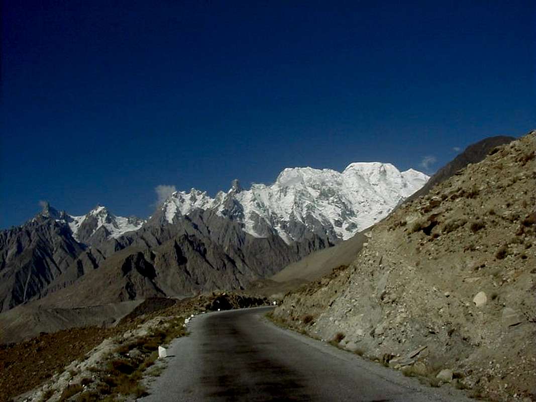
UltarNice photo. The broad snowy peak to the right is the East side of Ultar II I think.

Afzal - Jun 21, 2008 9:44 am - Hasn't voted
Re: UltarThanks. Yes, you are right.

Noondueler - May 28, 2011 10:53 pm - Voted 10/10
What is the elevationhere Afzal?
Must be an exhilarating and challenging drive.
Afzal - May 29, 2011 3:34 am - Hasn't voted
Re: What is the elevationFrom Gilgit the Karakoram Highway branches away from the Gilgit River and, after following the Hunza River northwards about 100 km reched to Aliabad (2240m). Further, the road climbs, winding up and crossing the Hunza River many times, to reach Pasu (2543m). So I think that altitude at this point is between 2240 to 2243m. Further driving on KKH, one can reach at Sost and Khunjerab Pass (4709m). At the pass the traveler crosses into China having covered a distance of 256 km from Gilgit and 873 km from Islamabad, a journey through one of the most inspiring and desolate regions of the world.
Noondueler - May 29, 2011 6:25 pm - Voted 10/10
Re: What is the elevationThanks for the information Afzal. The Khunjerab Pass is over 3,000 feet higher than the highest pass in the Rocky Mountains of Colorado which is 12,183 feet or 3,713 m
Cheers,
-Windsor
Afzal - May 30, 2011 3:16 am - Hasn't voted
Re: What is the elevationThanks for your reply. In Pakistan especially in Gilgit Baltistan, the most of the villages are above 2500 meters surrounding by the high peaks of 4000/5000 meters.


Comments
Post a Comment