
-
 3019 Hits
-
 71.06% Score
-
 1 Votes
|
|
Route |
|---|---|
|
|
46.81550°N / 12.50780°E |
|
|
Hike and Scramble |
|
|
Half a day |
|
|
Walk-Up |
|
|
Approach
From B100 the Pustertaler Strasse at Abfaltersbach head northward to Anras. From Anras follow the signs to Kobreil were the (long) ascent starts.
Route Description
- Start altitude: 1500m
- Summit altitude: 2918m
- Prevailing exposition: SE
- Type: 1h over forest roads, 2h over meadows, 2h rocky summit climb
- Protection: marked but without security
The ascent starts at the little hamlet of Kobreil on the northern slopes of the Pustertal Valley. From the village a forest road heads northwest up the mountain, rapidly turning north. From there on it winds through the fir and larch forests until it crosses the timberline at some 1950m.
You have to cross three gates before you get to the large meadow across which Lampenweg runs in direction of Lake Anras. The trail is marked but not very easy to find. The marks are rare and at the end of the summer the grass can be high and hide the marks. Anyway, keep in northwesterly direction. Every km you will come to a signpost which points to Lake Anras, Gumiraul and Finsterkofel.
Shortly before you reach Anraser See the trail gets easier to find as you get into rocky terrain. To the right (north) the trail to Finsterkofel turns off. You reach a nice little cabin (see sig pict on the main page) and follow the trail to Anraser See. Here the trail splits: the normal ascent starts from the northern shore of the lake, from the southern shore you can do an easy traverse to the western approach from Winkeltal. The traverse is easy but the final ascent along the south ridge to the summit includes a long stretch of UIAA grade I+ terrain (see the Tillachalm Route for more details).
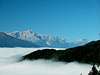
The normal route offers some great views of Lake Anras with the Carnic Alps or Sexten Dolomites as a backdrop. You follow the ridge between Finsterkofel and Gumiraul to its southern side (don't be fooled you keep some 150m below the ridge). The last 200m are very steep but not exposed and rather easy. At the summit you'll find some planks for sitting down, a summit cross and great, great views! To reach the real summit you have to climb into a little saddle and then do an UIAA grade III+ climb of some 30 - 40m.
 |  |
Essential Gear
To reach the false summit with the cross (some 15m lower than the real one) hiking gear is enough. If you want to climb the real summit (or the traverse to Gölbner you need to bring full climbing equipment.