Diamond in the Rough - August 31st, 2013
Diamond had been on my must-do list all summer, but weather and other factors had kept me from pursuing the peak through the end of August. Labor Day was close to being the last chance I’d have for the peak, and I was determined to take advantage of it.
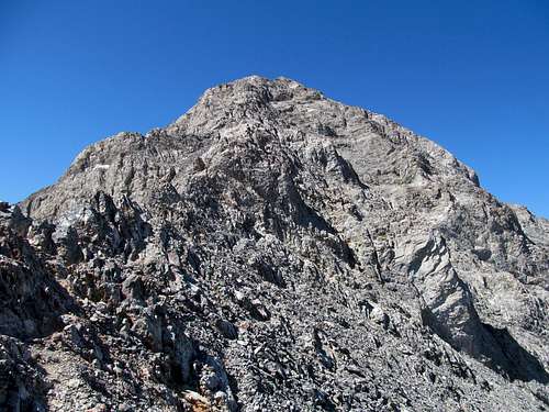
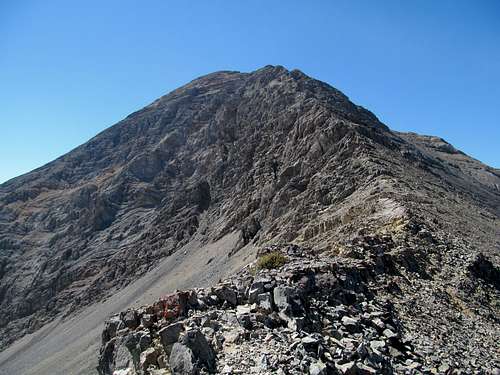
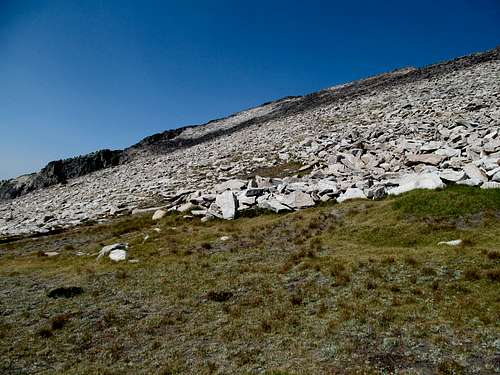
With the East Ridge presenting the prospect of a fun and basic scramble, I found myself concerned with the loose talus below the ridge proper. Having examined possibilities for this peak countless times over the last year , I decided that perhaps my best bet was to follow Scandinavian peakbagger Petter’s route as posted on one of his peakbagger.com
TR’s, which ascends an ENE variation of the East Ridge route. This put me at a lower starting point of 7,300’, and as I ascended the dry ridge towards the peak I glared enviously at a SUV making its way up the ridge to join a few other cars parked several hundred feet above me.
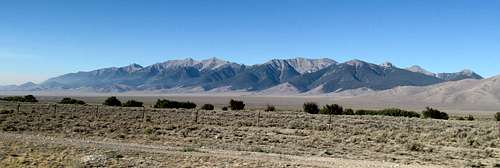
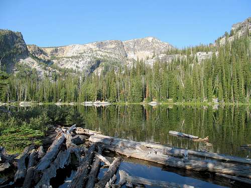
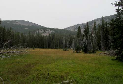
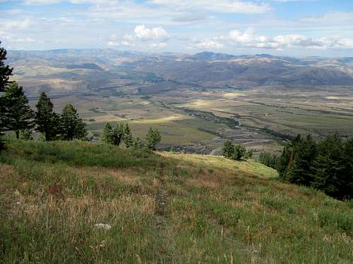
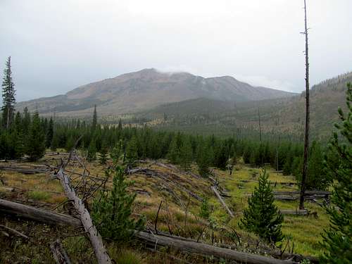
At least the air was clear. The drive up through eastern Idaho saw some heavy smog, but the haze had miraculously cleared up by the time by the time I drove past Mud Lake and into the valley between the Lehmi’s and the Beaverheads. The air was chilly in the late morning, the crispness signifying the shadow of a summer passed. The route was easy enough; from my parking spot at the bottom of the drainage separating my ascent ridge from the standard one I went up a few dry grassy hills to crest at a fairly level traverse which, as describe by the beta, took me through a small wooded area.
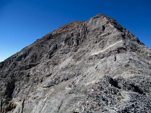
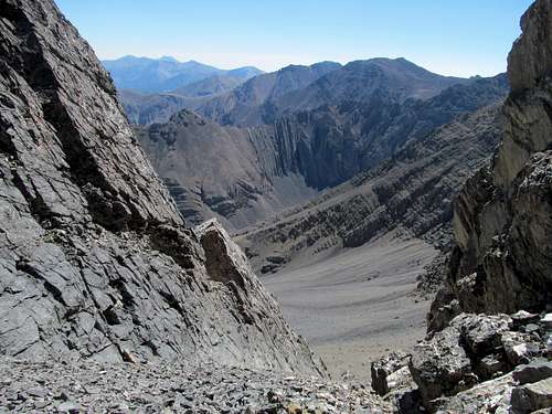
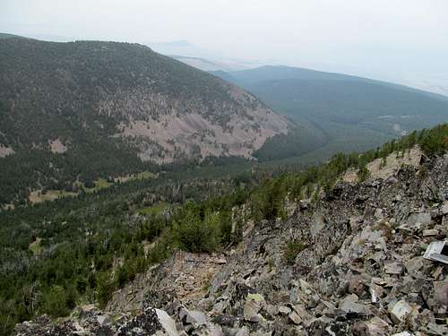
After a little bit of scrambling past this section I encountered some loose scree along a steep slope to rejoin the standard route on the main ridge; I imagine this brief few hundred feet of looseness is still a better alternative than the thousand feet or so you have to endure on the main route.
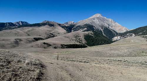
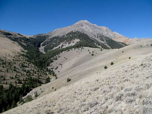
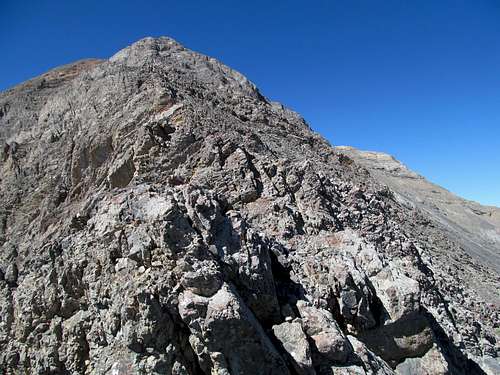
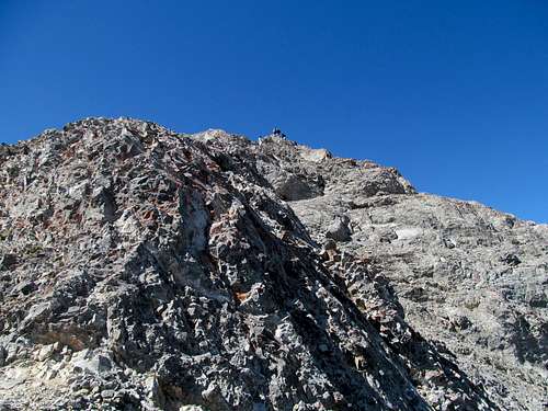
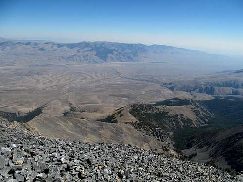
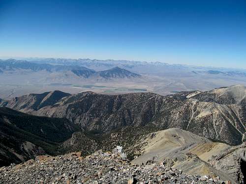
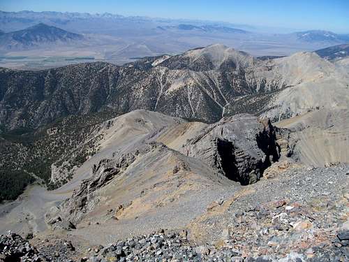
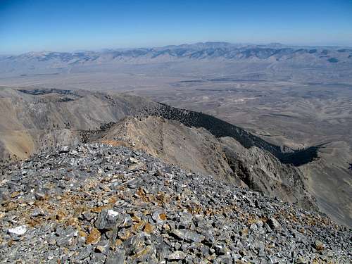
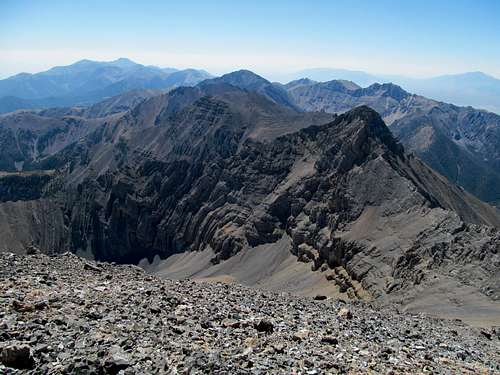
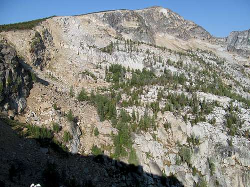
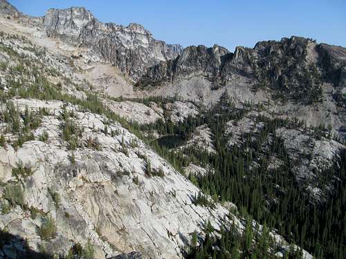
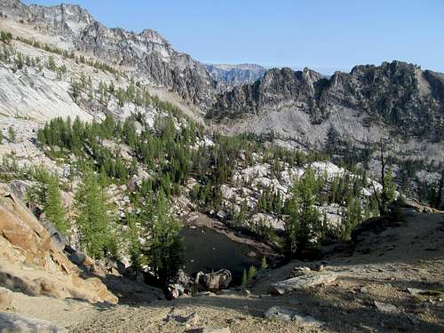
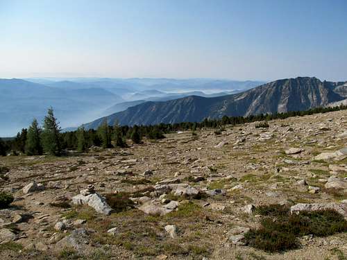
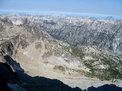
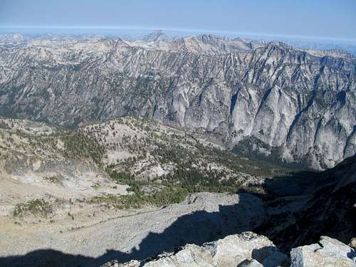
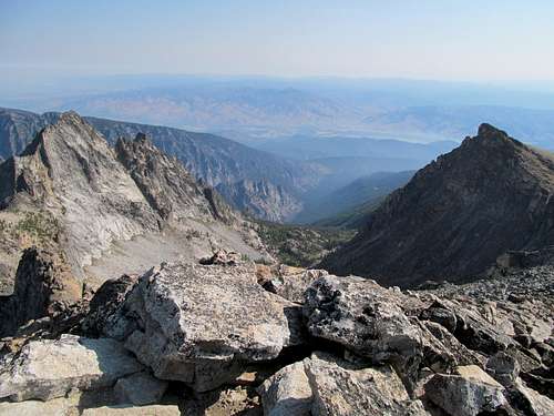
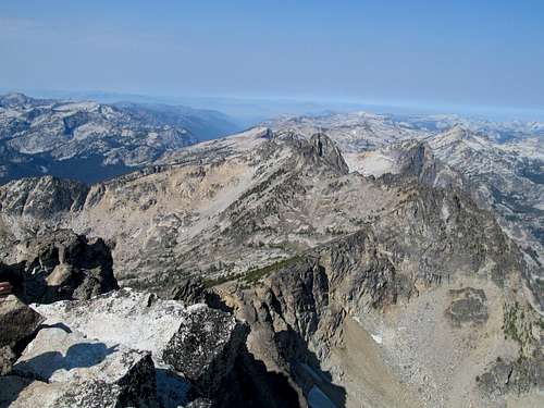
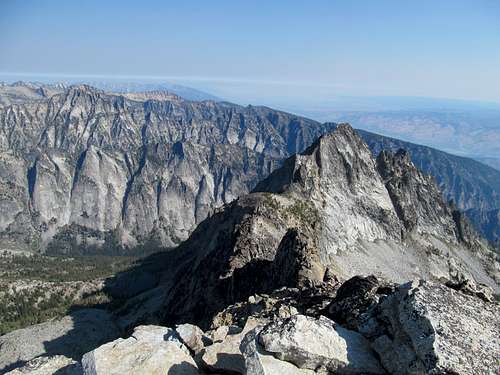
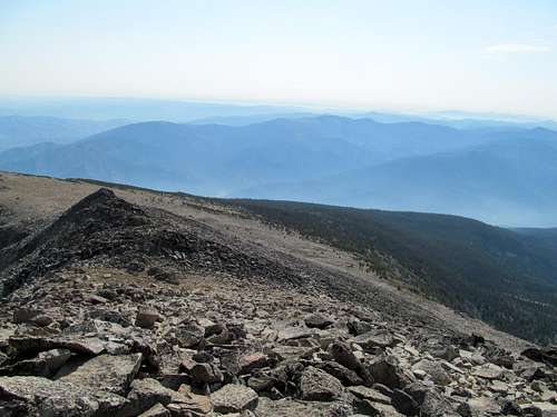
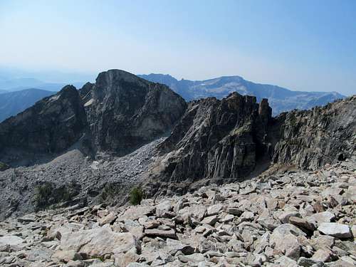
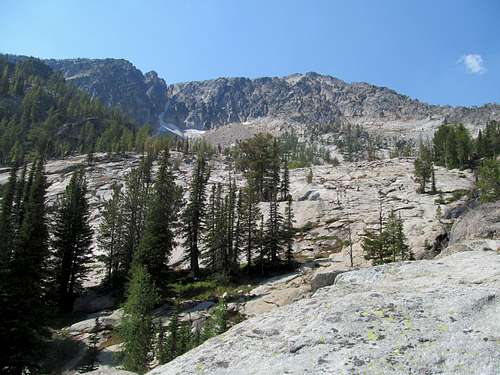
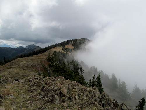
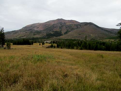
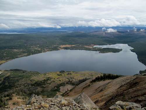
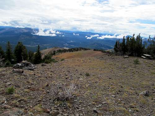
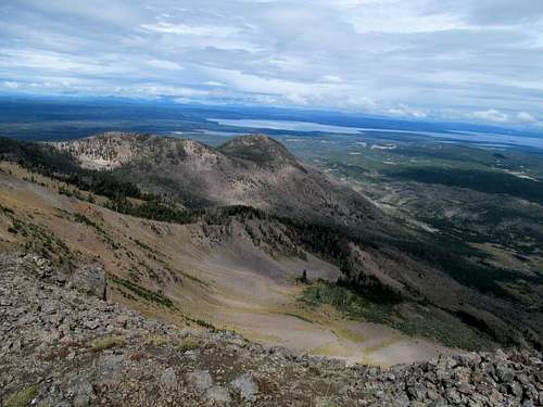
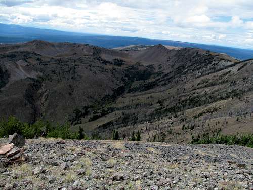
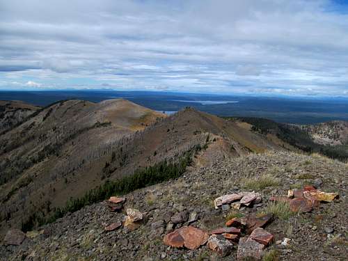
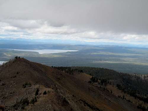
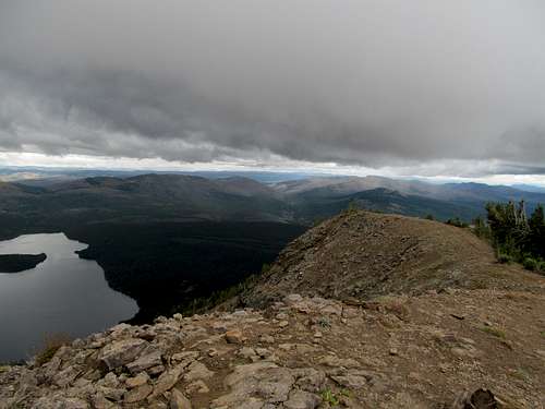
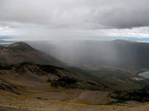
Once along the standard route, breathtaking views of the Riddler and Diamond’s southeast face soon gave way to scrambling. The ridge crest provided the best option composed of solid scrambling moves without excessive exposure as long as you’re careful not to veer too much to the left. To the right was a climber’s trail that followed the ridge in bits and pieces along the route, avoiding some of the scrambling but its looseness making it hardly a more palatable option. The main thing that struck me about this route was how sustained the class 3 climbing was. Once you start you don’t stop until you top out pretty close to the summit, it’s section, after section, maybe a quick break, then another steep rocky section, and so forth. Some areas look intimidating from further below but once you’re on the rock you see the obvious holds and moves.
A large group descended near a crux-y section. I awaited them and continued on.
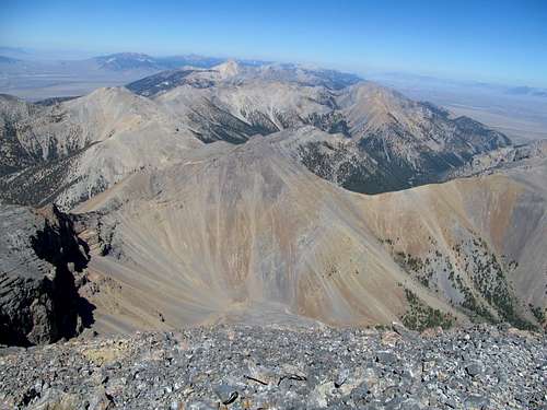
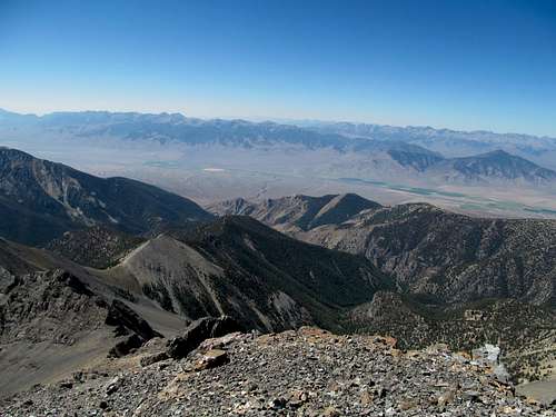
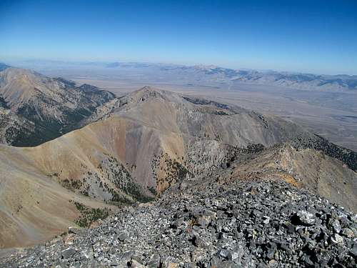
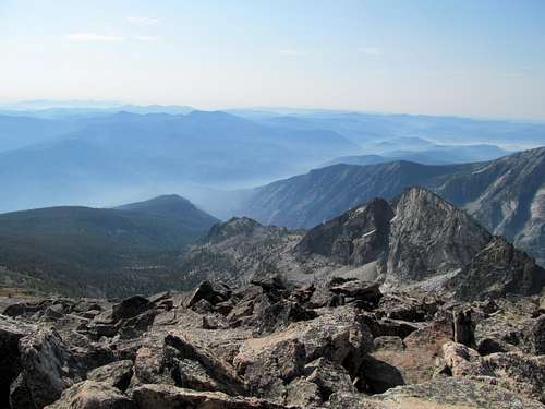
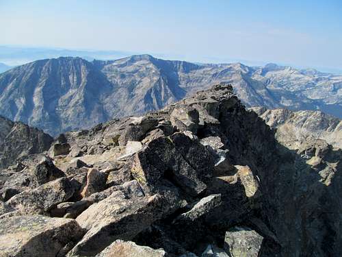
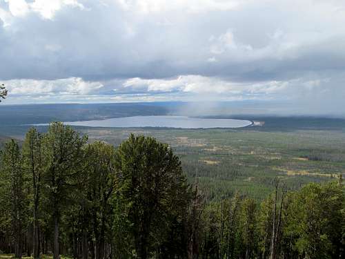
Soon, I had the summit to myself and enjoyed the views on this crystal clear day. What struck me, aside from the vastness barrenness of the region, was Saddle Peak to the south. It’s a P2K, but a lower peak by far, probably more than a thousand feet lower than Diamond, but for whatever reason, from my vantage point on the summit it looked higher.
I chatted with an Idaho County Highpointer as I started the descent; he was just making his way up to the false summit area. Then it was a careful retracing of the steps down. There were a decent amount of parties making their way up and down the peak today, a long weekend Saturday.
On the way down I noticed a kid struggling to the downclimber’s left on some ledges near the climbing trail. He was somewhat lost and confused by the terrain, his group waiting for him further down. I guess he had tried to give it a go, but it was too much for him. I steered him away descending down a misleading drainage, then walked him through a couple downclimbing areas back to the easy section. Then it was a steep walk in the afternoon sun back to my car, the open terrain allowing for easy navigation.
I made it to the rustic little town of Salmon later in the afternoon, enjoying the views of the steepest of the Beaverhead Range lining the valley to the east. A quick dinner, and I schmucked around to an early curtain call.
Trapper Keeper - September 1st, 2013
My goal for the next day was Trapper Peak, a gem high on my to do list and a long drive away from Salmon. With the air pollution forecasts showing a clear morning but haze later in the day, I hoped to get the peak early so I could avail myself with views before haze from the massive Gold Pan Wildfire southwest of Trapper, which had already closed a number of access roads in the region, clouded up my first ever visit to this magnificent range. It was partly for this reason too that in reviewing my route options I decided to forgo the standard trail for one of the excellent Baker Lake route outlines provided here on SP by ThePhotoHiker’s pages, favoring them not just for their superior scenic qualities but also for their brevity, as they could potentially get me to the summit earlier in the morning.
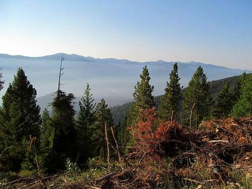
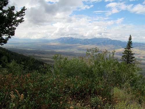
I got a coffee and left town in the wee hours of the morning, heart racing as I drove north into Montana. Having always been fascinated with the Lewis and Clark story, my heart raced as I ventured into this pristine yet historic region for the first time, imagining what this landscape would look like over two hundred years ago. Whereas the Idaho side seemed rustic and remote, Montana seemed to beckon a return to civilization. While I wouldn’t drive through any major towns (Hamilton would be further north from where I turned off), there just seemed to be more people, recreationists, in this valley. I drove the winding road to the Baker Lake trailhead, savoring the views of both the sharp crags of the Bitterroots as well as the occasional view to the northeast, where I could glimpse the Pintlers and the Pioneers fighting a losing battle against the low lying valley haze.
I enjoyed the views, knowing that this could be the last I see of them.
Having cut my outdoors teeth in the northeast, the lush landscape of Montana harkened me back to an earlier time. I hiked those 4,000 footers in New Hampshire grudgingly at first, complaining in my head that they would never measure up to the grander mountains out west, but by the time I had finished the NH four thousand footers as well as a host of other peaks I had grown to appreciate the subtle things about ascents mostly clouded below timberline, notably the smells and scents of the early morning. Such senses stood lost in deep hibernation when desert hiking, and even in dryer ranges up north like the Lost Rivers, Lemhi’s, or the Flint Creeks or Pioneers in Montana, but here the Bitterroots my nasal glands finally reawakened to the smells of a lush, truly northern range.
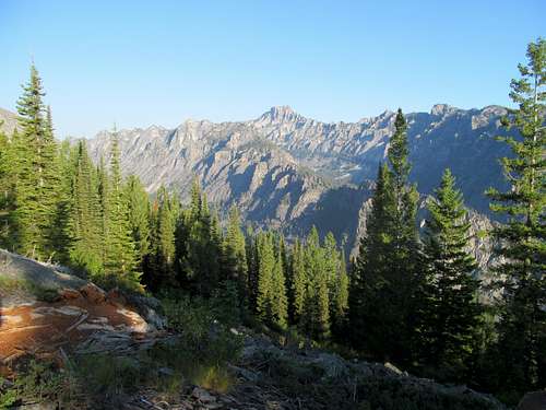
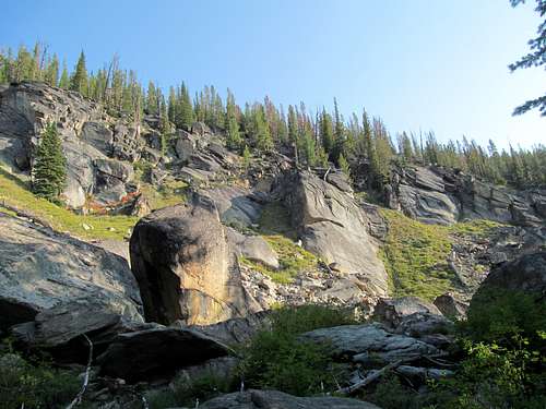
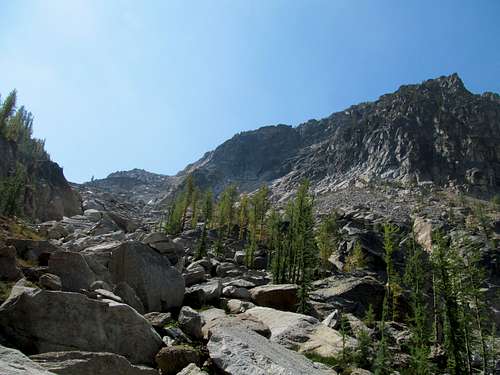
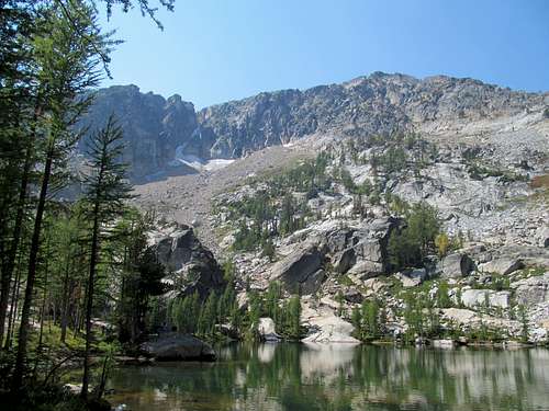
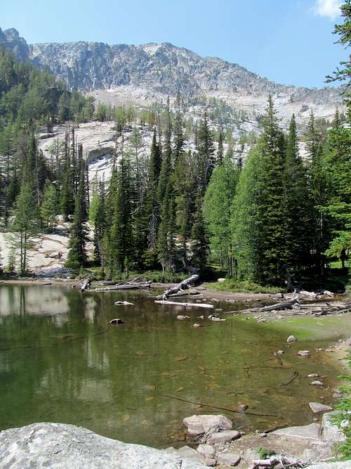
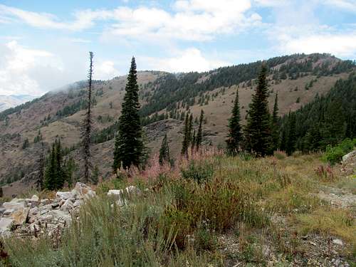
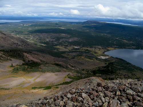
Some pretty cliff faces greeted me on the right as I hiked the short mile or so to Baker Lake, still and pristine in the early morning. Around me, campers were just waking up and starting up their breakfast routines, and I skipped past them and left the trail to gentle, meandering terrain along a wooded ridge to ascend the Baker Ridge route. Eventually the going got a little steeper cresting the ridge along a defined climbers trail, but the views down to the lake and the ridges to the north opening up made up for the extra effort.
It was a nice and pleasant ridge walk to join the main Trapper trail along the ridge crest. The terrain stayed gentle, the trees were pretty, and I could venture to the edge of the ridge at my own choosing to get a few glimpses of the northern panoramas.
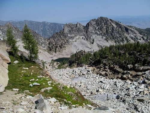
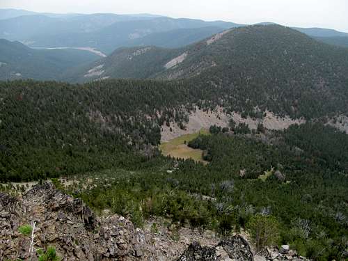
Along the way I scouted for my intended route down to Gem Lake as well, passing by a few gullies that seemed reasonable for the descent. I rejoined the crowds now gathering full force along the main trail, likely surprisingly a couple as they saw me pop out of nowhere from the trees. The rest of the trail was pretty basic until the summit area, where I lost a few times among the boulders.
Not being able to spot the landmark rock noted on the route pages here, I nevertheless muddled around looking from cairn to cairn until I reached the summit plaque marking the top.
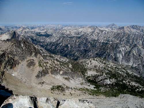
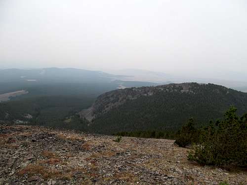
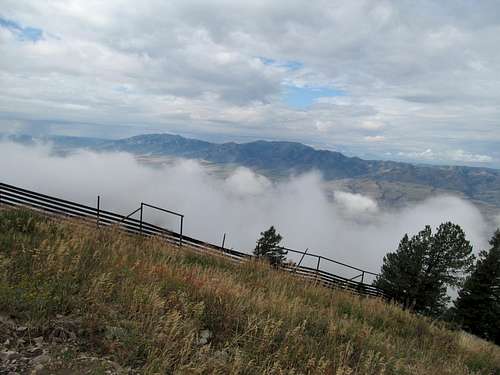
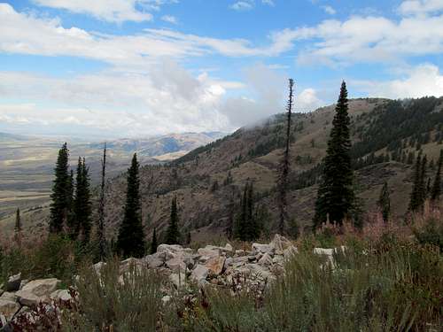
I was treated to one of the most amazing sights of my life. The vast expanse of the Bitterroots lay below me, but even more remarkably was a line of demarcating rounding out the views of the range north to the northwest, marking the early morning delineation above and below the forest fire haze.
Lucky for me I made it to the summit in time to witness this hazeline, allowing me far reaching views before it expanded and evaporated in the early afternoon, which it proceeded to do as I enjoyed the views for well over an hour, chatting with the other hikers I shared the summit with.
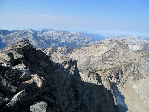
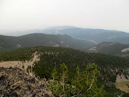
What really struck me about this area was the width of the range. I think the Bitterroots are often thought of as a linear range, but staring west from Trapper I saw a width of the range that seemed endless as it stretched back into deep wilderness towards Idaho and the even more remote Salmon River Range, where at the same time Greg was going after the 40-50 mile ascent of Mormon Mountain.
I left the summit reluctantly and started back down the trail, losing it briefly when I followed a climbers trail right, off the main trail. But the climber's trail was well defined and seemed to offer a quicker descent, so I followed it until I realized it was definitely leading in the wrong direction and not curving back to the main trail.
I sidehilled my way through some easy terrain back to the trail, then looked for my spot to leave it, again surprising a few other hikers along way when they saw me inexplicably walk cross country into the woods.
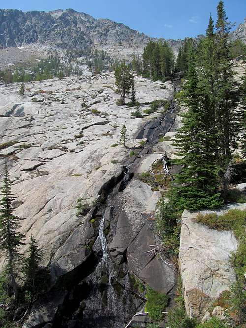
I’m still not quite sure whether I descended the same Gem Lake ascent gully described on the route here, as there’s a few ones that parallel each other above the lake. No matter, it was a gully, and it offered a reasonable descent directly to Gem Lake via some pretty springs and cascades.
I passed by some hikers and refound the trail leading back to Middle Lake. In between these two was a really cool granite slab where the outlet from Gem Lake trickled furiously down through a narrow crevice in the rocks.
I was a little concerned about how sore my legs were by the time I returned to a very crowded trailhead. My muscles should have been well conditioned this late in the year, and both Diamond and Trapper offered relatively short round trips. My guess is that two straight days of careful scrambling descents had stiffened my knees and quads. This was a concern because potentially my biggest day of the weekend would be Monday. Greg’s agenda had started Saturday with Taylor Peak, after which he would go after the afore mentioned Mormon Mountain, certainly one of the most remote summits in the lower 48. His plan was to (obviously) hike it in a day and then we would potentially meet on Labor Day for the relatively less remote and shorter McGuire Mountain, still a 20 mile jaunt deep in the Salmon River Mountains. I told him that I was unsure about the ascent, as the weather forecasts in the area portended some potentially nasty TStorms on Monday. Now add to whether my legs would cooperate for a longer hike, and after some arduous deliberation in Salmon I ultimately decided to stay in town rather than leave to car camp at the McGuire trailhead. Since he would be in the middle of nowhere for quite a few days, I told Greg prior to the weekend that I might bail on McGuire if the weather turned. Since he was set on McGuire rain or sun, he’d know as well that my absence would signal rough storms ahead.
Bloody Dickin' Around - September 2nd, 2013
The weather picture was iffy for Monday as well, and the updated unfavorable forecast deterred me from going for Lem Peak south of town that morning. Instead I decided to cross back over into Montana to go after Bloody Dick Peak, a P2K and the highest point of the Big Hole Mountains, a subrange of the Beaverhead Range (digest that verbiage for a minute. Makes Hoback seem tame). I drove the dirt roads over Lemhi Pass, a route with historical significance, it being the spot where Lewis and Clark first crossed the Continental Divide. Unfortunately their view cresting the pass was better than mines this morning, with a thick haze fully encompassing the vista of the Lemhi's.
Montana is big, and what looks like a short distance on a map stretches out a lot more than you’d expect. The dirt roads leading towards Bloody Dick seemed to stretch forever as they curled around the range past wide swaths of meadows to eventually graze the peak’s northern flanks. I took a right onto the rougher road but was stopped pretty quickly by a downed tree, so I gathered my belongings for a road walk.
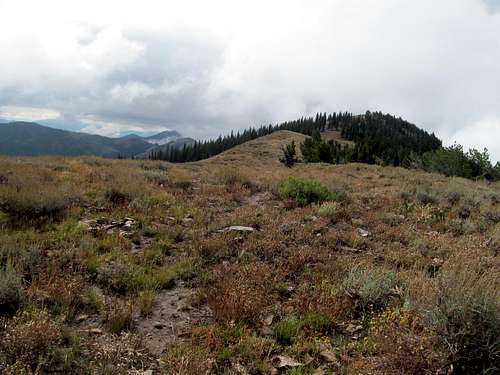
There’s not a lot of information online for this peak. The topo maps showed a trail all the way to the summit, but I wasn’t sure how closely this matched up with reality. I walked the road to its end, then followed the trail through the woods blindly to a soggy meadow. From here the trail got sketchy, disappearing through the meadow. I was able to find it on the other side and followed it the best I could as it started ascending a bit up the drainage. I had taken a screenshot of the topo so I knew that it would curve left soon to ascend a saddle north of the peak, and eventually it did. There were some small cairns making one initial uphill section, but after a few switchbacks it disappeared. For a GPS-less city slicker this would be disaster, but fortunately Greg had pointed out to me on past trips the rectangular markings on trees that signify the presence of a trail, past or present (whereas back east they’d be painted), and I was able to follow these markings from the saddle. From here I didn’t really need a trail, as some minor brushy areas aside, it’s a straight forward ridge ascent through the trees to the bare rock summit.
Oblivious as I was during these last few hundred feet being wrapped up mentally in my audiobook I was caught off guard by the sound of a sharp crack behind me, like two boulders smacking into each other. I pivoted my head to see a black bear barely ten feet away, jumping down from the tree it had been presumably chilling in. Less than a second later it was hightailing its way down the slope and out of sight. My first ever bear encounter in the wild provided me with a startling reminder to pay better attention to my surroundings; usually when I’m hiking by myself in the Northern Rockies I periodically alternate yelling “Hey Bear”, “Bobby Hebert”, and cracking my hiking sticks together, but Stephen King’s Dark Tower narration had caused to me to forget such measures during this monotonous stretch through the woods.
I reached the rocky, barren summit a few minutes later. The views were open but limited only to my immediate surroundings. Bloody Dick would have been an excellent vantage point to view the Homers Young section of the Beaverheads, but I could barely glimpse the outline of those peaks.
I retraced my steps down and drove through this dusty, barren corner of Montana east to I-15. I got a call from Greg as I was relaxing and coffeeing up at a Barnes & Noble in Idaho Falls. Apparently my decision to forego McGuire had been a good one, as I would have been hiking it alone. His route to Mormon involved descending 5000 feet or so to the Flying B Ranch on the Salmon River, accessible only by plane or boat, before a very long ascent back up from the river to the top of the Eastern Salmon River Mountains. By the time he hit the ranch on his return it was too tempting for him not to fork over some dollars to enjoy a warm meal and a soft mattress (my philosophy for every day, which is why I hate camping). He reascended back to his car on Monday and as he drove towards the McGuire Trailhead (where he surprisingly had reception along the way) he was glad to hear I hadn’t been waiting for him earlier that morning. He went on to get McGuire on Tuesday, and I continued my way back to SLC, glad to have enjoyed a productive season in the Northern Rockies and not knowing that I had one last swan song ahead of me.
On to Bonneville - September 14th, 2013
The following weekend I stayed local, my primary focus being the Patriots season opener. The third weekend of September I had a Vegas trip and, though unbeknownst to me at the time, snow would start reaching its icy fingers into the Rockies by the penultimate weekend of September. That left one weekend in the month open, and by open I mean a Pats Monday Night Game, which meant I had an entire day on Sunday for a long hike and a longer drive back. Greg was looking at one last trip up north as well. He had to finish one of two peaks of the Piney/Garns duo, and aimed at Mt. Sheridan in Yellowstone for Sunday. I was all for it, but once more the weather seemed iffy for the day and place. I was definitely out for Saturday. The Bama Texas A&M game was my priority, and I figured I could maybe fit in Bonneville Peak in the Portneufs before driving a short distance to Pocatello to catch this afternoon headliner.
After returning back to over 90% from my late June ankle sprain, I retwisted it pretty badly on American Fork Twin Peaks the week before. After a week of persistent icing it was back to maybe 65%-72%, and while I was a little worried about the cross country aspects of Bonneville, I hoped that a good trail on Sheridan would allow for easy cruising for the weekend.
It took me a few false starts to find the way to the Pebble Creek Ski Area. I saw the correct turnoff but didn’t see a sign so I kept driving south. After several miles without another left turn I backtracked and eventually drove up the many switchbacks to the abandoned ski area. Low lying clouds drifted in and out of the area as I started up under gloomy conditions. Above me I could see a line of clouds hugging to the surface of the mountain, and I knew I’d have to pass through some fog on my way up unless they burned off in the next hour or so. I was more concerned about the footing through the brushy slopes that serve as ski runs during the summer, but the ascent was pretty easy with my ankle brace on and Barstool podcast playing in my headphones. The terrain was pretty heavily vegetated, the damp leaves and brush still quite wet from recent precipitation.
I started up the road but took a straight shot up a few runs to rejoin the road as it makes its way up the last few switchbacks to the top of the highest lift. There was actually a construction crew here, and I wondered if they were as surprised to see me as I them. They pointed me to where the small climber’s trail starts steeply behind the shed, and I climbed the steep soily trail, following it most of the way up to a small flat clearing below at a saddle along the summit ridge.
The rest of the way to the summit was easy but the views in any direction except west and northwest were blocked by low-lying clouds.
I knew it would clear in a few hours but with Manziel vs. Saban about to kick off I didn’t have time to wait.
I lost the trail on the way down, contouring too far to the north, and had to endure some brush and loose talus slopes, which I took extra care to not test my ankle on. The rest of the descent couldn’t happen soon enough as I watched the clock tick away towards kickoff.
I made it to Pocatello in time for the game, but finding a place to watch it proved more challenging than expected. I tried streaming it at a McDonalds as I awaited my coffee, but their wifi was too slow. I drove up towards the Idaho State Campus and found a brewpub, but they lacked TV’s. I ended up at the diveyist of the dive bars near the campus, but it was a little too dirty for my taste, so after a few drinks there I left at halftime. Eventually I ended up at the Buffalo Wild Wings near Chubbuck where I watched the rest of this instant classic, yakked it up with the other patrons, and then made my way to Idaho Falls for the night. I felt a little guilty for patronizing a chain rather than a local bar, but I was realizing my limited options out west in these out of the way places. It was actually my first time in a Buffalo Wild Wings (I’d seen their commercials/bowl games thousands of times and always wondered what the big deal was), and while it was nothing special food and drink wise, I guess it is a major convenience when you have a bunch of games on simultaneously that you want to see. (Ironically they had just started expanding to Massachusetts when I moved away, and now they seem to be everywhere back home).
Sights & Suffering on Sheridan - Sep 15th, 2013
I chose Idaho Falls because it was a good pivot point for me to keep an eye on the forecast and my options open. If the weather in Wyoming took a drastic turn for the worse, I could backtrack and do an easy peak like Old Tom back near Pocatello. If it was reasonable on Sheridan then the original plan held.
I had discussed potential starting times with Greg before he went off into the dead zone of the Ashton forest road where they were camping for the night. With the chance of thunderstorms I wanted an earlier start, say 7 AM. I figured 4 hours would be a reasonable ascent time for the 12 mile one way trip to Sheridan’s summit, and that would put me on the summit by noon and hopefully before the worst of the late afternoon storms. Greg, who can usually outrun the weather, wanted a later start, maybe around 9 or 10, so I figured if I went for Sheridan I could start first, then he could arrive at the trailhead whenever and if he saw my car, run and catch up.
The weather report late Saturday night and early Sunday morning actually seemed to dictate worse weather, higher chances of precipitation, and more cloud cover earlier in the day, with skies clearing up after noon-1 PM. Maybe an early start wouldn’t be necessary after all. I left Idaho Falls in the darkness of a September 5 AM and made it to the Heart Lake Trailhead at 9, having taken my time to enjoy the drive, dropping into Jackson Hole from Teton Pass right before sunrise, enjoying the view of the valley and the Gros Ventres before going to the park and viewing these magnificent mountains up close for the first time since I was a child. (Some of my fondest memories of my childhood was touring this area with my parents. We had rented one of the boats and along whichever lake we were on I felt like I could touch these mountains, the first real peaks I'd ever laid eyes on).
I was a little weary of National Park tourists (drivers) by the time I arrived at the trailhead, what with their slow ass driving, stopping in the middle of the road for every deer, elk and grizzly the see along the way. (Okay, maybe I’ll grant you the grizzly, but bro, do u even bear? GTFO out of my way, I’ve got a mountain to climb!!!)
I didn’t see Greg and Kadee’s car at the trailhead, but I figured they’d be at the most an hour behind me, and any head start I could get would hasten the overall round trip time for both of us as well as the eventual trip back home. The first few miles of the trail were pretty boring, a monotonous trek through a flat forest landscape. It was a cloudy morning, and the few views towards the mountain at the occasional clearing saw its upper ridges still enshrouded in fog; I could only hope that the forecast for a sunnier late afternoon panned out.
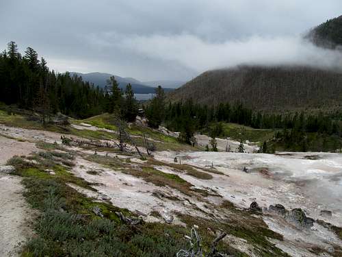
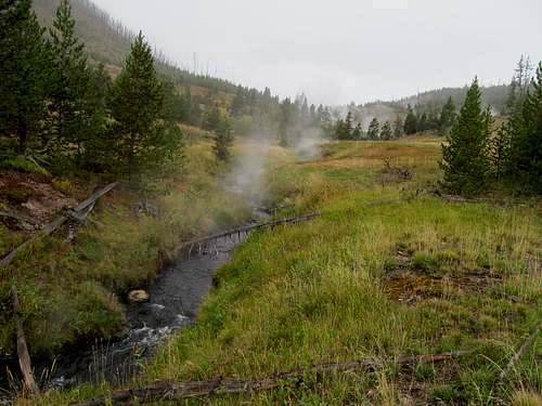
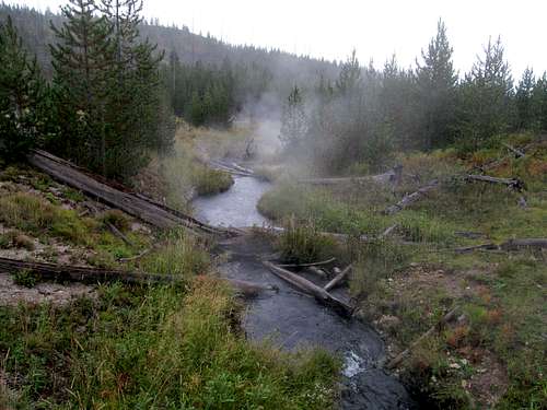
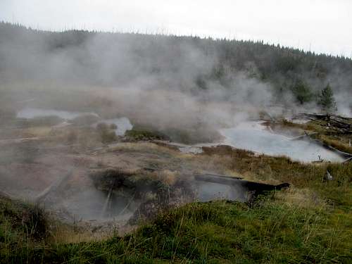
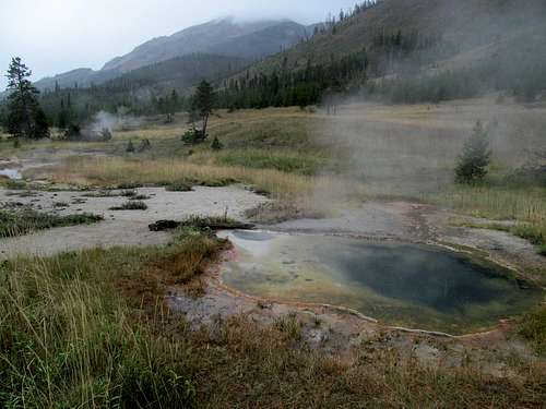
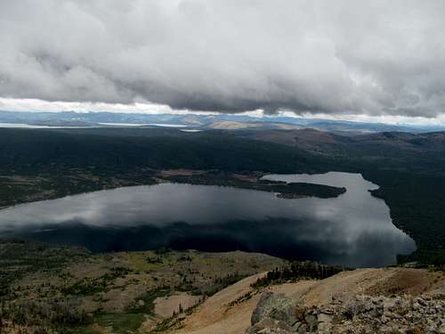
I obviously knew that I could pass by Heart Lake along this trail, but any brief descriptions I read of this route could not prepare me for the scene when the trail crested a high point to which the hiker got his or her first views of the lake and the surrounding valley. The gloominess of the fog and clouds added an even more mysterious quality to the view. The lake, 8 miles from the trailhead, looks deceptively close as well from this first vantage, and I amazed myself at the presumed speed in which I hiked, but as I started the very long descent down the Witch Creek drainage I realized how far I still had to go to reach the lake. I had not expected geysers along this route either, much less the casualness with which the hot springs dot this area surrounding the trail, explaining the creek’s name and adding an even more mysterious quality to the trail.
The significant elevation loss to the lake was unexpected as well, and the impressive flanks of Sheridan loomed over me as I descended lower and lower towards the lake. All these man miles already put in, and my wearying legs still had the entirety of the mountain to climb.
The tippy top was still hidden by low clouds, and I hoped with all my heart that all this work would not result in a blind climax.
I encountered my first company at the small cabin/station less than a mile before reaching the lake. They had just finished breakfast and were packing up for the climb. I had been very excited to see a car bearing Massachusetts license plates at the trailhead, and I asked if any of them were from my home state. Alas none of them were, and I was unable to locate my fellow Massholes on this trip.
I finally reached the shore and kept my eyes open for the side trail leaving right for the peak. The sandy walk along the small beach was not enjoyable after 8 miles of hiking, but I soon started the steep ascent up Sheridan’s flanks.
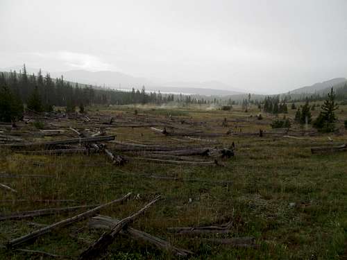
Much of the lower hike traverses a wide burn area presumptively from the great fire of 1988. The trail switchbacks easily through this area but alas, it would be far from the last dealings I would have with the long ranging repercussions from that fire on this fine day.
And yes, a fine day it was ultimately turning out to be. After all the gloominess and darkness of the first 10 or so miles, and even a little light drizzle past the lake I finally started feeling little inklings of sunshine making my way higher and higher, though at the time I was likely more distracted by the exponentially impressive views of Heart Lake from higher and higher above it.
I started running into more people further up the peak, backpackers who had stayed in campspots at the lake the prior night. A few older couples, but a lot of the groups appeared to be seasonal employees of the park, lodges, and other amenities. Many of them were younger, maybe just out of college, taking the summer off to work in Yellowstone, seeing the sights on their off days and making memories of a lifetime, and I envied their youth and eagerness (and yes, admired the yoga pants on some).
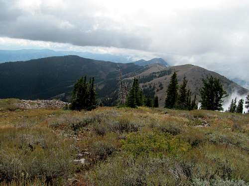
A trail climbs then steeply through some wooded areas on its high northern slopes before opening up in a grassy gully still green in early fall and glistening from the bright rays of the sun’s reflections, now finally in full force. As a curtain call the trail winds itself onto a saddle, with views southwest back to the road and the Pitchstone Plateau finally opening up, before ascending a short rocky ridge to the lookout tower at the top.
I had made it to the top in exactly four hours, which surprisingly matched my own prognostication. The question was, where was Greg??? I expected that he would have started maybe 30-60 minutes after me, so he should have caught up with me before Heart Lake even, and certainly by the time I started ascending Sheridan proper.
Yet no sign, even now as I stood upon the summit and marveling views of the entire expanse of the national park, down to Heart Lake glistening below, further towards all the inlets of Yellowstone Lake and beyond to some of the most remote places in the lower 48 towards the southeastern end of the park. To the north I could see the Madisons, Electric Peak starting to emerge from the clouds, and even beyond into Idaho, with the Centennials and vague shapes of the Lemhi’s and perhaps Borah Peak in the furthest reaches of the horizon.
I spoke with the ranger stationed at the lookout, a grizzled veteran of two or three decades in the park, and he had a wealth of stories to tell. He was a local, from the Cody area I think, and what struck me was his accent…he kept pronouncing Heart Lake like it was “Hurt Lake” and for the longest time I didn’t know what he was talking about. He recalled stories of seeing grizzlies swim across the lake 3000 feet down below, and discussed possible ways of traversing the park’s southern trails to get to Two Ocean Plateau, a very remote P2K just south of the border.
But where was Greg? I was starting to get worried now, maybe that something had happened the day before, or whether a grizzly got him on his way to the Lake. I had arrived at the summit at 1, and after an hour of conversation and views and waiting, I finally decided to head down.
I had descended about 500-600 feet back to the grassy area when I finally saw him running up the trail. He had had quite a late start, at noon no less, after a rough night with vodka in the woods and a longer than expected drive down the backroads into Wyoming. Two hours and fifteen minutes later he was close to the summit, and I followed up with him a ways before waiting for him at the saddle to finish the peak and get back down. (Ironically, he had thought that I started at 7 AM, and the fact that he had still yet to see me heading down caused him to think that I had been eaten by a grizzly).
After awhile I got pretty bored and said screw it, so I made my way back to the top. The ranger was regaling Greg with the same stories he had told us earlier, and we stayed up a little longer, not leaving again until it was maybe 3 or later. It had gotten dark a few times, storm fronts moving south from the Tetons into the area, but we saw two or three small cells blast rain through the valley and lake down below but somehow manage to skirt our summit.
We pondered our descent. We could retrace our steps back along the trail, and it would take us maybe another 3:30-4 hours before we'd return the trailhead, where we still had a very long drive back to Salt Lake ahead of us. Greg toyed around with idea of straight shotting it down the northwestern slopes of Sheridan, which would cut the distance in half. The problem was, this would be cross country, and the ranger warned that we would be traversing the heart of the 1988 fire, through land untouched by humans and thus likely inhabited by grizzlies.
We decided to go for the straight shot in an attempt to save time and hasten our arrival to Salt Lake. We first hiked through smooth meadows, then sidehilled through grass and talus as the late afternoon storm finally caught up with and soaked us. We hit the trees and descended steeply the last remaining slopes of the peak with views of the vast forest below us.
The trouble began once we had complete our descent. We were only 3-4 miles from the car, but these miles encompass some of the worst suffering, mental, and physical anguish I have experienced up to this point in my life, and all this started as we traversed the burn territory.
It’s tough to describe the ordeal. I had climbed Sawteeth in the Adirondacks a few weeks after Hurricane Irene rolled through, before the rangers had had a chance to clear the trail, and traversed hundreds of fallen trees as a result. And this was several times worse. Dense woods, dense brush, and even denser deadfall, thousands of trees stacked on top of trees stacked on top of trees, a puzzle, a labyrinth where every 0.1 mile presented riddles, challenges, and struggles. We crawled under, over, crossed, and climbed over every kind of stacked deadfall imaginable. The trees were often still slick from the recent rains, and with a questionable ankle barely kept together by my brace, I prayed that I would have my ankles and balls intact by the time I was in Vegas the next weekend. (Yes, there were countless scenes where a bad slip or step would result in poor Victor riding the rails like a Tory circa 1776 New England).
The distance to the trailhead on Greg’s GPS counted down at an impossibly slow pace, but we eventually popped out of the trees right at the trailhead. And after all that toil and trouble had been worth it, as we arrived after a deceivingly short three hour descent, shaving off at least 30 minutes on our descent if not more.
The drive back was almost as painful as the descent, following the hundreds of tourists lined up at barely 40 mph on a 65 mph road. I lost my patience well before we hit town and I was passing cars tenfold at a time as the sun set on the valley.
We got some fast food to go in town and drove through the night. Preoccupied with the thought of salvaging as much sleep as possible before work Monday, I let slip any sliver of circumspection. I still had a fall season ahead starting with the Vegas trip and half dozen of peaks afterwards, but looking back this was the real end of summer, and this one hike encompassed all the granduer, joy, difficulty, stress, and struggle of yet another summer spent chasing summits in the north.
Comments
No comments posted yet.