


|
|
List |
|---|---|
|
|
The Appalachian Trail

The famous plaque at on Springer Mountain, GA.
by CharlesD:
Perhaps the most famous foot-path in the world, the Appalachian Trail stretches for 2200 miles along the spine of the Appalachian Mountain Range in eastern North America. The project was originally concieved in 1921 by Benton MacKaye as a continuous wilderness trail connecting a series of work camps and retreats from urban life in the east. The trail as we know it today was completed in 1937, but every year the exact route and milage changes as old trails are decommissioned and new segments added.
The modern trail stretches from the summit of Springer Mountain, Georgia, to Katahdin, Maine. Along the way, it passes through 14 states. Each spring, roughly a thousand hikers start at the southern end within a few weeks of March 1st with the intent of "thru-hiking" to Maine. Most of these hikers drop out within a few hundred miles due to injury, changing motivations, or other reasons, but roughly a hundred hikers finish at the summit of Katahdin after four to six months of walking, leaner, stronger, and changed by the experience. Less popular is the north-to-south option from Katahdin to Springer, or various other topologies. People without six months of free time will often "section-hike" segments of various lengths. A series of shelters and campsites along the trail spaced at roughly 8-12 mile intervals provide resting spots for most of the journey. Frequent road-crossings and occasional trail towns provide places for long distance hikers to resupply with food and other neccessities.
The AT today is overseen by the Appalachian Trail Conservancy in Harpers Ferry, WV. Individual trail segments are maintained by 35 different regional groups, many of them entirely volunteer-based. Two other major north-south trails have since sprung up in North America; the Pacific Crest Trail along the Sierras and the Continental Divide Trail from Mexico to Canada along the crest of the Rockies. Both trails are longer than the AT and tougher in spots, but the AT remains king in terms of popularity, history, and public mystique.
The Mountains
The mountains in this list will be broken up by state, runnning South to North in the traditional hiking order. Since the Appalachian Trail uses sidetrails to reach many major mountains along its route, mountains that have trail that reach the A.T., from their summit, in less than 1 mile will be included in this list.
Georgia (75.4 miles)
By: e-doc
The AT begins its 2000+ mile journey through 14 states atop Springer Mountain in Northern Georgia. Springer Mountain (3782') lies on NF land north of Amicalola State Park. Most hikers access Springer from the AT via Amicalola State Park; though USFS road 42 is 1 mile north of the terminus. The AT follows the eastern crest of the Blue Ridge Mountains for 75.6 miles to the North Carolina state line while crossing 4 mountain over 4000'; Blood, Blue, and Tray Mountains with Kelly Knob. The Benton MacKaye trail (Maintained by the Benton MacKaye Trail Association) turns off the AT a a few miles past Springer and will not intersect the AT until north of Fontana Dam. The Benton McaKaye trail is a 300 mile footpath opened in 2005 to fullfill MacKayes vision of a more westerly route for the AT. For anyone who has hiked the Georgia section of the AT, they will attest to the constant up and down and rockiness of the path. Hiking north one will cross Sassafras Mountain, and follow the crest of the Blue Ridge to Blood Mountain (the highest point on the Georgia AT at 4461') then drops to Neals Gap in 30.7 miles. Neals Gap is the location of the famous Walasi-Yi Inn, the first dropoff/resupply point.
Fifteen miles from Neels Gap is Chatahoochee Gap (3500'). In this gap Brasstown Bald is north and south of the ridgeline is Chattahoochee Spring; headwaters of its namesake river and the water supply of Atlanta. In fact the summit of Brasstown can be accessed via the 2.4 mile blue blazed Jacks Gap trail. After Chatahoochee Gap, the trails crests Blue Mt (4025') then down to Unicoi Gap. Northbownd the trail goes over Tray mountain(4430'), the Blue Ridge Swag, and Kelly Knob (4276') then the AT climbs north through Dicks Creek Gap and the road to Hiawassee. It continues north through the Southern Nantahala Wilderness to Bly Gap and the state line. (The wilderness encompasses 24,515 acres in Georgia and North Carolina.) Enjoy the shelters in Georgia (there are 11), they are some of the nicest I have ever seen or used. The AT trail maintaining club is the Georgia Appalachian Trail Club. (Just remember, if you hear a twig snap in the night, its probably the US Army Rangers observing you with their night vision goggles.)
North Carolina: Bly Gap to Fontana Dam (87.9 miles)
By: e-doc
The southernmost section of the AT in North Carolina traverses the Nantahala and Stecoah Mountains, from Bly Gap to Fontana Dam (87.9 miles). There are 7 roads; and 2 rivers that must be crossed, the Nantahala and Little Tennessee, yeilding long climbs and descents. The AT crosses on wilderness in the 88 miles, the Southern Nantahala Wilderness.
The AT enters NC Nantahala mountains at Bly Gap and it continues its 21.9 mile hike through the Southern Nantahala Wilderness. After almost encircling Yellow Mountain, the AT climbs Standing Indian Mountain (5499') with its 360 degree views of the Appalachians: Rabun Bald (4696'), Tray Mountain(4430') and Brasstown Bald (4784'), Tusquitee Bald (5250'), Wine Spring Bald (5440'), Cheoah Bald (5062'); and to the far north the southern Great Smokies. It is the first mountain on the AT over 5000 feet and the highest mountain south of the Great Smokies. After Standing Indian, the section to Wallace Gap maintains a height of over 4000 feet with gradual elevation changes. The exception to this being the 0.3 mile grunt up Albert Mountain (5250') with a 430 foot elevation gain. From this summit tower, outstanding views are seen east over the Coweeta Hydrologic Laboratory. Shortly thereafter one comes to Wallace Gap and the hiker stop at the Rainbow Springs CG.
Northward from Wallace Gap the AT completes its traverse through the Nantahala mountains when it reaches Wesser (and the famous Nantahala Outdoor Center) after another 30.4 miles. This section has more sustained elevation changes while crossing directly or by side trails Silers(5216'), Wine Spring, Wayah (5342'), Copper Ridge(5200'), and Wesser(4627') Balds. Most have impressive views of the Tusquittee, Unicoi, Stecoah,and Smoky Mountains; the eastern Blue Ridge and the North Georgia mountains. This section concludes with a 4.5 mile descent to Wesser and the Nantahala River. The trail from Bly Gap to Wesser is maintained by the Nantahala Hiking Club
The AT then traverses the Stecoah mountains from the Wesser(1723') to Fontana Dam (1700'). The Smoky Mountains Hiking Club is responsible of maintaining the AT from Wesser to Fontana Dam (and through the Great Smokies to the Pigeon River).This section begins with the formerly infamous climb of Cheoah Bald (5062'). It had a reputation as being the hardest climb on the entire trail before being lengthened and relocated. It still climbs a total of 3682 feet in 8.1 miles with a respectable grade of 455 feet/mile. (This is the first of 5 long climbs up from a major river in NC and Tenn in the next 230 miles; the Nantahala, Little Tennessee, Pigeon, French Broad, and Nolichucky.) The summit of Cheoah Bald has more outstanding views of the Southern Appalachians; Wesser Bald, Wine Spring Bald, Standing Indian Mountain, and the Unicoi's. The trail follows the ridgeline 22 more miles until the final 3 mile downhill to Fontana Dam, the highest dam in the eastern US. There are 11 shelters in this section; the hiker friendly store in Fontana Village and the Hike Inn with Jeff and Nancy Hoch is right down NC 28. Usual resupply points on this section are Rainbow Springs, the NOC and Fontana Village. (I use the term resupply to note usual trail towns where hikers restock food and postal service is available.)
Great Smokies: Fontana Dam to Pigeon River/I-40 (70.5 miles)
By: e-doc
The AT follows the crest of the Great Smoky mountains, bisecting the namesake park (GSMNP) on a 56 mile ridge from Gregory Bald (4949')to Mt Cammerer (4928'). The northern and southern boundaries of the GSMNP are the Pigeon and Little Tennessee Rivers; meaning that long climbs are necessary to reach the Smokies crest. The park is over 500,000 acres in size and split east/west by one road, US 441 in Newfound Gap. It has over 800 miles of trails and contains one of the most diverse collections of flora in the world.The GSMNP is the most visited National Park in the US and the crest of the high ridgeline is exceeded in height only by the Black Mountains. I suspect the park has some of the most remote areas on the east coast, save for the Everglades, Okeefenokee, and woods of Northern Maine The trail is usually divided into two sections; 38 miles from Fontana to Newfound Gap and 32.5 miles from Newfound Gap to the Pigeon River (Though the parks boundary is Davenport Gap, 1.6 miles south of the Pigeon River.) The usual supply points are Fontana Viaage and Mountain Momas in Waterville.
The GSMNP was an idea begun in the early 1900's. In the 1920's public and private interests began to purchase land, mostly from large logging companies. In 1928 John D Rockefeller contributed 5 million dollars for land aquisition and the park was finally dedicated by President Franklin Roosevelt, at Newfound Gap in 1940.
In the southern Smokies, because of the elevation changes, one sees Southern and Northern hardwood forests,a Canadian Spruce Zone and Southern Appalachian Balds. At this southern end of the section is Fontana Dam. It was constructed during WW II and, at 480 feet, is the highest dam in eastern America. After crossing Fontana Dam the AT slogs up a graded trail for 2920 feet over 7.3 miles ascending Shuckstack Mt to Doe Knob. For the next 20 miles the AT, an ungraded fire trail completed by the NPS in 1931, continuously climbs up and down the ridgeline to Silers Bald (5607 ft). The most memorable of these is the steep climb from Spence Field up to Rocky Top (5441') and Thunderhead Mt (5527'). From this ridgeline there are outstanding views of multiple mountain ranges to the east and the Tennessee valley to the west. (Just south of Silers Bald the AT reaches an elevation of 5000 feet. It remains above this elevation for the next 34 miles, when it drops to Camel Gap in the far north side of the park.) Clingmans Dome (6643'), the highest point on the entire AT, is reached after hiking 30 miles from Fontana Dam. On a clear day, the view from the tower on the Dome is impressive; Thunderhead, Mt LeConte (6593'), and Mt Guyot in the Smokies, and all the mountains from North Georgia, Mt Mitchell,and Black Mt on the Kentucky/Virginia state line. The trail is steep and rocky on the descent from Clingmans Dome to Mt Collins (6188 ft) but then improves into Newfound Gap (5045'). Many trails climb to the ridgeline, from both the east and west. From the east trails climb from Fontana Lake via Eagle, Hazel and Forney Creeks, as well as the Deep Creek CG. On the west side there are trails that climb up from Cades Cove, Tremont, and Elkmont. There are 7 shelters on this 37.8 mile section (most have been recently rebuilt), which must be reserved except for AT through hikers.
North of Newfound Gap, the AT follows a trail mostly constructed by the CCC with a grade no more than 15%.Because the AT on this side of the park is more elevated than its southern counterpart, the ridgelines are dominated by Spruce and Hemlock. A few miles past Newfound Gap, the Boulevard trail turns left, and in a short distance leads to a side trail to Mt Kephart and the Jumpoff. As stated above, the AT stays above 5000 feet until reaching Camel Gap, now 20 miles to the north of Newfound. Throughout the section are outstanding views; some being from Ice Water Springs, Charlies Bunion, Bradleys View, Eagle Rocks, Mt Sequoyah, and Deer Creek Gap. Many throughhiking northbounders arrive to the Tri-Corner Knob shelter (5920') with a sense of accomplishment; they have hiked some of the toughest terrain on the AT and completed 10% of the trail. (Tri-Corner is so named b/c it is the intersection of two large SE mountain chains: the Smokies and the Balsams.) Shortly past Tri-Corner the AT reaches the elevation of 6400+ feet on Guyot Spur. This is the highest on the AT north of the Dome and an elevation >6000 ft will not be reached until Roan Mountain, then the White Mts of New Hampshire. Hiking north from Guyot Spur to the Pigeon River is a near 16 mile continual descent, losing 5000+ ft (there are two small ascents). A further 2 miles north of Guyot Spur, at Yellow Creek Gap, is Inadu Knob; best known for an F-4 that slammed into the peak in 1984 killing both crewmen. One last great 360 degree view is obtained from the tower at Mt Cammerer (4928'), 6.3 miles south of the Pigeon River (1400'). There are 5 renovated shelters on this 32.4 mile section, again reservations required. As on the south end of the park, many trails climb to the ridgecrest. From the east side trails leave Cataloochee, Big Creek, Round Bottom, and Smokemont. On the west trails reach the crest from Mt LeConte and Cosby. Hikers previously could stop in Waterville at Mountain Momas. Unfortunately this has closed. As stated this section is maintained by the Smoky Mountains Hiking Club
Tennessee-North Carolina: Pigeon River/I-40 to Erwin (98.0 miles)
By: e-doc
The AT continues its northern treck after leaving the GSMNP. Over the next 98 miles, the AT continues to follow the state line and crosses 2 more rivers (French Broad and Nolichucky), again requiring 2 major climbs and descents. There are 9 road crossings in this section with the supply points being Hot Springs and Erwin. The range of mountains from Erwin to the Pigeon River is known as the Bald mountains.
From the Pigeon River/I-40 (1400') the AT climbs over 2800 feet in 5 miles to the crest of Snowbird Mt. It descends and then climbs Max Patch (4629') a truly breathtaking southern Appalachian Bald. (Imagine 50 years ago when small planes took off and landed atop Max patch.) Continuing north the AT follows the state line, up Tennessee Bluff(4868 ft) then slowly descends 10 miles to the hiker friendly town of Hot Springs NC (1326'). Here is the French Broad River and Bluff Mountain Outfitters;, 33.4 miles from the Pigeon River.
The AT then gains 2317 ft in a long climb of 8.3 miles from the French Broad to Rich Mt (3670'), reached by short sidetrail.The trail has further ups and downs before skirting the summit of Camp Creek Bald (4844'). The AT continues north to Gravel Knob, turns south (though northbound on trail), then back north over Lick Rock to Sams Gap (I-26); 42.2 miles from Hot Springs. There are 7 shelters in this section.
North of Sams Gap (3800') the AT slowly ascends Big Bald (5516'). The AT last had this elevation in the Smokies near Yellow Creek Gap, almost 100 miles away. The summit of Big Bald offers one of the best panoramas in the Southern Appalachians; the northern Smokies, Tennessee Bald, Sandymush Bald, Mt Mitchell and the Black Mountains, the Roan Highlands, Unaka Mt and the Tennessee Valley. After crossing Little Bald (5185 ft),the AT drops almost 2000 feet to Spiveys Gap (US 19-W). There is little elevation gain in the next 8 miles before the AT drops 1550 feet in 2 miles to Erwin Tennessee (1700') ,and Miss Janets House, at mile 98. There is one shelter in this 22.4 mile section. The trail maintaining clubs are the Carolina Mountain Club (Pigeon River to Spiveys Gap/US 19W) and to Erwin the Tennessee Eastman Hiking Club (then through the entire next section all the way to Damascus Va)
Tennessee-North Carolina: Erwin to Damacus (115.4 miles)
by: e-doc
From Erwin to Damamscus the AT traverses Beauty Spot, Unaka Mt, the Roan Highlands; White Rock, Iron and Holsten Mts. The AT around the west side of Roan High Knob is the last section of trail >6000 feet until New Hampshire.
After leaving Erwin, the AT begins a slow climb, first reaching Beauty Spot (4347')in 10.7 miles and Unaka Mt (5180')at 13.8 miles. Beauty Spot is another grassy bald with a 360 degree view; Big Bald, the Black Mountains, Roan High Knob/Bluff, and the Tennessee Valley. At 17.3 miles the AT reaches Hughes Gap and the begin of one of the longest and steepest climbs on the southern (possibly the entire) AT, the ascent to the Cloudland Hotel site. The trail gains 2110 feet in 2.7 miles, almost 800 feet per mile. At the old hotel site, the Cloudland trail goes west about a mile to Roan High Bluff (6267'), the AT to the east to Roan High Knob (6285').The old Rangers Cabin on the summit is now a trail shelter and the highest on the entire AT. Shrtly thereafter is Carvers Gap, the highest road crossing on the AT at 5512 ft. The AT continues north over a series of spectacular balds that comprise the Roan Highlands (Round Bald 5826', Jane Bald 5807', Grassy Ridge 6189', Big Yellow Mt 5420', Little Hump 5459' and Hump 5587'). Atop Hump Mt is another 360 degree view: Clinch, Beech, Snake, Grandfather mountains; Linville Gorge with Hawksbill and Tablerock, and the Black Mountains. Also Iron and Holsten Mountains as well as the Tennessee Valley. The AT then begins a 5 mile, 2707 foot descent to US 19-E, which is 44.8 miles from Erwin. This intersection is infamous for the vehicle breakins and vandalism (even a burning); park overnight with caution. There are 7 shelters on this stretch of trail. The history of the Roan Highlands can be found in
Roan Mountain: A Passage of Time by Jennifer Bauer Wilson.
The AT crosses 19-E and begins a 22 mile westward stroll across White Rocks Mt. Along the trail one can see the Roans off to the south, before dropping down to Dennis Cove Rd and then the rugged Laurel Fork Gorge. The old AT followed the gorge down to US 321 but it has been relocated through the Pond Mt (4329') Wilderness. This relocation added a fairly significant climb and descent before arriving at Watauga Dam. The AT then climbs NE on Iron Mt and travels through the Big Laurel Branch Wilderness. It then ridge walks Iron, Cross, and Holsten for the next 36 miles with no significant elevation changes. On Iron Mt the second shelter reached is the Iron Mt shelter, the starting line for the Damascus Marathon.(It is so named b/c some throughhikers complete this 26 mile stretch to/from Damascus in one day.) The AT then turns NW onto Cross Mt (The Iron Mt trail, the old AT, continues down Iron Mt to Damascus). After 3.5 mile hike down Cross Mt, the AT turns NE onto Holsten Mt.(To the left goes the Holsten Mt trail, SW down to Holsten High Knob and the Holsten Hilton shelter.) The last 18 mile portion of the AT brings hikers past the McQueen Knob shelter, the earliest (circa 1934) and smallest shelter on the trail. (Not much of a shelter, its only use would be as an emergancy shelter.) Continuing NE the side trail to Backbone Rock is passed, then the state line, before descending to the trail town of Damascus. Here you find Mt Rogers Outfitters, owned by Damascus Dave and Jeff Patrick. Damascus is not only the home of Trail Days but also location that marks completion of 25% of the AT. There are 7 shelters in the 70.6 miles between 19-E and Damascus.The supply points are usually Erwin, Elk Park, Hampton, and Damascus. The trail is maintained by the Tennessee Eastman Hiking Club
Southwest Virginia: Damascus to US 460/Pearisburg (162.5 miles)
By: e-doc
The AT north of Damascus the AT first crosses the Mt Rogers NRA and after makes a big change. After summiting the highest peaks in Virginia, the AT begins a traverse of the long mountain ridges that lie to the west.The trail crosses Iron, Little Brushy, Big Walker, Garden, and Sugar Run/Pearis Mts before descending to Pearisburg. Of interest, Iron Mt is a long NE to SW ridge just west of Mt Rogers. The mountain crest stretches from Hampton Tenn to Galax Va, a distance of >80 miles, and was the location is the site of the original AT. Construction of the Blue Ridge Parkway after WWII necessitated relocation of the trail to the west.
After leaving Damascus (1928'), the trail begins a slow climb to the roof of Virginia. The trail passes over Cuckoo Knob, Straight Mt, and Lost Mt before the last climb to Whitetop (5520 ft) and descending to Elk Garden (4334'). It climbs through the Lewis Fork Wilderness, around Mount Rogers (the roof of Virginia at 5729') and through the Grayson Highlands on Wilburn Ridge (5526 ft), Stone and Pine Mountains. These are the last of the Southern Appalachian Balds and mountains >5000 feet until the Presidentials. Both Whitetop and Wilburn Ridge offer the last views of the big mountains in the south; Beartown, Clinch, the Roan Highlands, Snake, Beech, Hanging Rock, Grandfather, Mt Jefferson, and Haw Orchard. To the north is the Blue Ridge Plateau, Buffalo Mountain, BM Maiden on Burkes Garden; Iron, Big Walker and East River mountains. After dropping off Wilburn Ridge the AT skirts the Little Wilson Creek Wilderness, First, Second , and Third Peaks, passes through the Scales before dropping down to Va 603, 40.7 miles from Damascus and the end of Grayson Highlands. The trail now crosses Iron, Brushy and Glade Mts before ending at I-81, 34.6 miles later. This section contains the Partnership shelter, with a privy and HOT showers. There are 9 shelters in the 75.3 miles between Damascus and I-81.
At I-81 (2420') the traveler now has 87.2 miles to Pearisburg. The AT now begins it long runs of the mountain ridges of western Virginia. Northbound the AT climbs over Brushy and Big Walker before ascending Garden Mountain (4409'). Garden Mt almost encircles Burkes Garden, known by many as God's thumbprint. The southwest corner of Burkes Garden is anchored by BM Maiden at the intersection of Garden and Clinch mountains. The best views of the cove are from the Chestnut Mt shelter at the southeast corner of Burkes Garden and the AT follows the eastern side of Burkes Garden for 7.5 miles before descending to Little Wolfe Creek (and eventually US 52, 44.4 miles from I-81). Continuing northeast, the AT follows Brushy Mt for 18.6 miles, then crosses Kimberling Creek. For the next 7.5 miles, the AT follows Dismal Creek before climbing Sugar Run Mt. Running the crest of Sugar Run and Pearis Mts, the AT drops to the New River Narrows and Pearisburg (1600') 15.5 miles from Dismal Creek and the end of the AT in Southwset Virginia. There are 8 shelters after I-81 and the trail crosses one wilderness, the Beartown. Aside from the ends one can get resupply in Adkins and Bland. The responsiblity for 162 miles of trail maintainance are the Mount Rogers Trail Club, Piedmont Appalachian Trail Hikers, Outdoor Club of Virginia Tech, and the Roanoke Appalachian Trail Club
Central Virginia:US 460/Pearisburg to Rockfish Gap/I-64 (224.8 miles)
by: the doctor
North from Pearisburg, the AT follows the WVa/Va state line on Peters mountain and intersects the southern terminus of the Allegheny trail. It then turns back east towards Roanoke,the "star city of the south". In traveling up and down; the AT crests Potts mountain, Kelly Knob; then Sinking Creek, Brush, Catawba, and Tinker mountains as it approaches Roanoke and the eastern Blue Ridge. (On Brush mountain lies the Audie Murphey monument, honoring the most decorated WW II soldier, killed in a plane crash in 1971.)There are outstanding views from these peaks as well as from Dragons Tooth, McAfee Knob, Tinker Cliffs, and Hay Rock before dropping to I-81 just outside the Roanoke city limits. The latter 3 spots overlook Carvins Cove; a beautiful valley and site of the Roanoke city reservoir.
After crossing I-81 to AT climbs up to the Blue Ridge at Blackhorse Gap and its namesake road. (As mentioned before the original AT followed the edge of the Blue Ridge from Galax to Roanoke but was relocated in the late 40's due to construction of the Blue Ridge Parkway.)
For the next 120 miles the AT parallels the parkway on the Blue Ridge crest to Rockfish Gap and I-64; the Great Valley of Virginia to the west and Virginias Piedmont to the east. After climbing up from I-81, the AT runs north and around of the Peaks of Otter; Flat Top, Sharp Top, and Harkening Hill. Rejoining the parkway 14 miles later the trail next crosses Apple Orchard mountain (4225'); the highest point on the AT between Grayson Highlands and New England and home to an FAA radar site. Over the next 15 miles the AT descends (mostly), away from the parkway, to the James River (659'). It travels through the Thunder Ridge and James River Face Wilderness's. The latter contains the Devils Marble Yard, a tremendous expanse of Granite boulders, reminiscent of large boulder fields in the western US. The James is the lowest spot south of Harpers Ferry and site of the longest foot use bridge on the AT (625' long). This bridge is also a great spot for a 50' jump into the Bedford City Reservoir. Northbound the AT climbs up Bluff Mountain, around Lynchburg's reservoir and up to Bald Knob (4059'). It continues on the high ridge, past Mt Pleasant to the 5963 acre Priest Wilderness. After crossing the Priest (4063') the trail descends 3100' in 4 miles to the Tye River. Northbound is a 3000' up to Three Ridges (3970') then a return to the proximity of the parkway.After climbing Humpback Rocks, the AT begins a slow descent to I-64 and Rockfish Gap (1902'), the gateway to the Shenandoah National park and end of the section.
There are 27 shelters in this section and the trail traverses 5 wilderness areas; Peters Mountain, Mountain Lake, James River Face, Priest, and Three Ridges. There are 5 AT maintaining clubs on this section; Outdoor Club of Virginia Tech, the Roanoke Appalachian Trail Club, the Natural Bridge Appalachian Trail Club,the Tidewater Appalachian Trail Club, and the Old Dominion Appalachian Trail Club. Aside from the ends resupply is at Daleville, Glasgow, Natural Bridge, Buena Vista, and Montebello.
Shenandoah National Park/Northern Virginia: Rockfish Gap/I-64 to Harpers Ferry (154 miles)
by Buz Groshong
From Rockfish Gap north the AT lies primarily within Shenandoah National Park for about 104 miles. Within the park it roughly follows the main ridge of the Blue Ridge Mountains, as does the park's primary roadway, Skyline Drive. The AT and Skyline Drive cross each other numerous times, but also go their separate ways, and at times are far enough apart either vertically or horizontally that the roadway is not evident to the hiker.
Southern Section of SNP
The southern section of the Shenandoah Park begins with an 8-1/2 mile stretch that is little more than a narrow right-of-way containing the AT and Skyline Drive. In that short segment, the trail crosses the summits of Scott Mountain (2762 ft.), Bear's Den Mountain (2885 ft.), and Calf Mountain (2974 ft.) before entering the main body of the park at Jarman Gap (2114 ft.). The next peak that the trail crosses is Blackrock (3120 ft.), where it loops around the actual summit that is only a short distance up a spur trail. The trail then dips down to Brown's Gap (2599 ft.) and ascends Big Flat Mountain (3389 ft.) where it loops around the Loft Mountain campground. After it passes the Loft Mountain wayside the trail crosses Loft Mountain (3290 ft.). It then dips down to cross Ivy Creek and Pinefield Gap (2530 ft.) before crossing Weaver Mountain (2864 ft.). After that it crosses Simmons Gap (2253 ft.), Powell Gap (2294 ft.), and Smith Roach Gap (2622 ft.) before crossing Hightop (3587 ft.) and heading down to cross U.S. 33 at Swift Run Gap (2375 ft.).
Central Section of SNP
The central section begins with a climb up to Saddleback Mountain (3296 ft.) followed by a descent to the South River picnic area, where a side trail leads down to South River Falls. From there the AT climbs up Bald Face Mountain (3599 ft.), descends past Pocosin Cabin, and continues past the Lewis Mountain campground, where a side trail leads to the summit of Lewis Mountain (3569 ft.). Bearfence Mountain (3620 ft.) is next, although to cross the actual summit (and to enjoy the best that Bearfence has to offer), you need to take the blue-blazed Bearfence rock scramble trail that roughly parallels the AT. From Bearfence the trail dips down to Bootens Gap (3243 ft.), which is very near the eastern end of the Fairfax Line, and then crosses Hazeltop (3812 ft.) before heading on to Big Meadows (3593 ft.). Big Meadows is not usually thought of as a peak because it is a broad, relatively flat area, but it is the high part of the ridge between Milam Gap (3257 ft.) and Fishers Gap (3061 ft.). Black Rock (3720 ft.) is the highest point at Big Meadows. North of Big Meadows the trail passes beneath Franklin Cliffs and the summit of Hawksbill (4050 ft.) as it circles to the west of it, however a side trip over the summit can be made by turning right on the Salamander Trail and returning back to the AT on the north side of Hawksbill by the Lower Hawksbill Trail.
After passing Hawksbill, the trail passes Betty's Rock (3680 ft.) on the west, but a side trail leading up to Crescent Rocks Overlook on Skyline Drive puts you at the trailhead for a short trail that will take you to the summit. From Betty's Rock the AT passes over Pollock Knob (3580 ft.) before passing Skyland and going over Stony Man Mountain (4011 ft.). The
trail does not pass over the very top of Stony Man, but a short side trail takes you to the true summit and on to the western side of the summit, with its great views. North of the summit of Stony Man the AT passes a rock outcrop known as Little Stony Man (3539 ft.), which is very popular with rock climbers - because the trail passes over the rock outcrop, the location is very suitable for top-roping. The bottom of the rock outcropping at Little Stony Man is also accessible from below, from the Passamaquoddy Trail, which the AT originally followed. After Little Stony Man the trail passes over The Pinnacle (3730 ft.) and Mary's Rock (3514 ft.) before descending to Thornton Gap (2241 ft.).
Northern Section of SNP
From Thornton Gap, the AT crosses the summit of Pass Mountain (3052 ft.) and then follows the ridgetop to Elkwallow Wayside before climbing to the summit of Hogback Mountain (3474 ft.). From Hogback the trail crosses Little Hogback (3076 ft.) and descends to Gravel Springs Gap (2630 ft.) before climbing to the summit of South Marshall (3212 ft.). From South Marshall the AT dips down to cross Skyline Drive at an unnamed gap (3087 ft.) and then climbs steeply up to North Marshall (03368 ft.). From there the trail descends to Hogwallow Flat and Jenkins Gap (2398 ft.) before crossing Compton Peak (2909 ft.) and descending to Compton Gap (2415 ft.). From Compton Gap the trail follows the former Compton Gap Road to the park boundary at Possum's Rest (2310 ft.) and then down to route 552 near Chester Gap.
North of SNP
North of Shenandoah National Park, the AT travels 53 miles over a series of hills and valley to Harpers Ferry and the Shenandoah and Potomac Rivers. There are no significant peaks in this segment.
West Virginia and Maryland (45 miles)
By CharlesD:
There are no significant peaks along the 3 miles of AT within West Virginia and most of it lies within the historic town of Harpers Ferry.
The 45 mile Maryland segment travels almost entirely along the crest of South Mountain 40 miles from the Weaverton Cliffs to PenMar on the Pennsylvania border. This long ridge includes a number of significant sub-summits/destinations: Lamb Knoll, Washington Monument, Annapolis Rocks, Black Rocks, Raven Rock, and High Rock. The Maryland AT also passes the imposing cliffs of Maryland Heights (available via a side-trail from the C&O Canal).
There is a tradition amongst some thru-hikers variously called the Maryland Marathon or the Four-State Challenge. In this masochistic rite, hikers start up on the hillside above Harpers Ferry (still technically in Virginia) at midnight and try to hike the entire 50 mile stretch to PenMar by the next midnight. The trail is uniformly easy through this section, but a 50 mile day is a significant feat!
Pennsylvania (230 miles)
By CharlesD and mtwashingtonmonroe:
The saying is that "Pennsylvania is where boots go to die." While not famous for lofty peaks or even tremendous elevation gain, Pennsylvania features some of the most brutal trail on the entire AT. Rocksylvania trail, particuarly in the eastern sections, is covered in shattered, sharp boulders which can and will rip even the sturdiest boot soles to shreds in short order. This is no joke!
The Pennsylvania trail runs from PenMar on the Maryland border, along the northern end of South Mountain, across the farmlands of the Great Valley, along the folded ridge-crests beyond all the way to the Delaware Water Gap. The total trail distance is 230 miles.
Peaks and other significant features (south to north):

- Buzzard Peak - 1,946ft.
- Snowy Mountain - 2,062ft.
- Pole Steeple - 1,250ft.
- Cove Mountain - 1,378ft.
- Peters Mountain - 1,377ft.
- Table Rock - 1,275ft.
- Shikellamy Rocks/Overlook - 1,370ft.
- Second Mountain - 1,440ft.
- The Pinnacle - 1,615ft.
- Mount Minsi and Delaware Water Gap - 1,549ft.
Other Significant Peaks:
- Hawk Mountain - 1,521ft.(reached via side trail of 1.3 miles each way)
- East Rocks - 1.425ft.(reached via 1.0 mile side trail)
- Sunset Rocks - 1,462ft.(reached via side trail of 0.5 miles)
New Jersey (70 miles)
By:RobA and CharlesD
The southern 43 miles of the NJ AT runs along the crest of Kittatiny Mountain from the Delaware Water Gap to High Point at the northernmost corner of the state. From here, the north-bound trail turns southeast for
30 miles across fields and swamps and over several significant mountains to the New York border.
| Name (South to North) | Height (feet) | Side Trail | Side Trail Distance |
| Mt. Mohican | 1,577 | No | N/A |
| Catfish Ledges | 1,565 | No | N/A |
| Paradise Mountain | 1,606 | Yes | 0.3 Miles |
| Blue, Bird, and Rattlesnake Mountains | 1497 | No | N/A |
| Culver Ridge (Normanook) | 1,510 | No | N/A |
| Sunrise Mt. | 1,663 | No | N/A |
| High Point | 1,803 | Yes | 0.25 Miles |
| Pochuck Mt. | 1,149 | No | N/A |
| Wawayanda Mt. | 1,448 | No | N/A |
New York (88 miles)
By:RobA
Further detail coming soon
| Name | Height (feet) | Side Trail | Side Trail Distance |
| Bear Mt. | 1,305 | No | N/A |
| Mt. Egbert | 1,329 | No | N/A |
Connecticut (50 miles)
By:big_g
Like some of the other "middle states", Connecticut's mountains don't stand out the same as some of the larger ranges north and south. The state and the trail are far from flat though. The AT summits four mountains including the highest summit in CT on Bear Mountain. Interestingly the highest summit is not the highest point in the state. That distinction falls to the slope of Mt Frissell on the CT/MA border who's summit lies across the state line.
In the foreground is mt Race and behind is mt Everett.
| Name | Height (ft/m) | Side Trail | Side Trail Distance |
|---|---|---|---|
| Caleb's Peak | 1,160 / 353 | no | - |
| Mt. Easter | 1,350 / 411 | no | - |
| Prospect Mtn | 1,475 / 125 | no | - |
| Bear Mtn | 2,316 / 609 | no | - |
mountains listed south to north
Massachusetts (90 miles)
By:big_g
Massachussets represents two things to the long distance AT hiker. To northbounders Mt. Greylock is the highest mountain since Shenandoah National Park and is a return to more mountainous and rugged terrain. To southbounders it is the gateway to easier trail and lower elevations. The Appalachian Trail is never easy and never really leaves the mountains but there is a significant difference between what is found in Vermont, New Hampshire, Maine and what is found in the Mid Atlantic states.

Gazing at Mt. Greylock from The Cobbles
| Name | Height (ft/m) | Side Trail | Side Trail Distance |
|---|---|---|---|
| Mt. Everett | 2,602 / 793 | no | - |
| East Mtn | 1,800 / 548 | no | - |
| Becket Mtn | 2,180 / 573 | no | - |
| Warner Mtn | 2,050 / 539 | no | - |
| Mt. Greylock | 3,491 / 918 | no | - |
mountains listed south to north
Vermont (150 miles)
By:big_g
One hundred fifty miles of AT cross Vermont from the Massachusetts border near North Adams to Hanover, New Hampshire. This distance is maintained by two dedicated volunteer groups, the Green Mountain Club and the Dartmouth Outting Club.
The trail can be divided into two sections in this state. First there is the southernmost 104 miles to Maine Junction. This portion of the trail follows the slightly older Long Trail along the crest of the Green Mountains. At Maine Junction just beyond Rt 4/Sherburne Pass the AT leaves the LT and turns east to New Hampshire. This second part of the trail leaves the Green Mountains for hilly and sometimes swampy terrain. The most memorable mountains for the AT backpacker will likely be Stratton, Baker, and Killington although Baker is often overlooked.

Looking south from Baker Peak to Peru Peak
| Name | Height (ft/m) | Side Trail | Side Trail Distance |
|---|---|---|---|
| Consultation Peak | 2810 / 857 | no | - |
| Glastonbury Mountain | 3,748 / 1,143 | no | - |
| Stratton Mountain | 3936 / 1200 | no | - |
| Spruce Peak | 2,040 / 622 | yes | 300 ft |
| Bromley Mountain | 3,260 / 746 | no | - |
| Peru Peak | 3,429 / 1,045 | no | - |
| Baker Peak | 2,850 / 869 | no | - |
| Green Mountain | 2,509 | yes | .8 |
| White Rocks Mountain | 2,560 | bushwack | ? feet |
| Bear Mountain | 2,262 | bushwack | ? feet |
| Killington Peak | 4,241 | yes | .2 |
| Pico Peak | 3,957 | yes | 1 |
| Deer Leap Mountain | 2,6?? | yes | .6 |
| Delectable Mountain | 2,670 | bushwack | .5 |
| The Pinnacle | 2,550 | bushwack | .2 |
mountains listed south to north
Much of the AT in Vermont is really a narrow strip of protected land surrounded by private property. Pay attention to signage and guidebooks regarding private property and camping restrictions.
On or near the trail are 25 shelters, camps, or cabins. The standard shelter is a 3 sided affair with wooden floor and sometimes a picnic table in front. They sleep 6-8 usually. Cabins are just what the name says, log or frame cabins often with glass windows. They can be very nice and any are welcome in a storm. There are all different sizes. AT/LT camps are structures that are open to some degree but much more like a cabin than a shelter.
For more information about the AT/LT and the Green Mountains see Summit Post's own Green Mountains range page.
New Hampshire (161 miles)
By:CharlesD and nartreb

above treeline in the White Mountains
In northbound trail order,
named peaks within 1 trail mile of the A.T.:
4000-footers on the AMC list are in bold.
Sub-peaks are not listed separately
(eg, Wildcat A vs Wildcat D)
unless they have their own SP page.
Note: BW == "BushWhack".
named peaks within 1 trail mile of the A.T.:
4000-footers on the AMC list are in bold.
Sub-peaks are not listed separately
(eg, Wildcat A vs Wildcat D)
unless they have their own SP page.
Note: BW == "BushWhack".
Name |
Height (feet) |
Side Trail Length (miles) |
|---|---|---|
| Moose Mtn | 2,293 | 0 |
| Smarts Mtn | 3,240 | 0 |
| Mt Cube | 2,911 | 0 |
| Mt Moosilauke, South Peak | 4,523 | 0 |
| Mt Moosilauke | 4,802 | 0 |
| Kinsman Mtn | 4,358 | 0 |
| Mt Liberty | 4,460 | 0 |
| Little Haystack | 4,840 | 0 |
| Mt Lincoln | 5,089 | 0 |
| Mt Lafayette | 5,260 | 0 |
| Mt Garfield | 4,500 | 0 |
| Galehead Mtn | 4,024 | 0.5 |
| South Twin Mtn | 4,902 | 0 |
| Mt Guyot | 4,580 | 0 |
| Zealand Mtn | 4,260 | 0.01 |
| Mt Webster | 3,910 | 0 |
| Mt Jackson | 4,052 | 0 |
| Mt Pierce | 4,310 | 0 |
| Mt Eisenhower | 4,780 | 0.5 |
| Mt Franklin | 5,001 | 0.01 |
| Mt Monroe | 5,372 | 0.5 |
| Mt Washington | 6,288 | 0 |
| Mt Clay | 5,533 | 0.5 |
| Mt Jefferson | 5,712 | 0.4 |
| Mt Adams | 5,799 | 0.3 |
| Mt Madison | 5,366 | 0 |
| Wildcat Mtn | 4,422 | 0 |
| Carter Dome | 4,832 | 0 |
| Mt Hight | 4,675 | 0 |
| Carter Mtn | 4,610 | 0 |
| Mt Lethe | 4,584 | 0.1 (BW) |
| Imp Mtn | 3,730 | 0.1 (BW) |
| Mt Moriah | 4,049 | 0.01 |
| Mt Success | 3,565 | 0 |
The A.T. in New Hampshire is dominated by the White Mountains. After entering the state at Hanover, the A.T. heads rather directly north-northeast about fifty miles over a series of minor peaks, until it reaches the White Mountain National Forest, where it wriggles from one high ridge to the next.
Upon entering the WMNF, the trail quickly reaches the bald summit of Mount Moosilauke, then heads almost due north along much of the Kinsman Range, then hops east across Franconia Notch to turn north and cover the Franconia Range. It follows Garfield Ridge eastward, crosses the Twin Range, skirts to the south of the Willey Range to reach Crawford Notch, and then follows the main ridge of the famous Presidential Range for its entire length. From there it diverts southward into Pinkham Notch in order to turn north again along the top of the Carter Range. From there it continues north-northeast to the Mahoosucs on the border with Maine. (The reputed "hardest mile" along the A.T. occurs on the Maine side of the border, in narrow, boulder-choked Mahoosuc Notch).
Within the White Mountain National Forest you will find a series of High Mountain Huts managed by the AMC. Most are open seasonally, all charge a fee. There are also a number of tent platforms and shelters, where (much smaller) fees are charged during the busy season. See the Summitpost Mountain and Range pages, or the links above, for more details. Though these facilities are often crowded, long-distance A.T. through-hikers arriving at a hut can expect that if the hut is open, space for them will be found, if only on the floor. Individual hut managers are known to allow discounts to through-hikers (usually in exchange for chores such as washing dishes).
External link: AT in New Hampshire description on HikeTheWhites.com
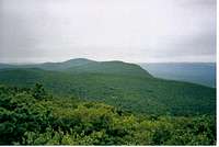
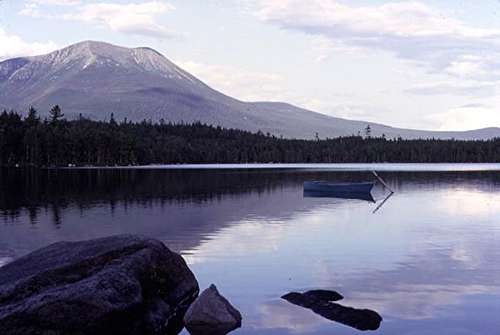
Maine (281 miles)
By: injektilo
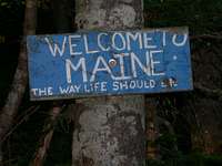
A sign that surely brings a smile to every north bound thru-hiker.
The 281 miles of trail in Maine are generally considered the most difficult of all fourteen states. While the AT traverses numerous peaks throughout the state, the following are some of the more interesting and significant peaks along the trail.
As the AT crosses into Maine, the hiker is already in the midst of the outstanding Mahoosuc Range. The trail passes over spectacular Goose Eye Mountain (3870') and Maine's third highest mountain, Old Speck (4180'), before descending into Grafton Notch. The AT then enters the Longfellow Mountains and climbs the dual peaks of Baldpate Mountain (3812'). The col between the west and east peaks of Baldpate is particularly interesting as the hiker will pass through an alpine bog. The AT continues north over the summit of Old Blue Mountain (3600') and descends to a high valley between Old Blue and Elephant Mountain (3772'). While traversing this valley, the AT passes through virgin red spruce for more than a mile.
After crossing Route 4, the trail passes over or very near a number of impressive 4,000 foot peaks. These include the wide open alpine ridge of Saddleback Mountain (4116') and The Horn (4023'), the barren summit cone of Mount Abraham (4049'), the wooded summits of Spaulding Mountain (4010') and Crocker Mountain (4168'), and the second highest mountain in Maine, Sugarloaf (4237'). The AT then crosses the beautiful Carrabassett Valley and ascends to the narrow ridge of Bigelow Mountain (4150'), which runs west to east for nearly 12 miles.
After descending from Bigelow, the trail skirts a number of lovely ponds and eventually enters the famed 100 mile wilderness. Rising from the center of the 100 mile wilderness, the AT climbs Barren Mountain (2660'), Chairback Mountain (2219'), and the open summit of Whitecap Mountain (3644'). The trail emerges from the 100 mile wilderness just south of magnificent Baxter State Park, home of the "Greatest Mountain".
The AT, called the Hunt Trail in Baxter, climbs Katahdin (5267') from the southwest. The grand finale of a grand trail.
Trail Clubs
By: RobA
There are many Trail Clubs that maintain the A.T. in every state. Some take care of only a few miles but others handle whole states. The major ones are listed below:
- Georgia
- Georgia A.T. Club
- North Carolina
- Nantahala Hiking Clb
- Carolina Mountain Club
- Smoky Mountain Hiking Club
- North Carolina / Tennessee
- Smoky Mountain Hiking Club
- Tennessee
- Tennessee Eastman Hiking Club
- Virginia
- Mt. Rodgers A.T. Club
- Piedmont A.T. Hikers
- Outdoor Club At Virginia Tech
- Roanoke A.T. Club
- Natural Bridge A.T. Club
- Tidewater A.T. Club
- Old Dominion A.T. Club
- Potomac A.T. Club
- West Virginia / Maryland
- Potomac A.T. Club
- Pennsylvania
- Mountain Club of Maryland
- Cumberland Valley A.T. Club
- York Hiking Club
- Susquehanna A.T. Club
- Brandywine Valley Outing Club
- Blue Mountain Eagle Climbing Club
- Allentown Hiking Club
- Philadelphia Trail Club
- Delaware Valley Chapter A.M.C.
- Batona Hiking Club
- Wilminington Trail Club
- New Jersey
- New York
- Connecticut
- Massachusetts
- Vermont
- New Hampshire
- Maine
Links
By: All
Add links of Trail Clubs, trail journals or other cool and informational A.T. sites here.
Appalachian Trail Conservancy
Potomac Appalachian Trail Club
Maine Appalachian Trail Club
Appalachian Mountain Club
Appalachian Long Distance Hikers Association
New York / New Jersey Trail Club
Tidewater Appalachian Trail Club
Green Mountain Club
tarol - Oct 12, 2006 5:50 pm - Voted 10/10
Baker PeakThought you might want to add the link to Baker Peak to your Vermont Section
nartreb - Oct 12, 2006 5:58 pm - Voted 10/10
Re: Baker PeakDone.
Rob A - Oct 13, 2006 8:59 pm - Hasn't voted
Re: Baker Peakthanks Rob
birdny - Feb 26, 2008 7:38 pm - Voted 10/10
Just thoughtyou'd like to add some links to the MD sections Washington Monument http://www.summitpost.org/mountain/rock/352045/Washington-Monument-State-Park.html Annapolis Rocks http://www.summitpost.org/mountain/rock/307793/Annapolis-Rocks.html Black Rocks http://www.summitpost.org/mountain/rock/307504/Black-Rocks.html Raven Rocks http://www.summitpost.org/mountain/rock/307692/Raven-Rock.html High Rock http://www.summitpost.org/mountain/rock/307669/High-Rock.html ANd the NY section Mt Egbert http://www.summitpost.org/mountain/rock/316540/Mt-Egbert.html
nartreb - Feb 28, 2008 4:36 pm - Voted 10/10
Re: Just thoughtDone!
birdny - Feb 28, 2008 7:48 pm - Voted 10/10
Re: Just thoughtThanks! Just a note...if you are keeping this page in a continuos South to North pattern, Maryland Heights should be noted first, and Raven Rock comes before High Rock in the Maryland section! Great page, love the A.T.
nartreb - Feb 29, 2008 11:36 am - Voted 10/10
Re: Just thoughtI changed the order of the Rocks, but I left Maryland Heights as an aside at the end of the paragraph, at least for now. Maybe Charles can think of a rewrite that preserves both northbound order and proper emphasis on major on-trail features.
Sarah Simon - Dec 23, 2009 10:47 pm - Voted 10/10
Rich Mountain parent?Hey there, I love this page, by the way. Great planning tool/resource. I noticed that this page is listed as a child to Rich Mountain (http://www.summitpost.org/mountain/rock/506107/rich-mountain.html). Seems it should be the other way around (Rich mountain should be a child to this page). Climb safely, Sarah
nartreb - Dec 26, 2009 1:50 pm - Voted 10/10
Re: Rich Mountain parent?Have you been good this year? Santa fixed it for you.
Sarah Simon - Dec 27, 2009 11:15 pm - Voted 10/10
Re: Rich Mountain parent?(sigh) I guess it's better that I've been nice than naughty. Glad the fix got taken care of. :) Cheers, Sarah