
-
 37377 Hits
-
 86.73% Score
-
 23 Votes
|
|
List |
|---|---|
|
|
Criteria
The criteria used for compiling this list was that the hike can be done within 24 hours and generally involves a hike to a single peak. The exception is when it is necessary to go over another peak to get to the objective on the designated route (e.g., going over Mt. Baden-Powell to get to Ross Mountain or going over Iron Mountain #1 to get to Mt. Baldy along the San Antonio Ridge).
Note that the criteria used excludes hikes where you just string together multiple peaks in a single day’s outing. There’s virtually no end to the combinations (and challenge of course) that can be put together on that basis.
The hikes listed here all involve out-and-back routes except for the loop routes for Iron Mountain #1’s north ridge (No. 1) and southwest ridge (No. 2a) and the point-to-point routes for Iron and Mt. Baldy along the San Antonio Ridge (Nos. 3 and 4).
I welcome comments and suggestions as to challenging day hikes in the San Gabriels meeting the criteria above that should be added to this list.

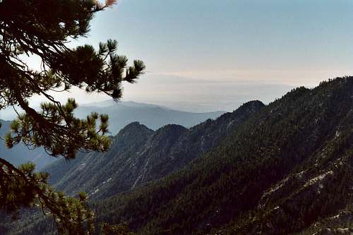
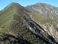
Iron Mtn.#1 seen from south ridge to Rattlesnake Pk.
The Hikes
1. Iron Mountain #1 via its north ridge from Fish Fork starting at Heaton Flat trailhead and returning via Iron’s south ridge and Heaton Flat Trail. See SP Route page.
North ridge of Iron Mtn. #1
2.Triplet Rocks via southeast ridge of (East) Twin Peaks starting at Buckhorn trailhead. See SP Mountain page for reference to this hike.
SE ridge from Twin Peaks (east summit)dropping to Triplet Rocks

Twin Peaks (east summit) seen from its southeast ridge
2a. Iron Mountain #1 via Allison Gulch and southwest ridge starting at Heaton Flat trailhead and returning via Iron's south ridge and Heaton Flat Trail. See SP Route page and SP Trip Report.

Allison Mine high up in Allison Gulch
3.Mt. Baldy via San Antonio Ridge starting at Heaton Flat trailhead (going over Iron Mtn. #1) and ending at Manker Flat trailhead. See SP Route page.

Mt. Baldy (L) and Iron Mtn.#1 (CR) with San Antonio Ridge sweeping left
4.Iron Mountain #1 via San Antonio Ridge starting at Manker Flat trailhead (going over Mt. Baldy) and ending at Heaton Flat trailhead. See SP Trip Report.
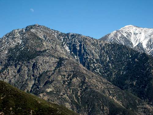
Iron Mtn.#1 (L) and Mt. Baldy (R) seen from south ridge to Rattlesnake Pk
5. Iron Mountain #1 via Heaton Flat Trail and south ridge from Heaton Flat trailhead. See SP Route page.

Looking east to Mt. Baldy and Big Horn Ridge from south ridge to Iron Mtn.#1
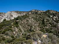
Part of south ridge route to Iron Mtn.#1

Looking down at Heaton Flat trailhead parking area (low center). Iron Mtn. is at top left and Mt. Baldy is back center.
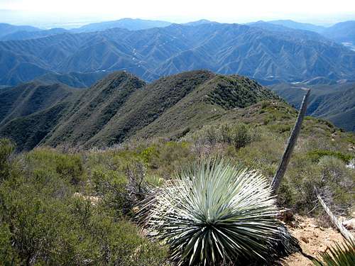
6. Ross Mountain via Mt. Baden-Powell’s south ridge (going over Mt. Baden-Powell) starting at Vincent Gap trailhead. See SP Mountain page for route.

Ridge route to Ross Mountain

View of ridge sweeping down from Baden-Powell (center back) to Ross Mtn. (just left of bare tree). Seen from Iron Mtn. #1's north ridge.
7. Cucamonga Peak via Deer Canyon and South Ridge from north end of Haven Ave. See SP Route page.
8. Mt. Baldy via Baldy Village (Bear Canyon) Trail from Mt. Baldy Village. See SP Route page.
9. Mt. Baldy via Blue Ridge Trail from Blue Ridge trailhead. See SP Route page.
10. Mt. Baldy via Register Ridge (SE ridge of Mt. Harwood) from Manker Flat trailhead. See SP Route page and see HPS Peak page.
11.Rattlesnake Peak from Shoemaker Road trailhead. See SP Route page and Mountain page.
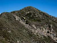
Rattlesnake Peak
South Ridge leading to Rattlesnake Peak
Ridge route (center) from Rattlesnake Peak
12.Etiwanda Peak from Icehouse Canyon trailhead. See SP Mountain page for route and see HPS
Peak page.
13.Monrovia Peak from Canyon Park starting on Cull Trail. See SP Mountain page for route and see HPS Peak page.