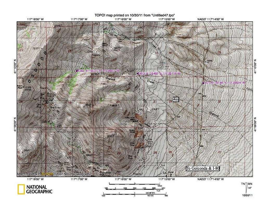
After driving over 21 miles from Golconda (all on good roads), the crux of the road situation is to find the junction located at waypoint 41.16184 117.23621
As you can see on the map, the road is just before the Julian Creek road and bends back to the southwest. After 0.2 miles, watch for a road that heads northwest to waypoint 5615 at 41.16462 117.26118 where the road will then head into Osgood Creek canyon. Drive into the canyon and head up to the waypoint shown at 6363 feet 41.16531 117.28431. It is about 1.4 miles from waypoint 5615 to 6363 and the road is very brushy at times and is rough on your paint job. Speaking of rough, it does get rough in spots and high clearance will be appreciated. You could easily walk up from the 5615 waypoint if driving a vehicle with low clearance. You will have a few crossings of the stream to contend with.


