


palic - Nov 22, 2005 6:31 am - Hasn't voted
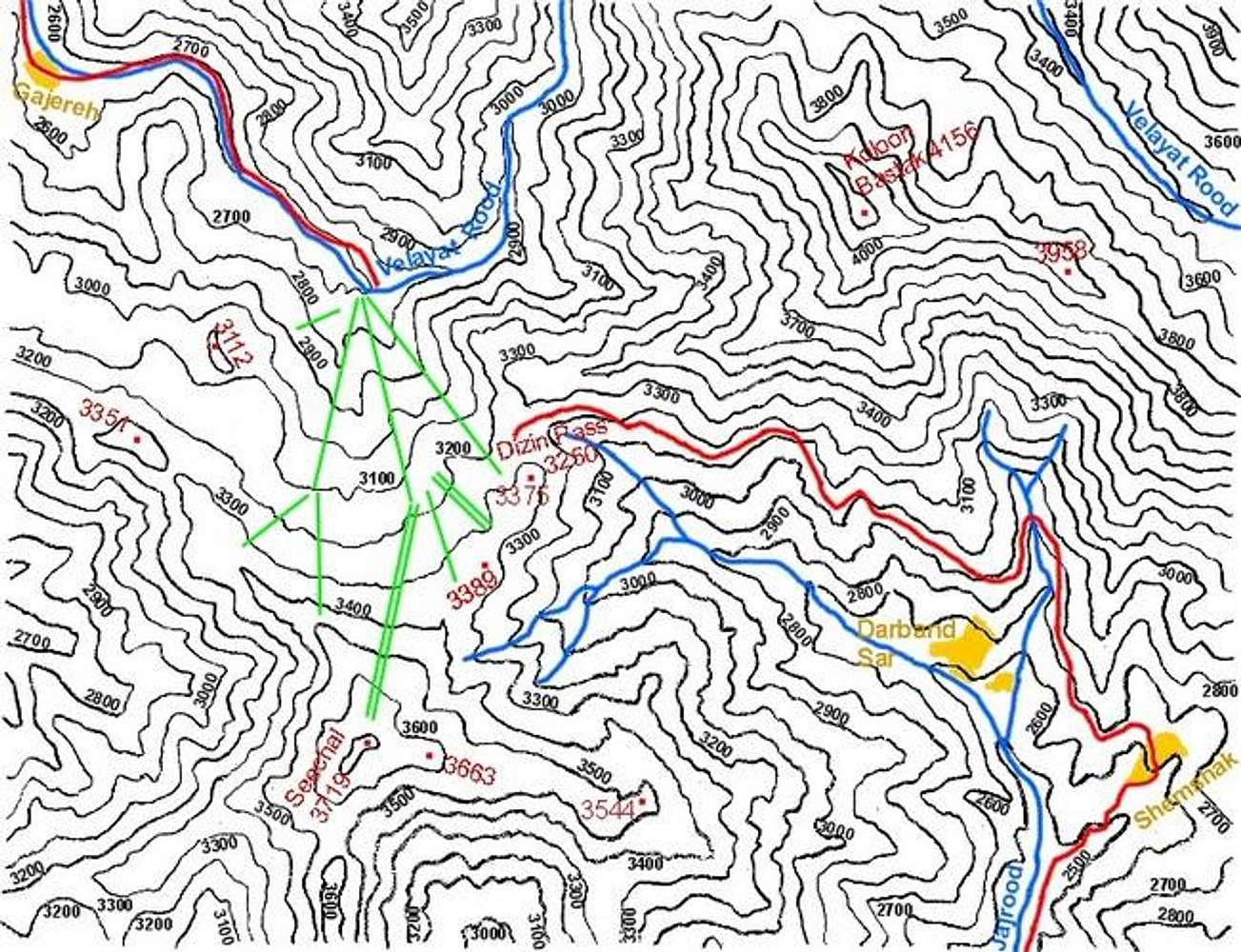
Heights of mountains around Dizin.Another source: http://www.skifed.ir/slopes/dizinmap.jpg set the height of Seechal peak to be 3550 m. What's more precise?

nader - Nov 22, 2005 9:46 am - Hasn't voted
Re: Heights of mountains around Dizin.Thank you for your comments. The 3719 m figure appears on the Iranian 1:50 000 map (1998 issue). These maps seem to be very accurate. The elevation figures on them compare very favorably with measrements by my own GPS/altimeter (for this mountain I got 12240 ft). The Soviet military map (late 1980s issue) says 3750 something meters.
The 3550 m figure is the elevation of the top lift not the summit of Seechal (and even that is probably closer to 3600 m by my own GPS readings in 2004). Even in the early 1980s I had measured the elevation of the top lift with my old analog altimeter many times and always got 3600-3700 m. Unfortunately many popular sources in Iran seem to give rounded and inaccurate elevations. For example the elevations of "Shah Alborz", "Siyalan" and "Dobrar" Peaks are usually quoted as 4250 m while in reallity they are 4125, 4123 and 4072 m respectively.
nader - Nov 22, 2005 3:50 pm - Hasn't voted
Re: Heights of mountains around Dizin.Correction:
I just looked at my maps and notes from when I climbed Dizin.
The Soviet military map says 3748 m.
My GPS showed 12250 ft (3734 m) for the summit.
My GPS showed 12000 ft (3657 m) for the top of the lift.


Comments
Post a Comment