Toggle navigation
Mountains
Routes
Images
Trip Reports
Forum
What's New
People
Areas & Ranges
Articles
Trailheads
Canyons
Huts & Campgrounds
Albums
Logistical Centers
Fact Sheets
Lists
Custom Objects
Gear
Plans & Partners
WELCOME TO SUMMITPOST
SIGN IN
REGISTER
East Ridge
Additional Parents
Image
Map of the roads at the...
View High-Resolution Image
Map of the roads at the...
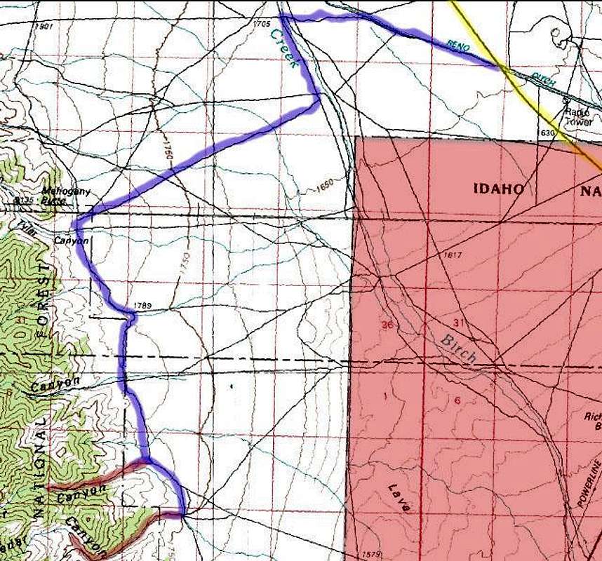
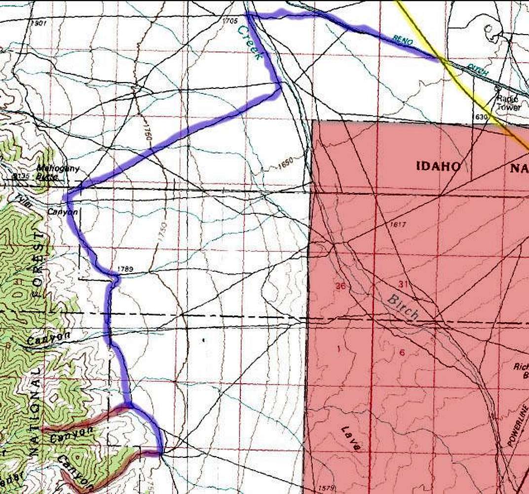
Map of the roads at the southern end of the east side of the Lemhi Range.
Red section: INEEL.
Yellow: ID-28.
Blue: The route I took from the highway to the southern canyons. Reno Ditch is at milemarker 35.
Red: Canyon entrances.
« PREV
NEXT »
brendon
on
Sep 24, 2004 1:02 pm
Comments & voting
Other parents
Lat/Lon:
43.93750°N / 112.9539°W
Image ID:
70985
3495 Hits
73.06
% Score
3
Votes
Log in to vote
Comments
No comments posted yet.
to post!
Don't have an account?
East Ridge
(Route)
« PREV
Viewing
#2 of 2
GALLERY
You are at
the Last
Image
brendon's Image Gallery
« PREV
Viewing
#361 of 577
GALLERY
NEXT »
Saddle Mountain
(Mountain/Rock)
Loading....
×
You need to login in order to vote!
User Name
Password
Remember me
Forgot your password?
Log me out when I close my browser.
Keep me logged in all the time.
sign in as a user
Don't have an account?
Register now for FREE
Rating available
Suggested routes for you
People who climb the same things as you
Comments Available
Create Albums
Register Here


